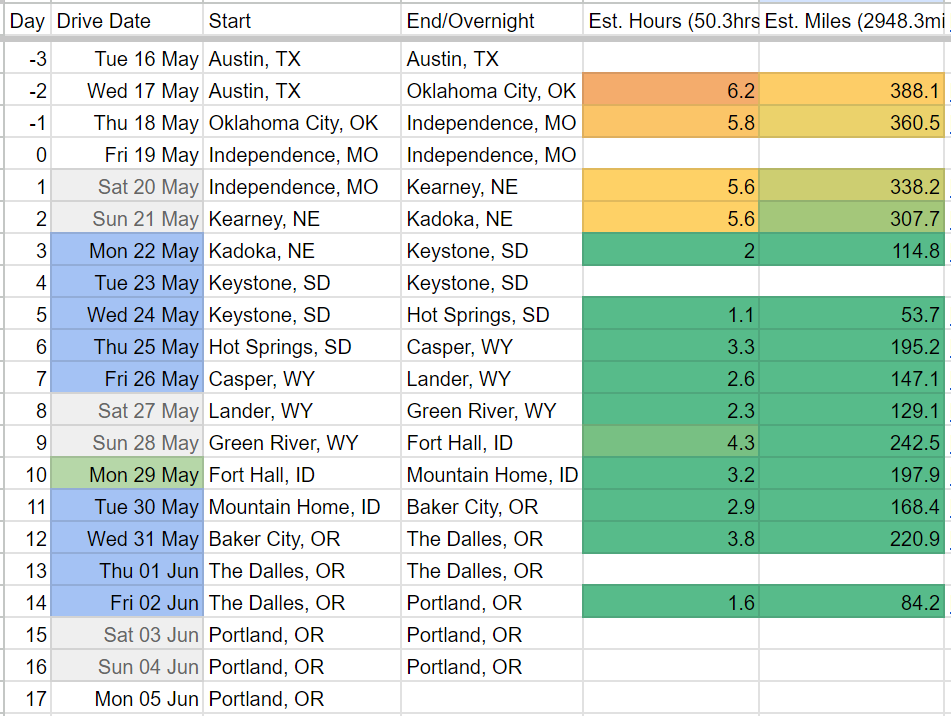
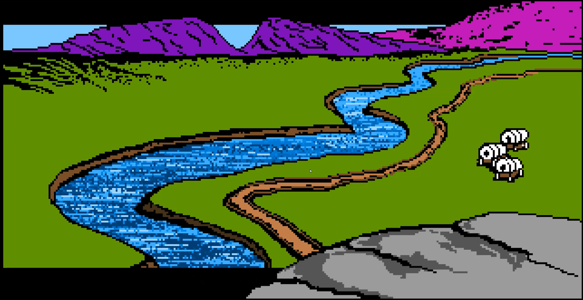
Having successfully (more or less) crossed The Oregon Trail by videogame thrice, we felt sufficiently well-schooled to start planning a great crossing of our own. The National Parks Service maintains a website and interactive ArcGIS map on The Oregon National Historic Trail, which we’re using as our primary route reference:
We’ll also be grabbing alternates and detours as we figure out the rest of the route. The trail as prescribed was a wagon migration, which means three things: they weren’t necessarily in it for the sightseeing along the way; they might have preferred easier roads and less dramatic landscapes than we’ve come to be spoiled by; and although we’ve had our share of lemons and breakdowns, our cars should be ever-so-slightly more capable. (Well… perhaps…).
As we zoomed out a little from the route map, we saw a lot of beautiful experiences to be had between Independence (Kansas City metro) and Oregon City (Portland metro):
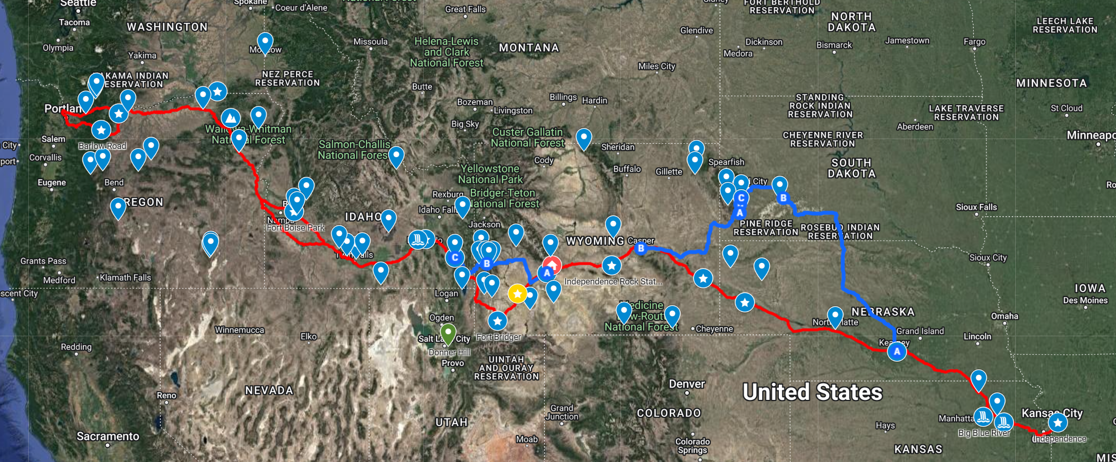
We’ve marked every fort and settlement from the game and are defaulting to those for stopover nights. Most of my covid-time in Wyoming was further northwest in the state, but I’ve added what I know. And I’ve wanted to give Idaho another go since that one night and work day in Boise. We’ve also all got plenty of things we’d like to do in Oregon along along the Colombia River Gorge — although we may need to face the bandits and toll collectors on The Barlow Road around Mt. Hood.
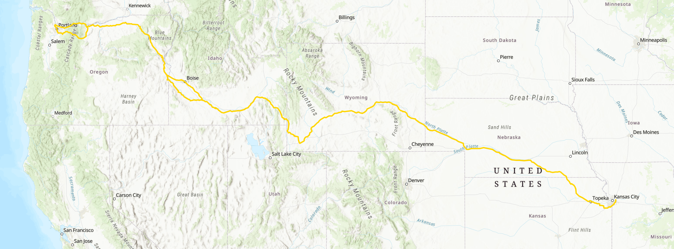
All of which is to say, I’m very excited by everything that happens after crossing into Wyoming. But getting there from Independence (Kansas City Metro) is a lot of interstate-woven cornfields in Kansas and Nebraska…
The First Half
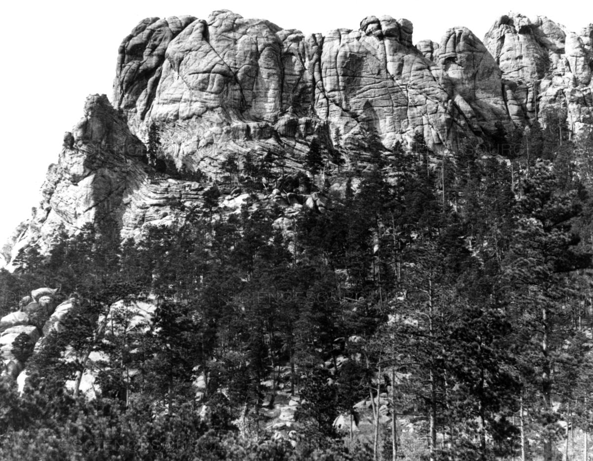
When originally considering options for a fourth trip, George mentioned an interest in Black Hills National Forest generally and the Needles Highway and Iron Mountain Road specifically.
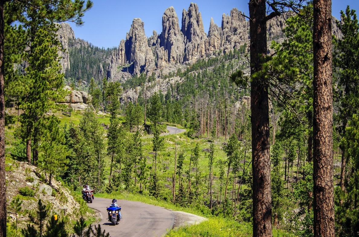
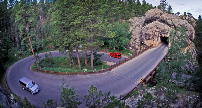
Now that is a road. Sign us up. And it lets me shoehorn Badlands National Park into this trip, as is my specialty as Chief National Park Officer of our little posse. So we’ve decided to follow the historic route to the first in-game respite at Fort Kerney, then hellride it up from there to Kadoka, South Daktoa for these.

Since we’ll be in the area, we may also add a stop at what remains of the Lakota site Tunkasila Sakpe Paha (“Six Grandfathers Mountain”), too.
So that’s a big departure from The Oregon Trail official route, but we’ll rejoin the route somewhere between Fort Laramie and Casper and will following the rest of the trail a little more faithfully.
The Second Half
From there, the trail runs south of the Shoshone National Forest near Atlantic City and South Pass City (with its bizarre history I caught a short glimpse of in 2021) toward Rock Springs and Green River.
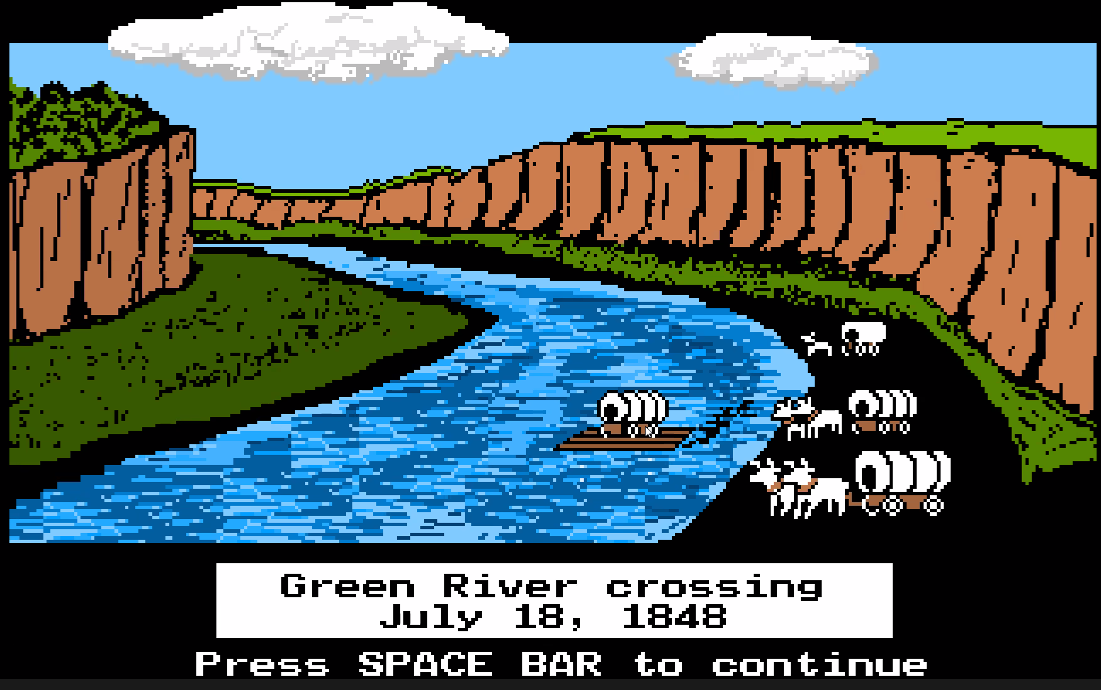
The game offers a fork here: take the trail down to Fort Bridger as a detour (red line) or cross the Green River between South Pass straight to Soda Springs.
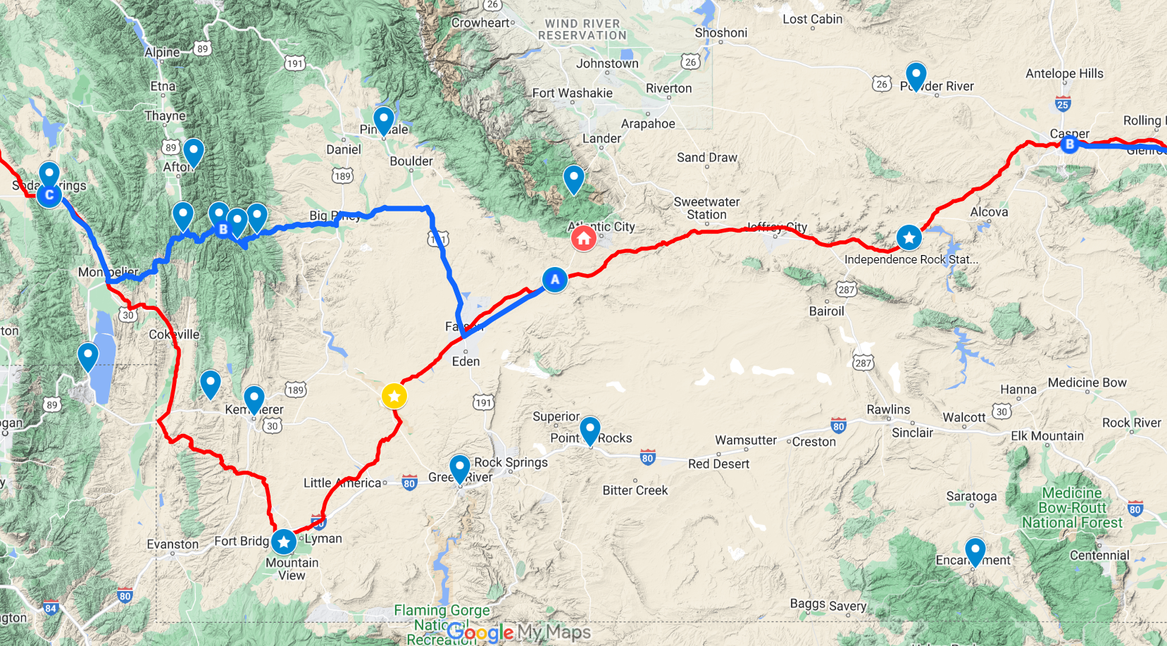
In truth, either route would cross the Green River, but in the game, the Fort Bridger route doesn’t have to suffer that. Modern travelers would likely route across on US-30, which isn’t so far out of the way, but we decided to see if we could take a direct route across the mountain range in the middle — because of who we are as people (blue line).
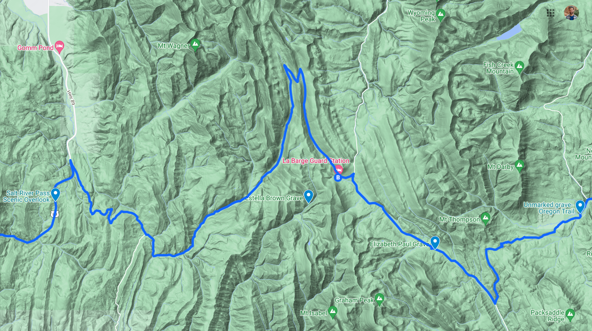
There is a pass on an unpaved forest service road between Wyoming Peak and Graham Peak which passes by three old gravesites, a historic guard station cabin, and a Salt River overlook.
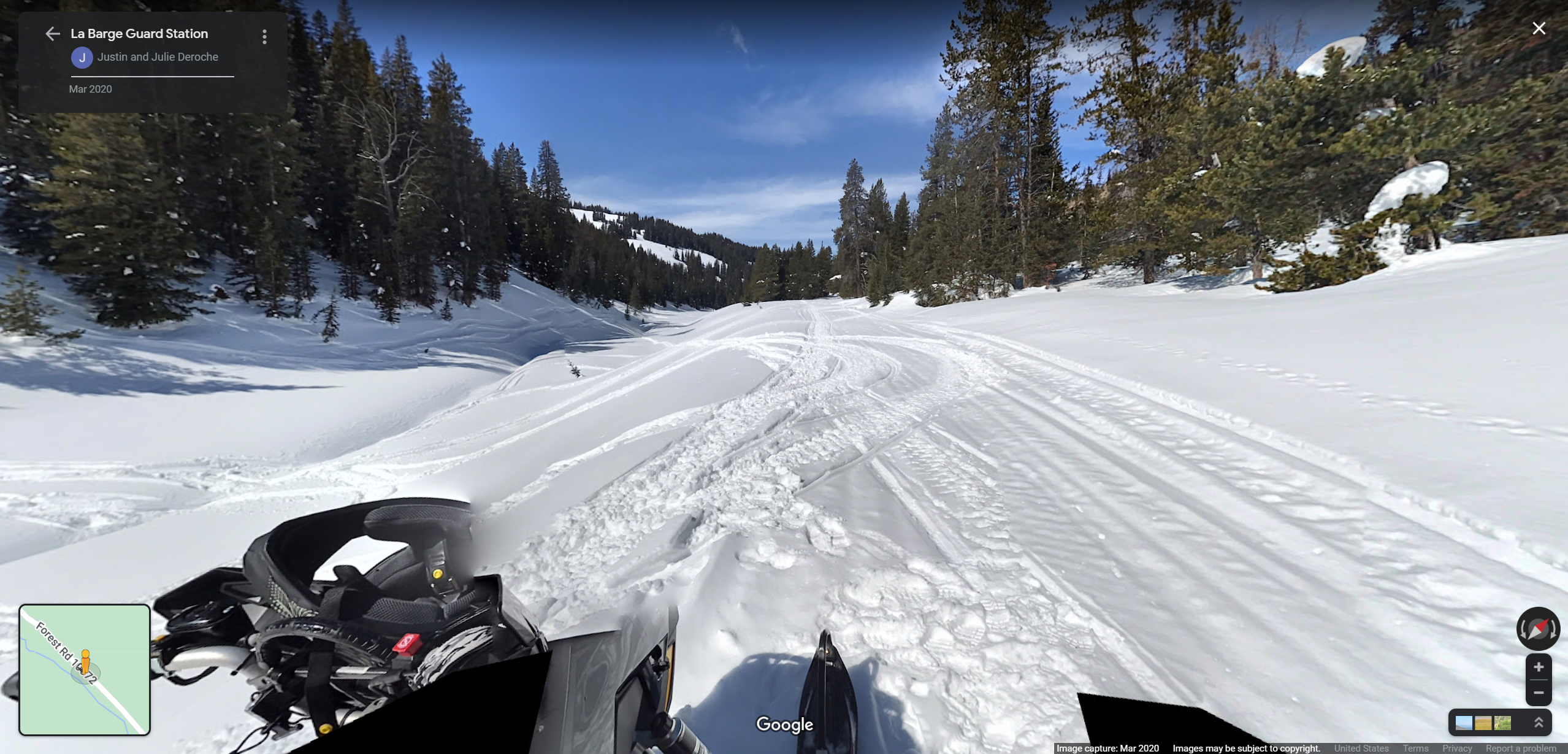
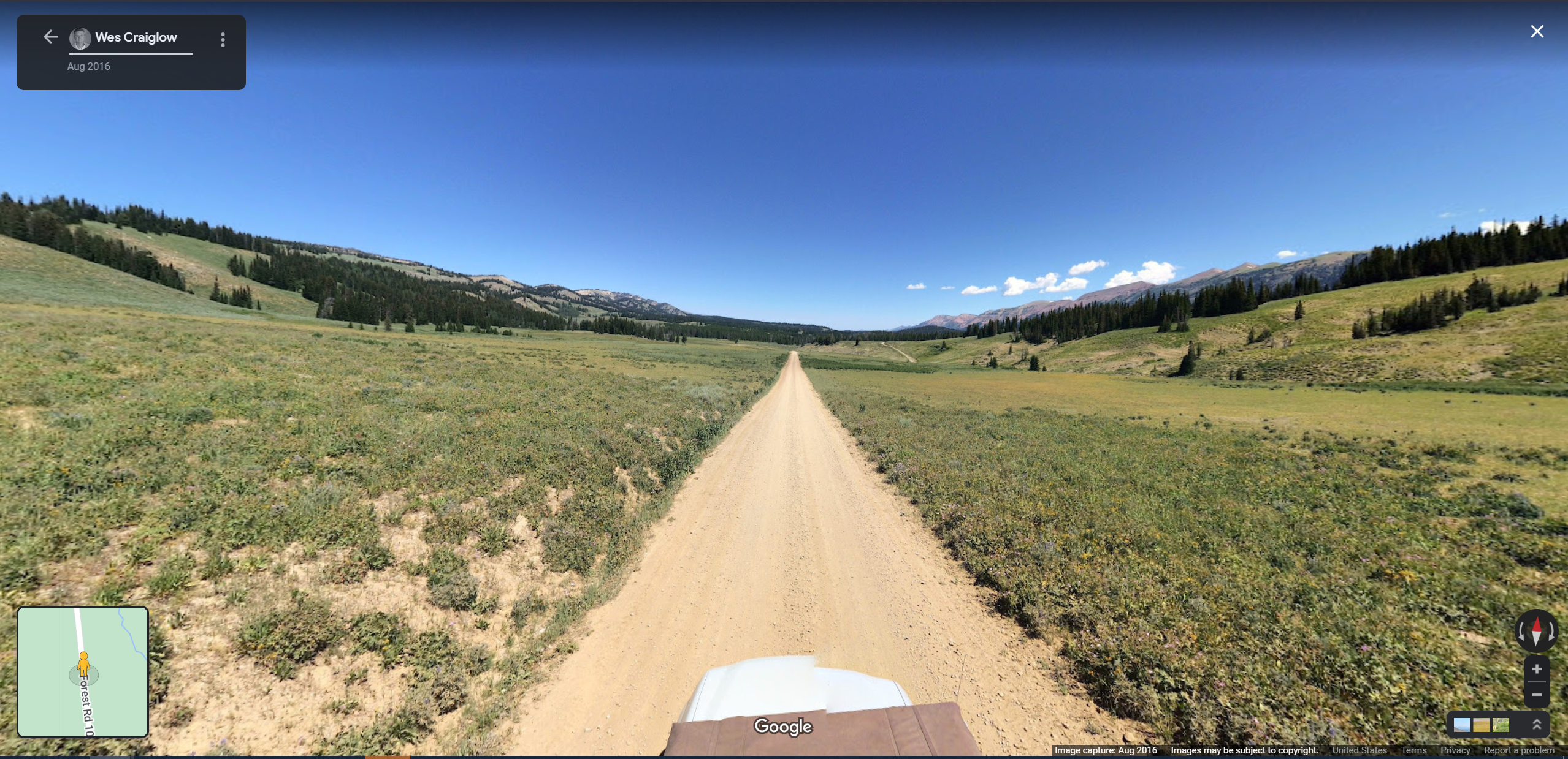
There are only two Google Street View captures on this route; they are these. I suppose we should confer with an old-timey almanac to see which most closely resembles “Late May.”
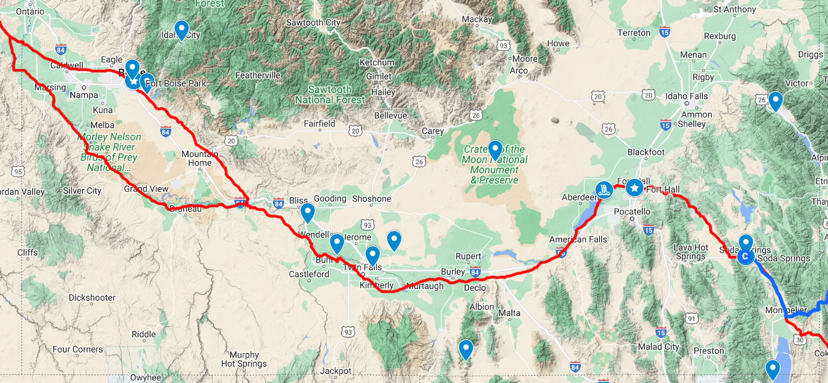
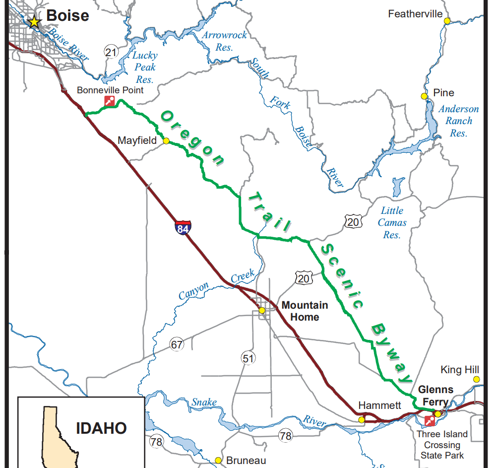
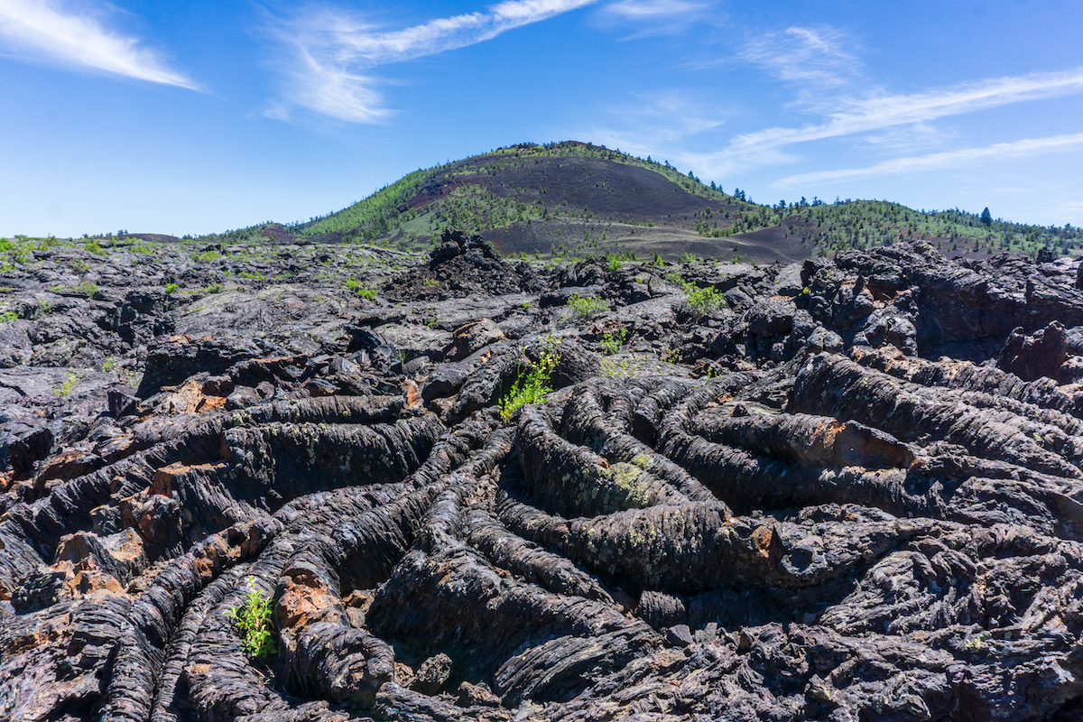
Beyond Soda Springs, we have fewer specifics planned. We may add Craters of the Moon National Monument. Idaho also has a scenic byway that parallels I-80 to the northeast called “The Oregon Trail Scenic Byway” that runs along the edge of the mountains.
From there, we make our way through Boisie and into Oregon to cross the Blue Mountains into present-day Pendleton. Even the pass on I-84 is beautiful.
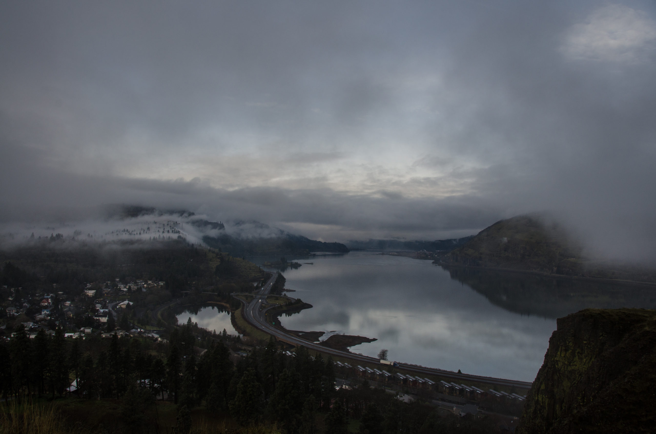
After Pendleton, it’s a short drive to The Dalles along the Columbia River, where we’ve decided to have a “beach day” to explore.
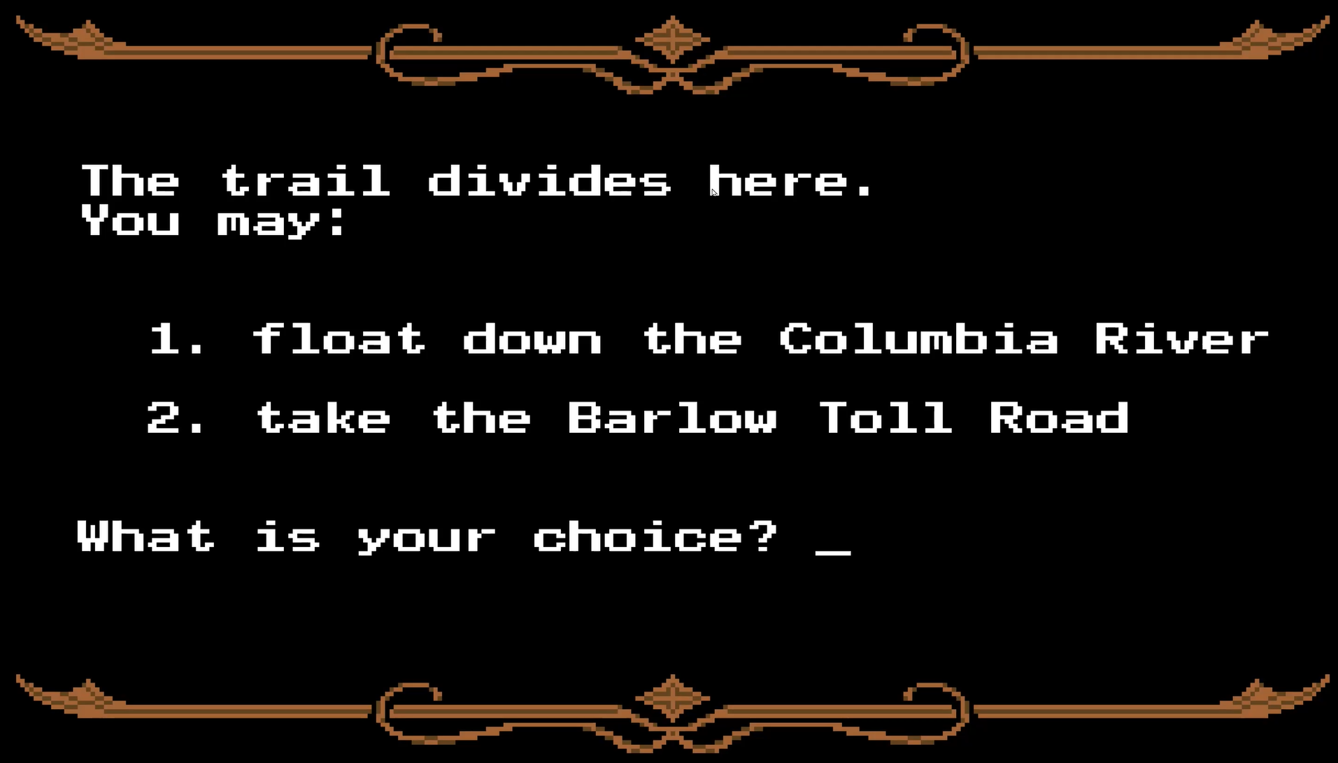
Finally, the game offers its final fork: pay $10 (if you still have it) for the Barlow Toll Road or float your wagon down the Columbia River. Both are downright treacherous, so we have yet to decide how we’d like to arrive into the Willamette Valley ourselves, but have lots of options. After that, as tradition dictates, we host a car sale in Portland.
How hard could it be?
So that gives us a schedule, which is daunting for two reasons: it’s real now, and it’s very soon.