I’ve decided to disappear for a short while to ring in the summer and the successful end of a year-long project, among other celebrations. Normally I have a better itinerary planned, but I’m playing this one pretty lose. I started at the folks’ lakehouse, then did an overnight in Lubbock last night. Tonight, I’m headed up to Monte Vista, Colorado with some offroading and sightseeing to take me into Wyoming at least. Then who knows.
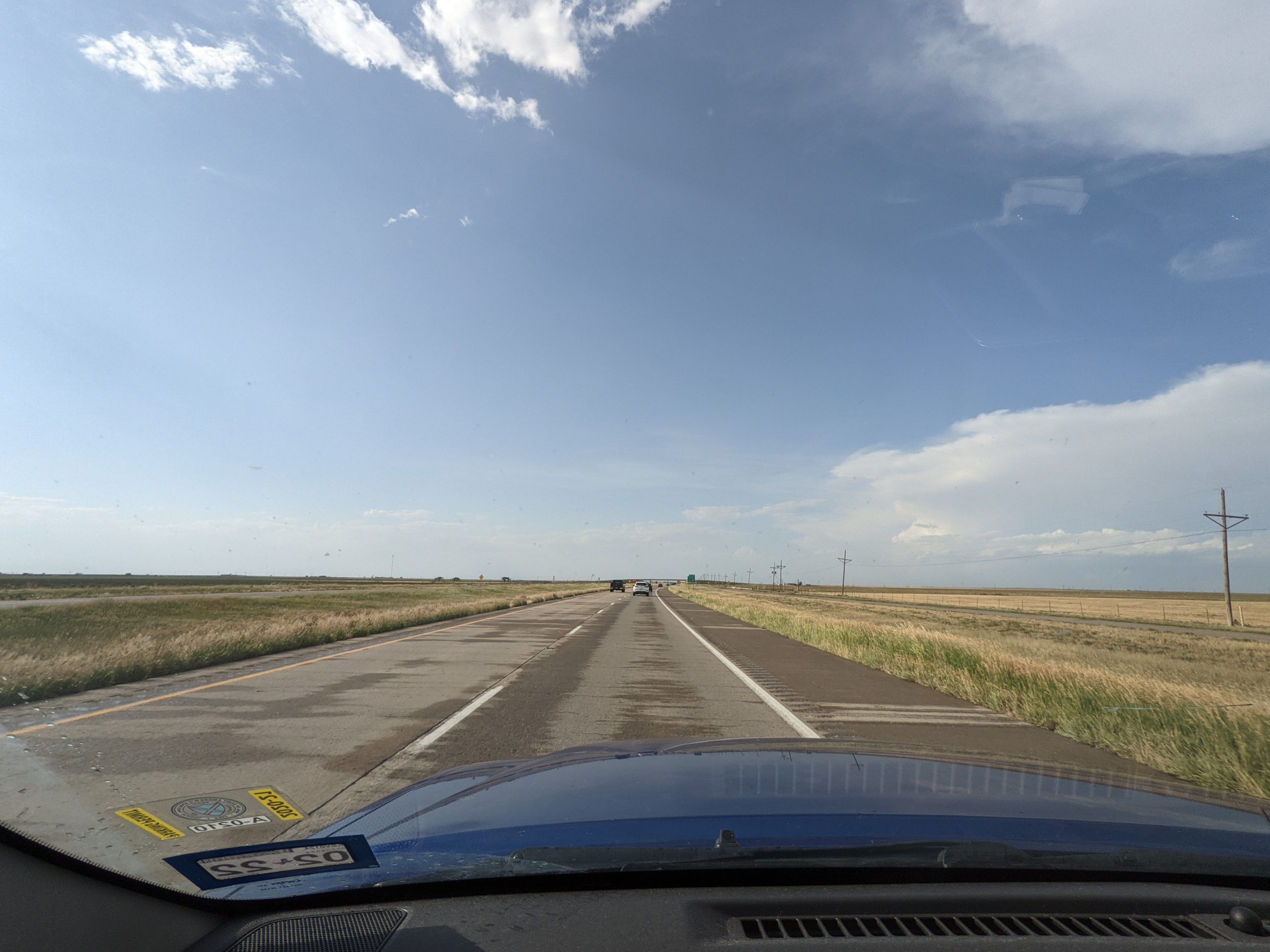
But it seems like the Panhandle wants to scare the shit out of me every time I leave. This rolled up rather quickly, and then escalated even more quickly.
This may be my scariest weather-on-the-road moment. The storm came out of nowhere and suddenly the white-out was so bad that I simply couldn’t see. I tried to get as far off the road as I could, hoping not to be the first — or worse, second — in a pileup, but I just couldn’t see. And as the wind whipped across the car and felt like it would roll it, radar showed the storm system moving in the opposite direction. With hail and a rotation hook.
And not fifteen minutes later, even the road was mostly dry.
So that was odd… hopefully things are calmer tomorrow.
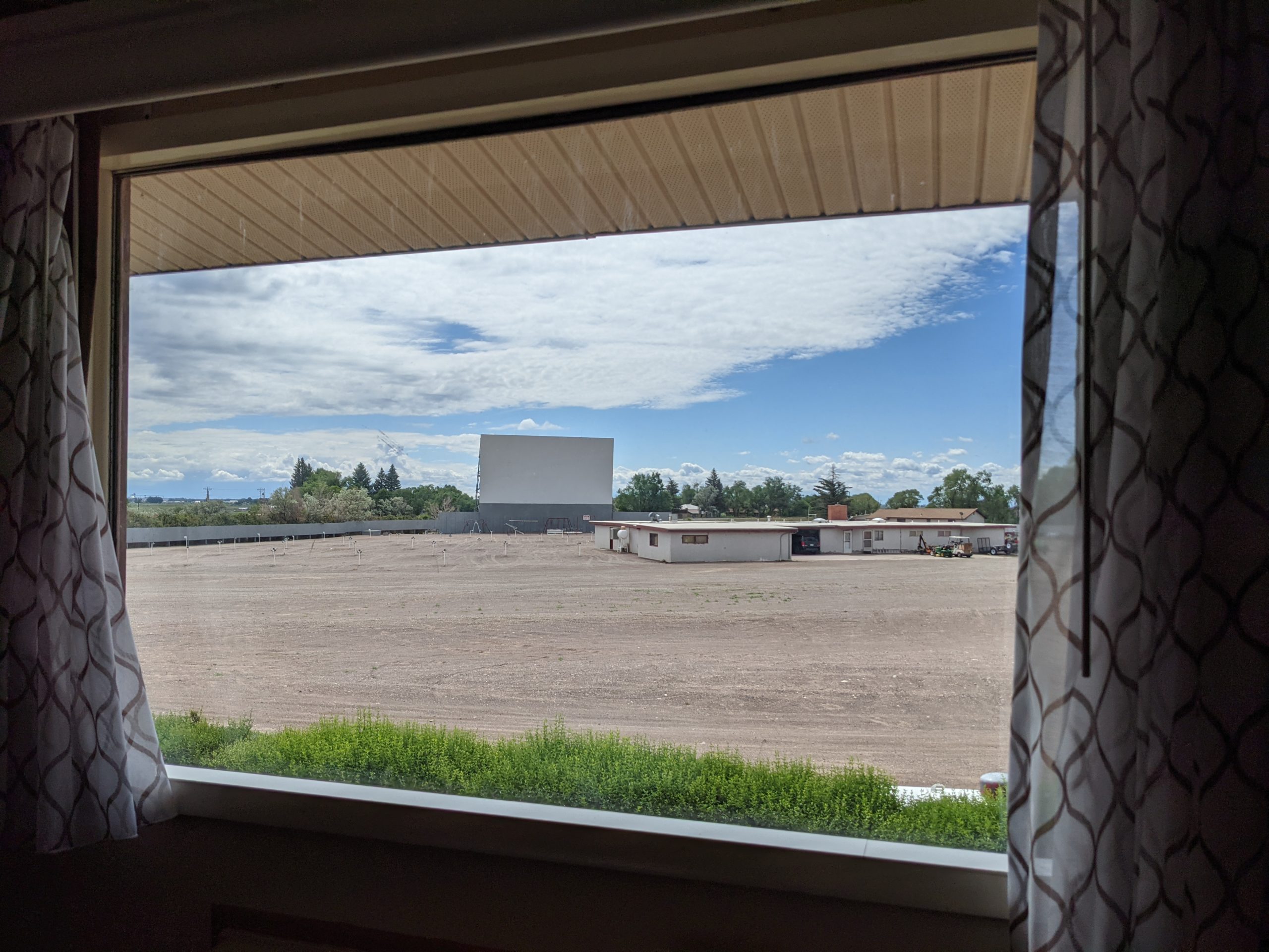
So my hotel last night is a movie theatre? It’s a two-screen drive-in movie with the motel arranged such that each room’s view can see both screens and there’s a switch by the door to activate a PA speaker in the room to listen. Gotta admit, that’s pretty cool. Too bad I didn’t get here until 1am.
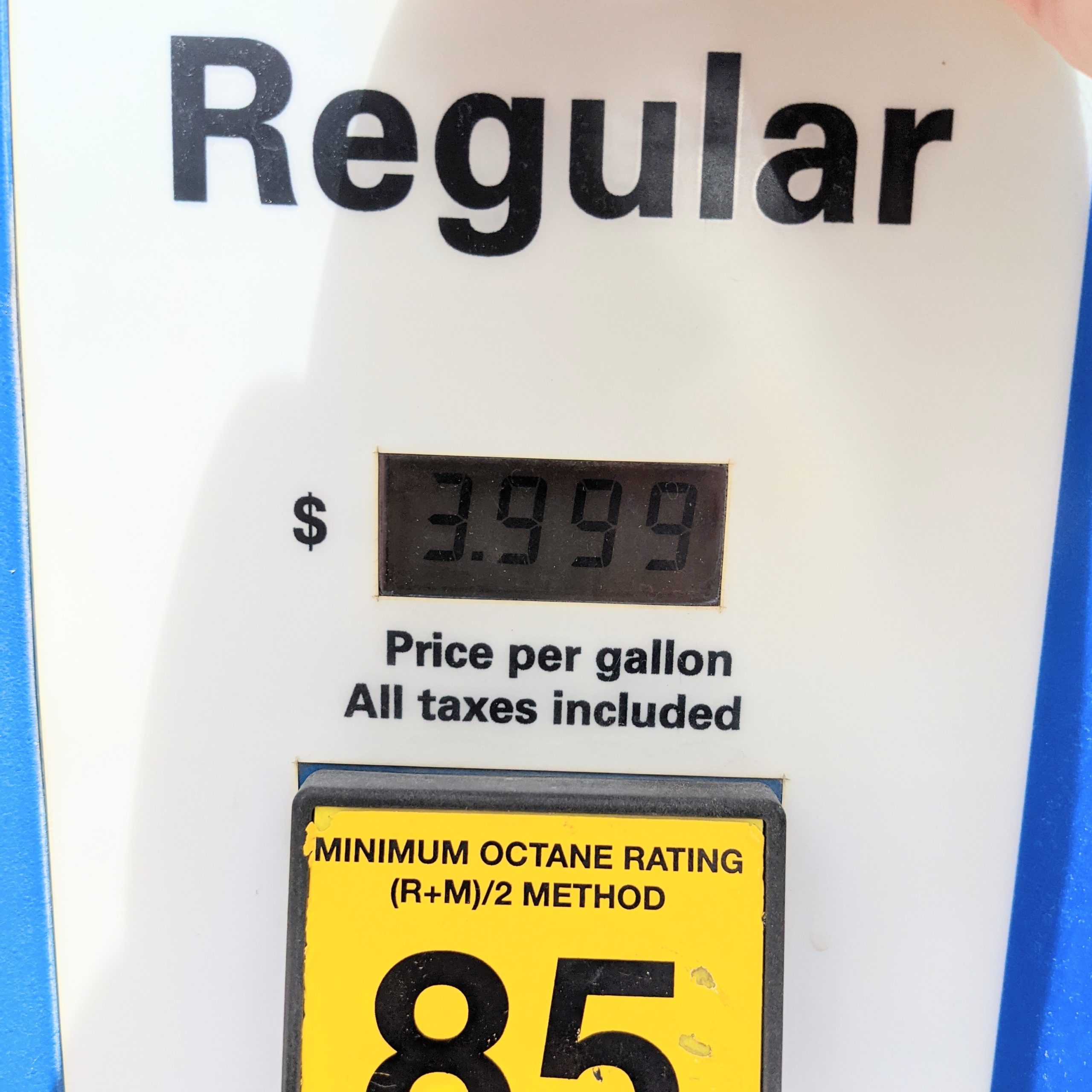
I was on the phone with Dad last night and complained that Raton, NM is rather proud of their unleaded. Today, I got what I deserved in Lake City, CO, at the gas station that’s also a bbq place and a bike shop.
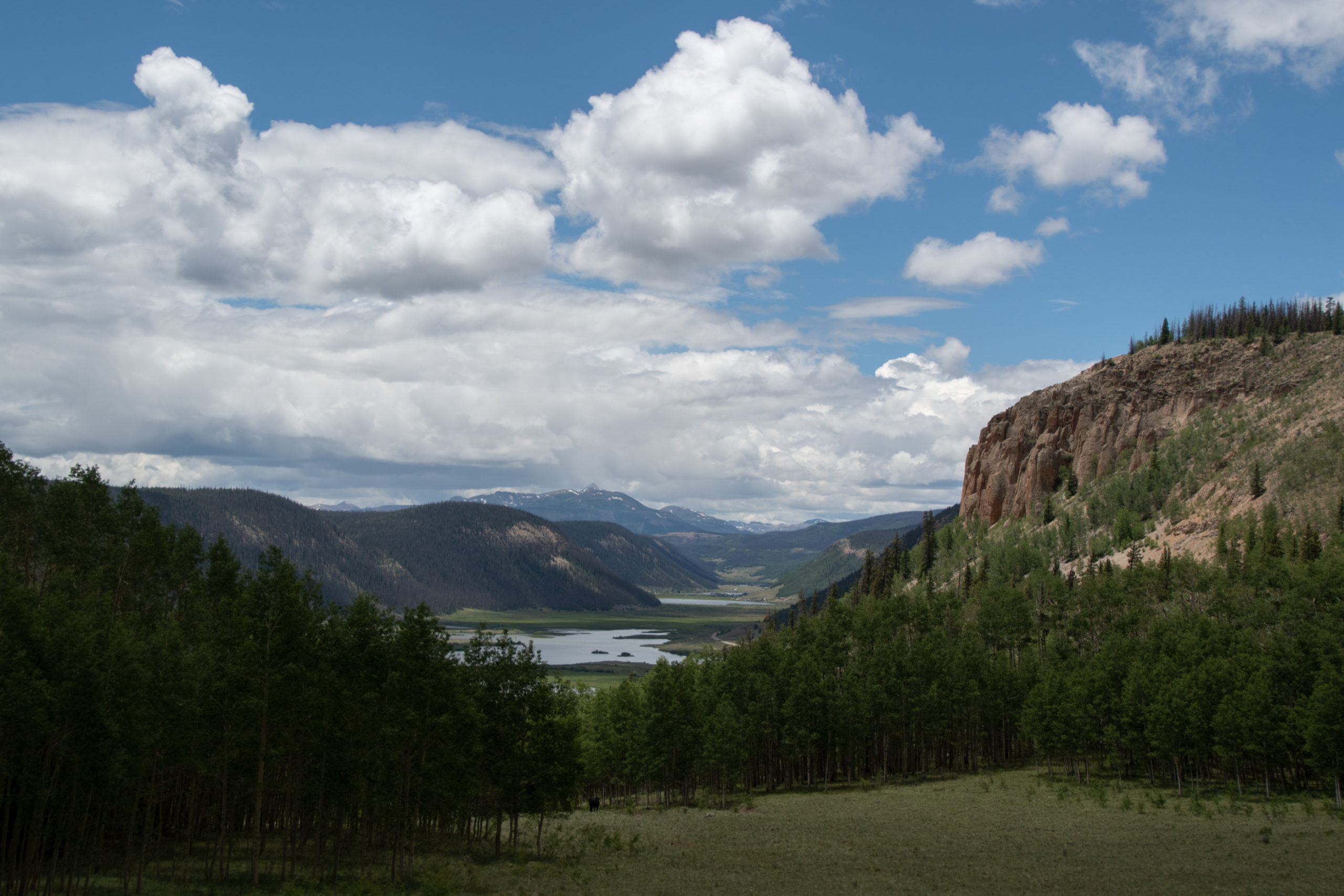
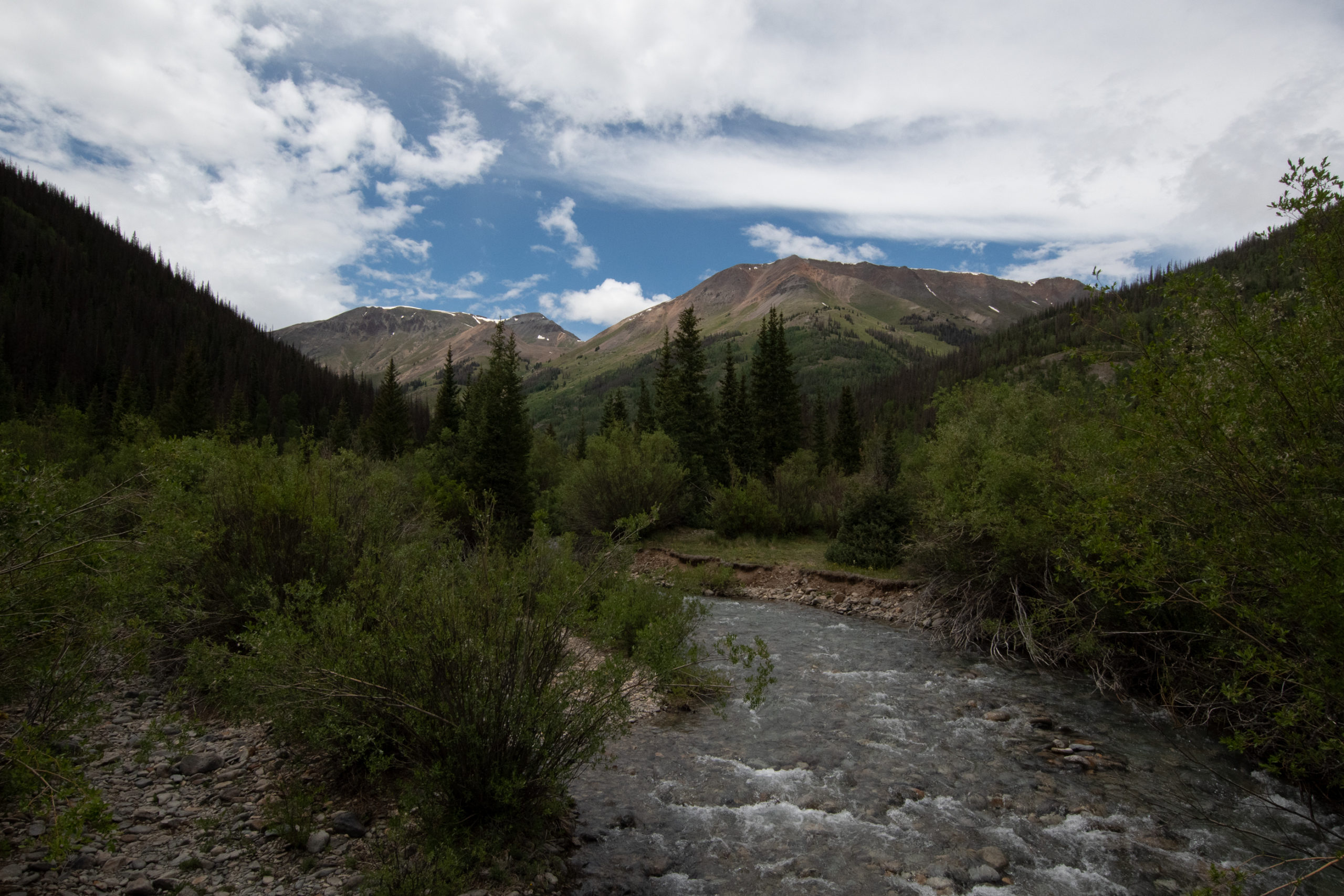
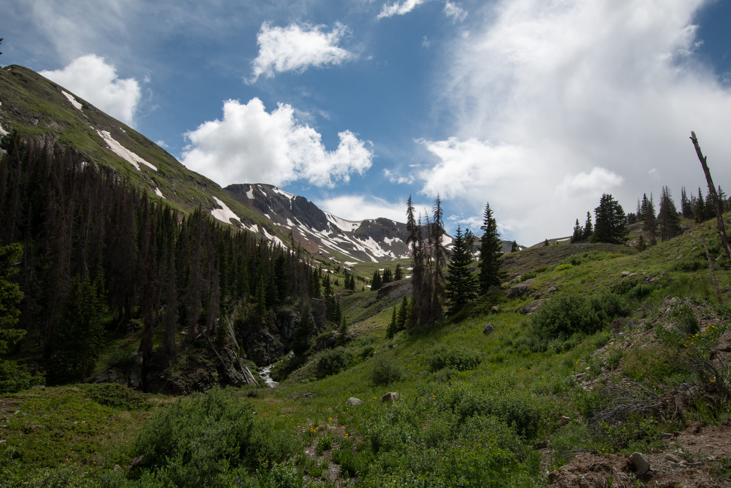
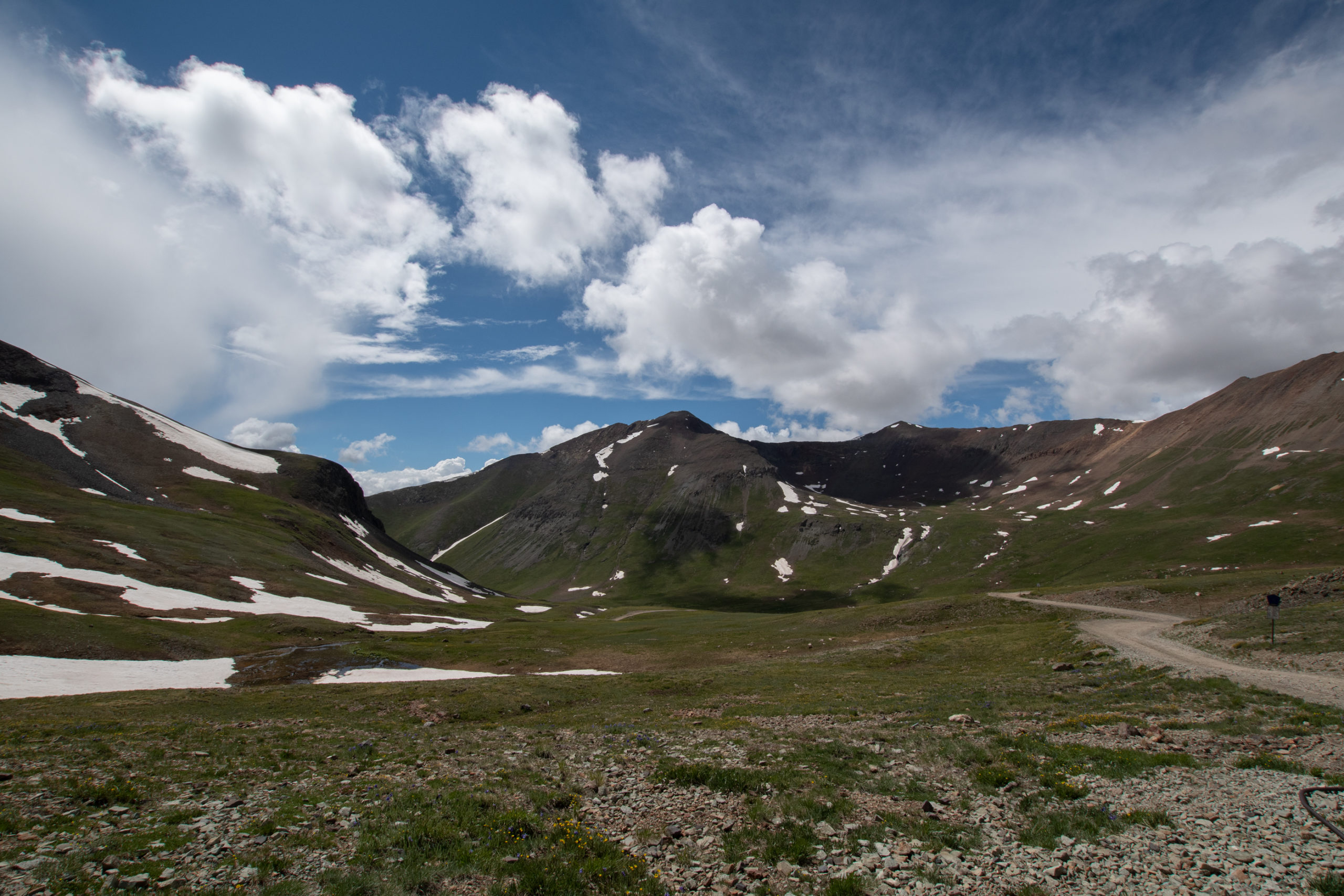
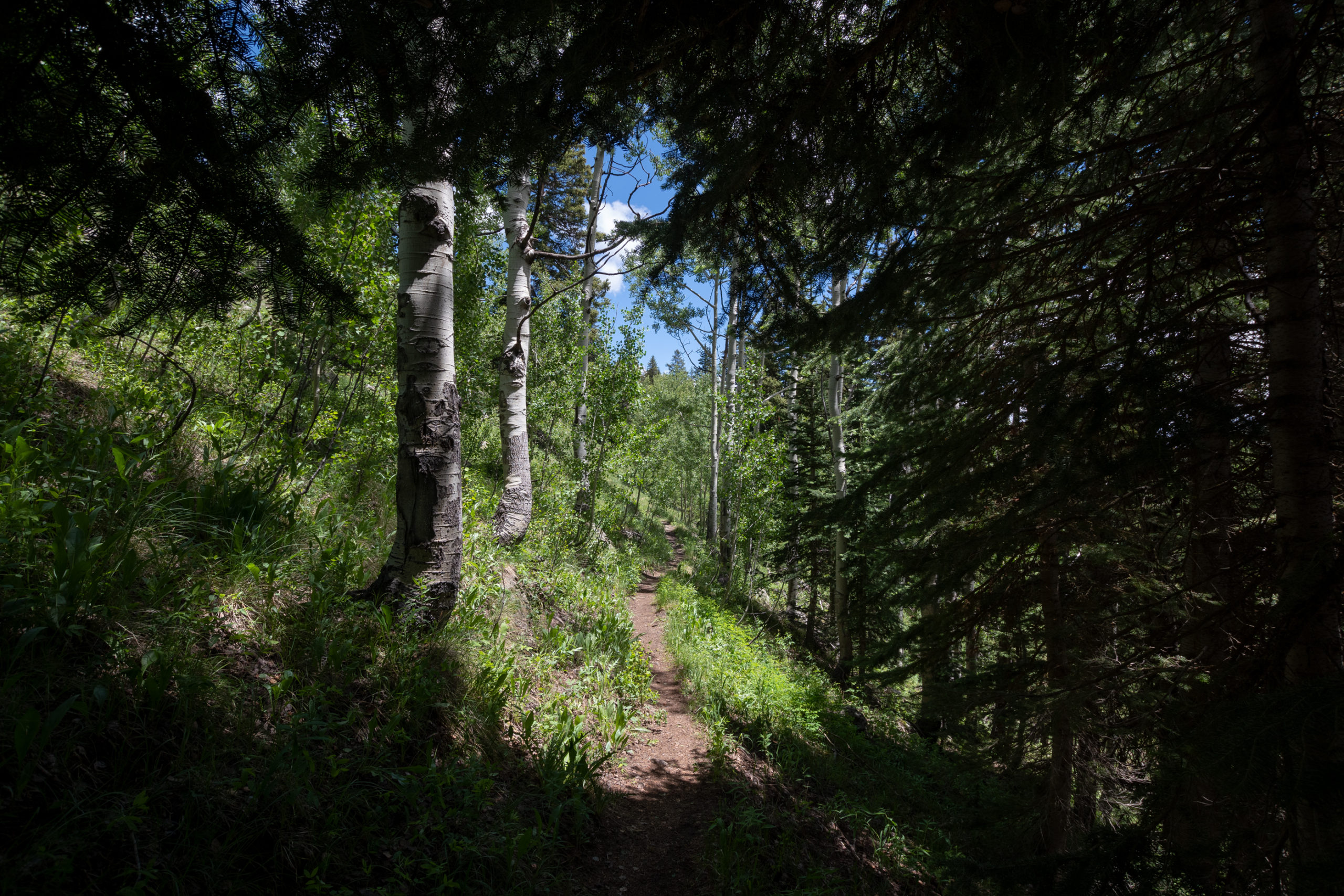
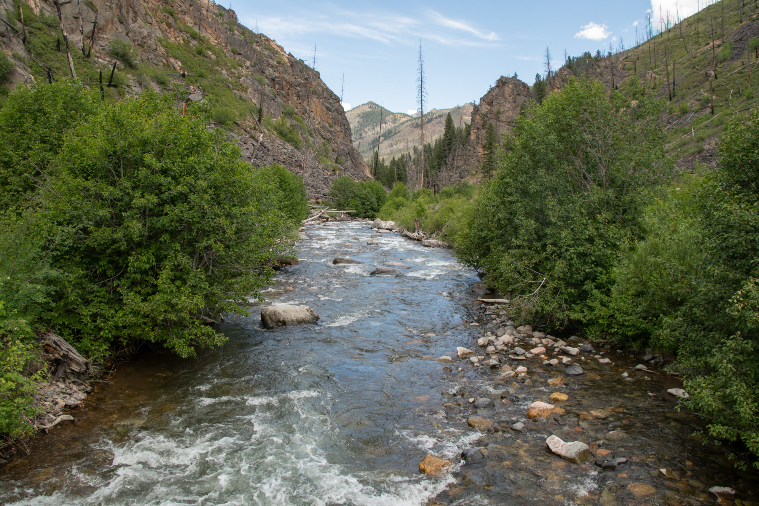
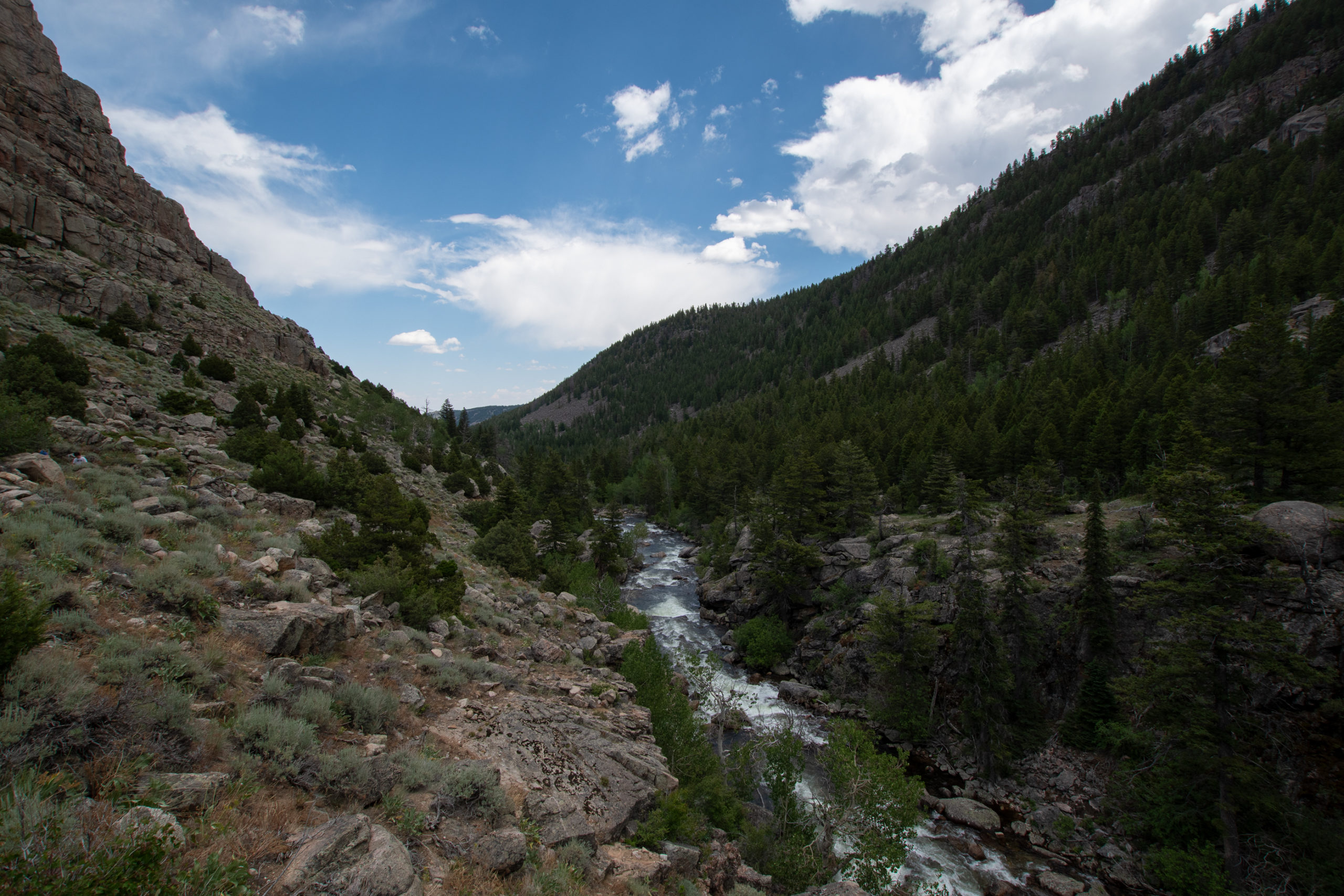
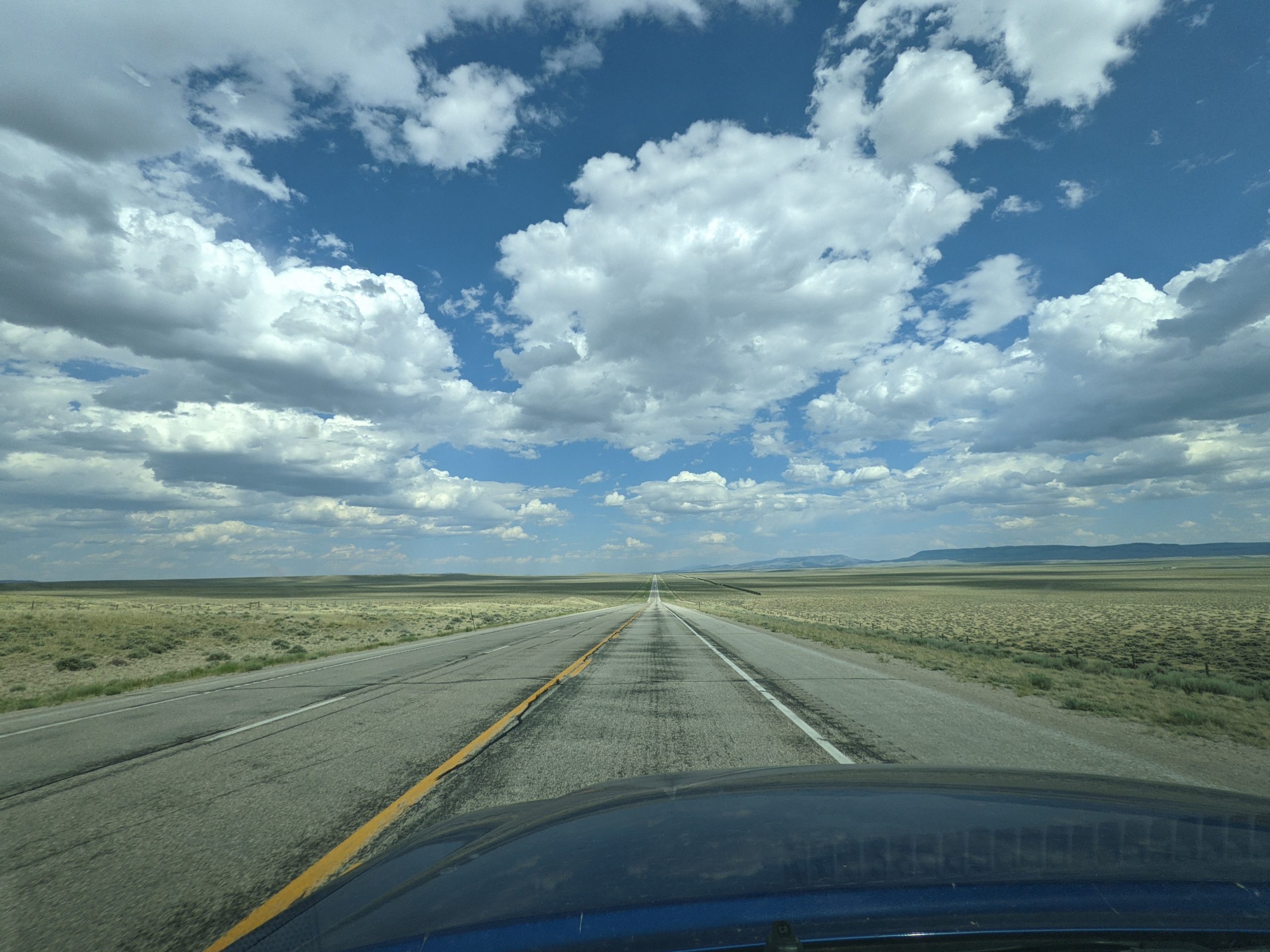
Turns out that Monte Vista is a lot further from the start of my offroading than I’d realized, so I spent several hours snaking my way up, what turns out, are the headwaters of the Rio Grande (like, the Texas Border river) headed to Lake City to pick up part of the infamous Alpine Loop.
Rio Grande in South Fork, CO
But did I mention how far the drive to the start line was? Beautiful though.
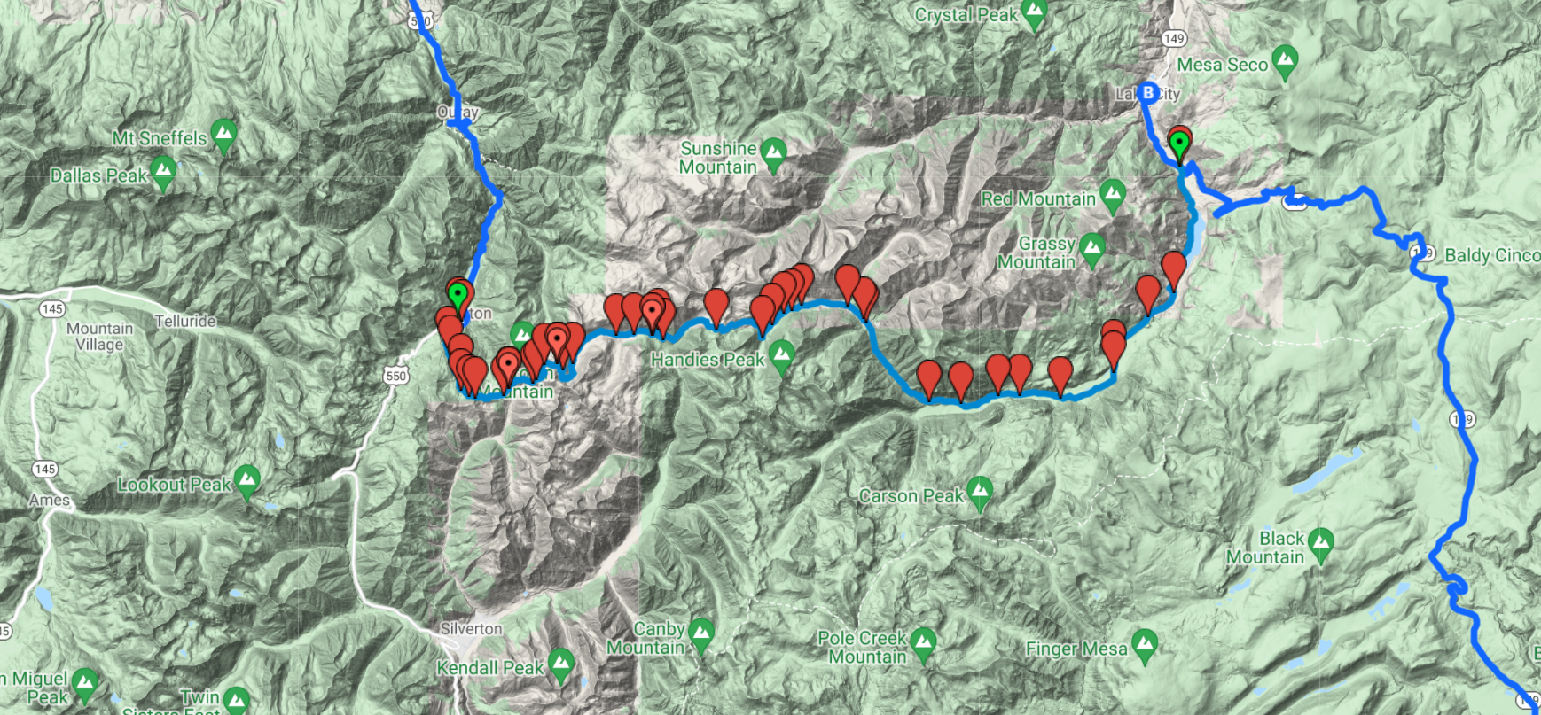
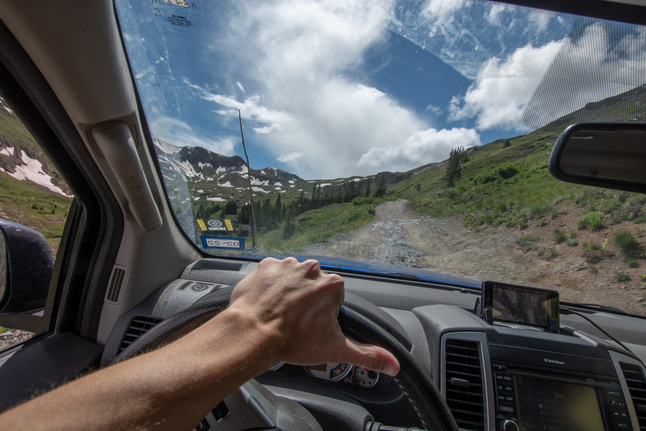
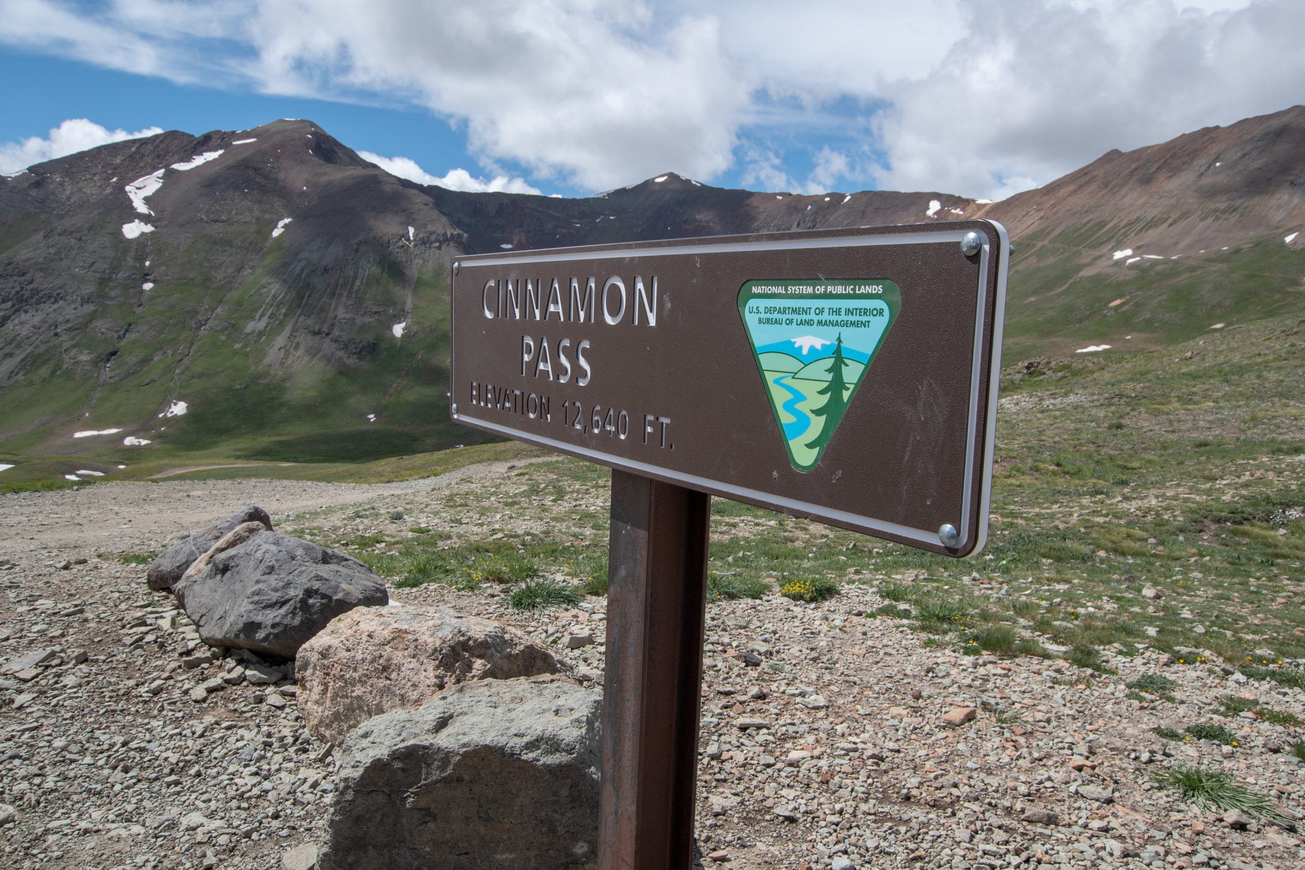
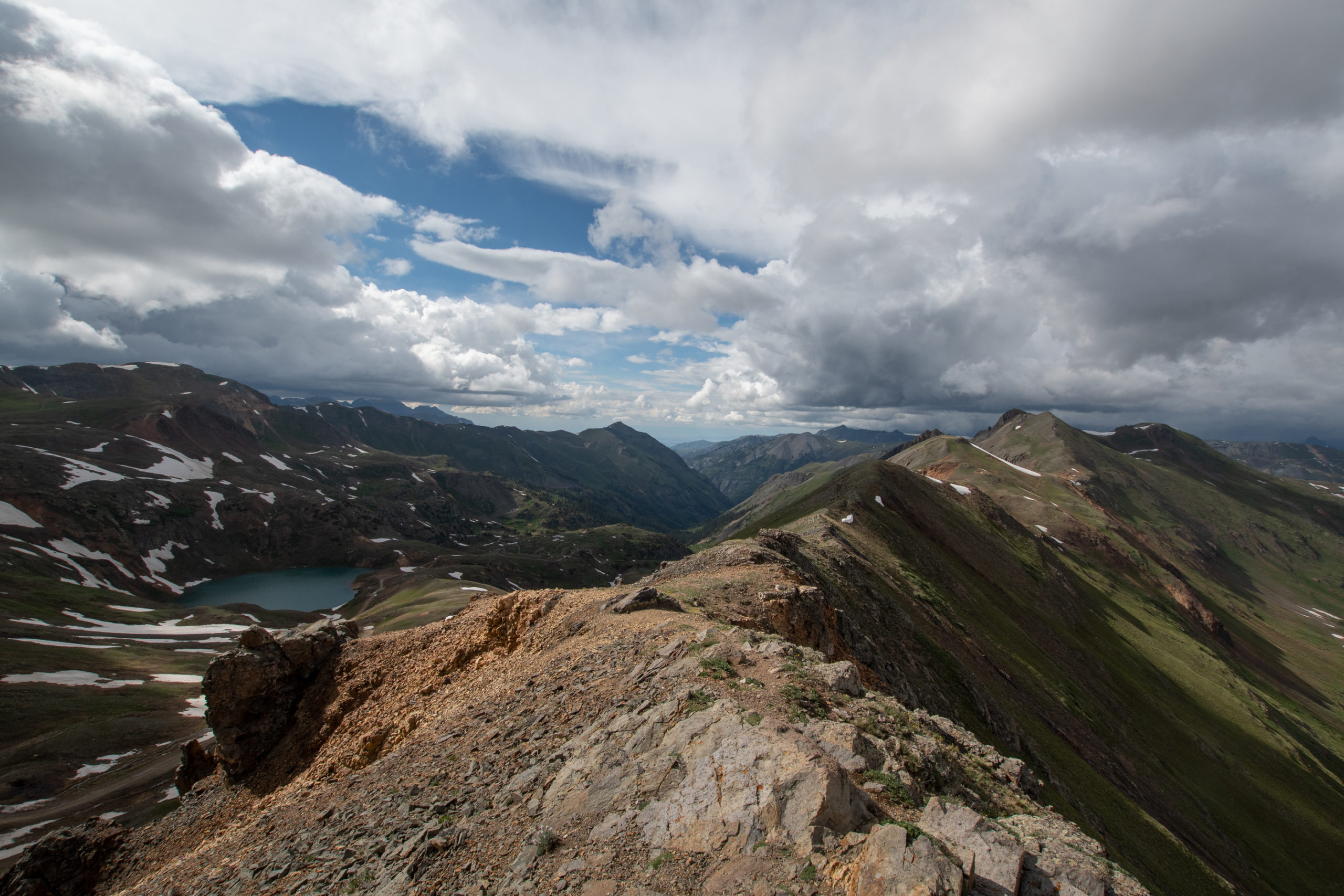
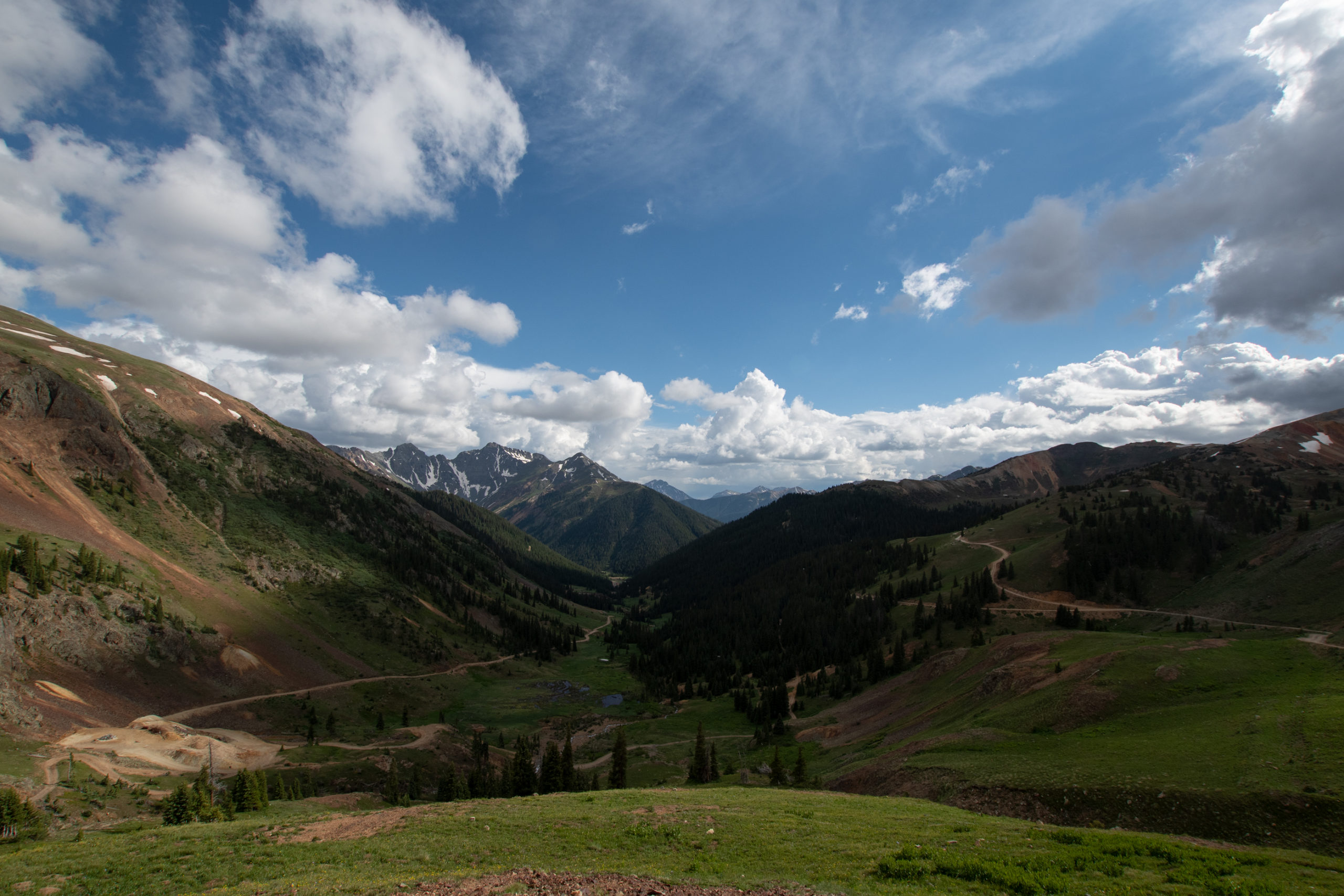
I’d planned to do part of the Alpine Loop and continue on to “The Million Dollar Highway” US-550 out the other side and up to Montrose rather than returning back to Lake City. Cinnamon Pass to California Pass to Hurricane Pass to Corkscrew Pass.
North of Silverton, CO from Lake City to Ouray.
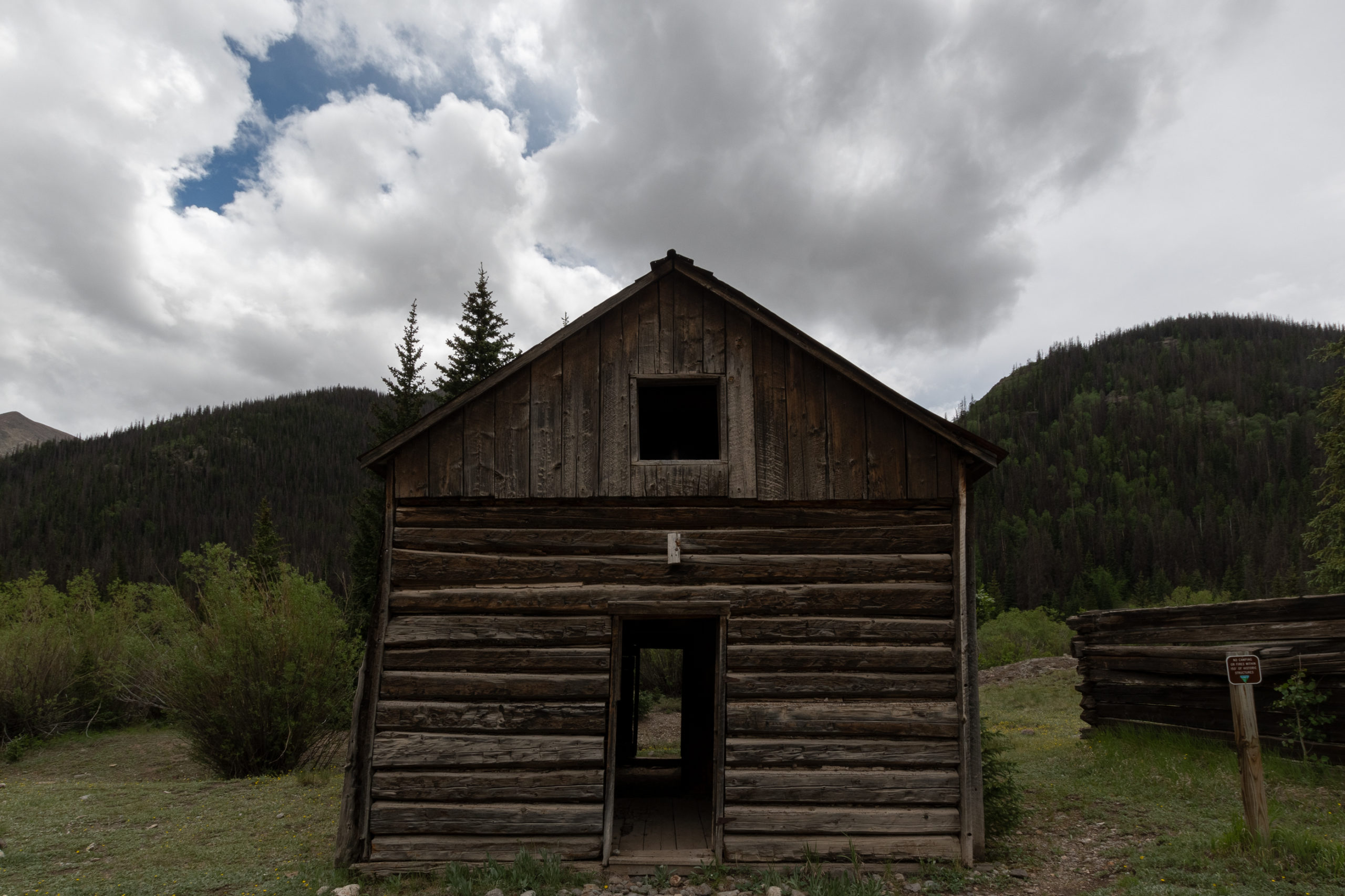
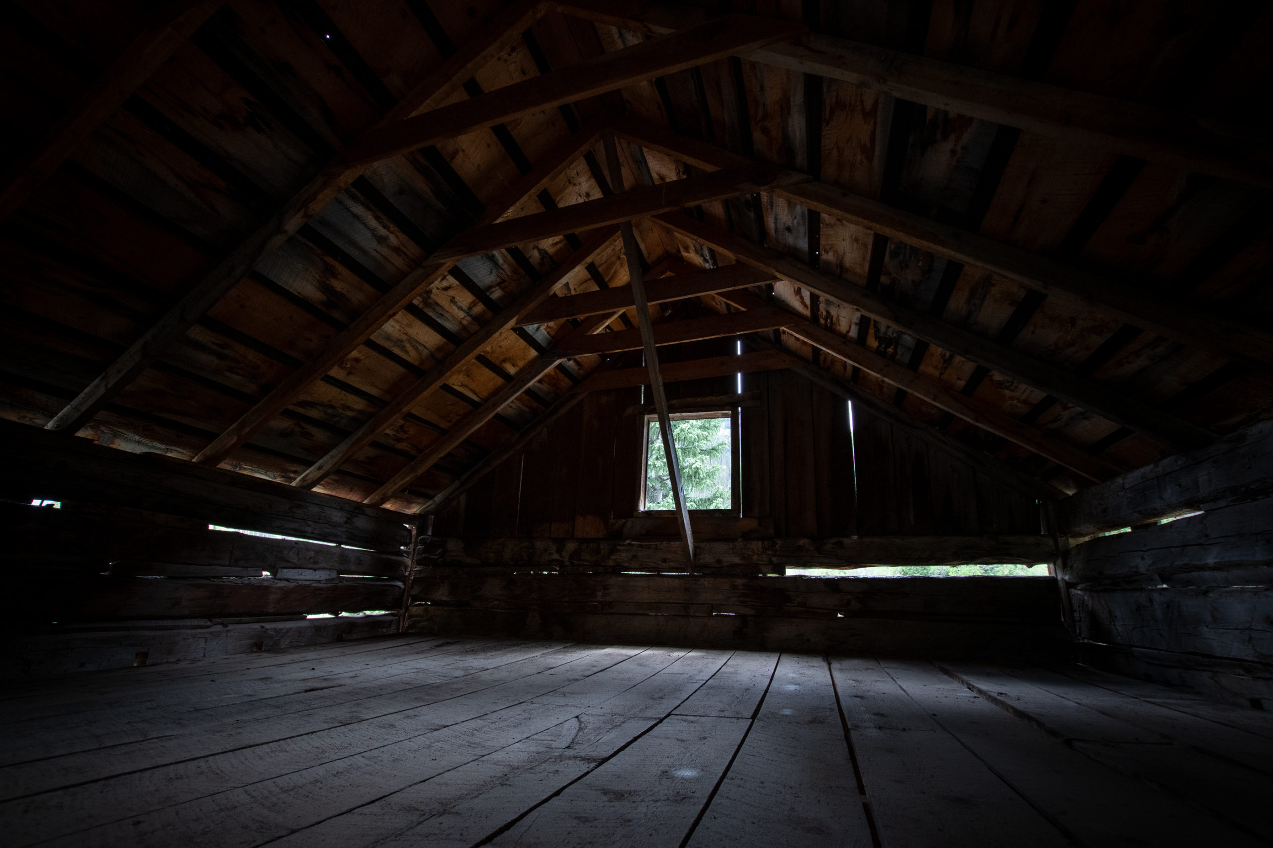
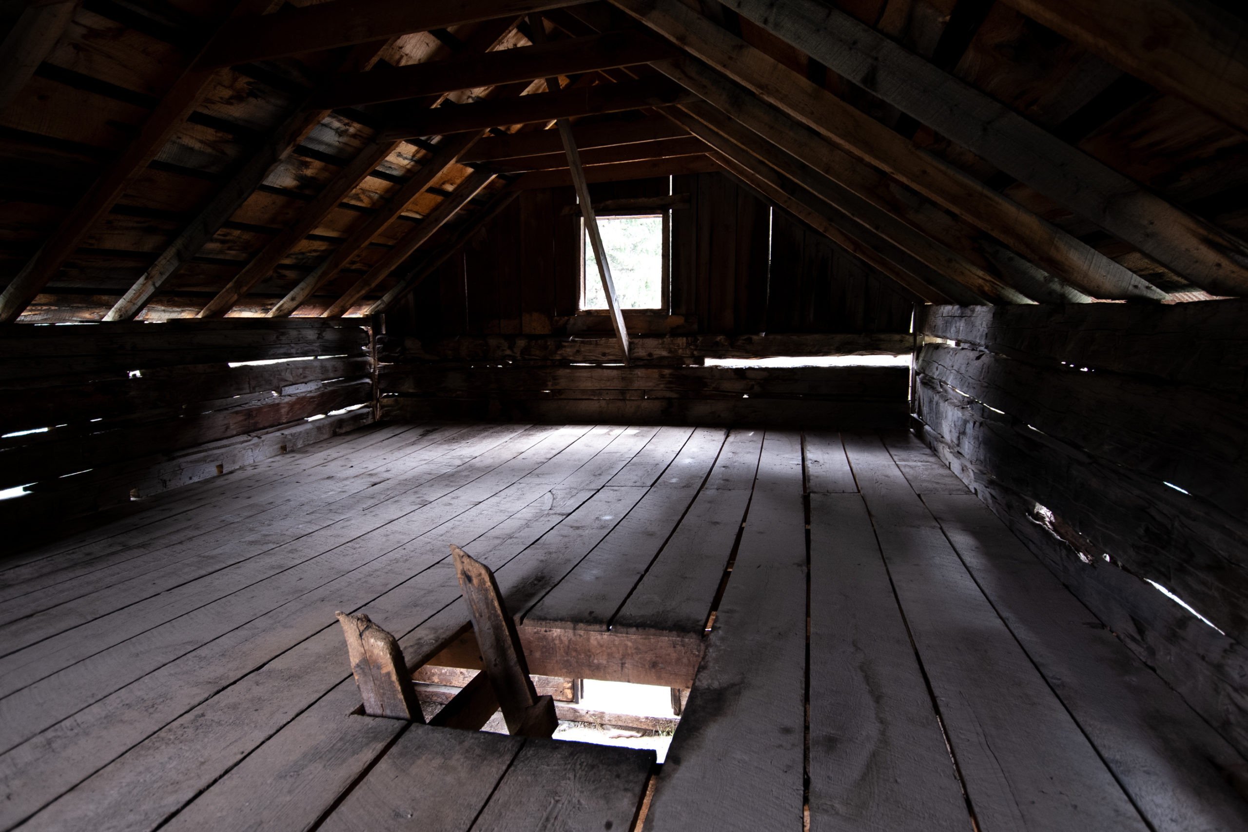
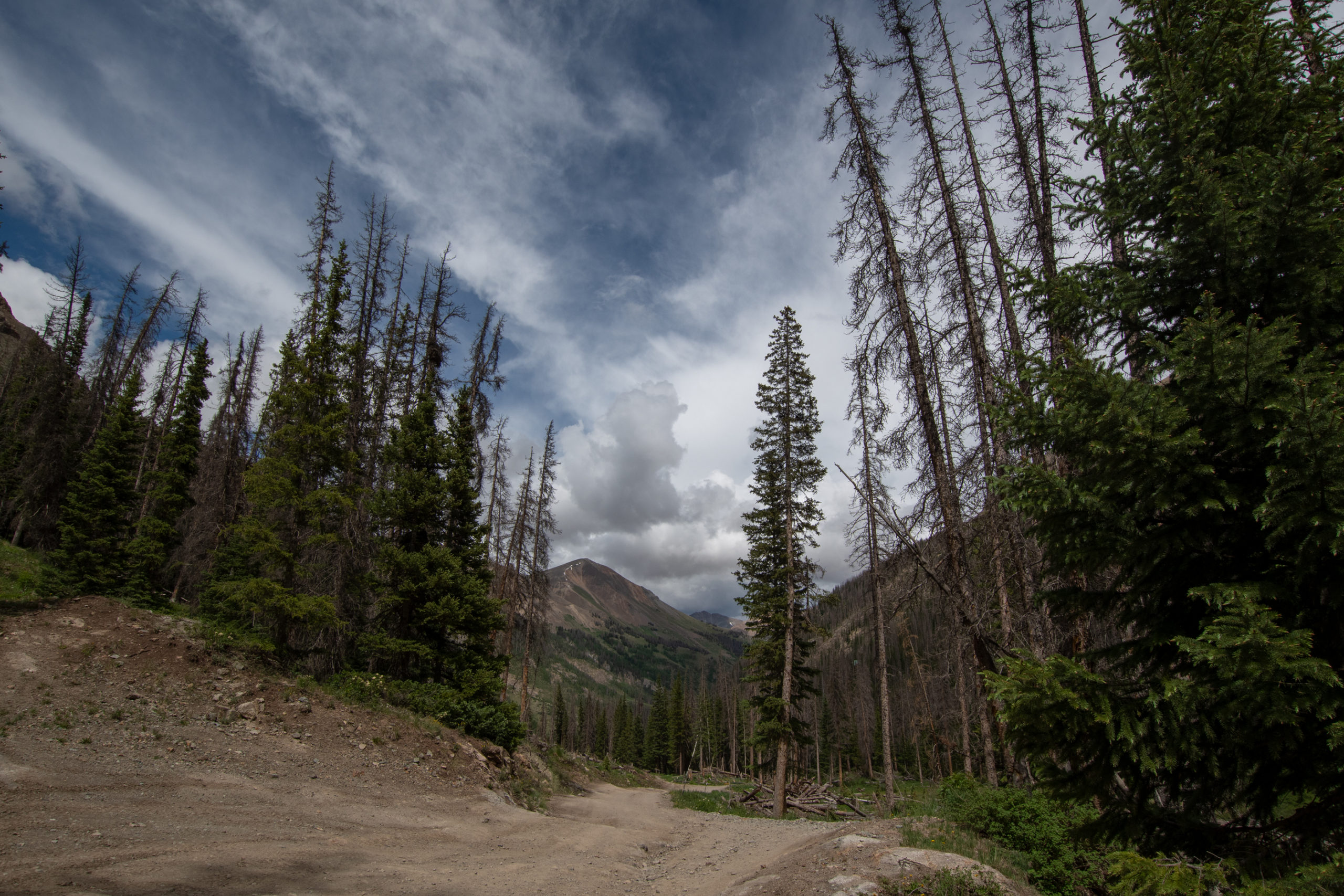
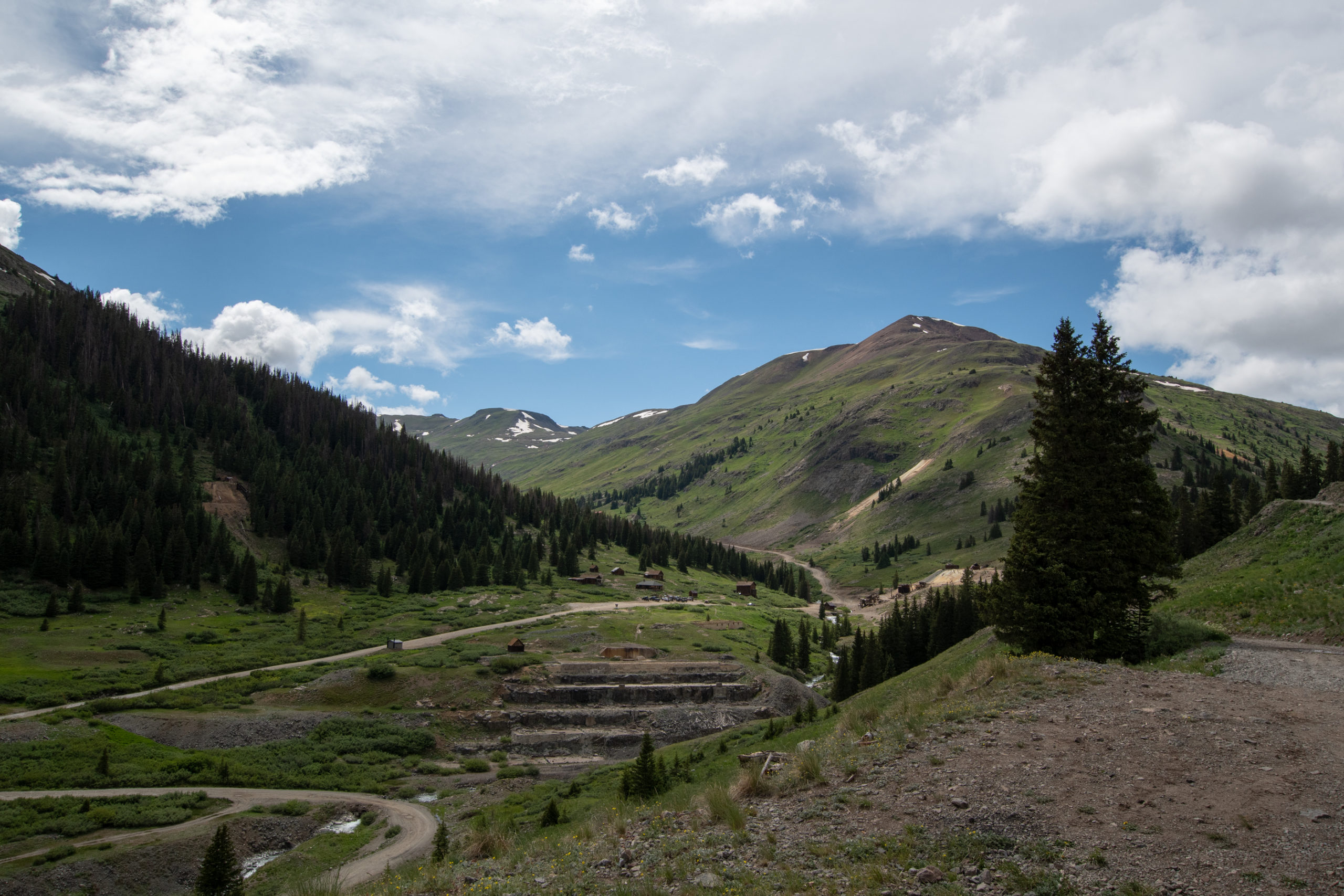
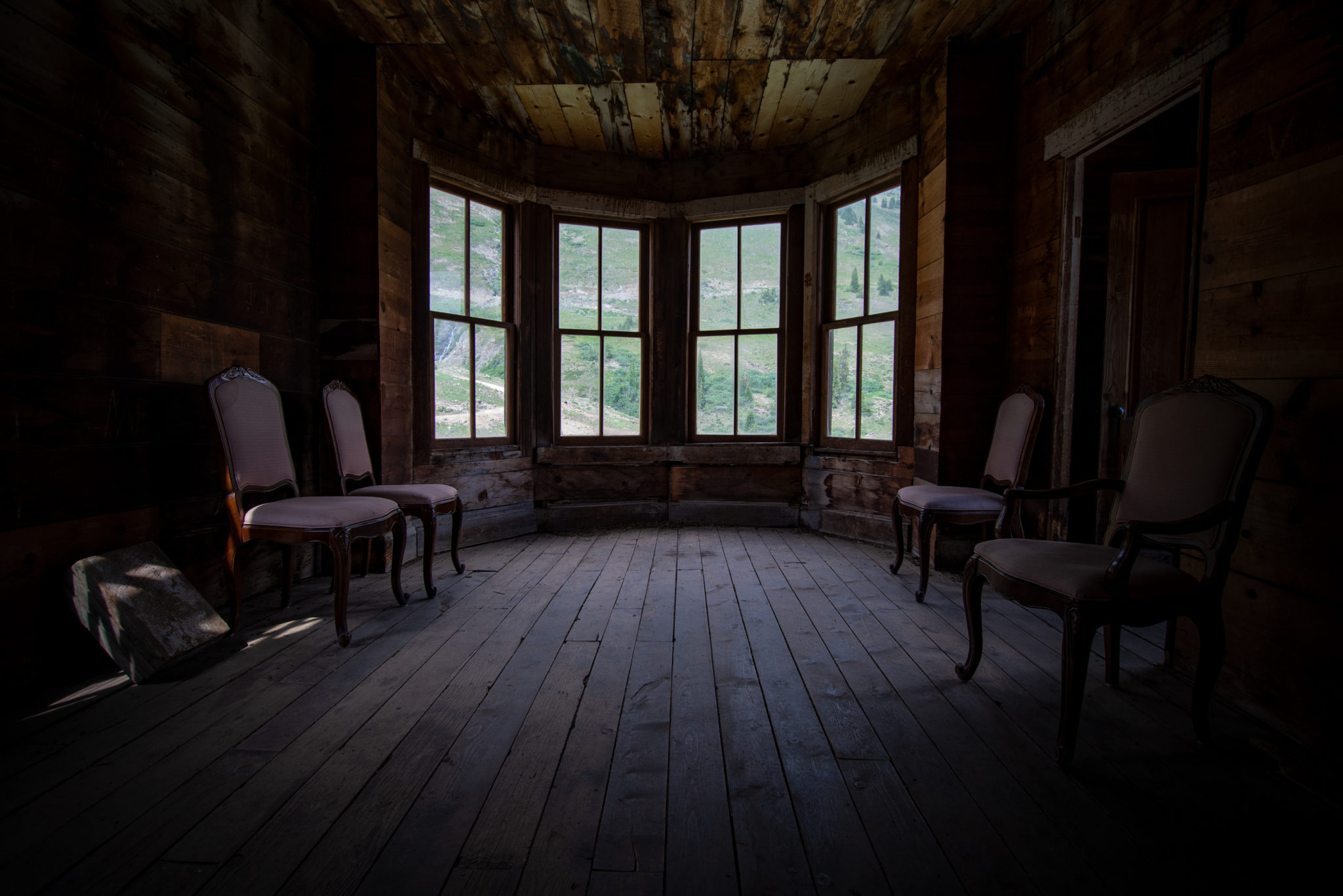
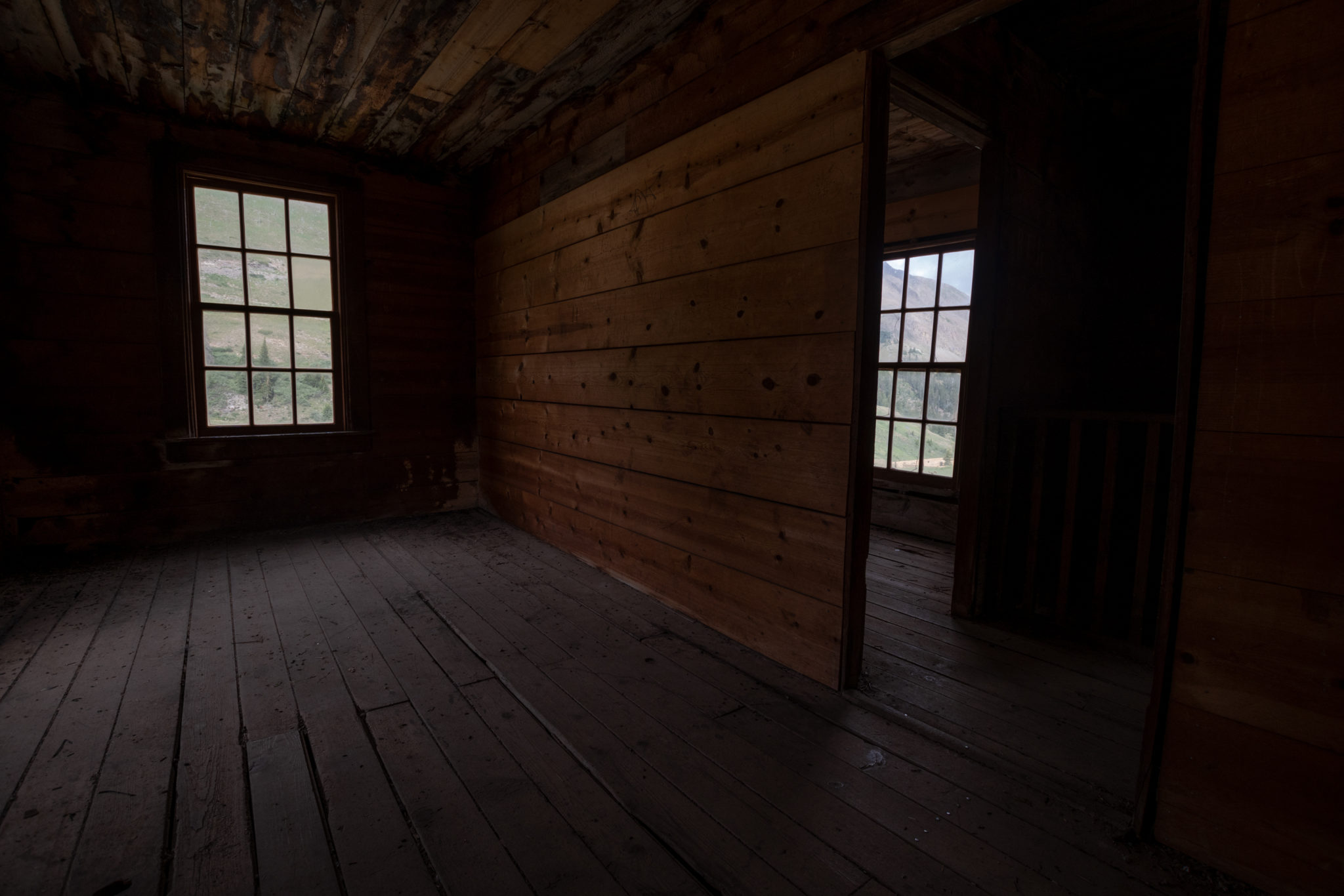
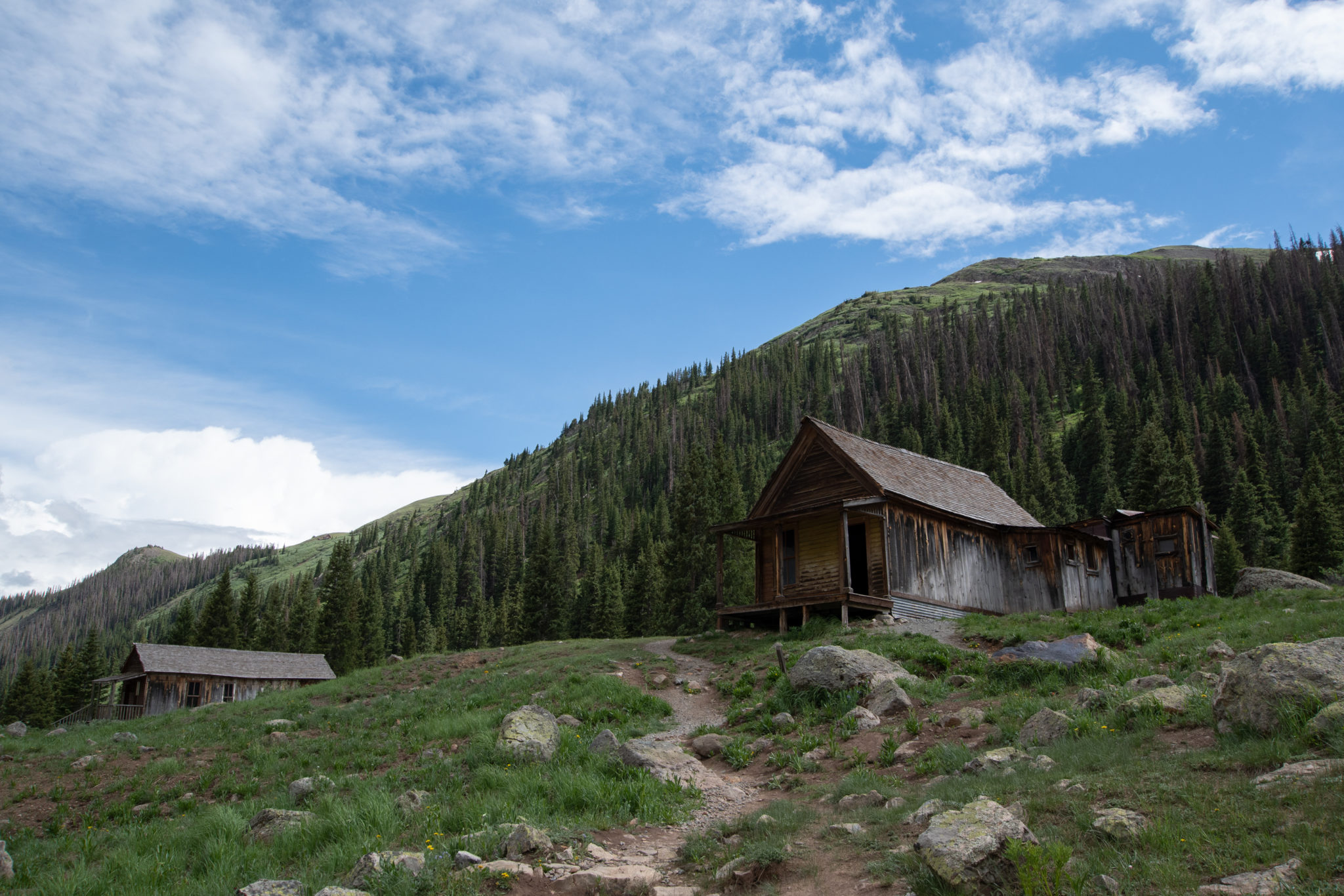
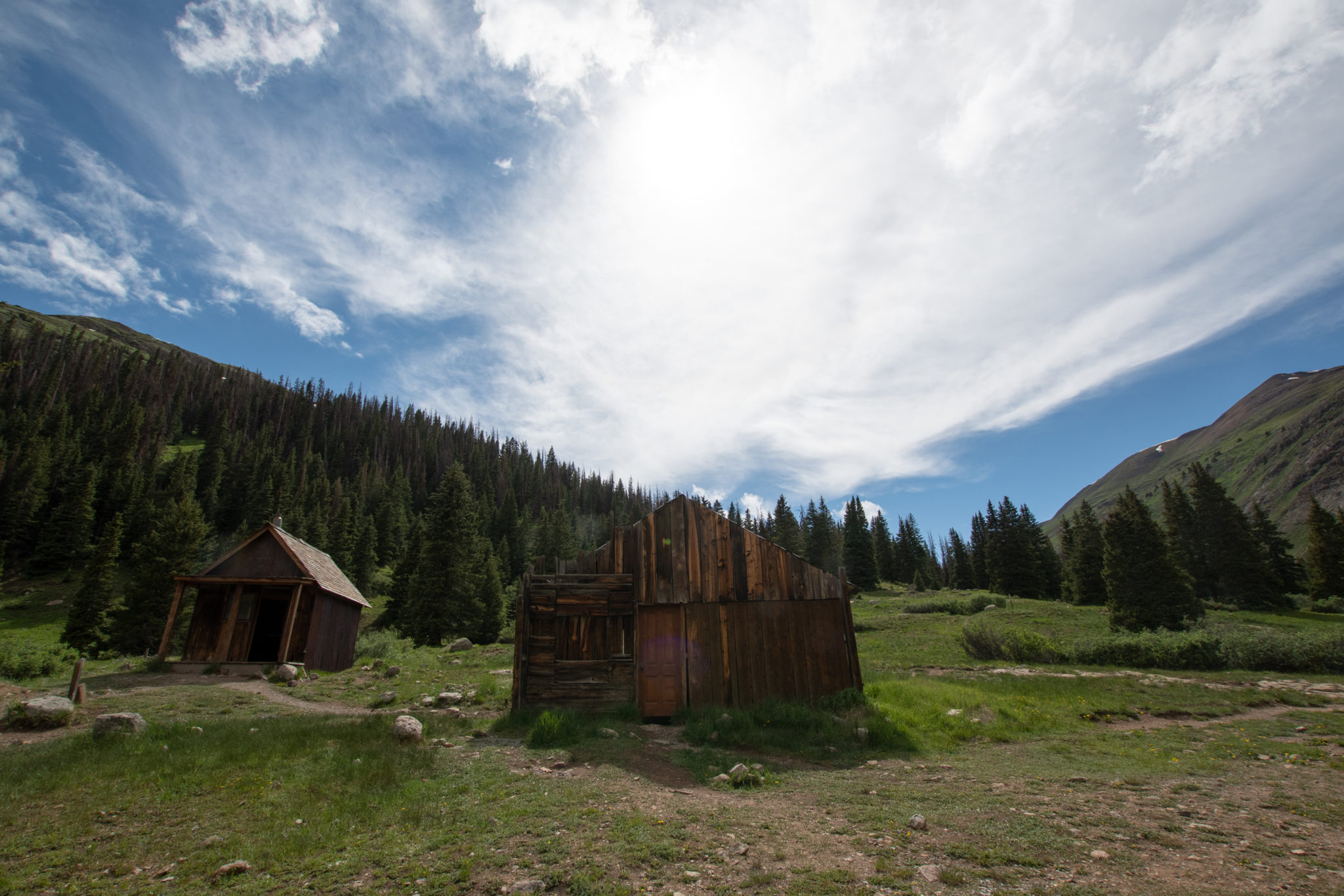
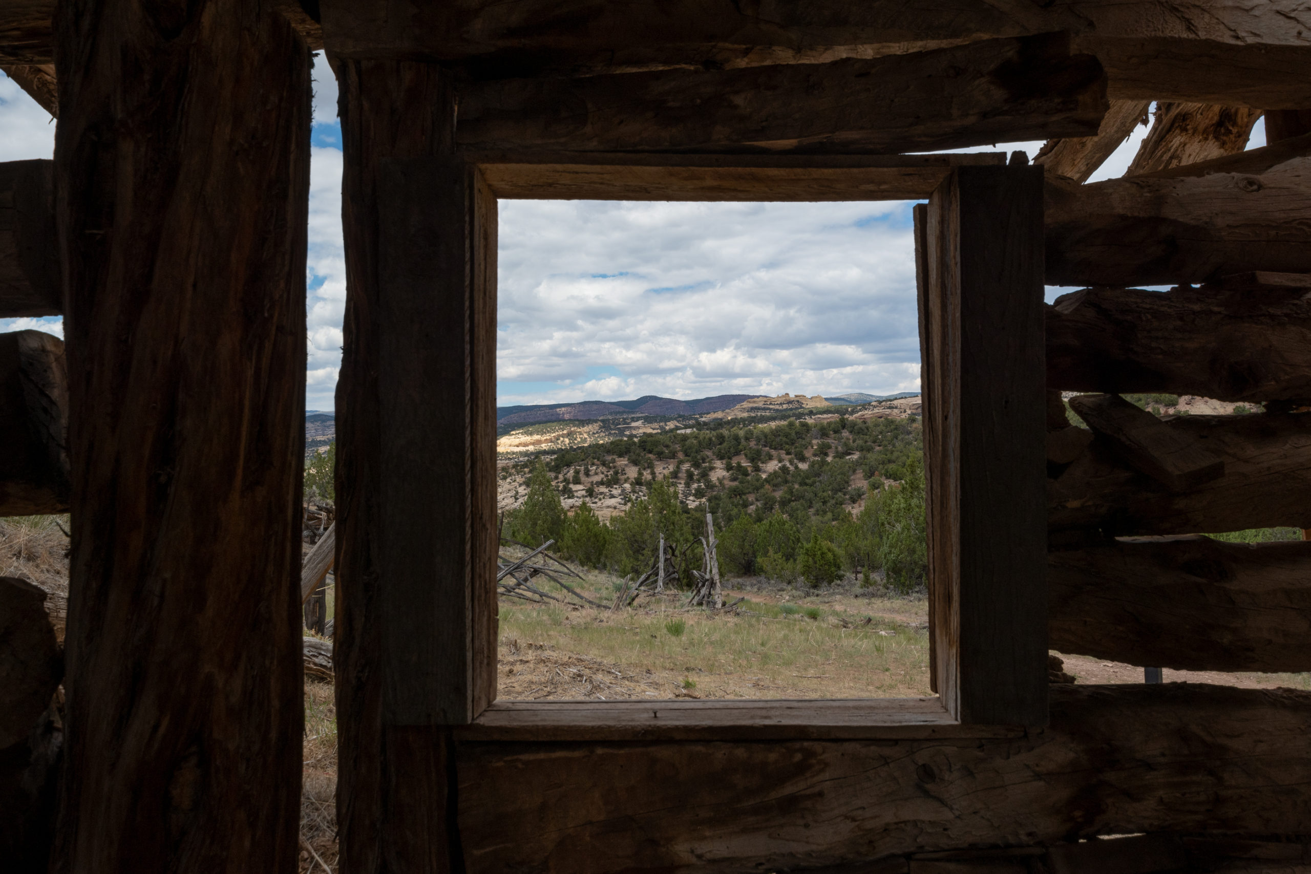
Except for what I thought — at the time lol — was a narrow shelf portion, most of Cinnamon Pass didn’t really start until a staging area by an old ghost-house. I didn’t realize today would be ghost town themed, though.
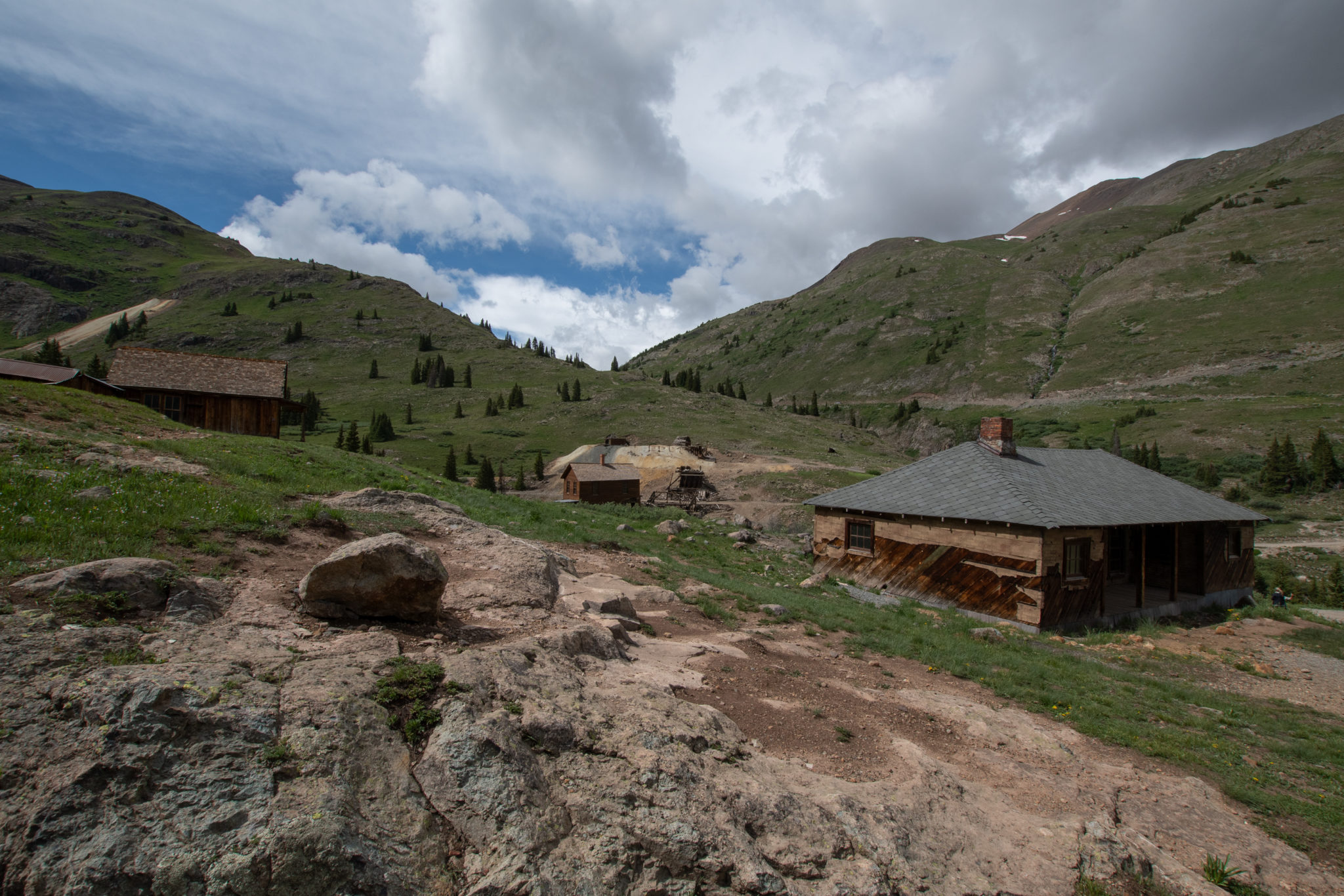
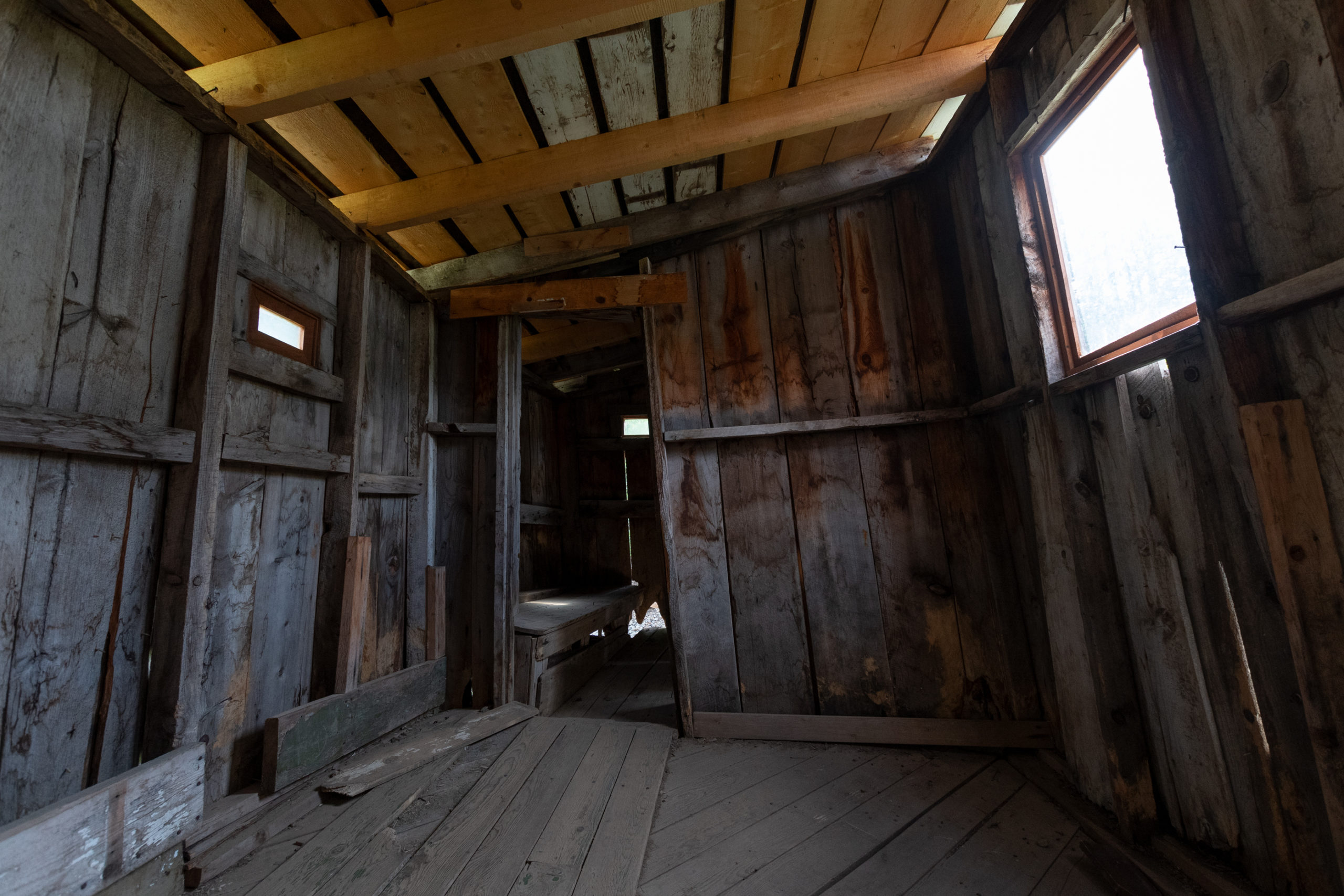
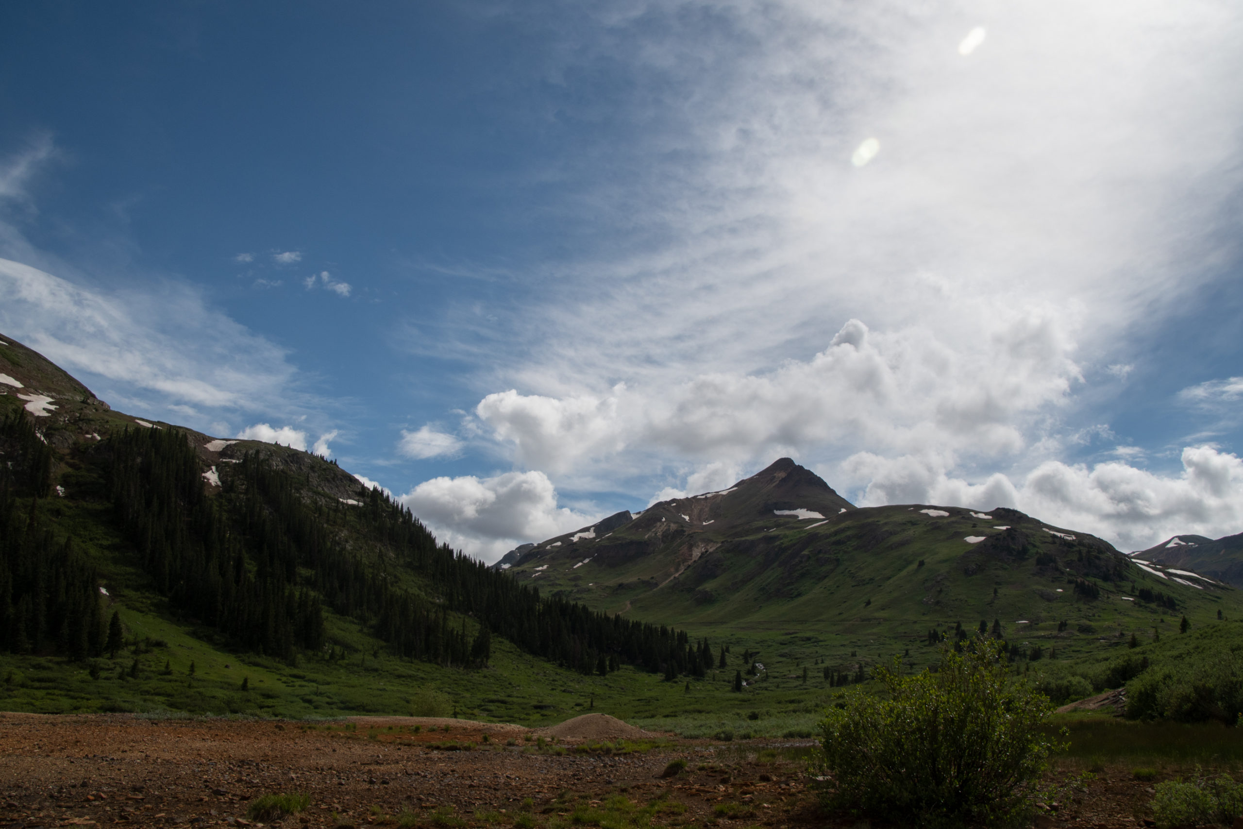
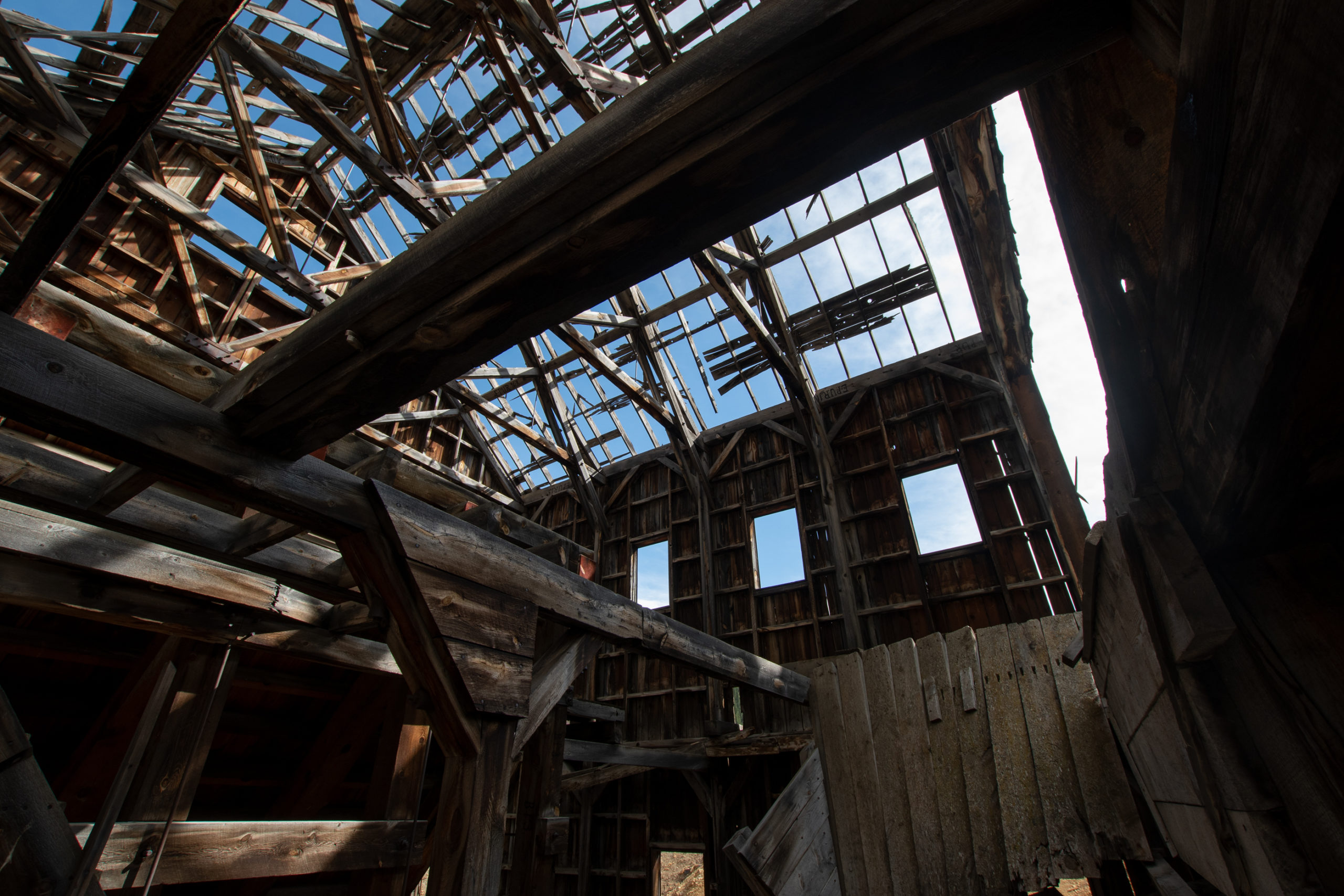
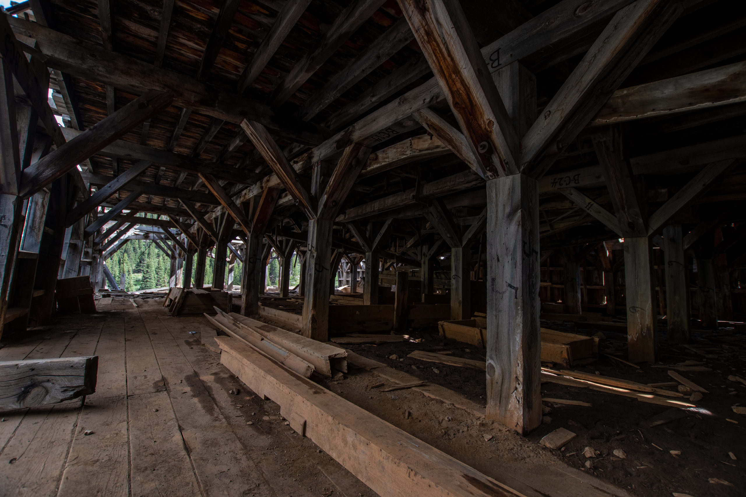
Cinnamon Pass ends along with Engineer Pass, the more technical alternate and Alpine Loop favorite, in what remains of the old mining settlement Animas Forks.
Early prospectors wintered in “Three Forks of the Animas” in 1873 looking for gold and silver. In 1875, the town name was shortened and a road was constructed up from Silverton to link up with the original road from Lake City, now called Cinnamon Pass. By 1885, the summer population was about 450 people, but few remained through the brutal winters of 11,200 feet. The town operated until the 1920s and still holds the record for highest-altitude regular newspaper. But when metal prices fell world-wide, Animas Forks slowly devolved into a ghost town.
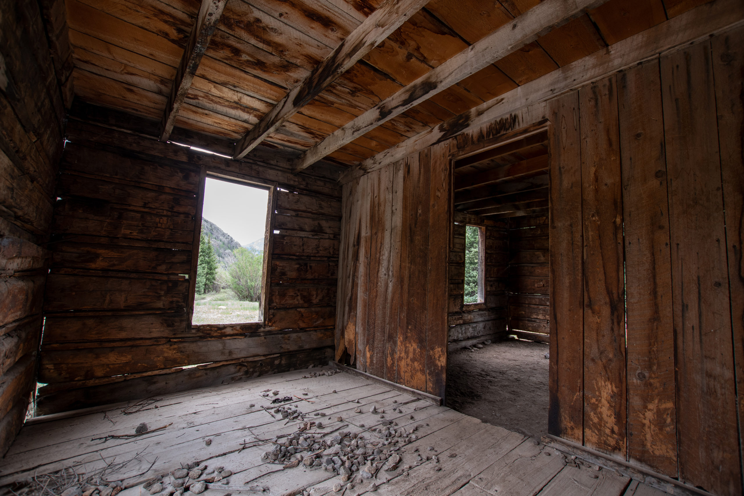
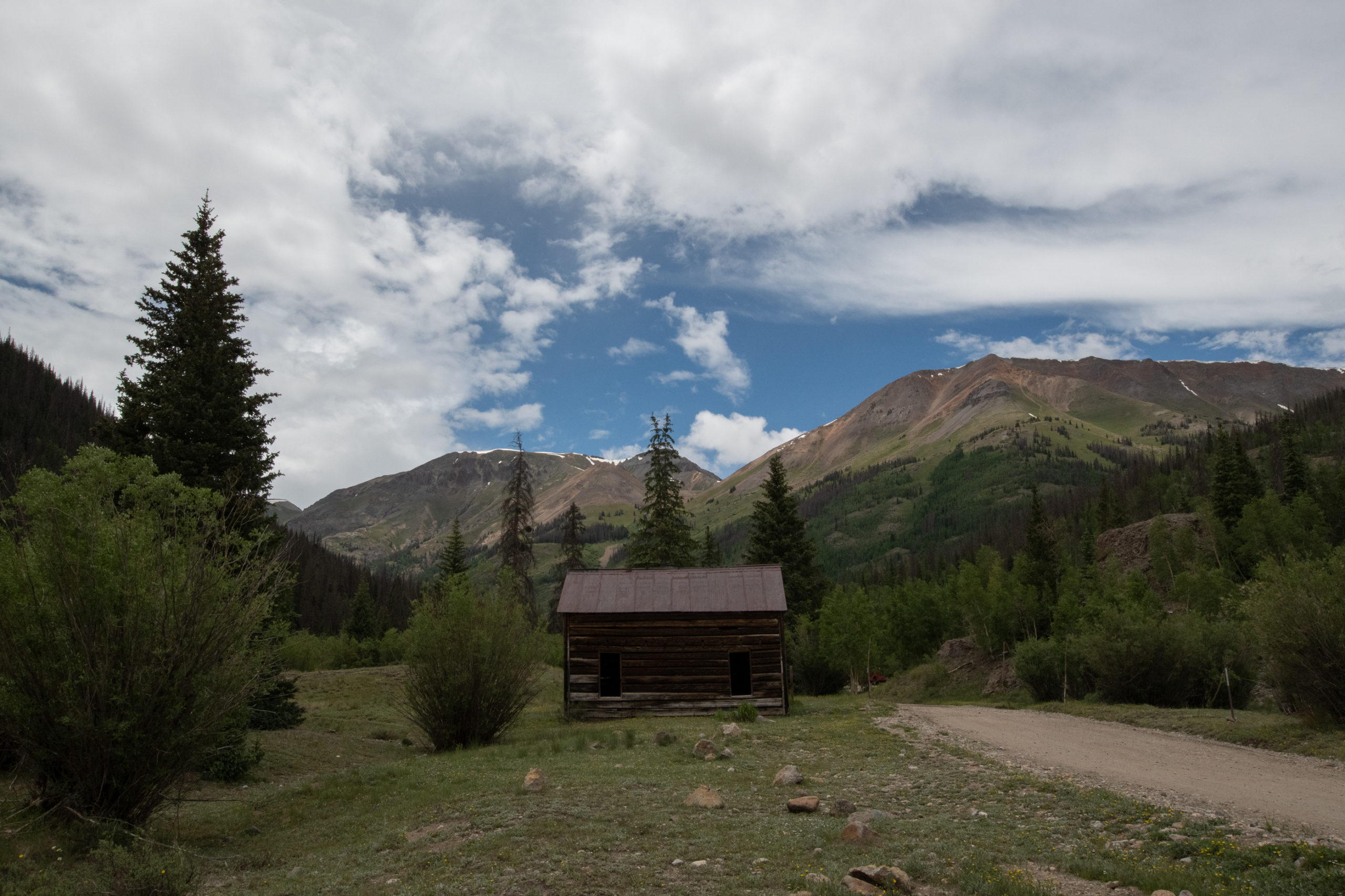
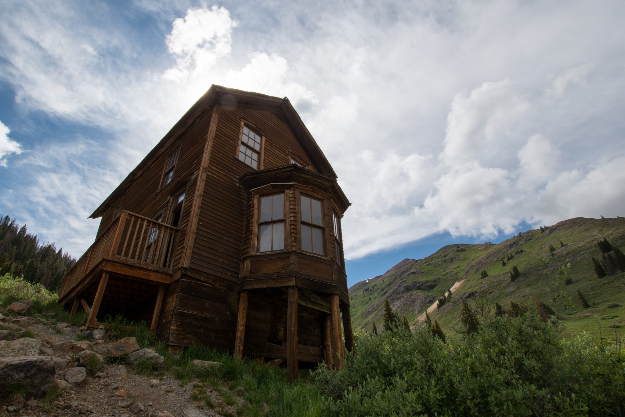
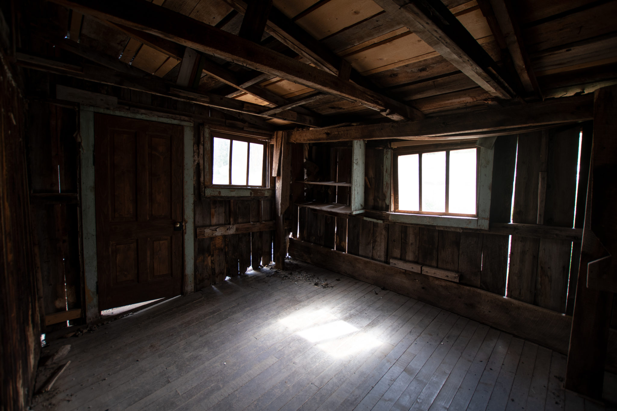
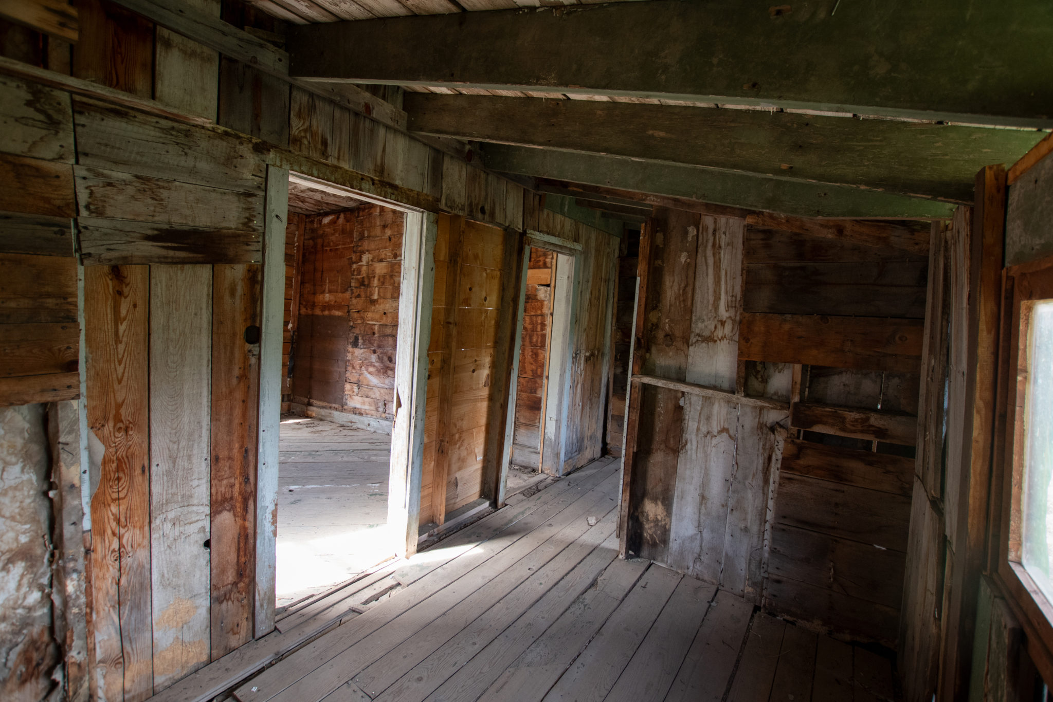
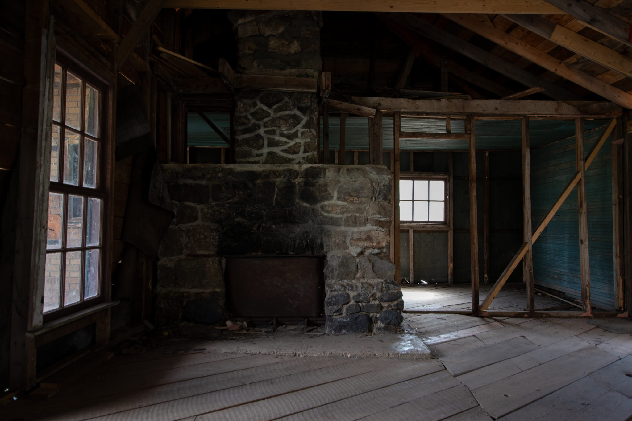
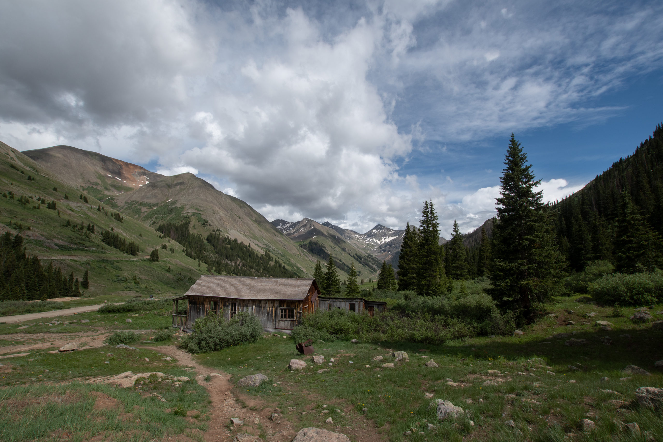
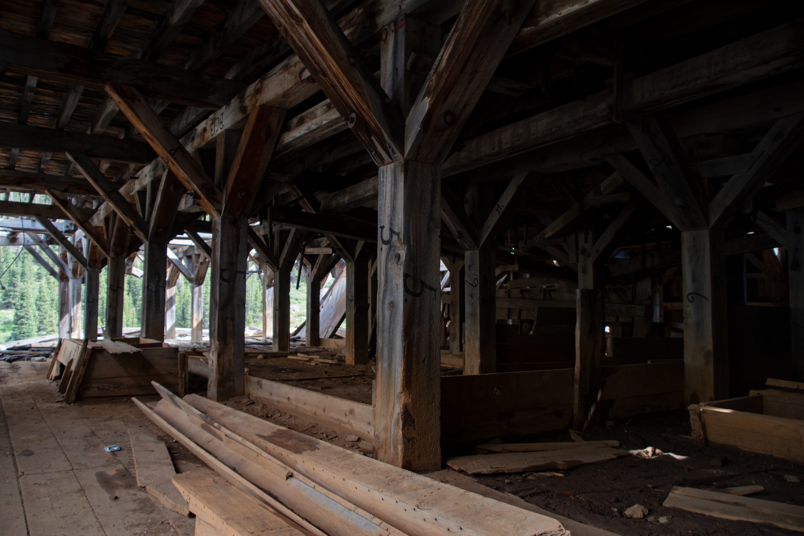
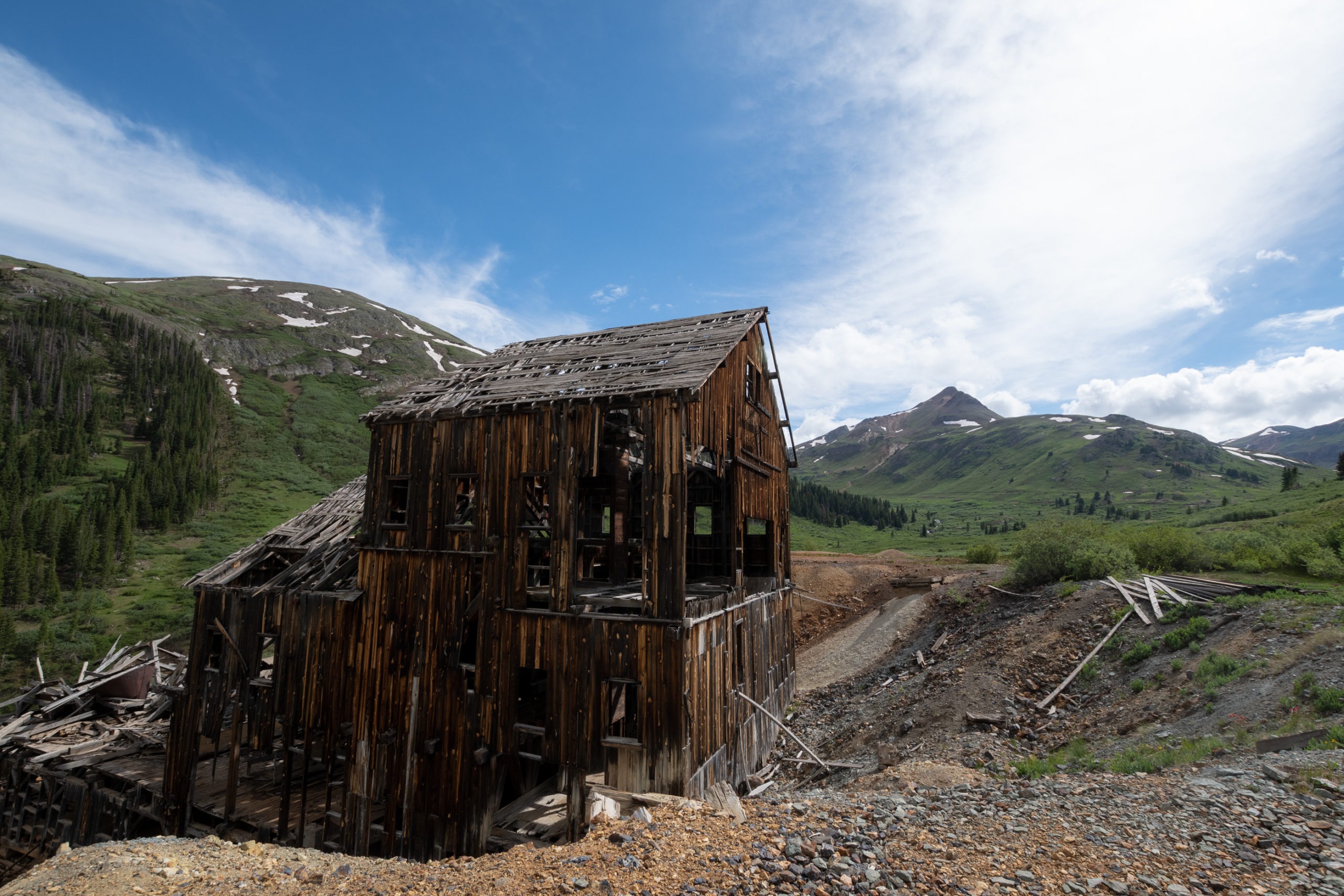
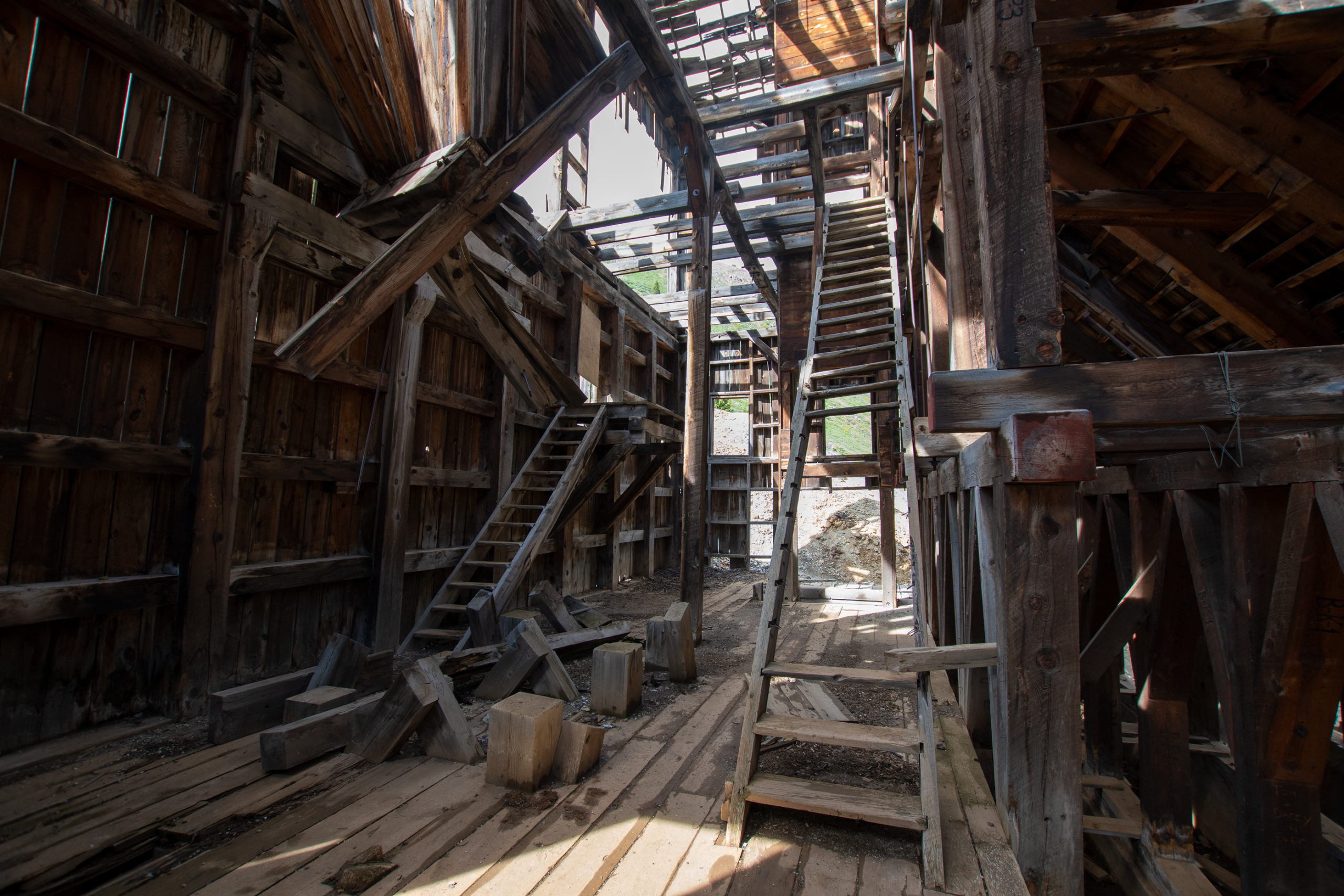
I left Animas headed up California Pass. But not even half a mile later, another abandoned building. This one was particularly large, but I didn’t see any signage. Looks like some kind of processing area, but it doesn’t look like it had a furnace like Mariscal did — it was all wood, no brick to speak of. Just about ten thousand OSHA violations.
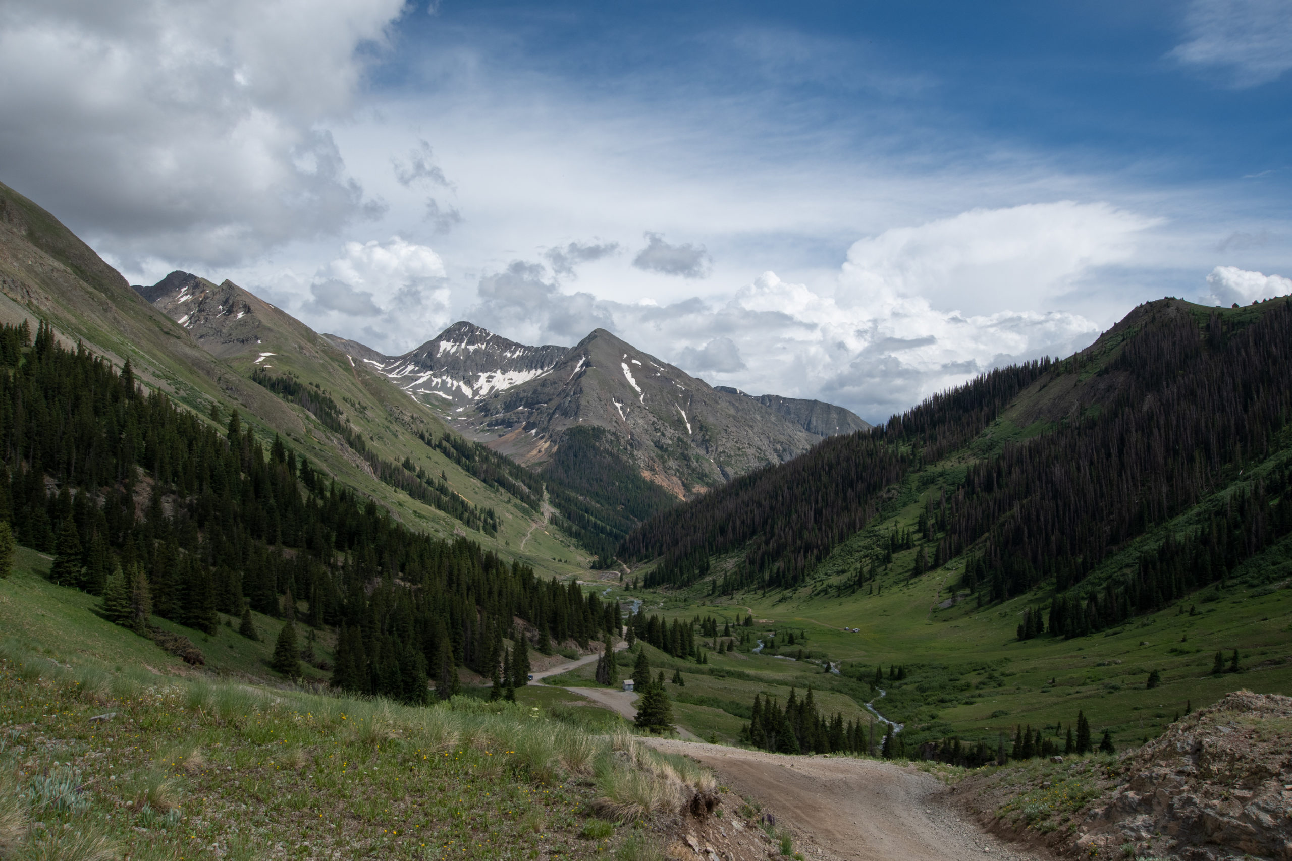
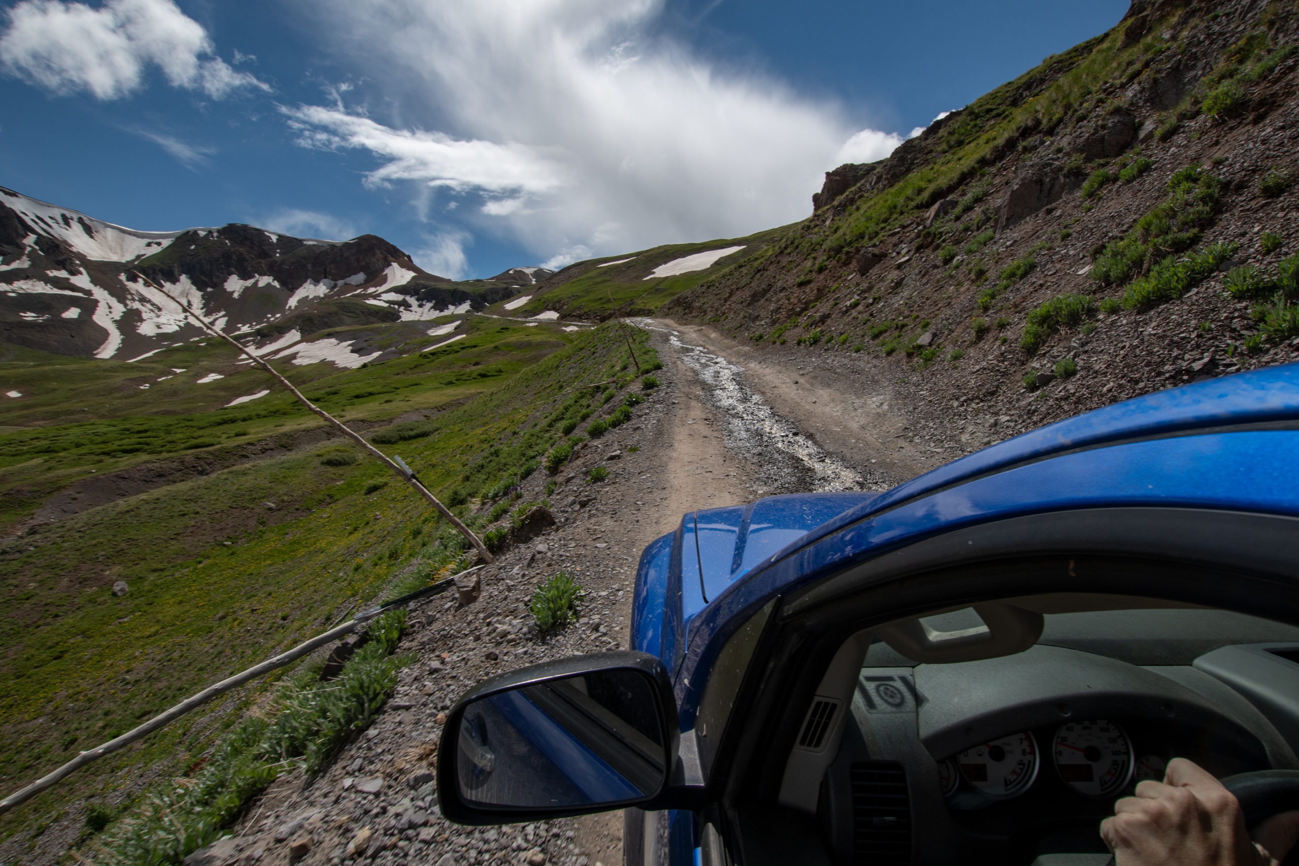
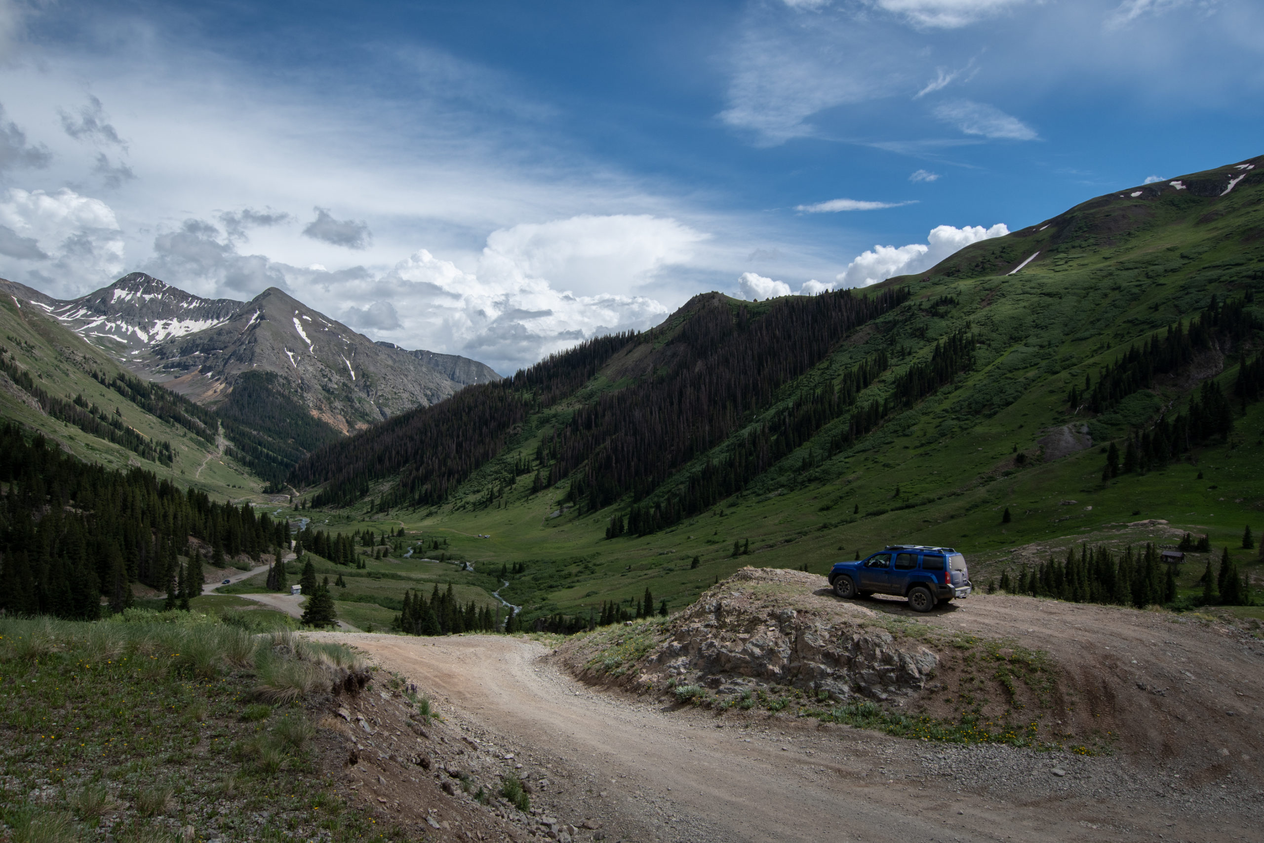
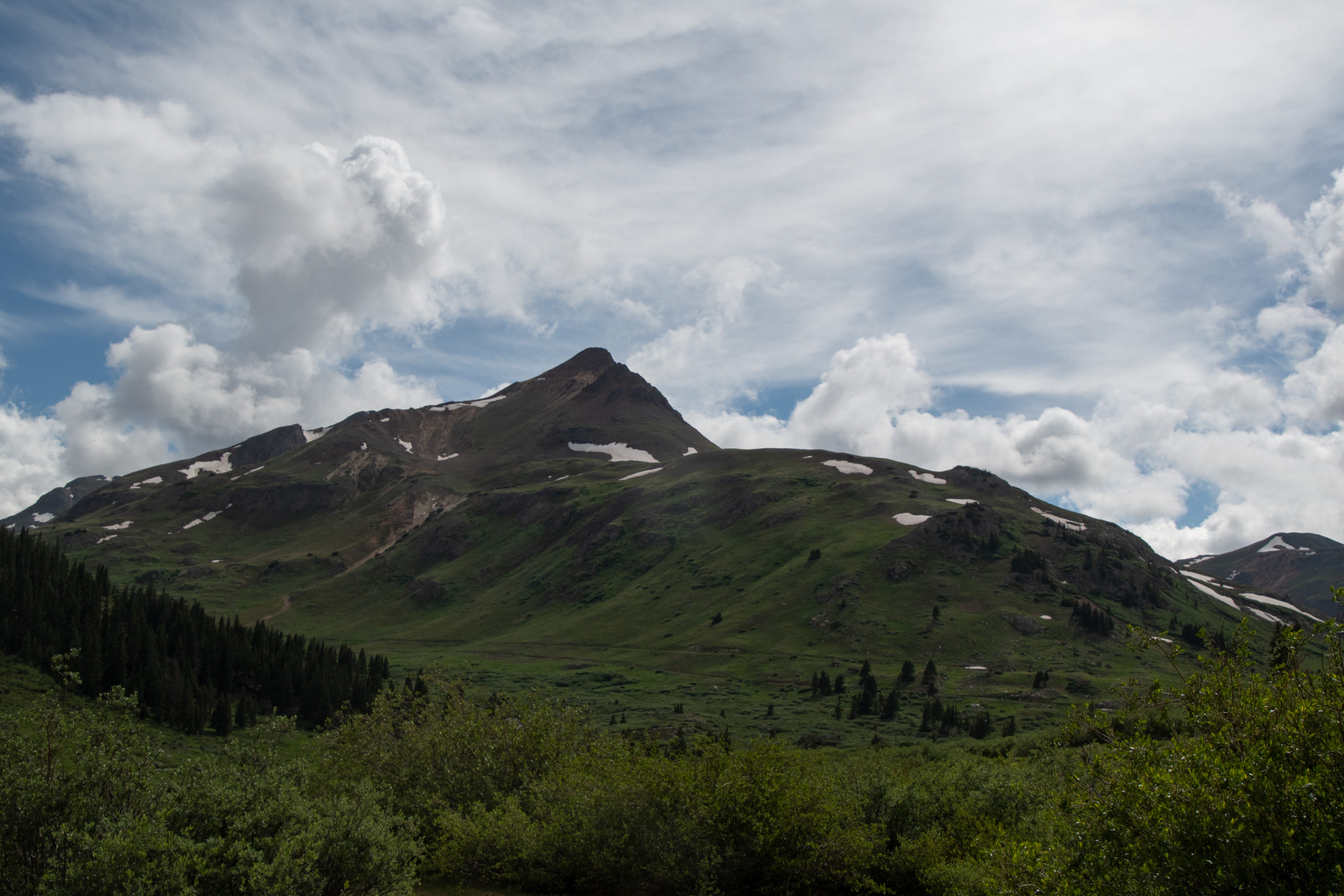
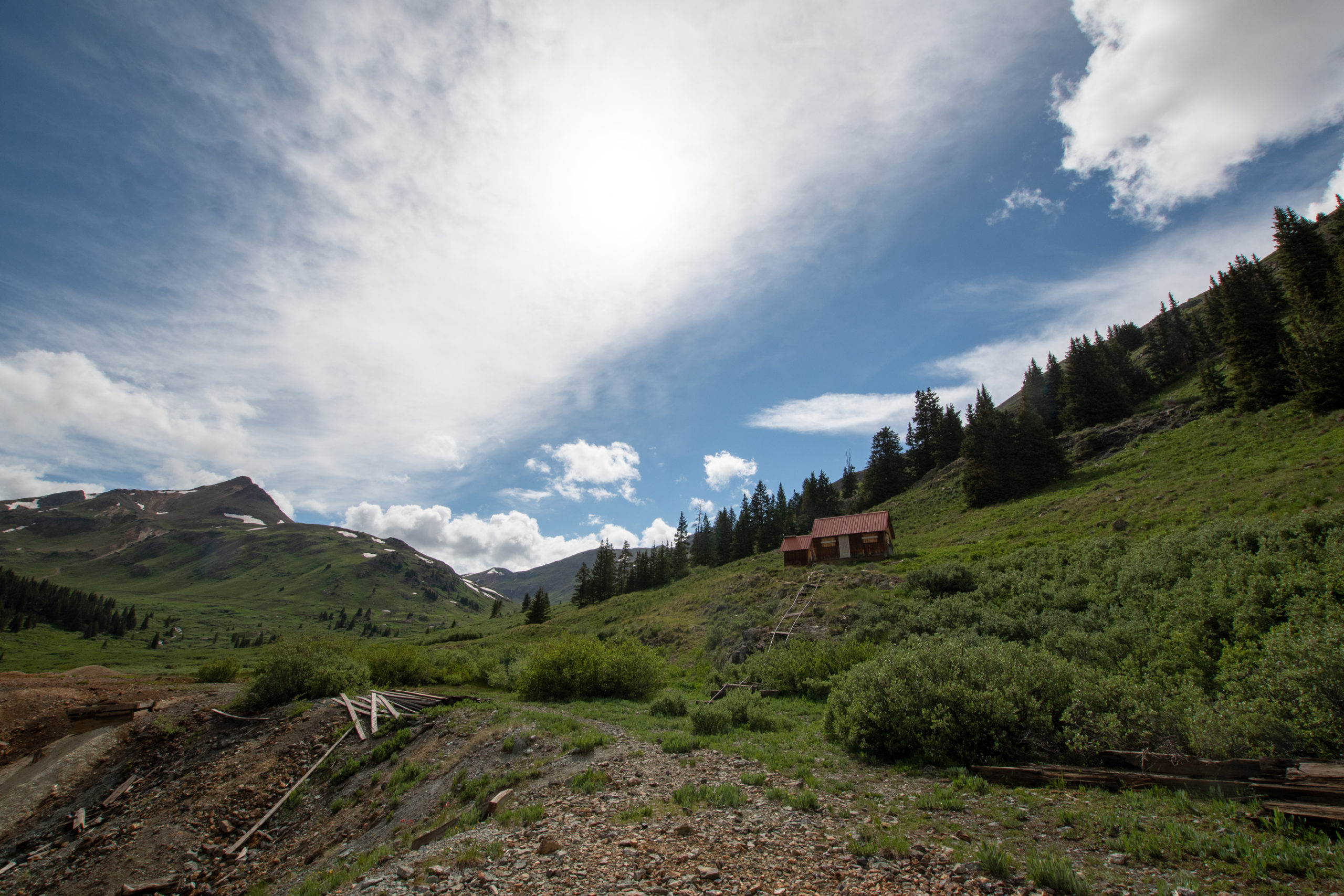
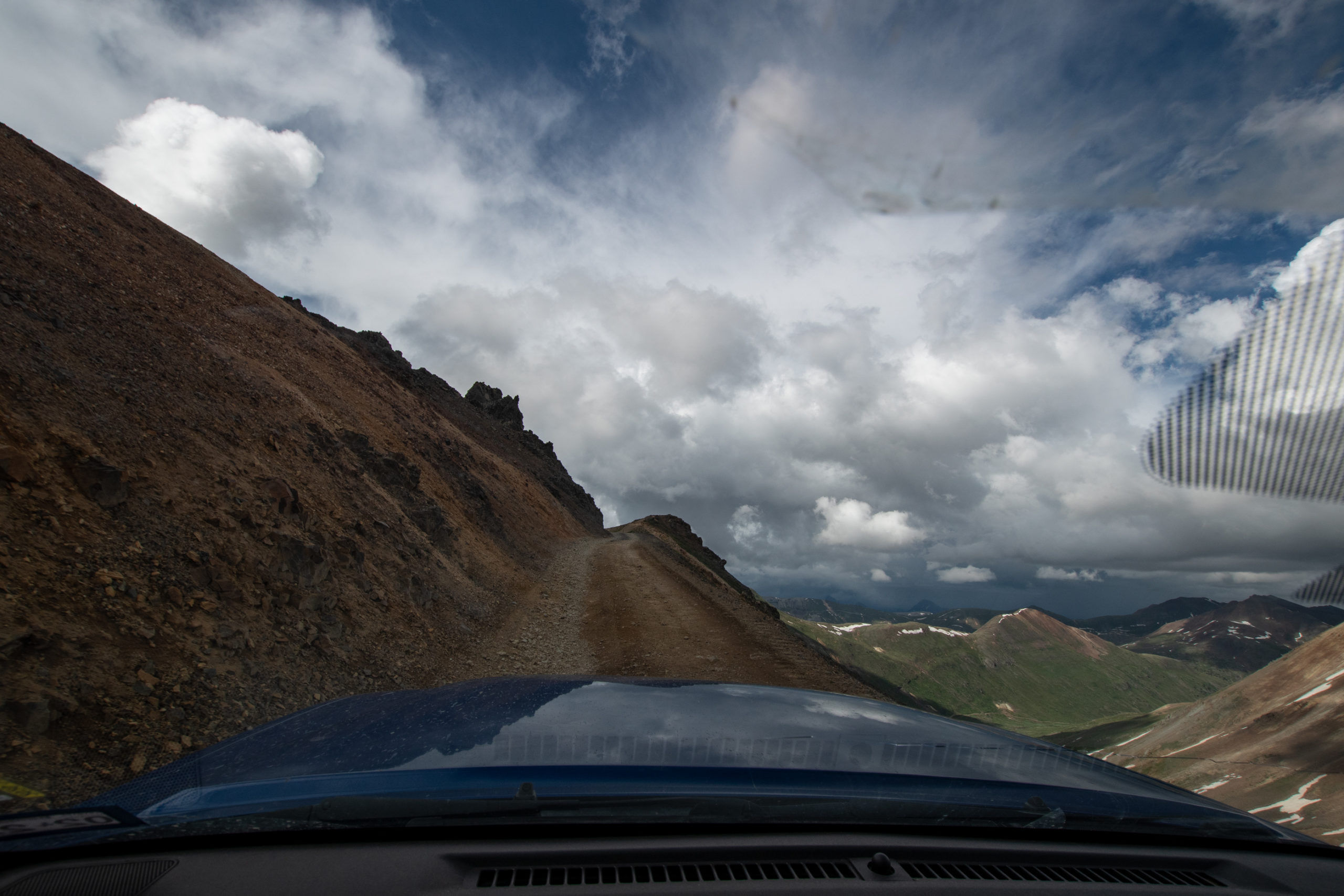
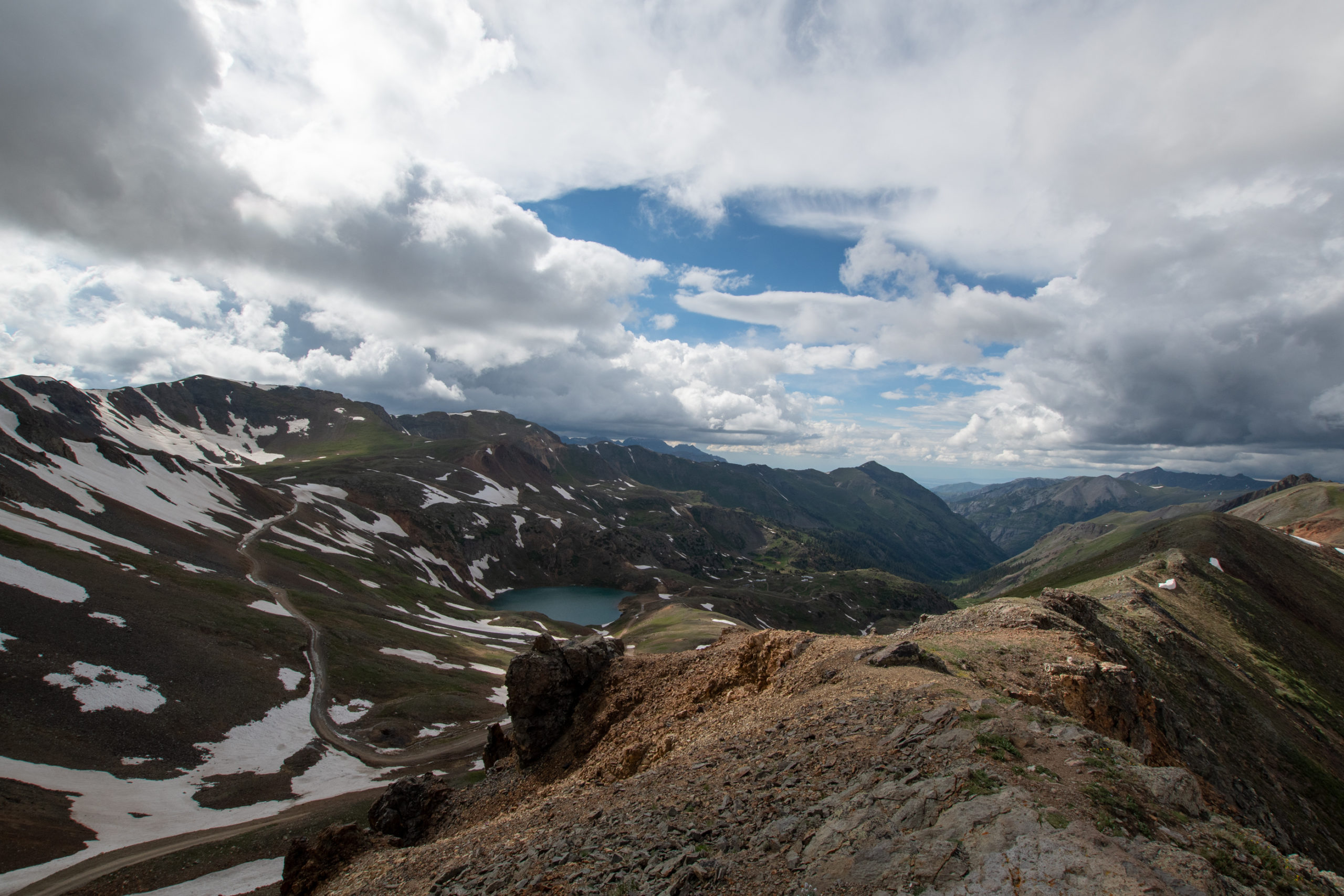
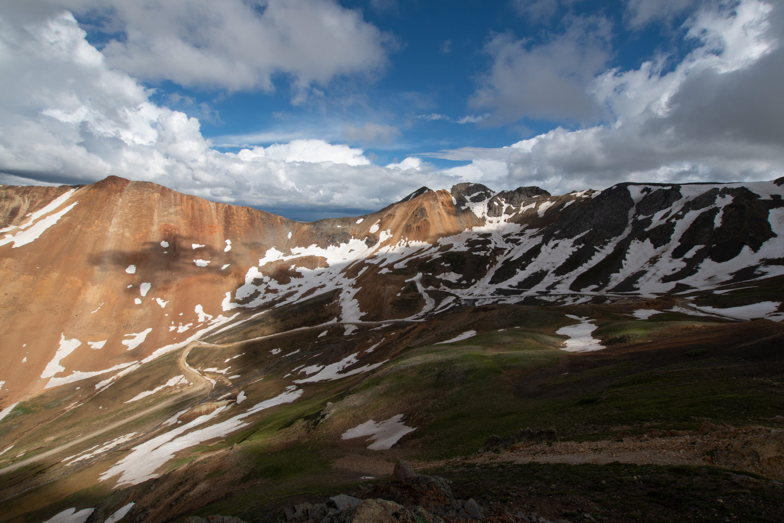
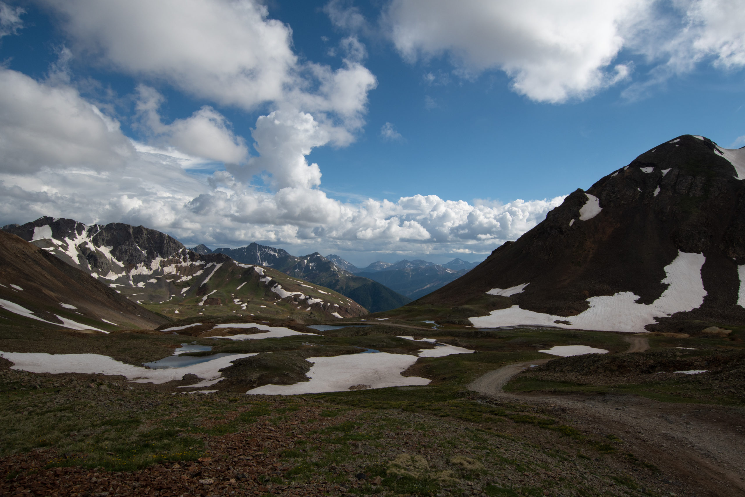
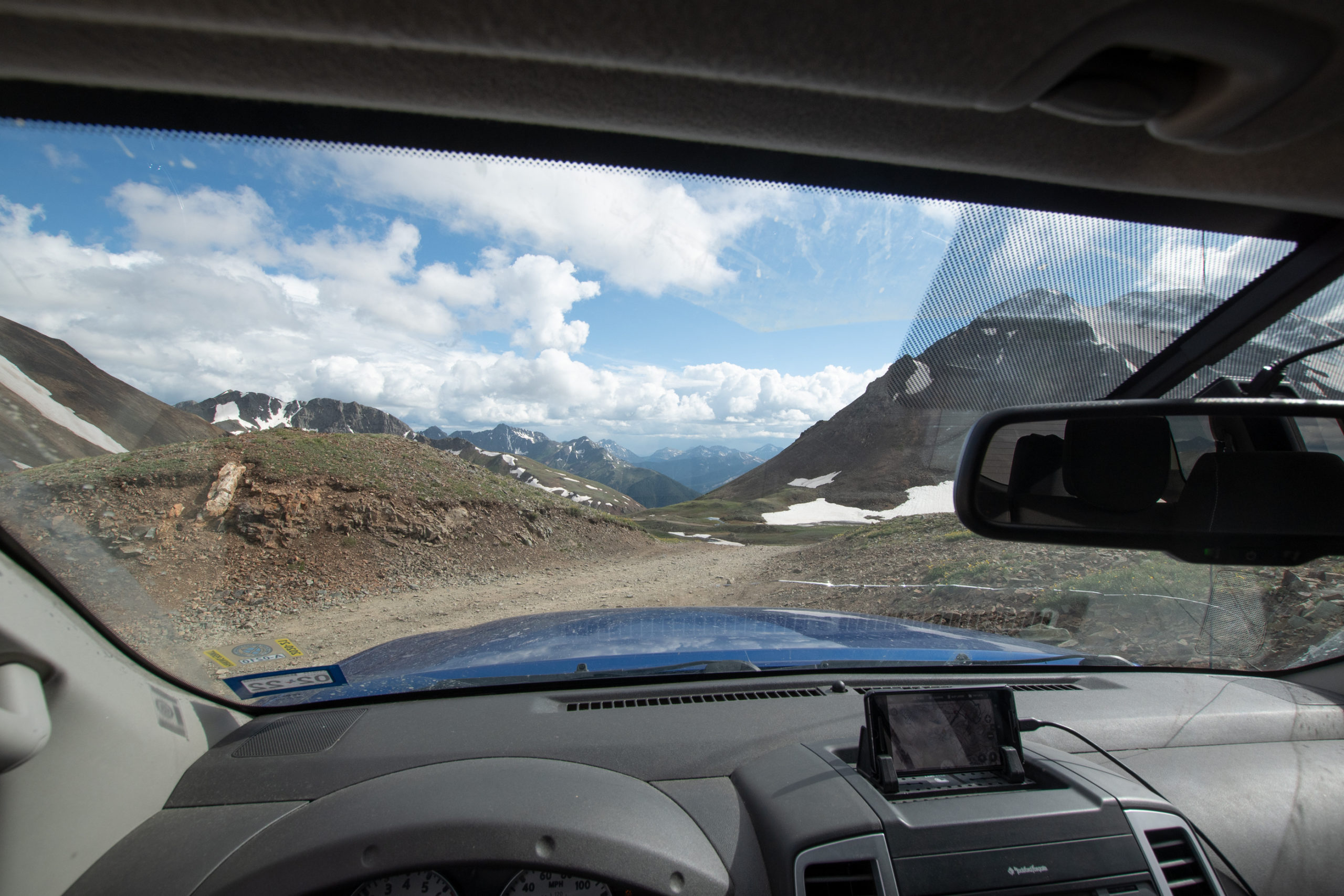
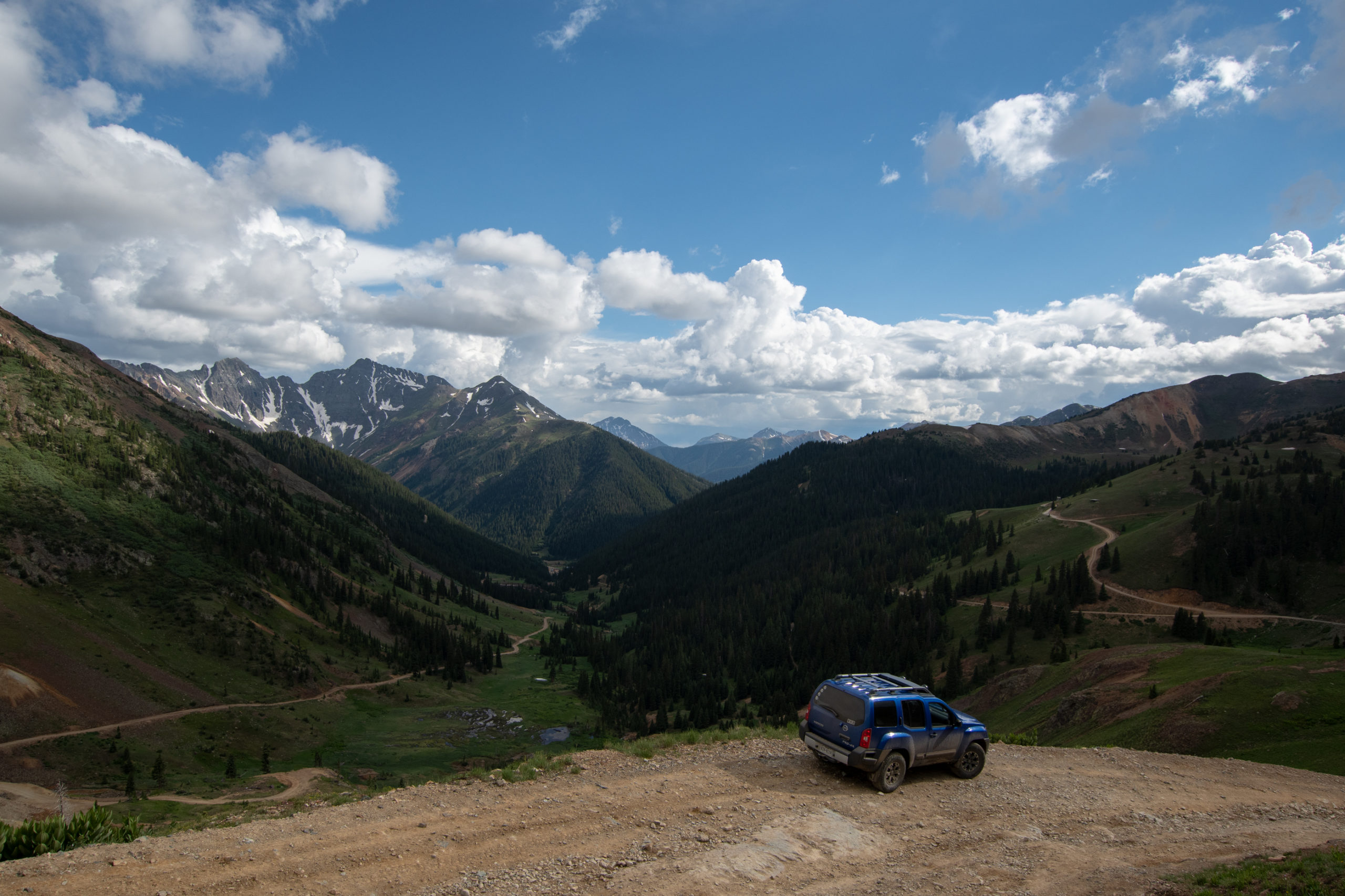
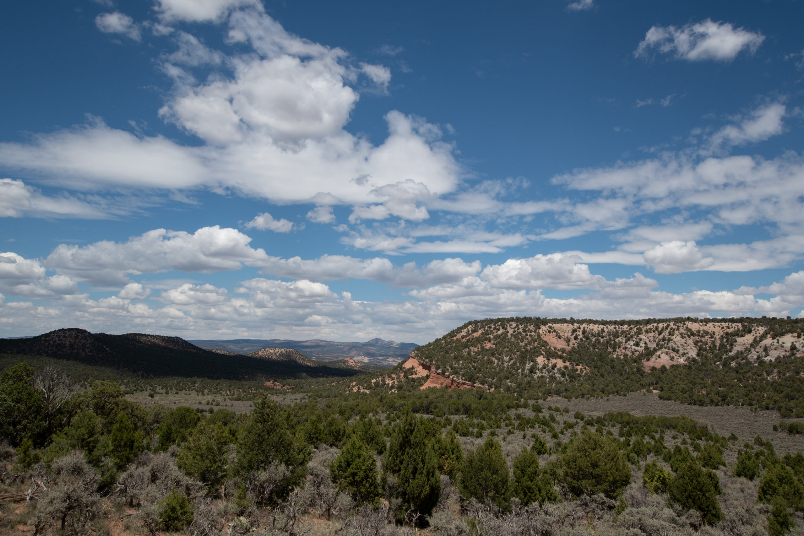
California, Hurricane, and Corkscrew passes made for a dramatic roller coaster. Nothing particularly difficult, but very narrow shelves and extremely steep grades with loose rock. It was awesome.
Mom used to shriek going around the switchbacks of Berthoud Pass when we headed up to the Rockies for family reunions in the summers. Too bad she wasn’t here today.
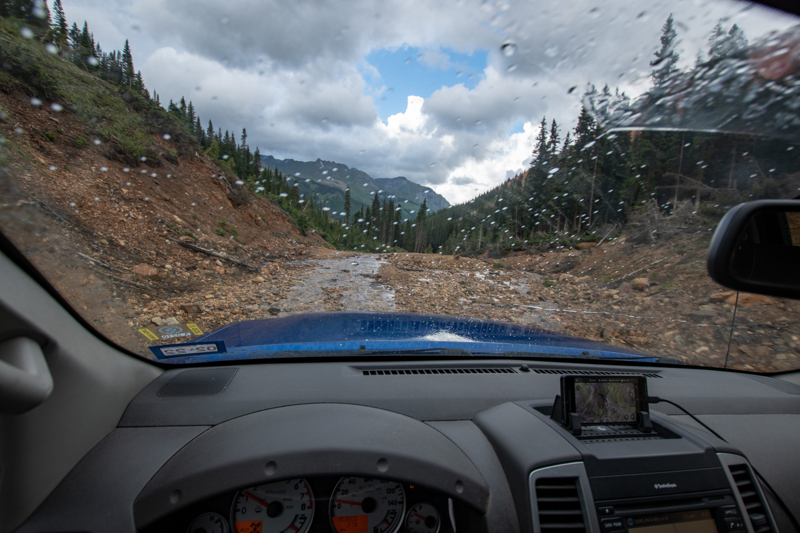
Usually I win for “most effective engine braking” but there was actual fighting and shouting to try and keep my speed under 15 on the final descent, as it started raining.
And with that — in 5 hours, I covered about 35 miles. All-in-all, I rate this circuit of four trails as 11 out of 10, would do again to avoid having to take a civilized mountain pass.
PS: I would like to thank Evan and George for the 10-20mm ultrawide gift they got me for the Jeep Float. I barely used anything else all day. At the time, we joked that 15mm-ish with rectilinear distortion is basically “Real Estate Photography” mode. Pretty sure I sold a ghost town today.
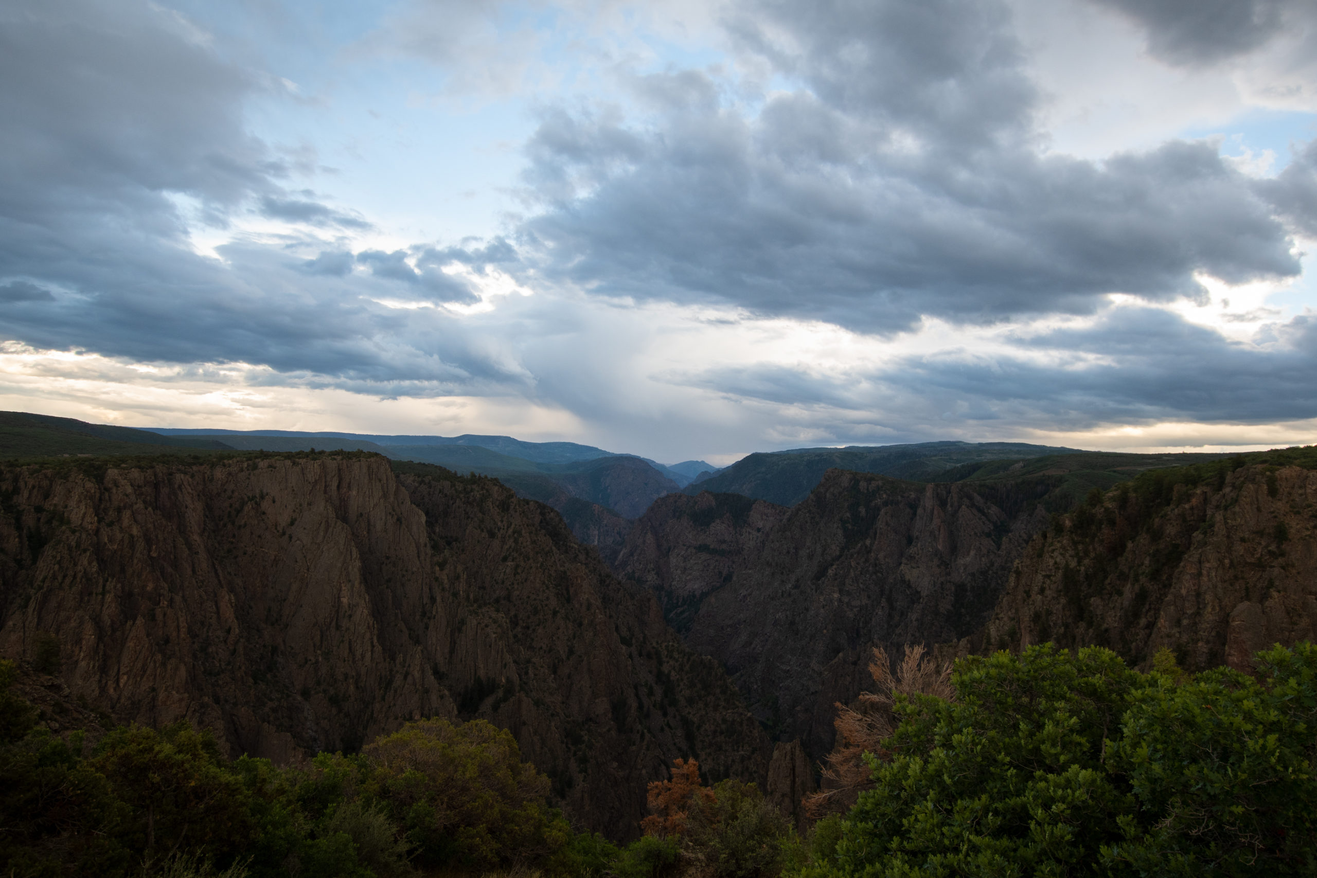
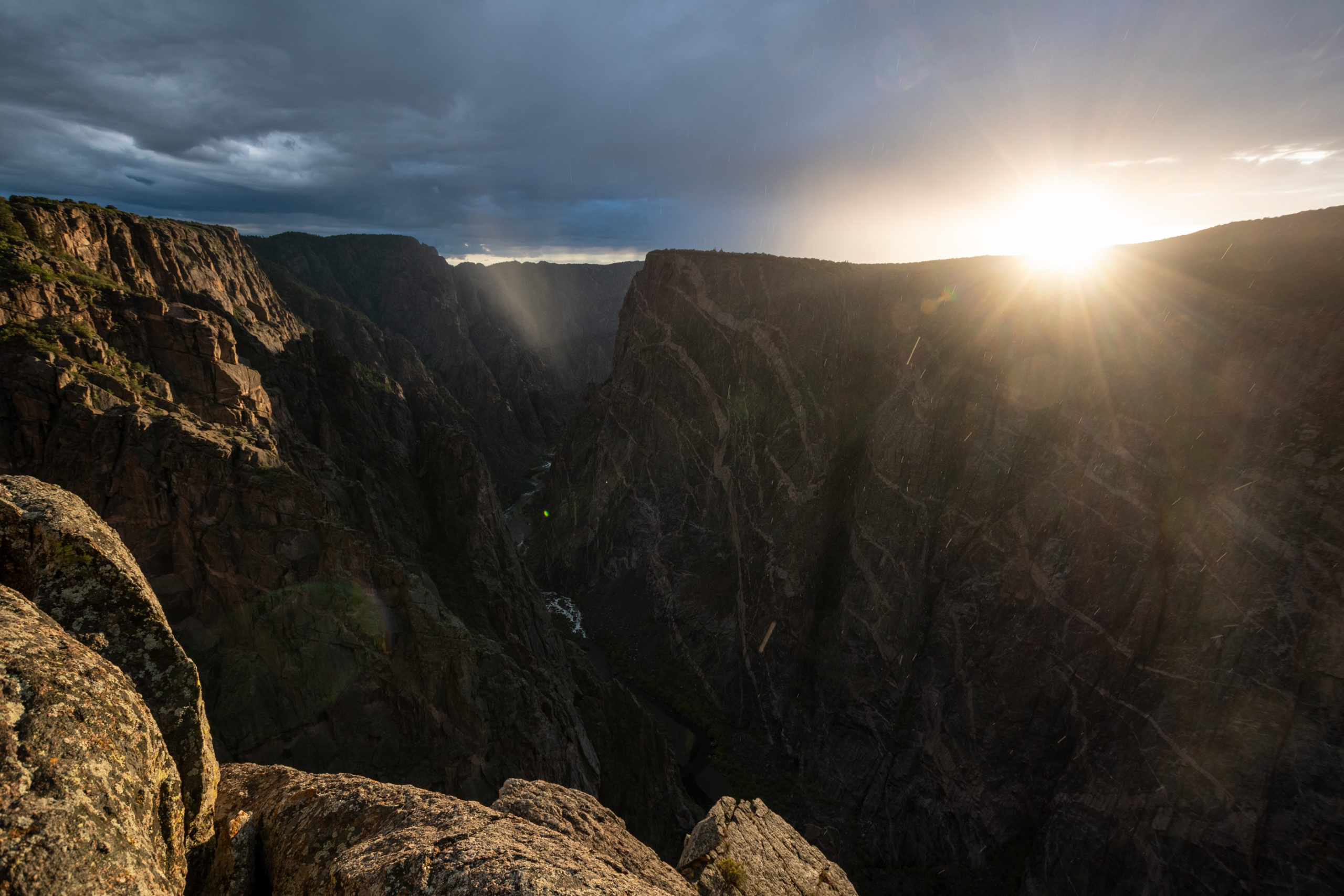
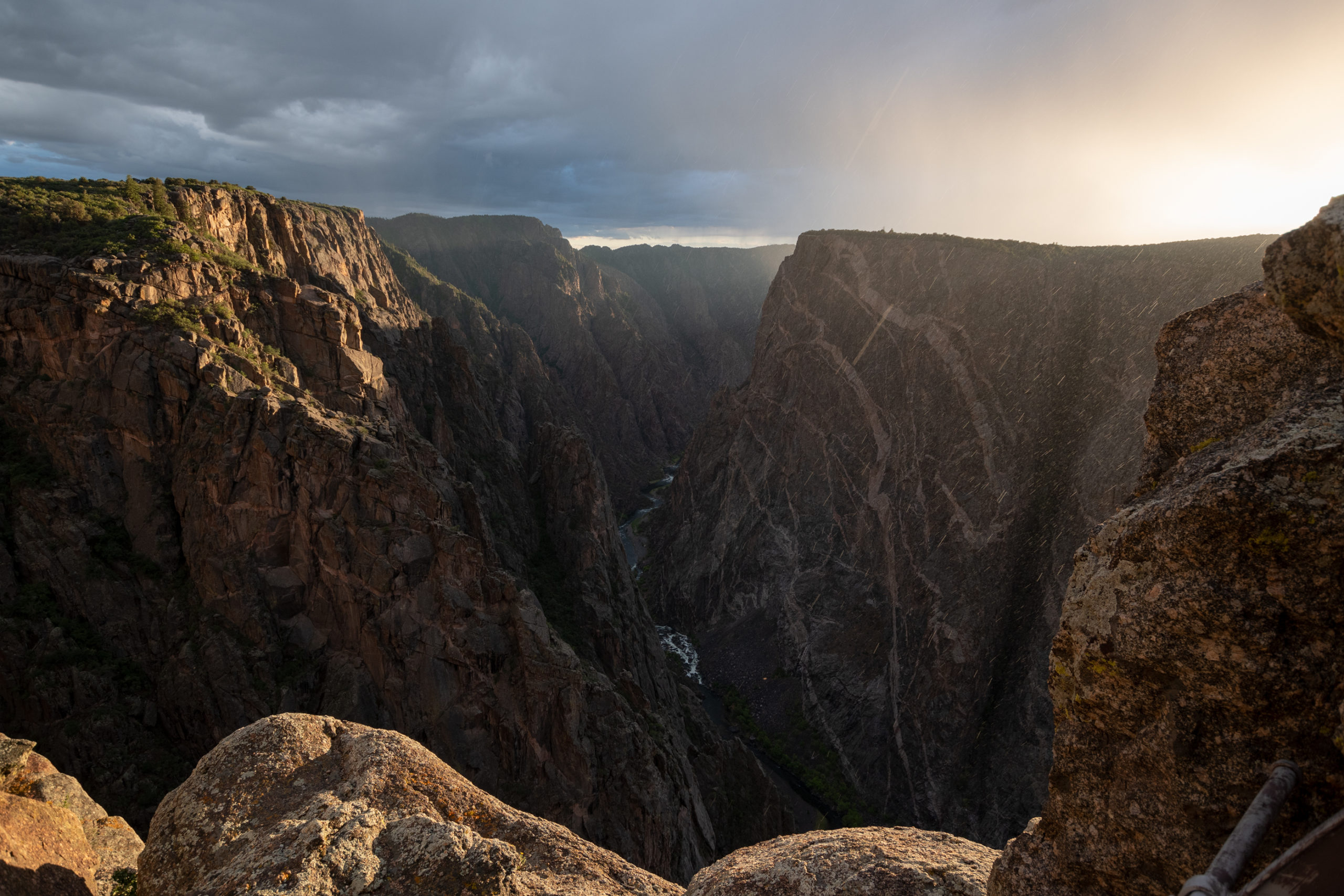
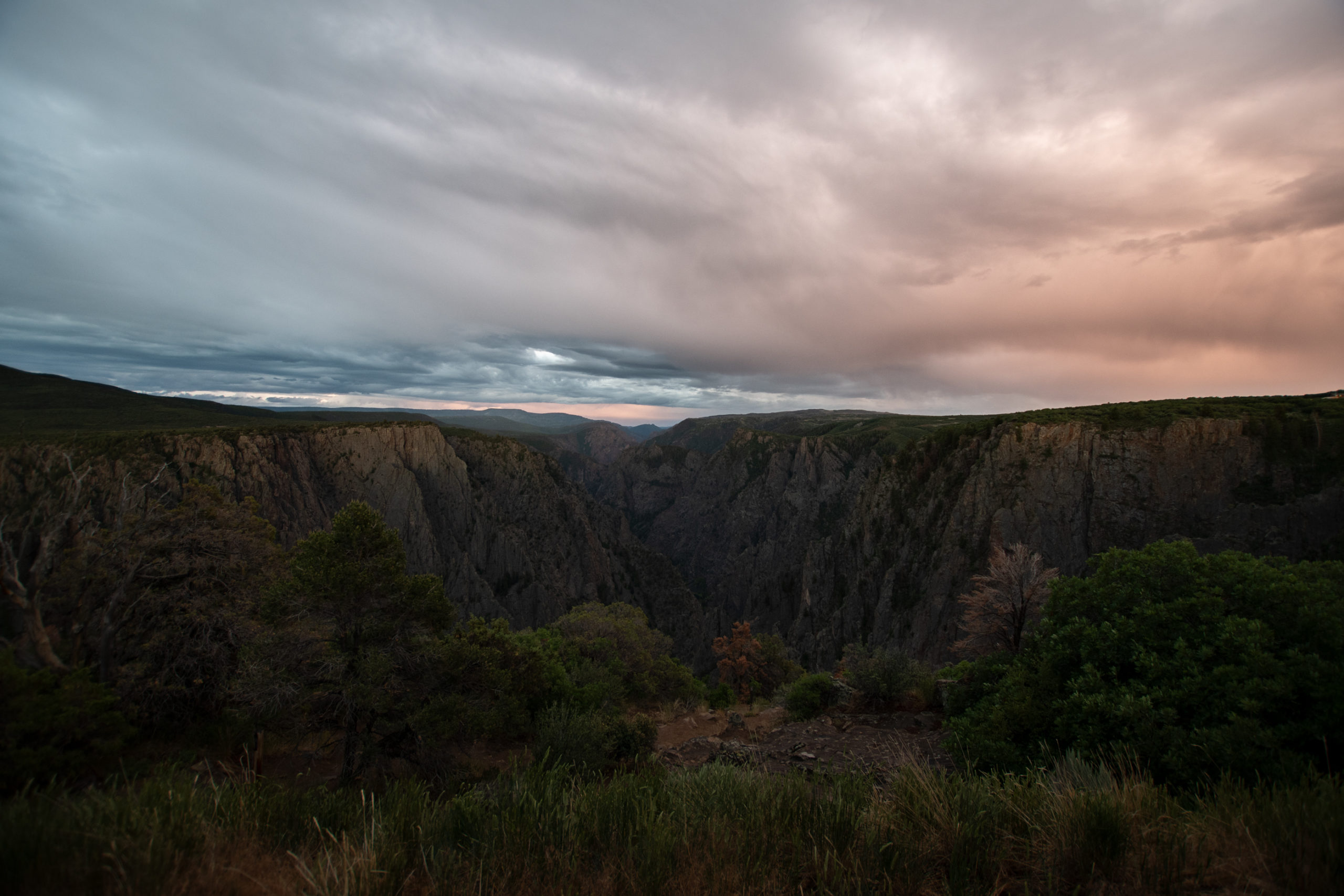
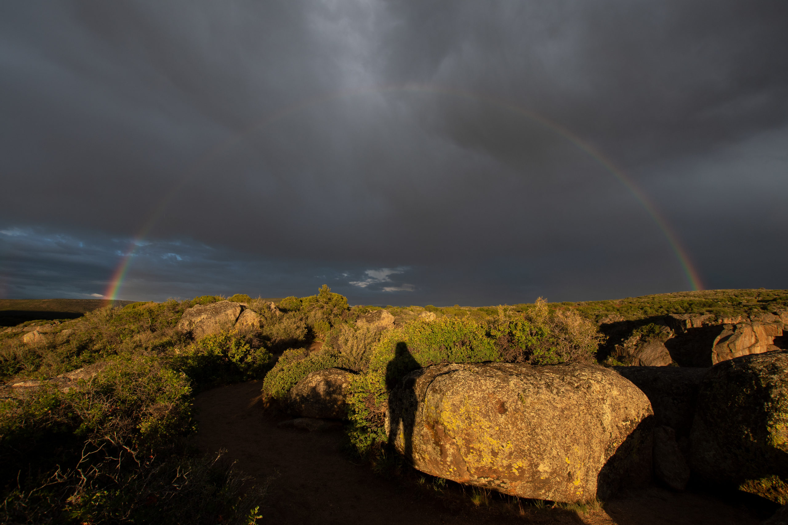
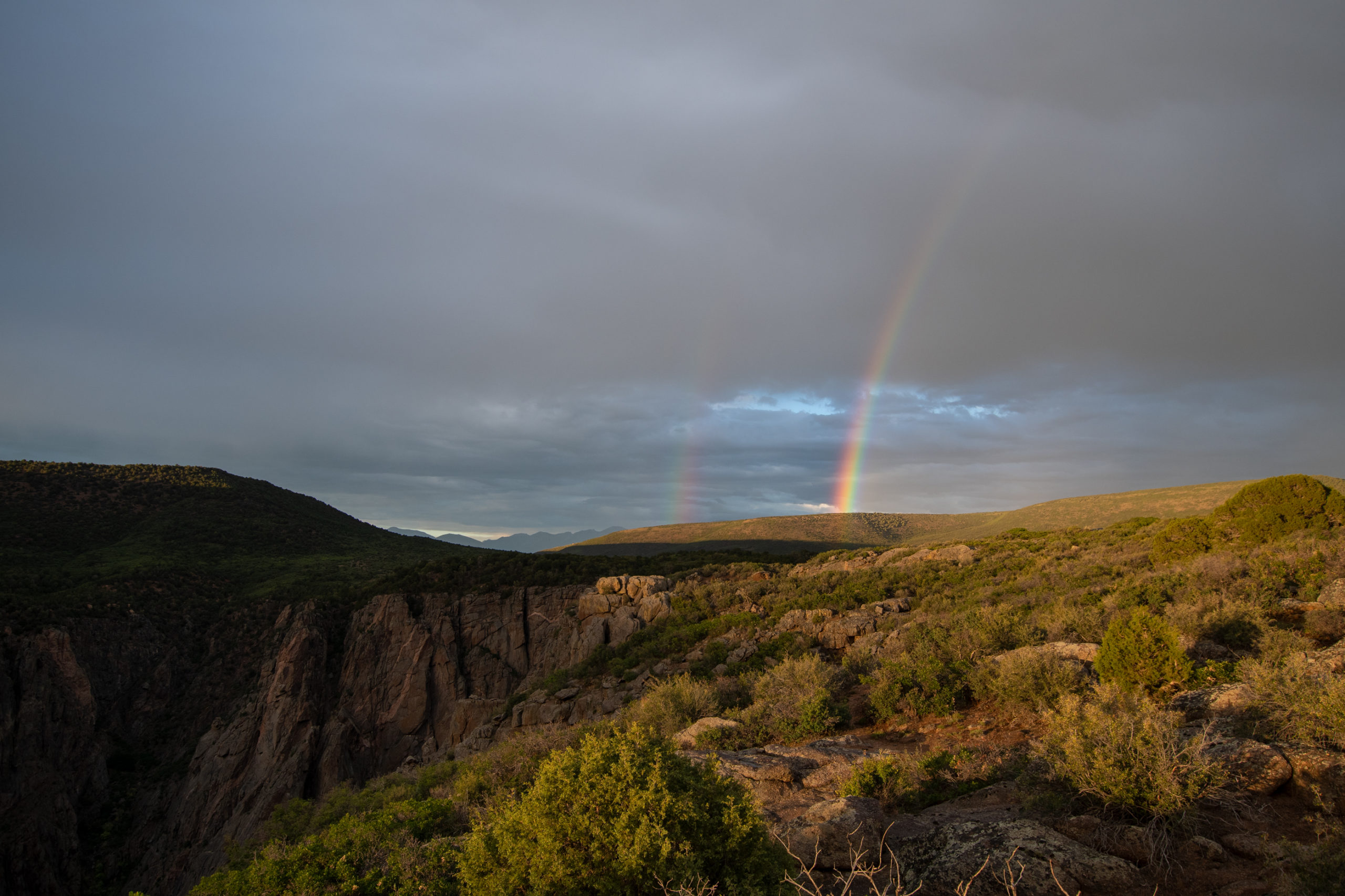
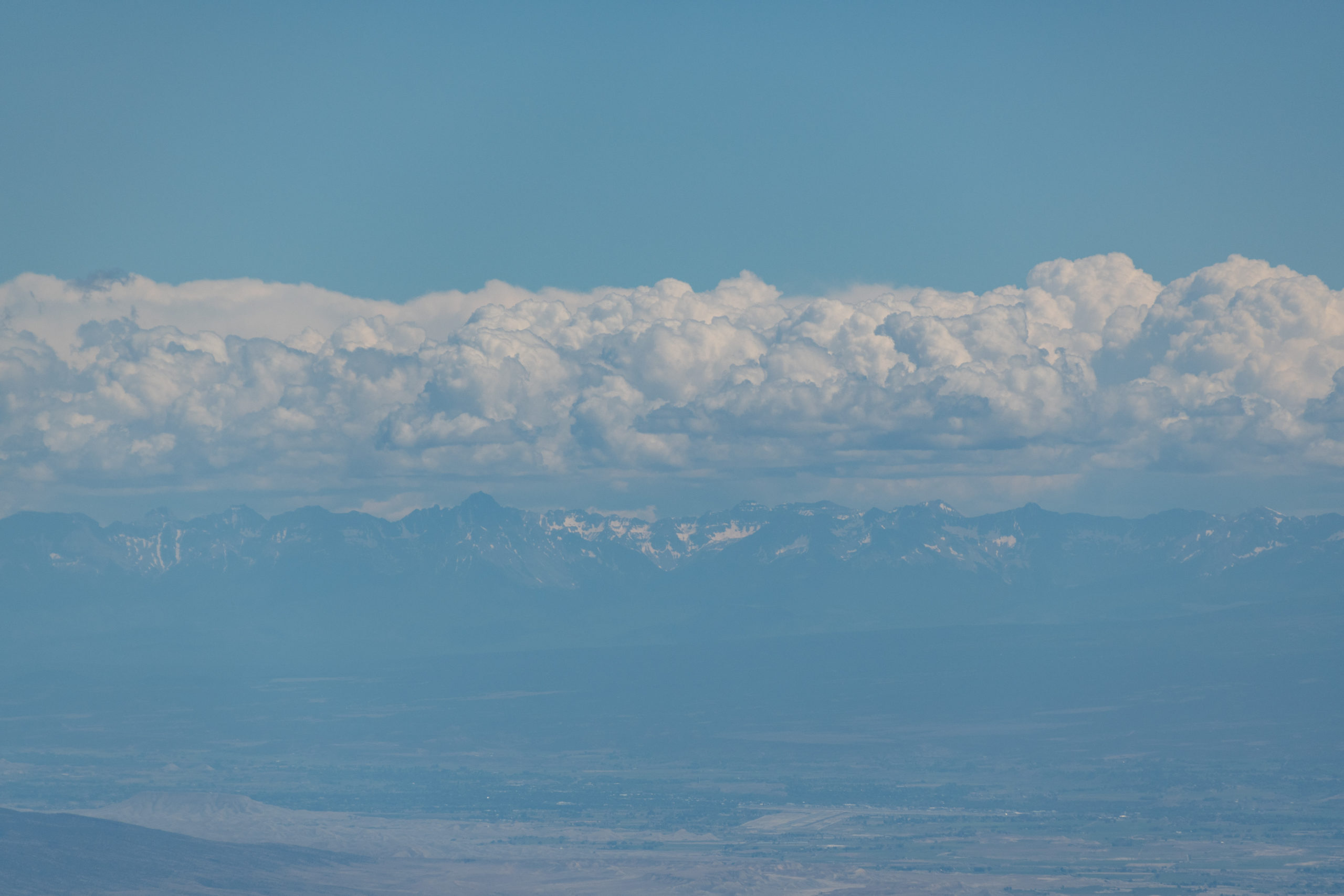
After spending far longer than originally intended getting from Monte Vista to Montrose, I made haste for a quick sunset stop in Black Canyon of the Gunnison National Park. It was still raining, but these mountain showers seemed so intermittent, I just hoped it’d work out.
That was fairly perfect timing. Something that photos of this place don’t seem to capture well is the depth of this canyon — it is not wide but it is 1700 to 2700 feet deep through the park. The river itself drops 95 feet per mile in this canyon.
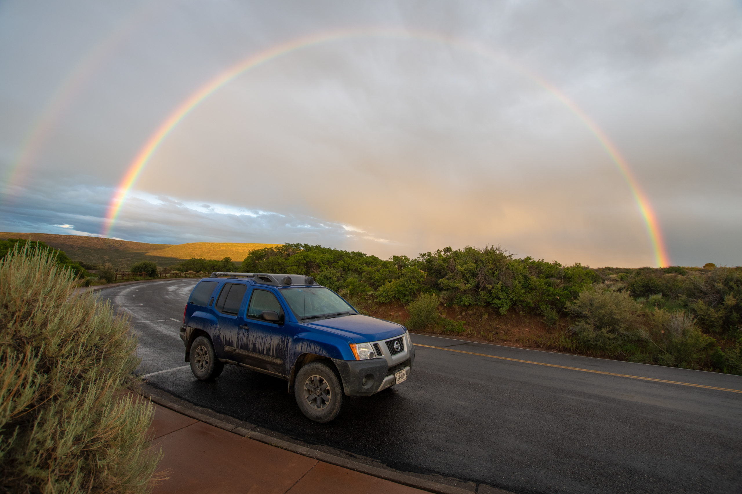
And as the rains lifted at sunset, I looked behind me and found something stunning.
Lol… sorry I had to.
Hereto was unfolded view after view of the most wonderful, the most thrilling of rock exposures, one vanishing from view only to be replaced by another still more imposing. A view which could easily be made into a Scottish Feudal Castle would be followed by another suggesting the wildest parts of imposing height and majestic propotions.
H.C. Wright, member of the 1882 Byron Bryant railroad survey. (Or so a placard at the overlook explained to me. 🙃)
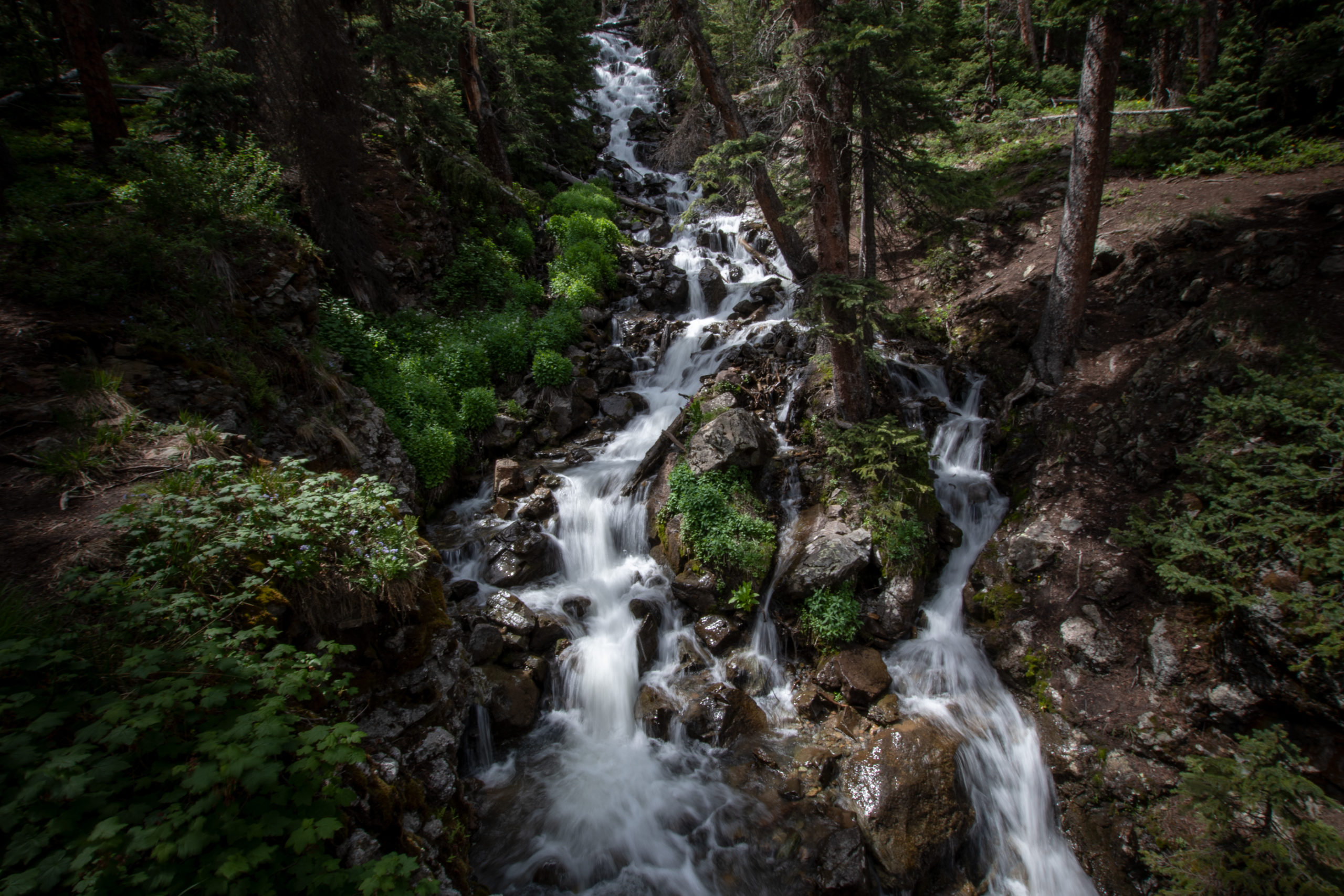
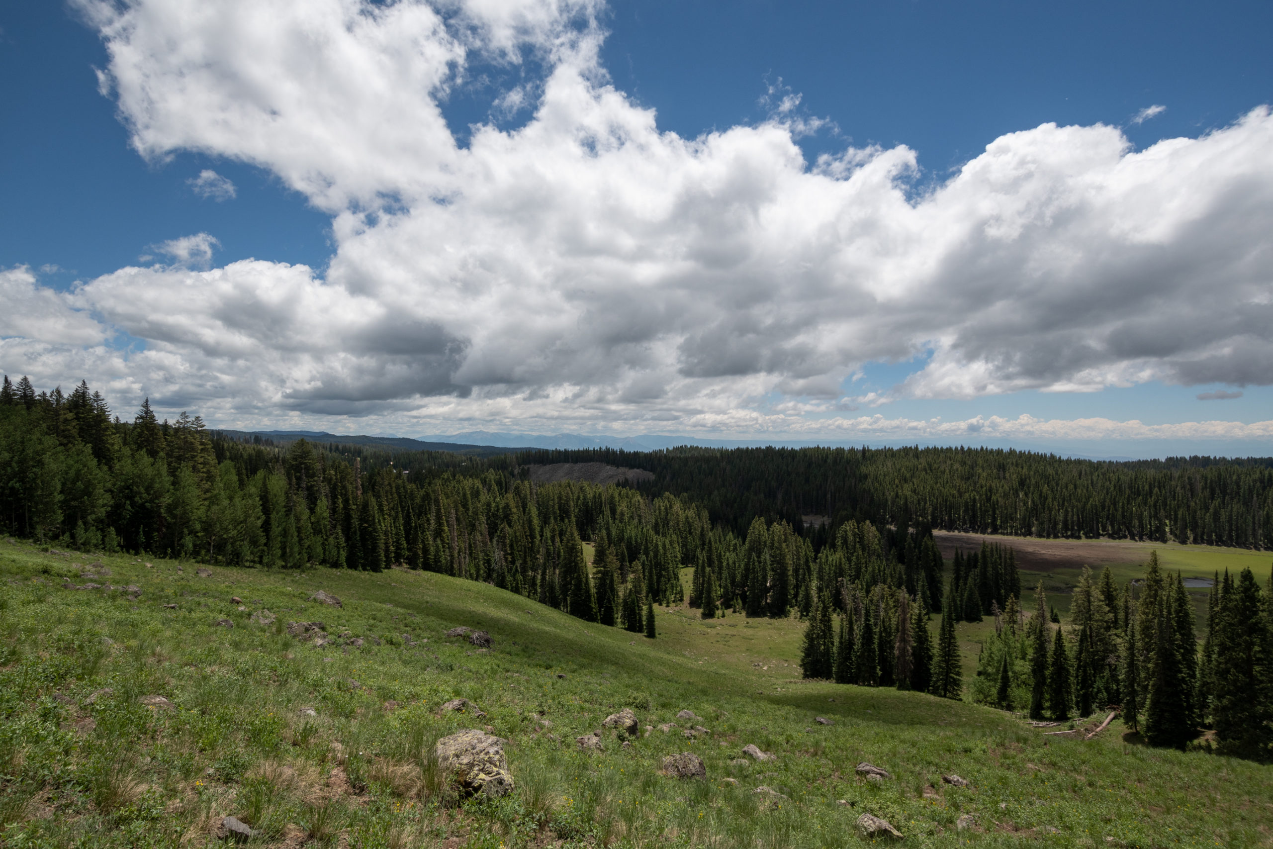
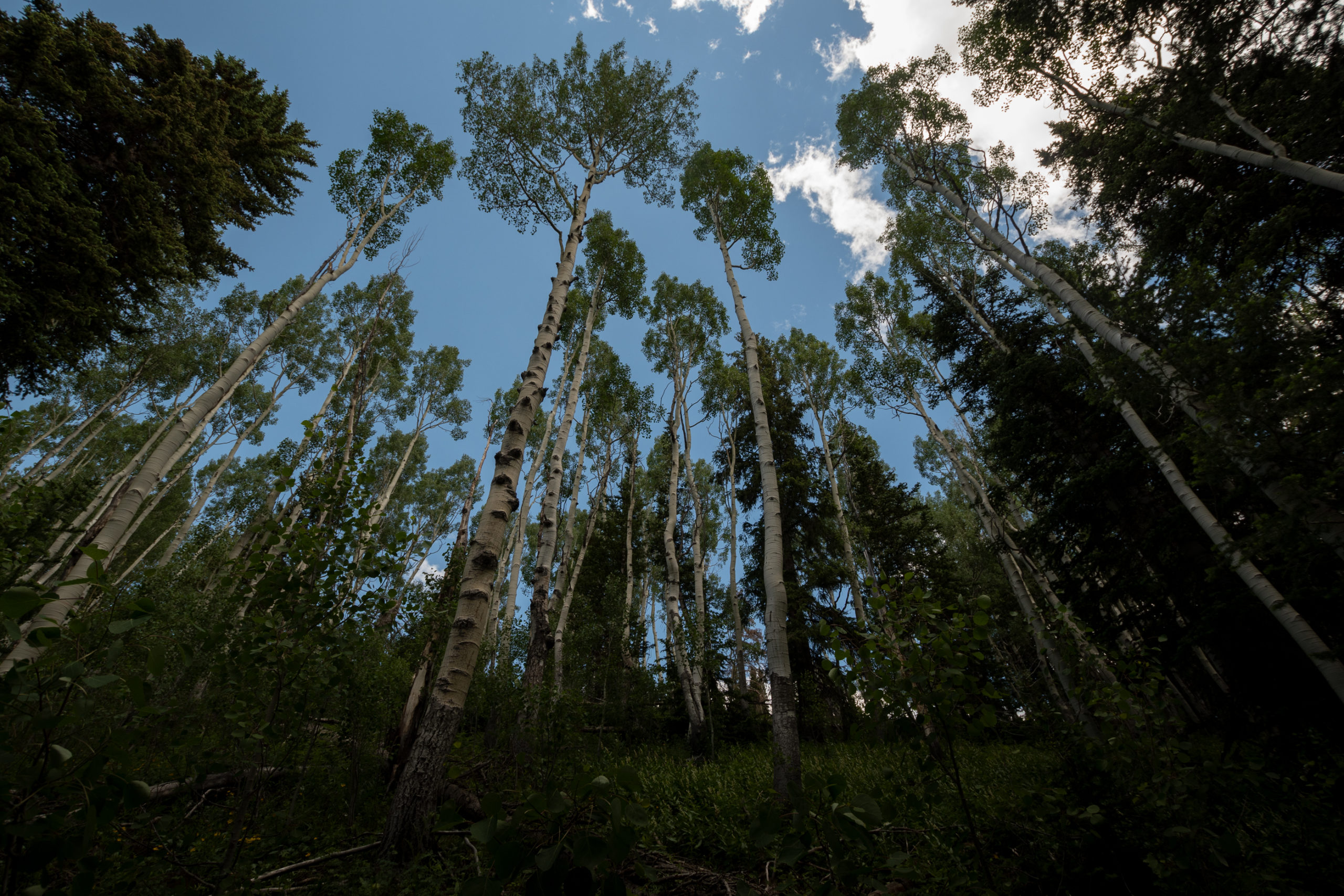
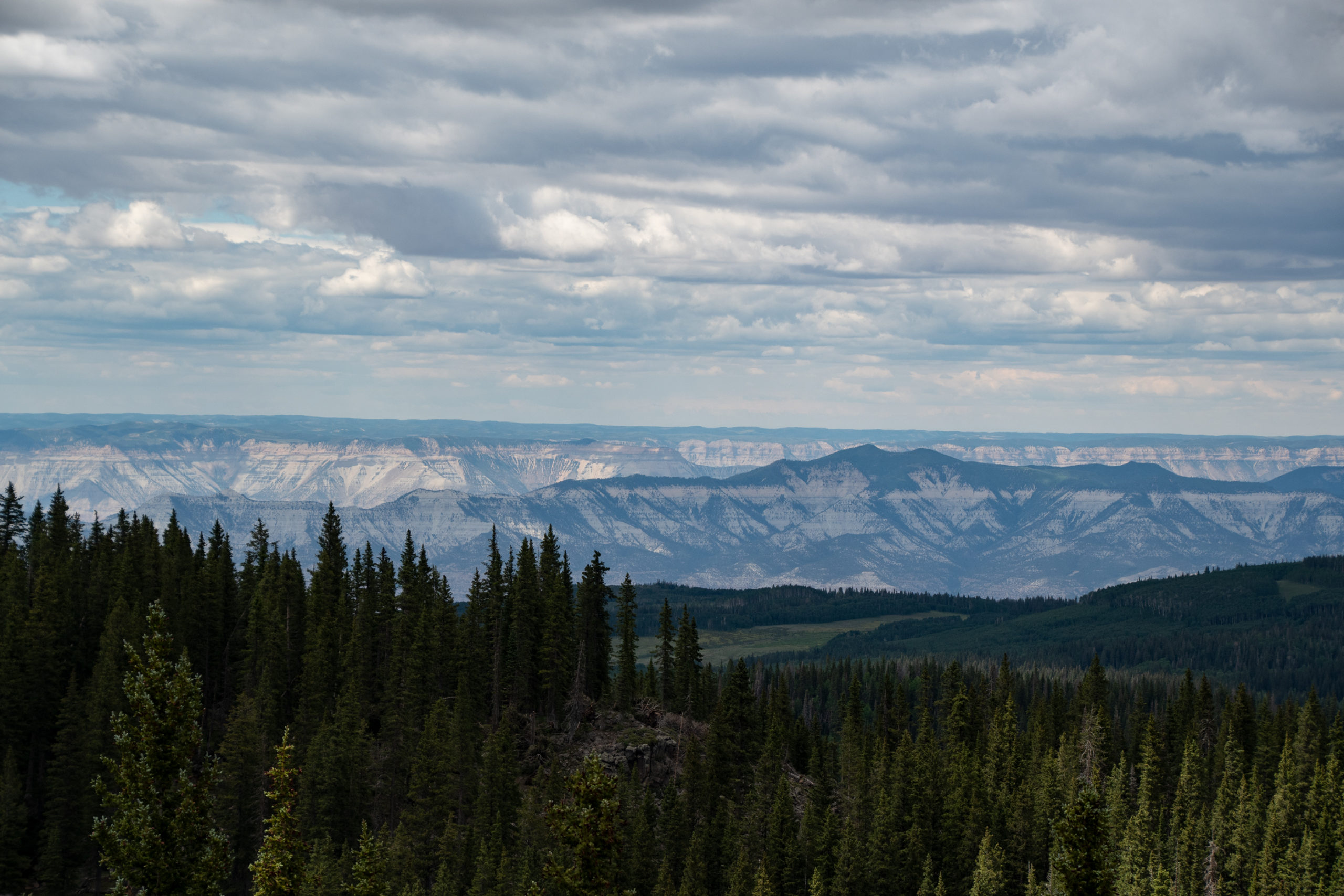
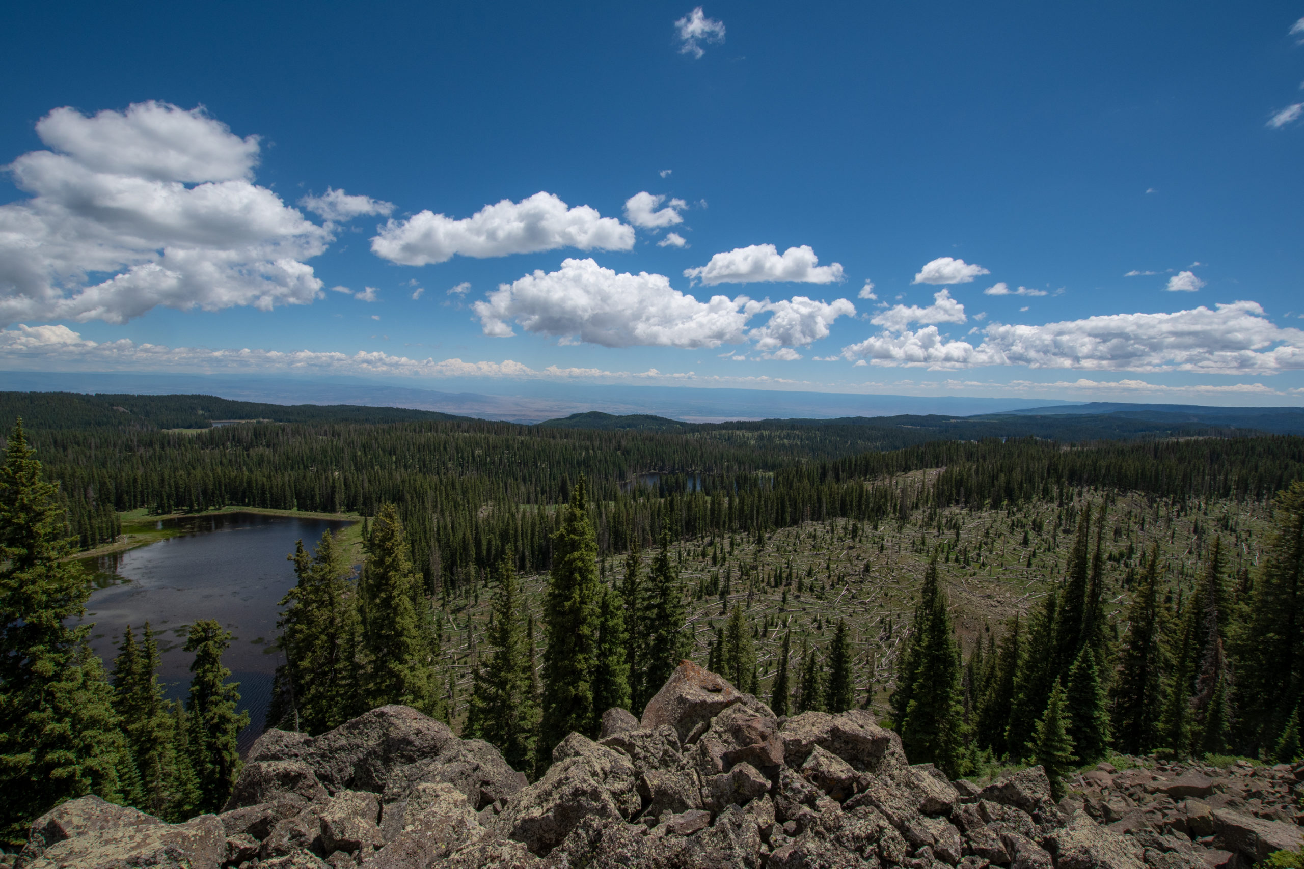
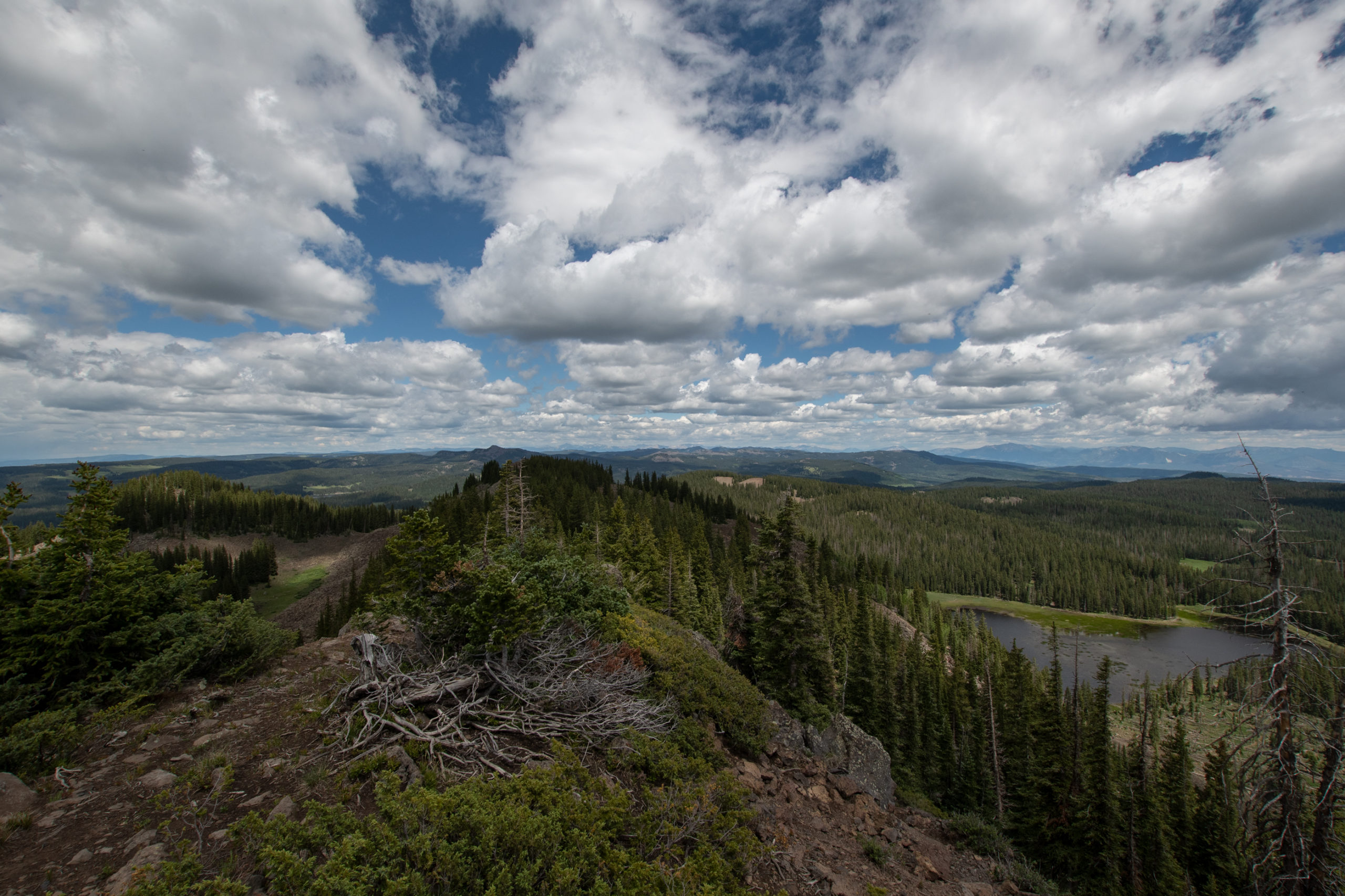
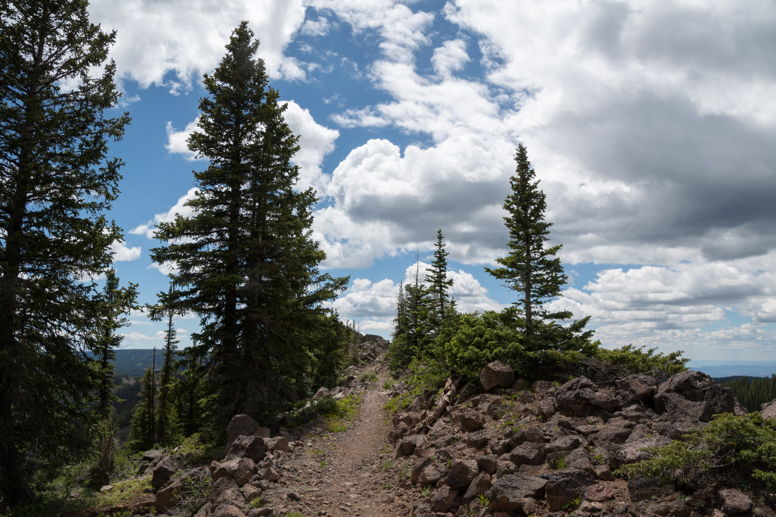
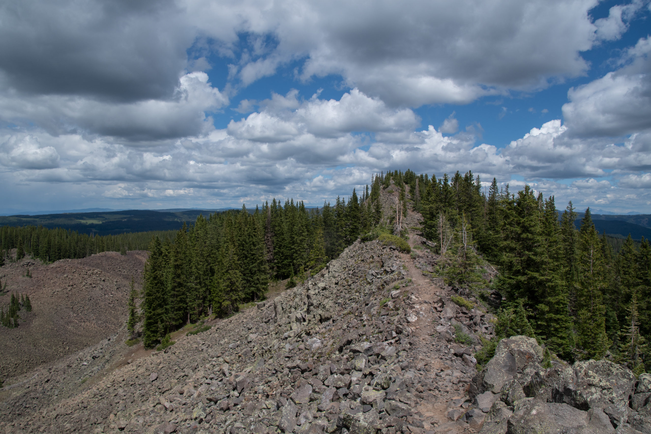
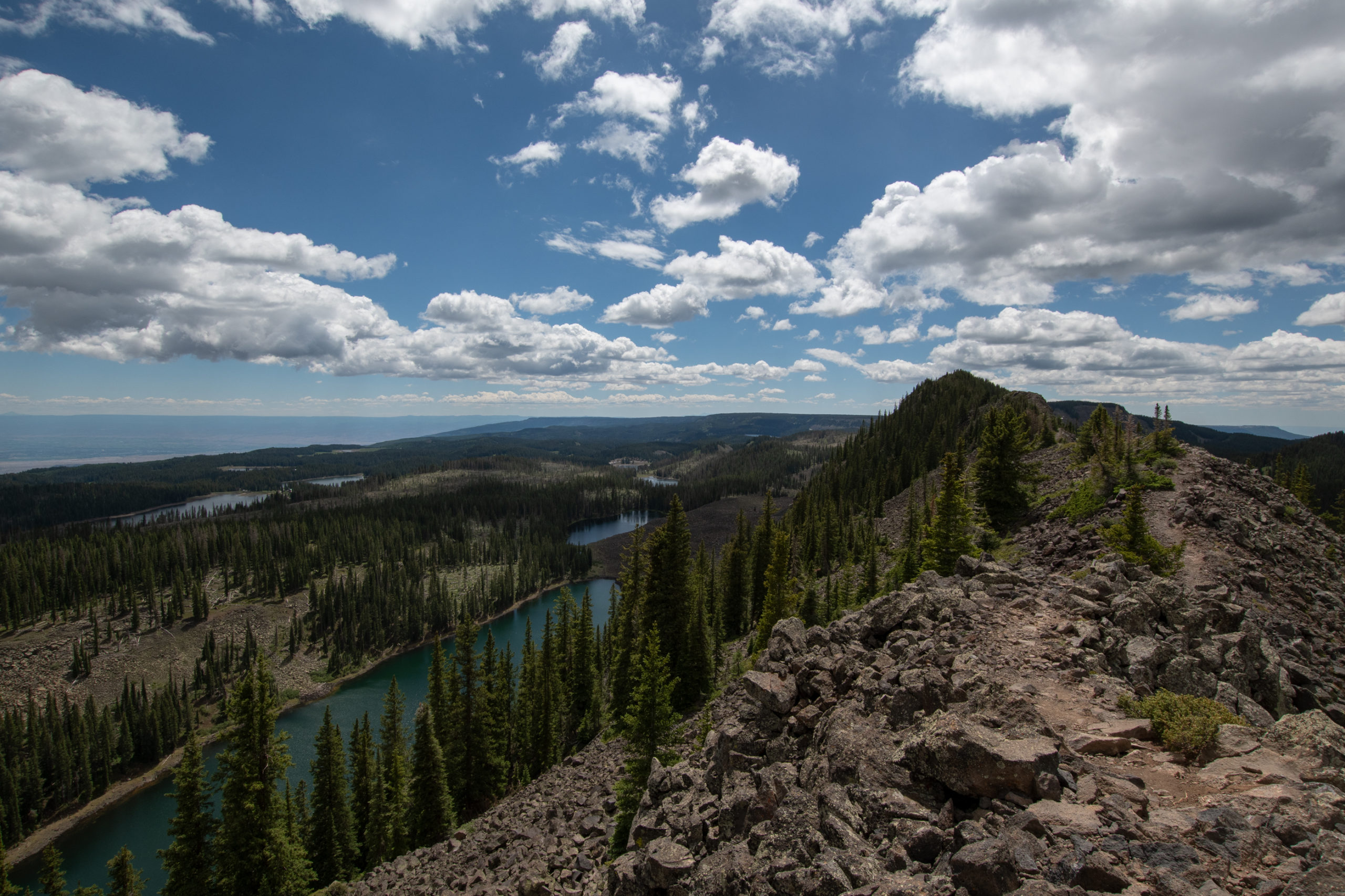
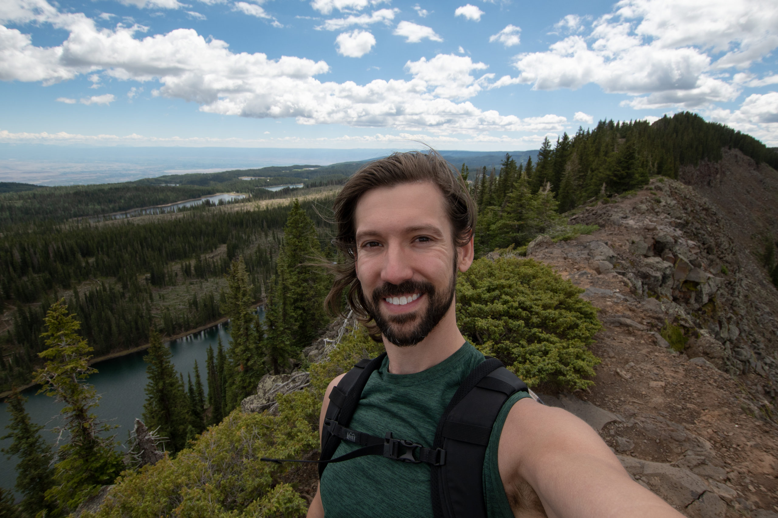
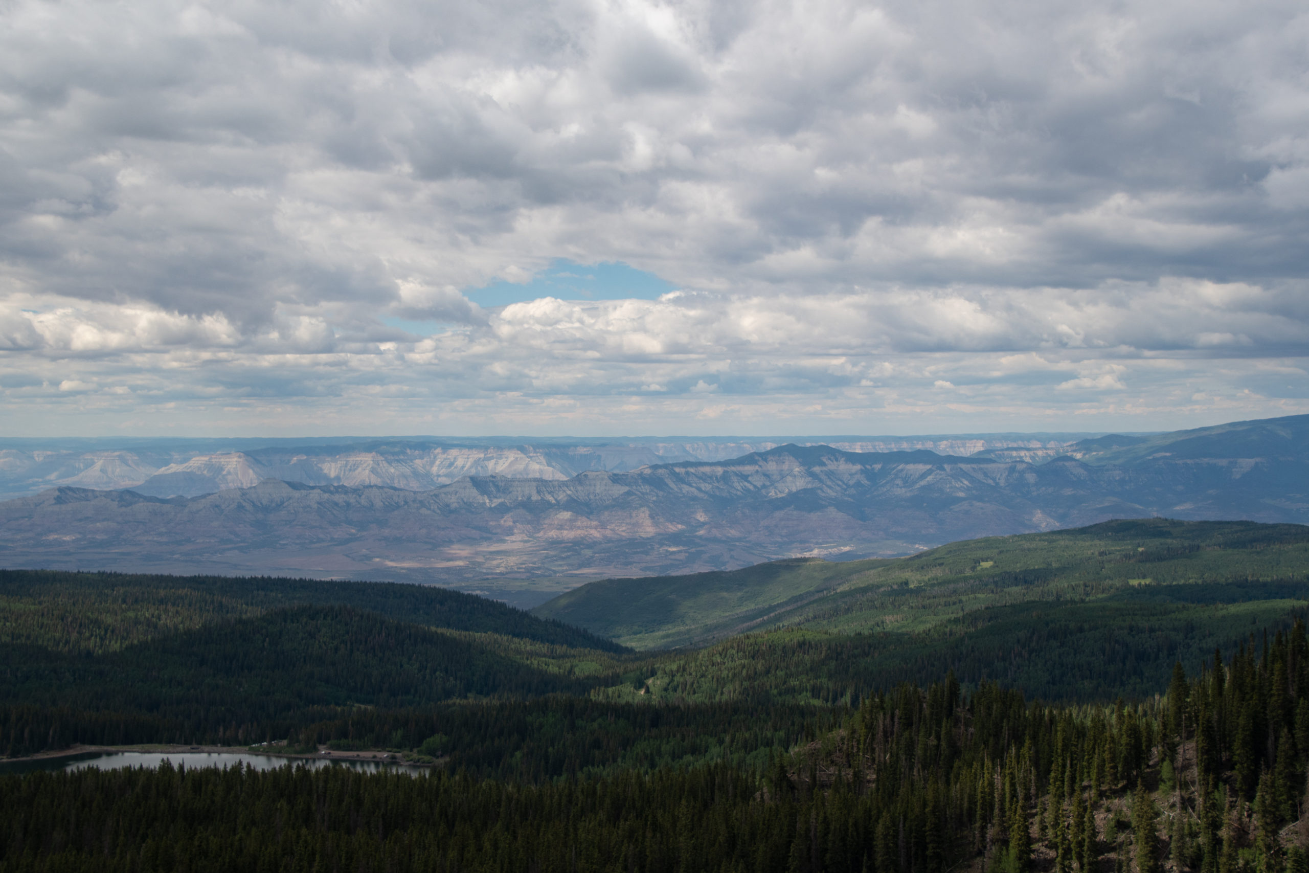
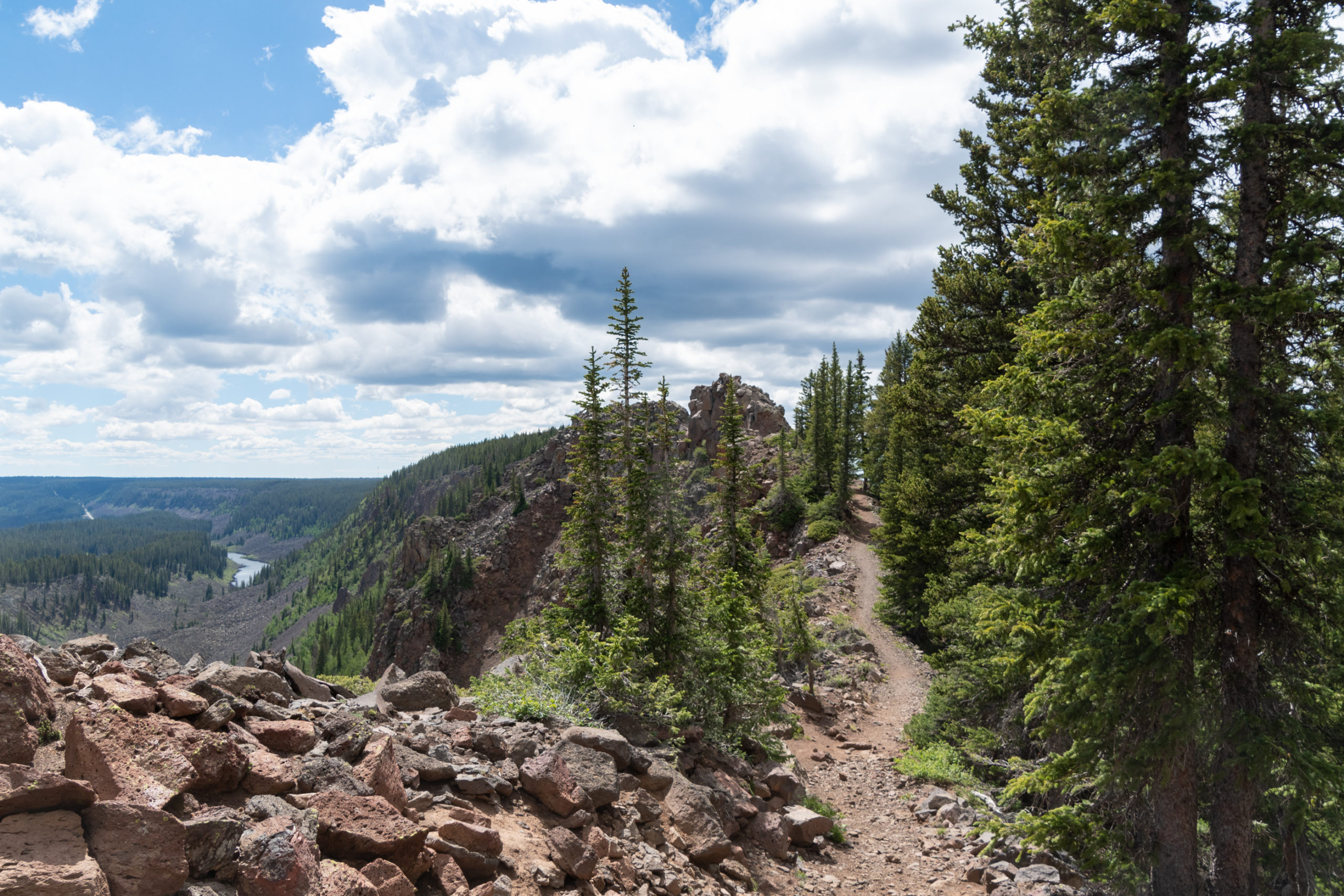
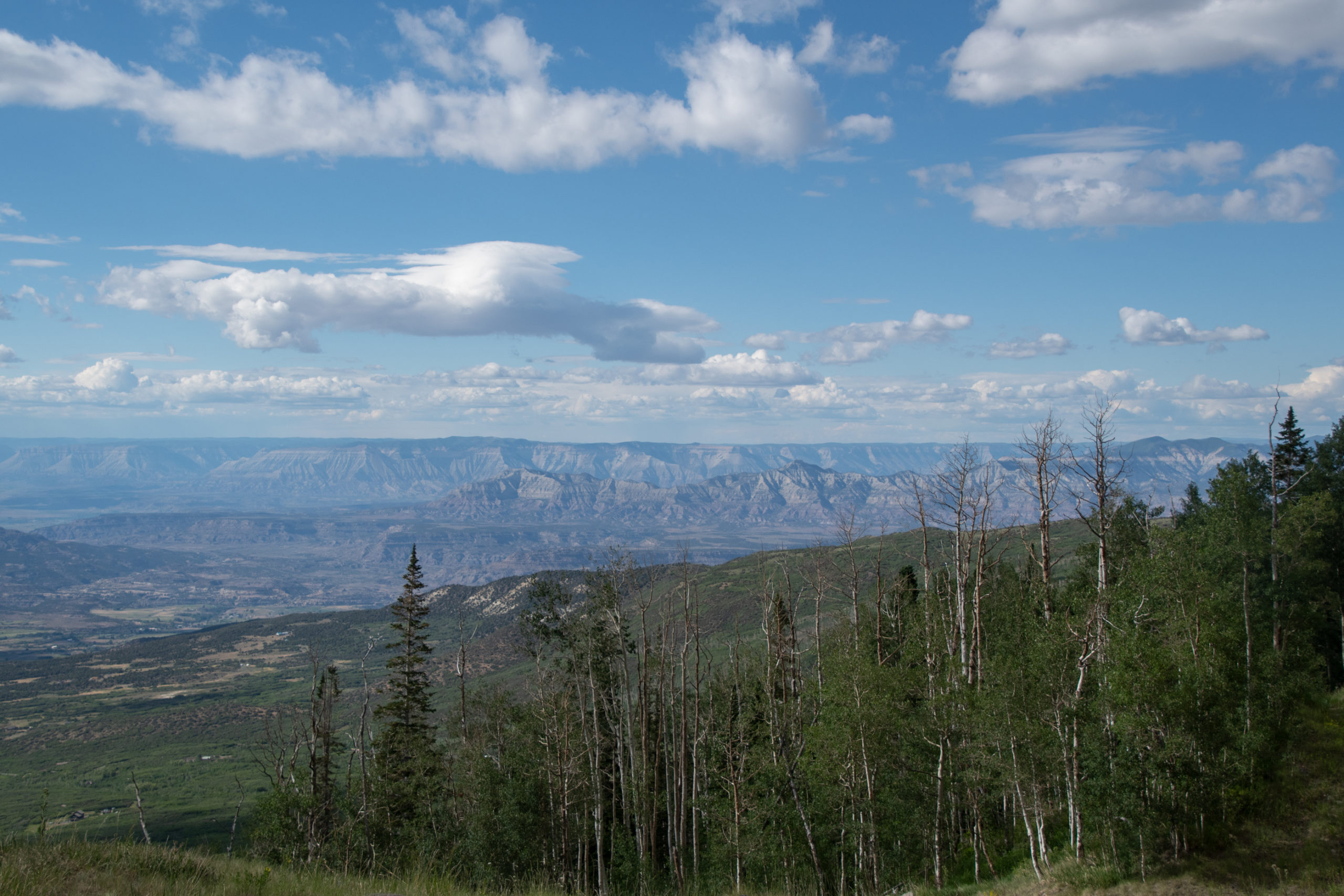
After a big day of driving, I decided I should wear out my feet a bit. Continuing my diagonal trek across Colorado, I found a hike along a crest atop Grand Mesa. The mesa is the largest flat-topped mountain in the world with an area of about 500 square miles, with an elevation of about 11,000 feet. The road over it, State Highway 65, is a scenic byway. Crag Crest trail caught my eye.
The Crag Crest rises from 10,150 feet at Eggleston Lake to 11,189 feet along the crest. At the lower elevations, the trail passes through stands of Englemann spruce, subalpine fir and open meadows. Quaking aspen, with leaves which are light green in the summer and brilliant yellow in the fall, grows among the dark green conifers. […] To the northwest, the Book and Roan Cliffs appear as multicolored cliffs and slopes. The highest point on the Grand Mesa is Leon Peak, [visible to] the east. This 11,326-foot peak was once used as a fire lookout.
I decided to do the loop “backwards” — if there is such a standard — because I thought saving the ridge for last would be 1) great, and 2) a good motivator to make it up the incline to the ridge which seems to happen all at once. That worked well.
And on the way back down, fellow Zelda Breath of the Wild enthusiasts will recognize an obvious korok seed:
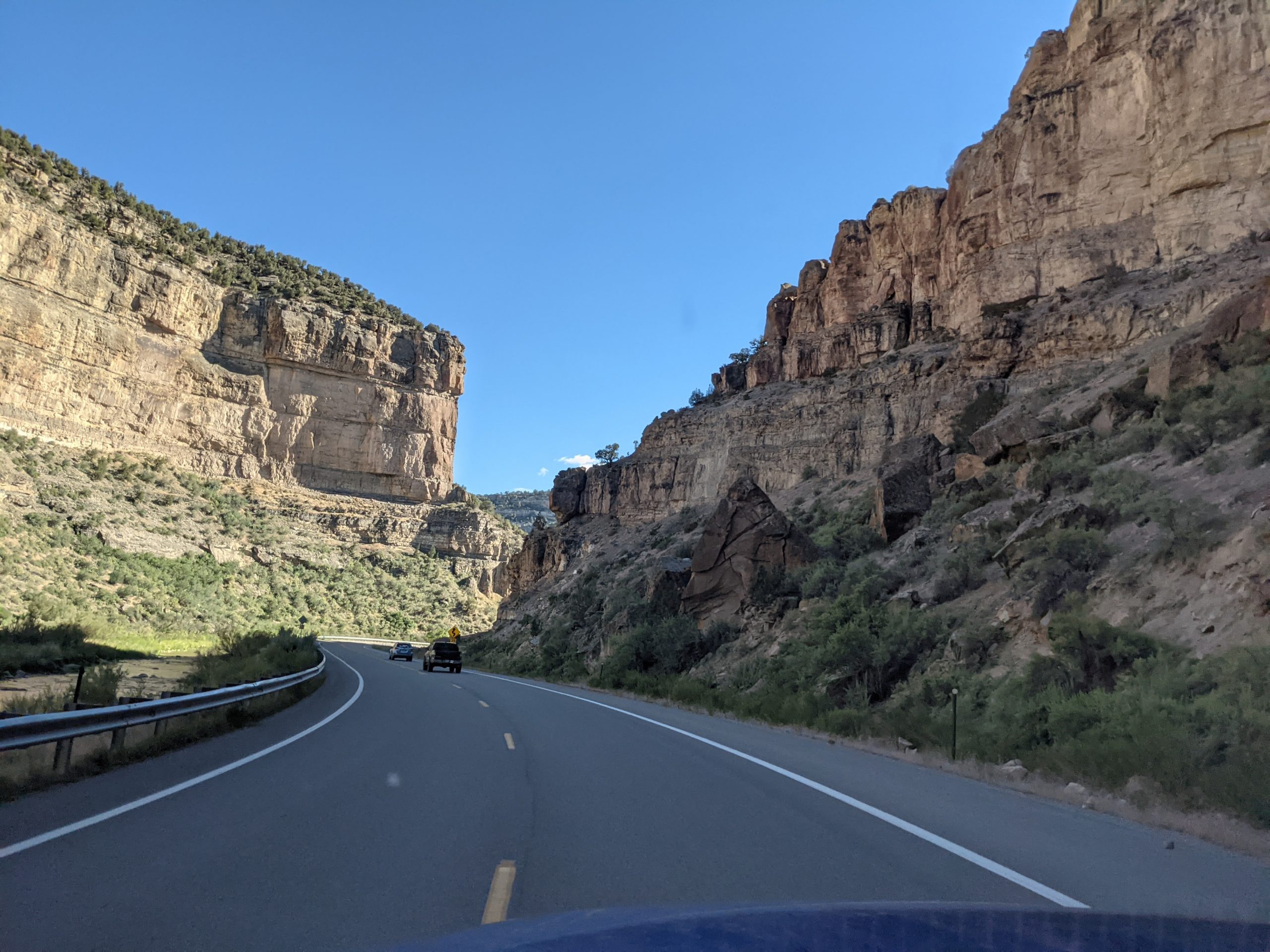
On the way back down into my overnight in Rifle, CO, I there was a fairly abrupt change from what I recognize as Colorado mountains to the plateaus and rocky canyons that I’ve long associated with the deserts of the southwest.
This took me east on I-70 just a bit, to discover that it is closed for the second time this week because of another massive mudslide in Glenwood Springs. The fire last summer — which is why I didn’t venture to Colorado on the Coronaroadtrip — stripped the landscape of all the retaining greenery that keeps the mountains off of the roadway. Thankfully I was able to stop short of that, and had booked my motel room before the slide sent the rest of the world to Rifle, too.
Never seen a deer run up a cliff face like that before.
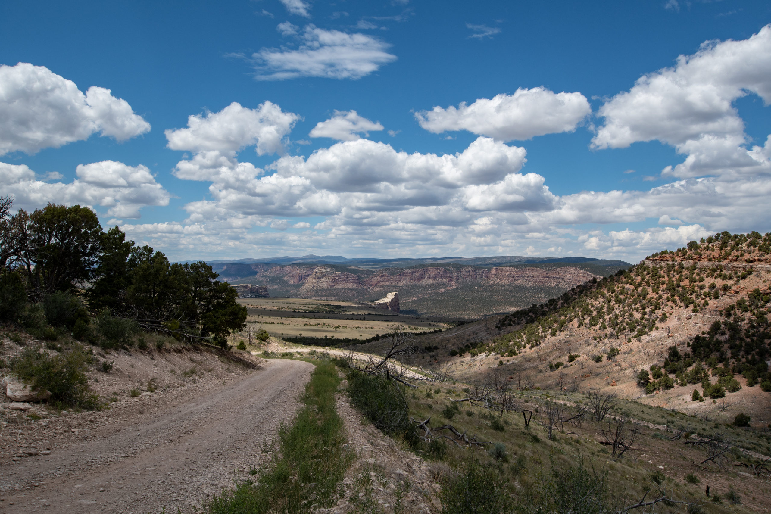
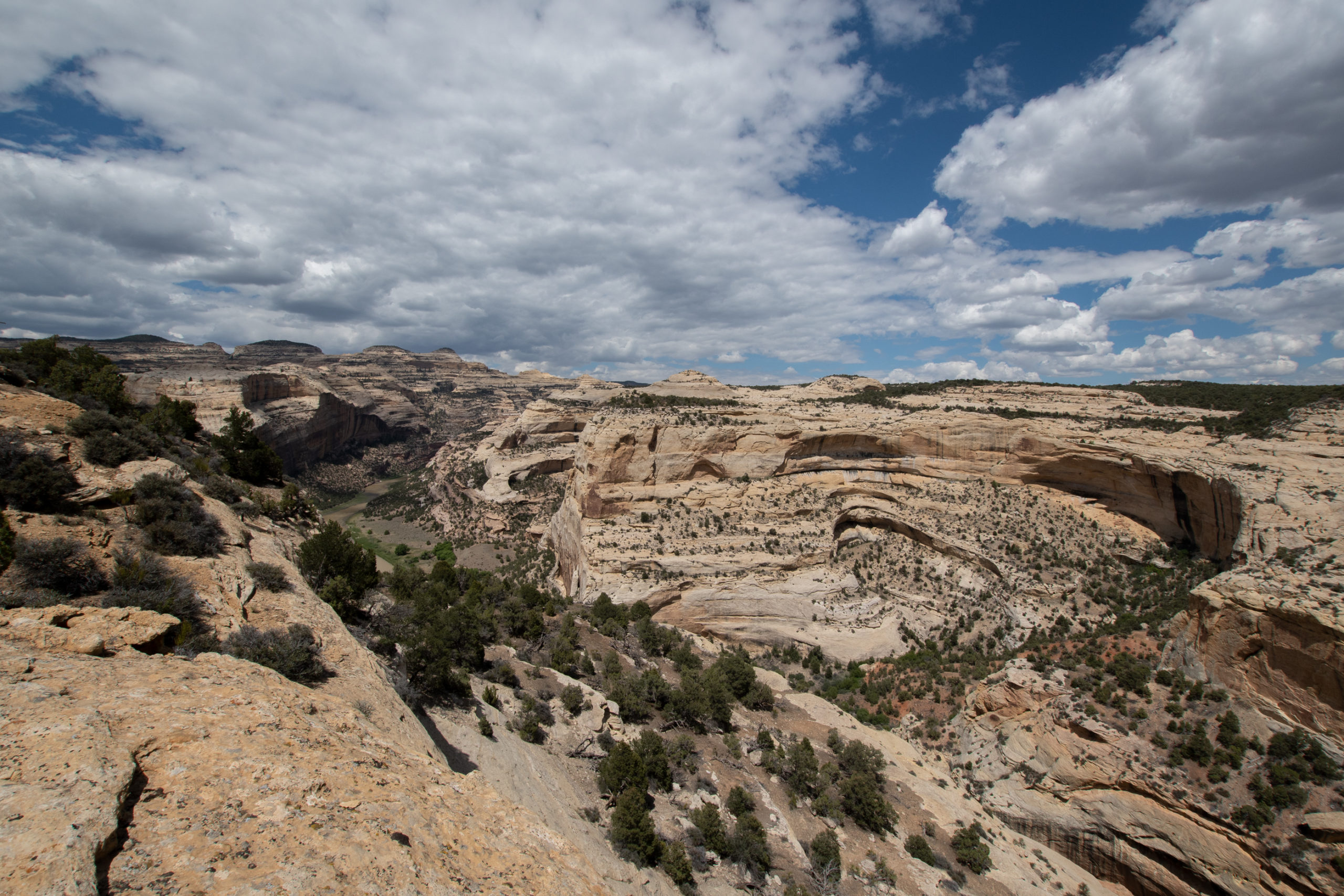
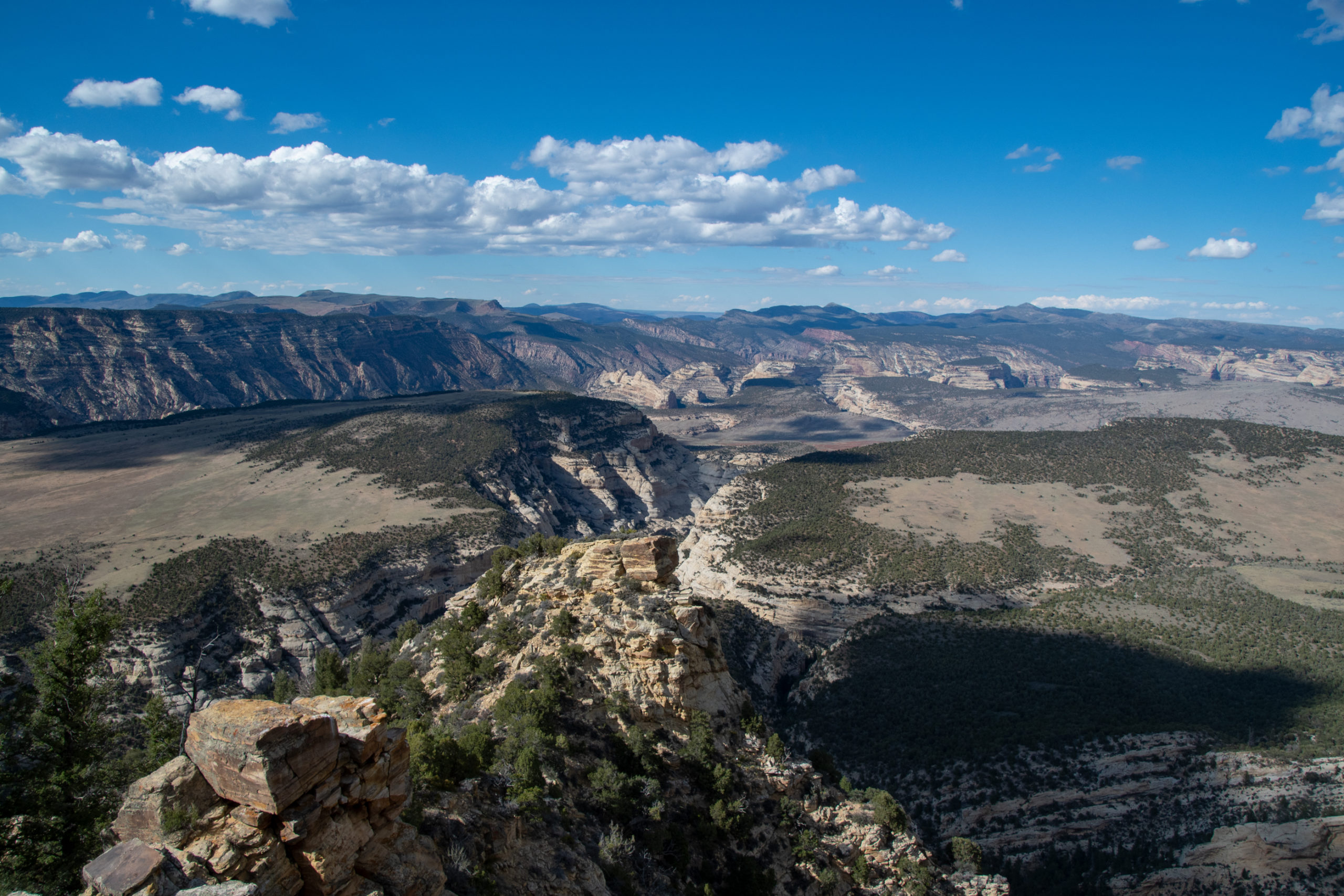
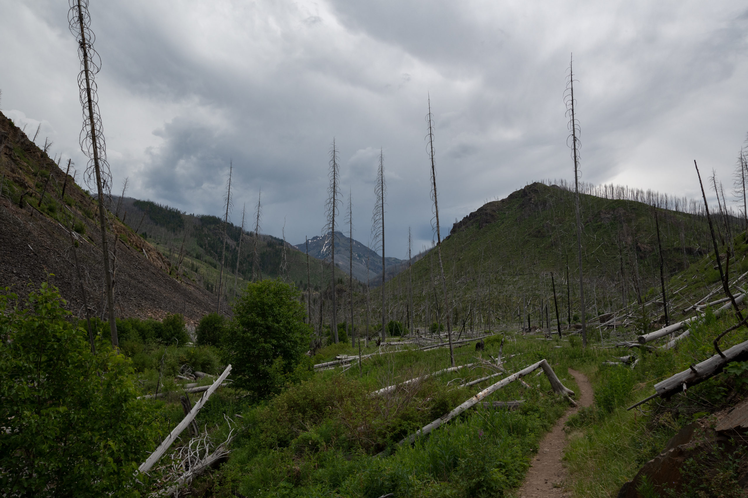
Continuing this trip’s theme of “out of the way places only,” I hit up Dinosaur National Monument on the way out the state. The monument straddles the Colorado and Utah border very close to Wyoming. In other words, a couple hours away from the closest airport in Grand Junction, in the middle of nowhere.
The park’s two claims to fame are the dinosaur fossils, which are housed in a visitor center that is (until later this week) still under reservation-only for capacity limitations and dramatic petroglyphs on the Utah side — a separate entrance. Which I will have to make another trip for. I got to the east entrance much later than originally intended owing to another “oh my atlas and Google Maps both were sure this was a public road, but some well-armed yokel has put up a fence and No Trespassing signs” incident.
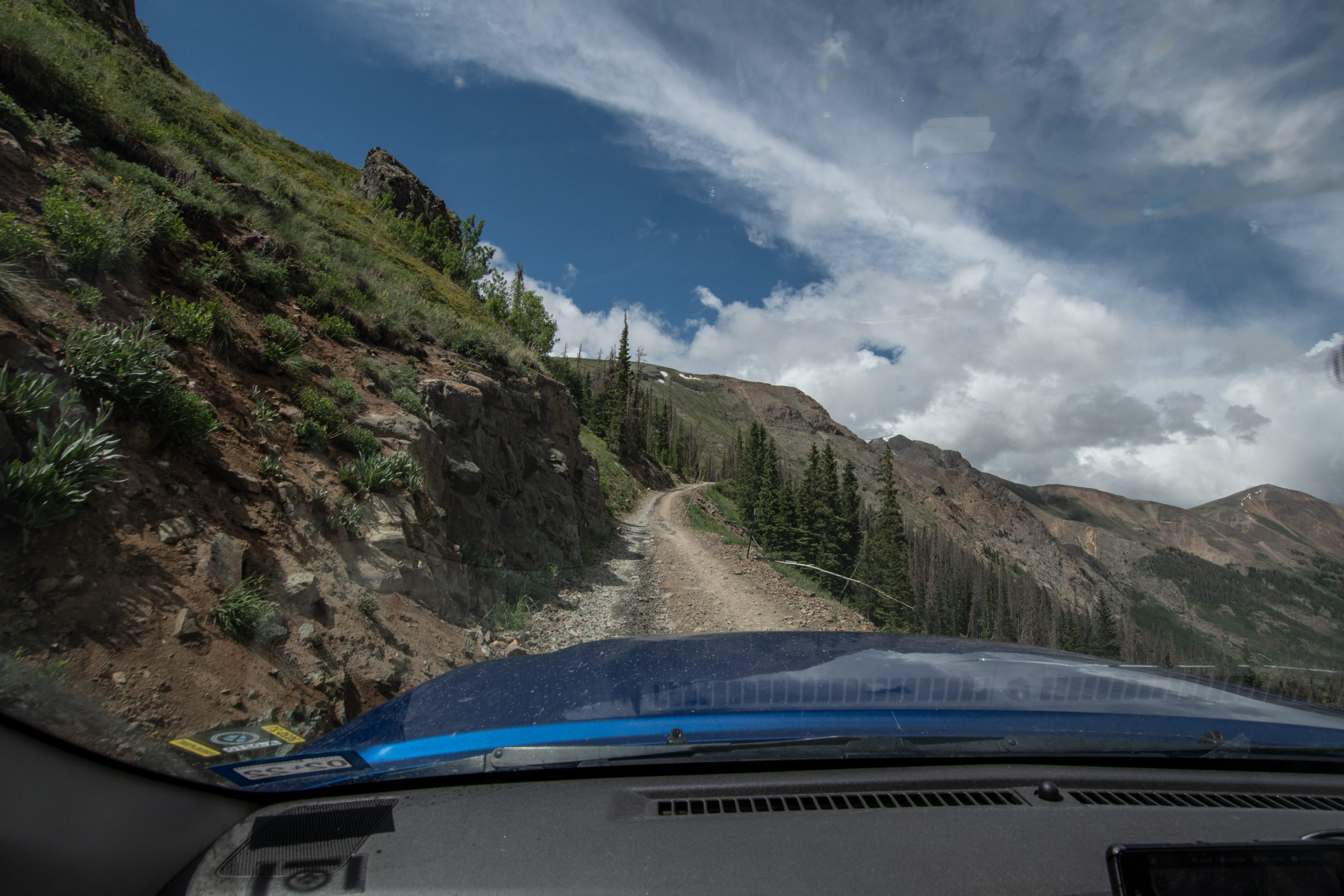
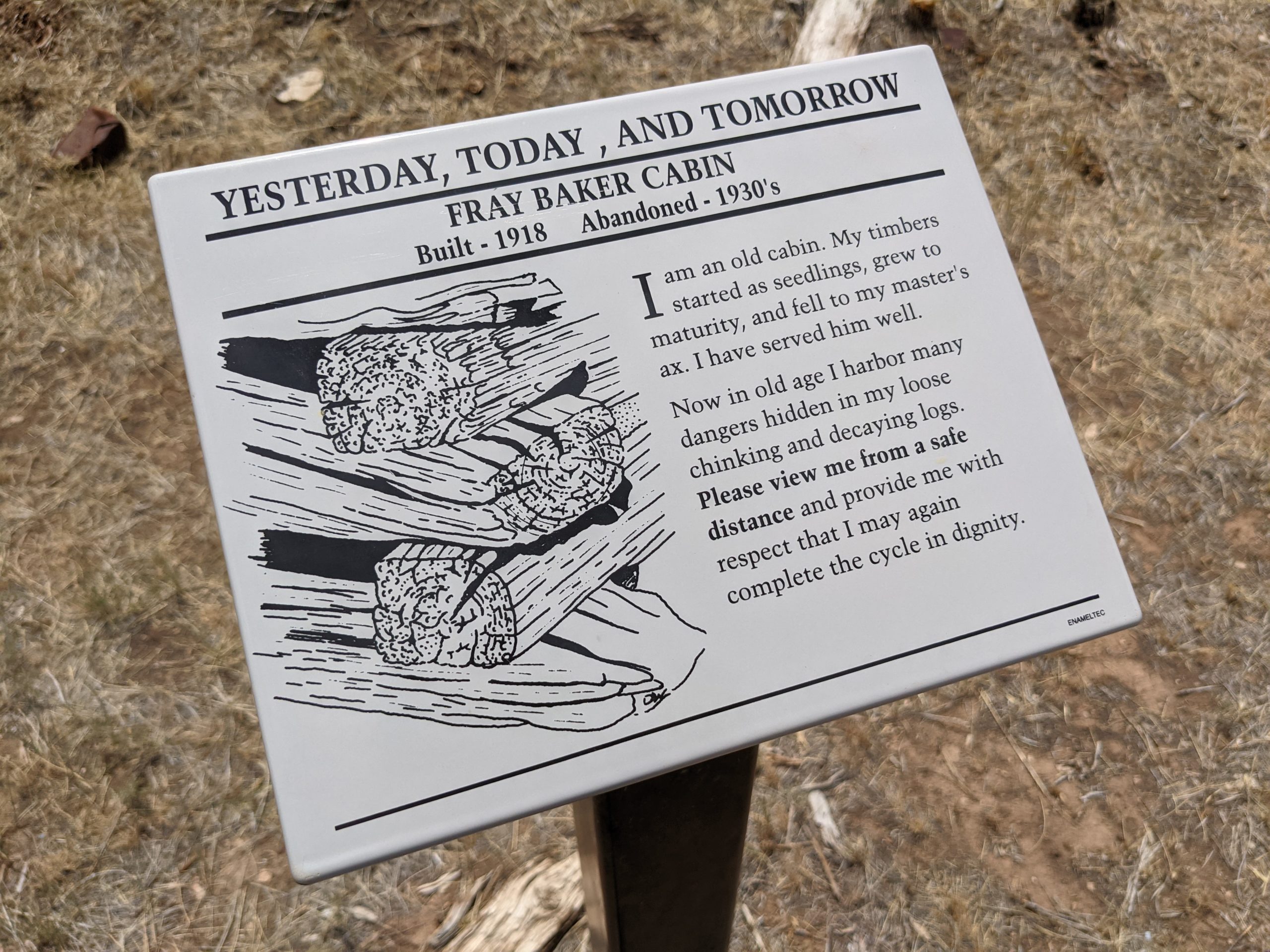
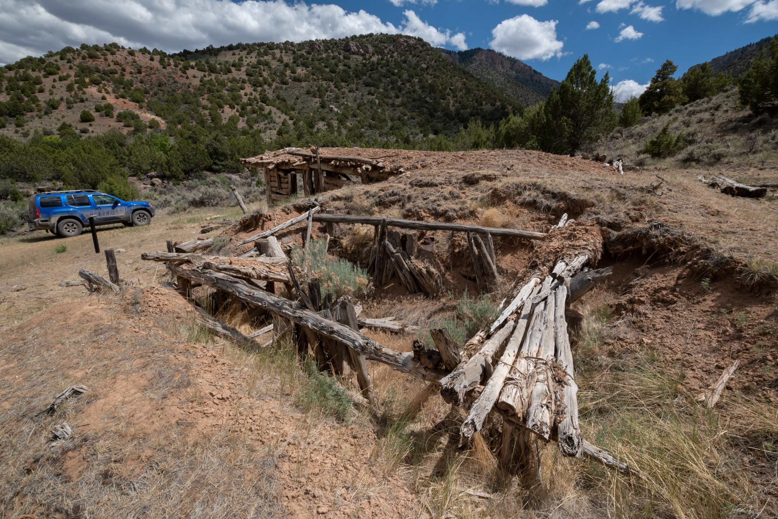
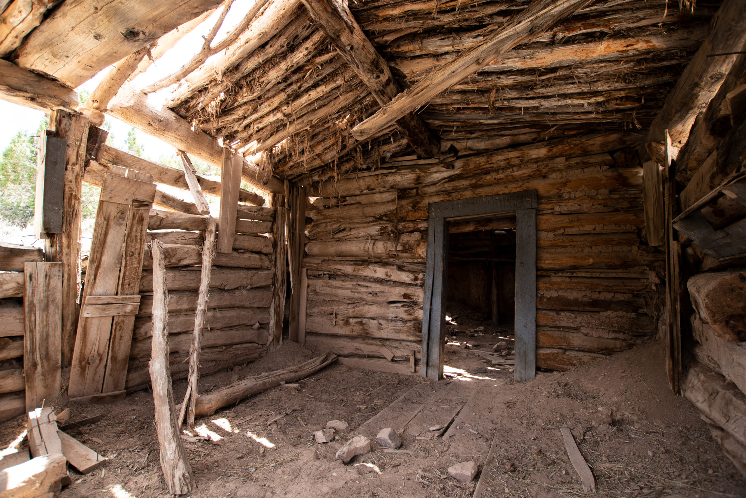
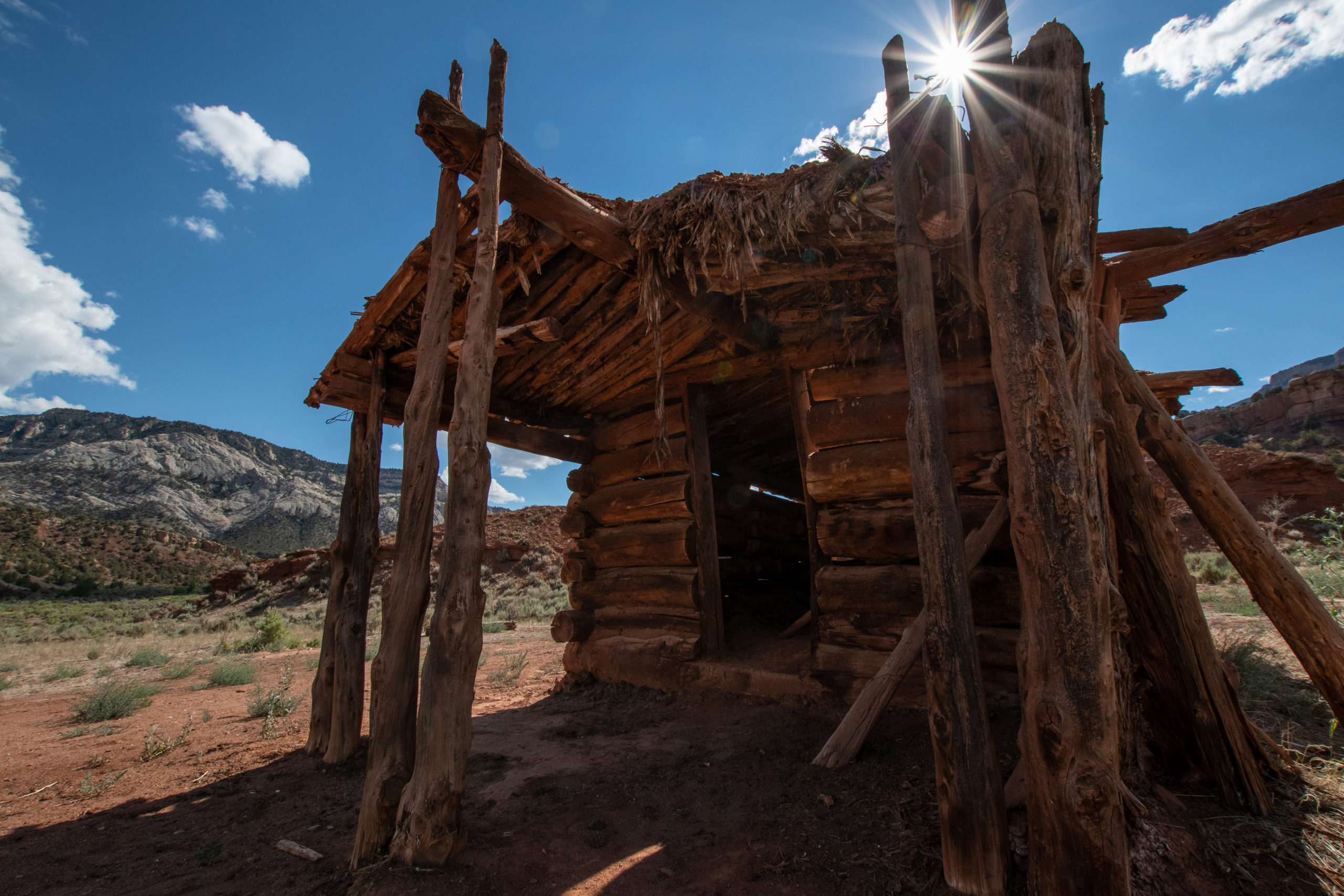
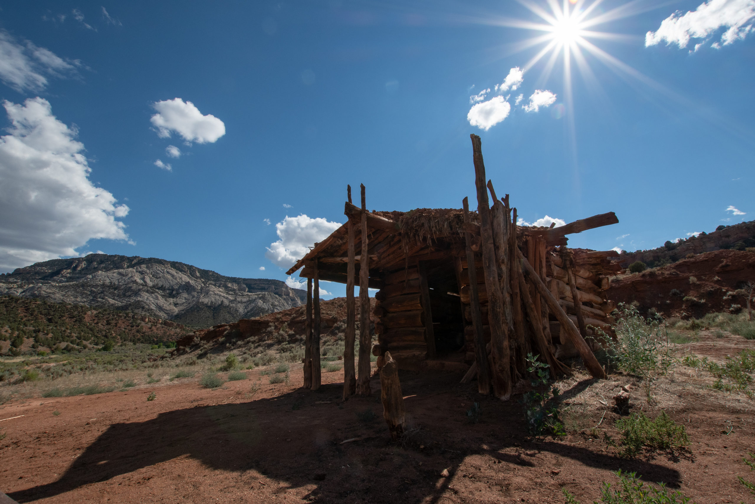
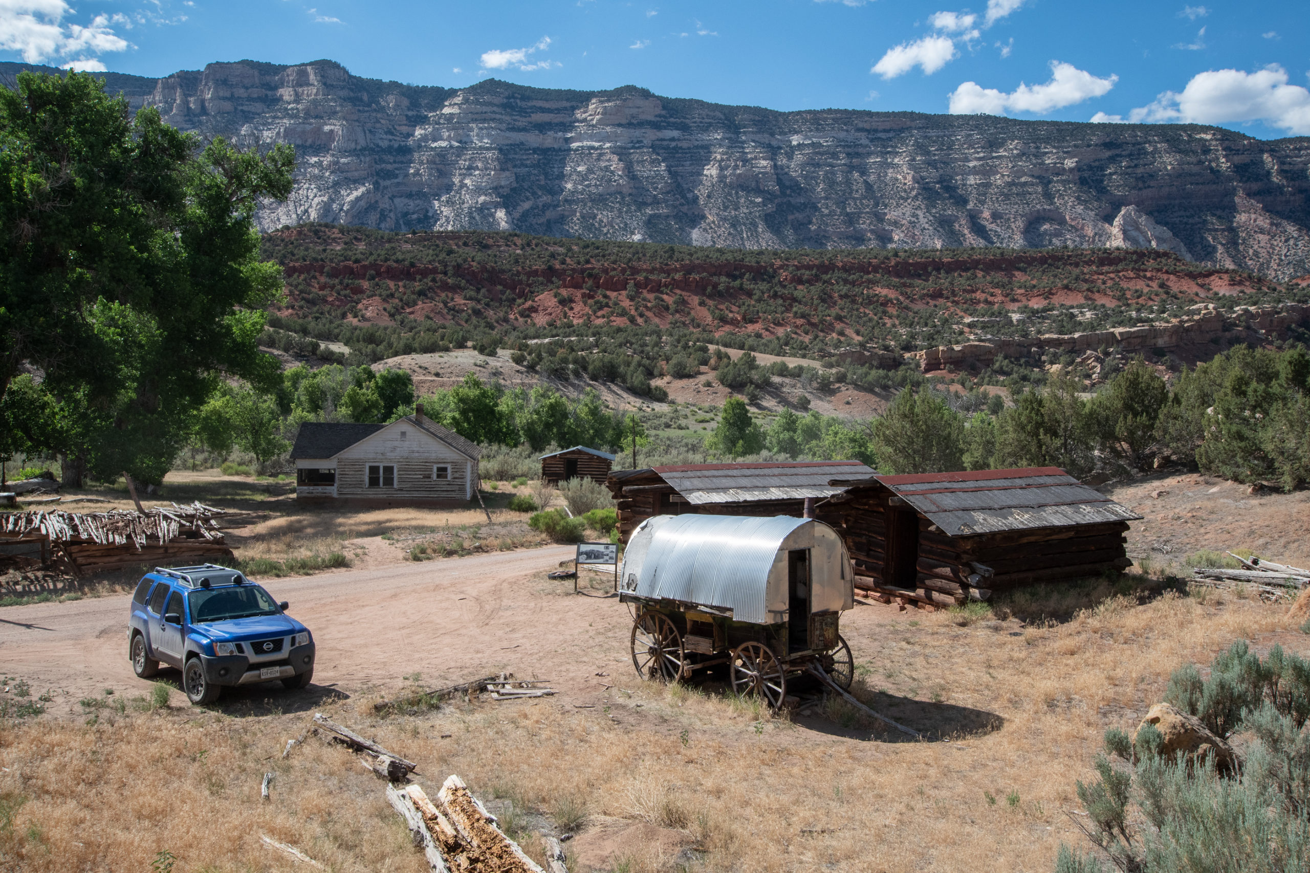
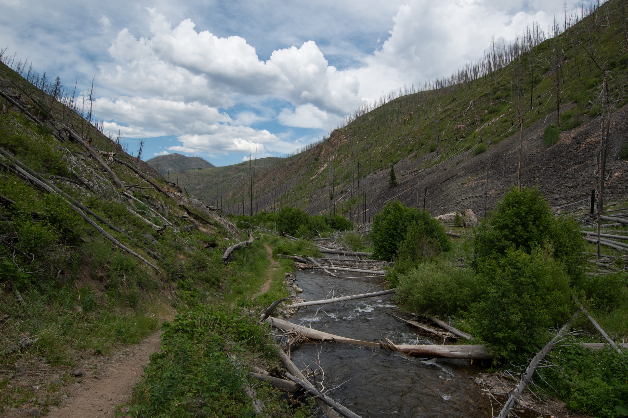
On the Colorado side, I had a long overland drive on Yampa Bench Road along the dramatic canyon rim that ended at a 1800s homestead.
Nothing about who lived here, but whoever they were, they had a killer view along the start of the bench.
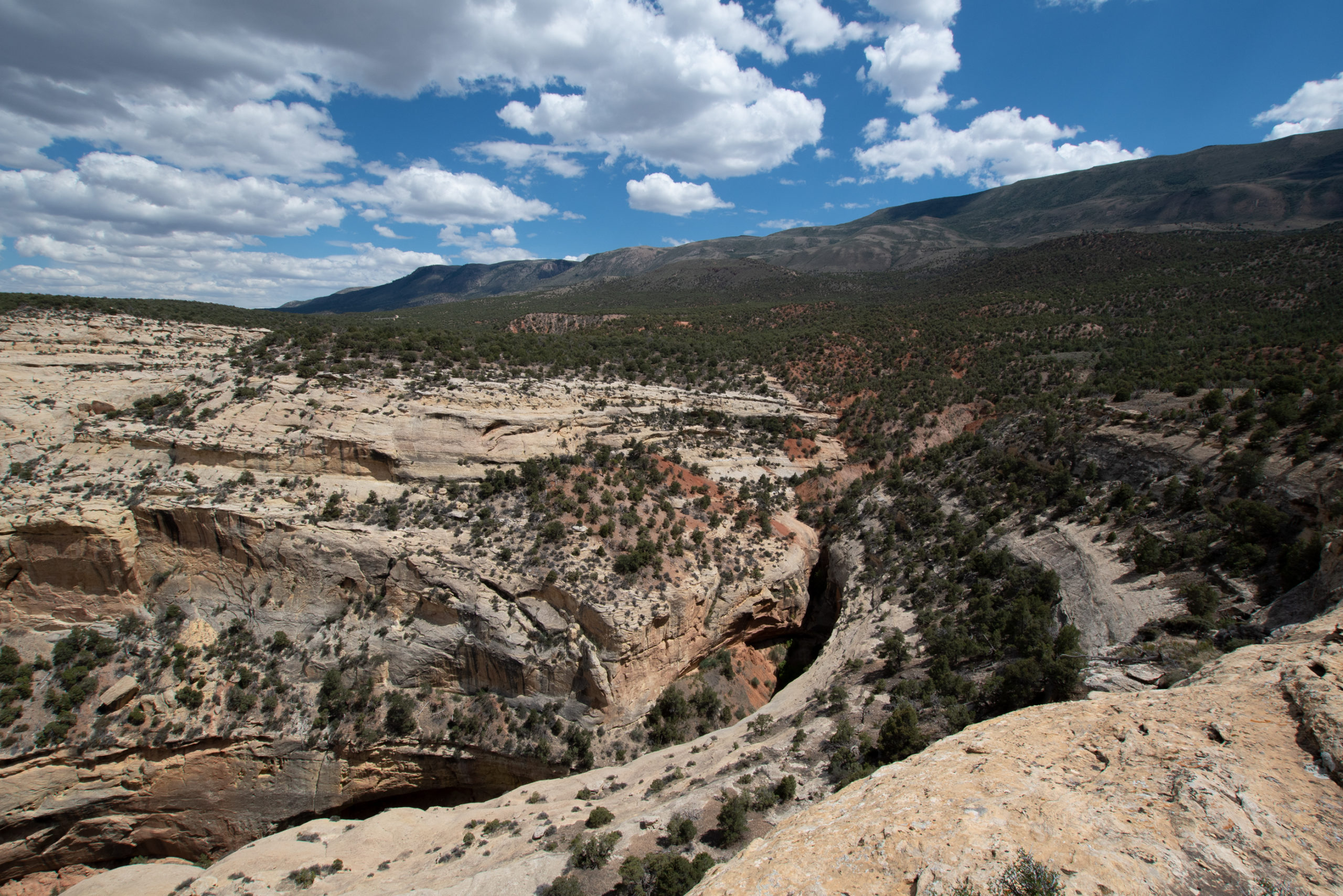
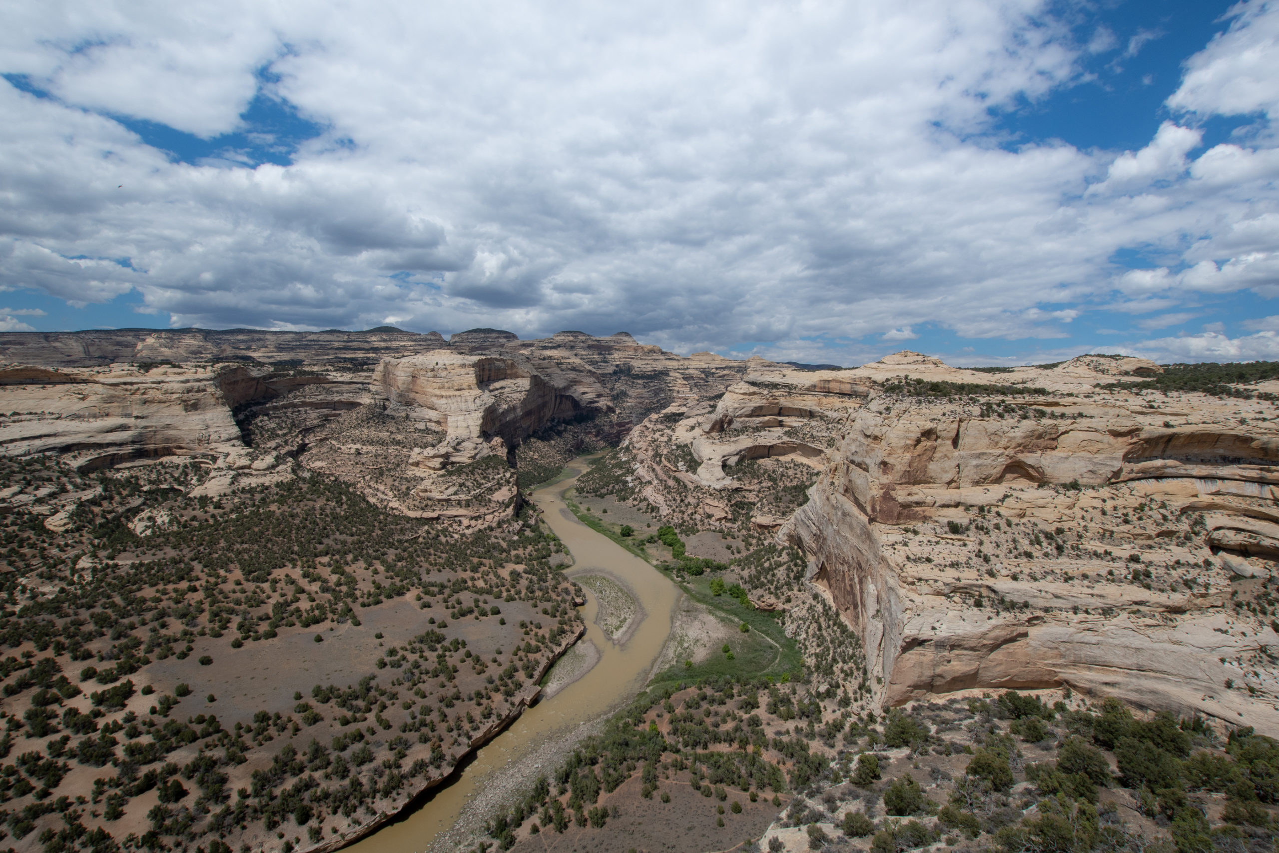
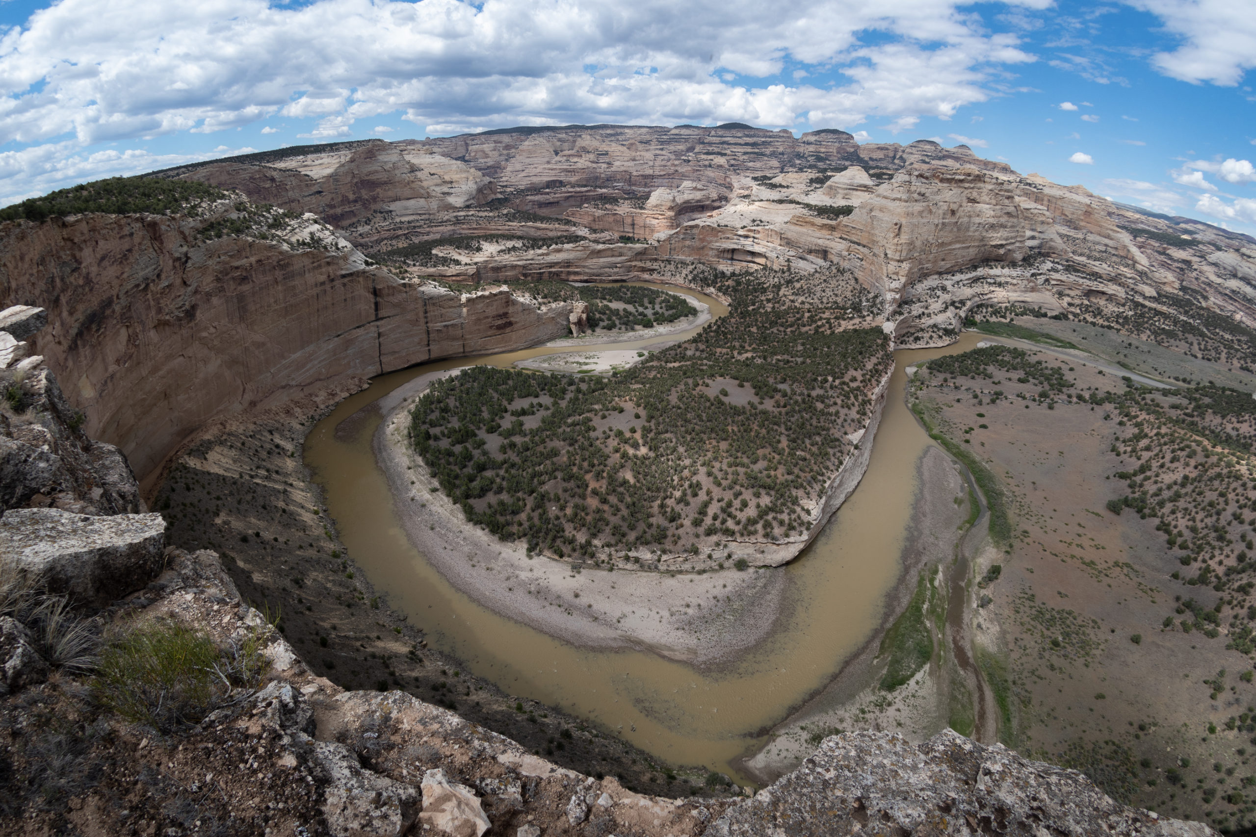
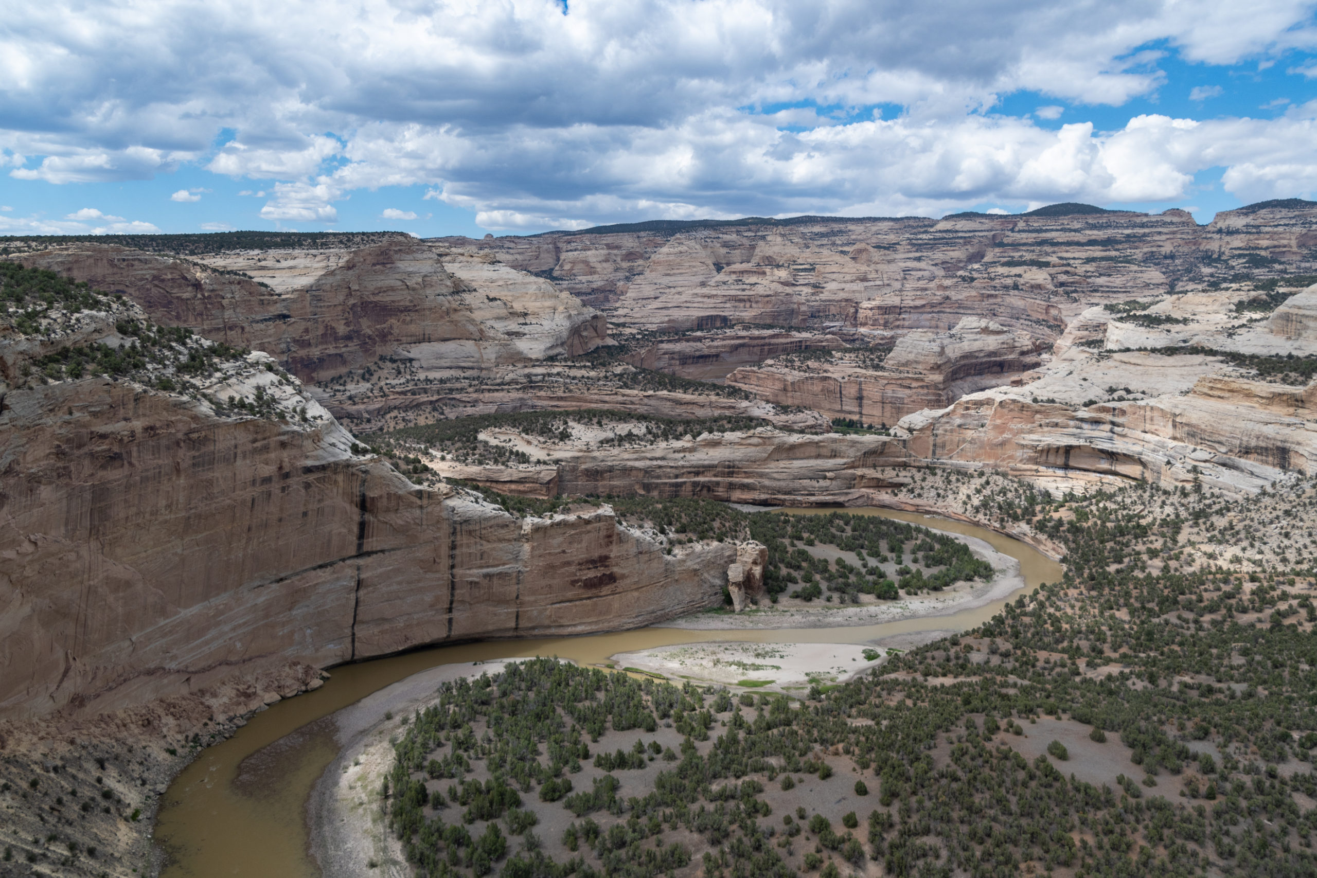
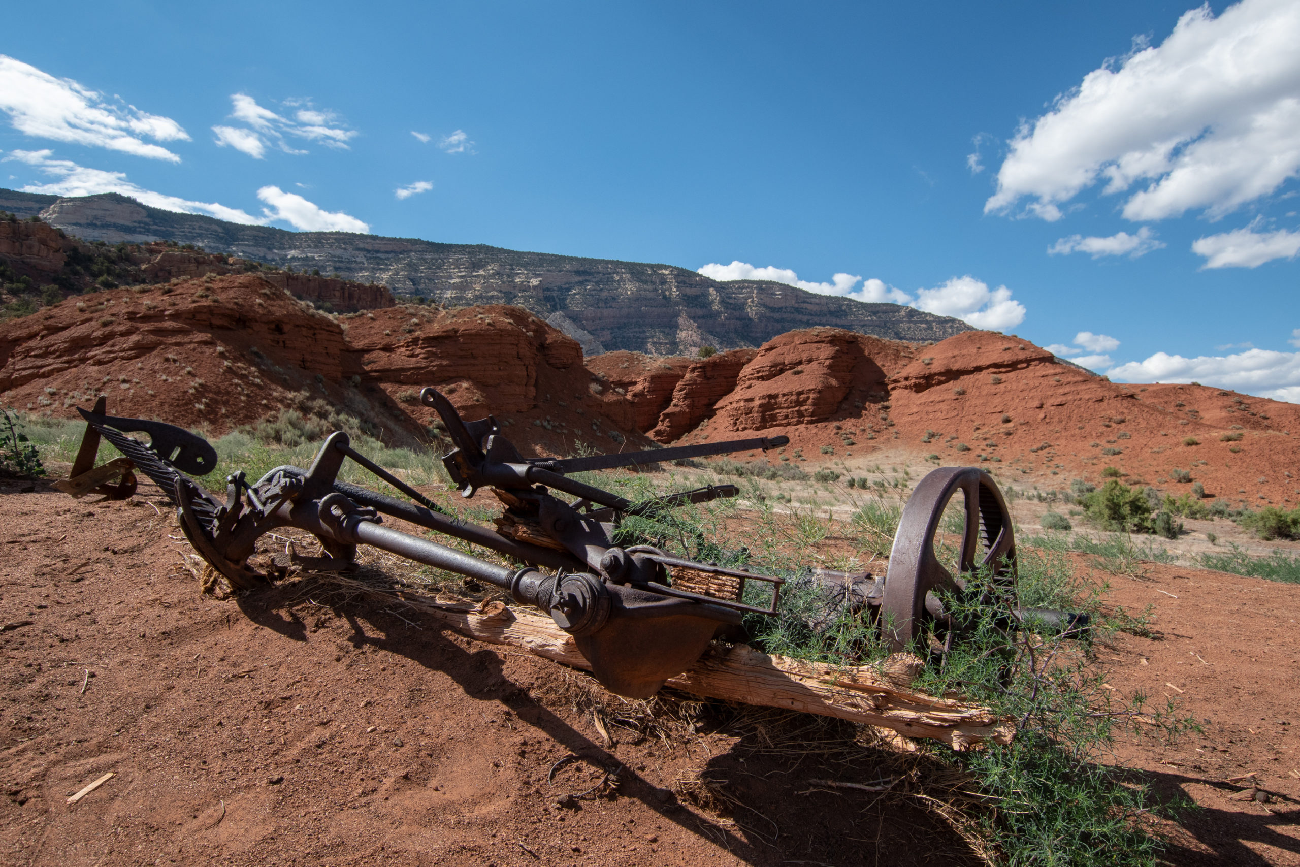
Yampa Bench ends into the main road from the Colorado entrance, which I had expected to be paved and wasn’t. And the section headed up toward the highway had some stoutly rocky switchbacks, which probably explains why I had this end of the park mostly to myself. But before heading back, a few stops along the way down to Echo Park.
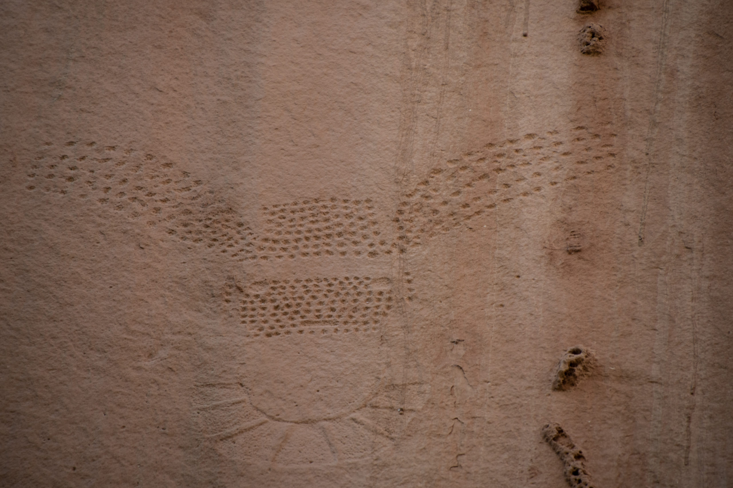
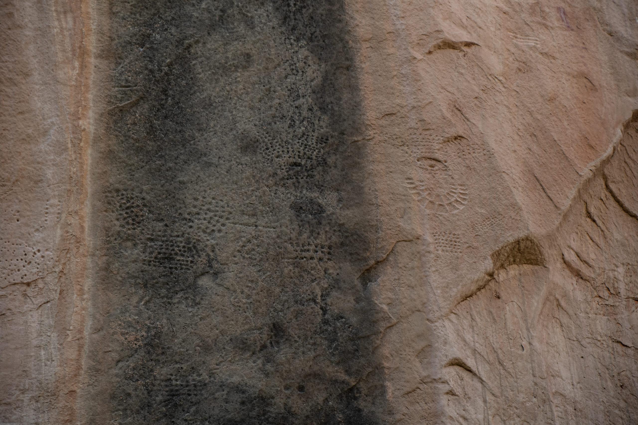
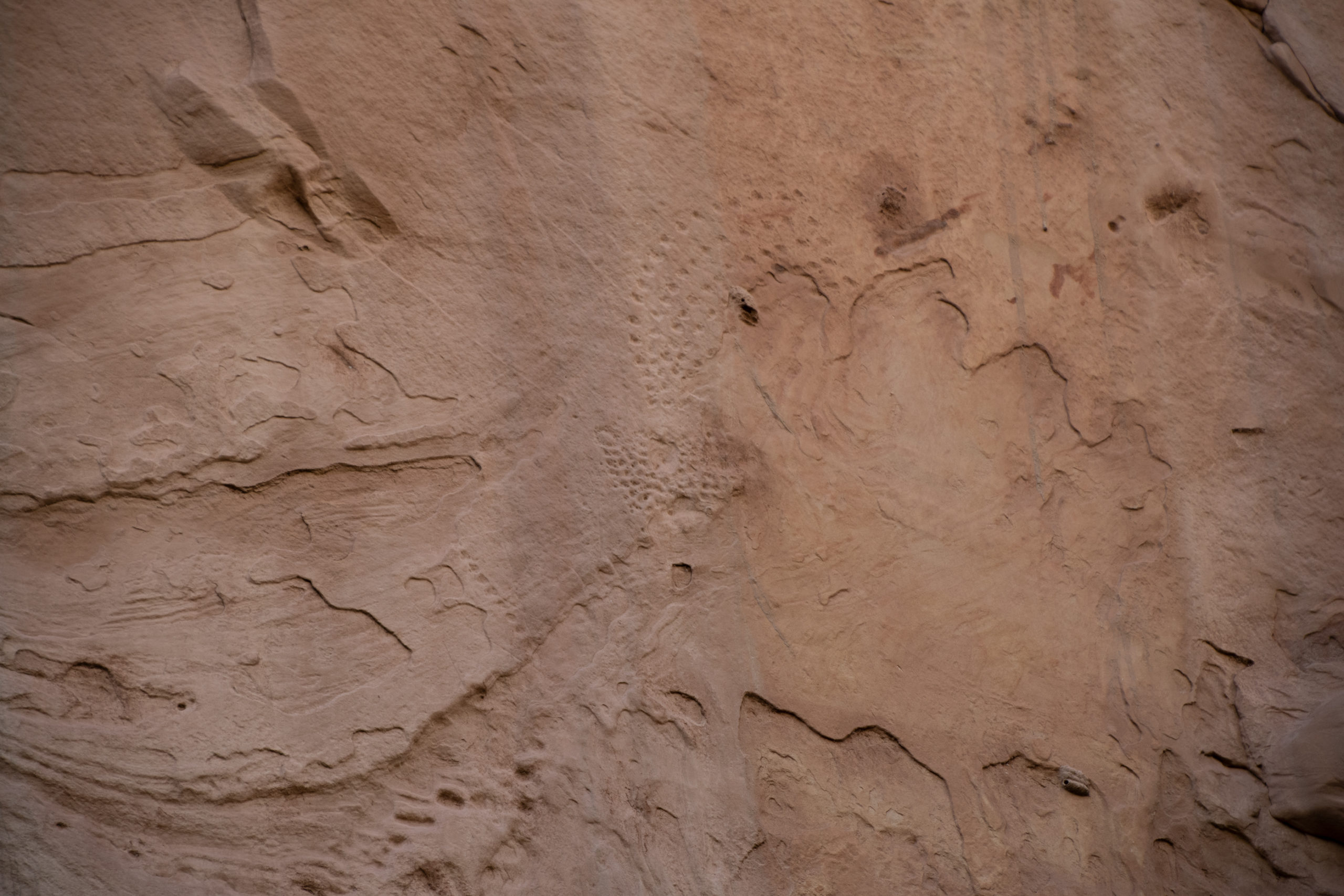
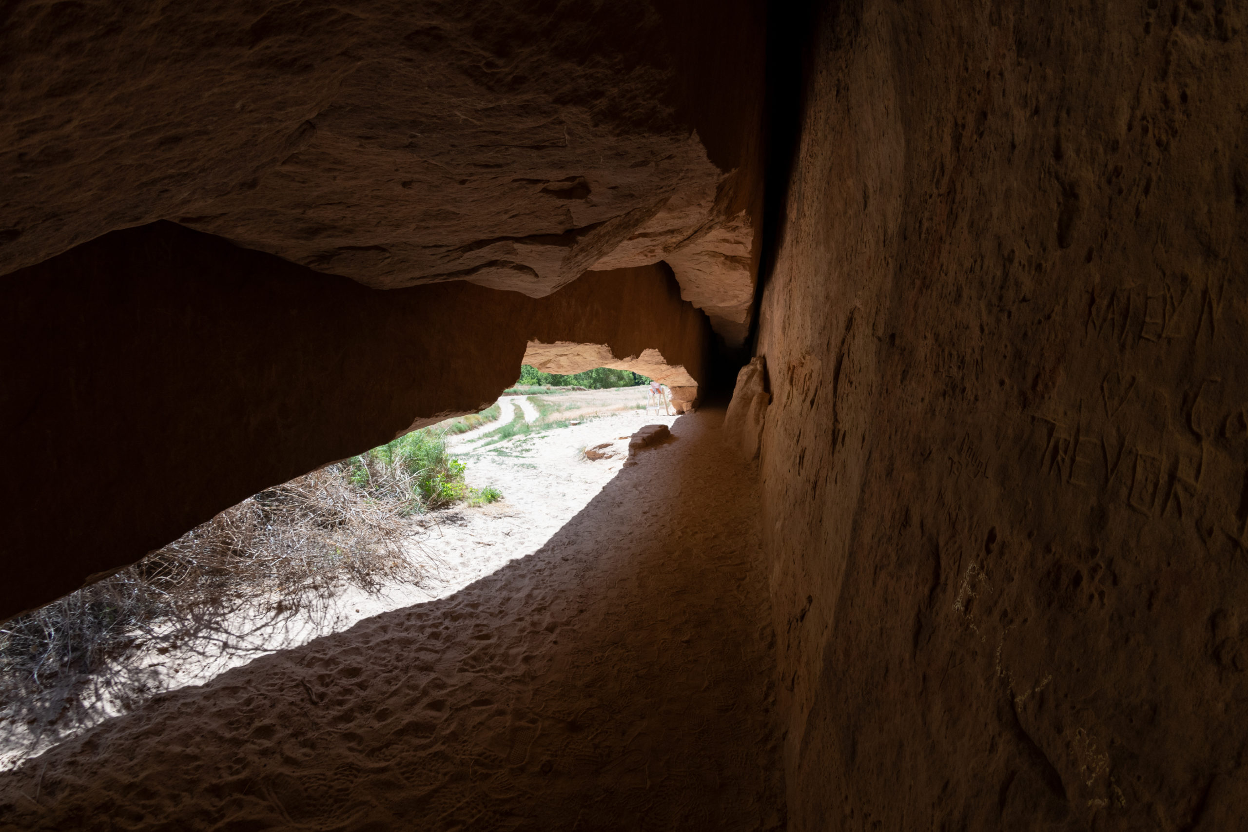
Faintly visible in a cliff face are petroglyphs created by the Freemont people about a thousand years ago. They’re about 30 feet off the canyon floor now because the creek has worn away the sandstone below.
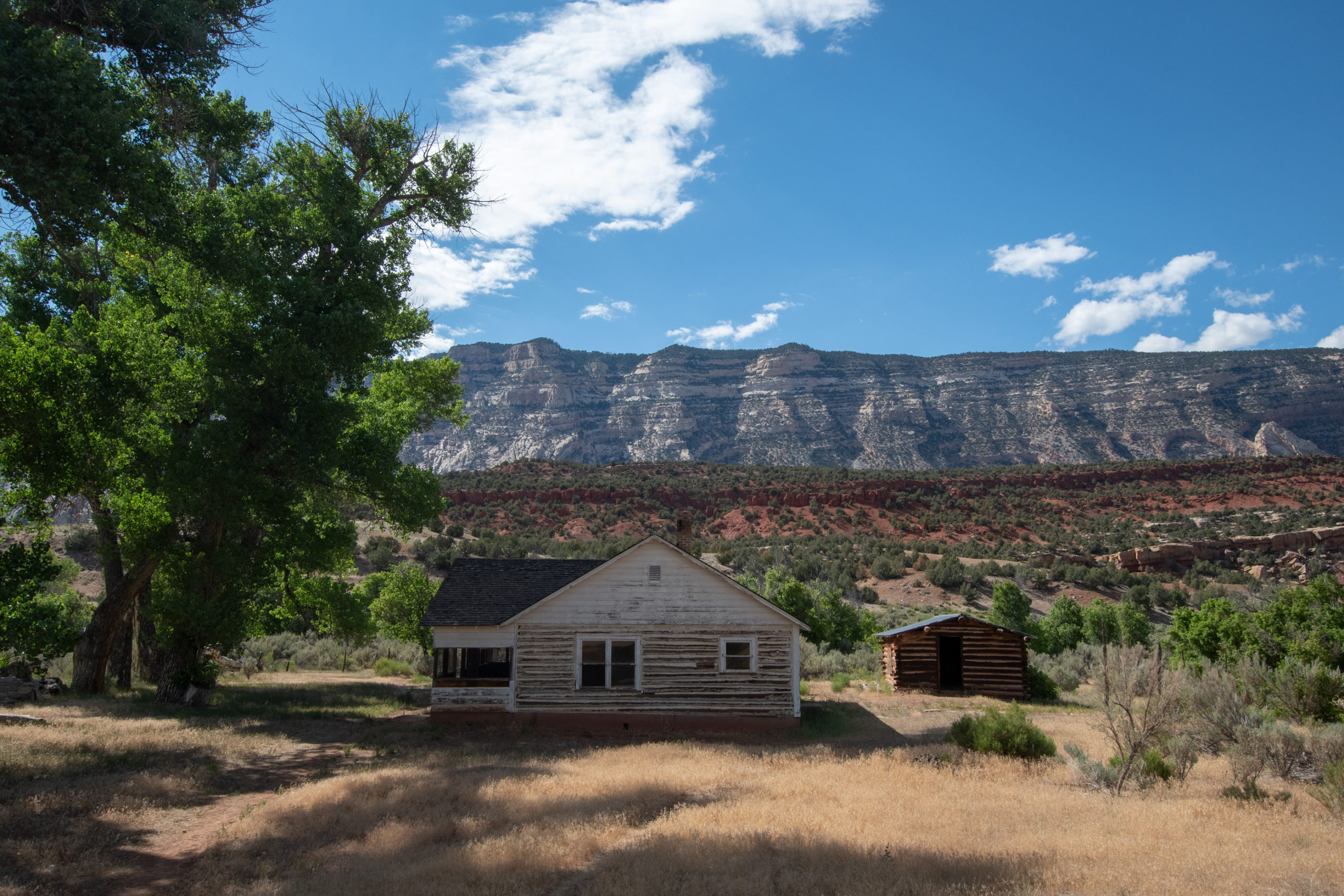
In 1910, Jack and Mary Chew moved here to Pool Creek and established a homestead, initially a one-room cabin but the eventually built out more buildings as they established the ranch. By the 20s, two of the sons maintained the ranch with their mother and increased the holding to 2,250 acres. They held the ranch until 1966, when Rial Chew sold the 1,900 acres within Dinosaur National Monument to the National Parks Service.
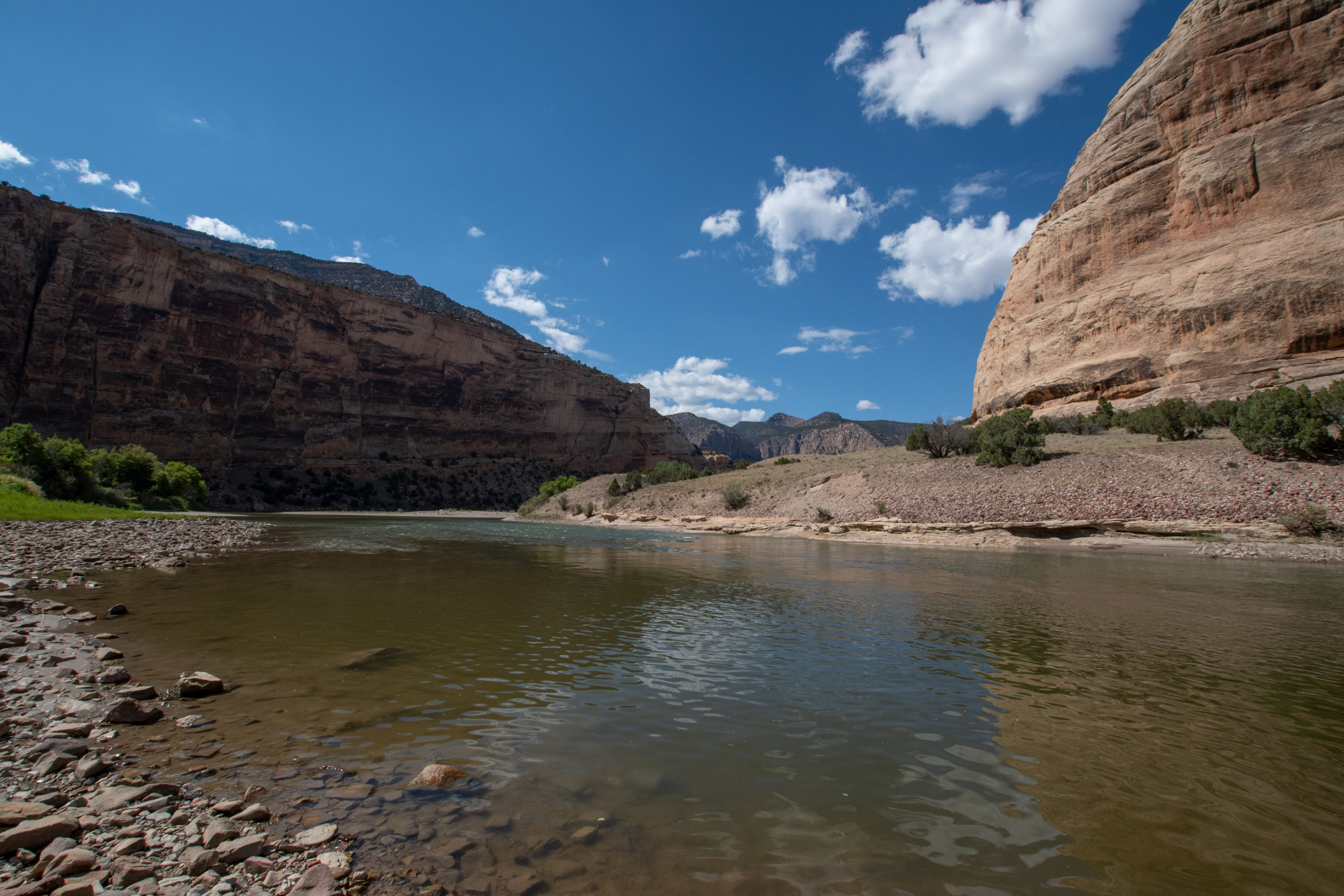
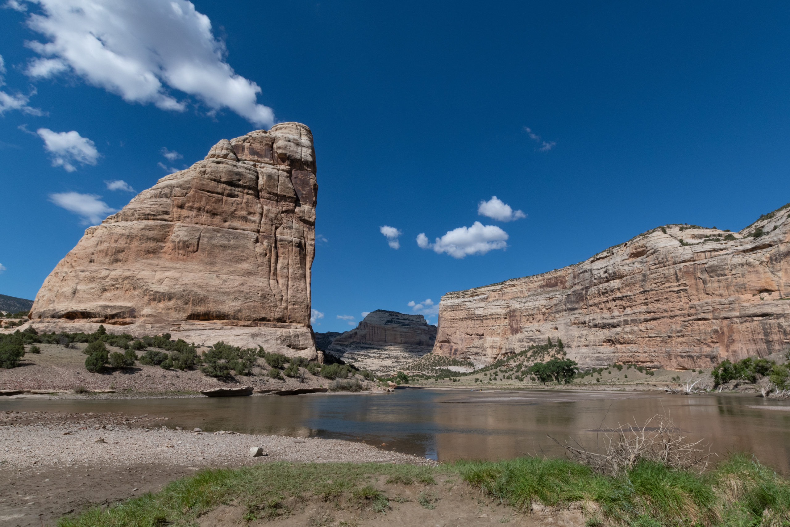
At the end of Harper’s Corner Road was another dramatic bend in the river, with a boat launch, trailhead, and beach.
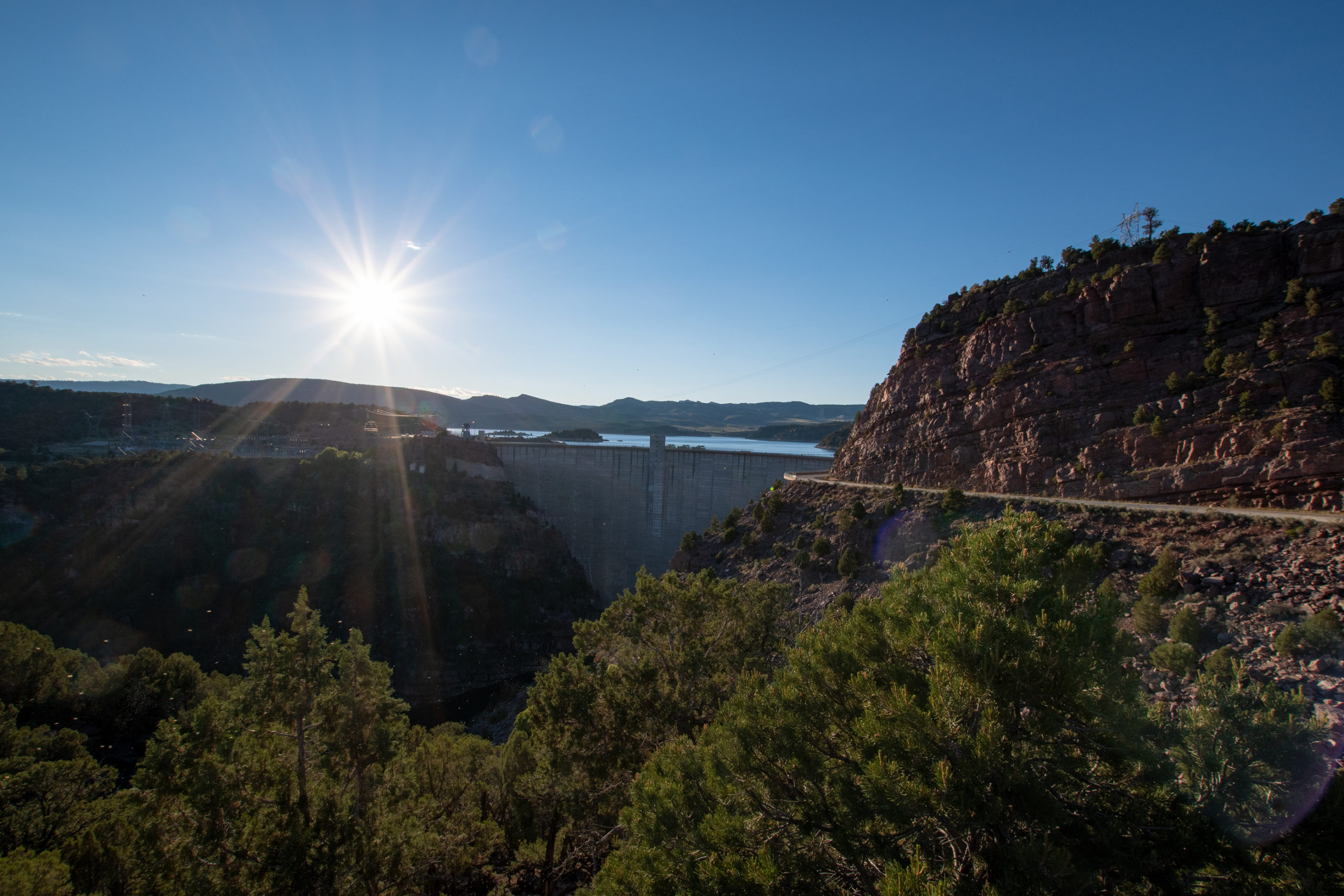
After making my way out of the park, I headed out toward a brief overnight in Pinedale. The route went through the Flaming Gorge National Rec Area over the dam and up US-191 into Wyoming.
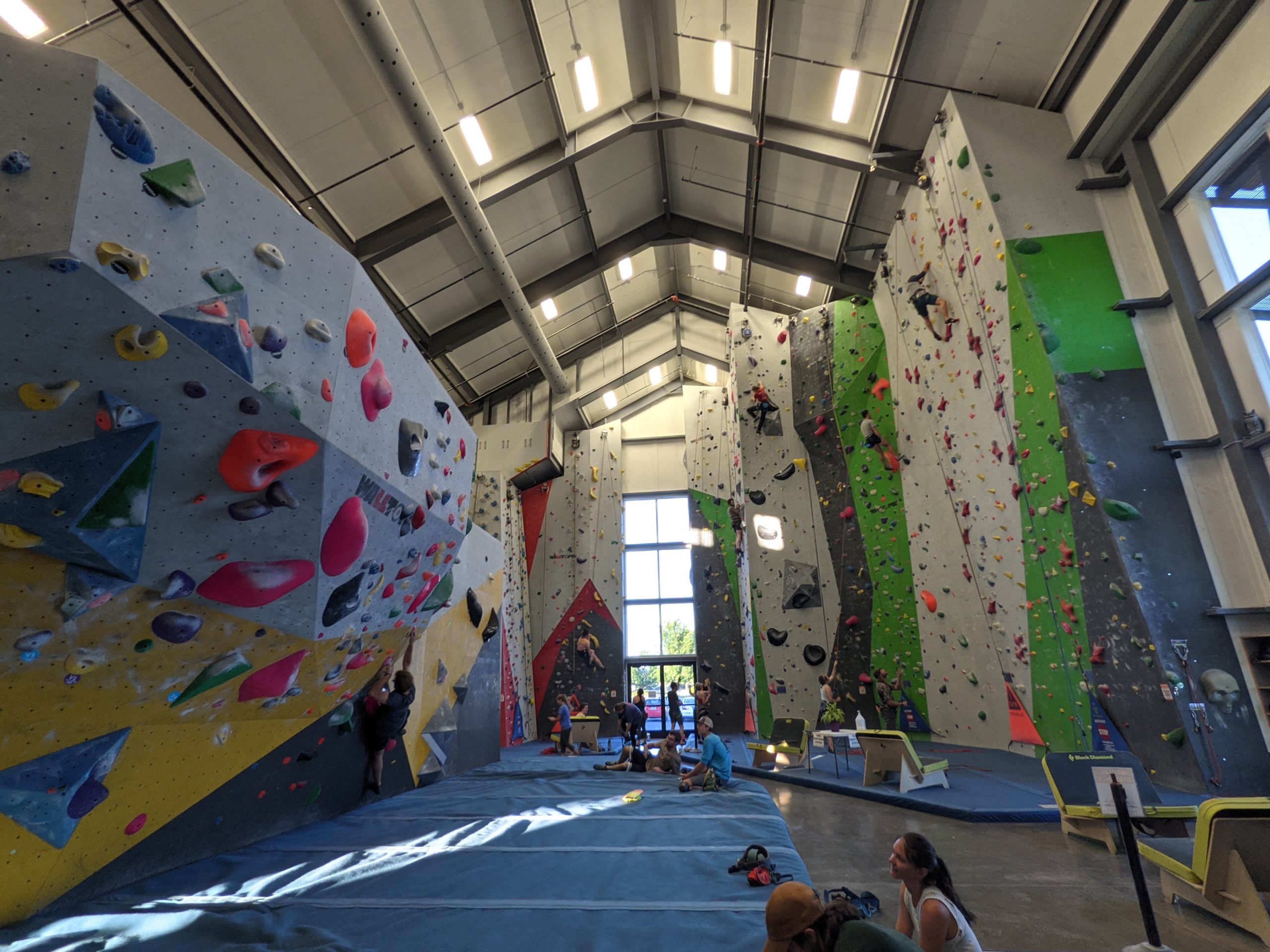
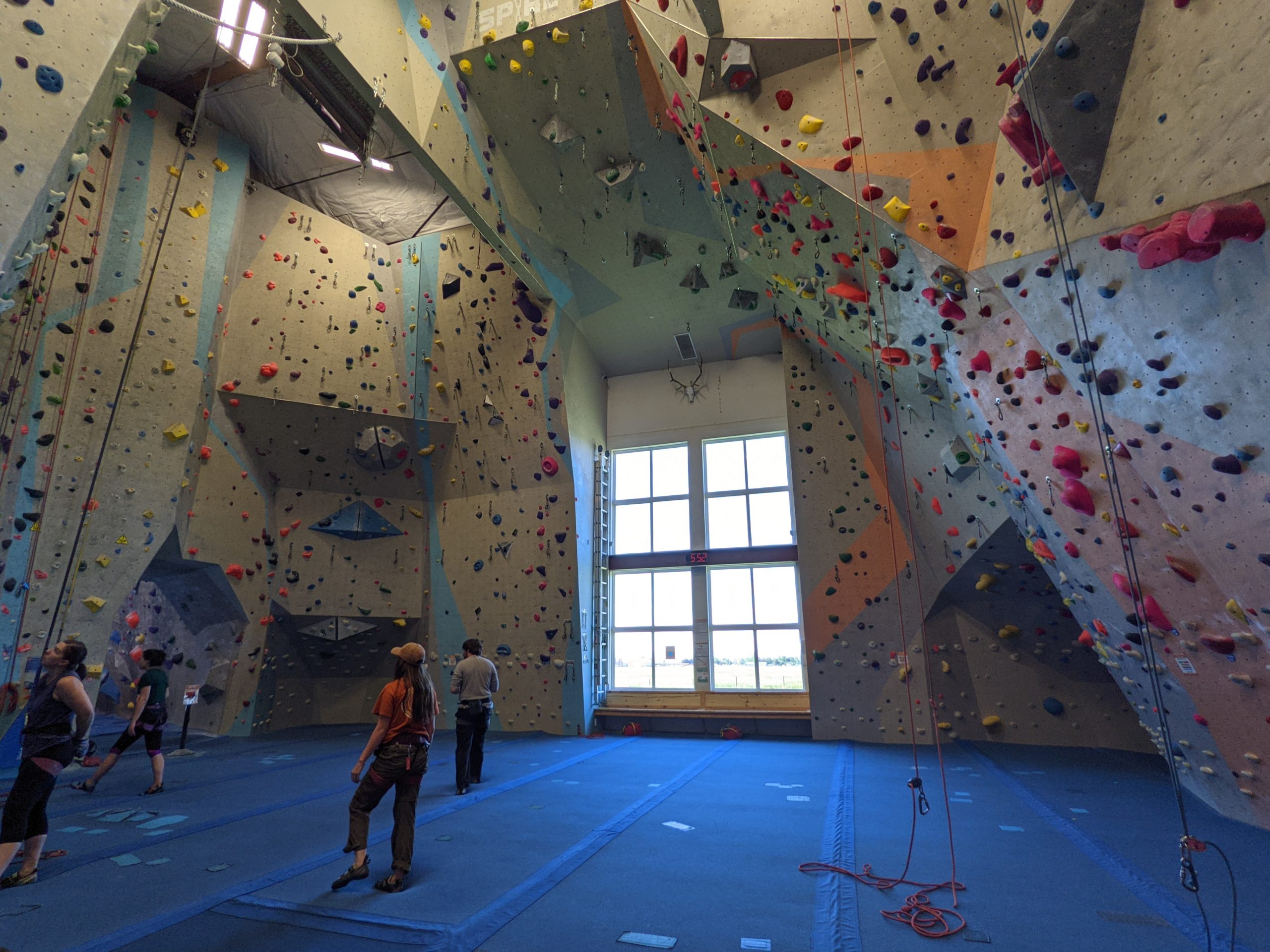
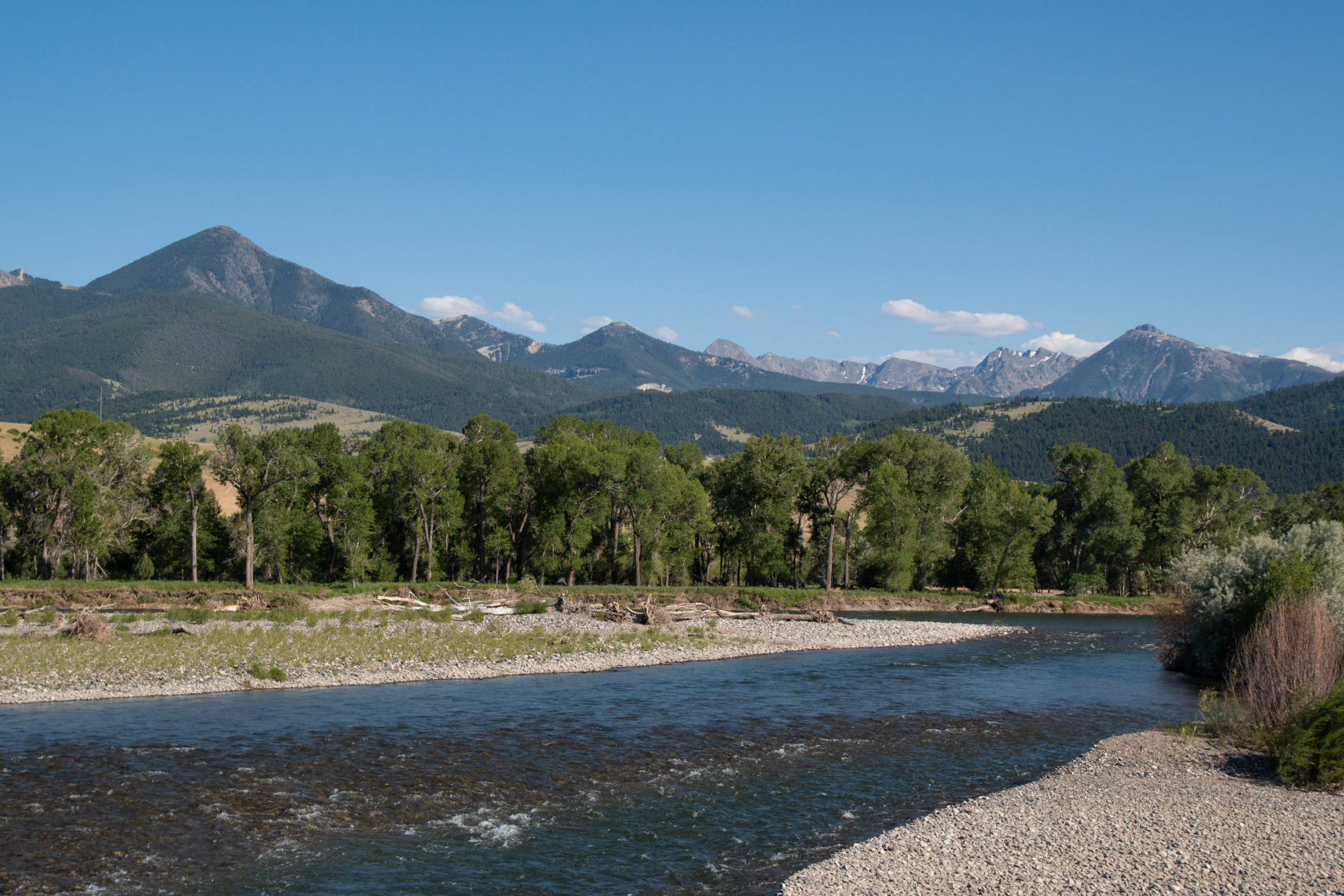
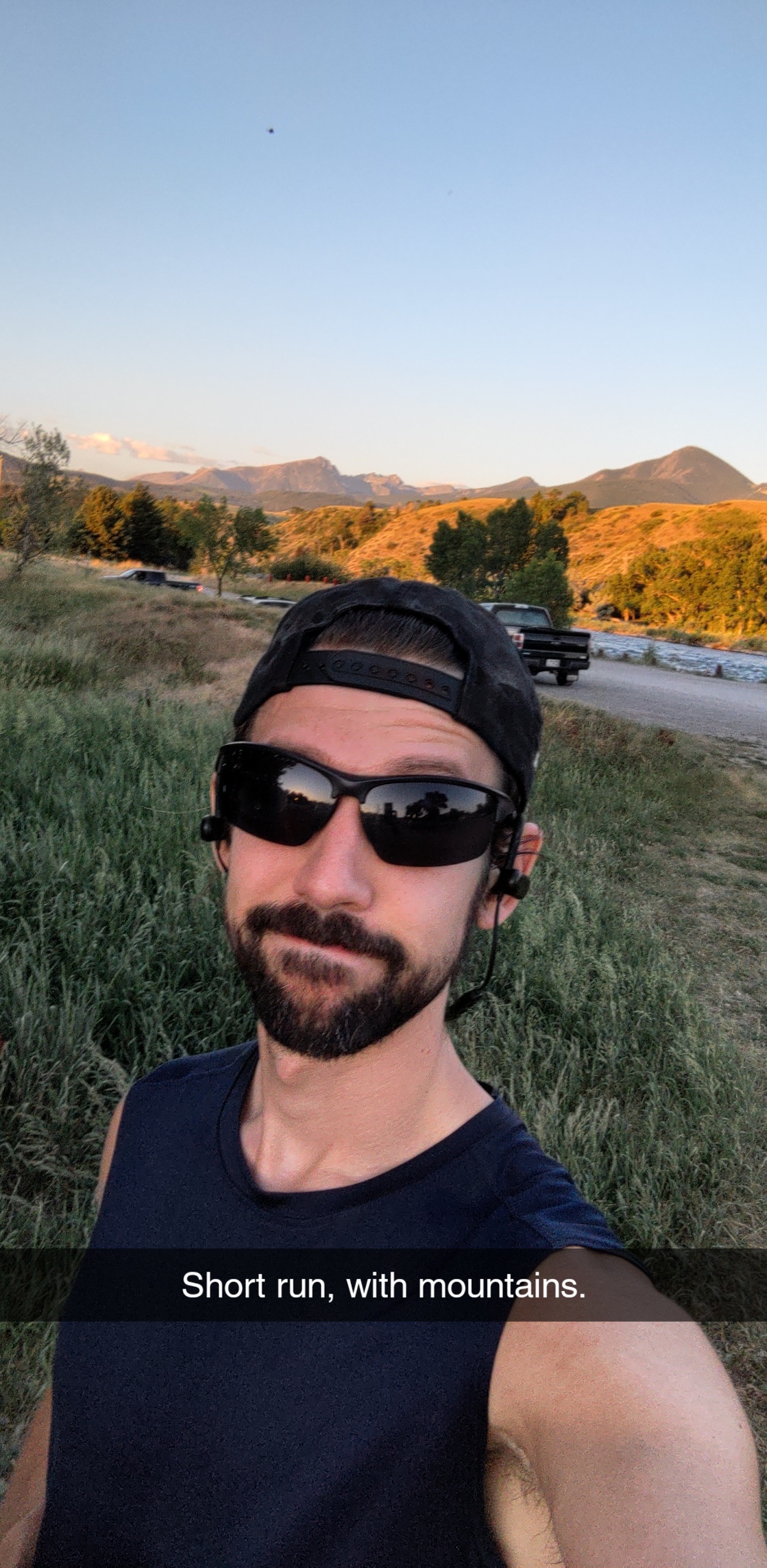
After Dinosaur, I overnighted briefly in my current-favorite mountain town of Pinedale on the way up to Montana to visit a friend and catch a couple events I’d been invited to. And between a meadow hike, Spire Rock Gym’s first ever LGBT climbing night, a hike to a waterfall, the Livingston Farmer’s Market, my first bar-crawl since Covid in Bozeman, a short run along the river, the Livingston Roundup rodeo/market/parade at which I bought a piece of art made out of aspen bark from a wildfire, and a drag brunch-for-dinner in which we had a friend performing, I’d say I packed a lot of fun into a small number of days. Livingston makes a great vacation.
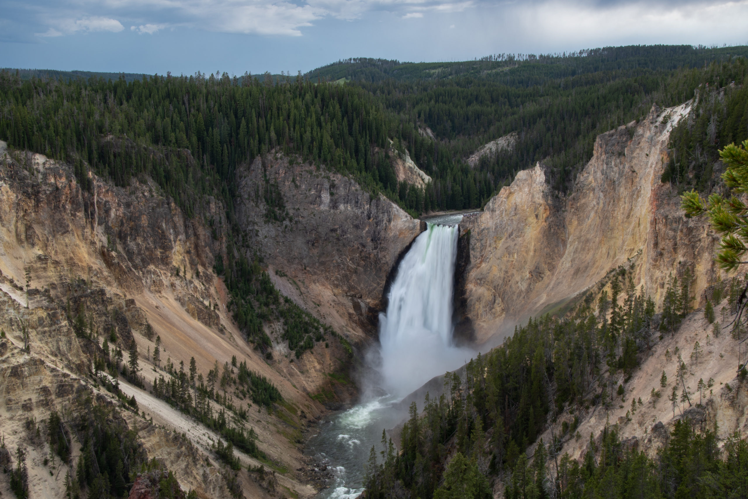
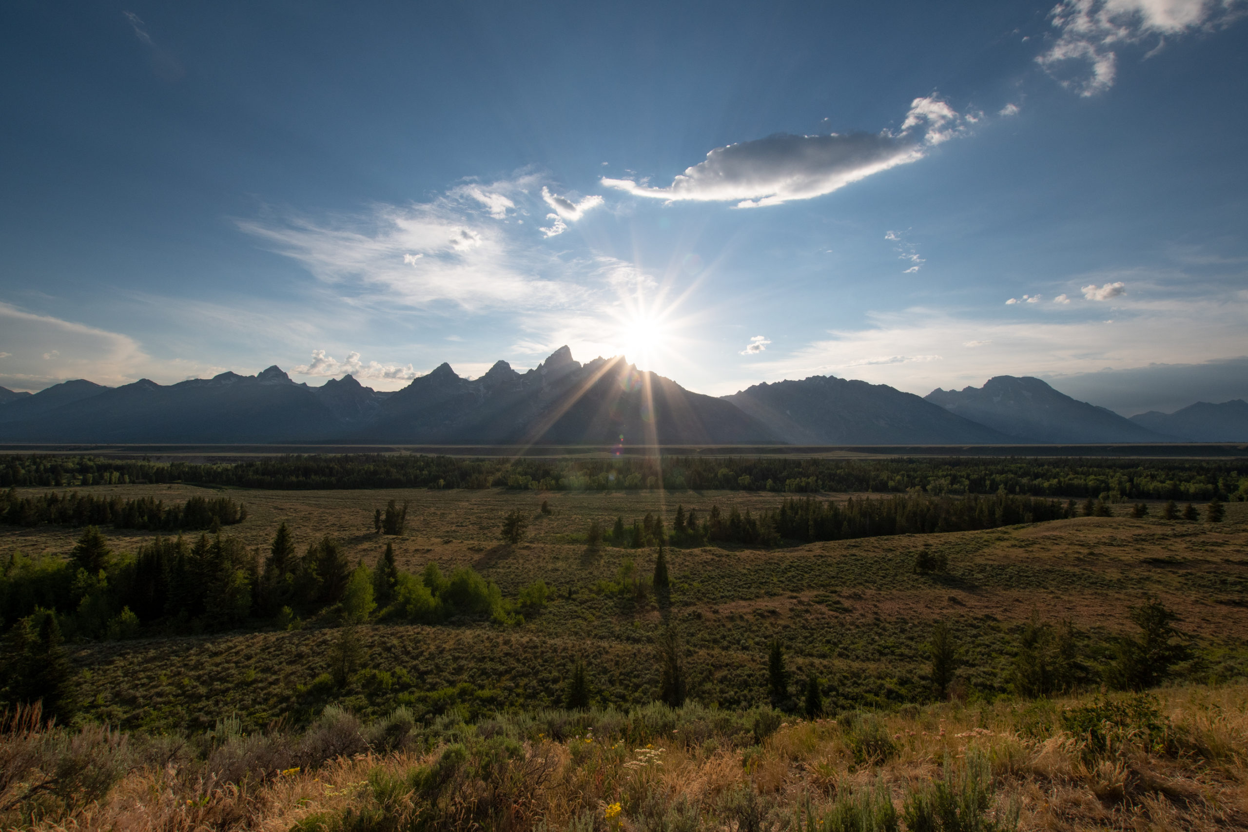
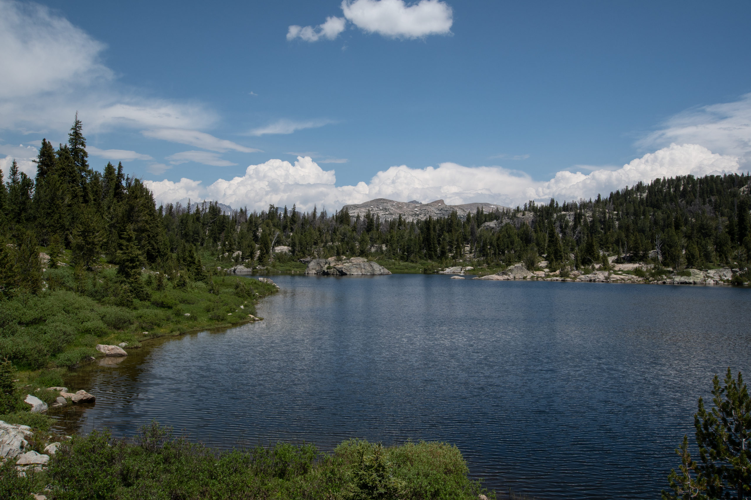
Having reached the north-most point on this adventure, I headed back down to Pinedale for a couple days. But unlike the trip up where I bypassed the park through Idaho, I took the eastern half of the Grand Loop road in Yellowstone along the lake and US-191 along the Tetons.
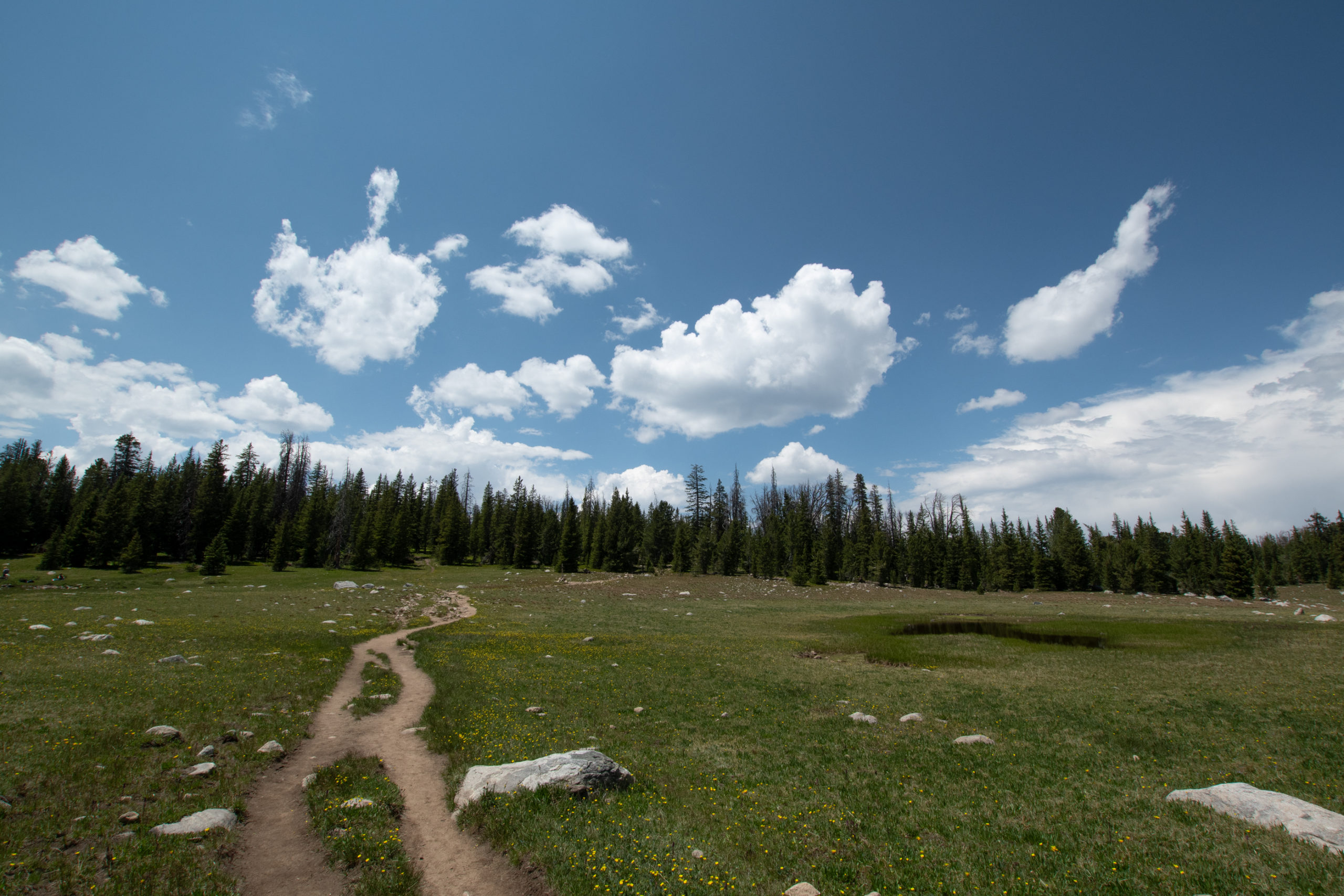
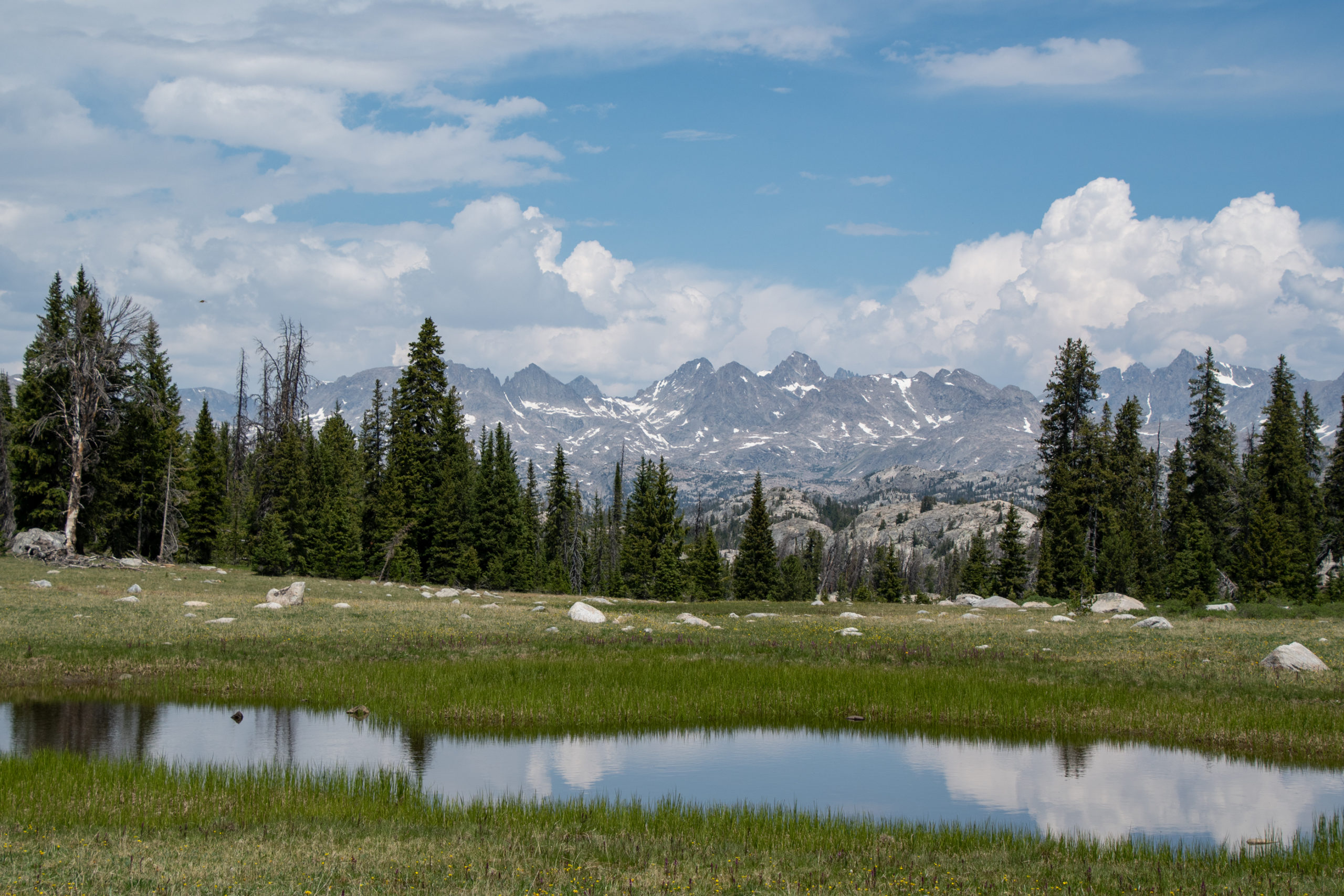
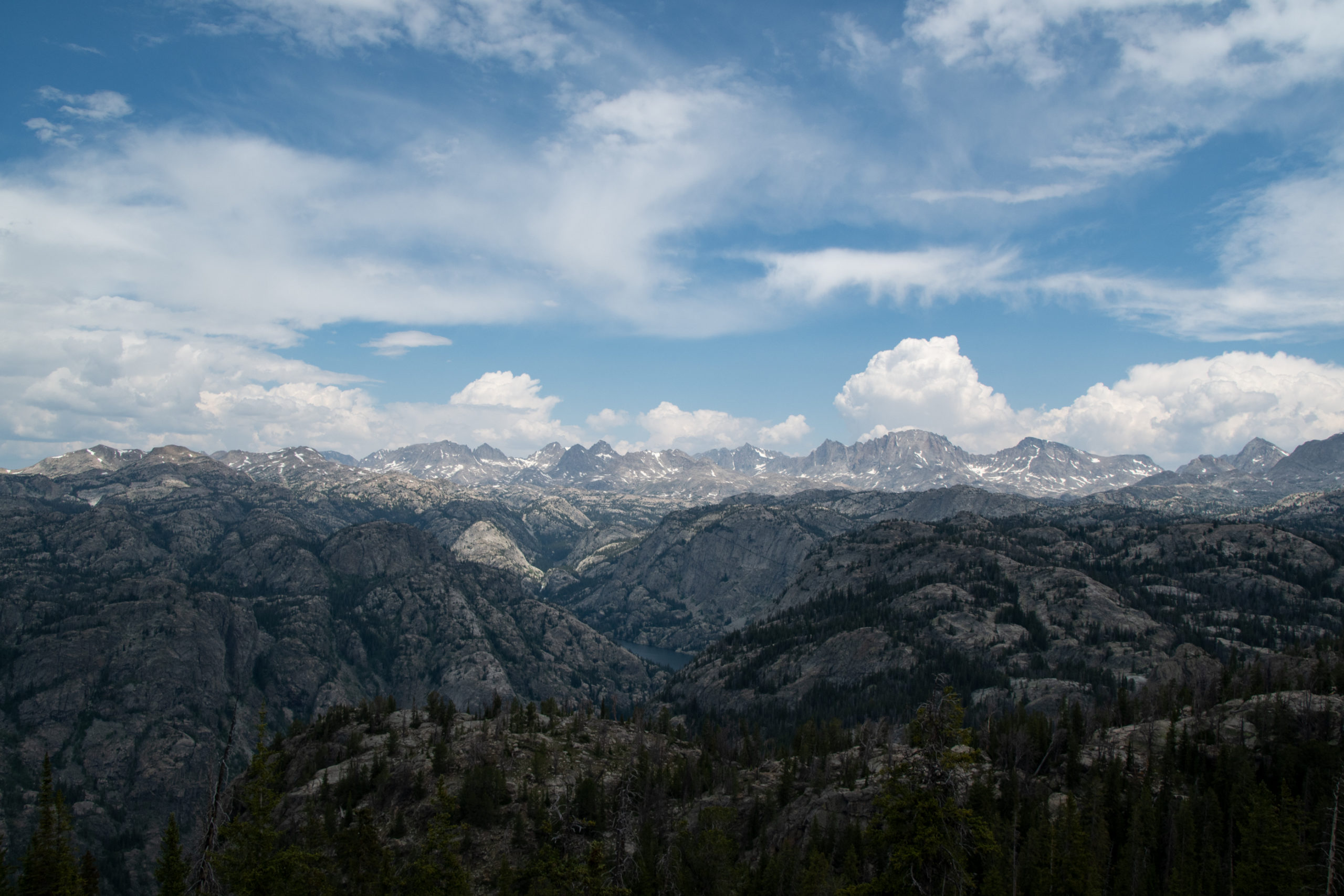
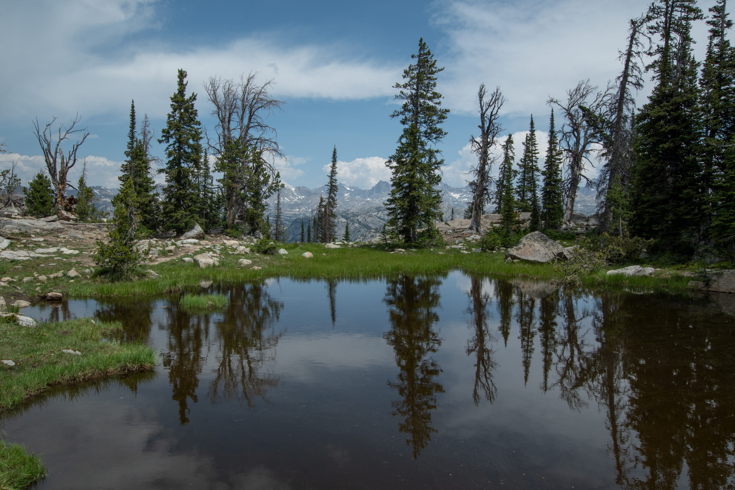
Something about Pinedale really captured me last year, and for reasons yet to be put on record (edit), this felt like the right week to return. I set out on the Pole Creek trail again, but instead of the short hike to Sacred Rim, the wind-blown trees have been cleared out allowing passage to Photographer’s Point and Elklund Lake a bit further down the trail.
No one warned me that this time of year, Wyoming is home to a Gulf Coast of Mosquitoes. But the views were tremendous and the sky a proper blue. Last year, wildfires of the west coast had brought a smoky haze to settle over this whole range, obscuring many of the mountains and desaturating a lot of the sky.
After the hike, I went down the mountain, determined to grab dinner from that brewery I liked. The bartender, after it took ten minutes to get her attention, informed me that even takeout would take an hour and a half. Post-pandemic travel has found my mountain, clearly. So I took a chance on some tiny-western-town Thai food, which went better than expected.
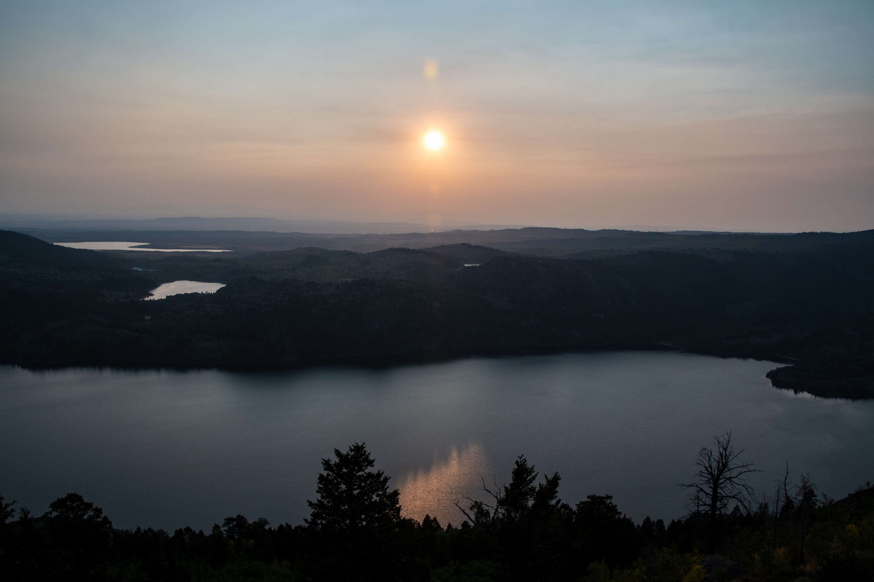
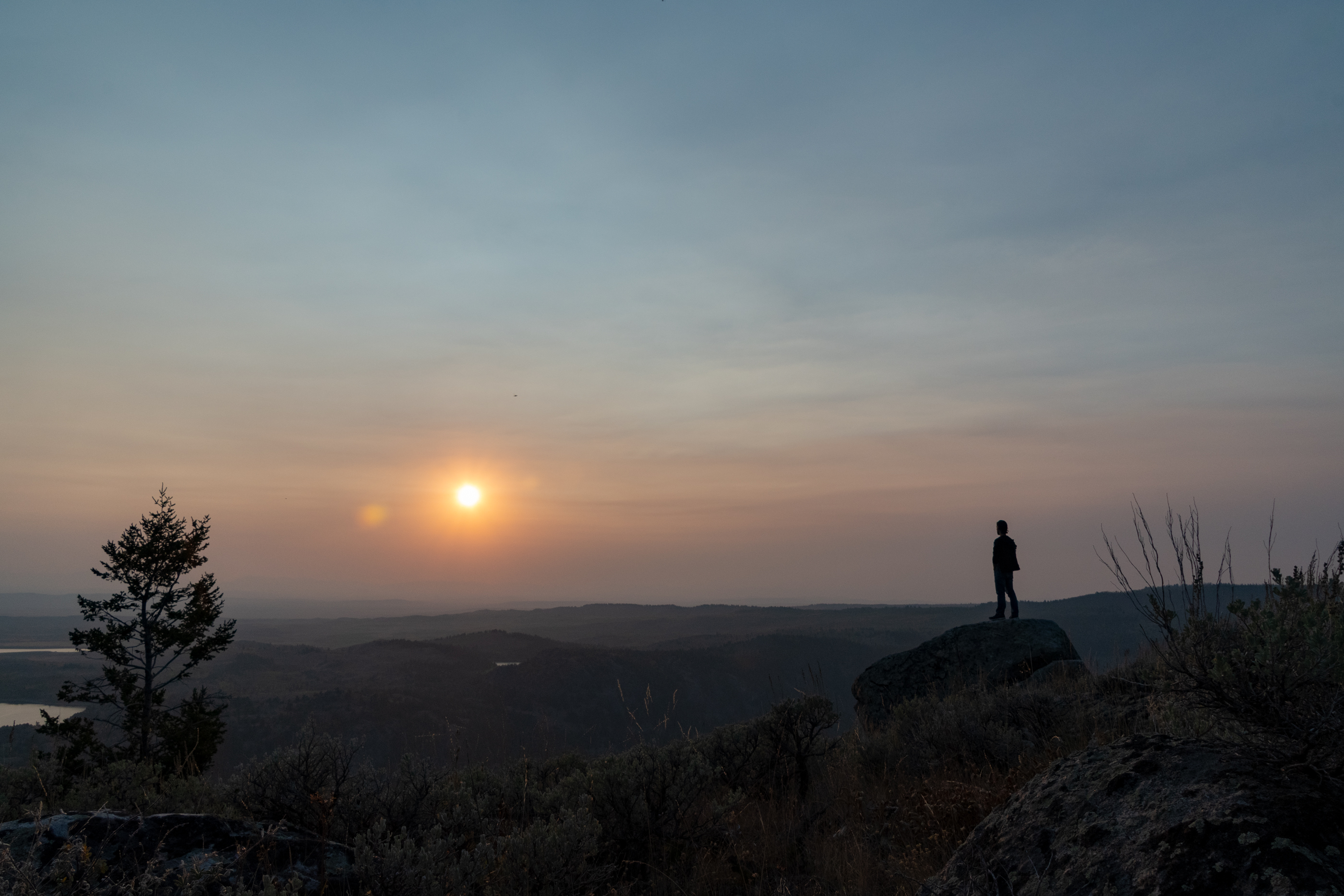
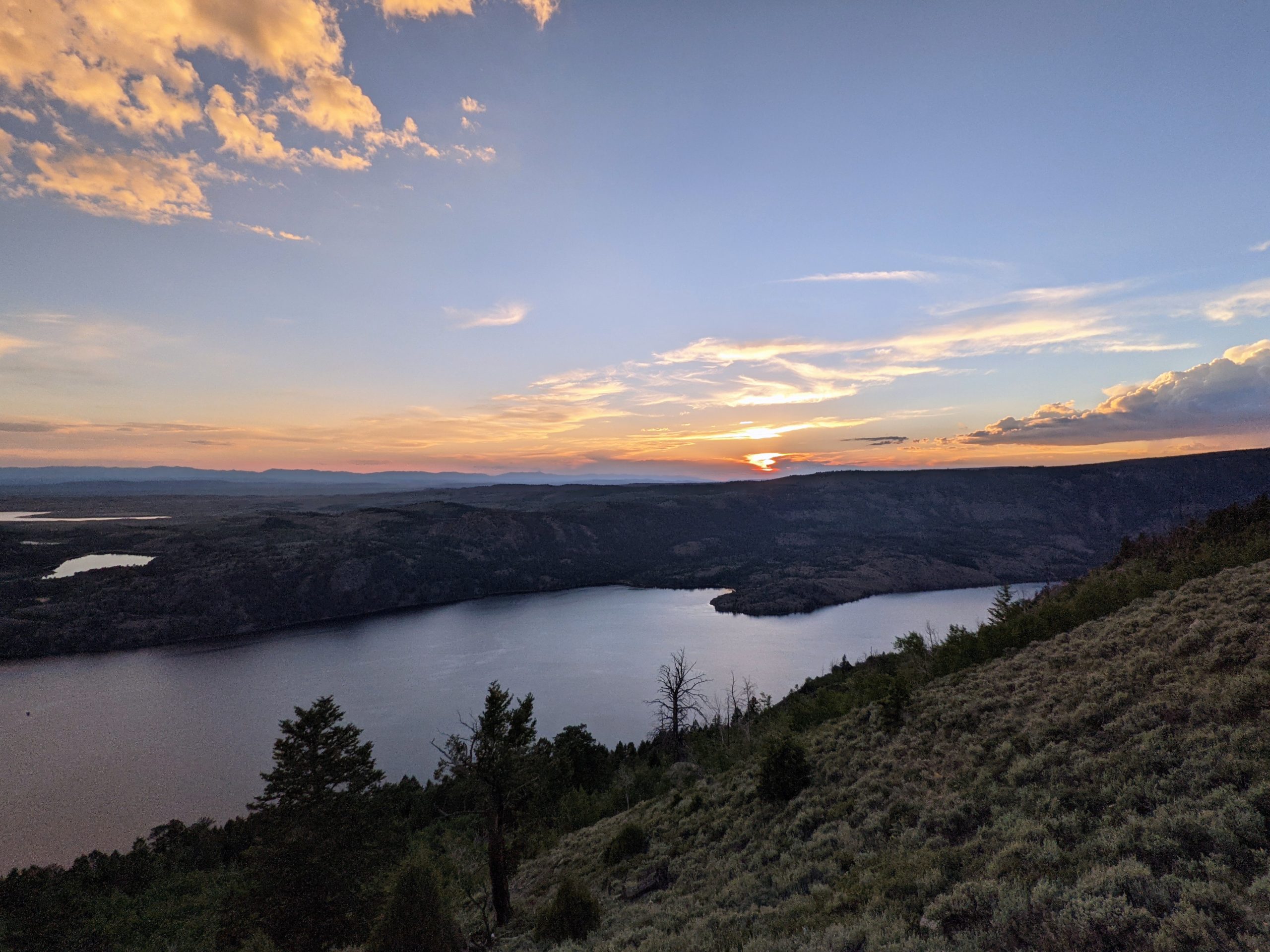
And for the final event of Pinedale, I went back up Skyline Drive in an attempt to recreate a moment:
September 2020, a sunset in both a literal and metaphorical haze.
In my post-hike, post-takeout stupor, I left my camera at the hotel (which, turns out, is not without precedent in this region). I was mad at myself, but that passed quickly in the cool mountain air while I thoroughly enjoyed the moment, nonetheless.
Same rock, though no dramatic self-portrait. July 2021. Under a blue sky with a clear view. Despite the shitty telephone camera.
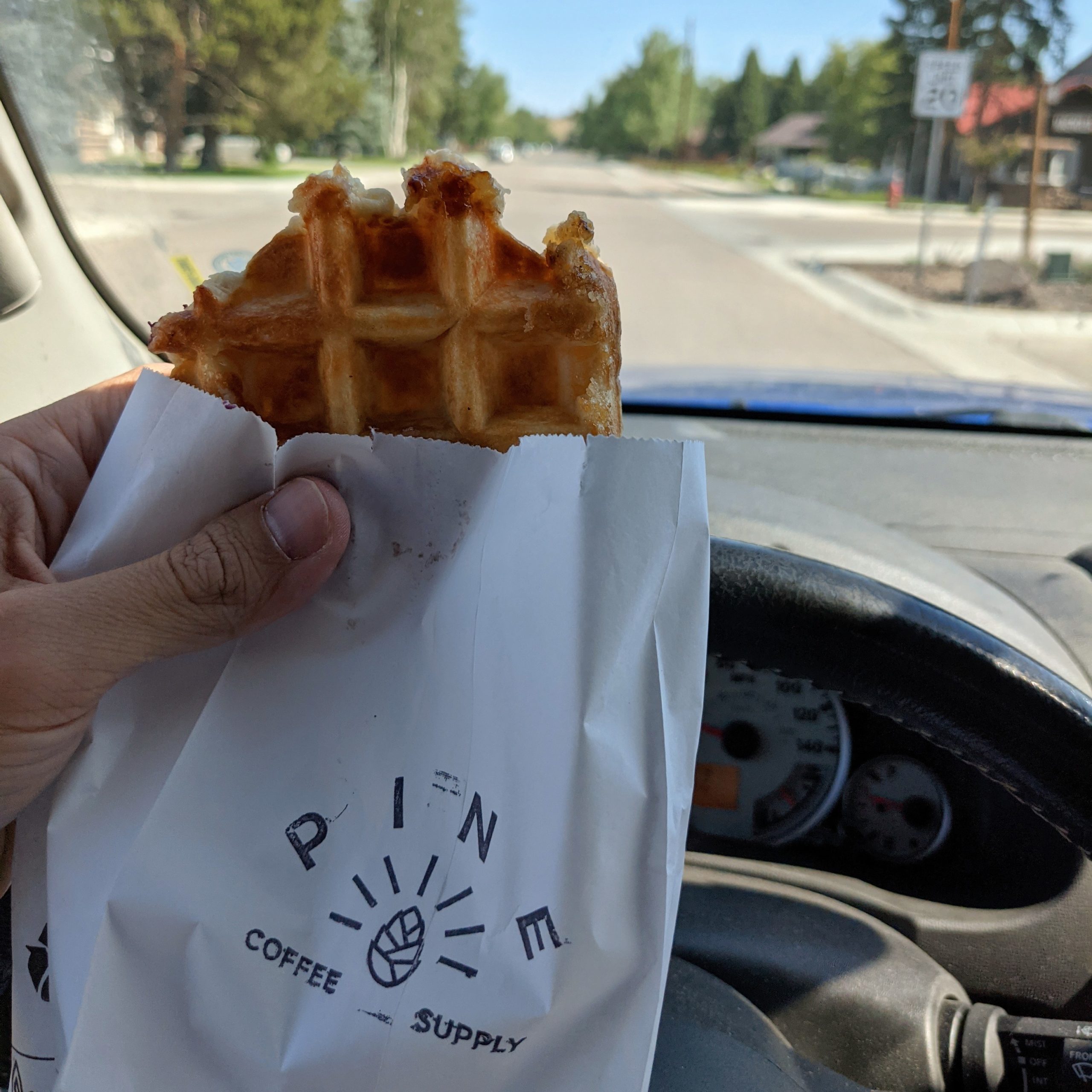
I headed out from Pinedale this morning, intent to return again one day and stay longer. But I picked up coffee, a mug, and a glorious breakfast from Pine Coffee Supply on the way out.
Somewhere between a donut and a waffle with a glaze that’s kinda crunchy.
I split off from the highway back to Rock Springs to hit the southern edge of the Wind River Range and the Shoshone National Forest. On the way to the park, I made a quick detour drive-through of a couple interesting neighboring mining towns, Atlantic City and South Pass City, simply because of all the signs.
Situated some 27 miles south of Lander, Wyoming lies the once prosperous gold mining camp of Atlantic City. One of several gold camps that were outgrowths of nearby South Pass City, prospectors discovered gold near Rock Creek in the summer of 1868. The mineral-rich quartz vein, they called the Atlantic Ledge due to its location on the east side of the Continental Divide, was several feet thick and thousands of feet long.
[…] In 1884, in came a French engineer named Emil Granier, with investment capital to begin a hydraulic mining project. Hiring some 300 men, he began to build a 25 sluiceway to provide water to his claims east of Atlantic City down from Christina Lake, high in the Wind River Range. The ditch, that passed through miles of hard rock before snaking its way to Atlantic City, was finally completed in 1888. But, Granier’s dream would be foiled when it was found that the ditch had been built with too much slope and when the water rushed through it, many of the sluices were destroyed, spilling water and gold along the way. Small miners then rushed in and used the water for panning in the numerous gullies, many of whom were successful. By 1893, Granier’s company was bankrupt, and the defeated man returned to France to explain the project’s failure and request additional financing. Instead, he was jailed, tried, and sentenced to life in prison, where he died a few years later.
Atlantic City’s general store still operates, the old hotel now operates as a B&B. South Pass City is almost entirely a ghost town preserved as a state park, with one or two residences remaining nearby. The state purchased the land as a 75th Birthday gift for its citizens.
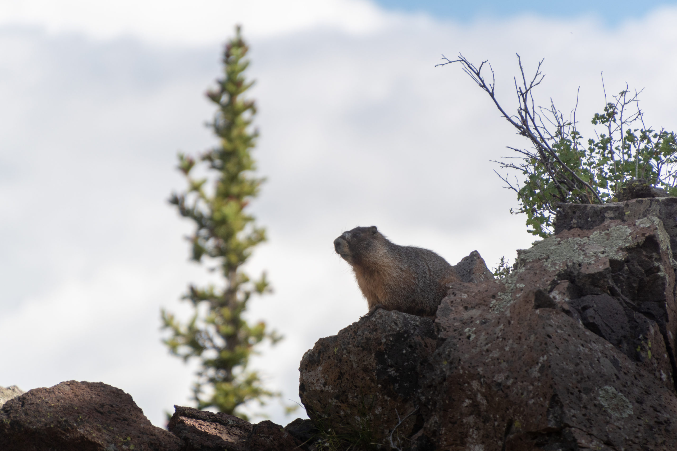
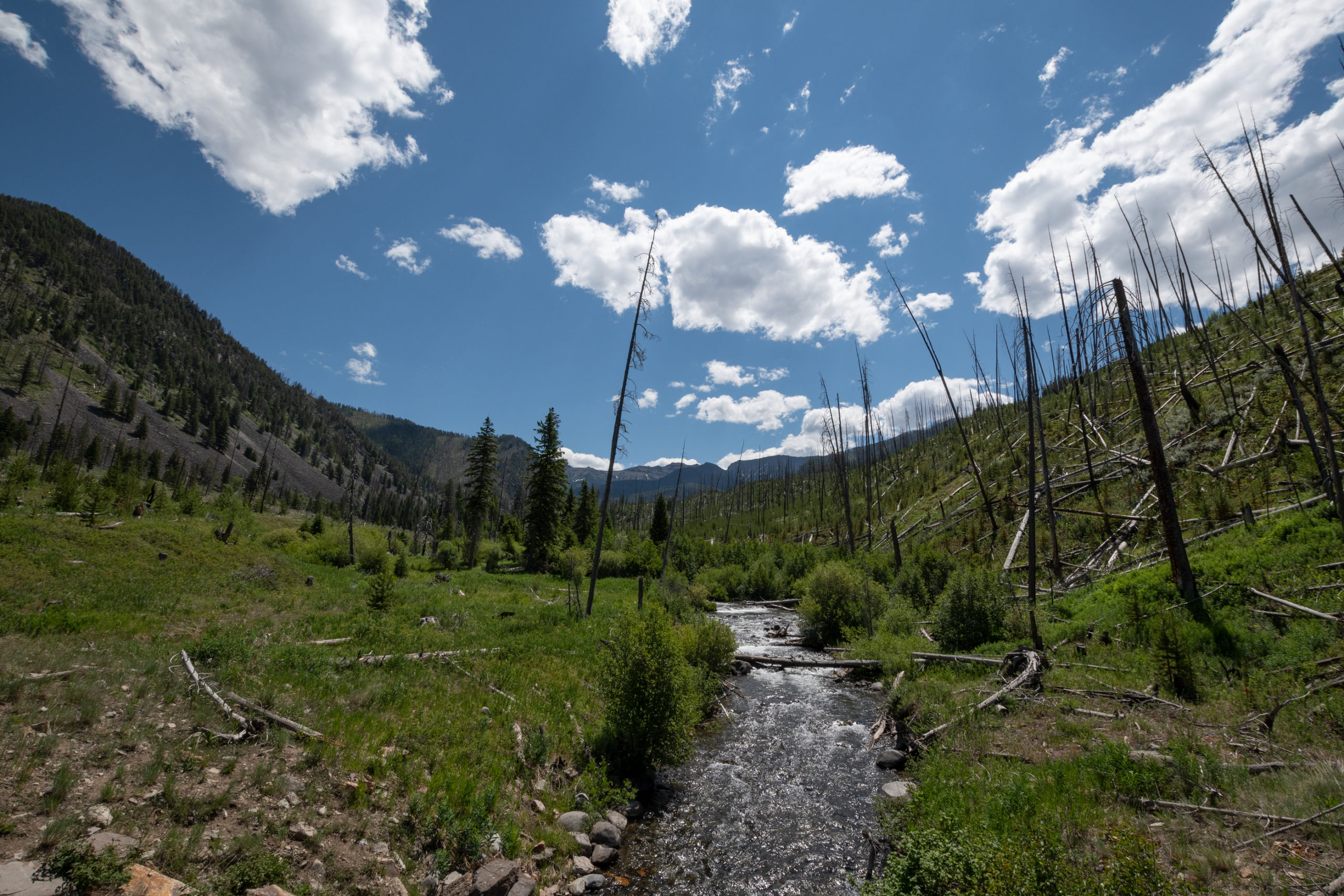
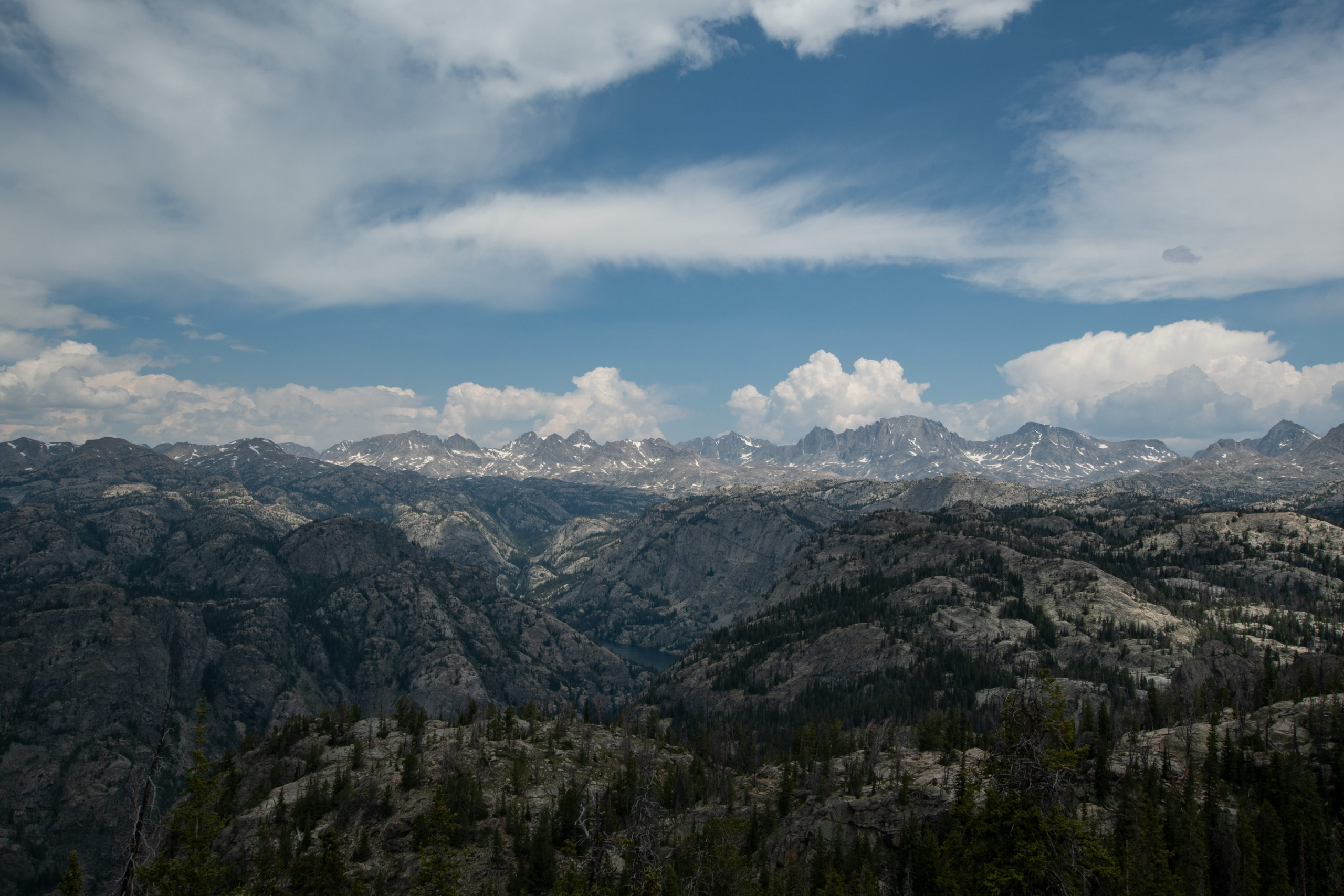
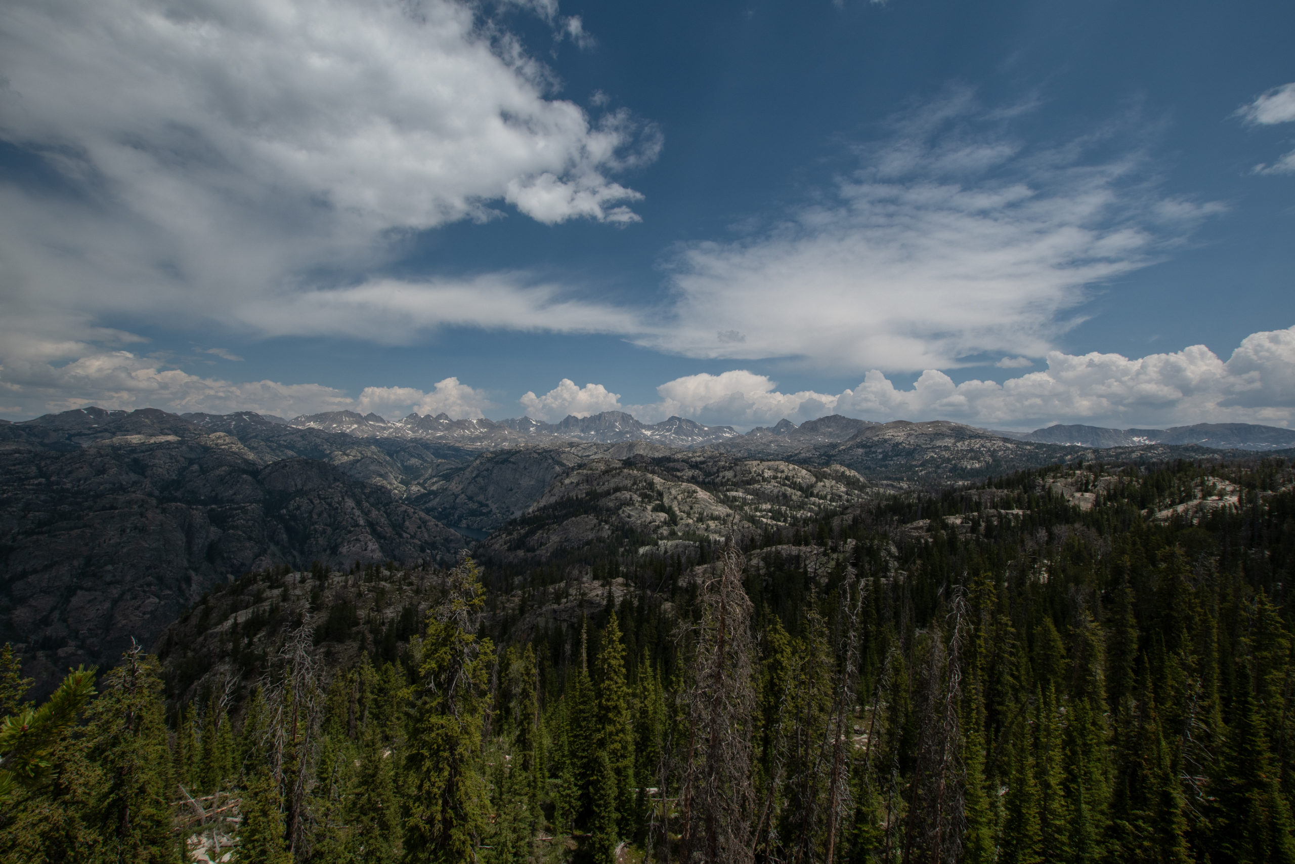
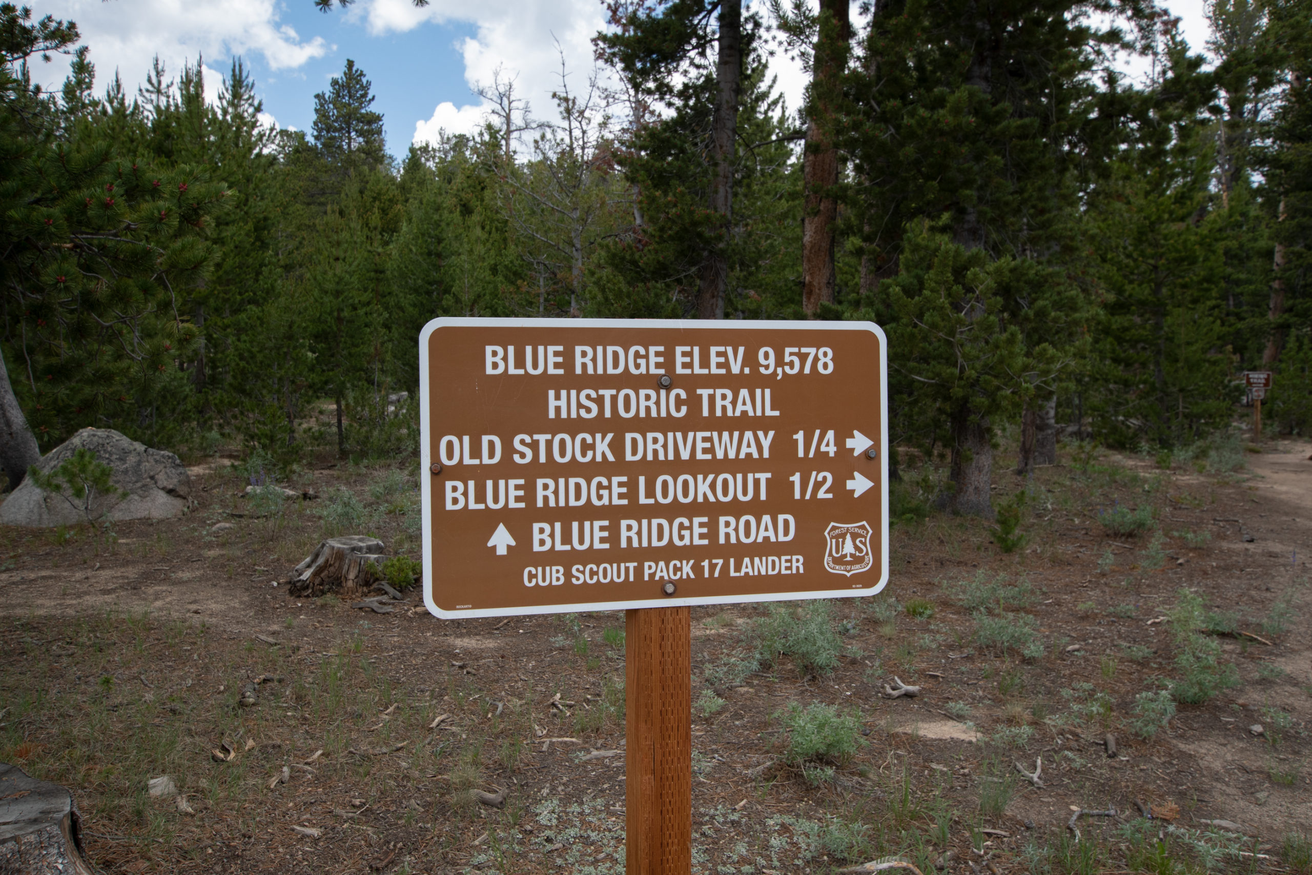
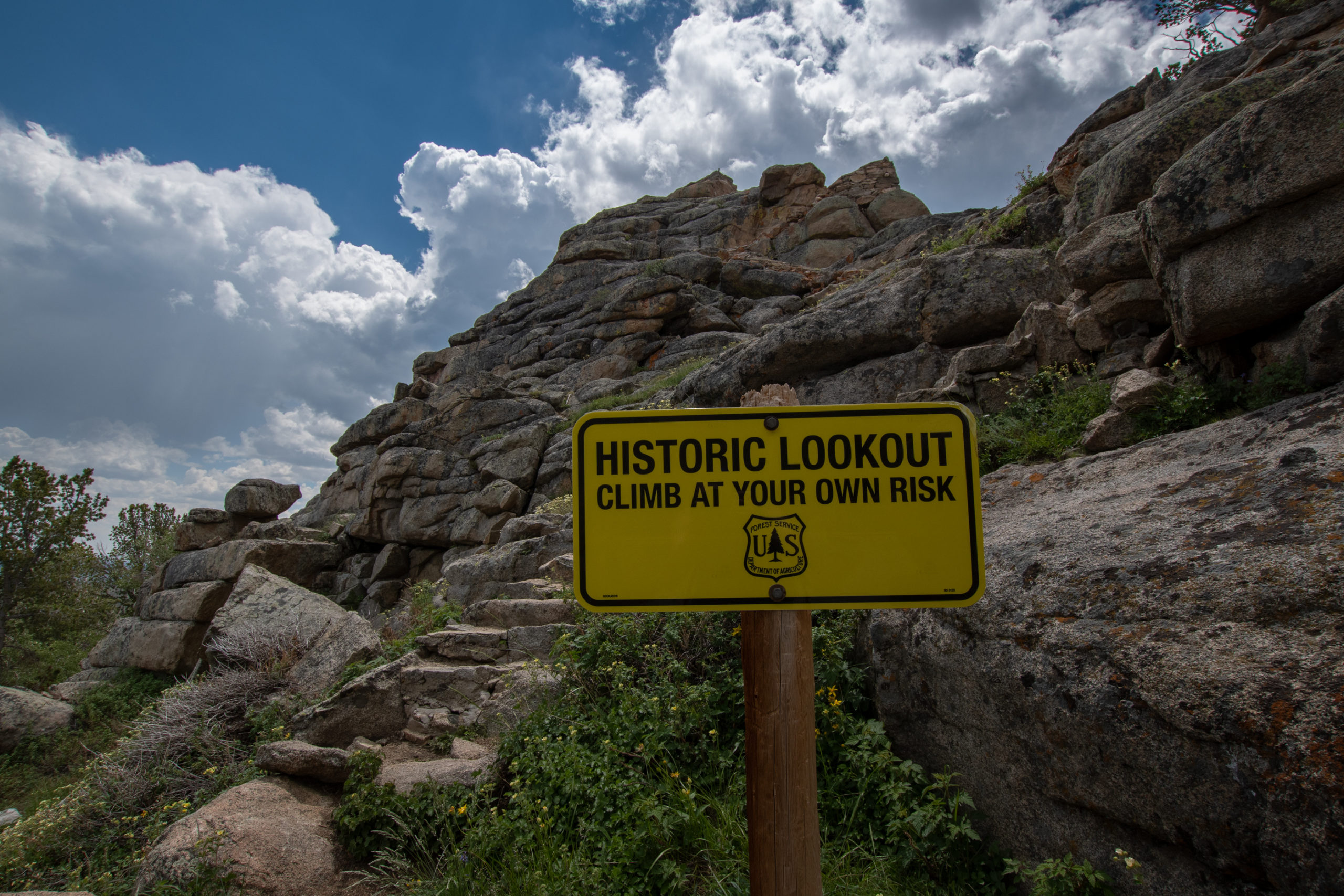
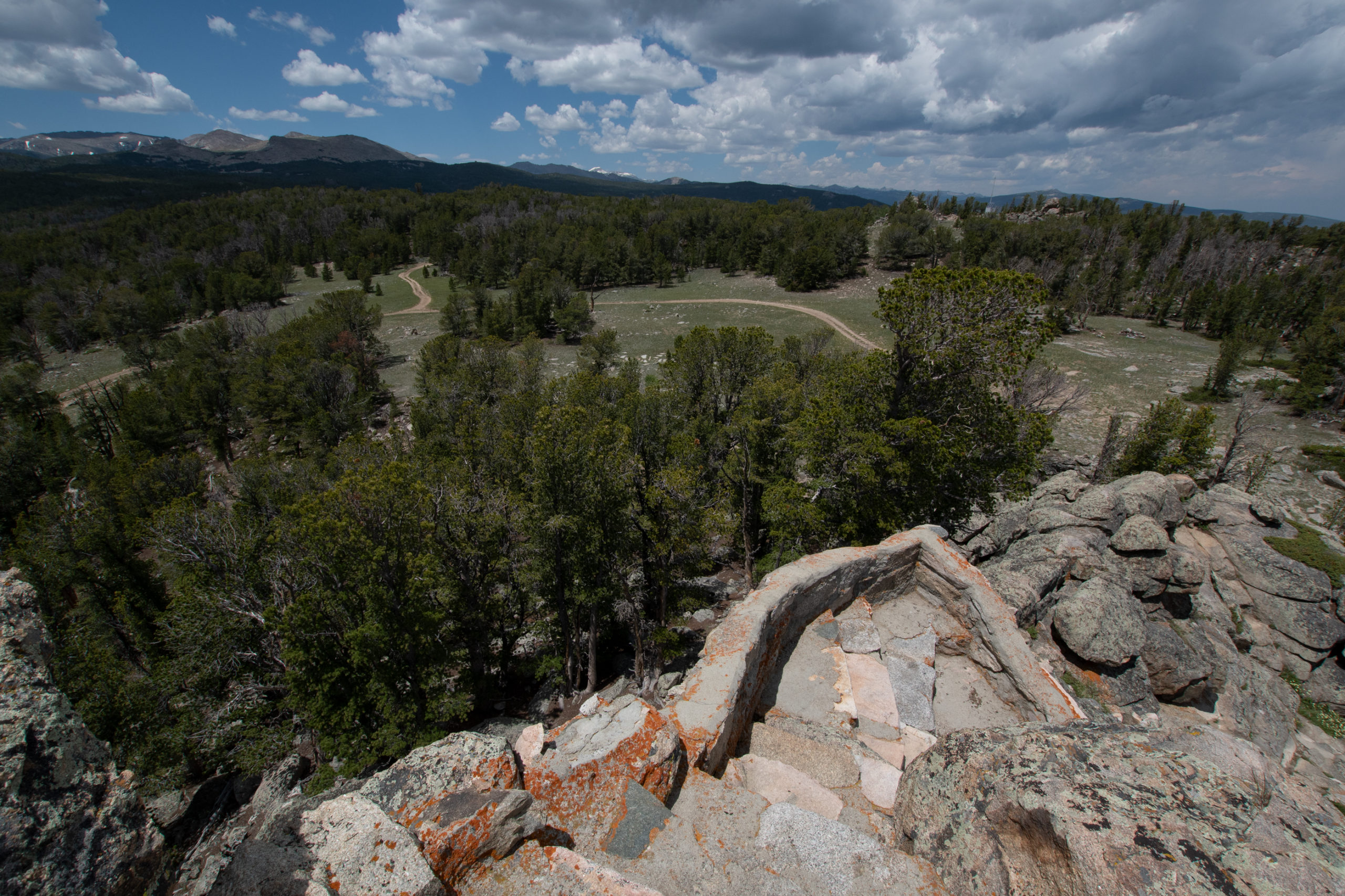
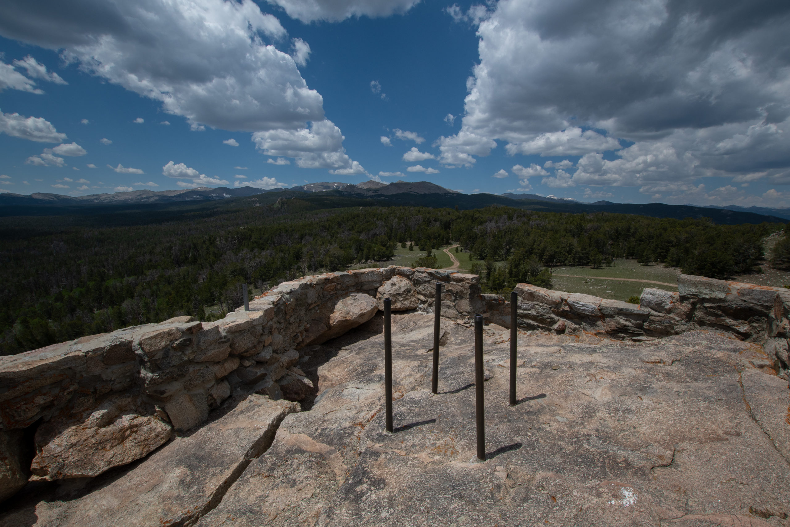
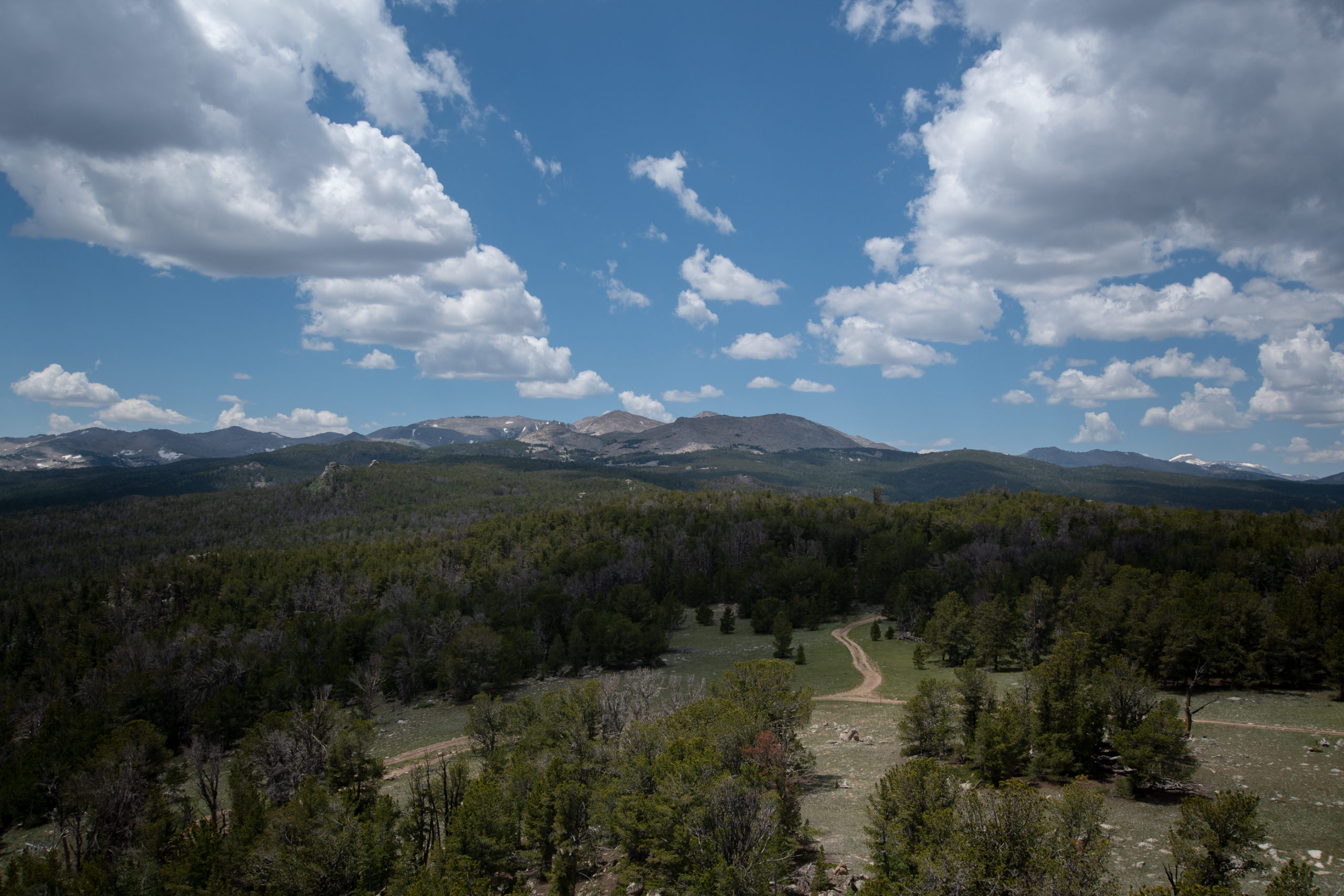
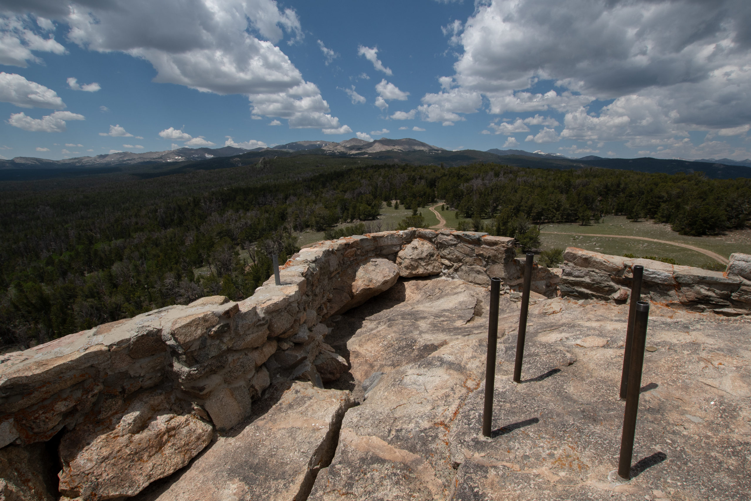
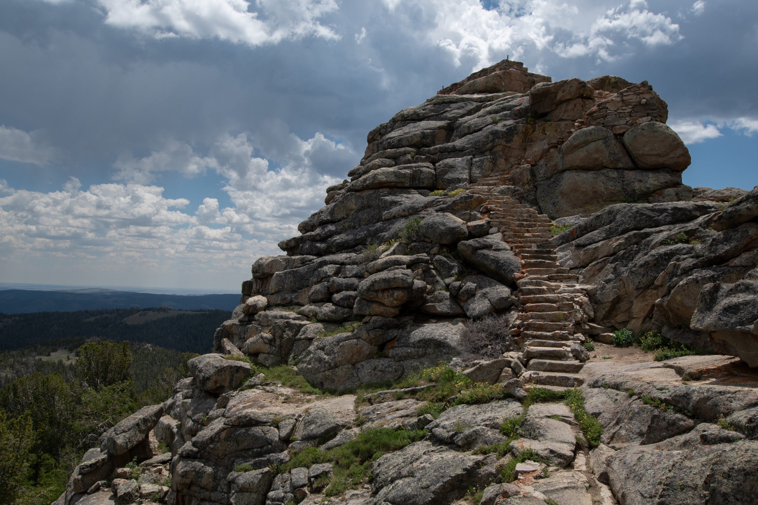
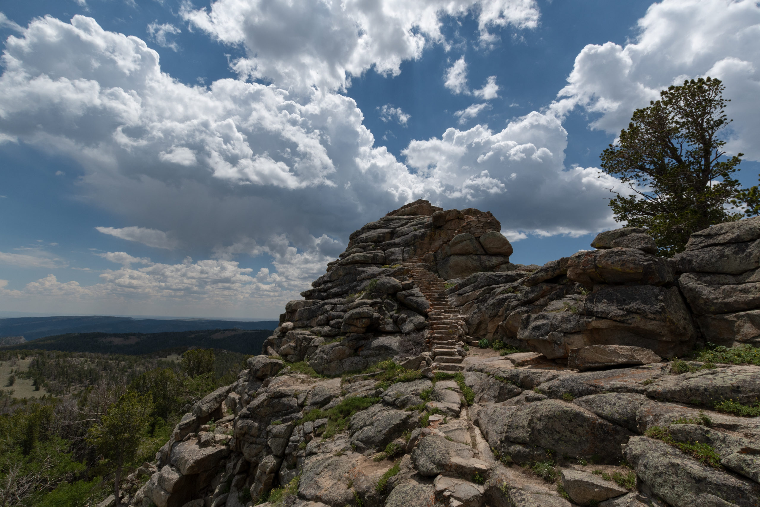
I turned up the road into Shoshone National Forest headed toward Lander. The forest was filled with RVs camping out for the holiday, but the drive was nonetheless lovely. I stopped rather abruptly when I noticed a sign for a lookout. Those never disappoint.
I wasn’t able to find much information on this lookout other than that it was built in 1938. It’s near the Continental Divide on the southern end of the Wind River Range at 10,000 feet.
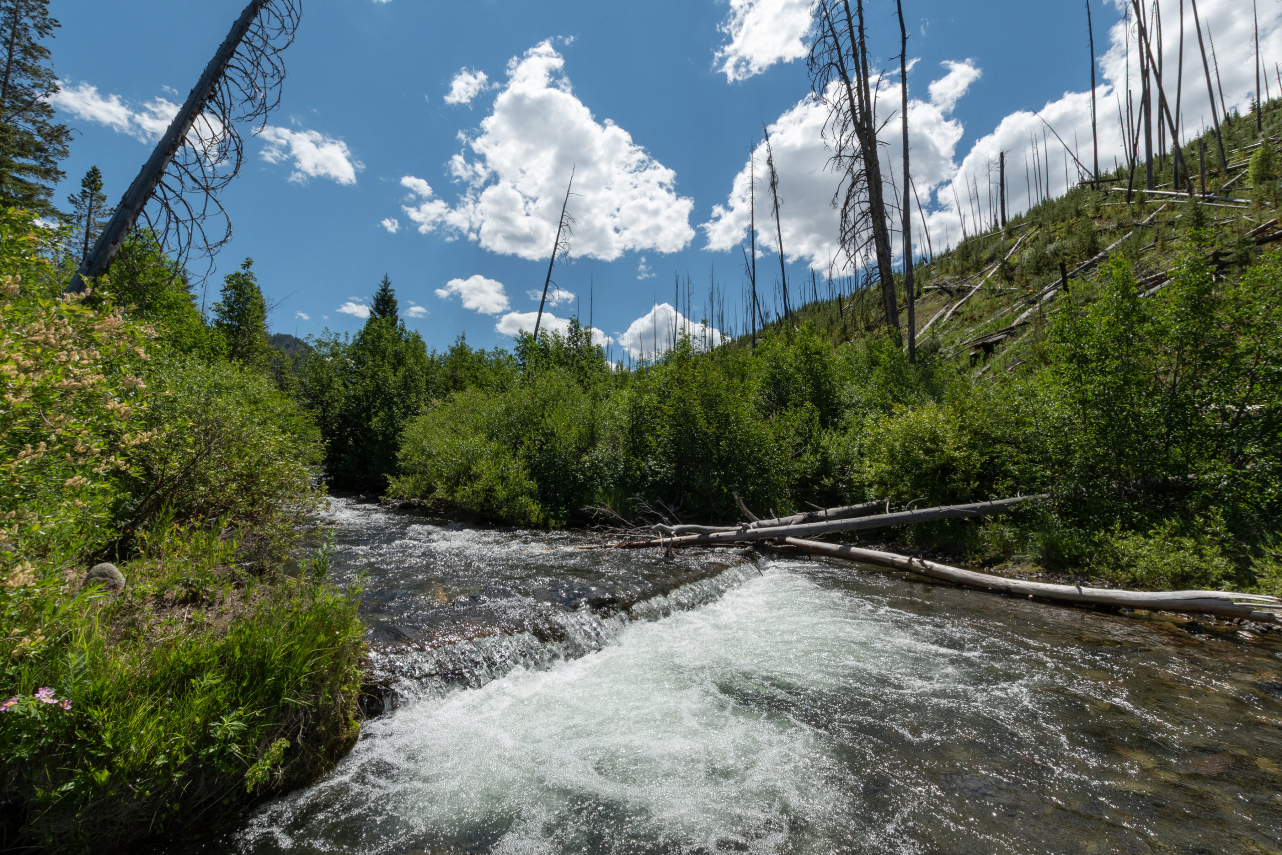
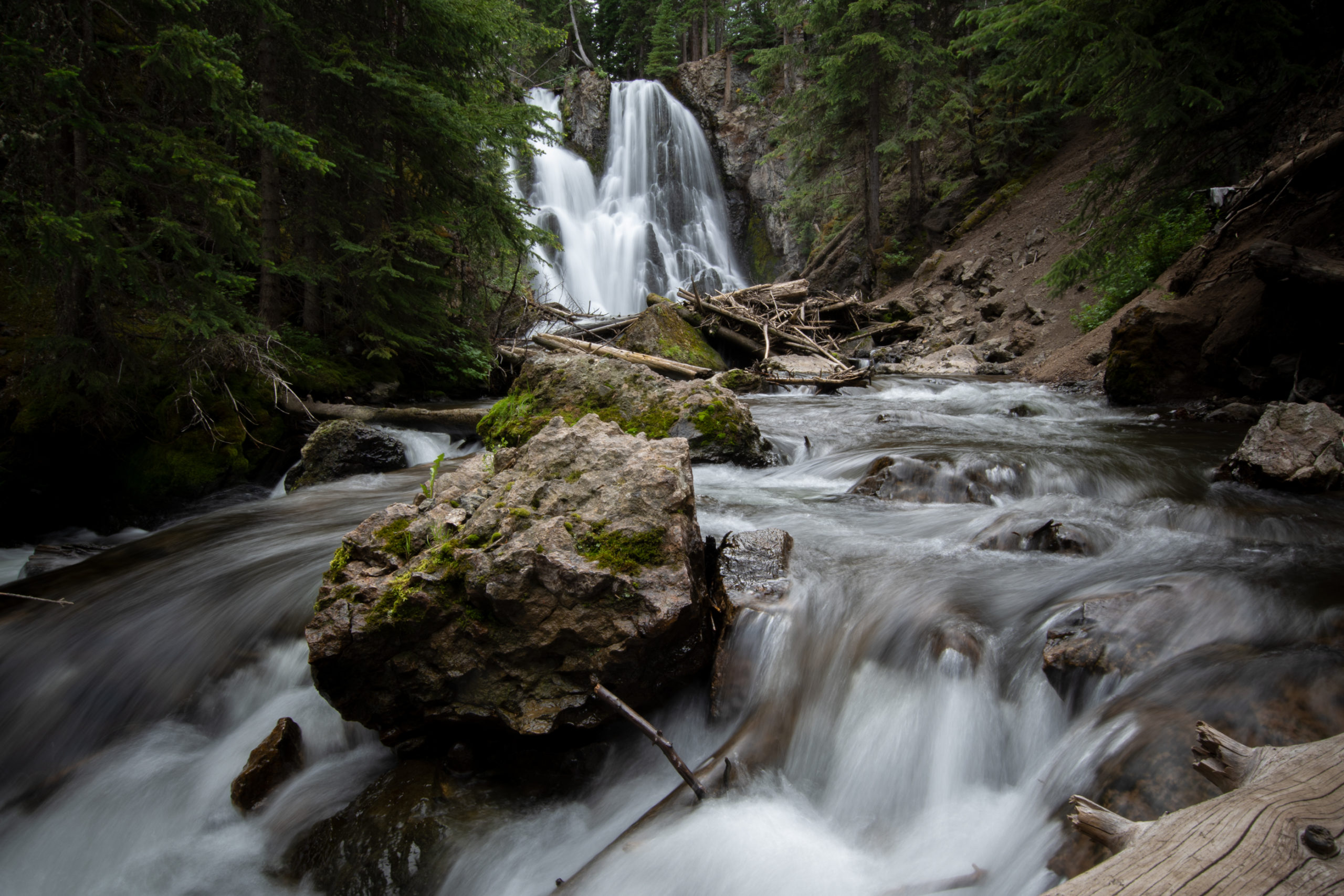
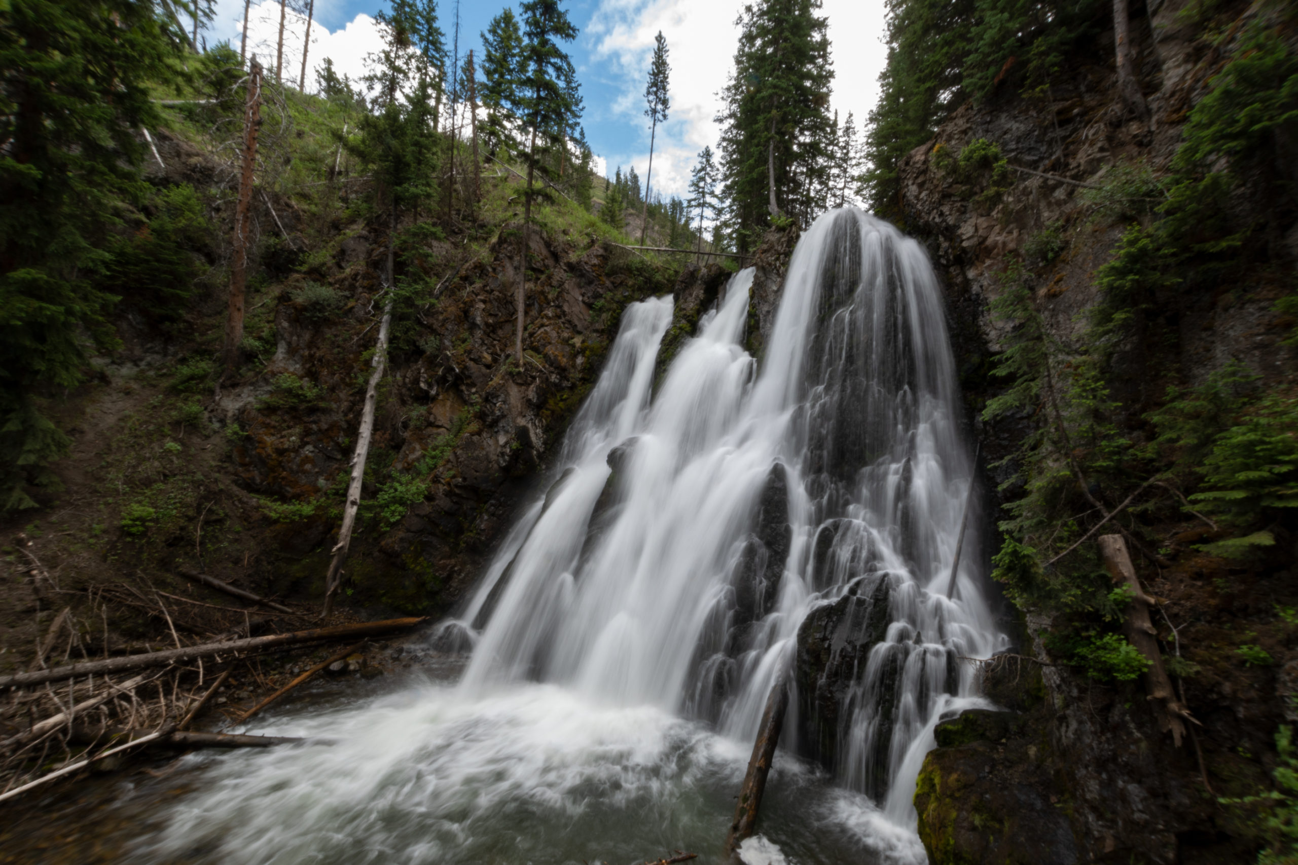
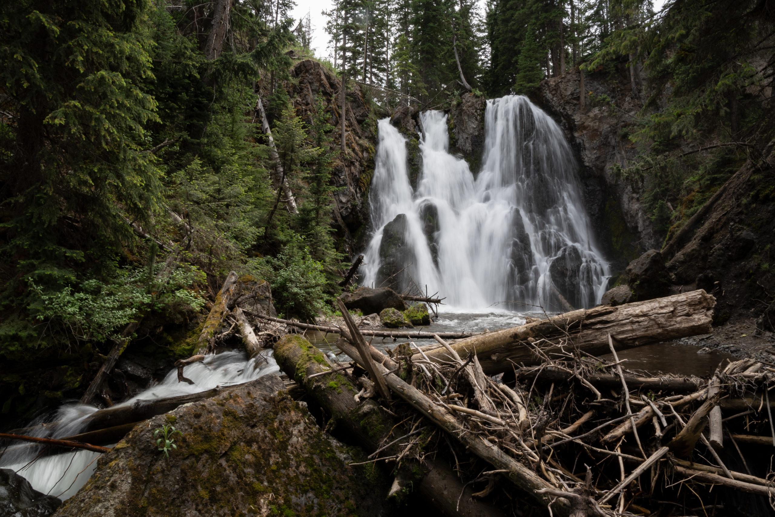
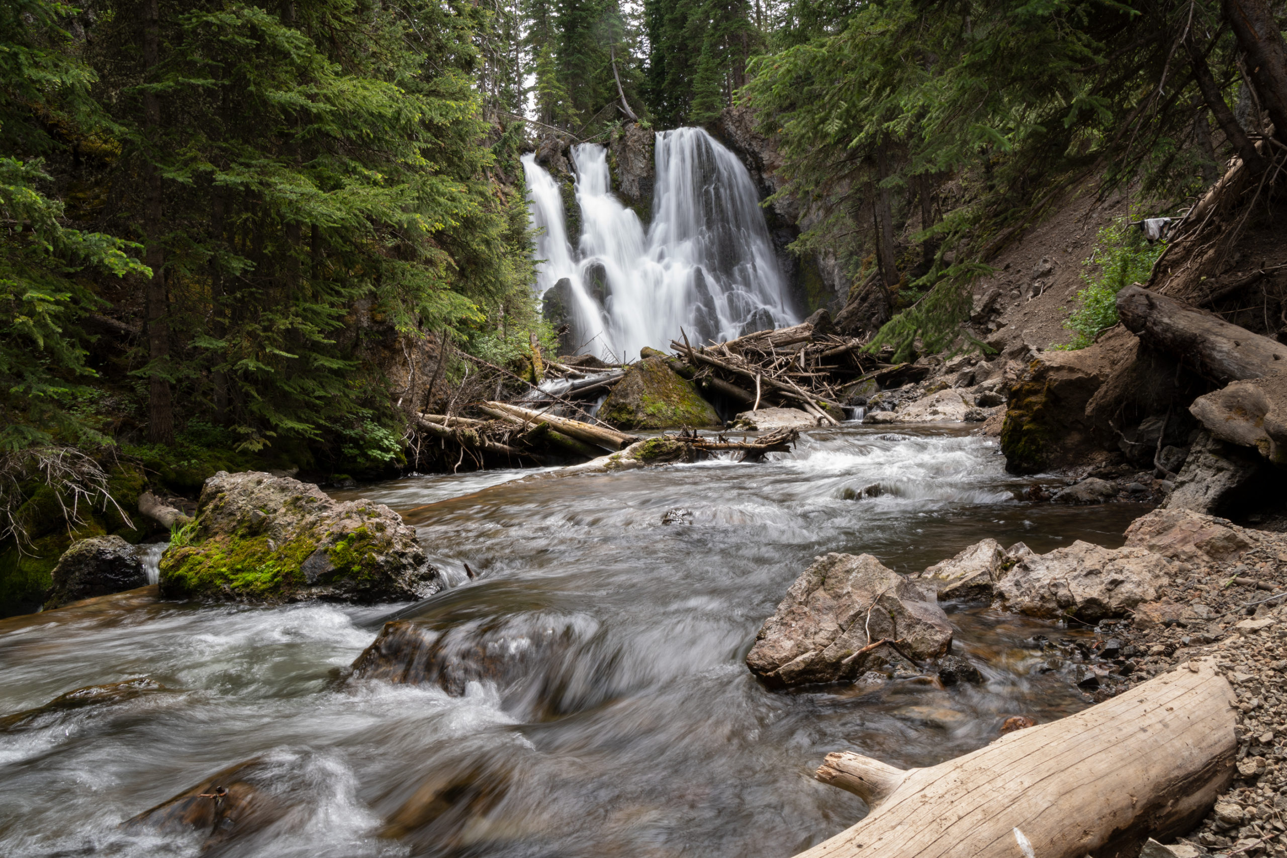
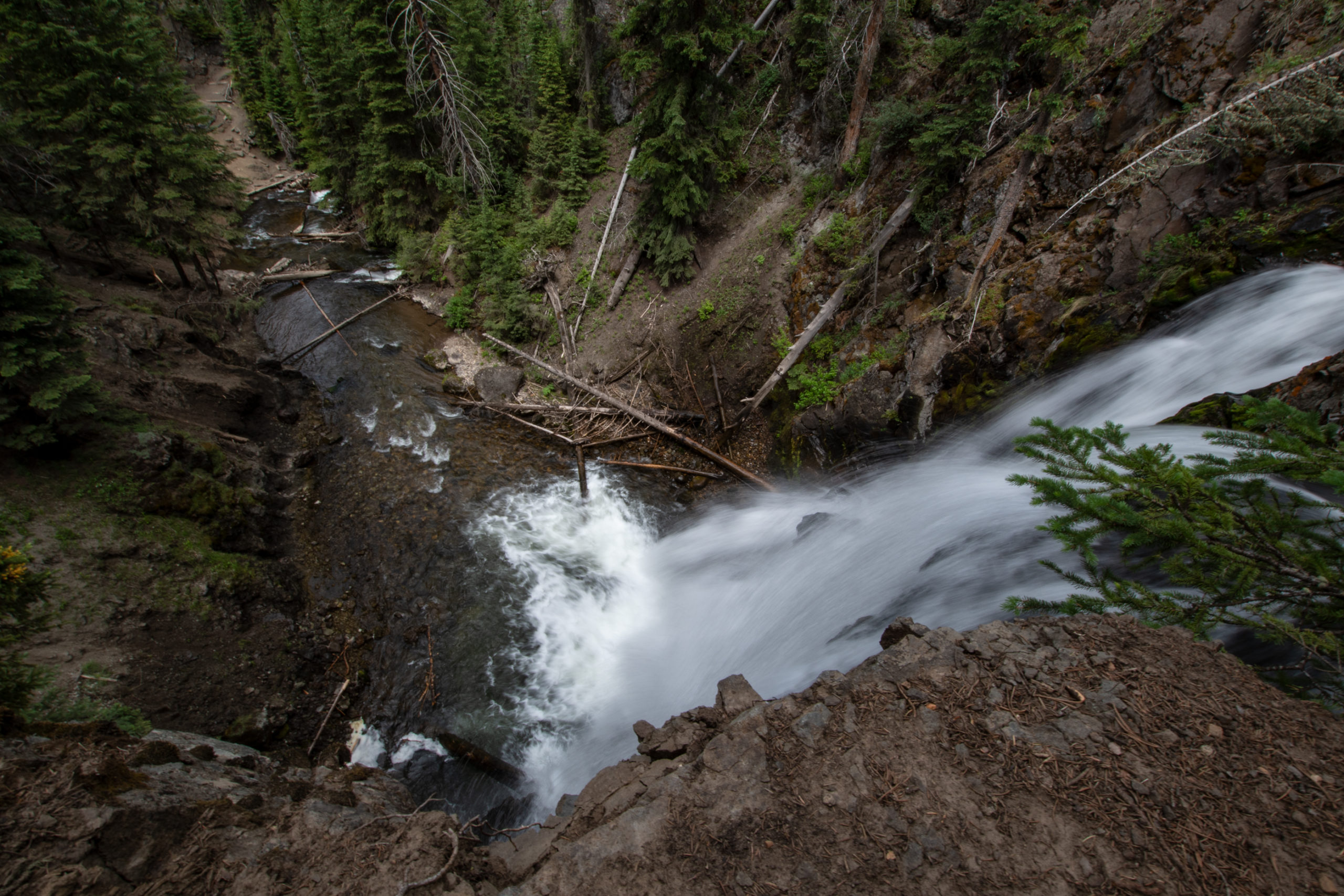
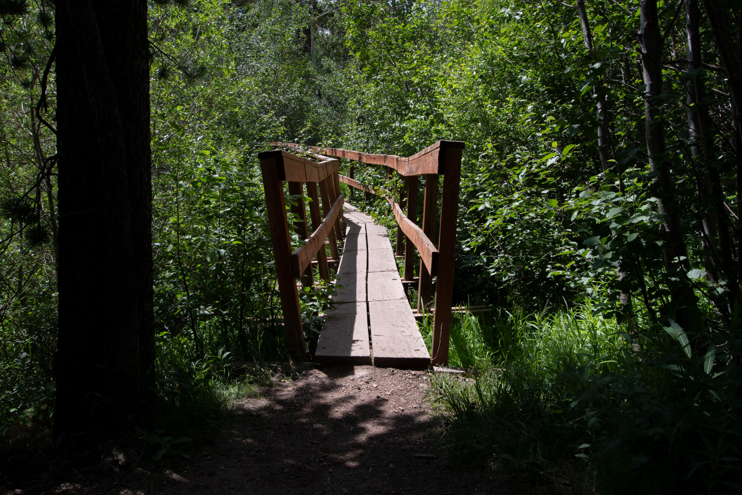
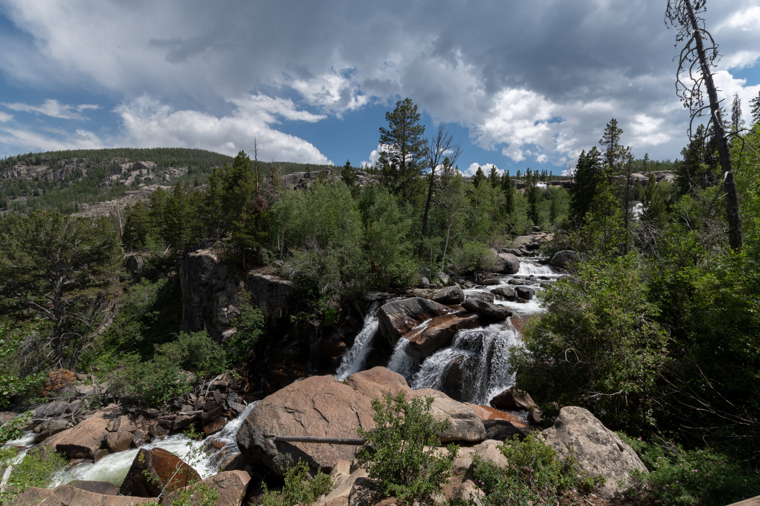
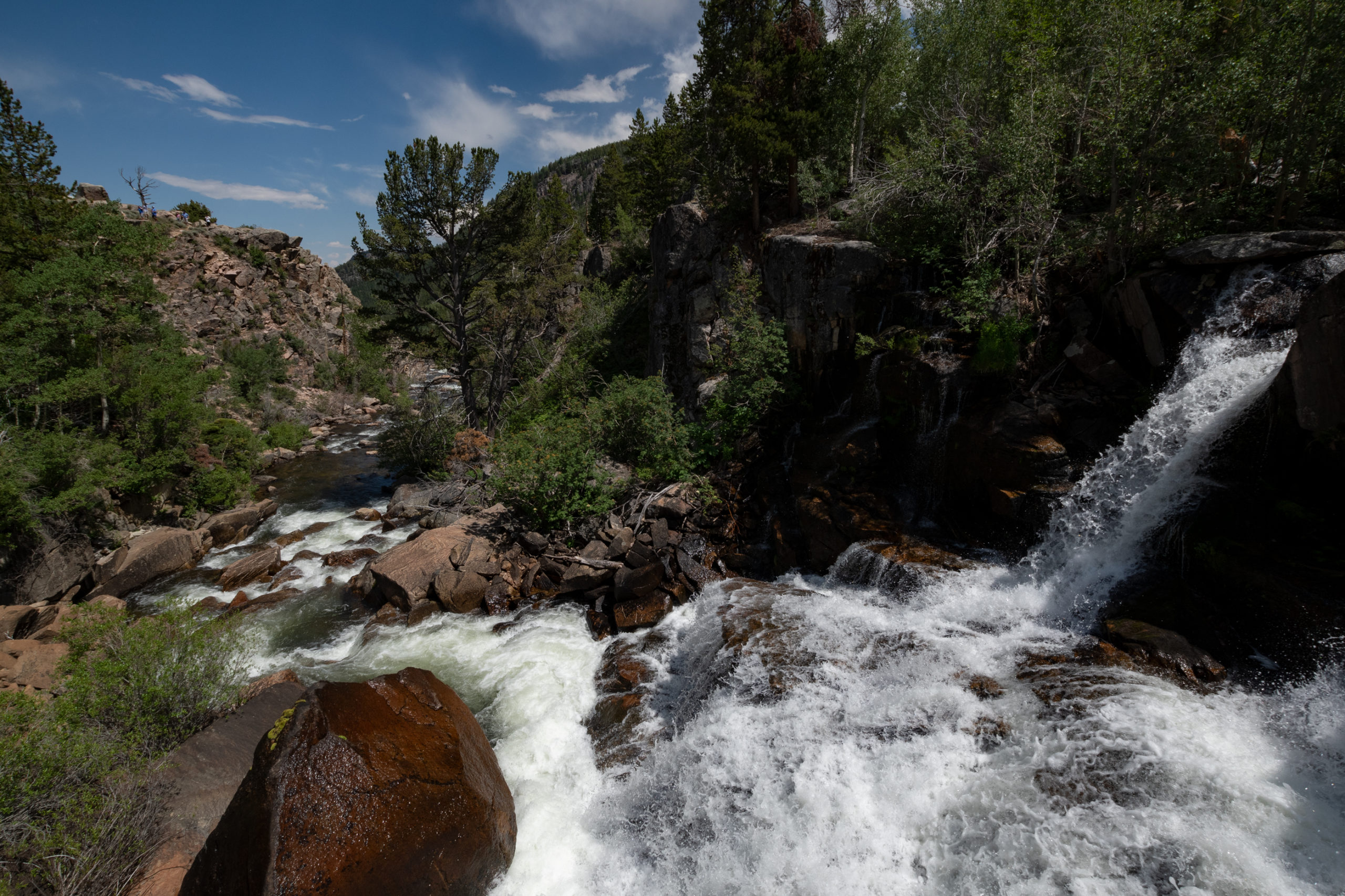
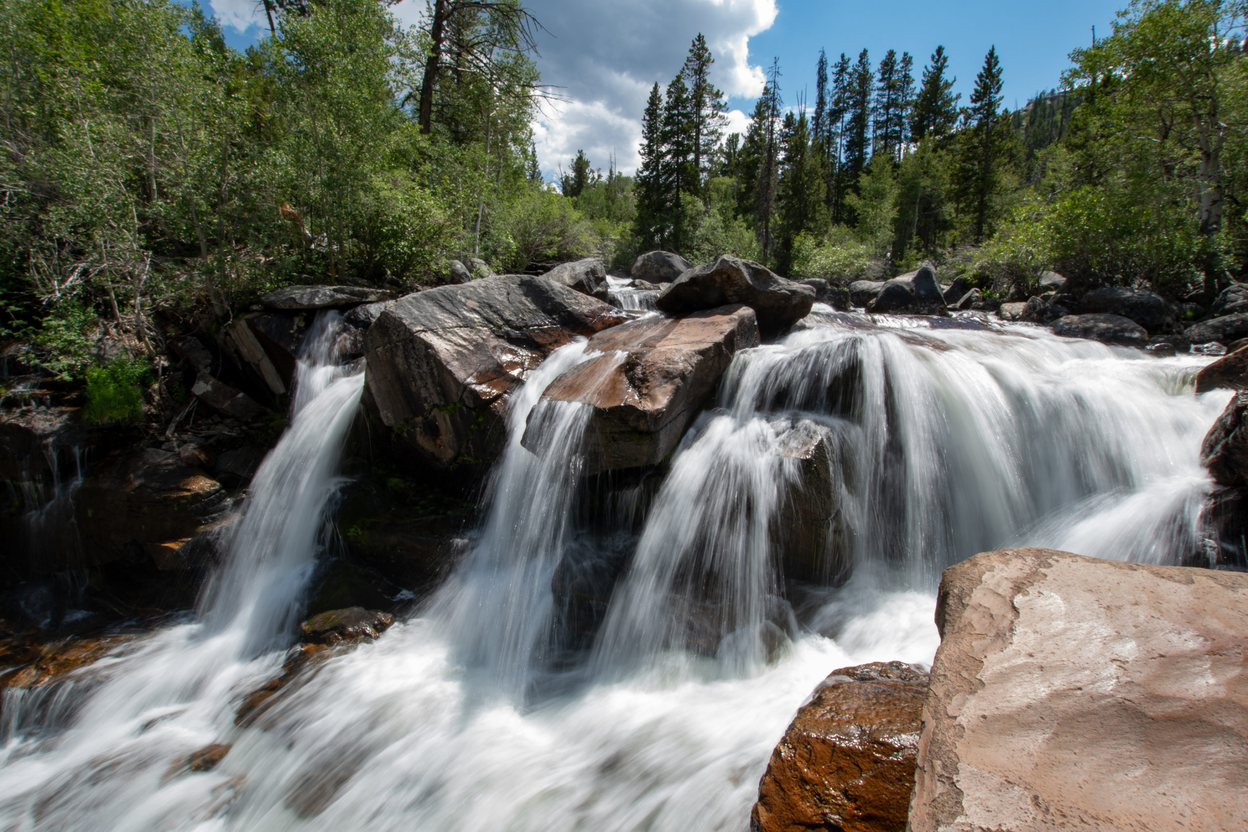
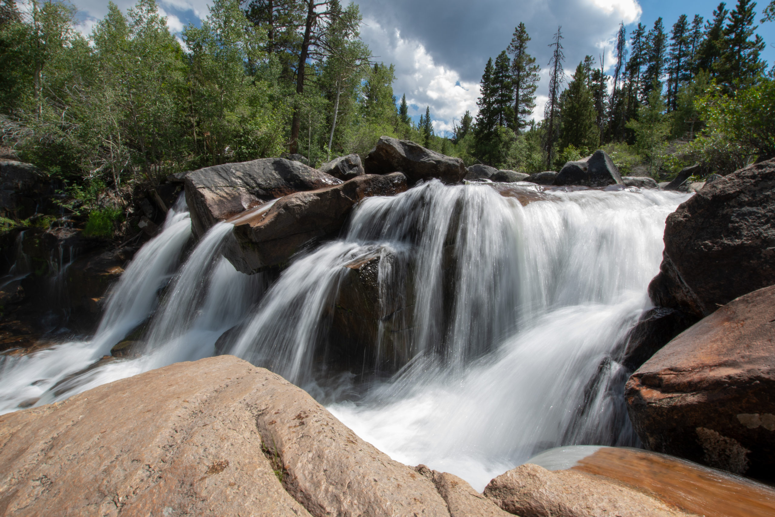
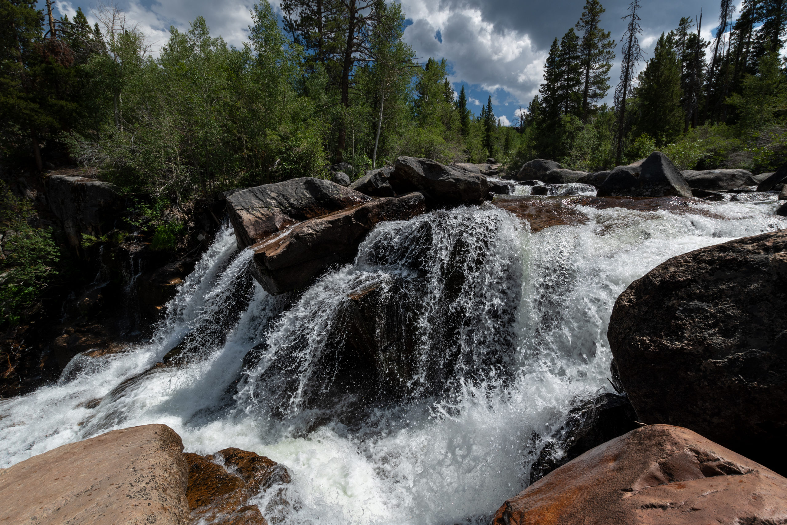
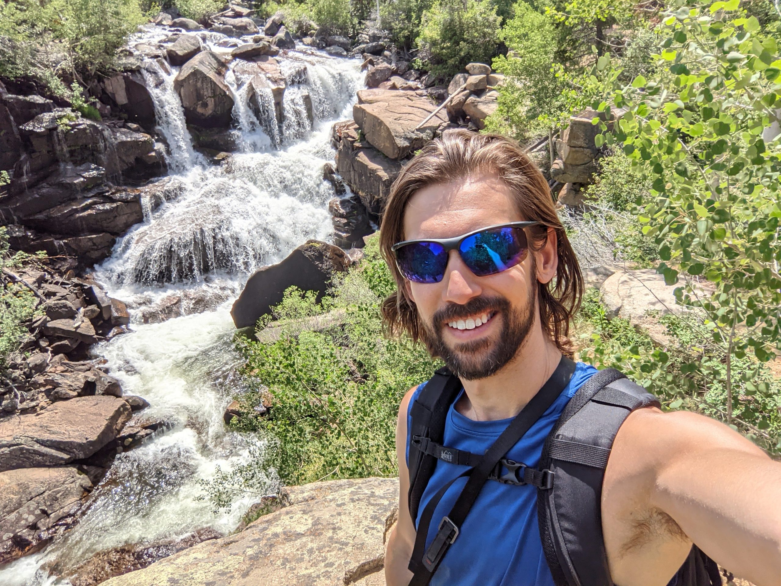
Continuing on, shortly after rejoining paved road, I found my planned hike for the day, the Popo Agie Falls Trail, a short hike along the Popo Agie river. It was by far the most crowded hike I’ve done in a while, but I had the overlook at the falls all to myself for picnic lunch.
After the hike, it was time to make haste to Tulsa. Or at least more-than-half way. Wyoming was a dream, yet again, and even after I ran out of mountains, the beauty remained. Sunset came and went as I crossed the border back into Colorado.
As I sped through Denver on I-25 headed toward 70, the city and all its sprawl erupted in a rainbow of fireworks in all directions. Happy Fourth of July.