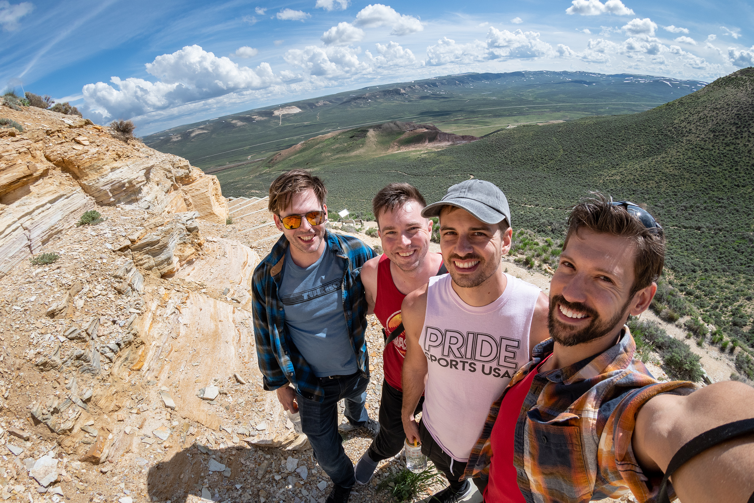
The time has come my friends to talk of many things: Of cars — and tires — and carnauba wax of cheap cars and road kings. And why the radiator is boiling hot and whether redbull gives you wings.
Callo-Callay, come, rust away, with cheap cars and road kings.
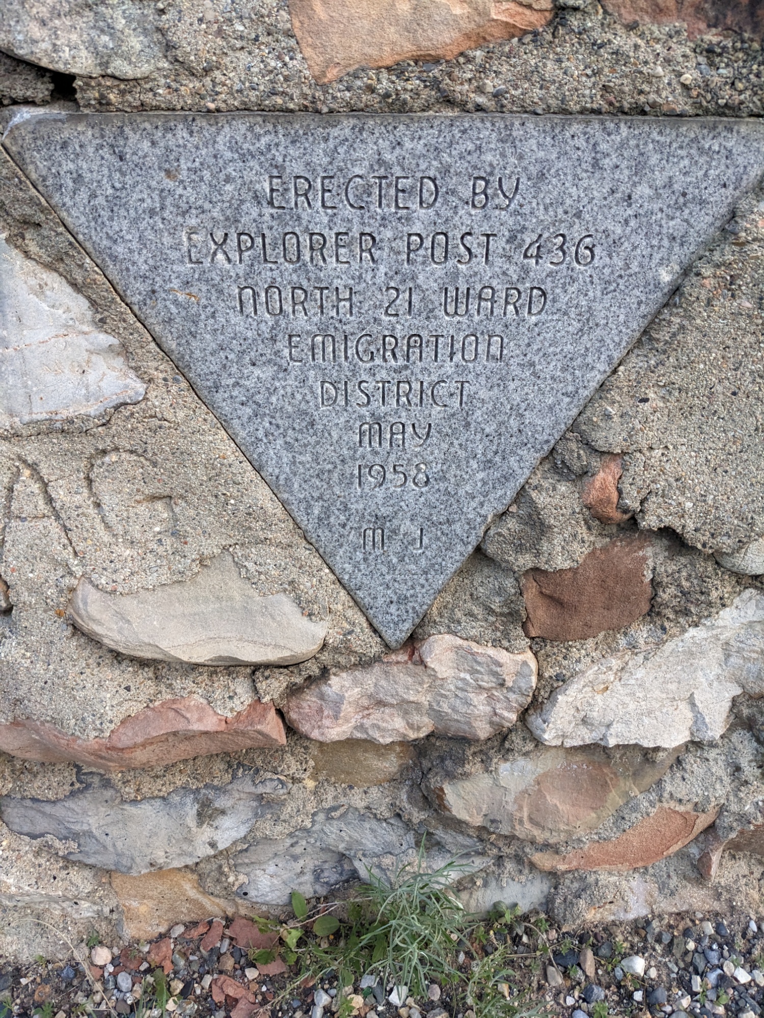
Evan Mackay
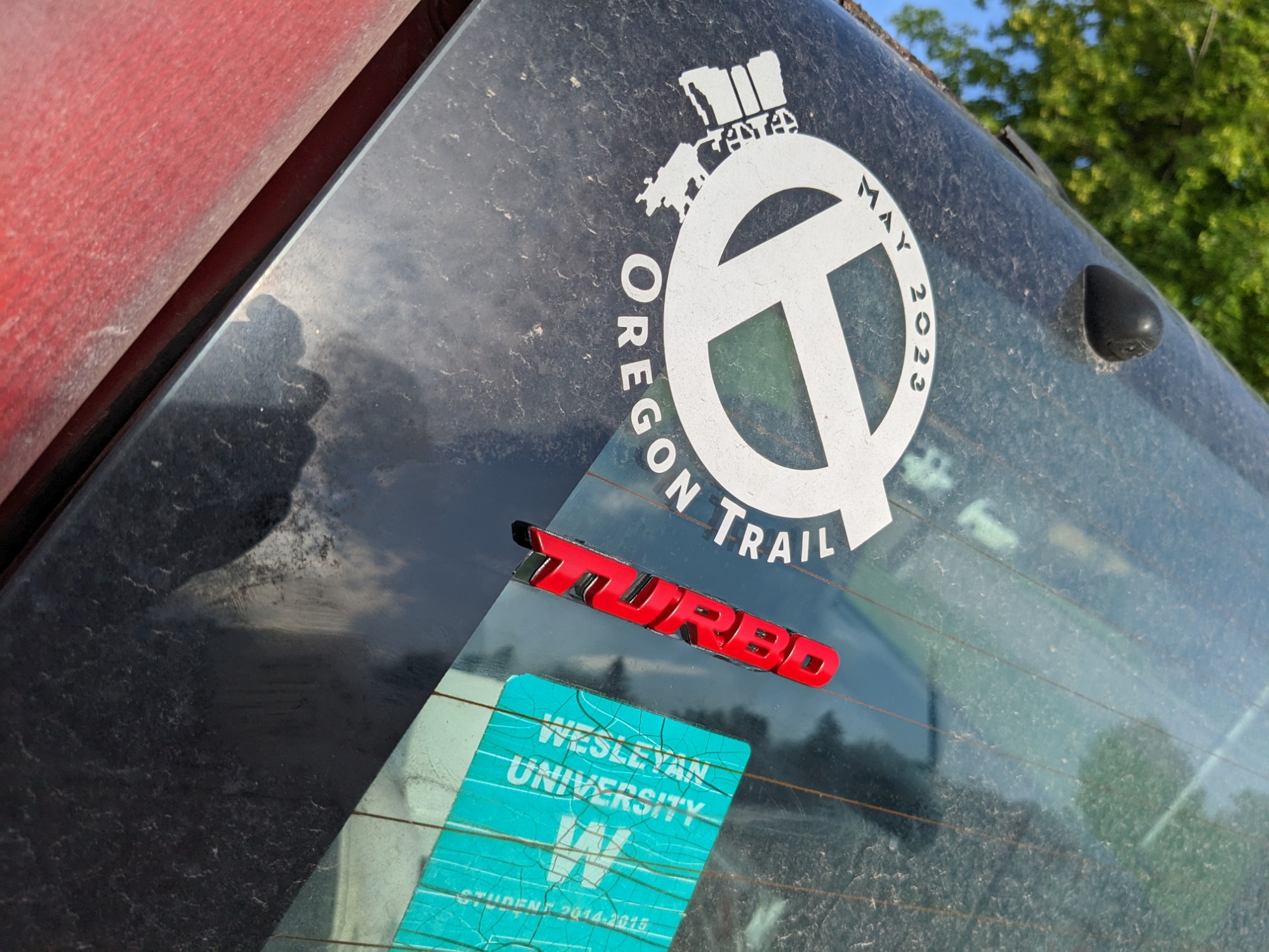
EM and I both realized that in the haste of getting underway, we hadn’t done a post focused on cars and the stories of acquiring them. He posted his on Opposite-Lock today, which has a very gearheads audience, but is definitely worth the look for his read on the situaiton:
Diamonds in the Rough – [BELATED] Oregon Trail Road Trip Car Reveal!
The time has come my friends to talk of many things: Of cars- and tires- and carnauba wax- of cheap cars and road kings- And why the radiator is boiling hot- and whether redbull gives you wings. Callo-Callay, come, rust away, with cheap cars and road kin…
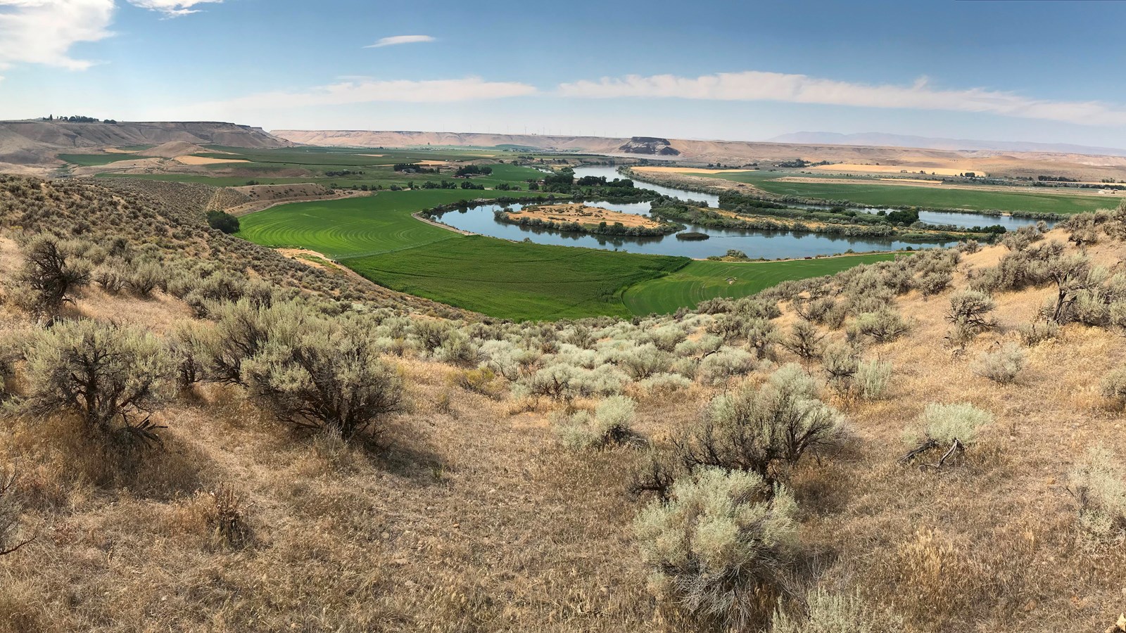
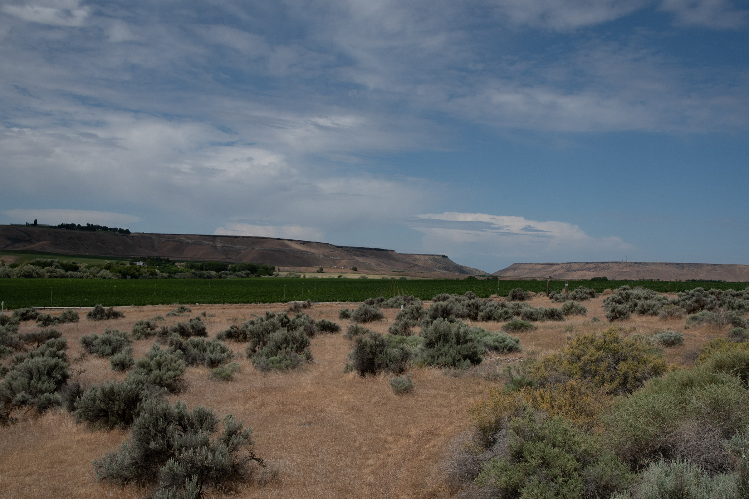
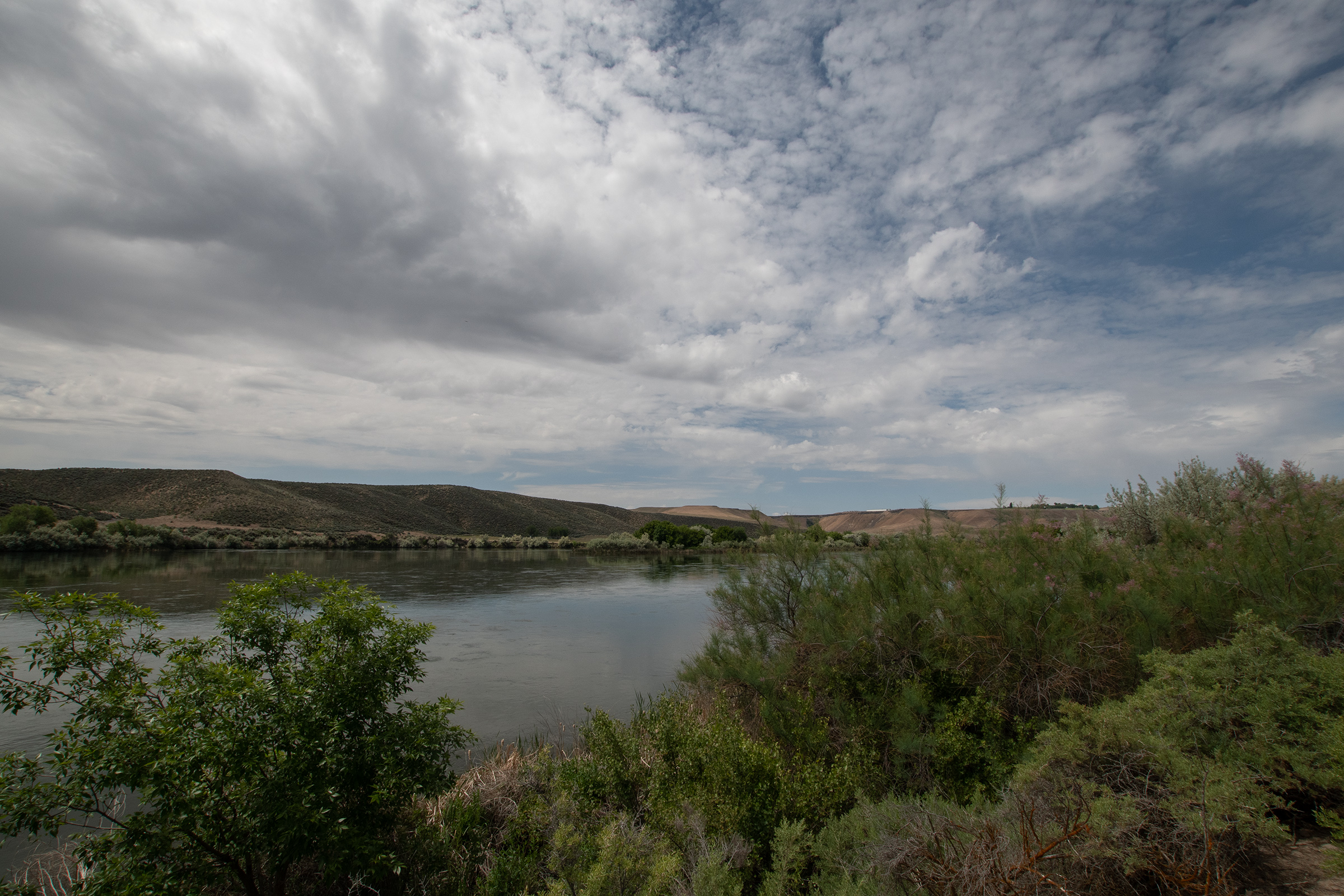
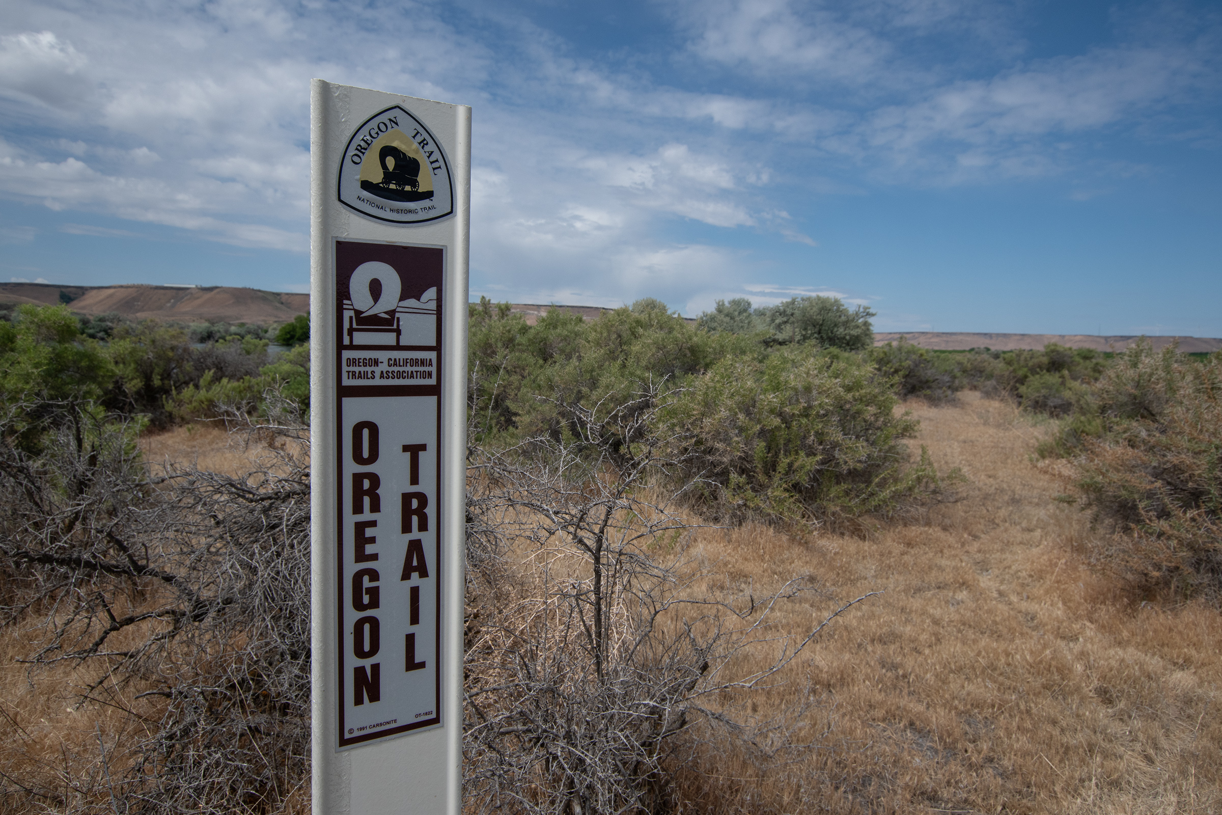
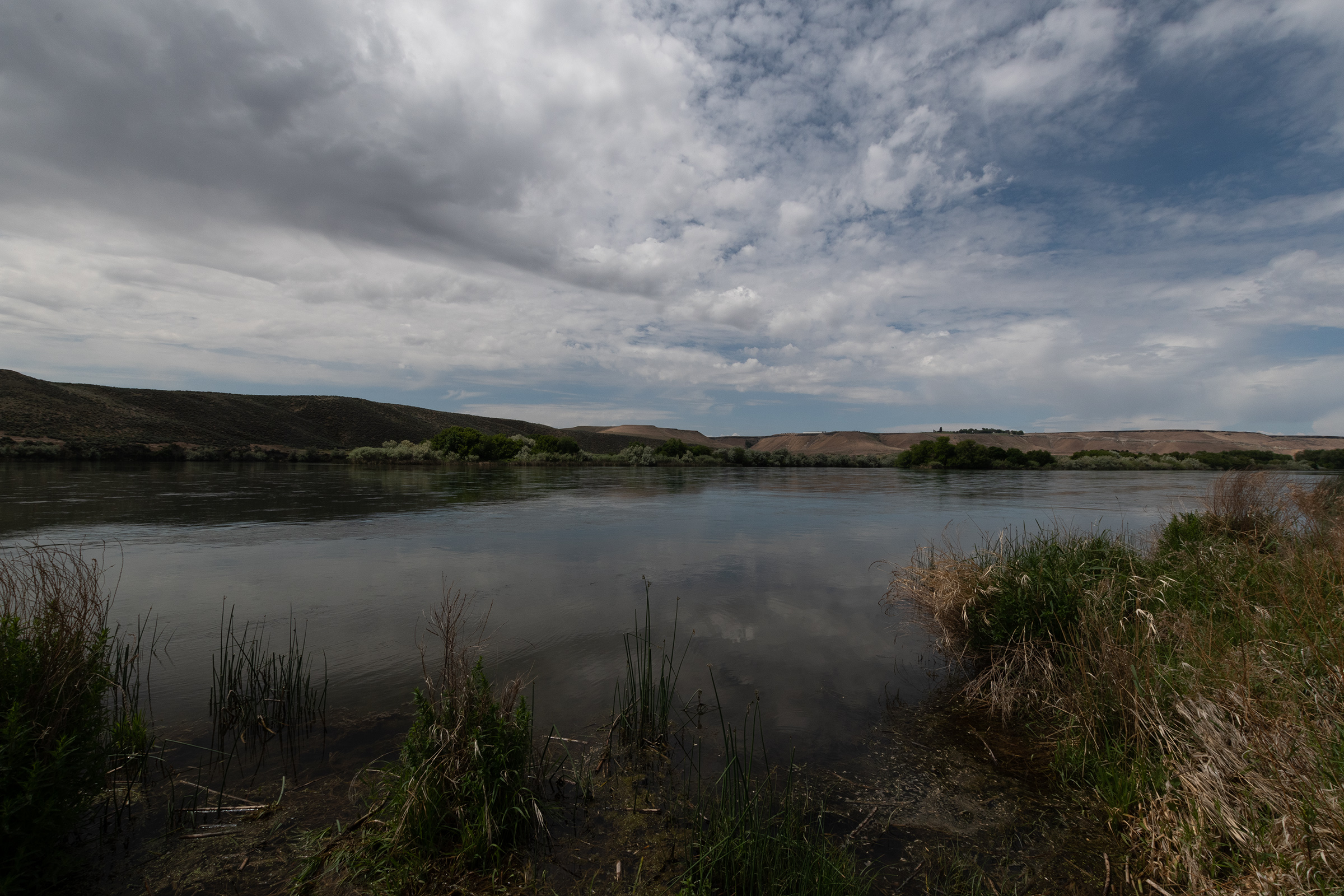
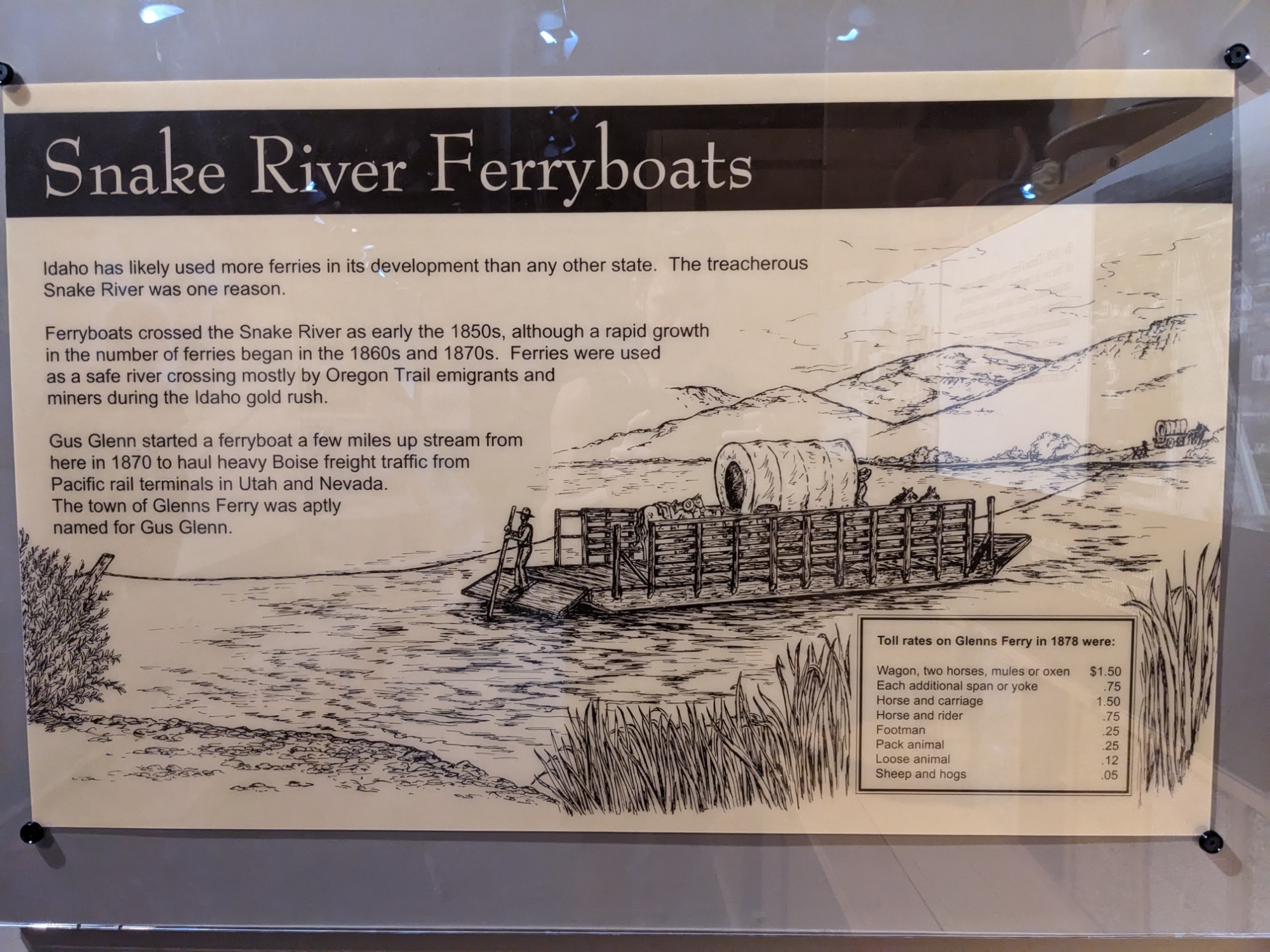
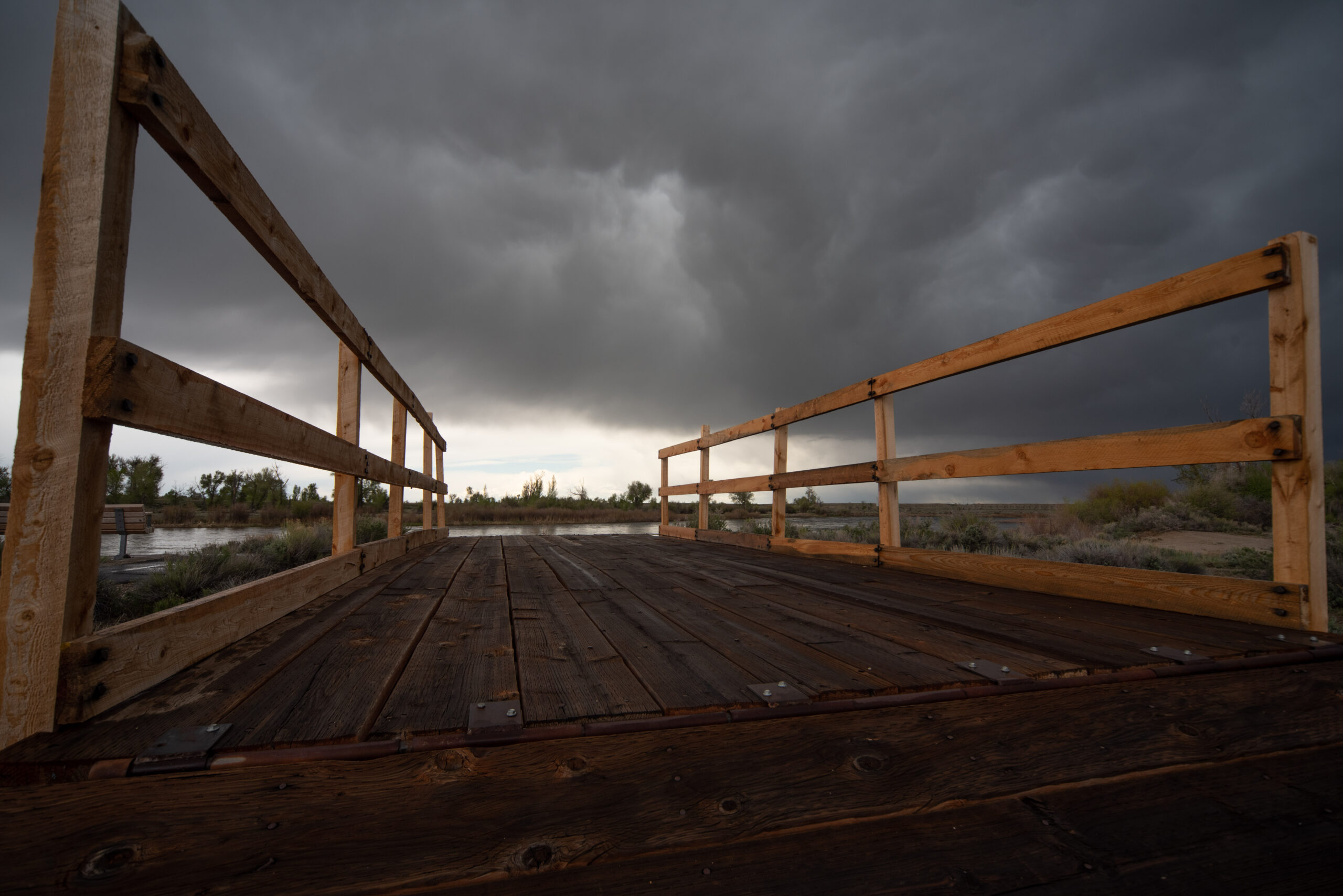
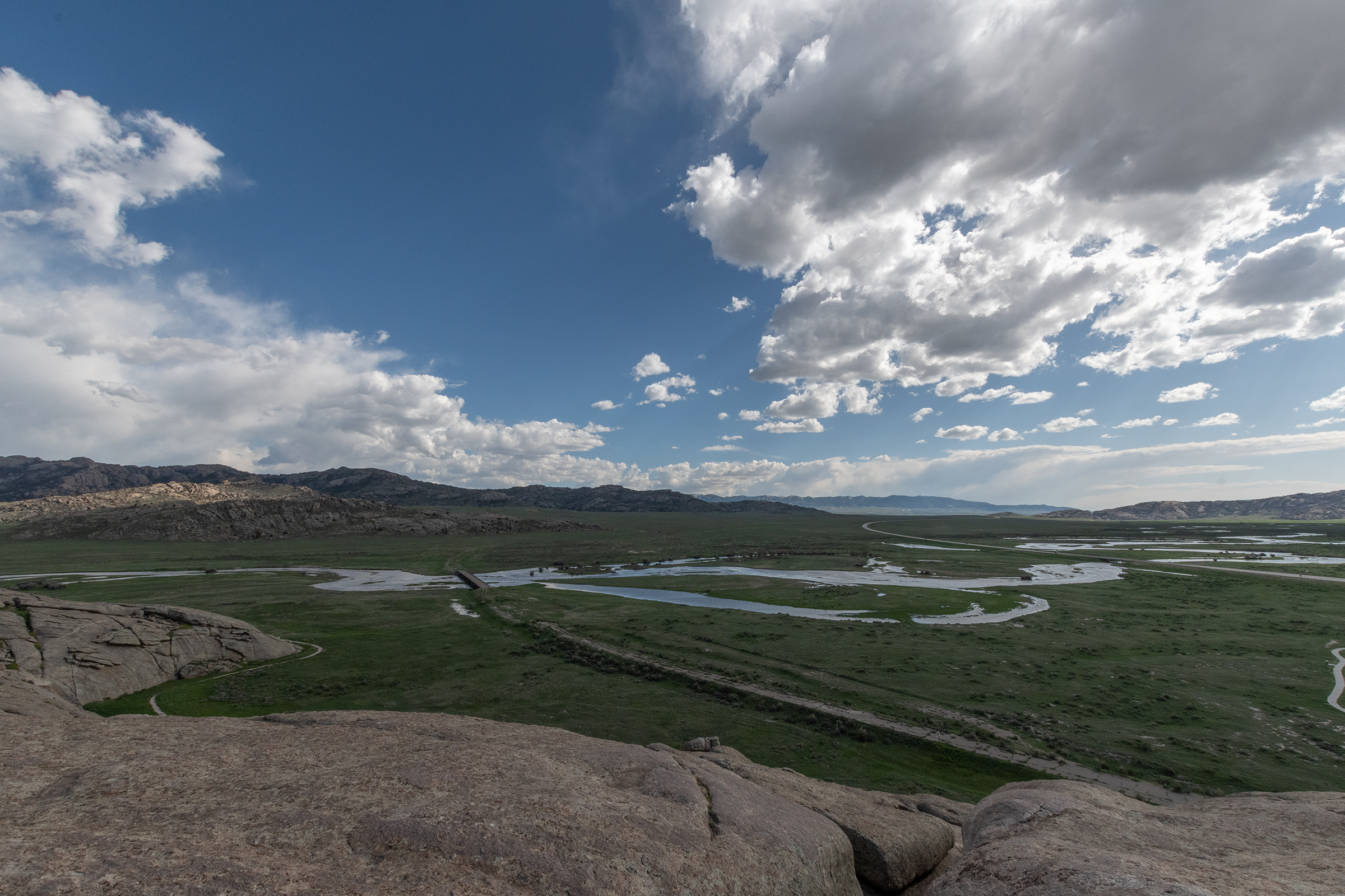
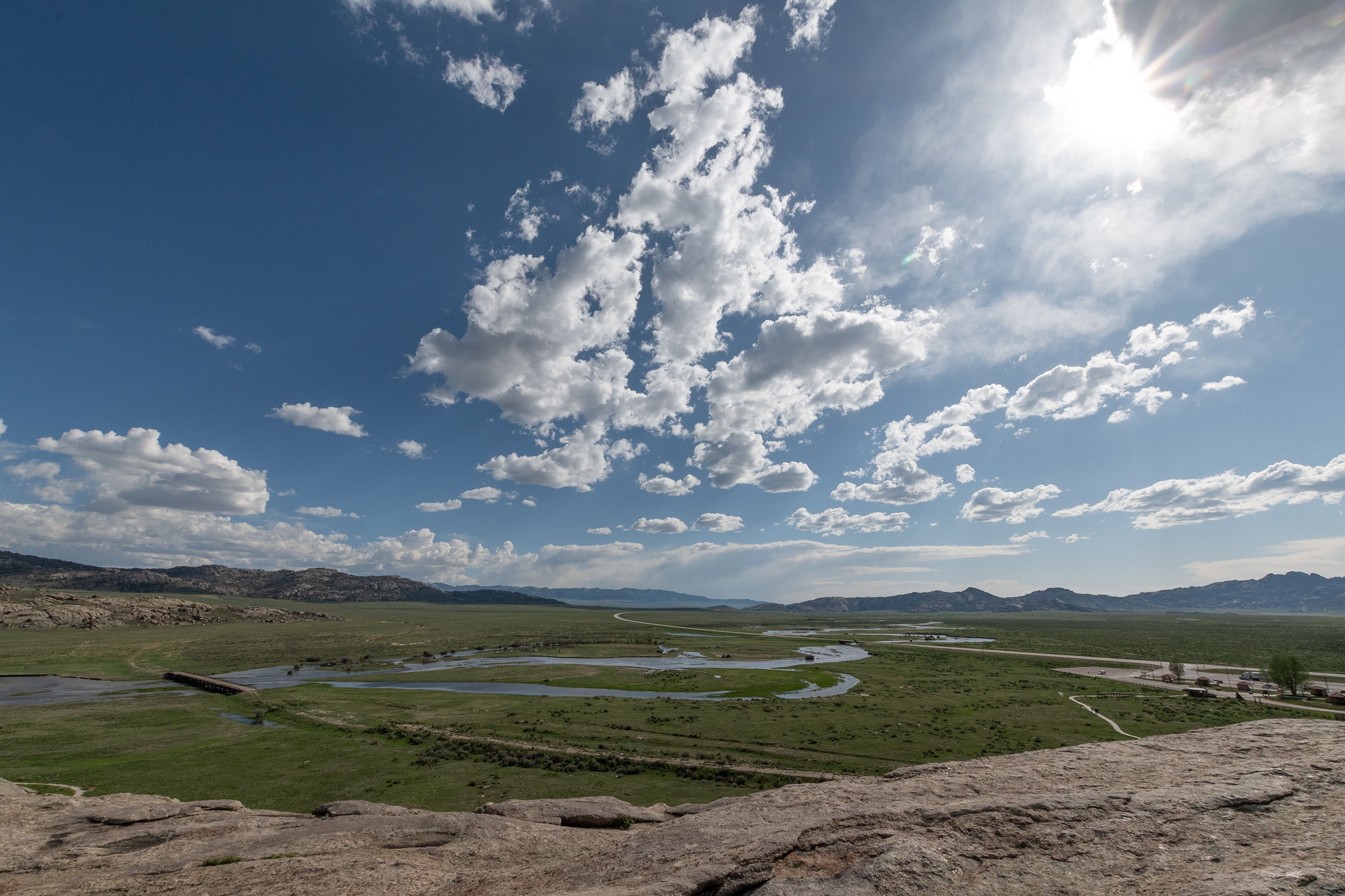
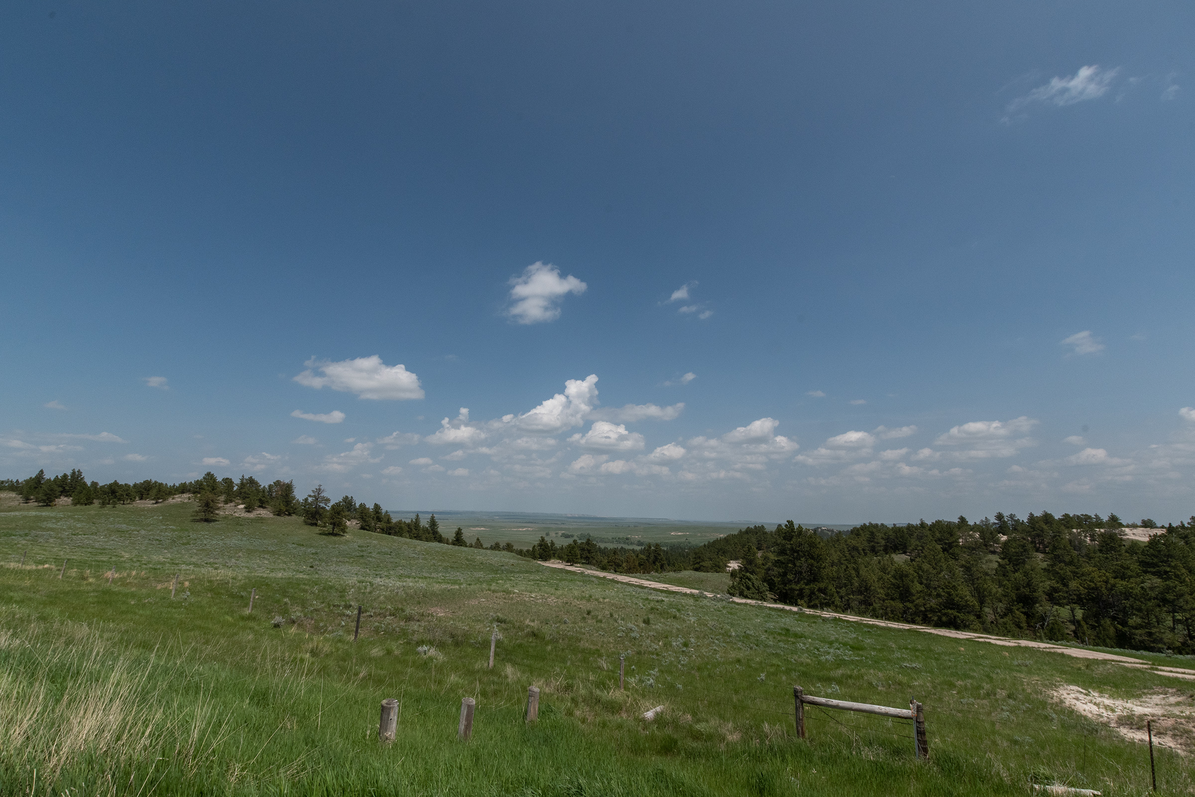
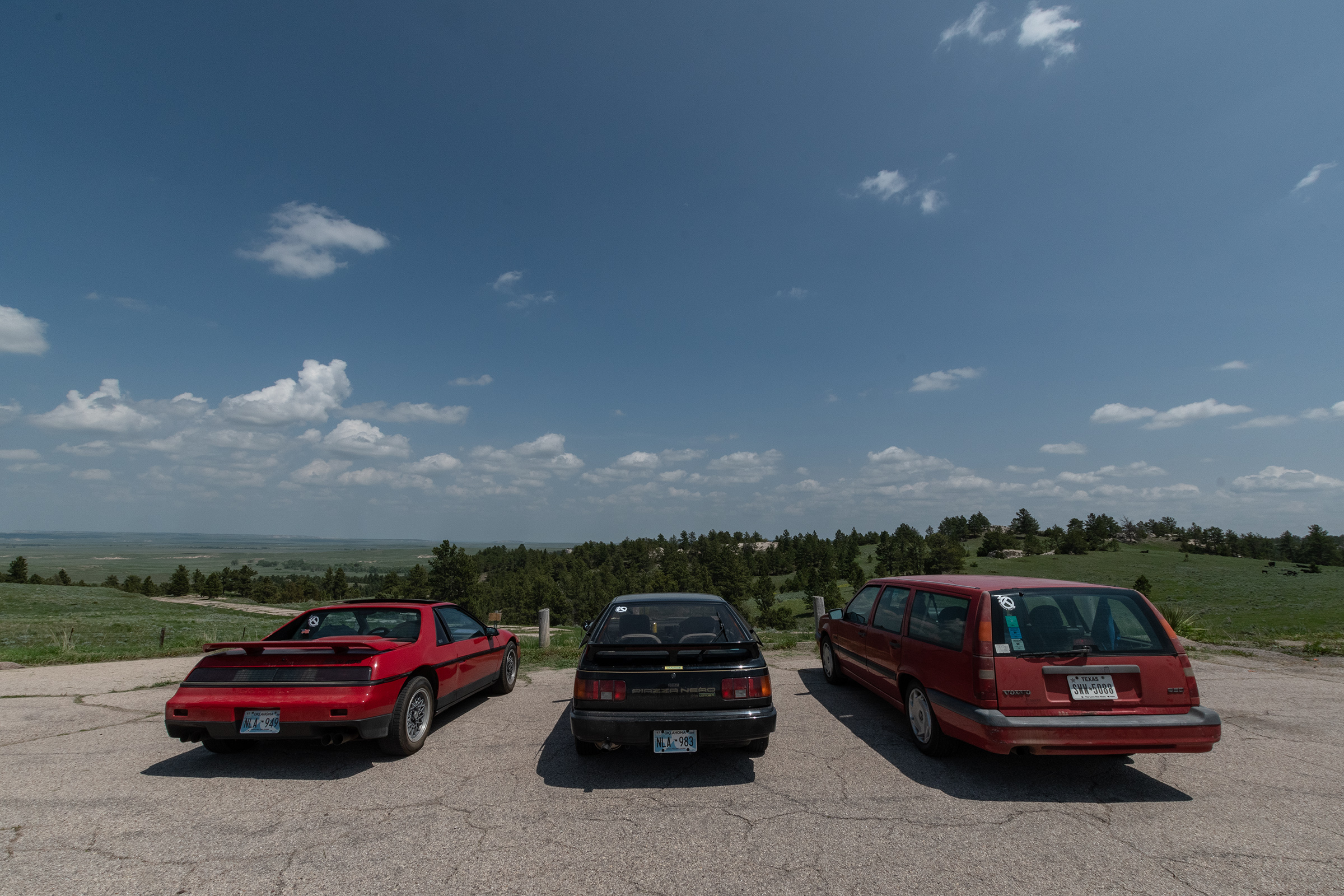
We started our last morning in Idaho at Three Island Crossing State Historic Site, where many pioneers crossed the Snake River en route to Fort Boise. It was a steep descent down a bluff, the tracks of which are still visible, and then three long fords across a string islands across the river.
National Parks Service, view from opposite overlook
Wednesday [August] 6 This morning we hired an Indian to show us the ford. After we saw him cross we determined to try it ourselves. We accordingly commenced making preparations. We crossed two slews to the second island. Here we put ox yokes under the wagon loads to raise them, and put four yoke of our best oxen to each of the four first wagons that crossed. These four got over safely. We then sent the teams back to fech the other three wagons… Suffice it to say we all got over, our cattle and all safely.”
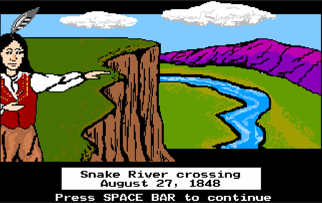
(And despite the potentially problematic screenshot above, the game does offer users a choice here: try to ford it yourself or hire a Native guide to help you across for the cost of some in-game provisions/supplies.)
An impressive visitor center is located along the trail up the shore with lots of trail history and a more thorough explanation of Native American involvement and history in the region than we usually see at sites like this. We walked down to the river, which looked impossibly far to cross and swiftly flowing.
Note #1
#1: Marnie’s quote here is presented in-game. But the display this photo is from illustrates the hilariously — almost criminally — inaccurate sales pitches made back East to potential emigrants.
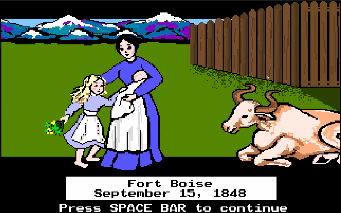
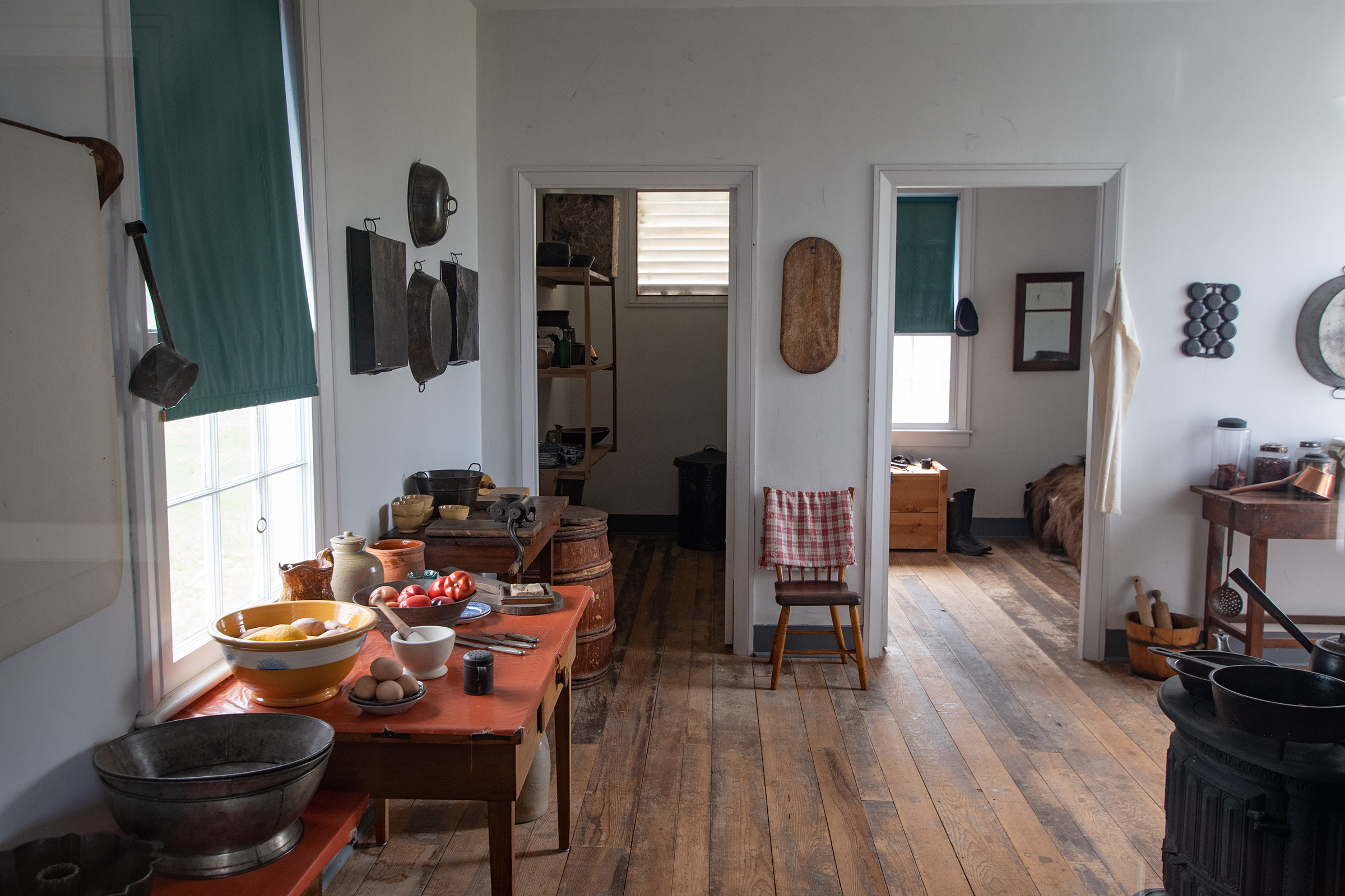
Fort Boise, Sorta.
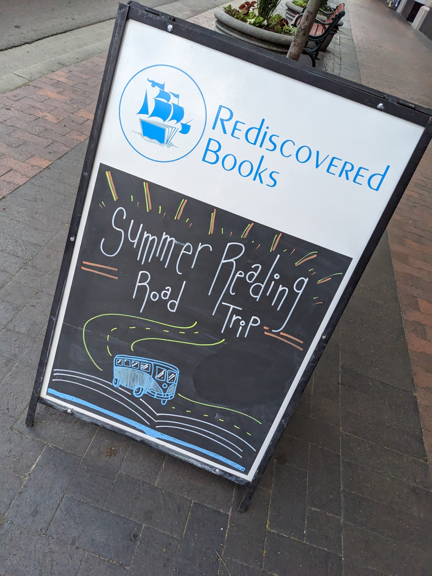
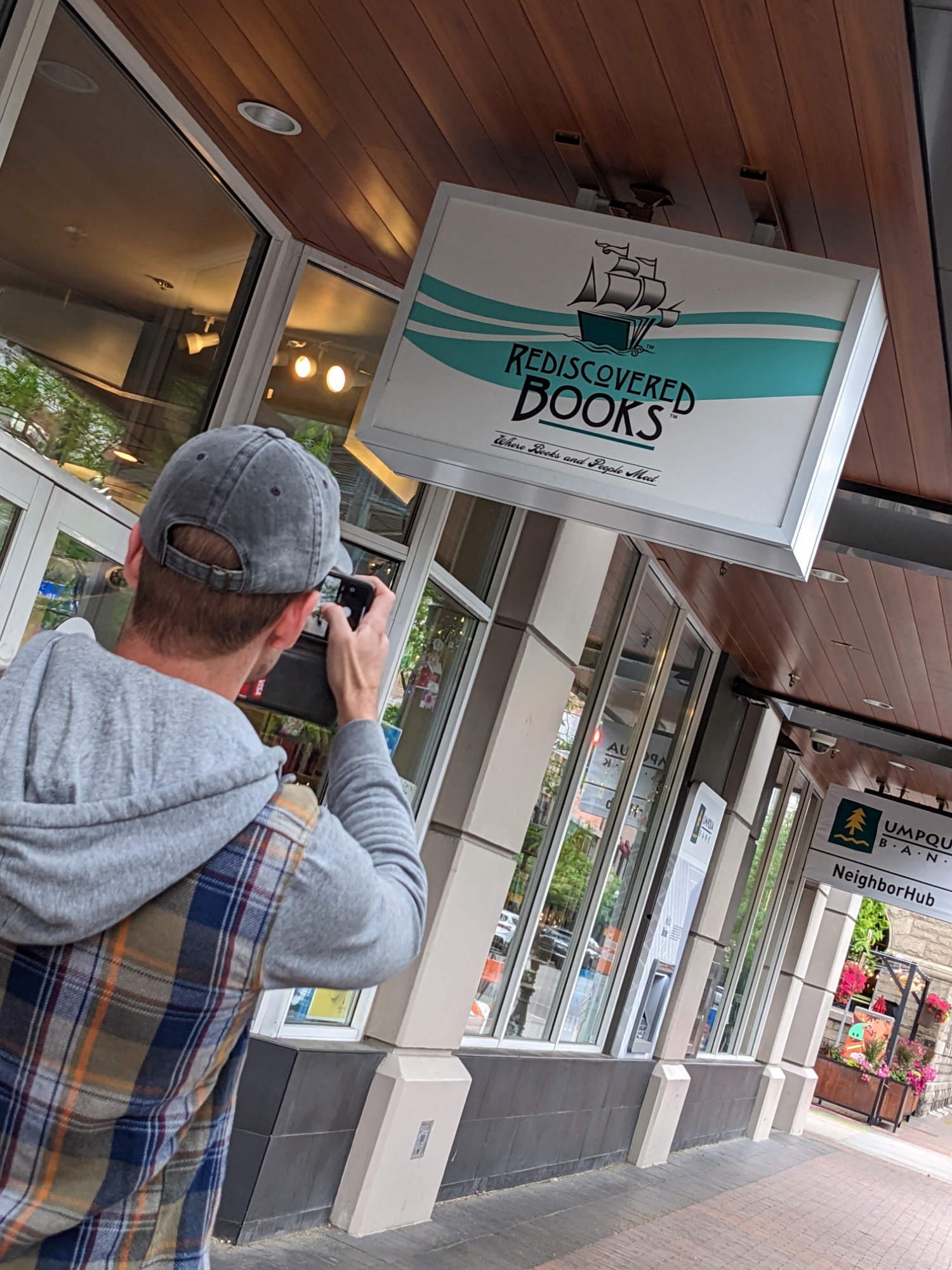
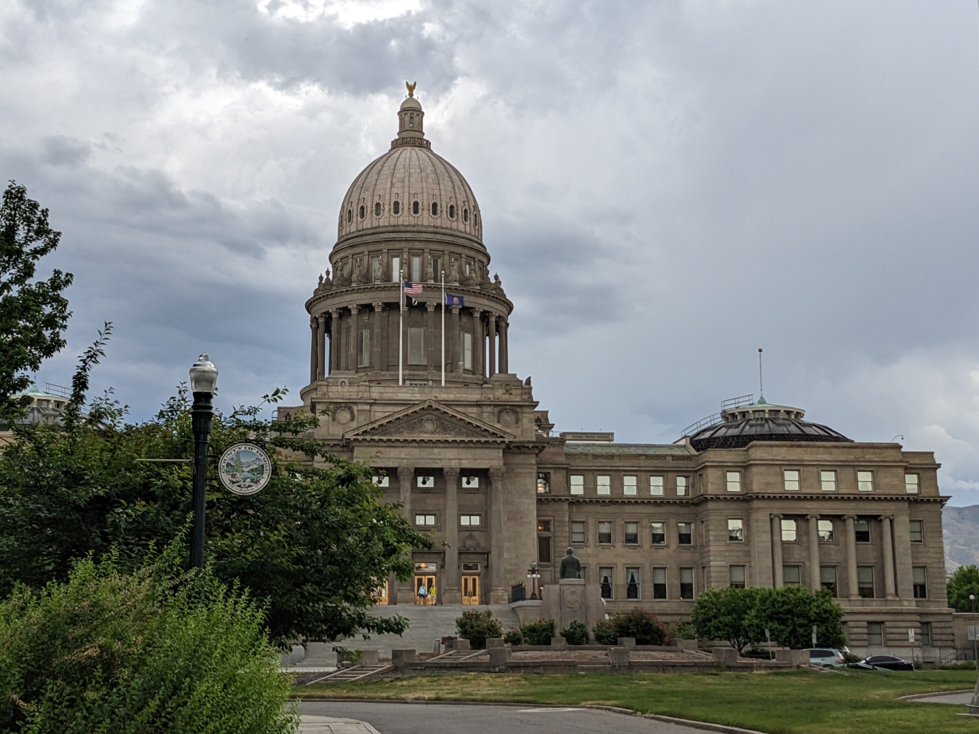
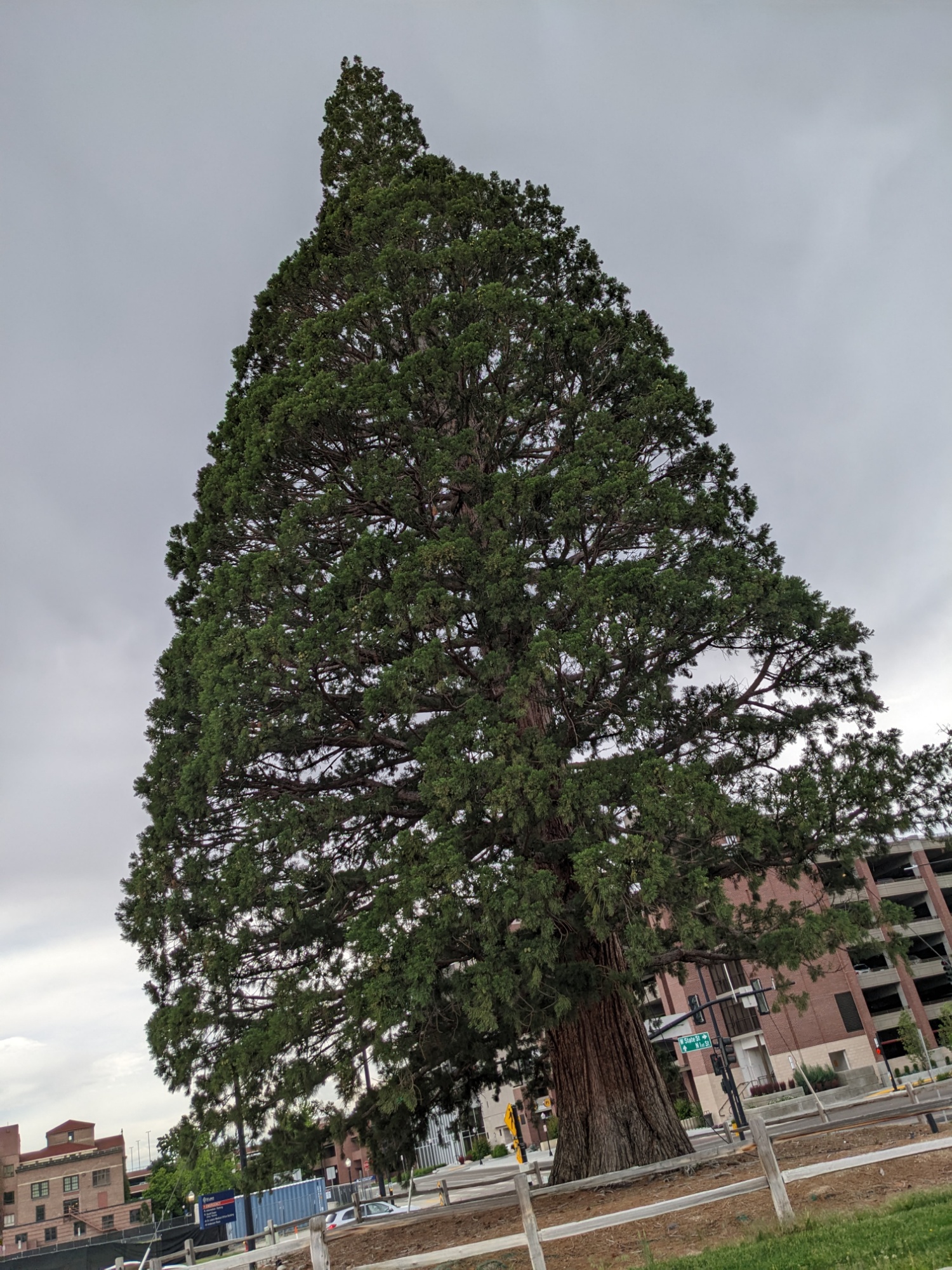
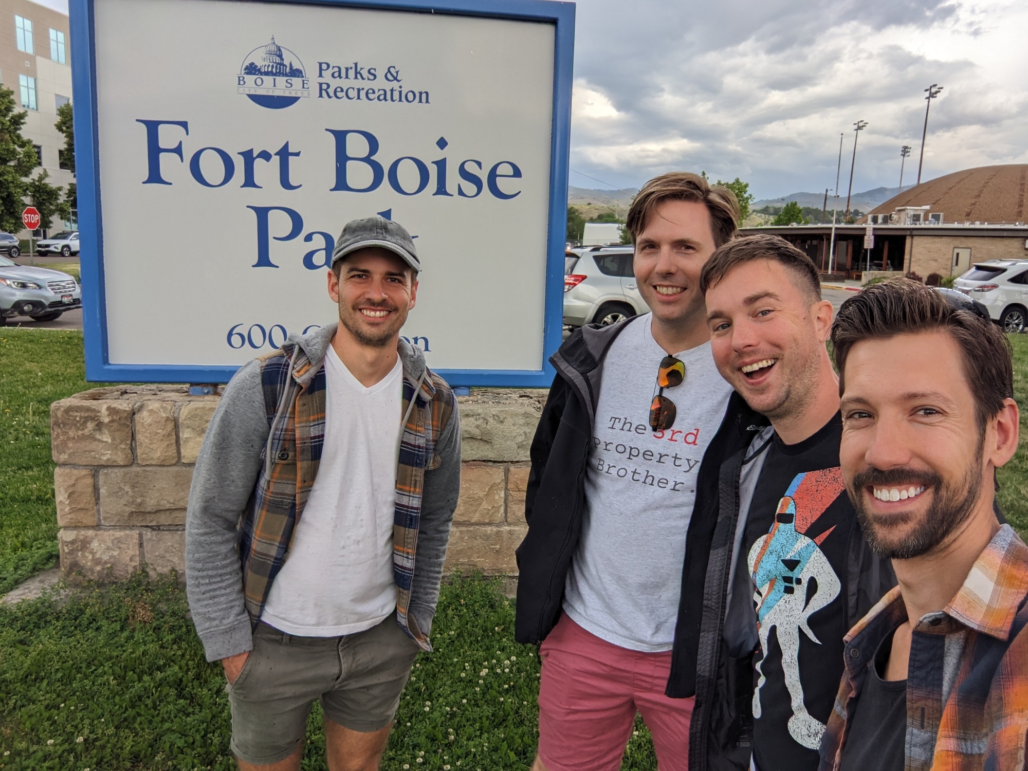
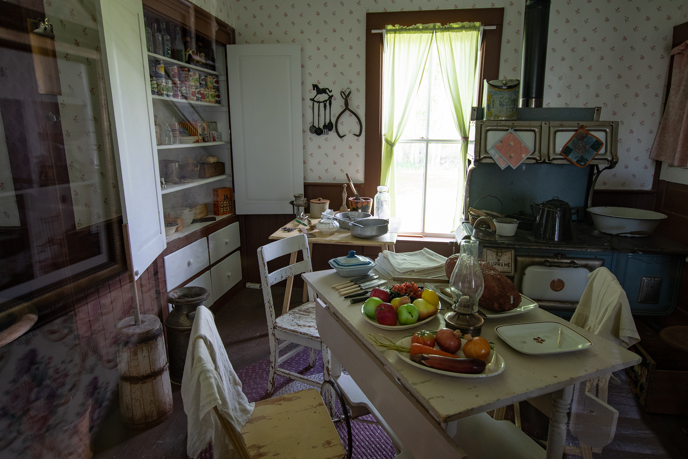
We rolled into Boise without as much of a plan as I’ve made at previous stops. And given long, rural drive days recently, at EG’s suggestion, we made today a bit of a city day. Which I was quite looking forward to; Boise is a lovely city with an interesting downtown. We had one of our best lunches of the trip, poked through an independent bookstore where a couple of us found our next read, and walked over to Fort Boise City Park — which was — a giant tree and four softball fields.
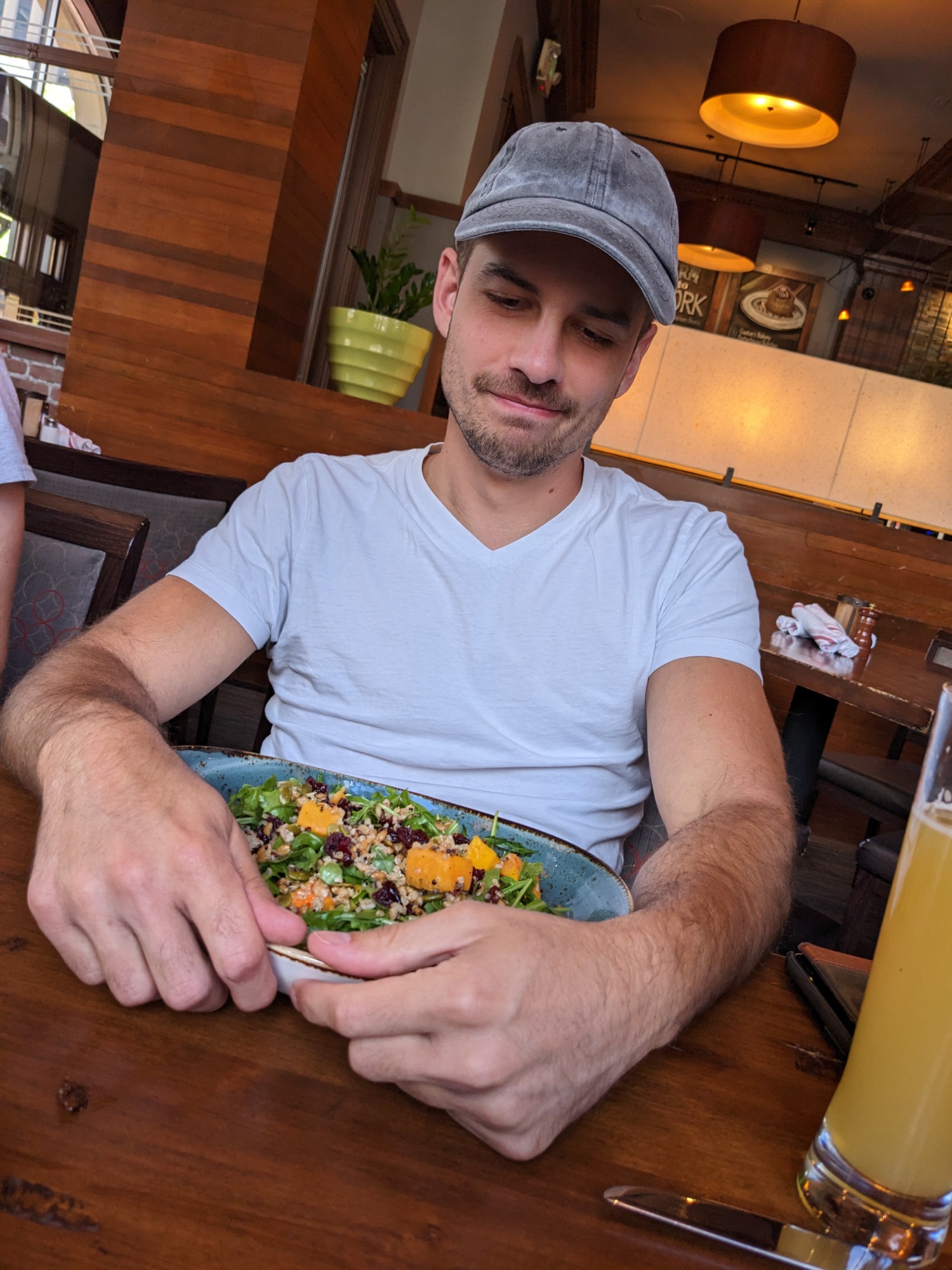
A happy vegetarian
Fort Boise is either of two different locations in the western United States, both in southwestern Idaho. The first was a Hudson’s Bay Company (HBC) trading post near the Snake River on what is now the Oregon border (in present-day Canyon County, Idaho), dating from the era when Idaho was included in the British fur company’s Columbia District. After several rebuilds, the fort was ultimately abandoned in 1854, after it had become part of United States territory following settlement in 1846 of the northern boundary dispute.
The second was established by the U.S. government in 1863 as a military post located fifty miles (80 km) to the east up the Boise River. It developed as Boise, which became the capital city of Idaho.
Ah, okay, so Fort Boise is the city now. So we weren’t too off course. I feel sufficiently resupplied for our next stage of the journey.
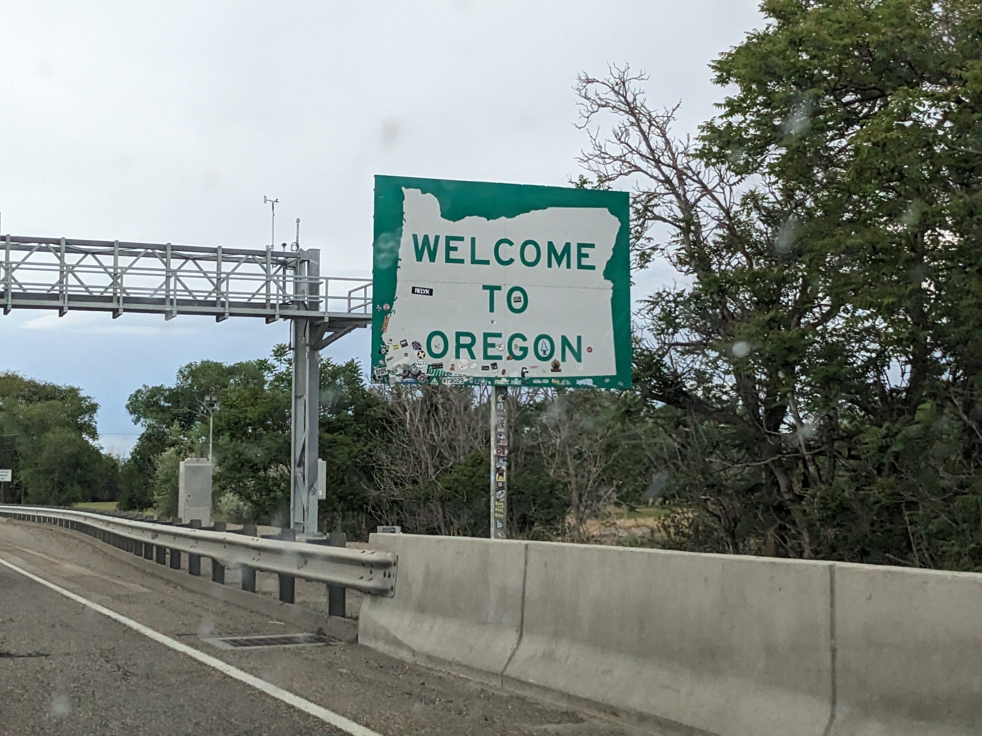
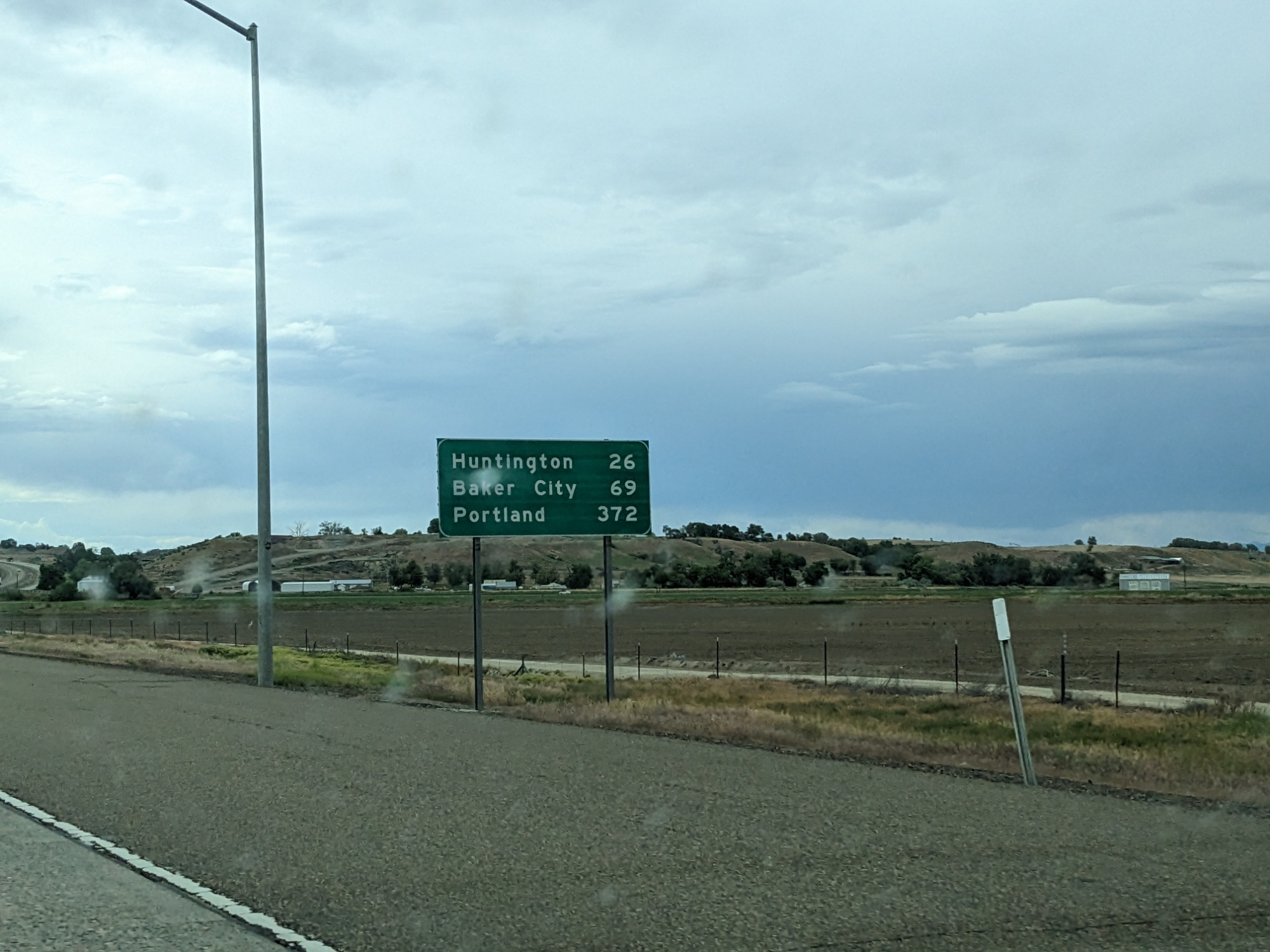
The Oregon Border
And now, after Texas, Arkansas, Missouri, Kansas, Nebraska, South Dakota, Wyoming, Utah, and Idaho… we’ve made it to Oregon Territory. What I was not ready for was to see a distance marker to Portland Oregon City on the way in.
But if I’m honest, I’m starting to see why all the things I’ve been reading have a tendency to start fading out or summarizing after the dramatic hazards of Wyoming… it’s been a long way… I’m runnin’ out of words as much as miles… But I don’t know if I’m ready for the end of this journey yet. I do know I’m ready for a beach day in The Dalles though.
I know very little about cars. Like, impressively little. Which feels like a sacrilegious confession as a newcomer to a road trip tradition in which cars—and their inner workings—are so central.
To be honest, I’ve long had a general disinterest in motorized vehicles, which made me a bit of an outlier as a kid, especially in a culture where there’s an expectation that boys will love all things that go vroom. I remember being a child and having the opportunity to pick out a Hot Wheels toy; I bypassed all the cars and sprung for a Hot Wheels-branded medieval chariot. And when it came to my Star Wars LEGO preferences—give me a Mos Eisley cantina or Yoda’s hut over an X-wing or AT-AT any day. (Dioramas? *Swoon*)
At the same time, though, I’ve always had a fixation with the *idea* of driving. It grew, in part, through music—Springsteen anthems, where cars were symbols of freedom and agency; Tracy Chapman’s “Fast Car,” where the car was the ticket out of a dead-end town… and later the ticket out of a dead-end relationship. When I think about cars, I think about stories: Getaway cars. People running away from things, or running toward things. Races against time. I also think about how my own cars have often been sacred spaces. Spaces to think and feel and process. Transitional spaces, between work and home, between errands and hangouts—spaces where all the versions of me stitch back together, at least for a few minutes.
So while I don’t know what’s under the hood (…an engine, maybe?), I think I get some of the emotional workings of cars. What they represent to folks. What they offer. And joining a caravan of quirky cars across a changing and dramatic landscape is already sparking new story ideas.
And who knows? Maybe I’ll pick up some technical know-how along the way. My little blue Prius waiting for me back home would probably appreciate it.
Today’s detour was not, in fact, entirely off-route. As we drove north out of Blackfoot, Idaho, I saw several signs marking the highway as the Goodale Cutoff of the Oregon National Auto Tour.
It was a desolate, dismal scenery. Up or down the valley as far as the eye could reach or across the mountains and into the dim distance the same unvarying mass of black rock. Not a shrub, bird nor insect seemed to live near it. Great must have been the relief of the volcano, powerful the emetic, that poured such a mass of black vomit.
Julius Caesar Merrill, a pioneer traveling Goodale’s Cutoff in 1864. Collected by the National Park Service.
“In 1862 an emigrant party asked guide Tim Goodale to lead them west from Fort Hall on the cutoff pioneered by Jeffrey. They hoped the alternate trail would enable them to reach the Salmon River gold fields more directly. Goodale succeeded in leading a group of 1,095 people, 338 wagons, and 2,900 head of stock safely from Fort Hall to Boise. It took this enormous wagon train — the largest to travel any section of the Oregon Trail — over 3 hours to get into or out of camp.
“By 1862, the Northern Shoshone and Bannock tribes were beginning to resist the intrusion of settlers into their homeland. In August of that year, Shoshone Indians ambushed a wagon train at Massacre Rock, killing 10 people. The growing Indian hostility along the trail resulted in increased demand for a safe alternative. In 1863, seven out of every ten wagons en route from Fort Hall to Boise took Goodale’s Cutoff instead of the main Oregon Trail.”
We began to see lava fields many miles before our turn to Craters of the Moon National Monument. But before we even made it that far, George discovered something.
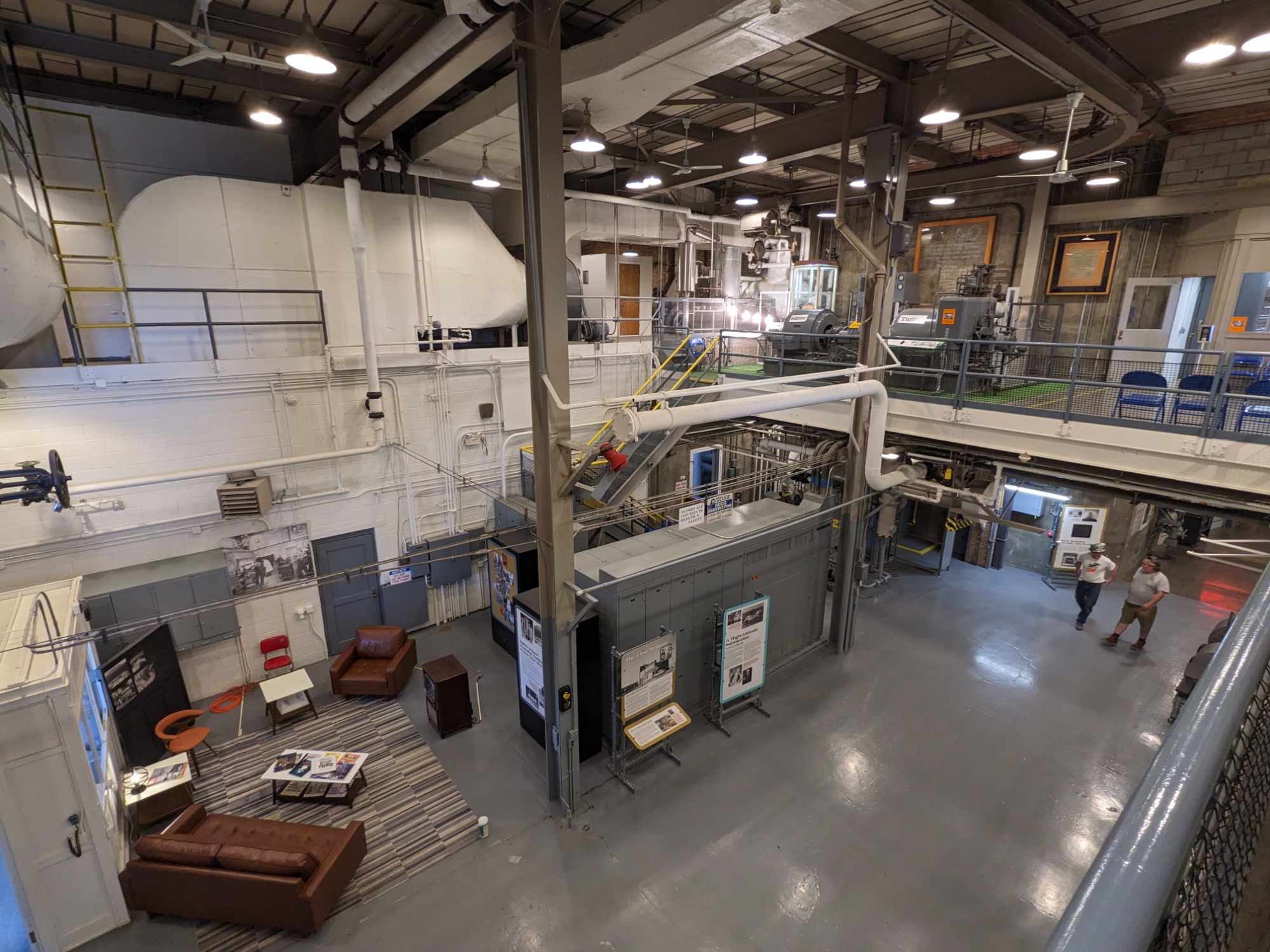
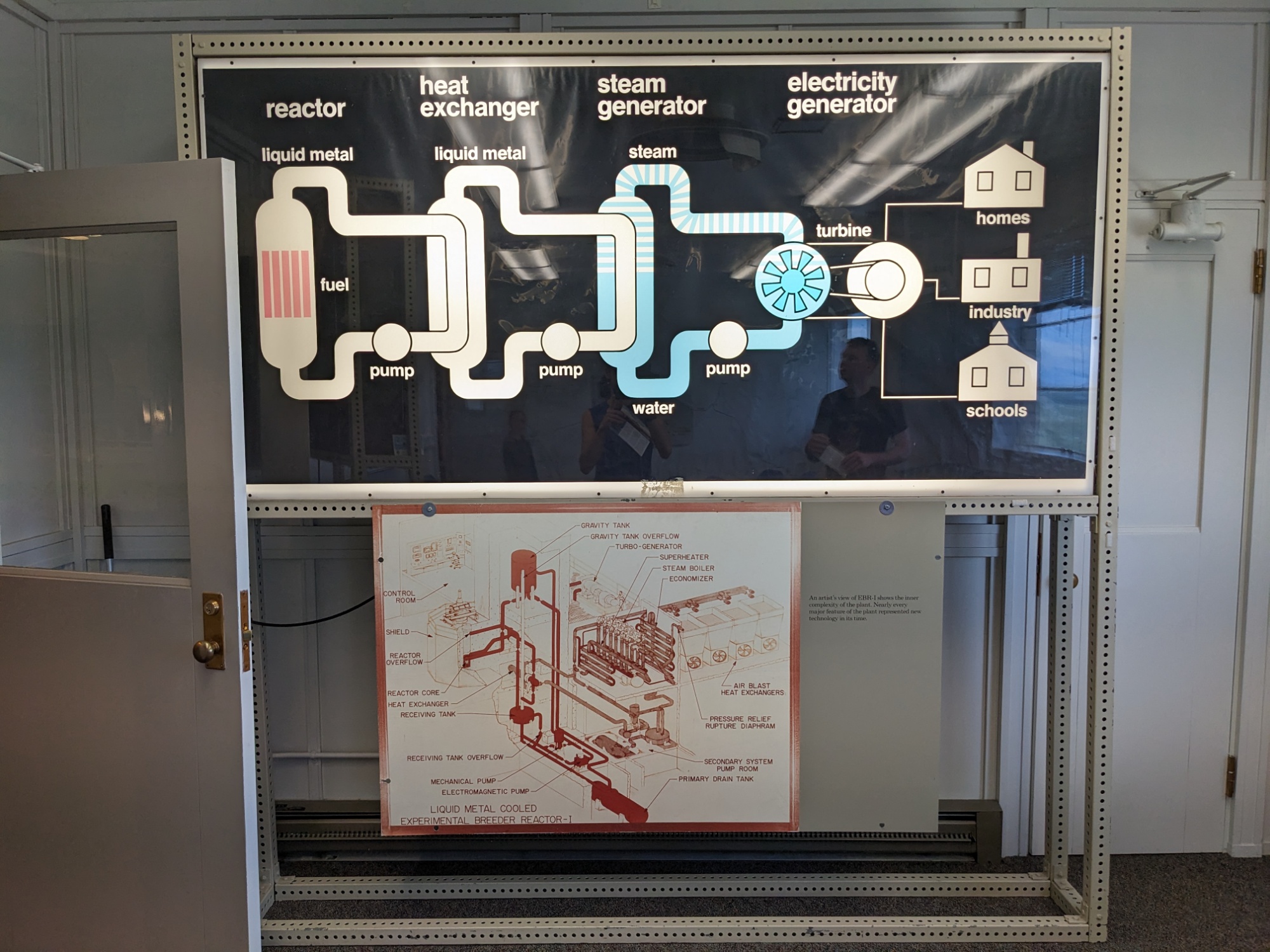
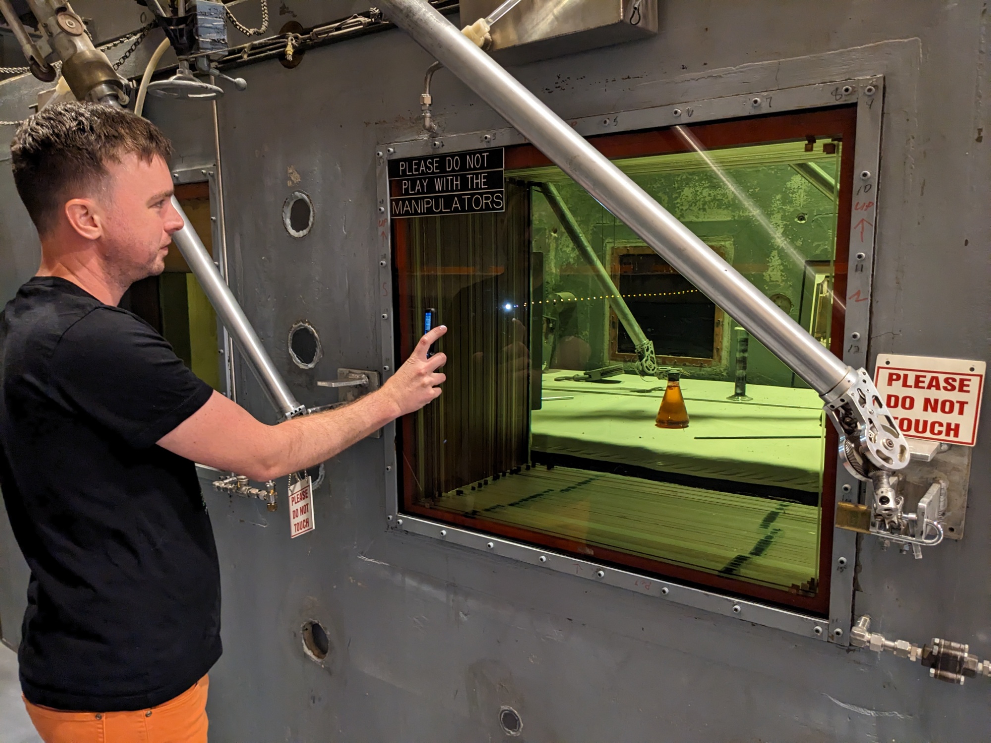
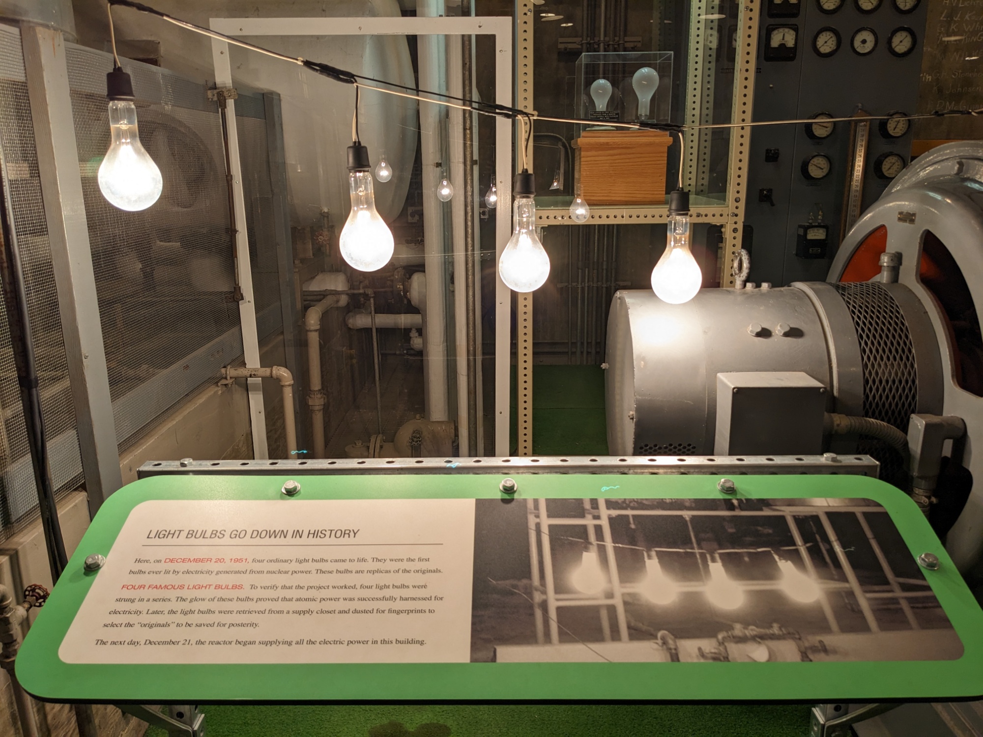
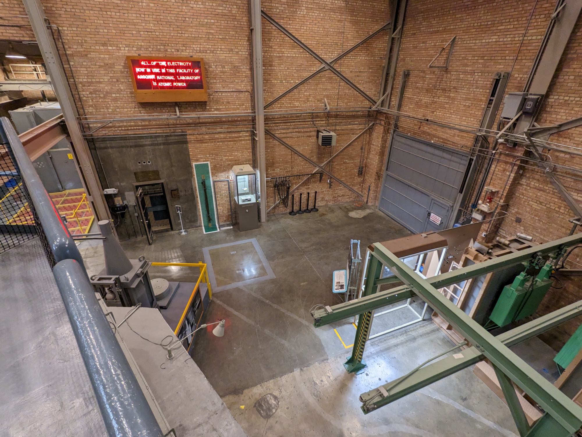
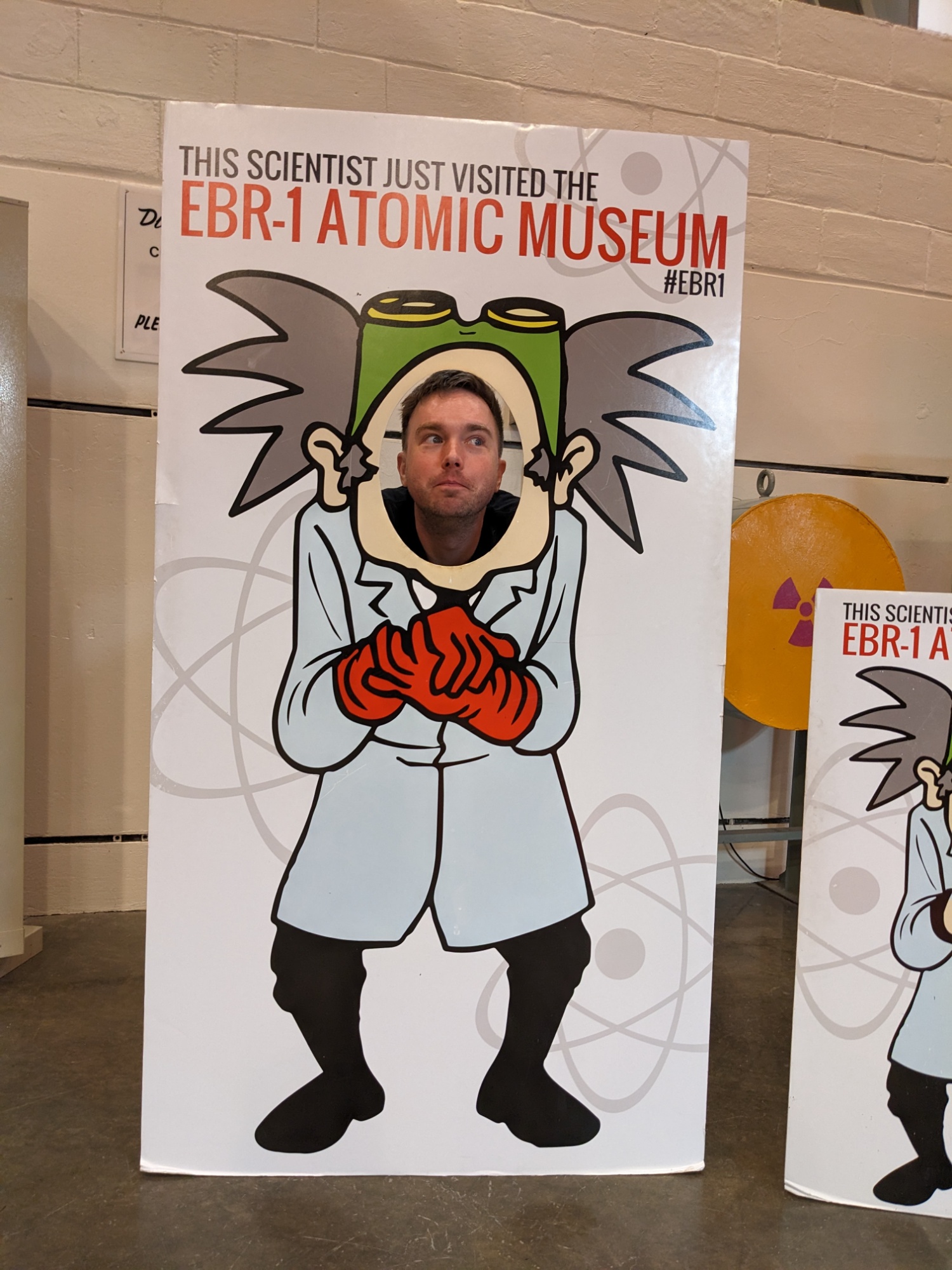
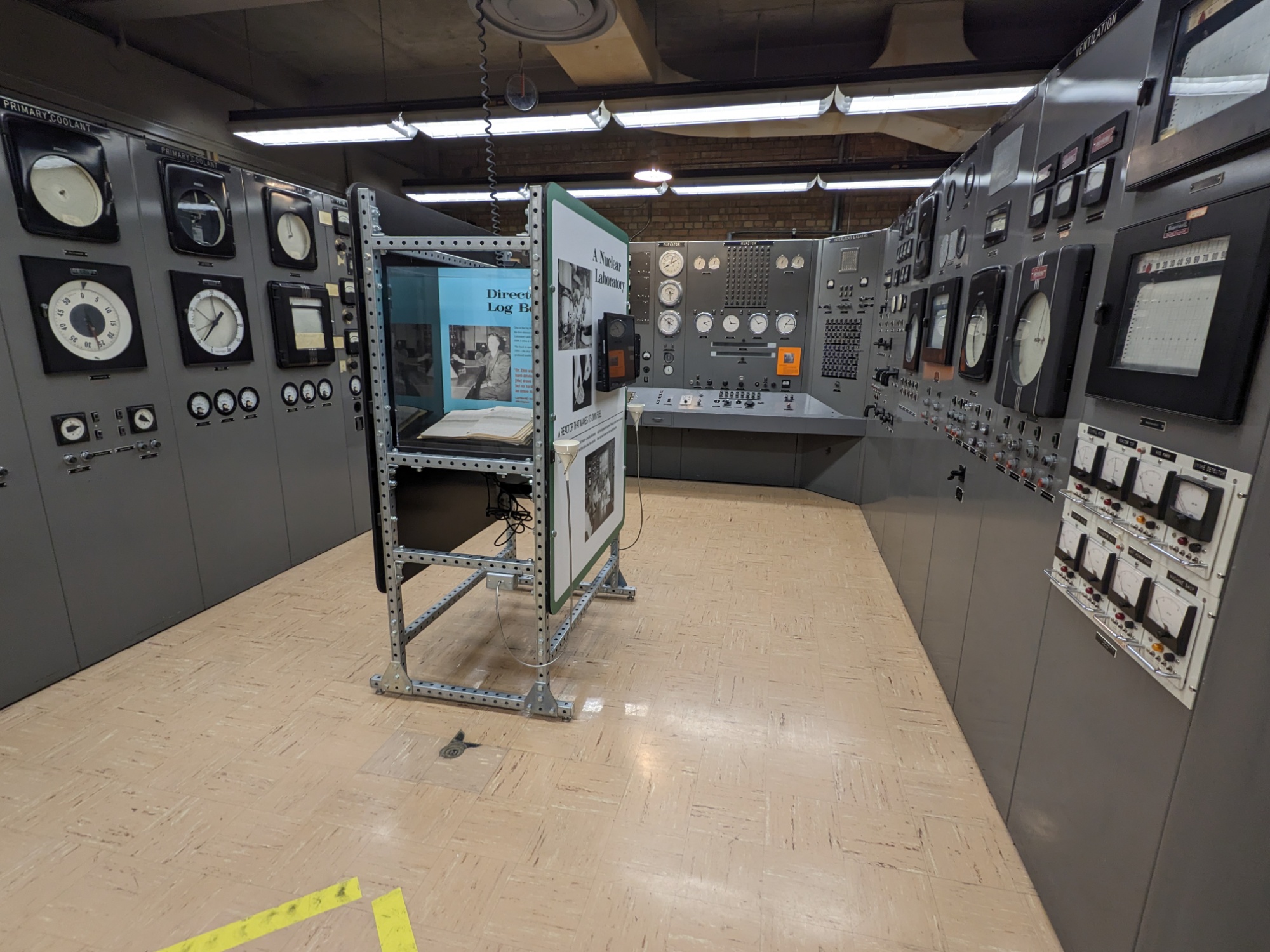
EBR-1, The First Nuclear Power Plant
US Highway 26 runs through Idaho National Lab, the site of America’s first, largest push into the peaceful use of nuclear physics — for the generation of electrical power. There is a free museum at the EBR-1, the world’s first “breeder reactor,” a reactor that produces more fissile material than it requires, and produced a useable amount of electrical power beyond what was required to operate it.
And the nearby town of Arco, Idaho was the first city to be entirely nuclear powered!
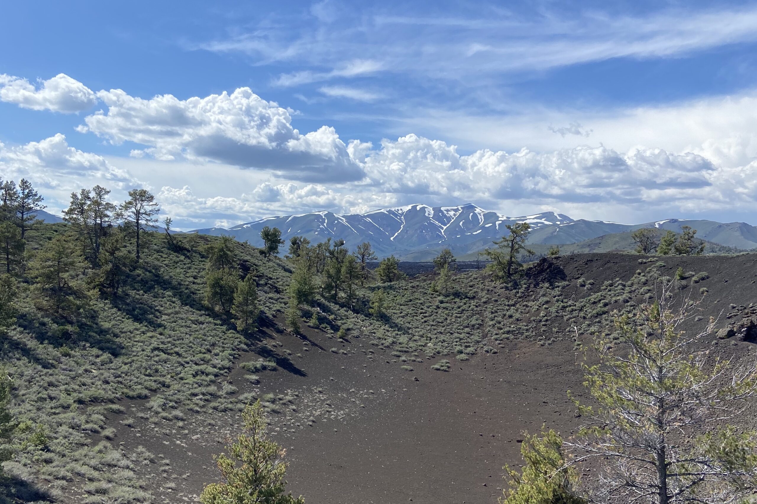
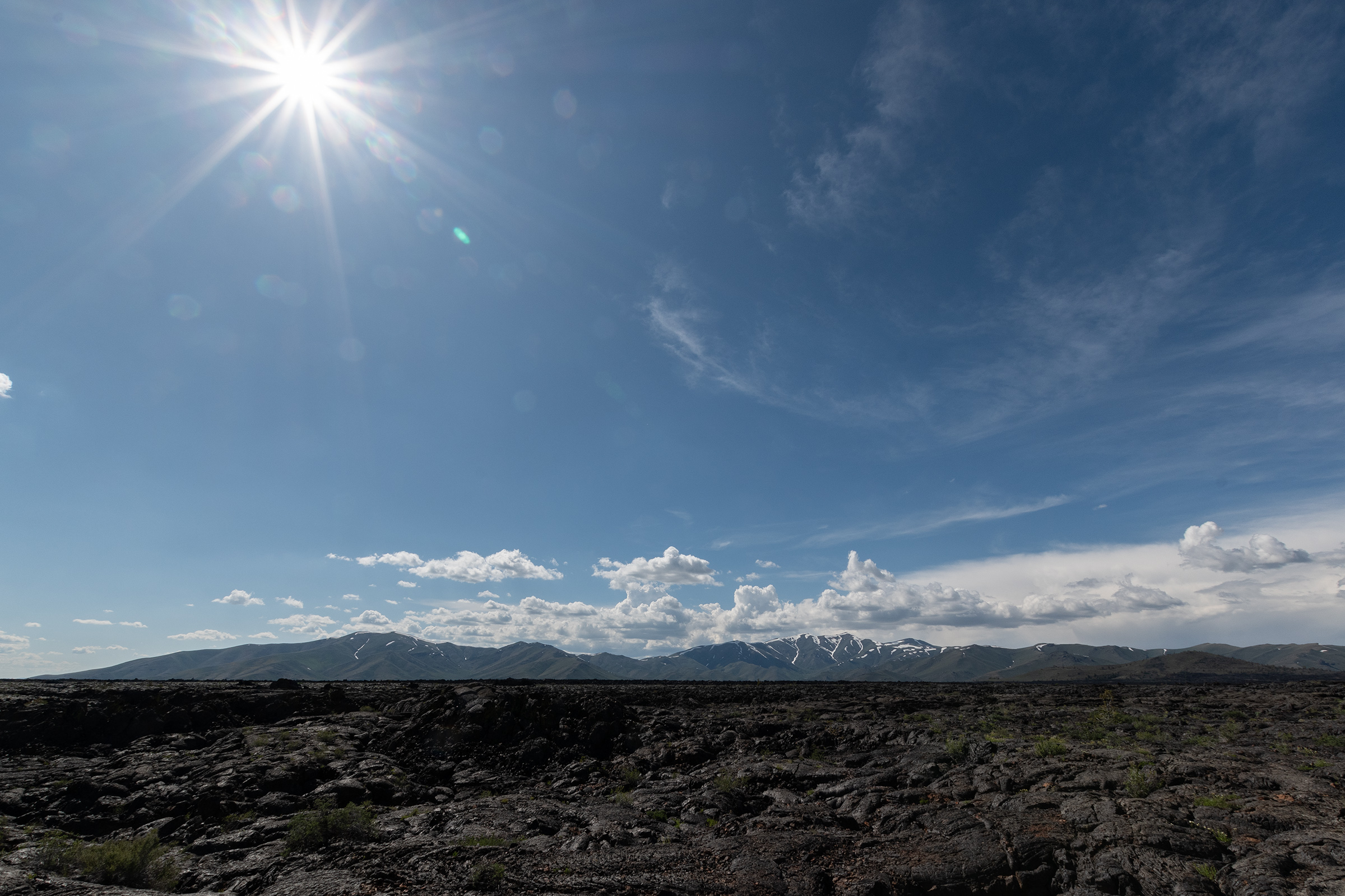
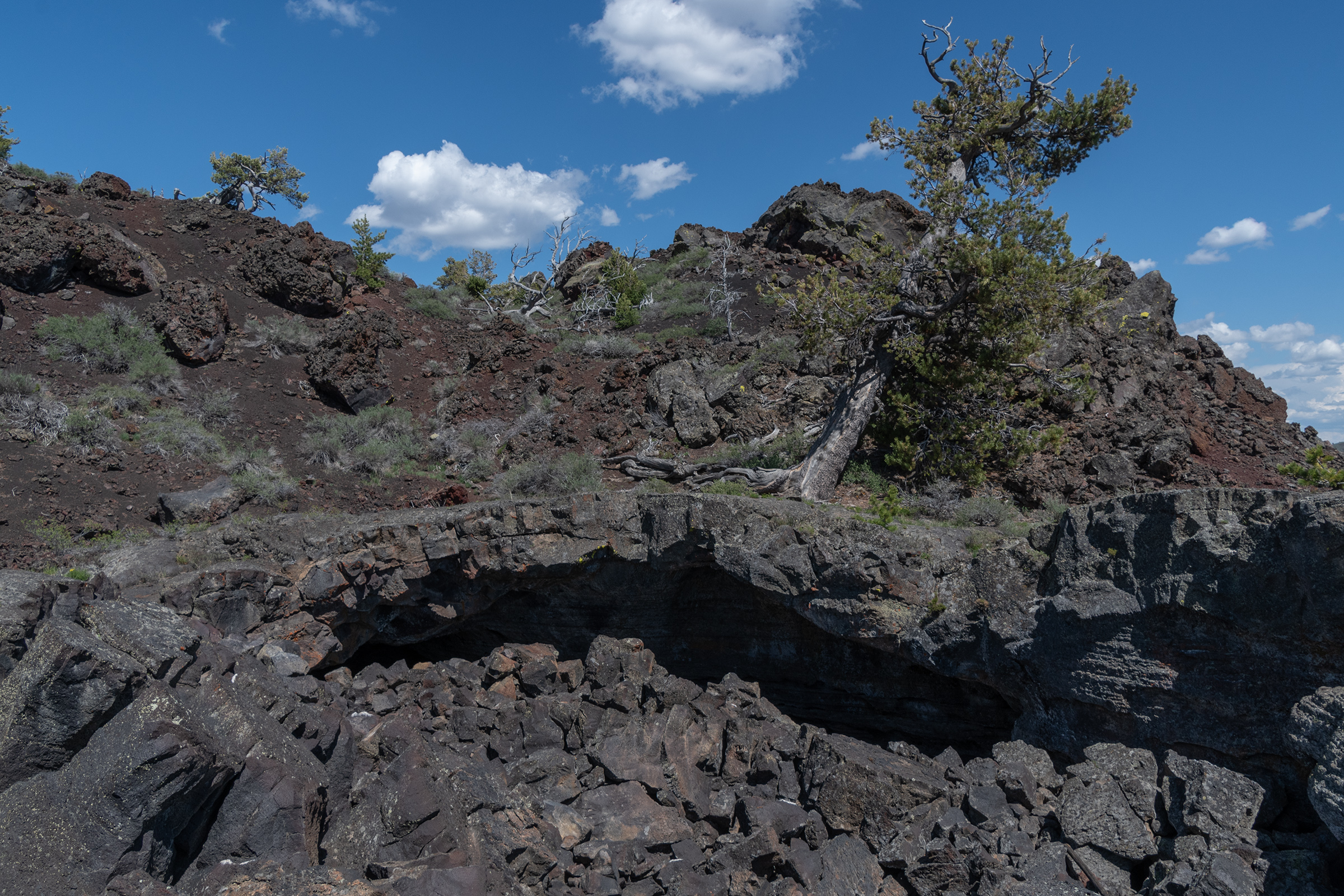
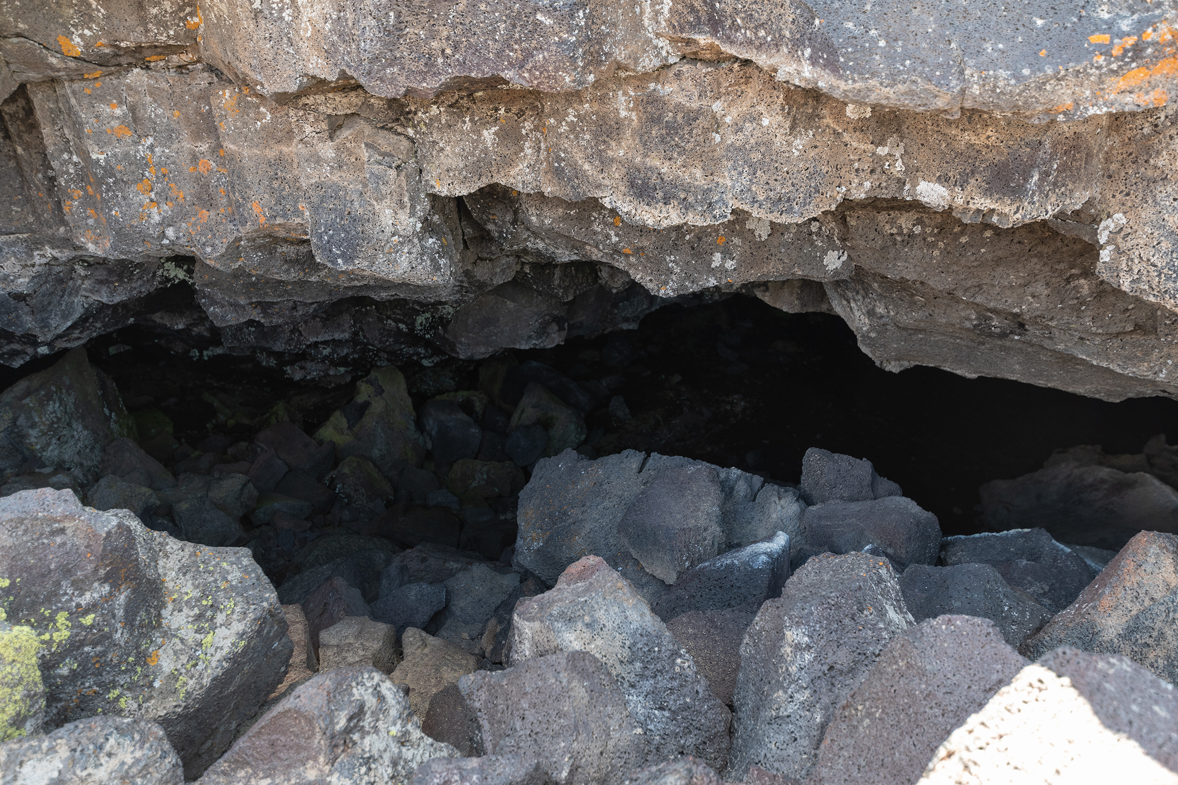
Craters of the Moon National Monument
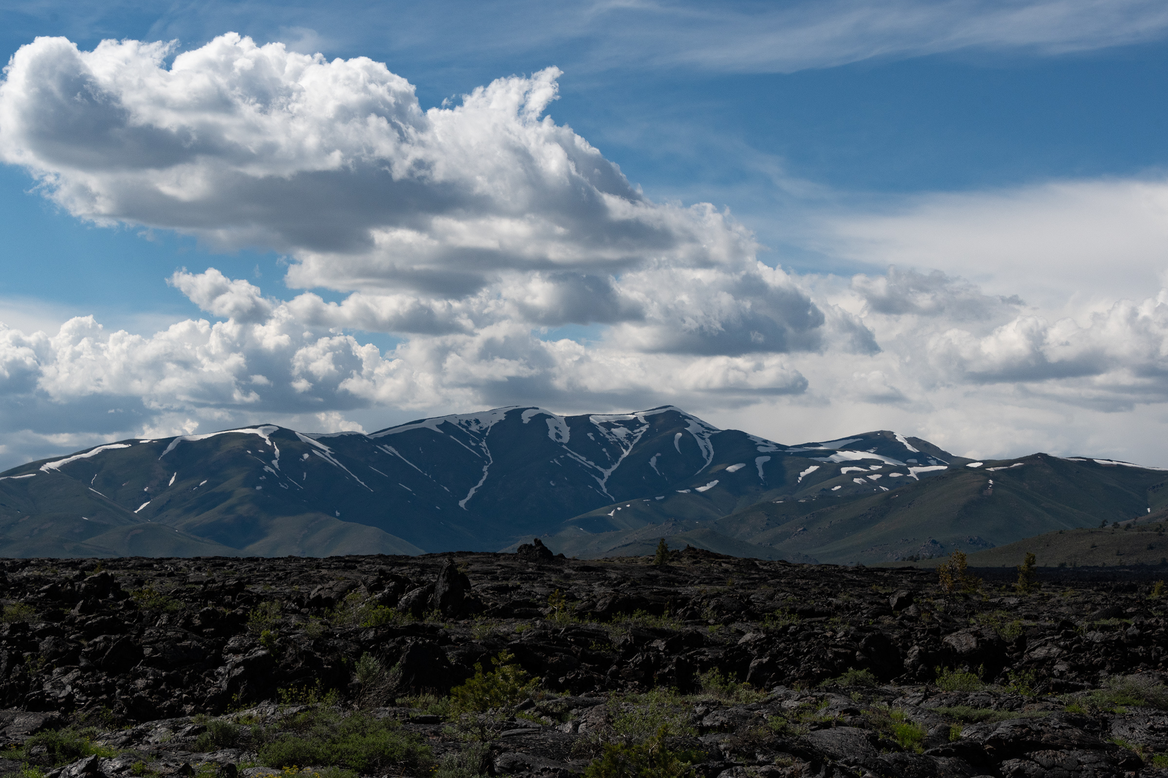
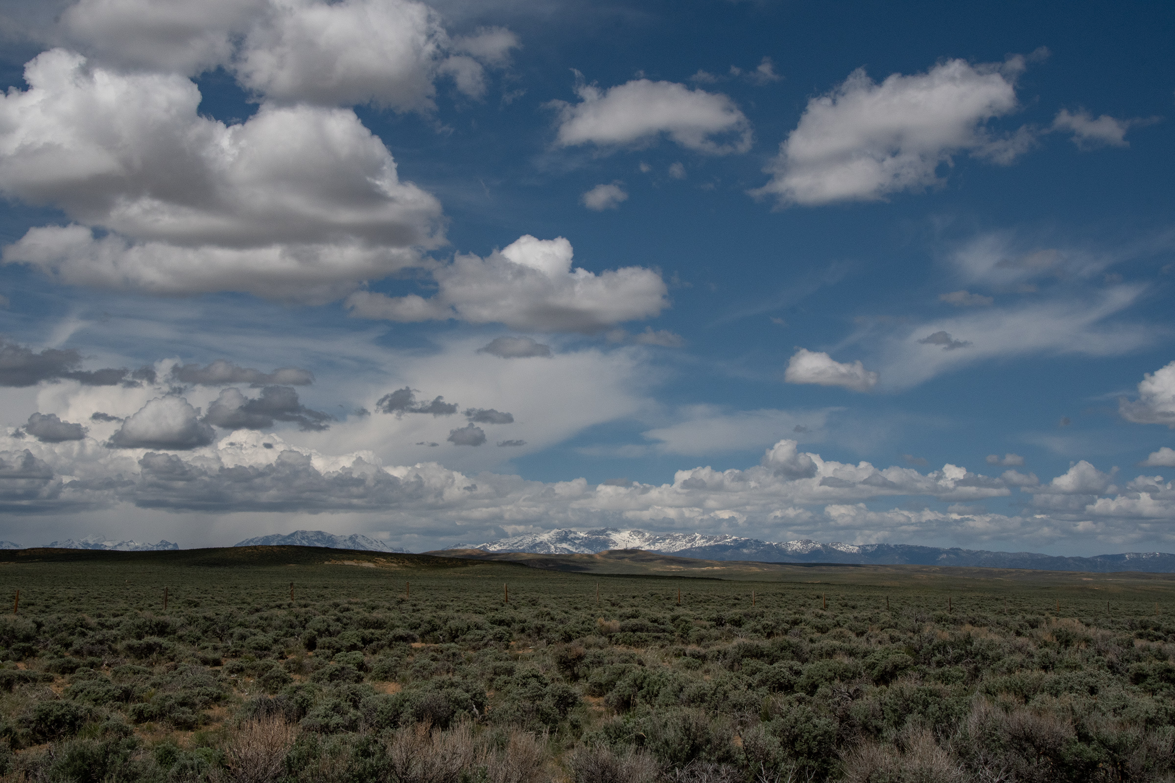
Back on the highway, it was a short drive down to the national monument. Can you imagine the despair of the pioneers who left the grasslands of Nebraska, crossed the Wyoming deserts, and arrived into the hellscape of an endless lava field? I had no idea that pioneers came this way. And while the Goodale Cutoff stayed a bit north of the park, largely along present-day Highway 26, there sure was a lot of lava rock and desolation to be had along the route. I was surprised that wildflowers and desert scrub bushes will grow out of it, so the land looks green-ish at a distance, but it would have been another stretch of little grazing and almost no usable water.
But it was beautiful and other-worldly. The fire-and-ice combination of lava fields against a backdrop of snow-covered peaks was a huge departure from what we’ve seen so far.
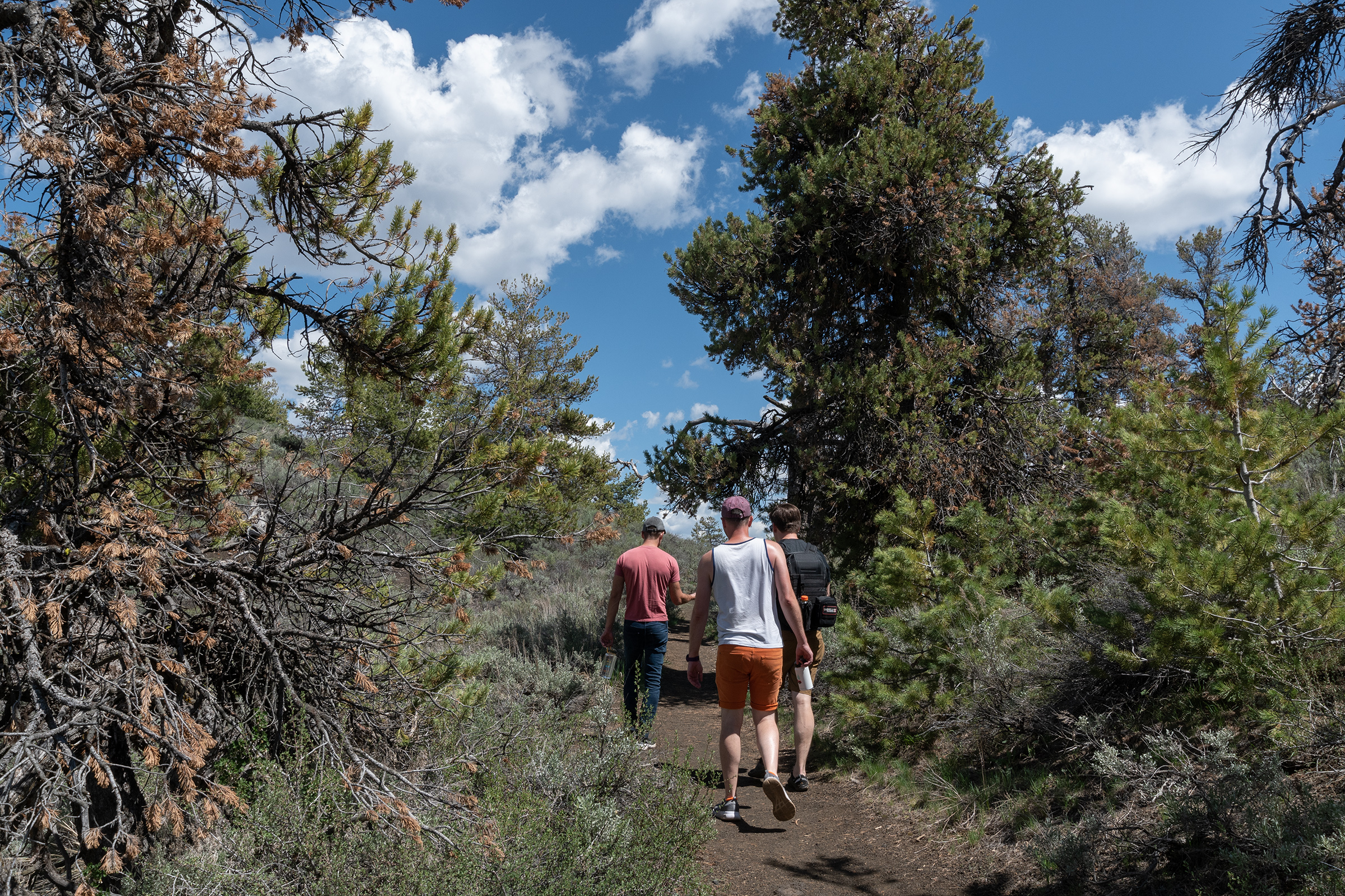
Tragically, the hikes into the caves lava tubes because they’re still snow-packed from a late winter storm. I was really looking forward to those, which I suppose means I’ll need to make my way back up here one day. On our hike, we did come to the entrance of The BatCave! — or, rather, a cave that bats are hibernating in, and was thus closed beyond its entrance, but the cold air rushing out of it made the cave feel like it was probably quite deep.
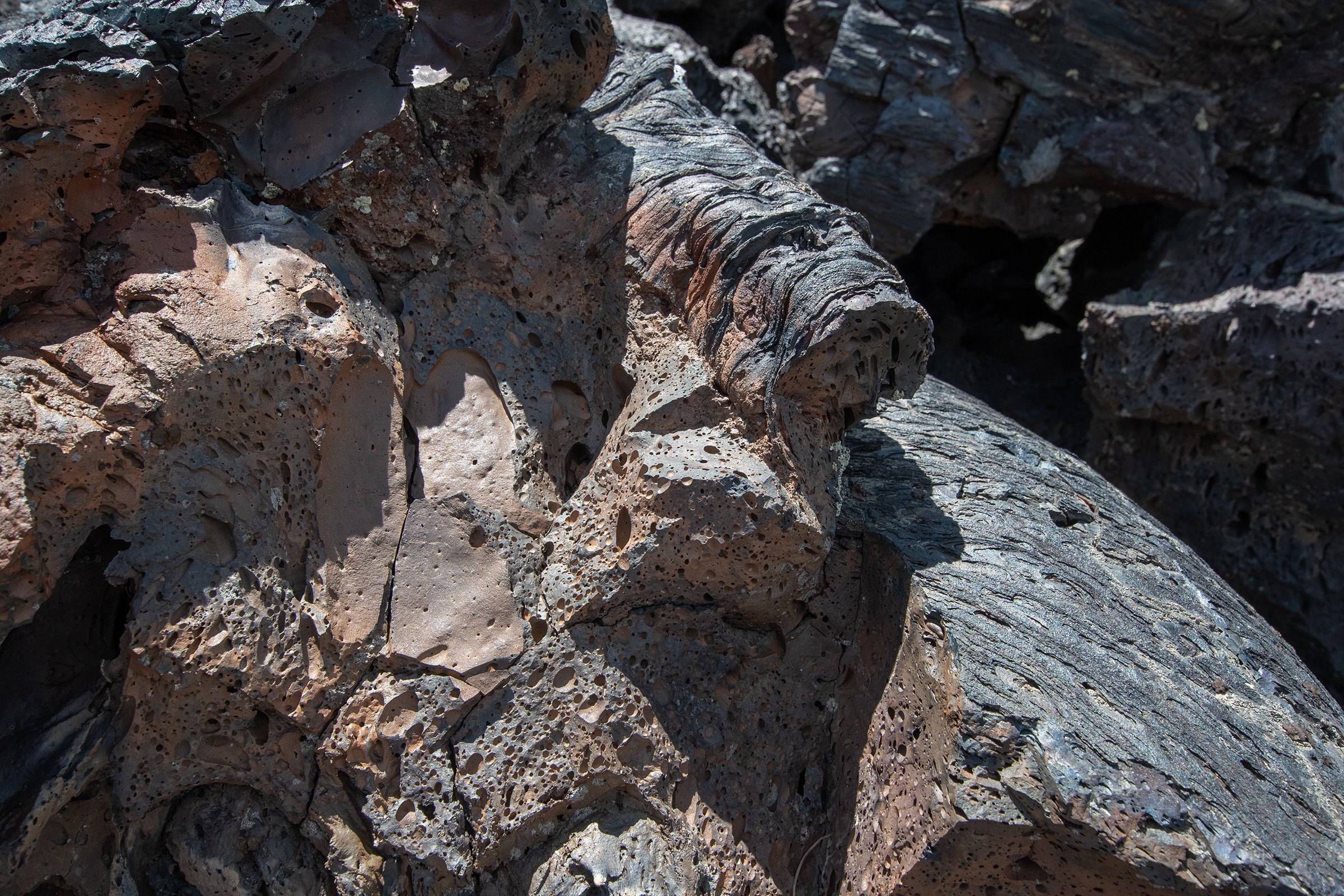
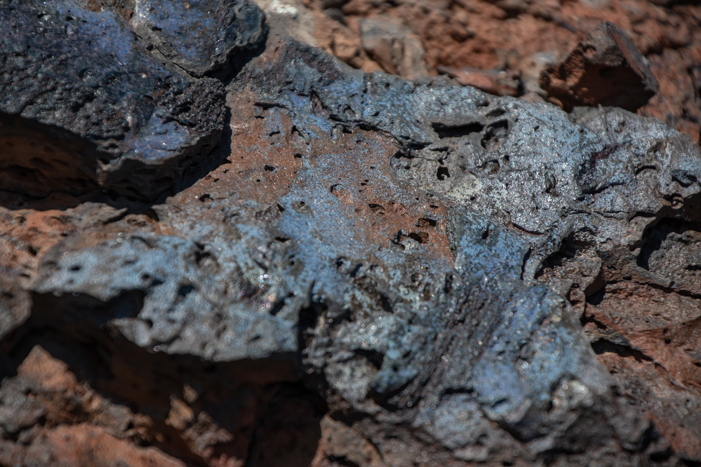
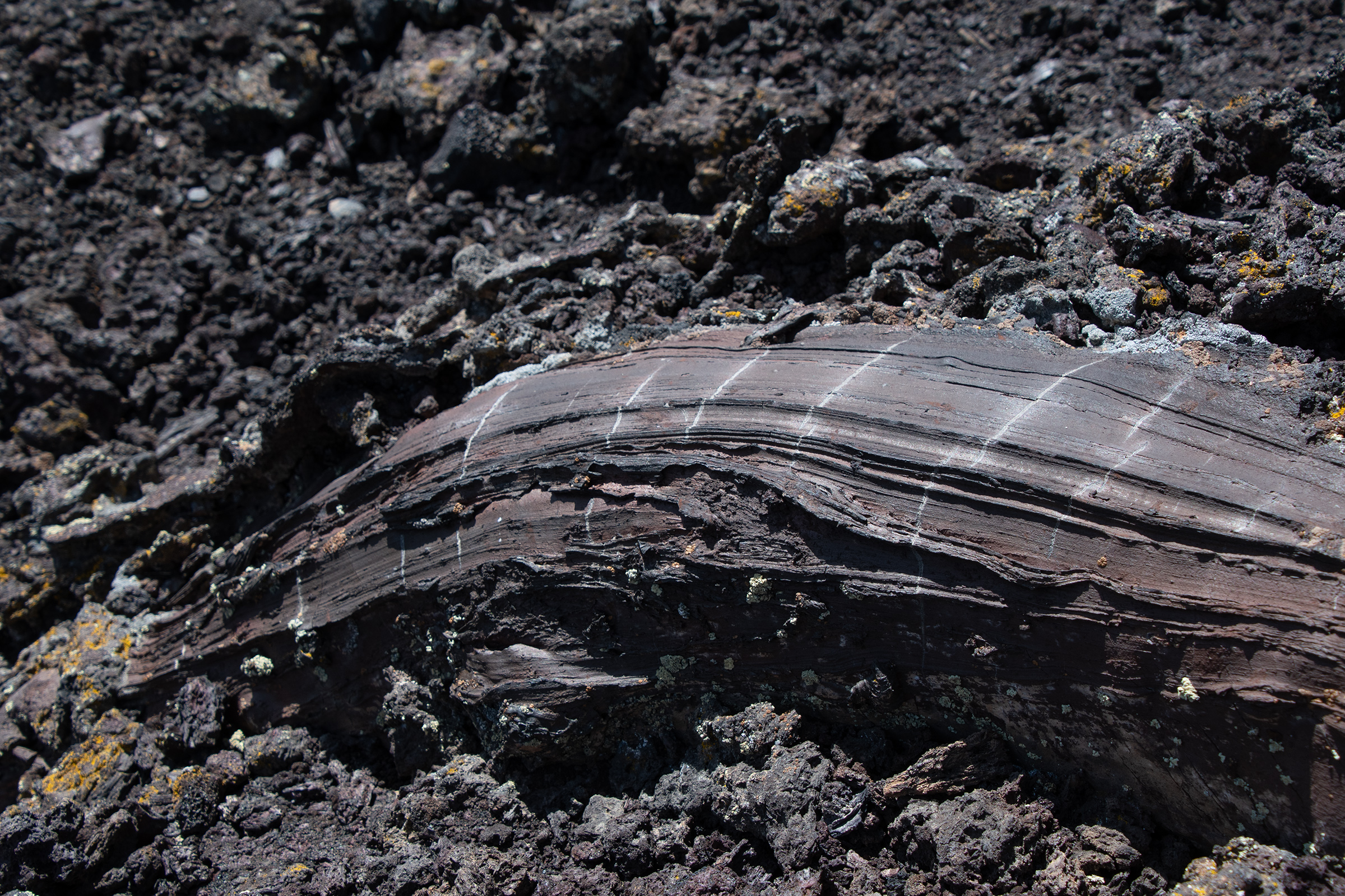
There were also “tree molds,” where oozing lava encased trees and branches and solidified before the wood burned away — or in other cases, the reverse, where lava seemed to have replaced wood or root systems and retained their texture and feel. Something between petrified wood and charcoal.
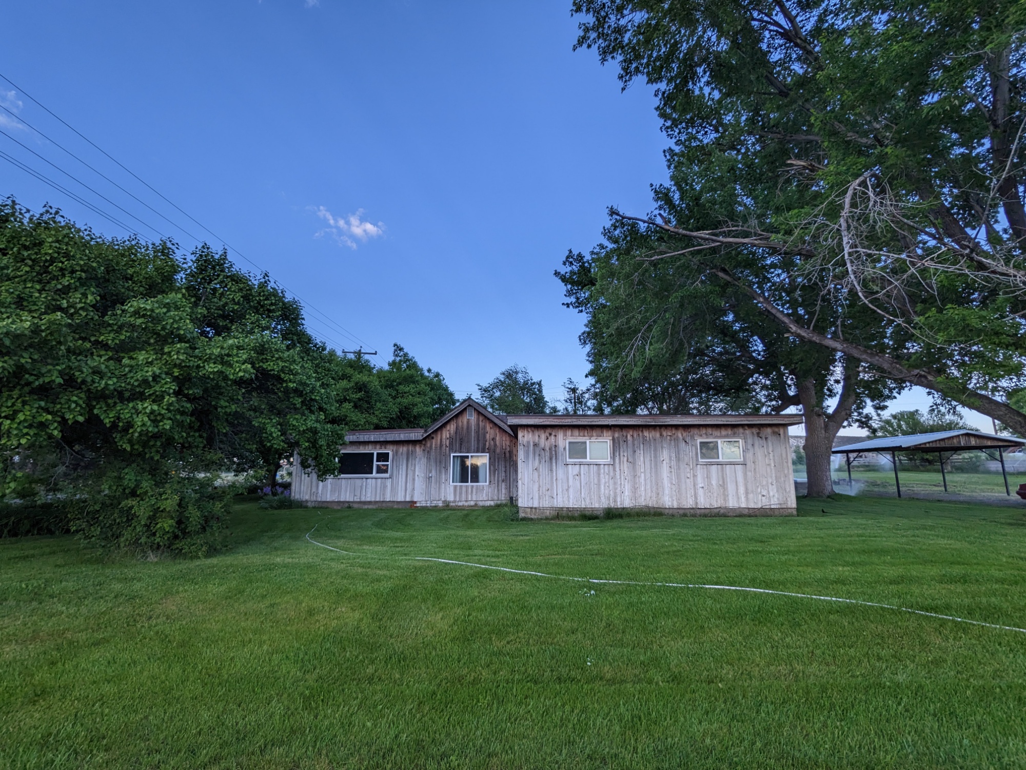
The Farmhouse
Tonight’s lodging in King Hill and Mountain Home, Idaho was the somewhat ominous looking wooden farmhouse without an address. I’m grateful that we managed to make it here in daylight because the place is actually much more inviting than it appears on the listing. Although as we slowly approached, EG suddenly said, “Oh, it is standing,” which I think sums up its curb appeal.
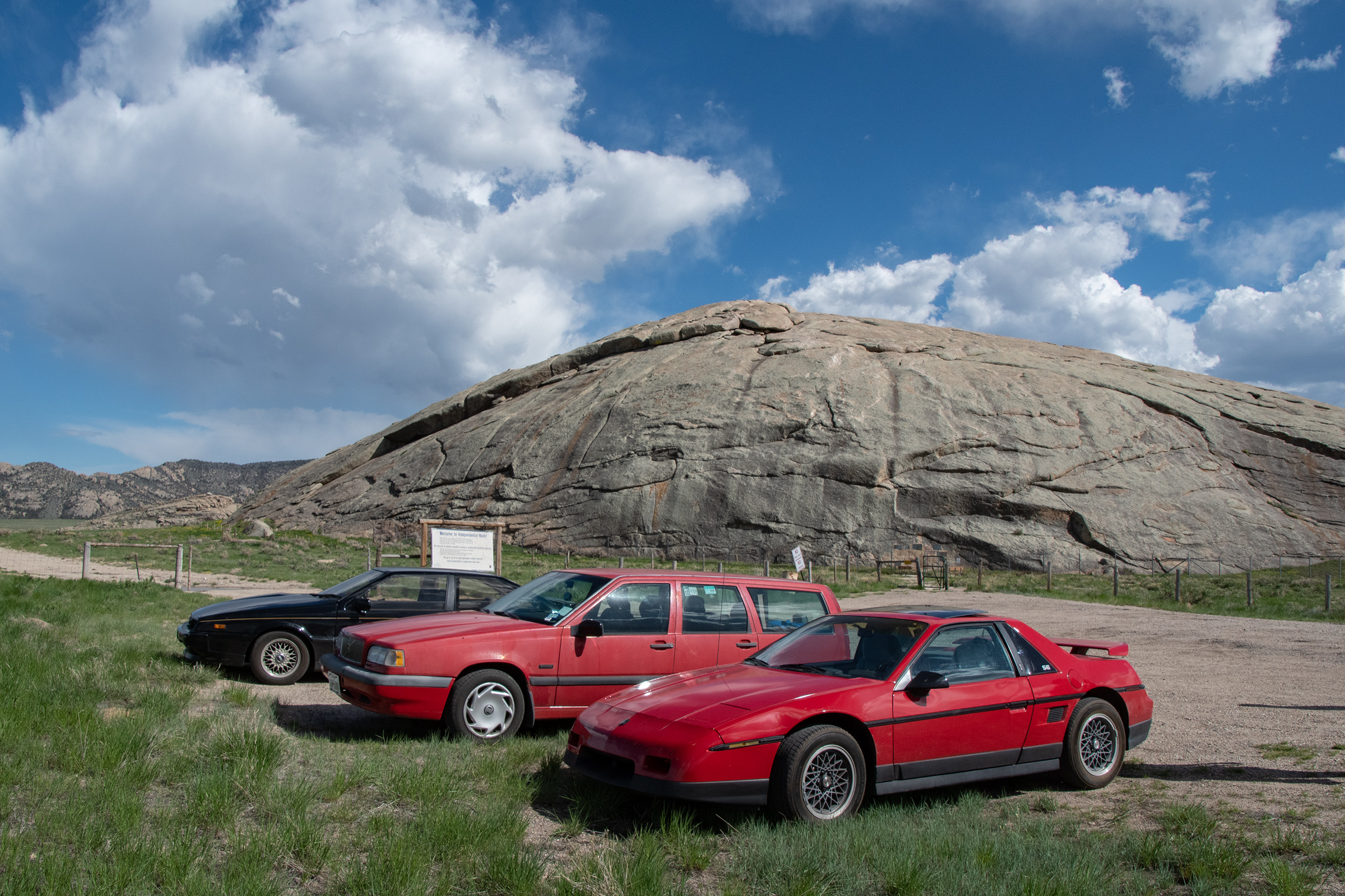
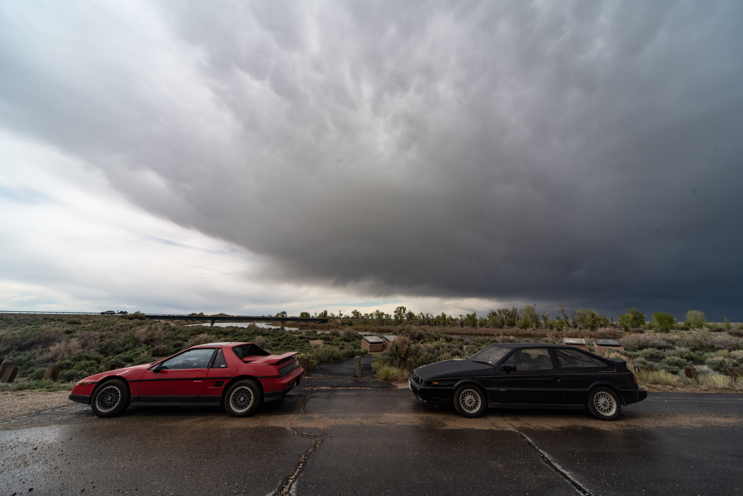
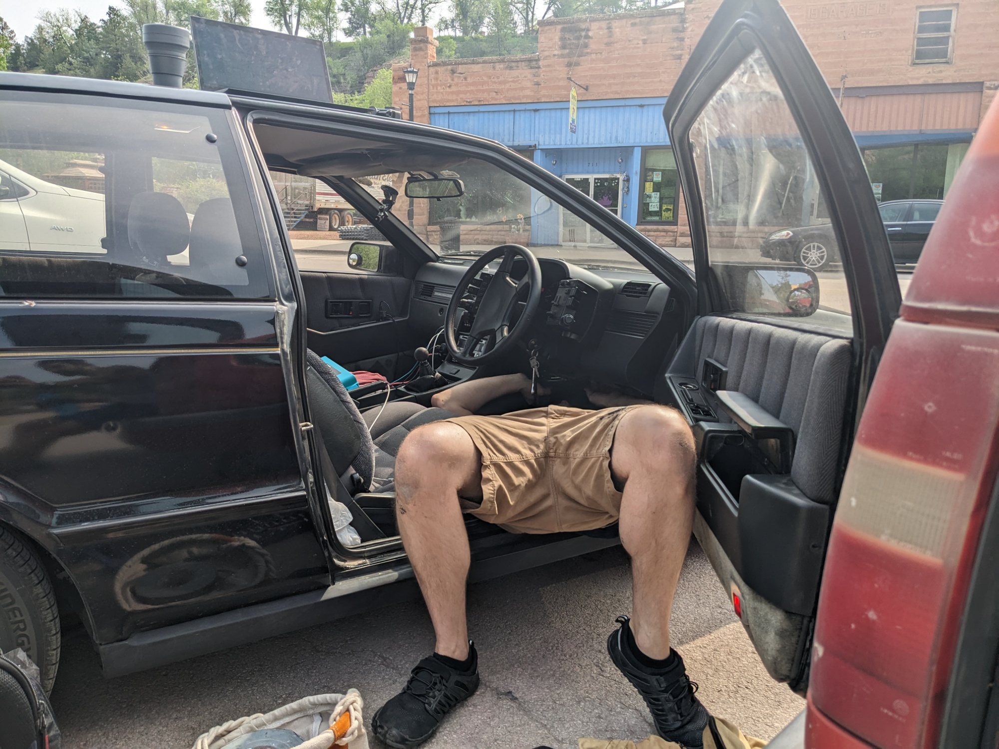
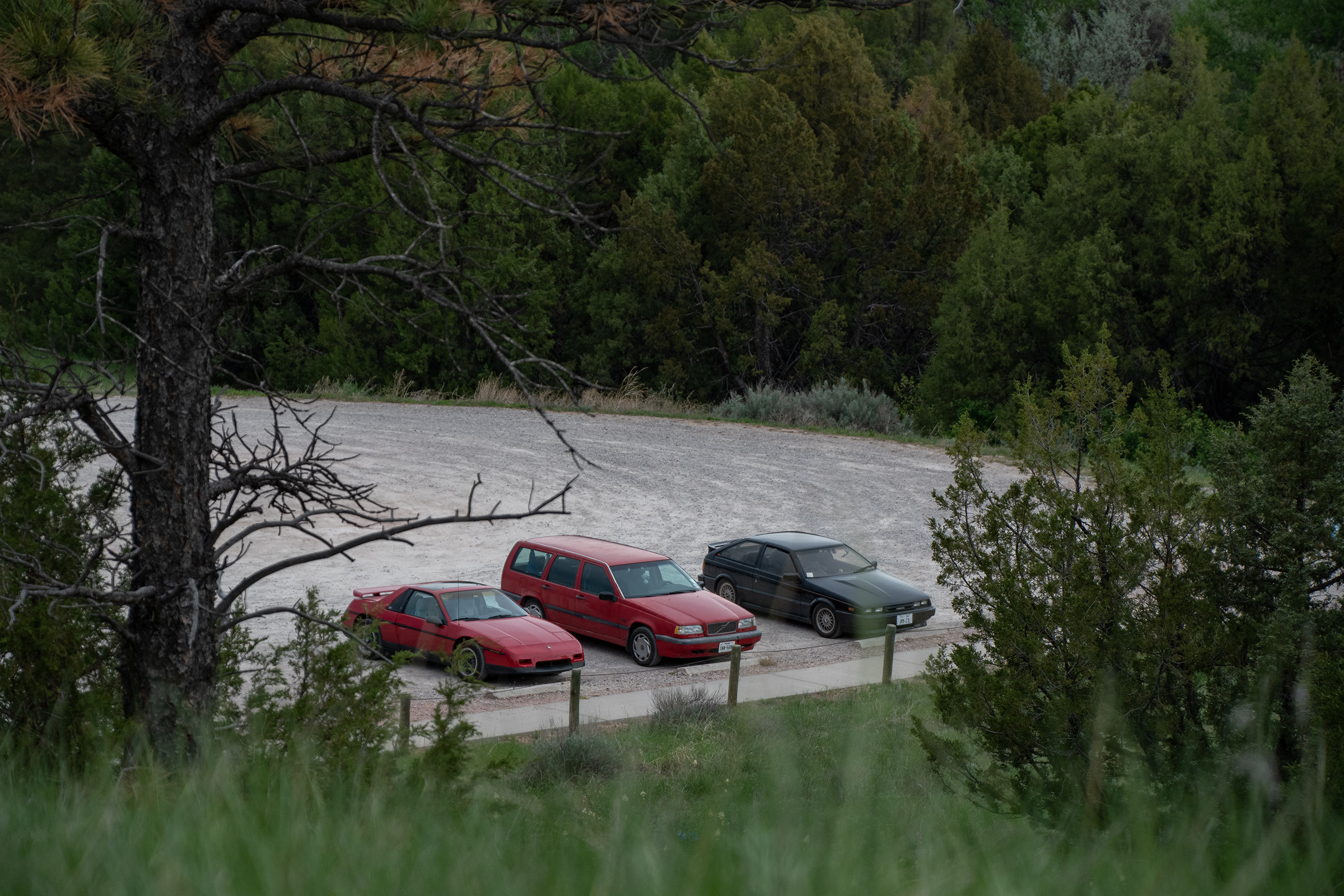
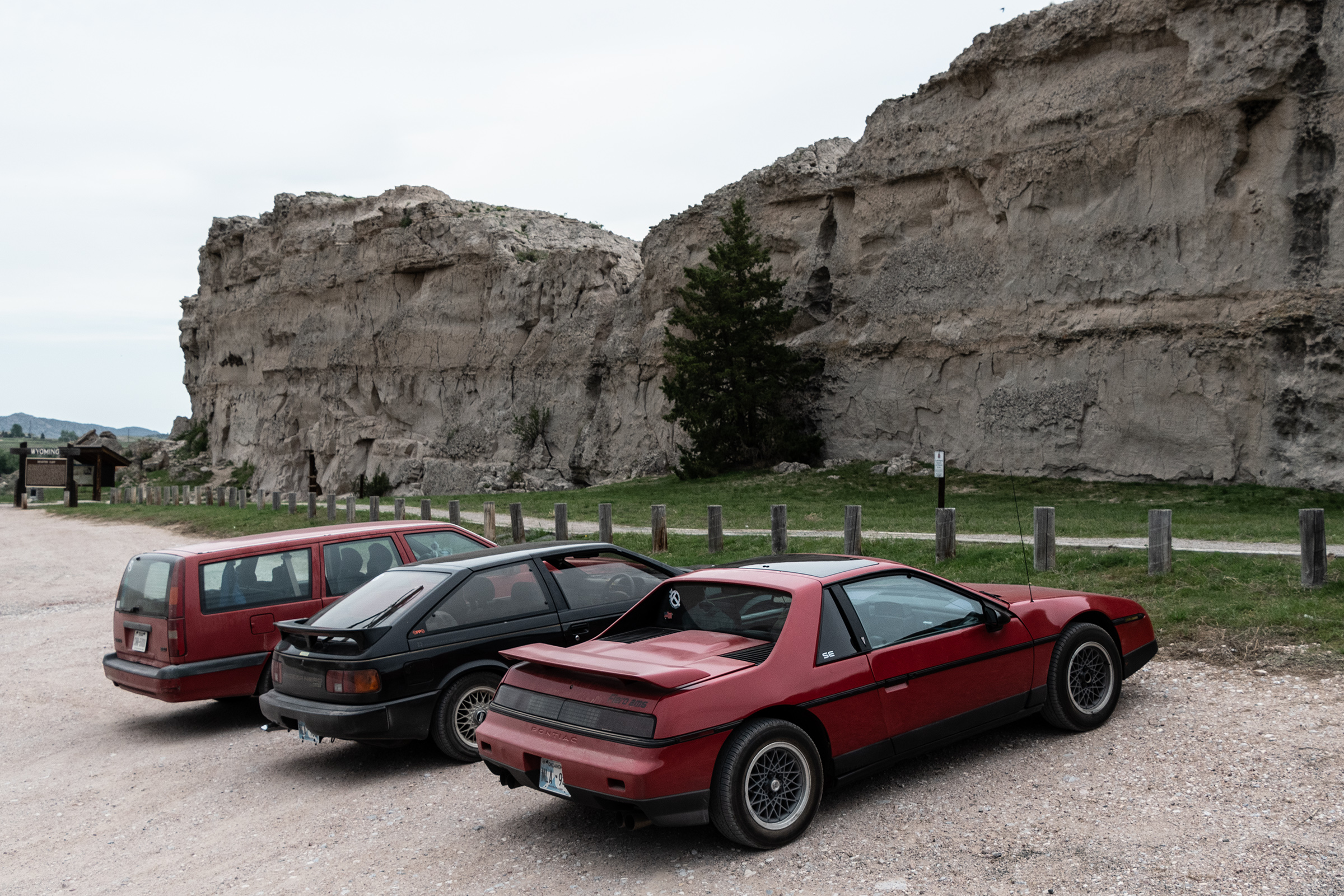
I suppose there’s been little mention of the cars over the past few days, as each has settled into its own brand of subtle dysfunction but continues its long cross-country trudge to the Great Northwest. George continues to fight periodically with the roof glass rattle, but the Fiero is running well. The Piazza still has its sloppy steering, and Evan was able to disable the heater thus restoring the usefulness of his air conditioning. And my Wagon’s spark plug mitigation is holding — and the distributor cap replacement seems to have also improved its idle, too — but it is still quite slow on hills. Hard to think I’m going to put it up for a fire sale soon… I’ve come to rather like it. And although Evan M has always planned to take the Piazza home, George is still very much undecided. He did finally buy a flight yesterday… but it is refundable.
Not entirely sure what tomorrow brings. We know we will visit the Three Island Crossing State Historic Site in Glenns Ferry, where many pioneers crossed the Snake River. We’ll also stop at Fort Boise. But we may actually spend some time in Boise, which is not our usual style, but I did note a wish to come back to Boise when I passed through here in the Celica in 2019.
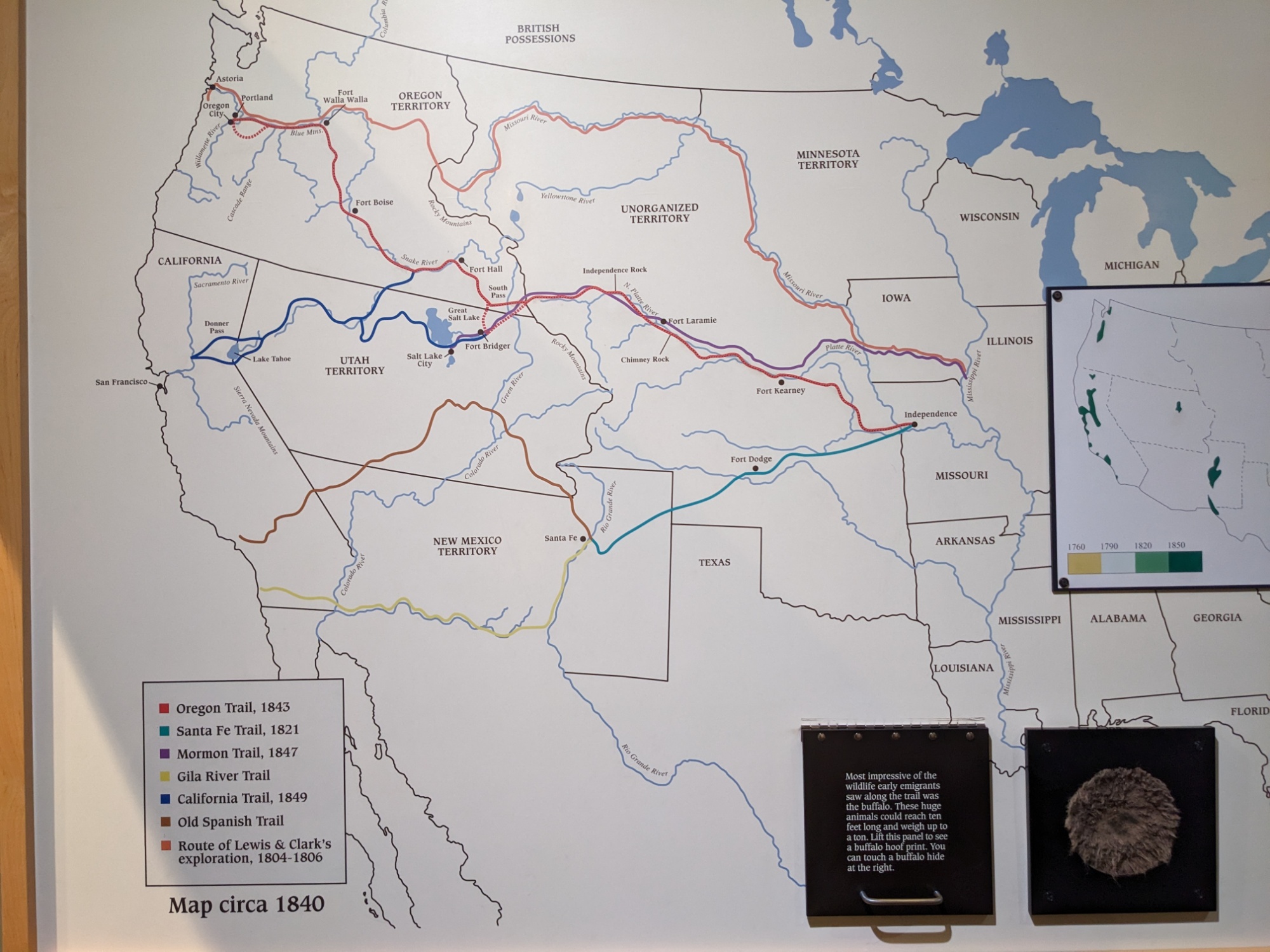
There is a “Main Oregon Trail Backcountry Byway” signed in this area, which I saw reference to once on an old PDF from Idaho’s Department of Transportation, but George and I can’t find it on any maps. And often “backcountry” means unpaved, which has been rough on both the Piazza and Fiero, so we may see if we can find where it starts but not sure if we’ll take it all the way to Boise.
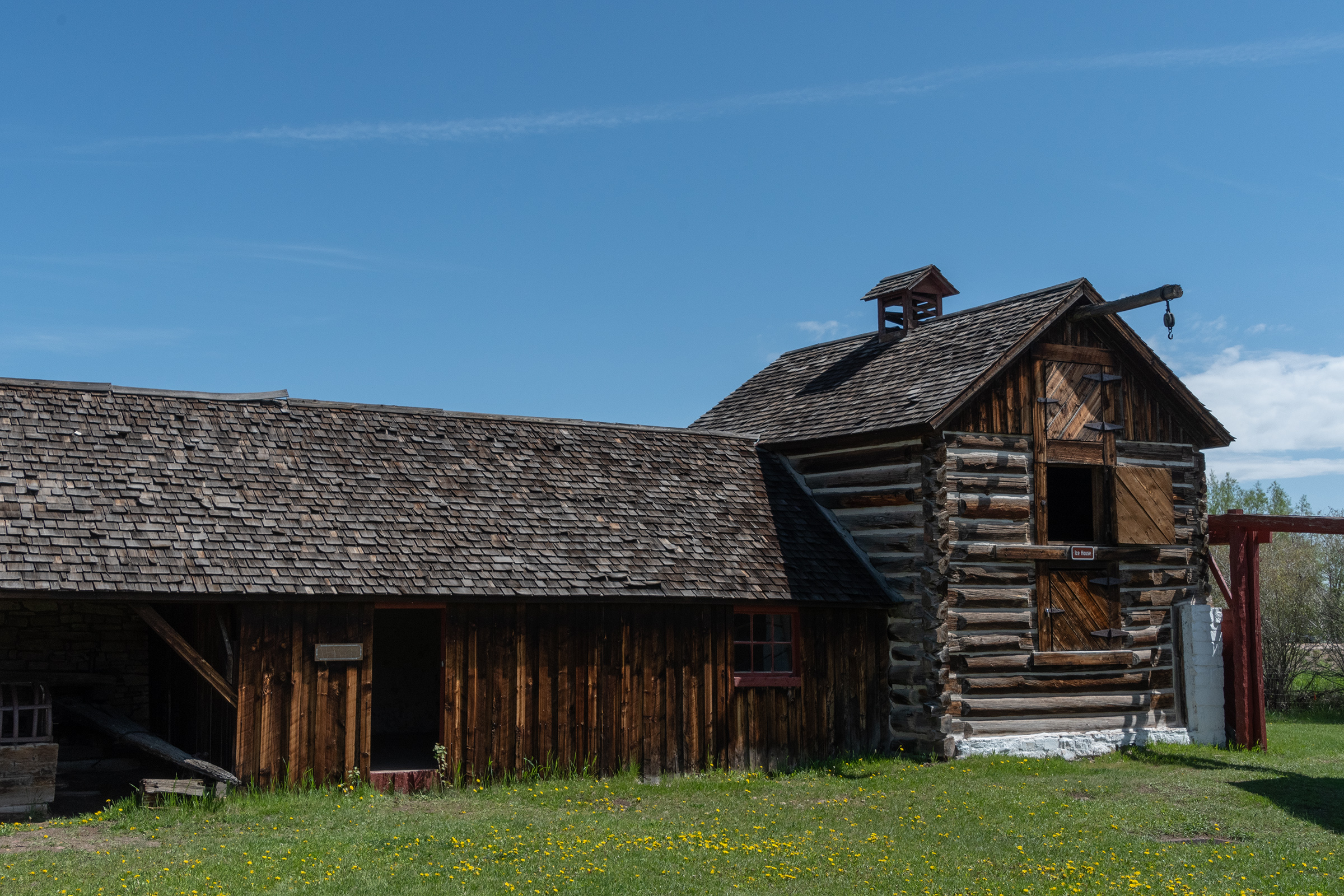
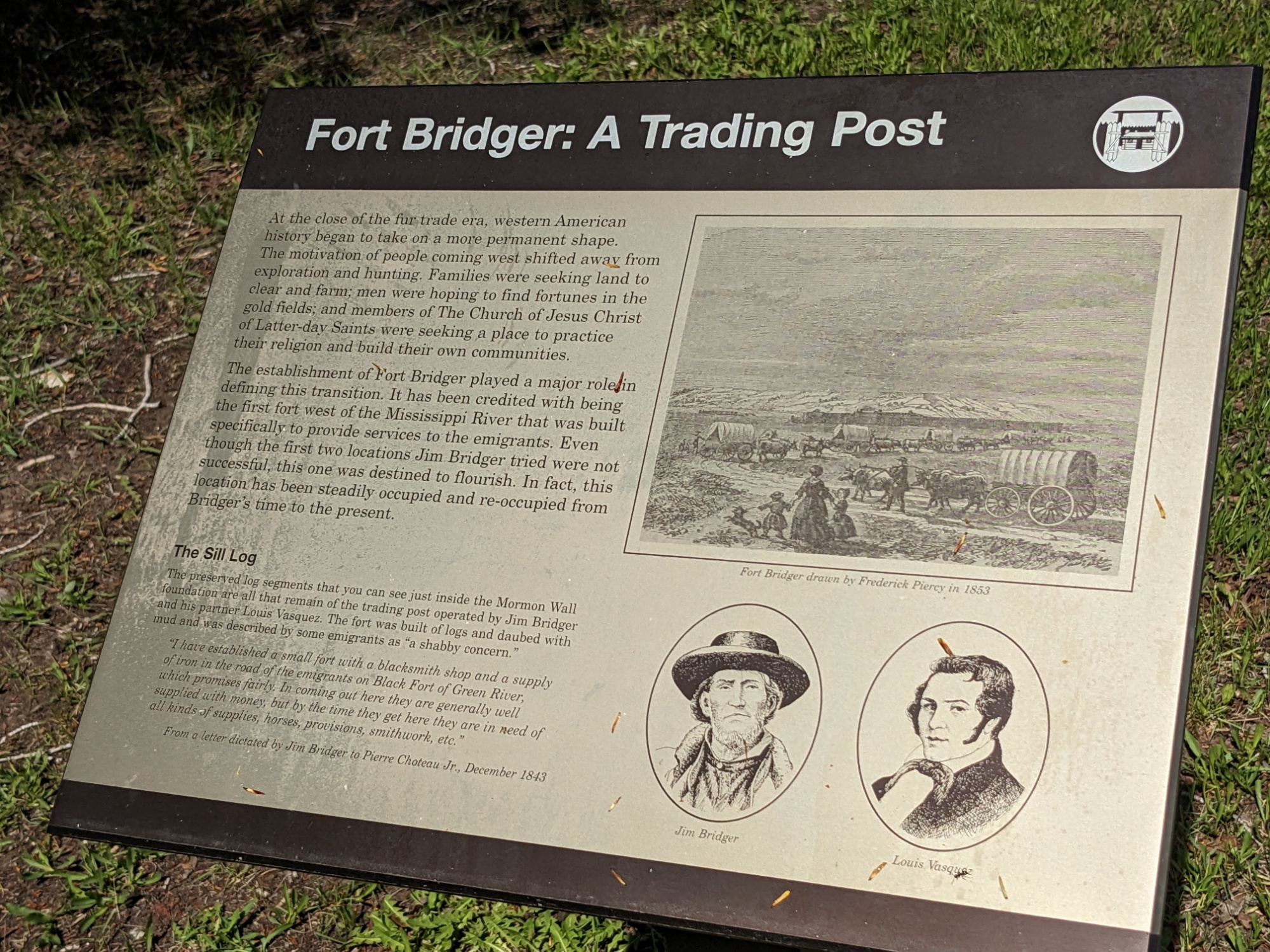
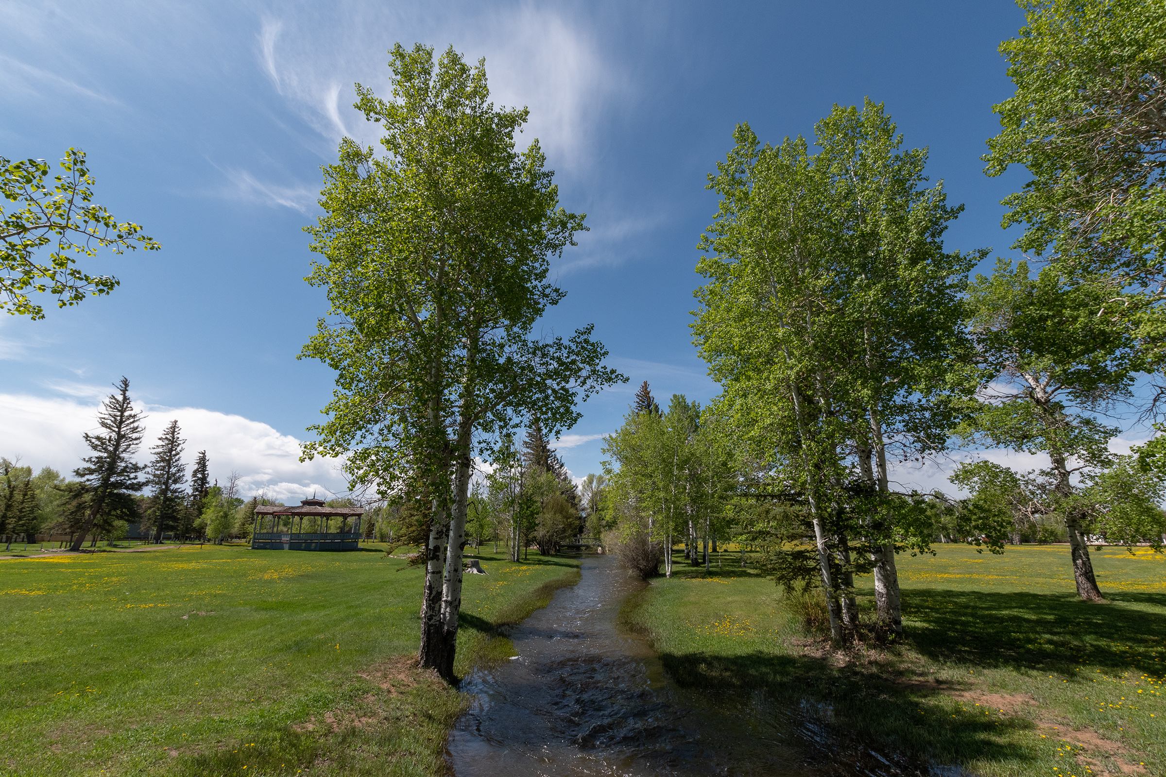
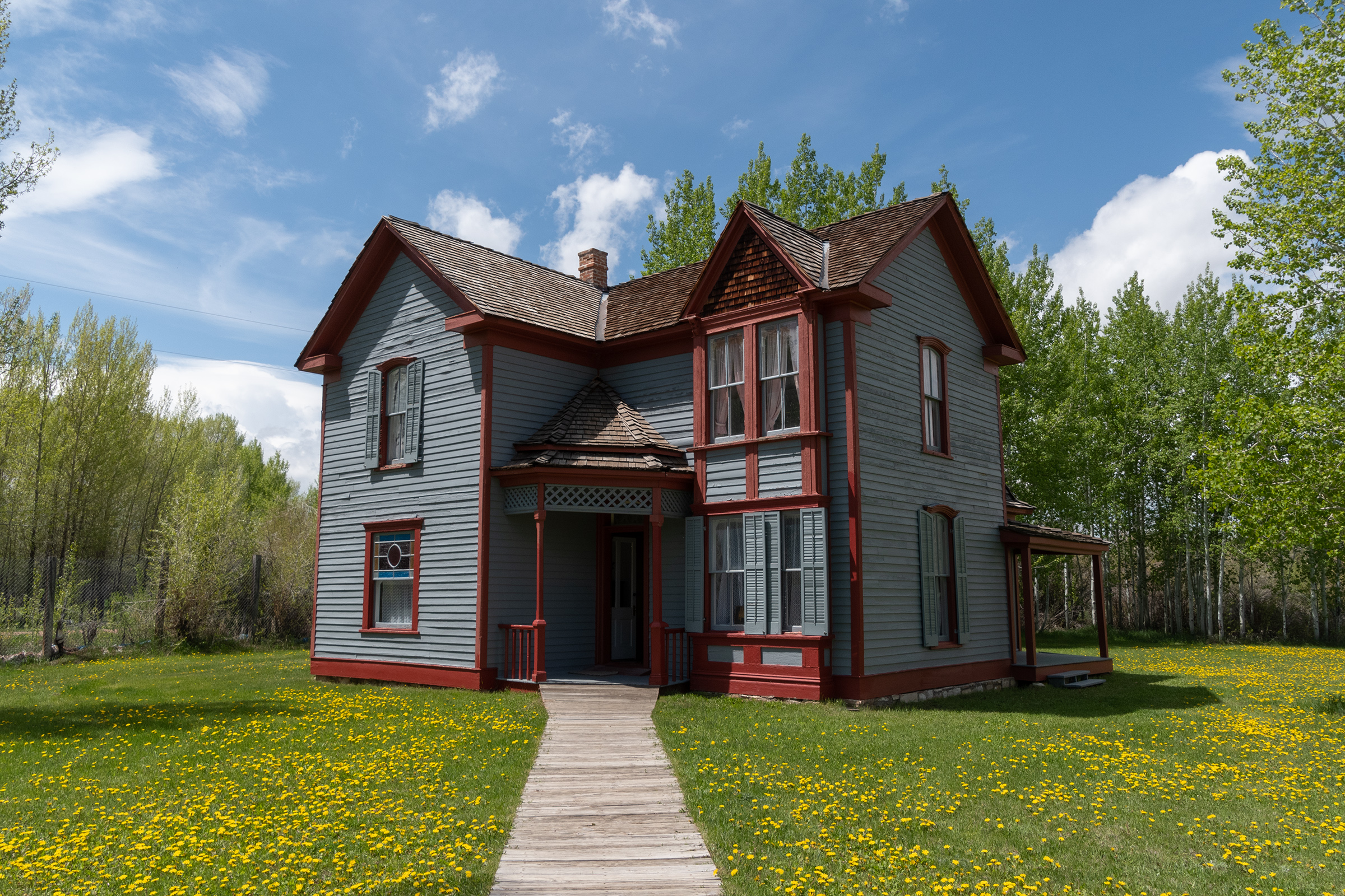
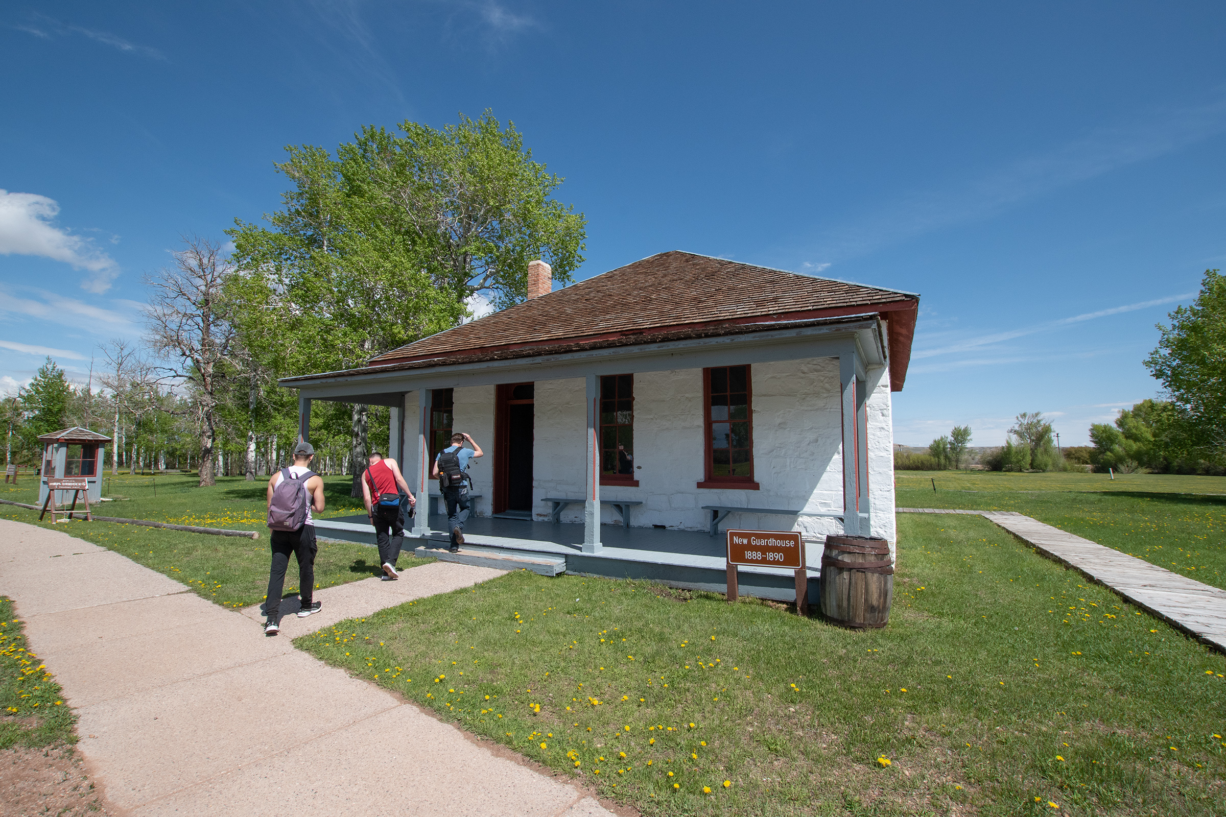
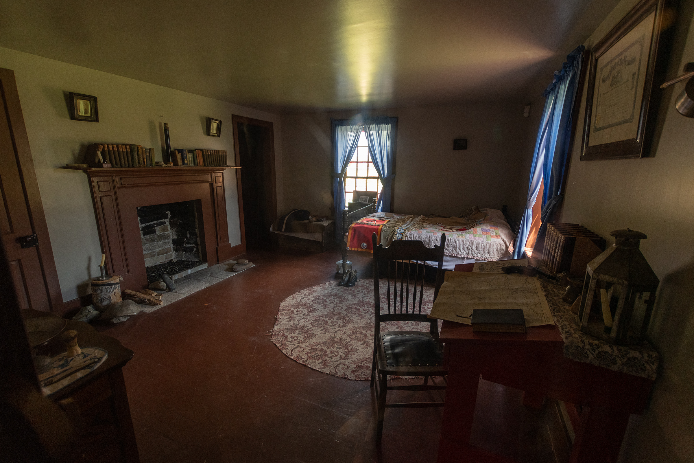
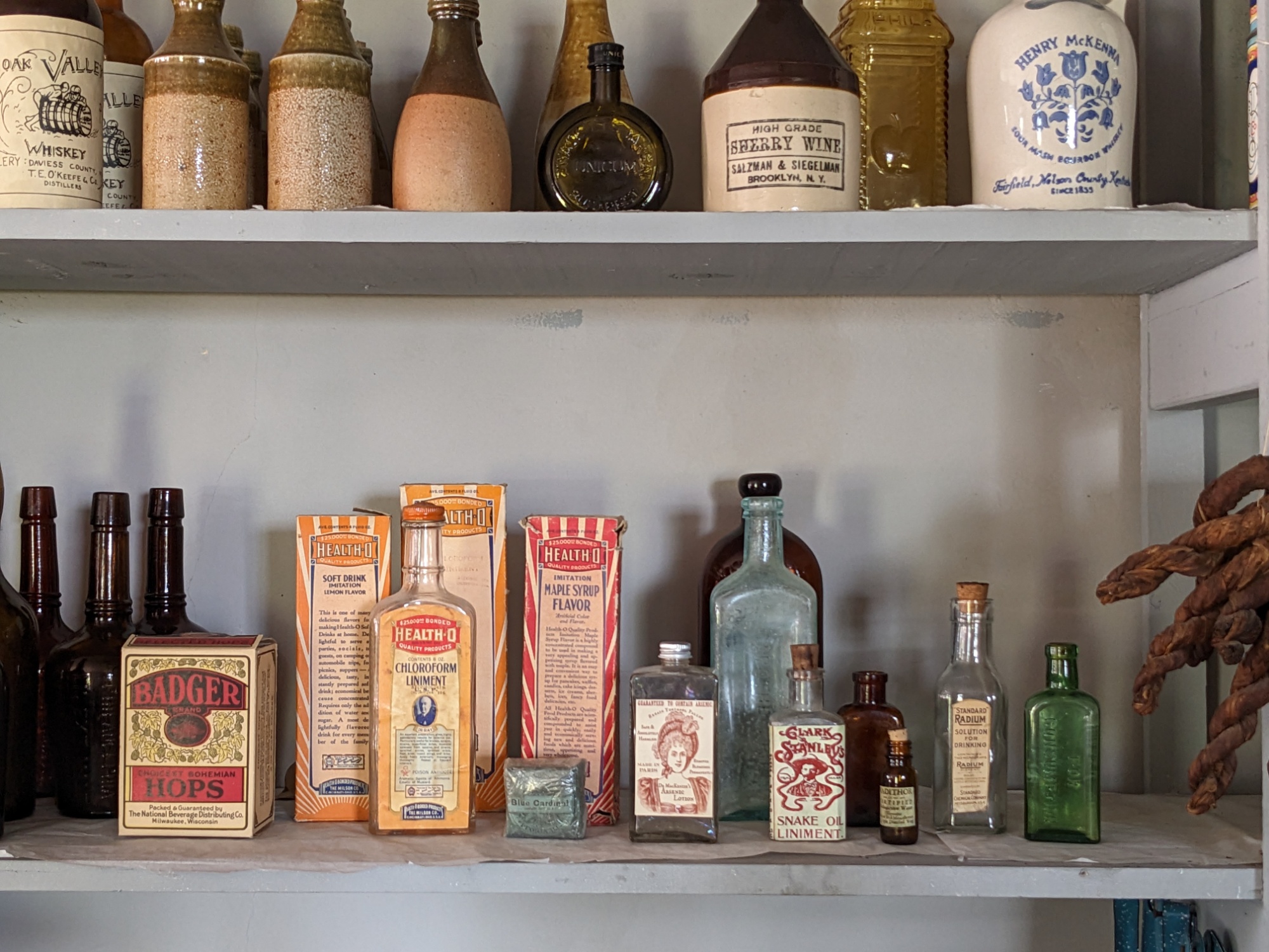
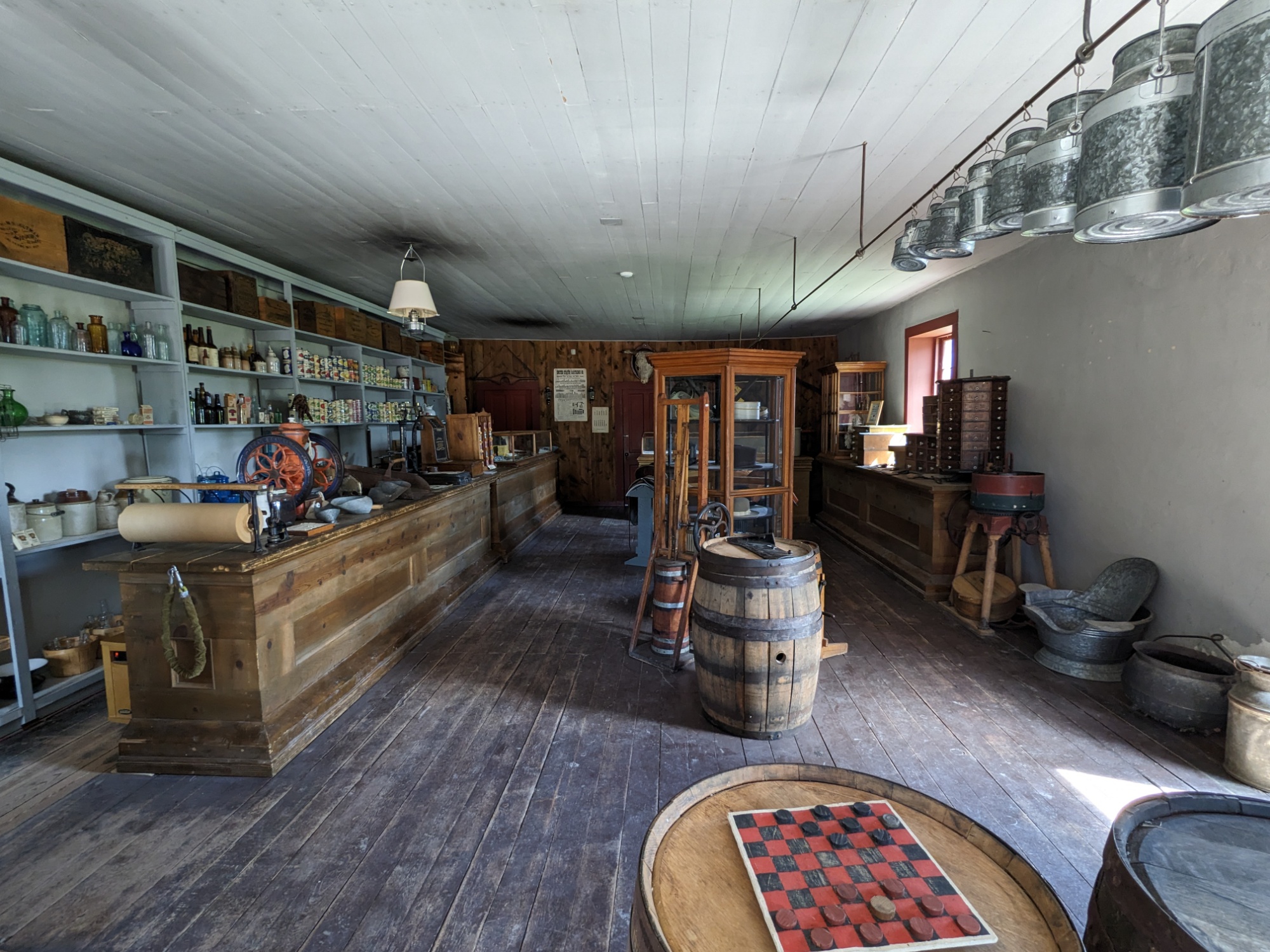
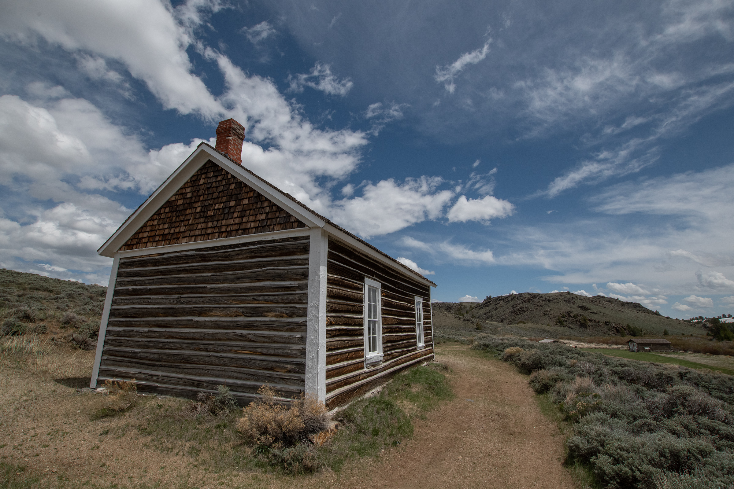
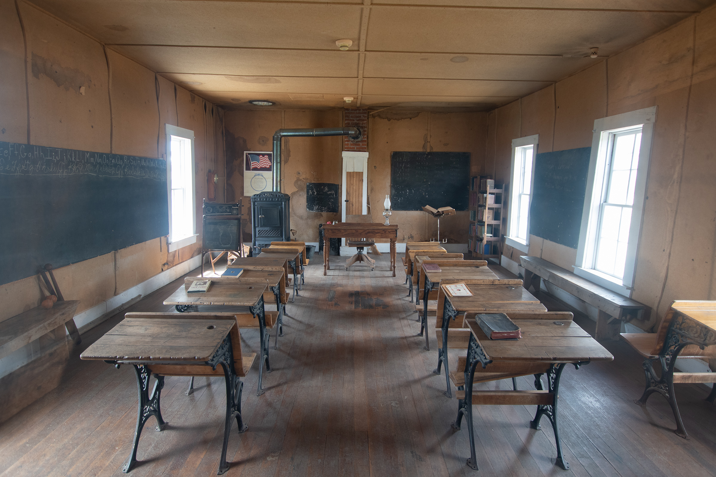
We started our day at the state historic site down the road from our Mini-Cabins Motor Court and Chinese Restaurant overnight. The fort, even moreso than Laramie, was renovated and well-maintained. Many buildings that had been deconstructed have since been rebuilt.
With the decline of the fur trade and the need to find a new way to make a living, mountain men Jim Bridger and Louis Vasquez built a small fort here, in what was then Mexico, as a stopover for the Overland Trails to Oregon and California in 1843. Consisting of only a few cabins and a stockade, Fort Bridger provided thousands of travelers each year with supplies, wagon repairs, and other assistance. In 1855, the Mormon trader Lewis Robinson bought the place in order to serve the thousands of Mormon immigrants headed for Utah. The new owner built a stone wall around the fort, measuring as high as 18 feet, but its wooden portions would not last much longer. As the U.S. Army approached during the Utah War of 1857, the Mormons burned the fort and retreated west.
Wyoming State Parks.
I’m sorry, what? Utah War? The four of us looked at each other, somewhat confused, not having heard that one before. Topic to research another day, but in short, apparently a war in which Mormon settlers blockaded Salt Lake City and resisted increased U.S. Army presence in the region, fearing religious persecution. In later years, the fort served as a center of trade and tribal negotiations as well.
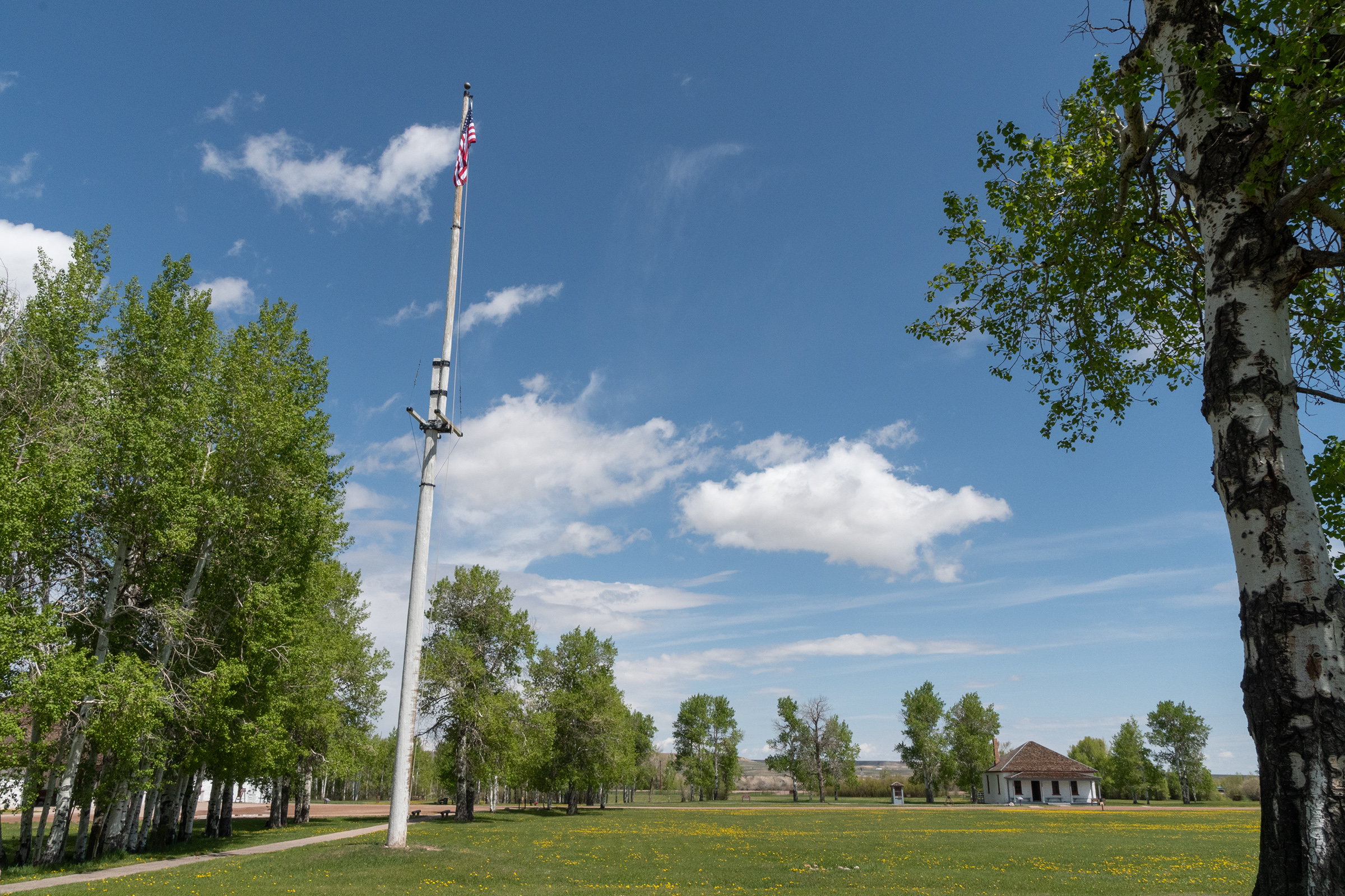
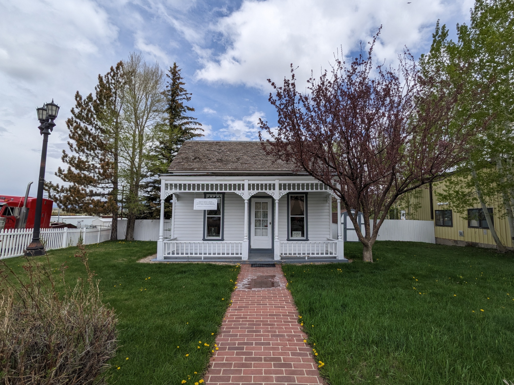
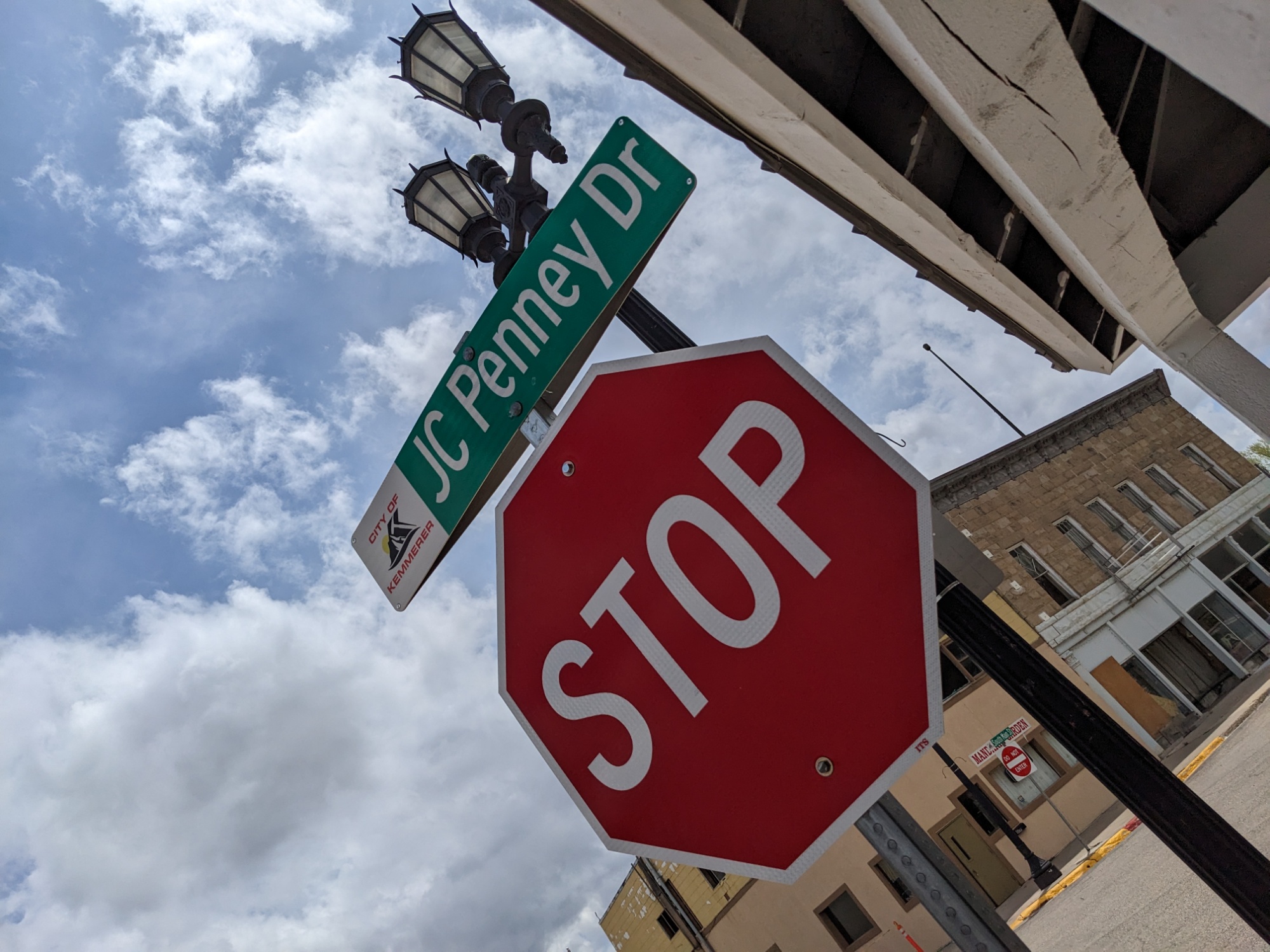
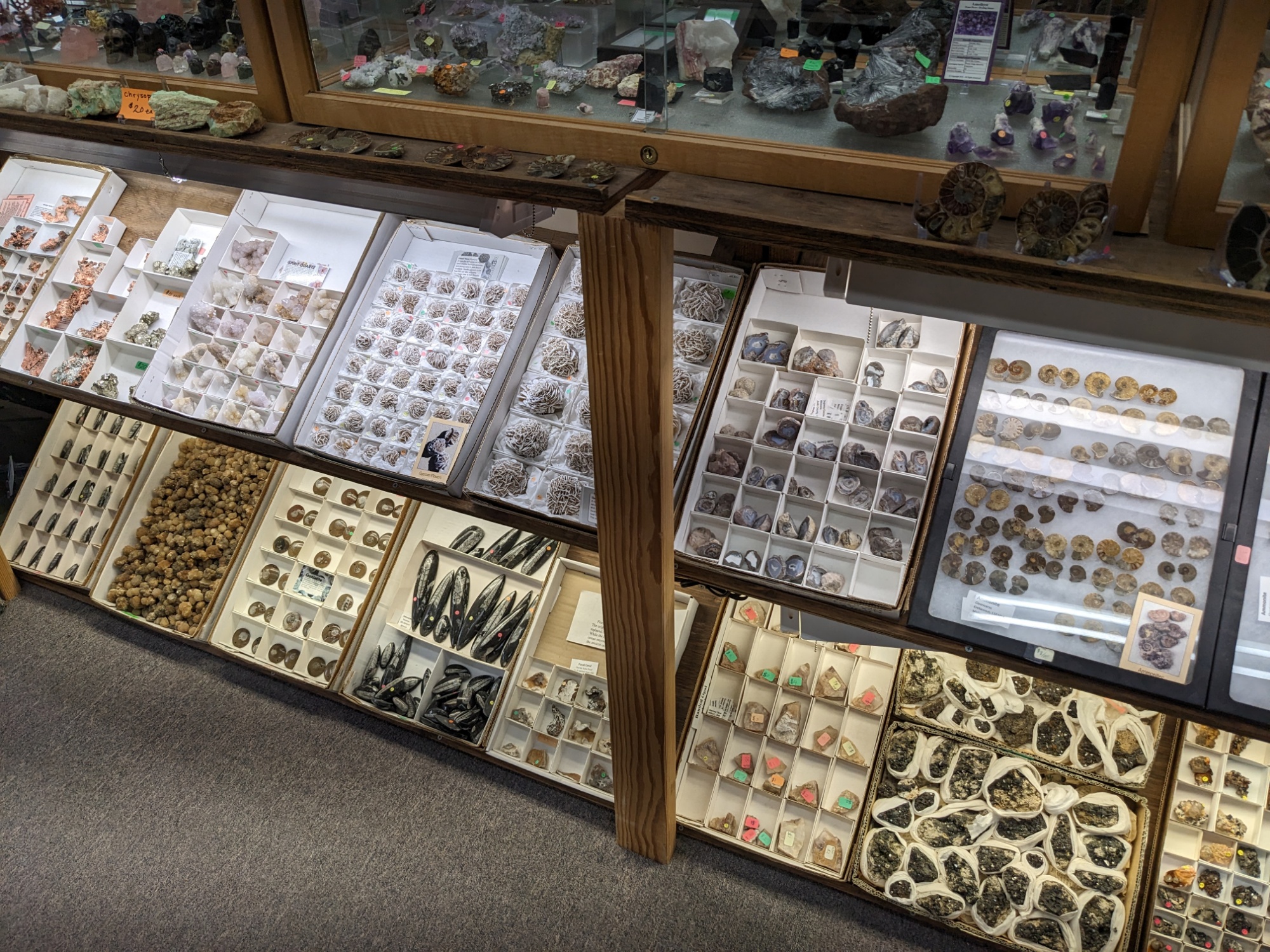
After Fort Bridger, we headed north to Kemmerer, Wyoming, a town with quite a fossil enthusiasm and the homestead and first store of retail mogul J. C. Penny.
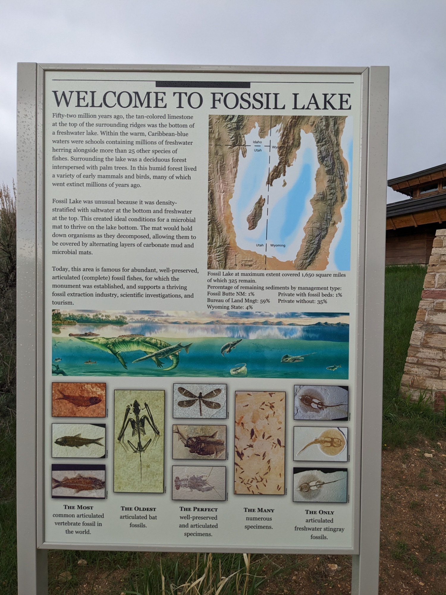
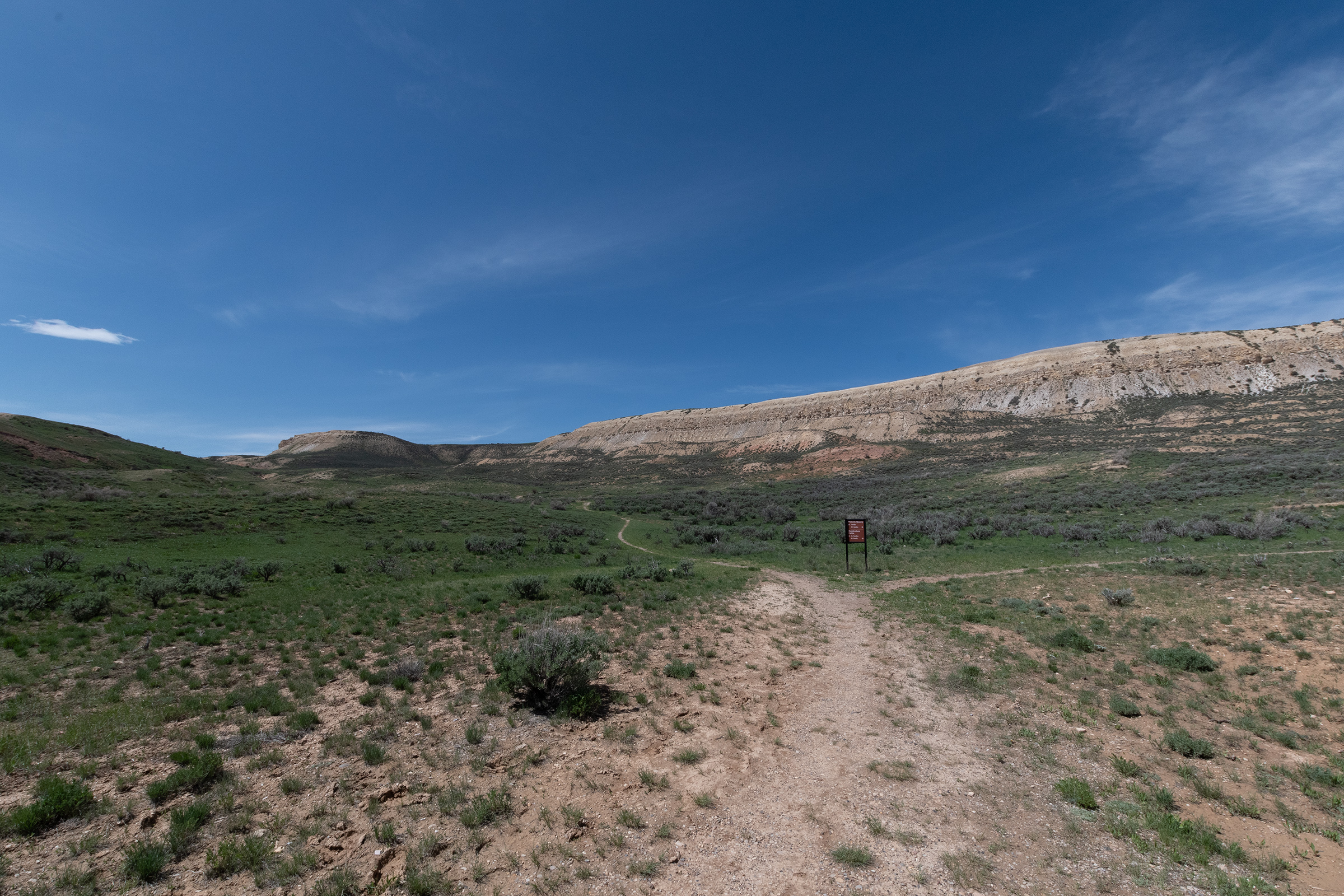
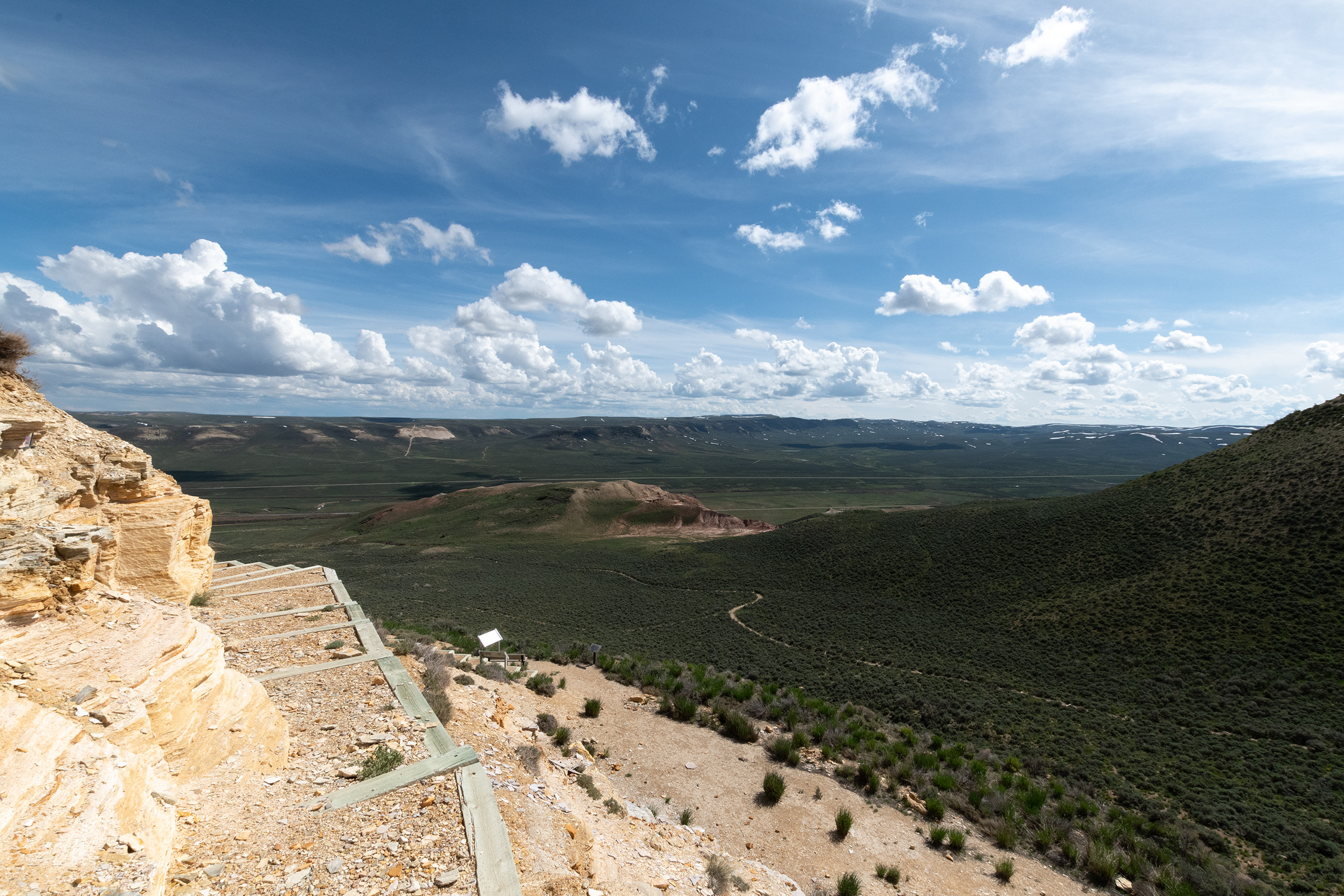
Fossil Butte National Monument
Fossil Butte is a tall rise out of a deep section of Fossil Lake, which spanned several present-day states approximately 50 million years ago. It drained slowly with soft sediment which left a multitude of fossils behind. Commercial and scientific quarries have been operating here since the late 19th century.
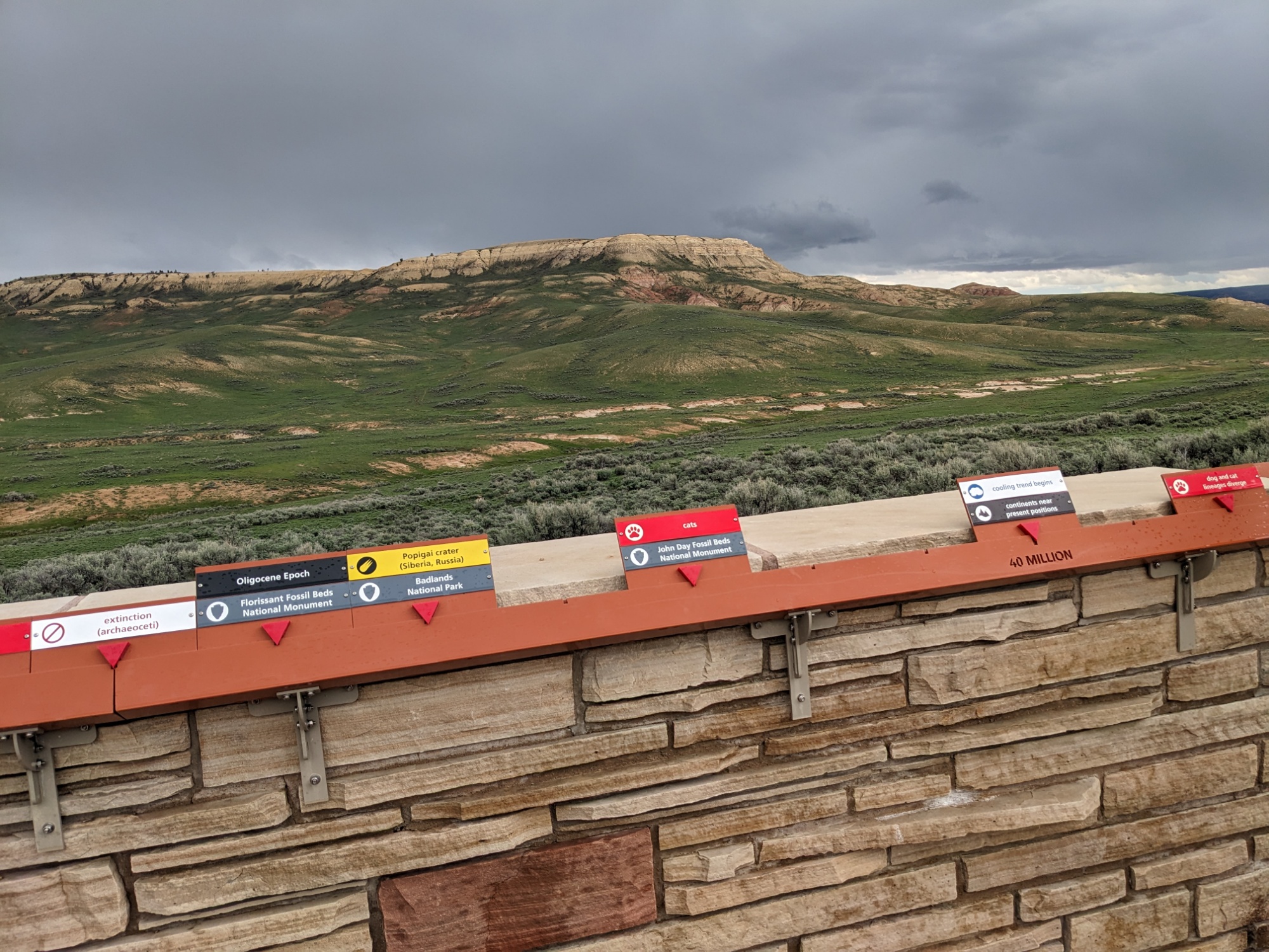
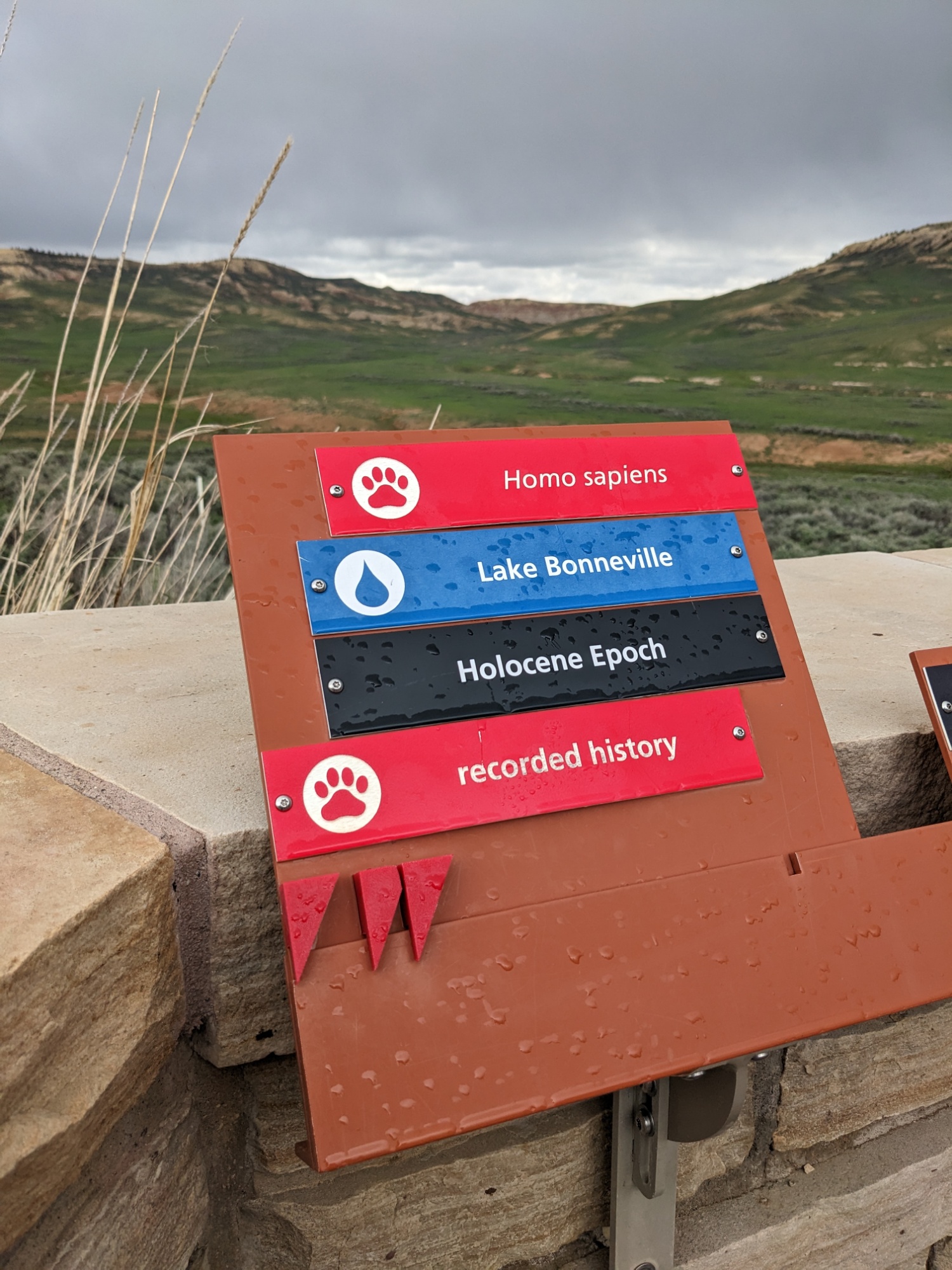
The park entrance begins a several-mile drive to the visitor center which features sign posts of a geological timeline. At the parking lot, the scale changes and the walkway toward the building features the development life on earth. In a timeline that is more than 2 miles long, humans exist only within the last two inches.
After an amazing visitor center fossil exhibit, we walked the historic quarry trail showing a campsite of the first independent commercial excavator, who camped in the area while digging. In the winters, he operated a gas station back in a nearby town.
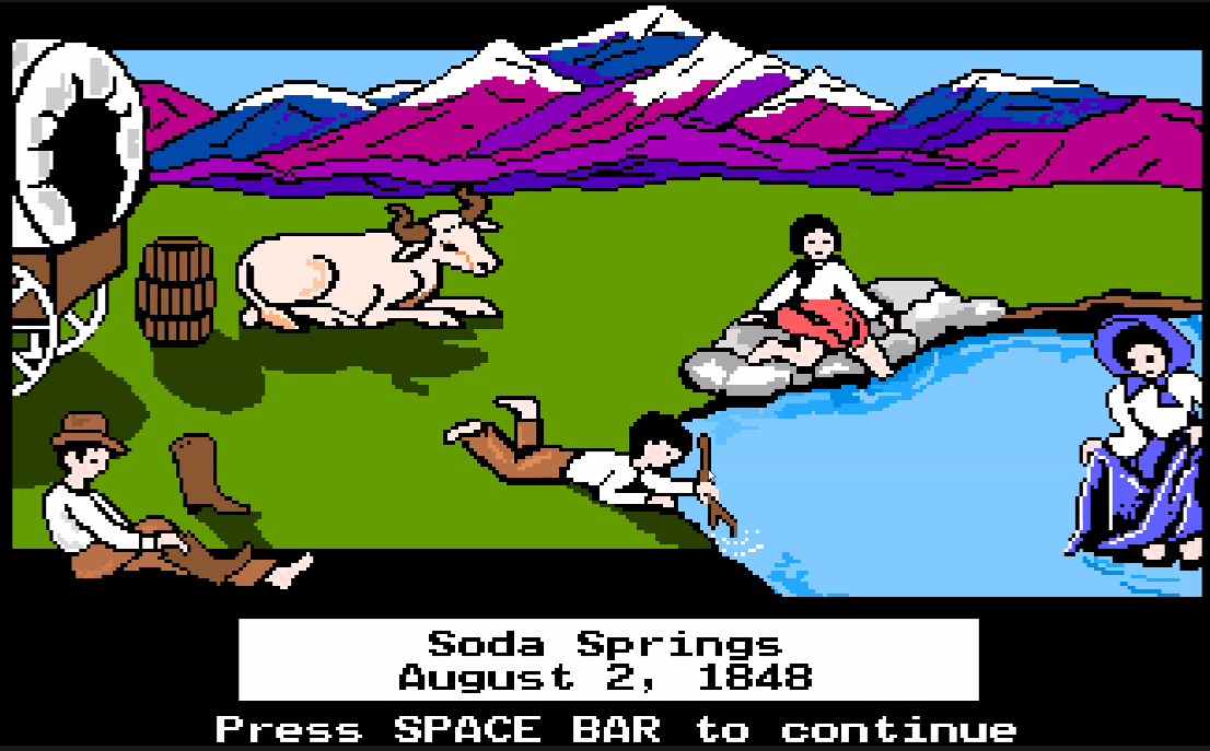
Soda Springs, Idaho
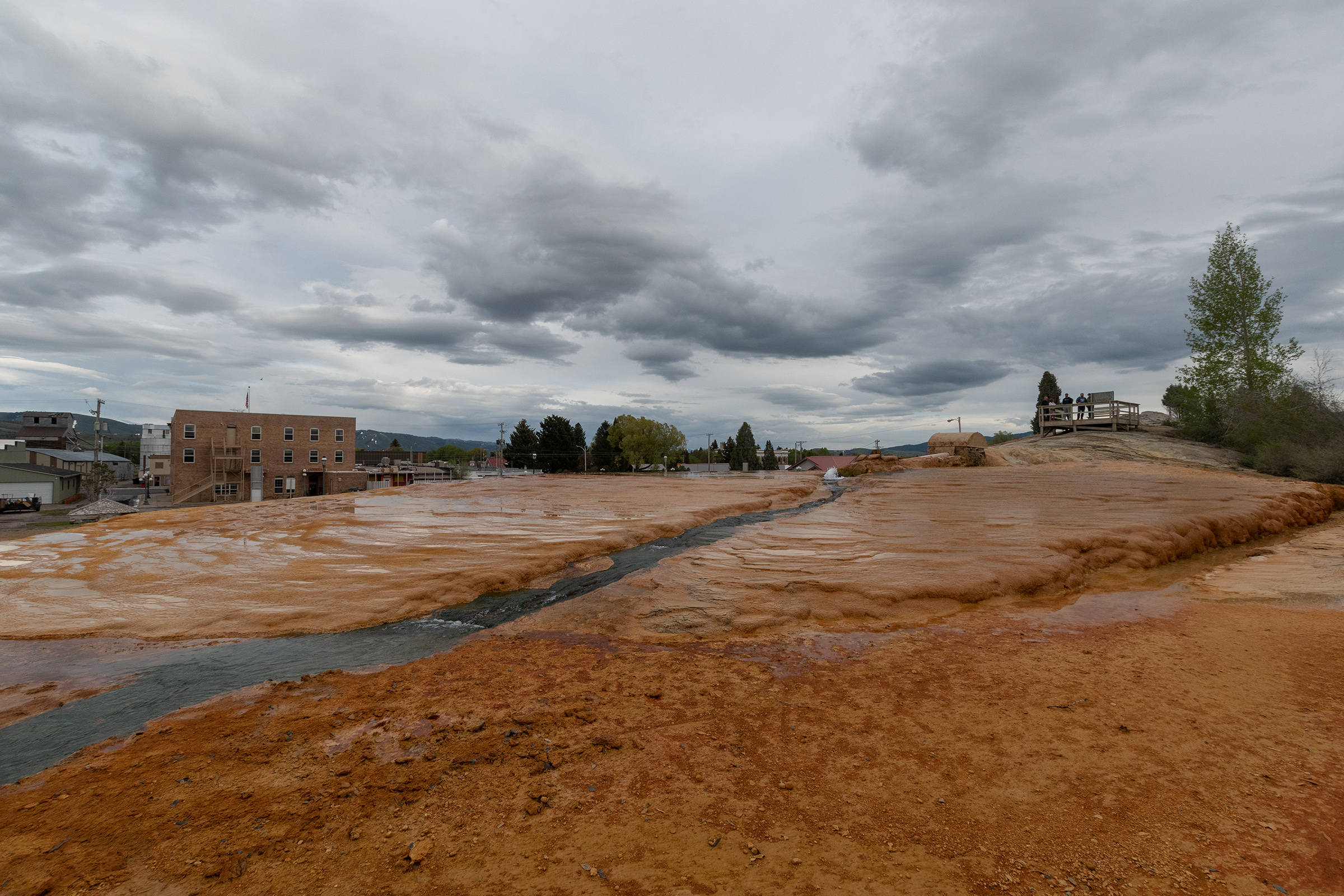
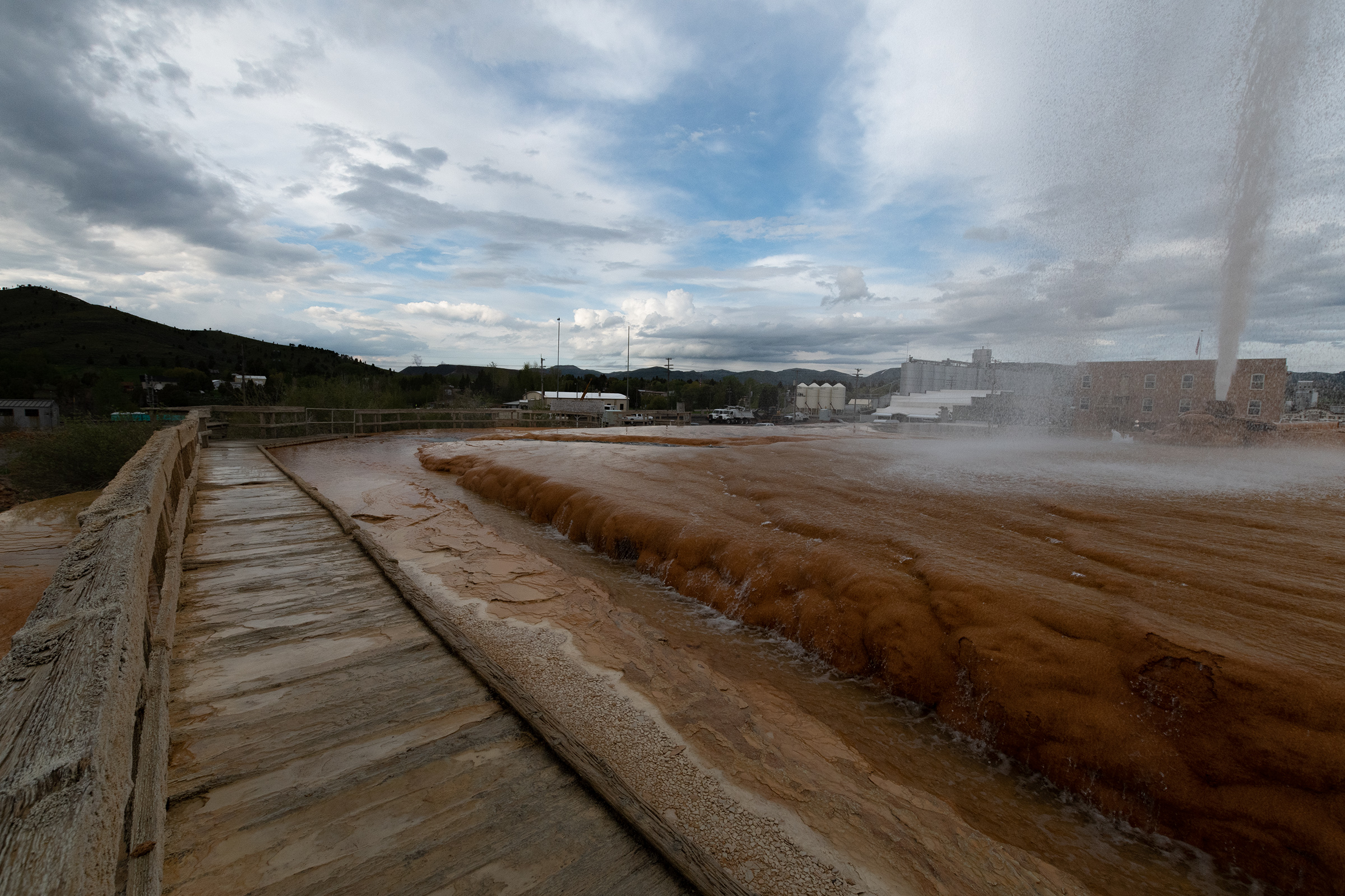
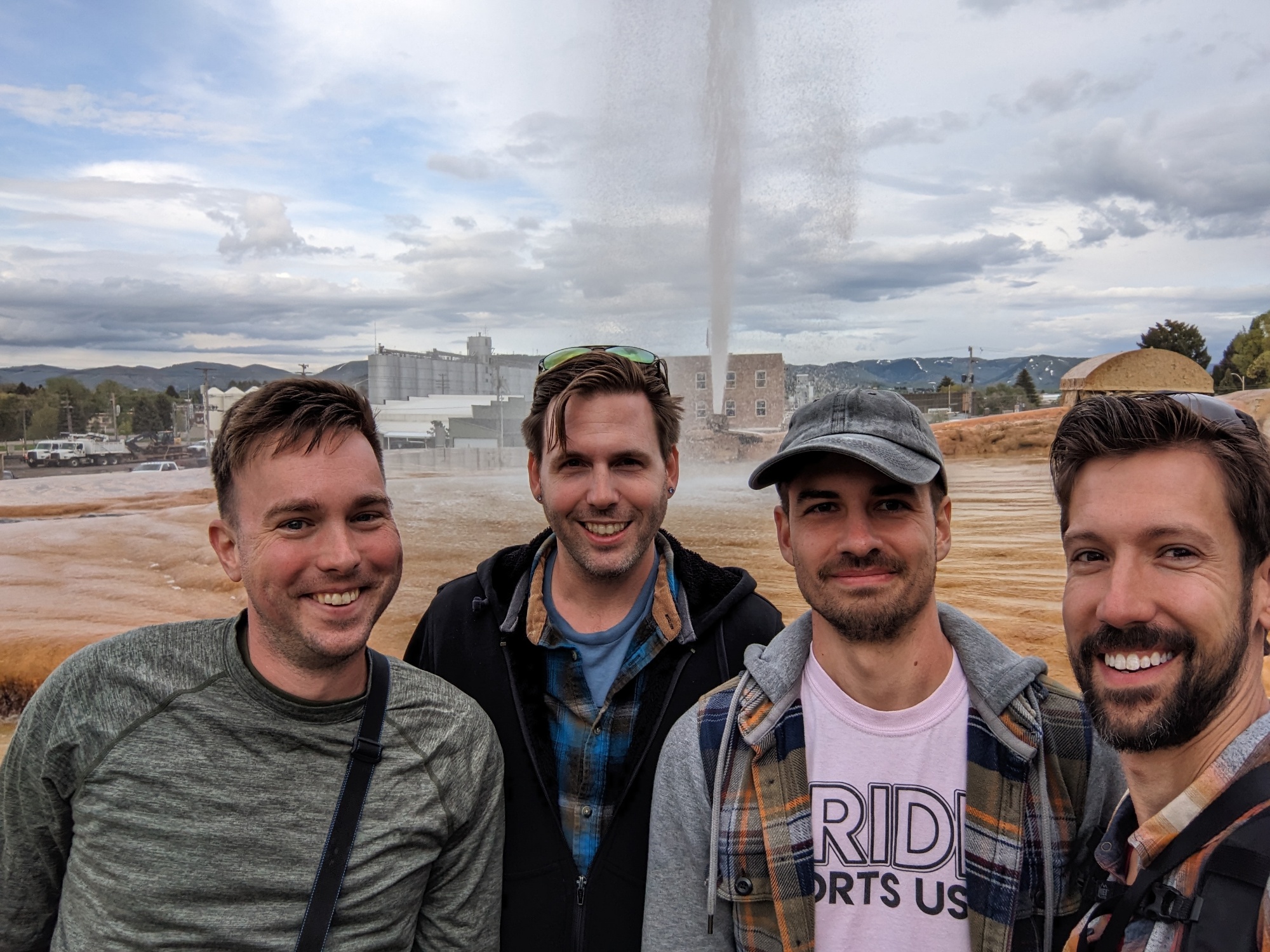
Our next game-inspired stop was Soda Springs, a camping and trading post just inside Idaho. When I went looking for “the spot” in Soda Springs to prove our that we’d been there, it seemed like there were several roadside signs, a park along the river, or a “world famous” mineral water “captive” geyser. So obviously we had to go there.
“Geyser erupts every hour on the hour,” is a suspicious sign in the parking lot at the end of an alley behind a bar, but it sure led to a modest boardwalk around the travertine pools of a mineral spring. Apparently in the quest to find a geothermal hot water source for a community pool in the 1930s, this erupted and was later capped, and now features this periodic mechanism to “release pressure” hourly. 🤔 ‘kay.
No one was there when we happened upon the place at 10-til the hour, but with about two minutes to go, about twenty people rushed up from the parking lot to watch the 7 minute eruption of this mineral water. It all seemed rather manufactured, but still cool. In the pioneer days, this area’s spring-fed water features were more like pools.
Traveled… along the bank of the Bear River & are encamped at Soda Springs. This is indeed a curiosity. The water tastes like soda water, especially artificially prepared. The water is bubbling and foaming like boiling water. I drank of it… We find it excellent for baking bread, no preparation of water is necessary. Take it from the fountain & the bread is as light as any prepared with yeast.
Diary of Sarah White Smith, July 24, 1838. Collected by Legends of America.
“These natural bubbling pools of carbonated water, caused by ancient volcanic activity, were first called “Beer Springs”. Visited by local Indians, fur traders, and trappers prior to the days of the Oregon Trail emigrations, the springs were rightfully considered to be one of the marvels of the overland trails.”
Grandma’s House
And then finally, we rolled into Pocatello, Idaho, to the AirBnB that most captured Evan M’s heart — what can only be described as someone’s grandmother’s house. Behold the scratch-n-sniff gloriousness of these views:
Tomorrow is Craters of the Moon National Monument, our other major detour off The Oregon Trail, but a park I’ve wanted to visit for quite a while.
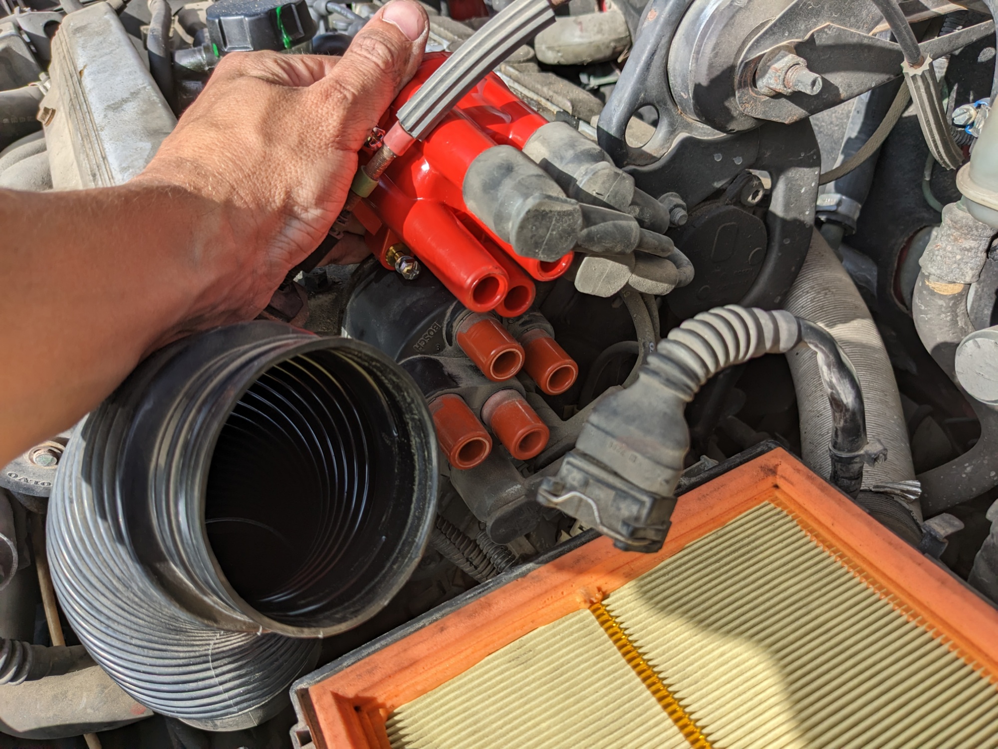
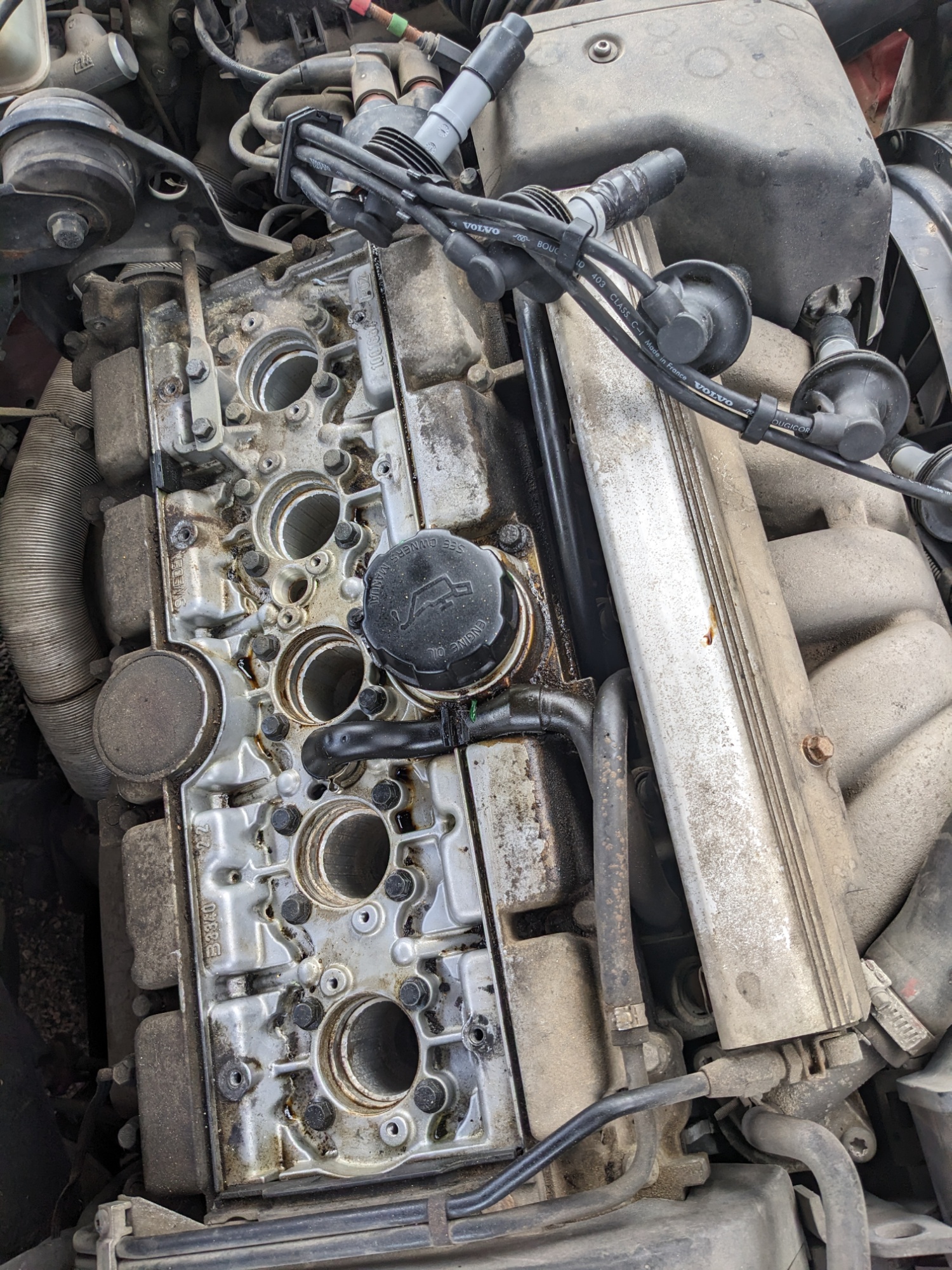
I replaced my distributor cap this morning to see if that would continue my improved running. I got it done faster than I expected to and the wagon started well. The old one had some residual scorch marks inside, likely from arcing and misfires because of the fouled spark plugs.
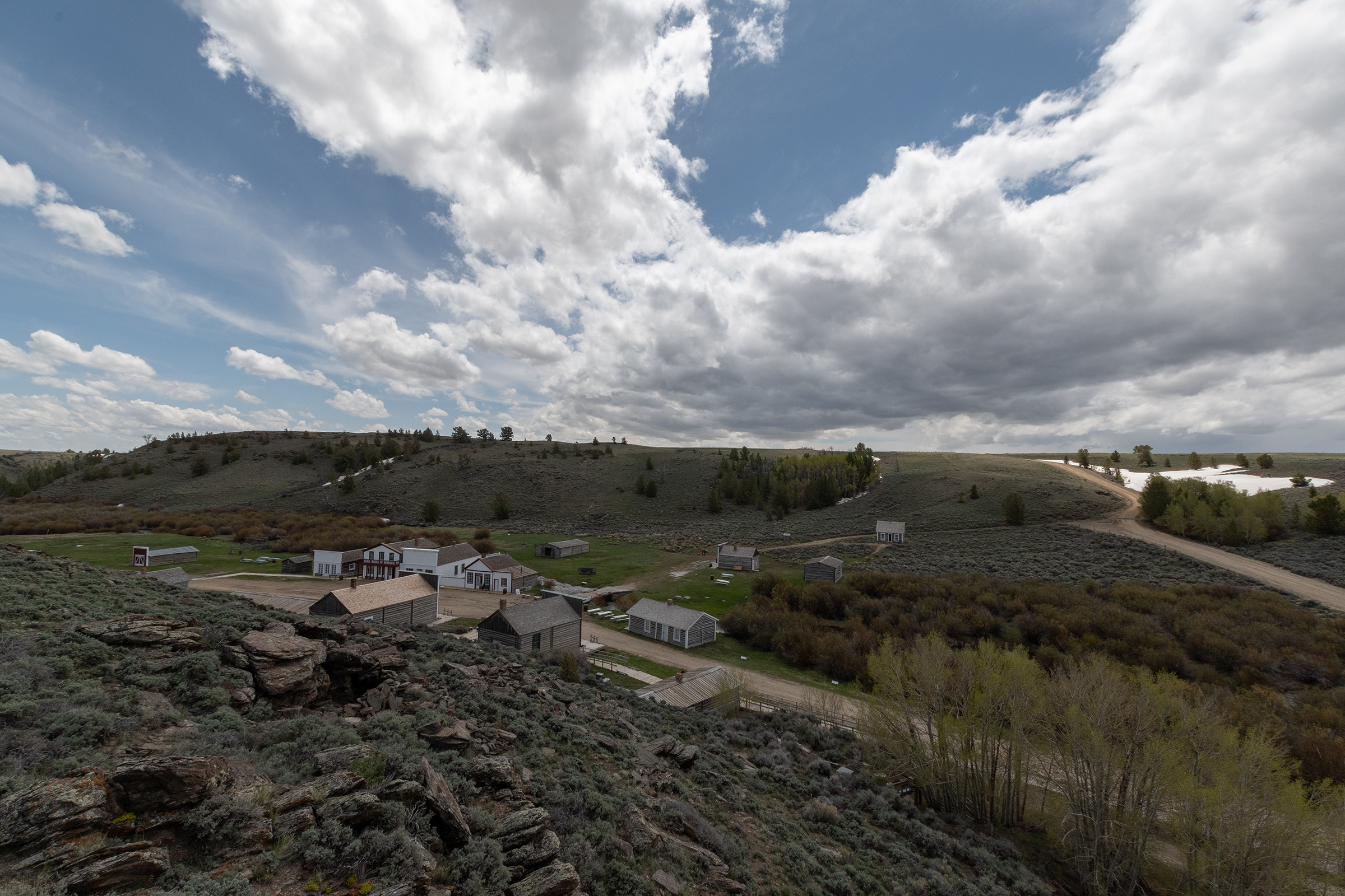
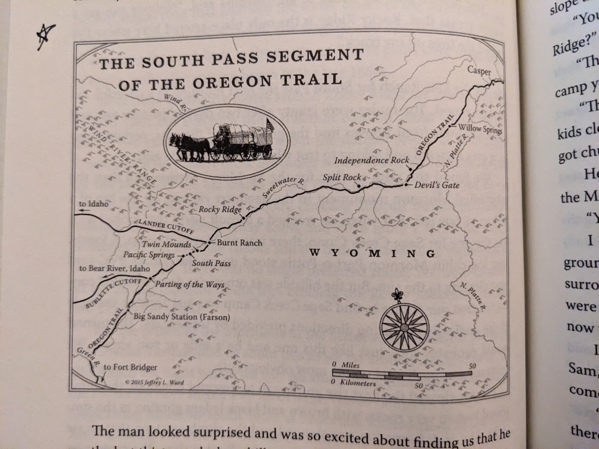
South Pass City
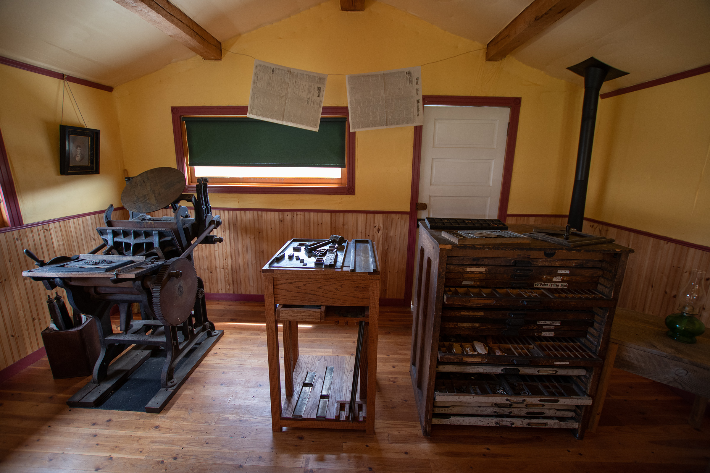
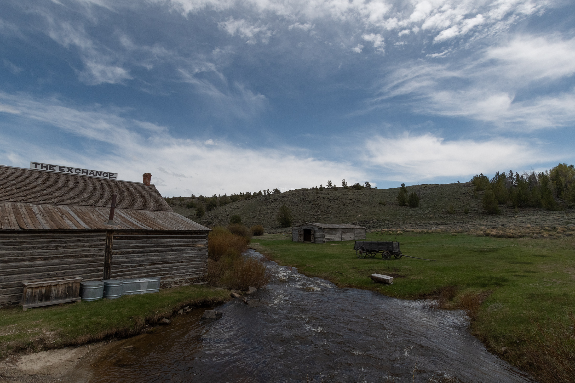
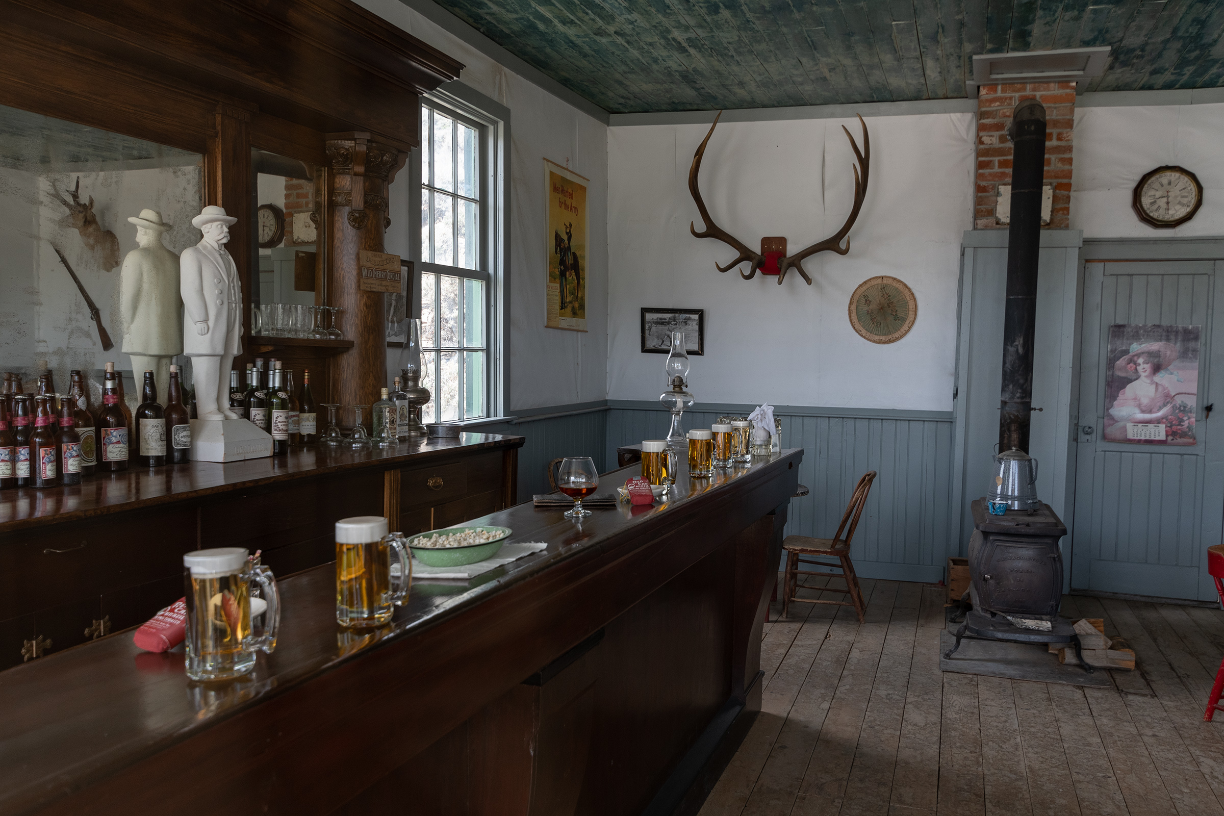
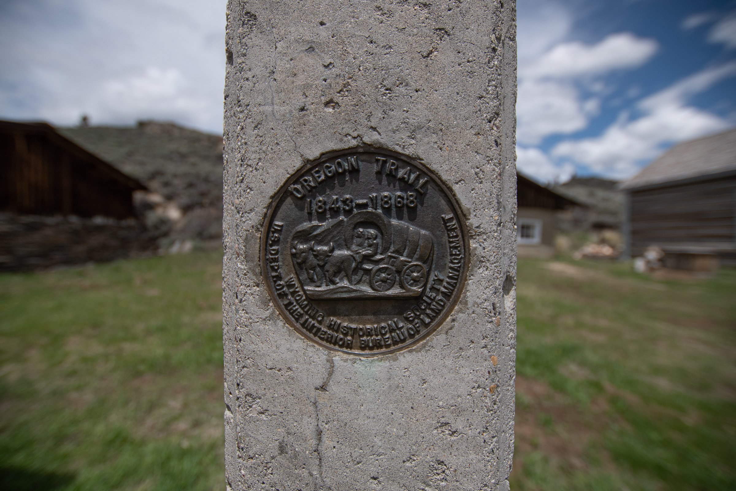
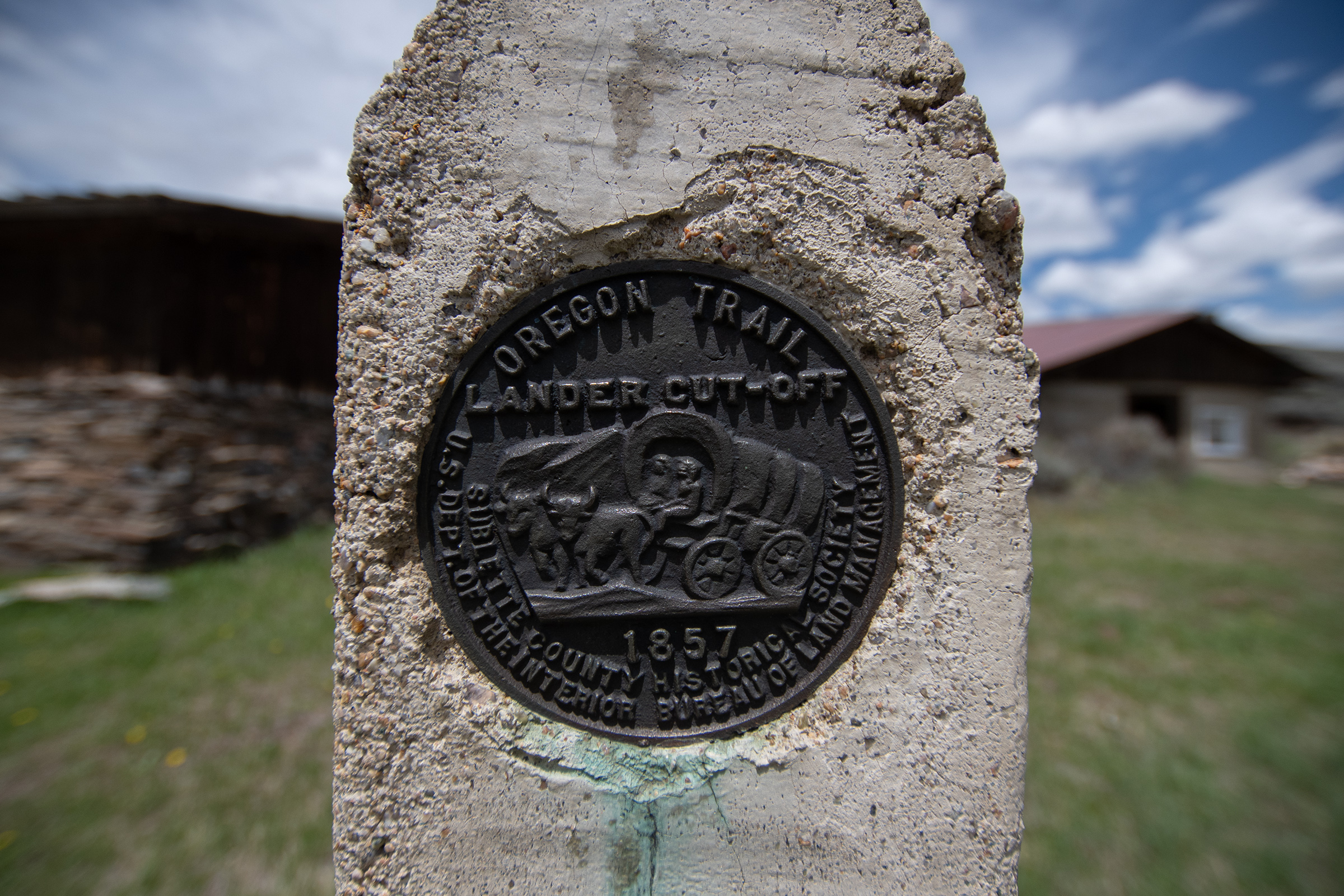
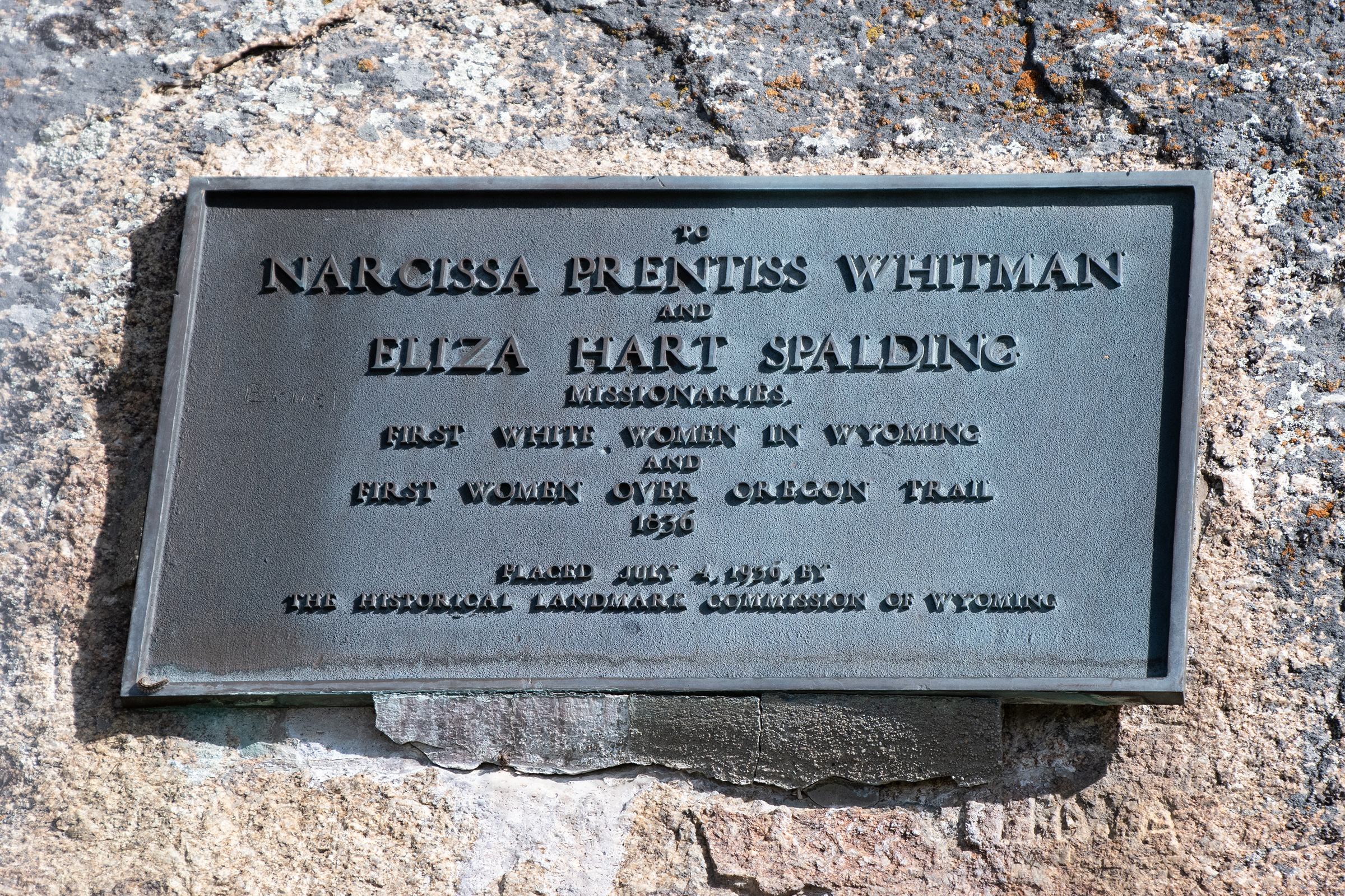
After breakfast in Lander, we headed up to South Pass City, a ghost town which was a camp and stopping point for Oregon Trail traffic — and marks the start of the Lander Cutoff — but boomed and busted in the 1860s-1890s gold rush era. The 1870 census recorded the population of 1,166 and two years later, there were less than 100 inhabitants.
From “The Oregon Trail: A New American Journey,” Lander north of the route between Split Rock and Rocky Ridge.
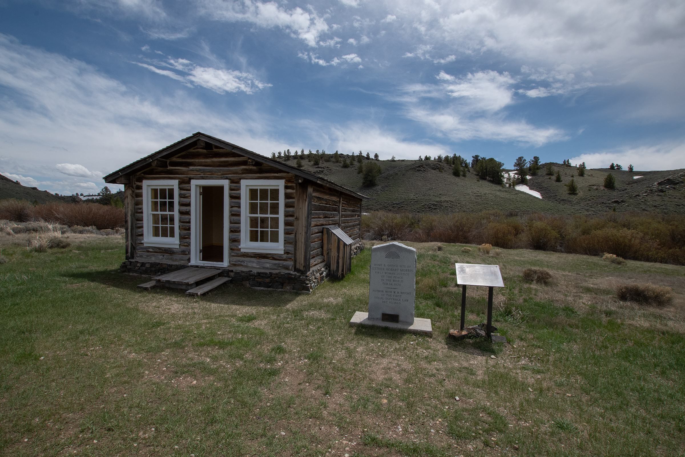
The town also marks the start of Women’s Suffrage. A state bill granting women the vote was written by a South Pass City resident, and ultimately passed. Shortly thereafter, Esther Morris, another South Pass resident, became the city’s Justice of the Peace, making her the nation’s first judge.
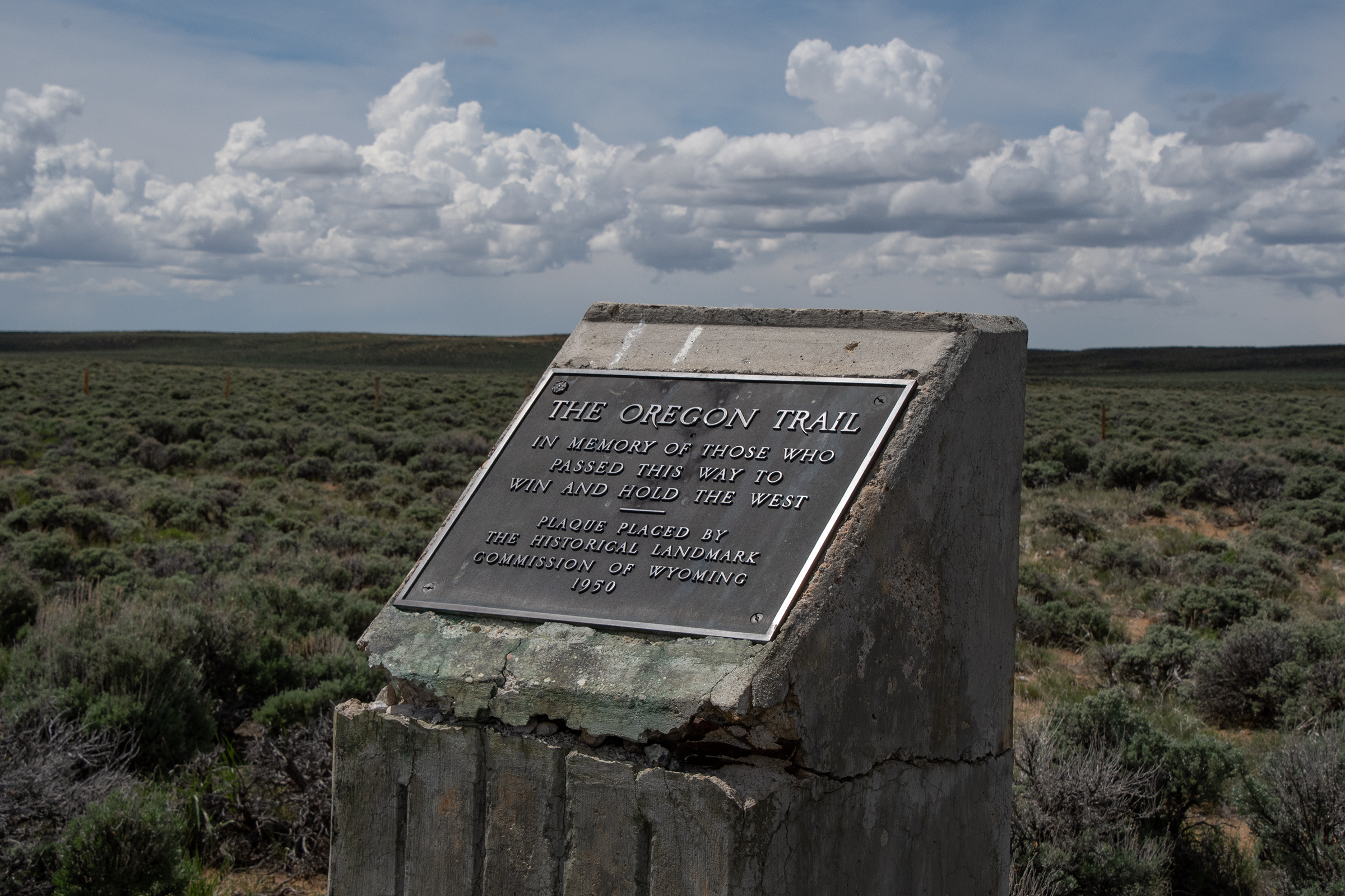
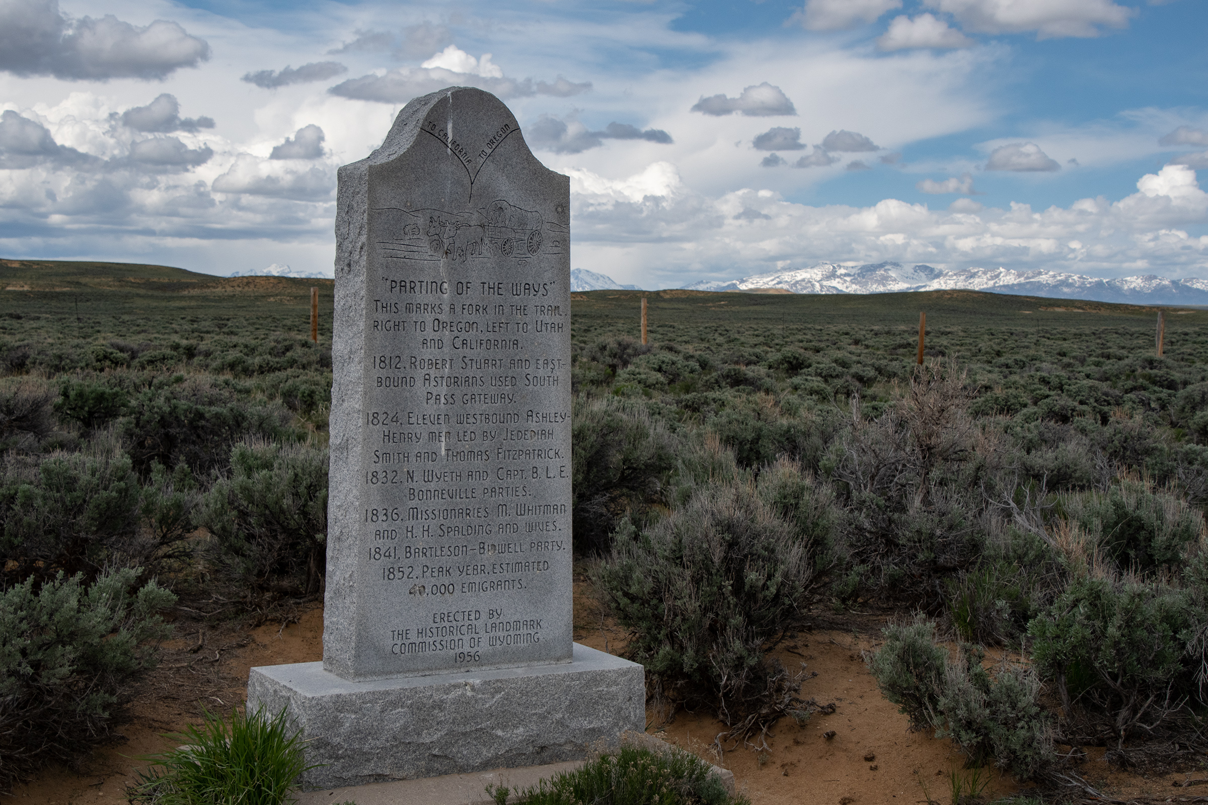
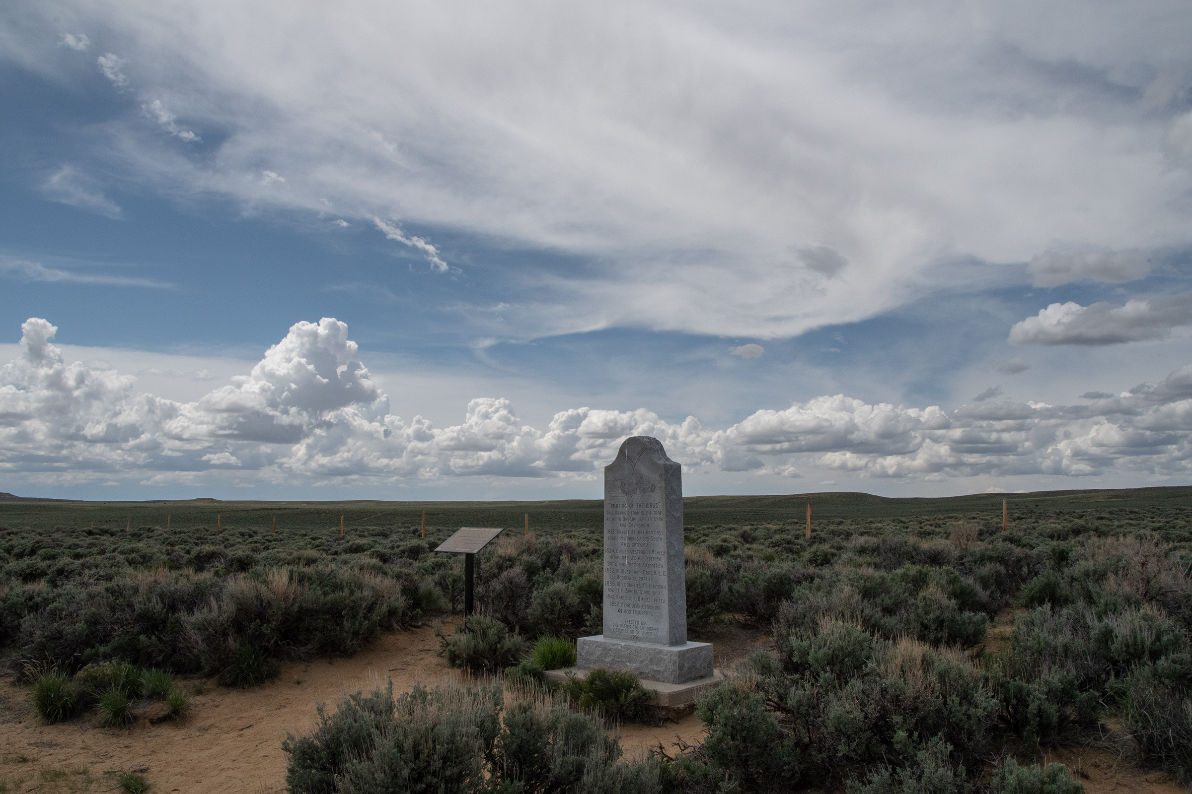
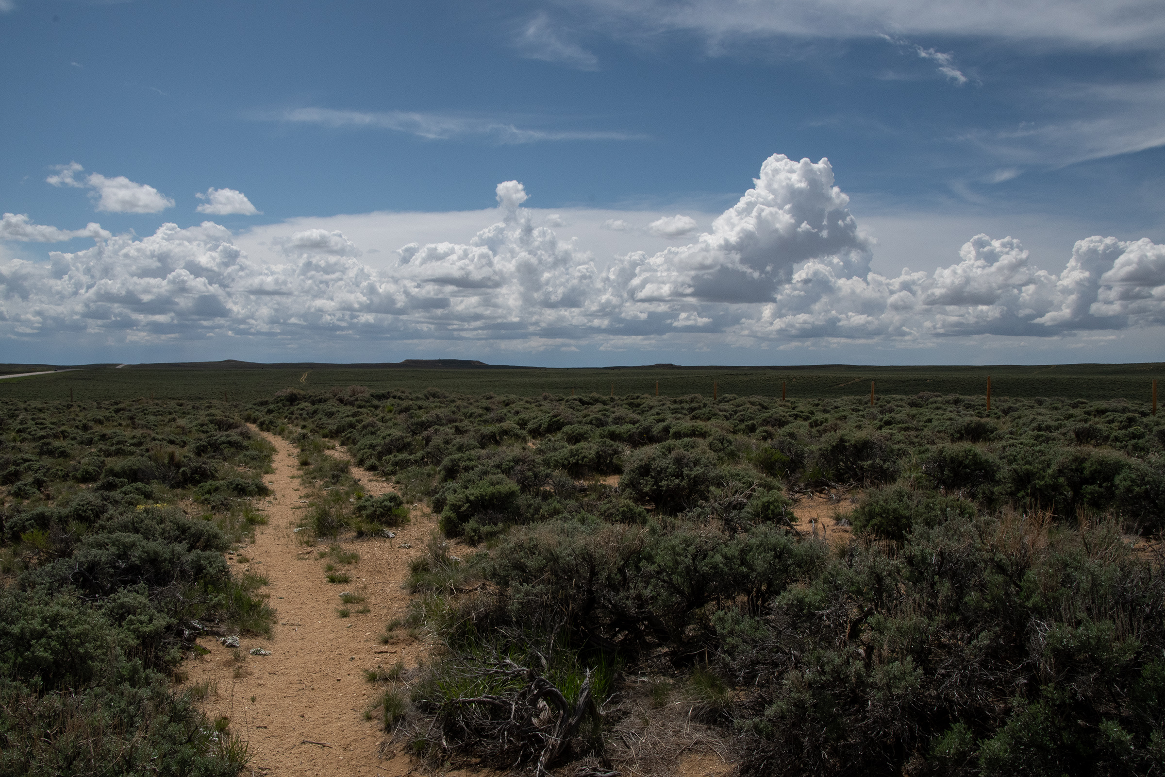
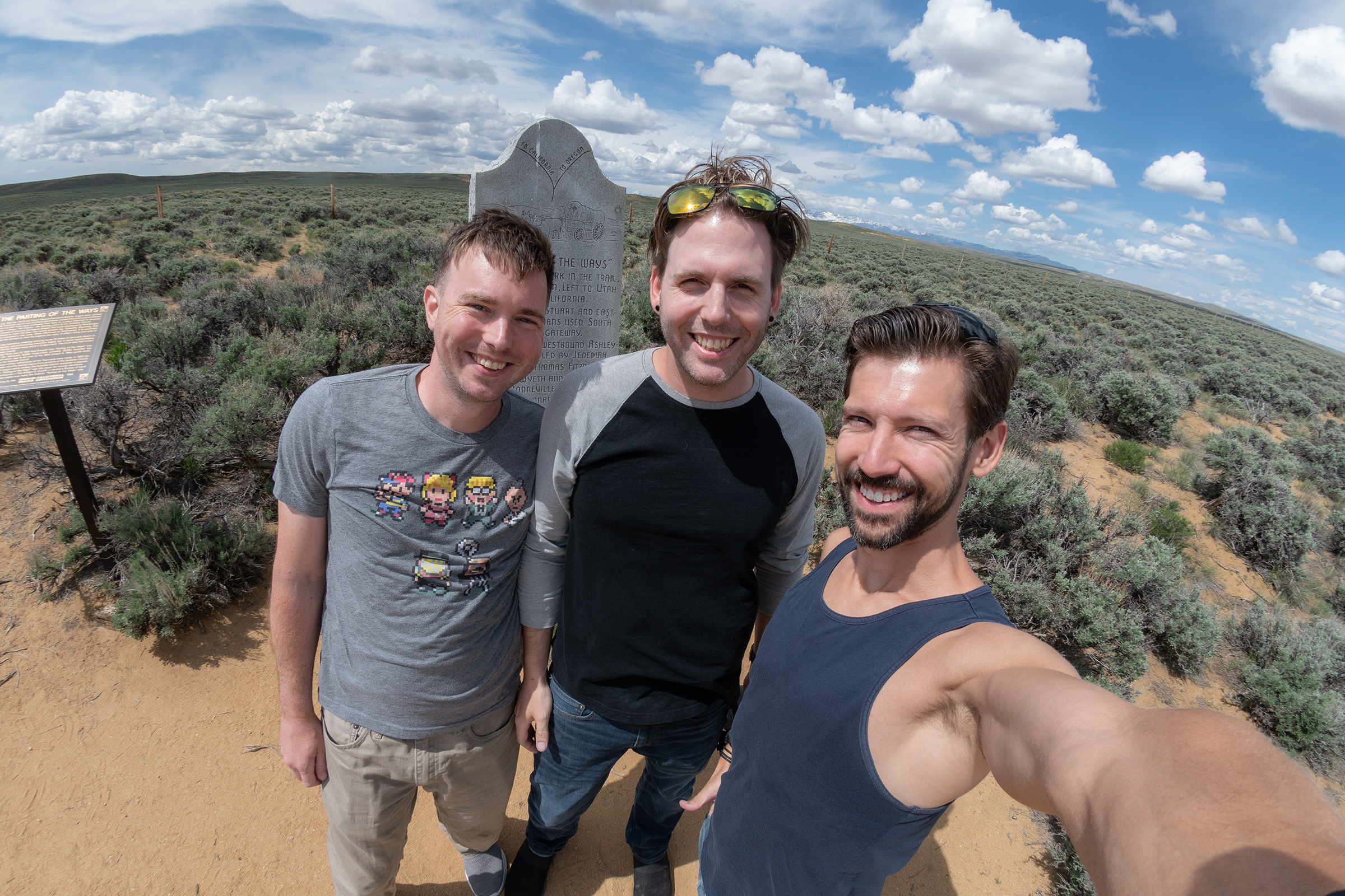
The Parting of the Ways
Our next stop of the day was a roadside monument a few miles down the highway at The Parting of the Ways, where a few forks of the trail divide. The Oregon, California, and Mormon Pioneer trails all continue down to Fort Bridger, but the Sublette and Lander Cutoffs fork off around here. This meant that some parties that had been traveling together since their starting point on the Missouri River — a thousand miles, over the course of a couple months — may decide to split here. The Sublette Cutoff really became popular in the gold rush era because it saved about a week’s travel, at the cost of 50 miles through semi-arid desert with no water and a dramatic decent into Idaho nicknamed “The Rockslide.”
And fittingly, at The Parting of the Ways, we parted ways — but only briefly. At Farson, I took US 191 down to Rock Springs to pick up I-80 (which does follow some of the Mormon Pioneer Trail) for Salt Lake City to pick up Evan G.
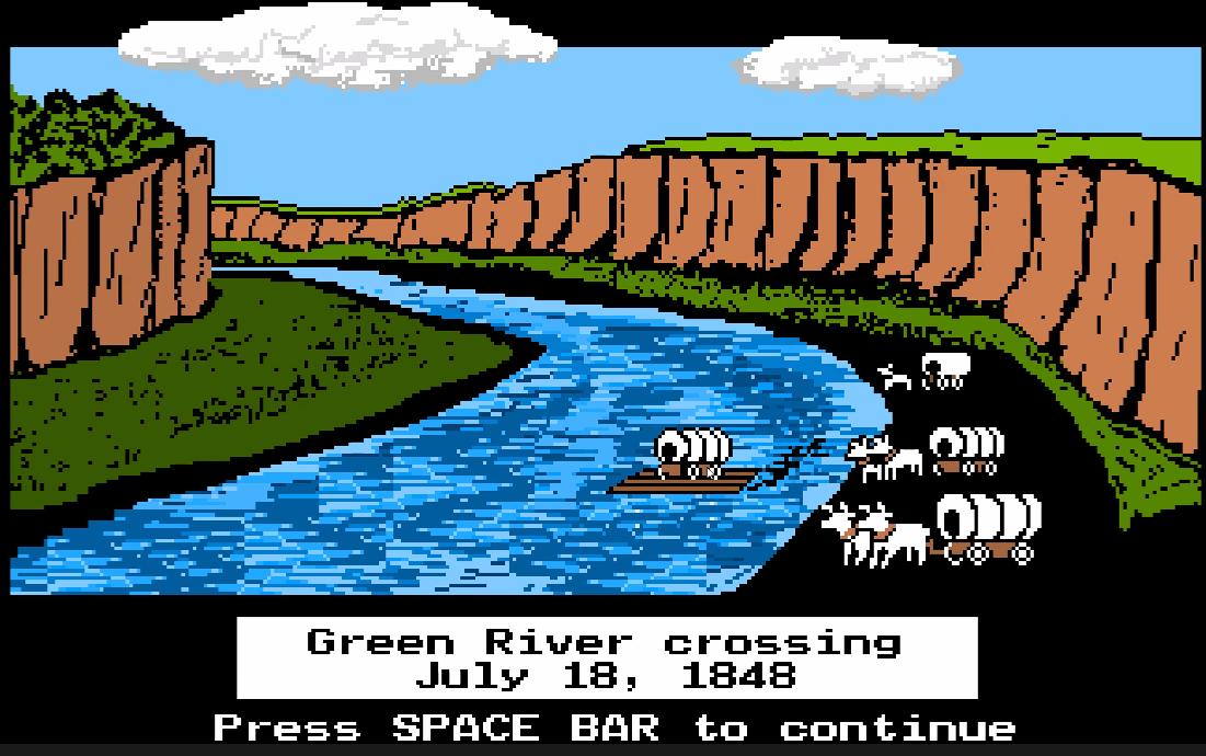
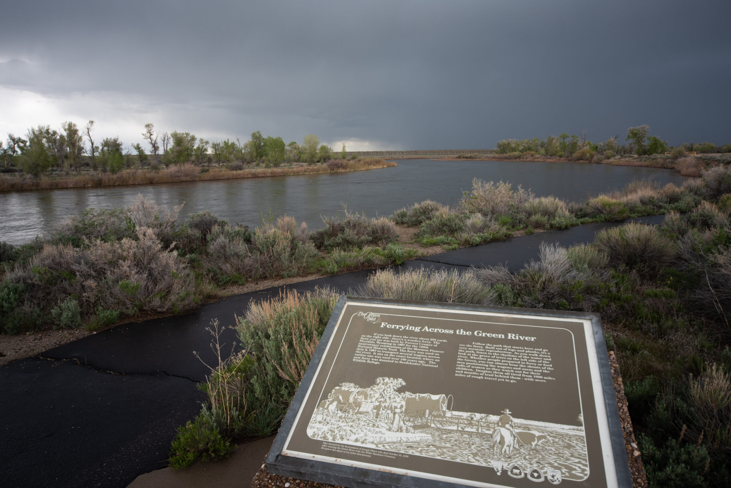
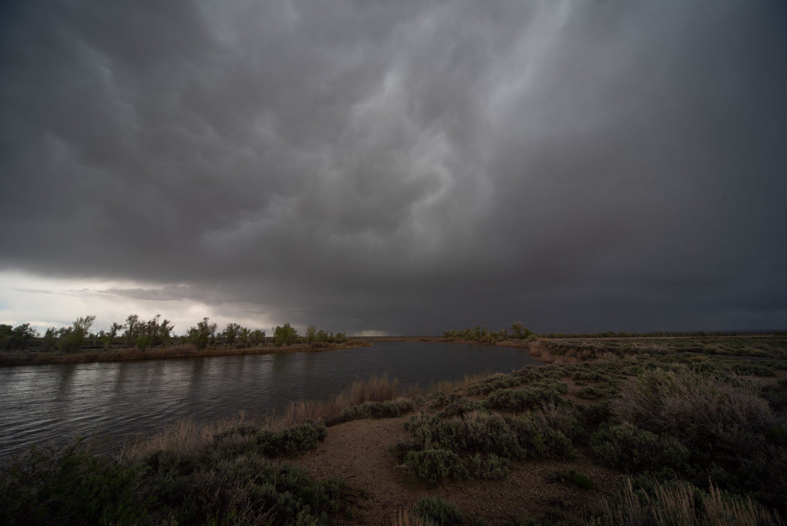
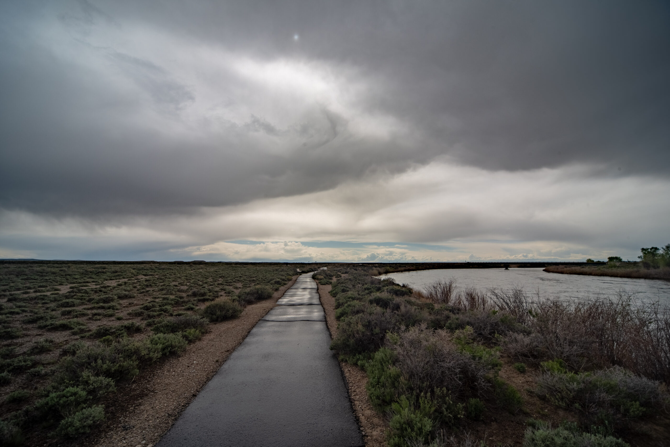
Green River Crossing
Meanwhile, Evan (M — I’ll figure out how to make this not weird) and George continued along the Oregon Trail route to the Green River Crossing to check out the historical marker to the crossing and the Mormon Ferry that operated there.
Photos from G&E
Imagine them all tired from a thousand miles and months of trail behind them — with more miles of rough travel yet to go.
Placard at the Green River Crossing ferry
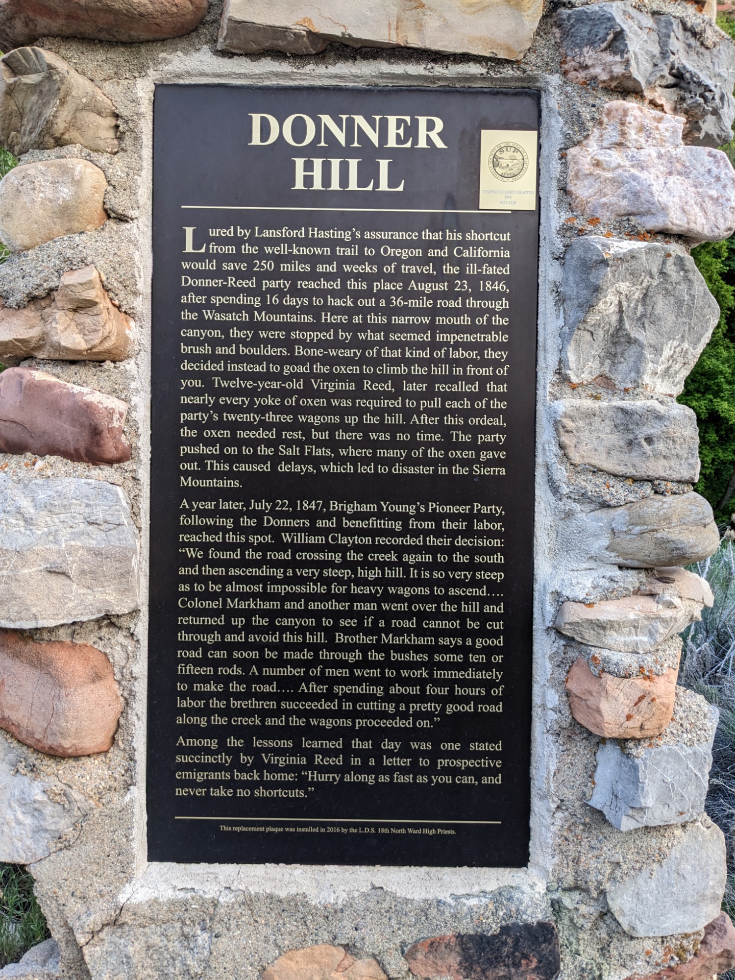
Donner Hill
Though I do try to find alternatives to interstates, I-80 into Salt Lake City does make a beautiful mountain pass. After picking up EG from a coffee shop in Salt Lake, we left town through Emigrant Canyon, which was the final segment of the Mormon Pioneer Trail as it entered present-day SLC.
Part of Emigrant Canyon Road marks Donner Hill, the most brutal segment of the descent which had to be essentially cut out of wild growth by the Donner-Reed Party, despite Lansford Hasting’s assurance that the shortcut was ready for use. The delay in doing so, compounded with the harsh salt plain desert that followed, ultimately set the party up for the eventual disaster in the Sierra Nevada. But the road they built was used and further developed by Brigham Young for the Mormon emigration that followed.
We regrouped at Mountain View, Wyoming — near Fort Bridger — for the night. Tomorrow we see the fort, then head for Idaho!
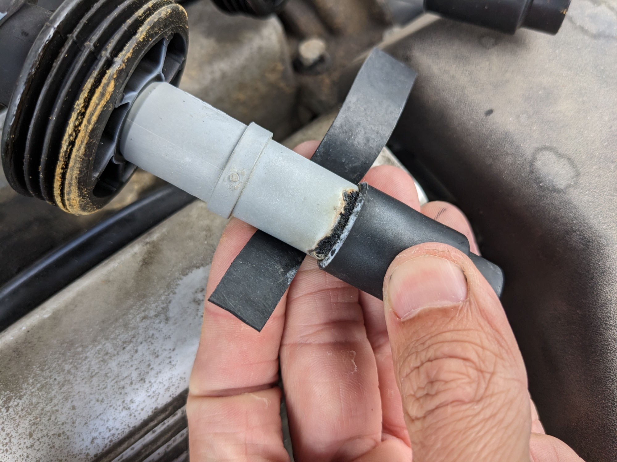
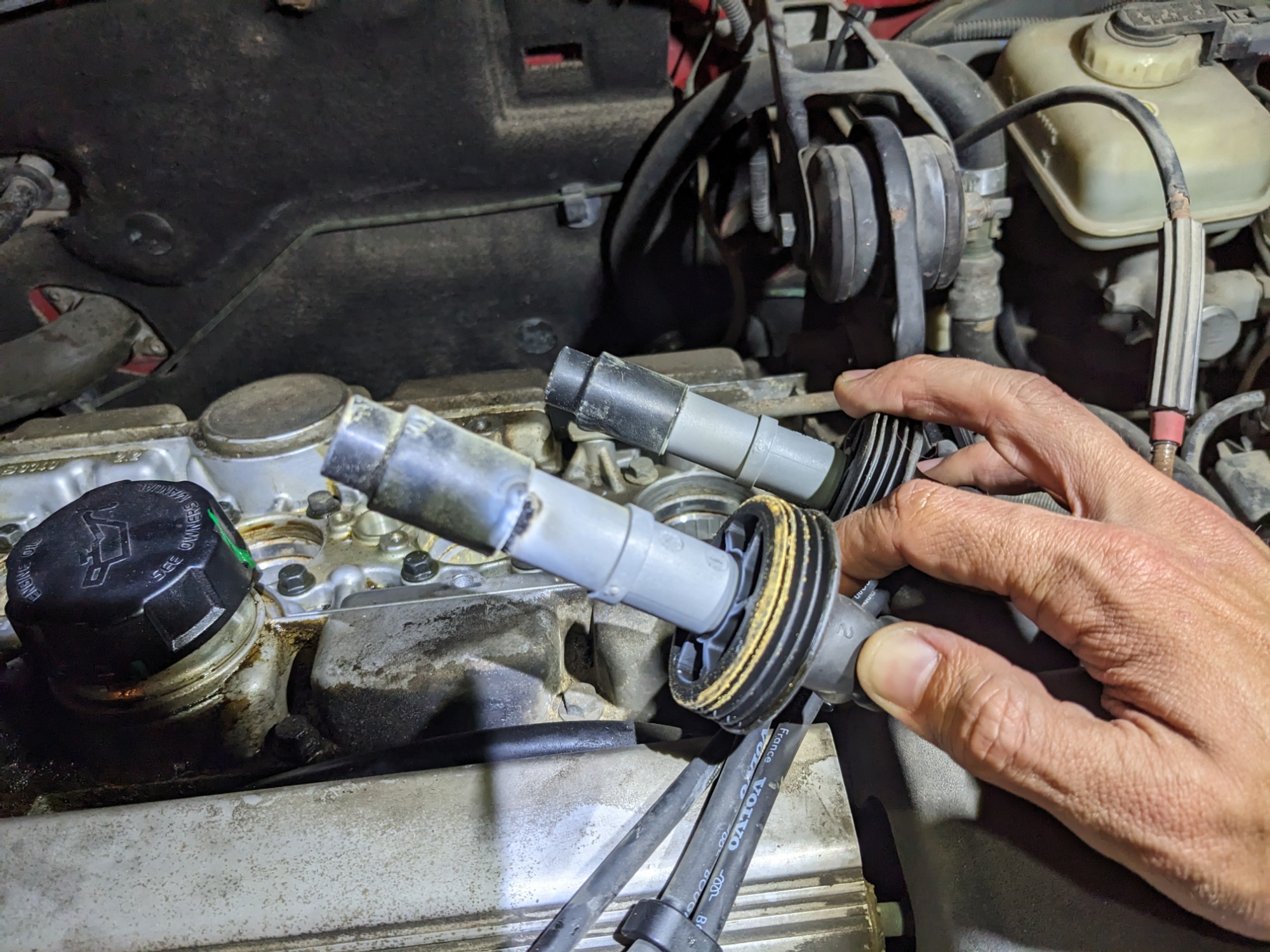
This morning, George and I both had to reassemble our cars again. When last night’s storm came through, I had new spark plugs put in and tightened, but the wires were still out and the wells needed to be cleaned out. And one of the plug wires needed … a miracle.
That’s some old grossnessBeforeAfter
I used two layers of butyl and multiple layers of a super-high-temp flex-tape. We’re hoping that is sufficient insulation that, when combined with new spark plugs that would offer less resistance, keeps the lightning inside the cylinder.
After I sewed my wagon back up, I started it briefly — with great anxiety. But dammit if that motor didn’t fire right up and sound shockingly healthy. At least, compared to the last several days.
Casper
Evan needed a couple pairs of shorts so we stopped at Targetneeded to stop at the market for more sets of clothes on the way through Casper. I also picked up an O’Reilly order for a replacement distributor cap. Then we stopped off for lunch and watched a huge and rather sudden thunderstorm roll through.
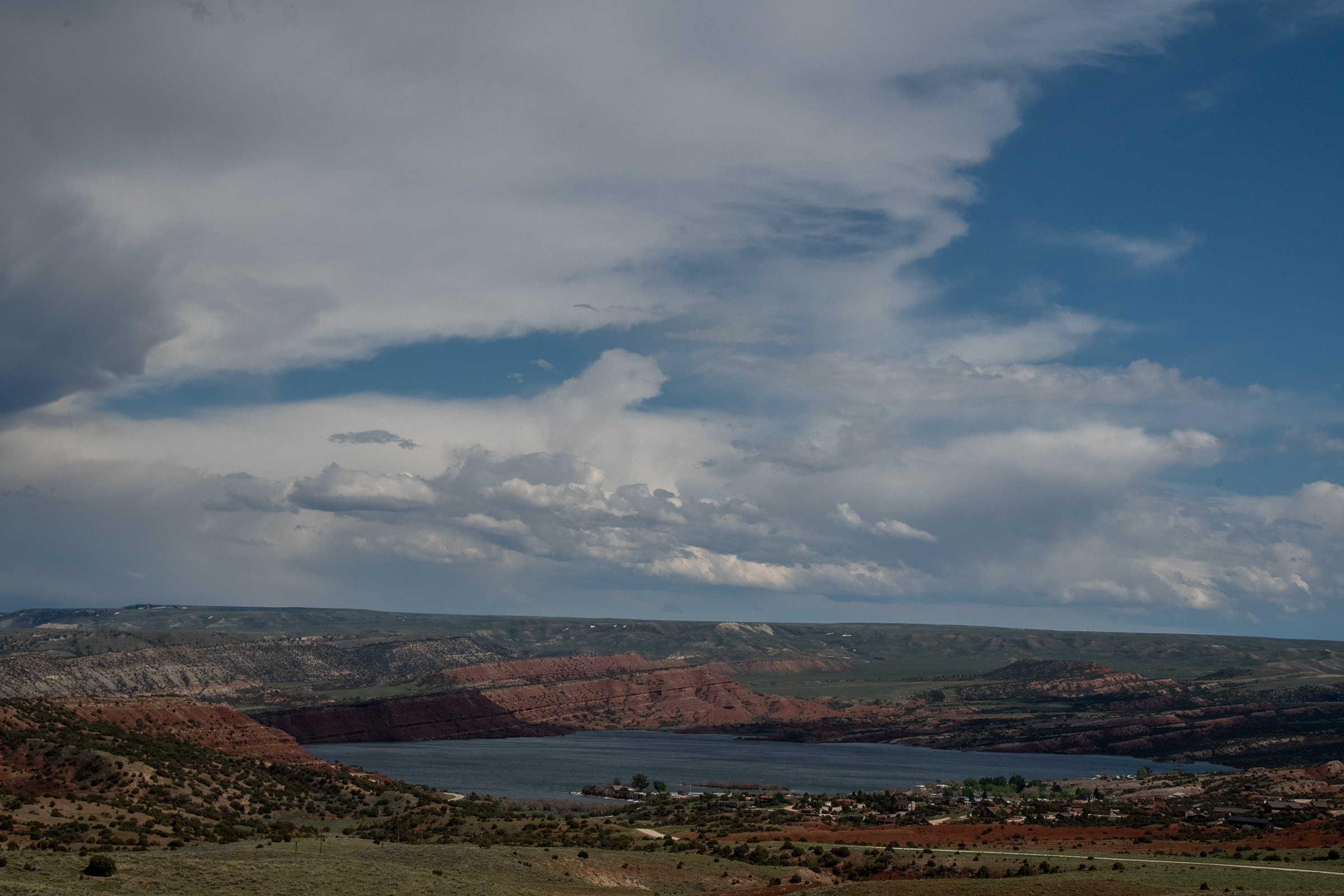
Alcova Reservoir
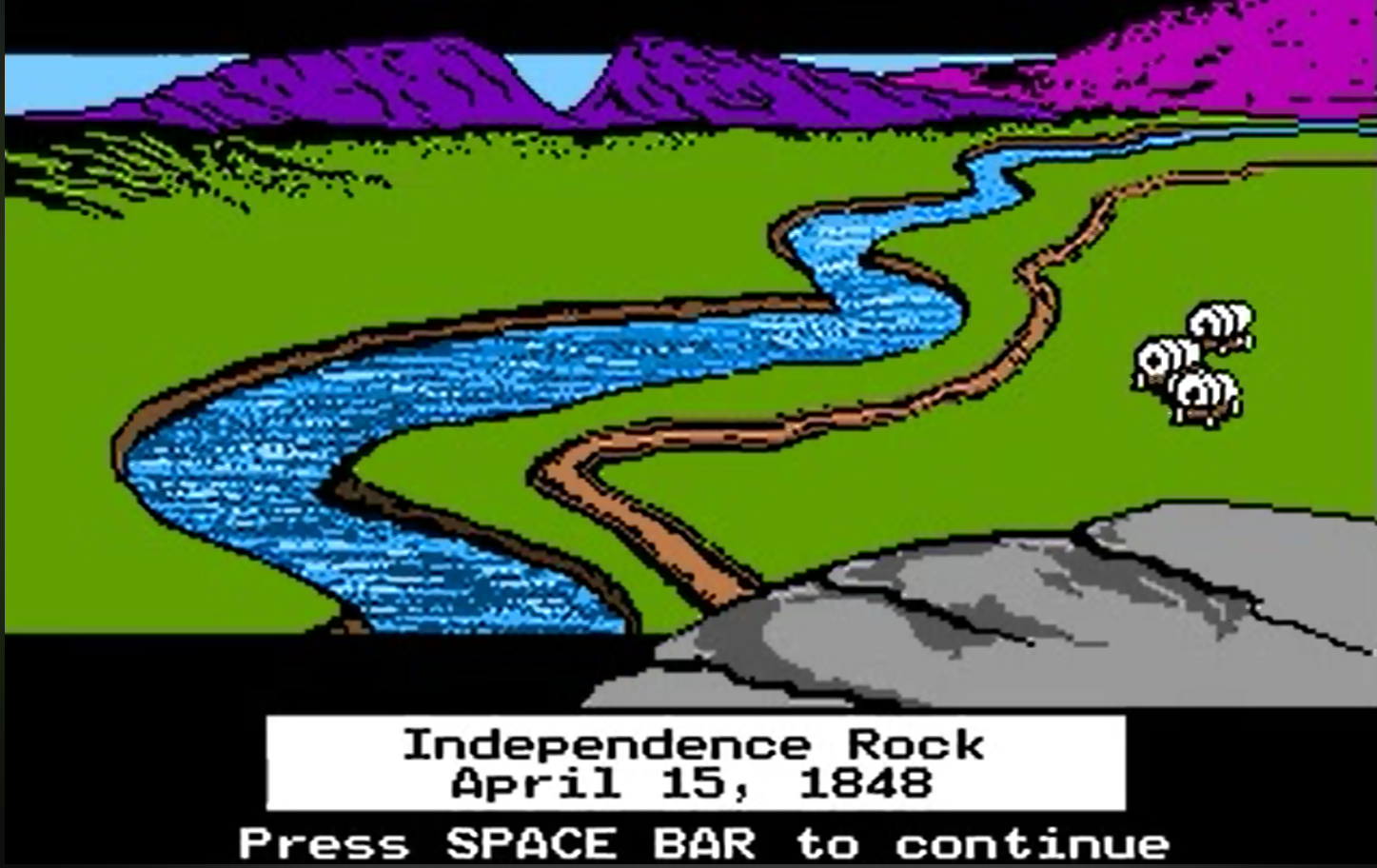
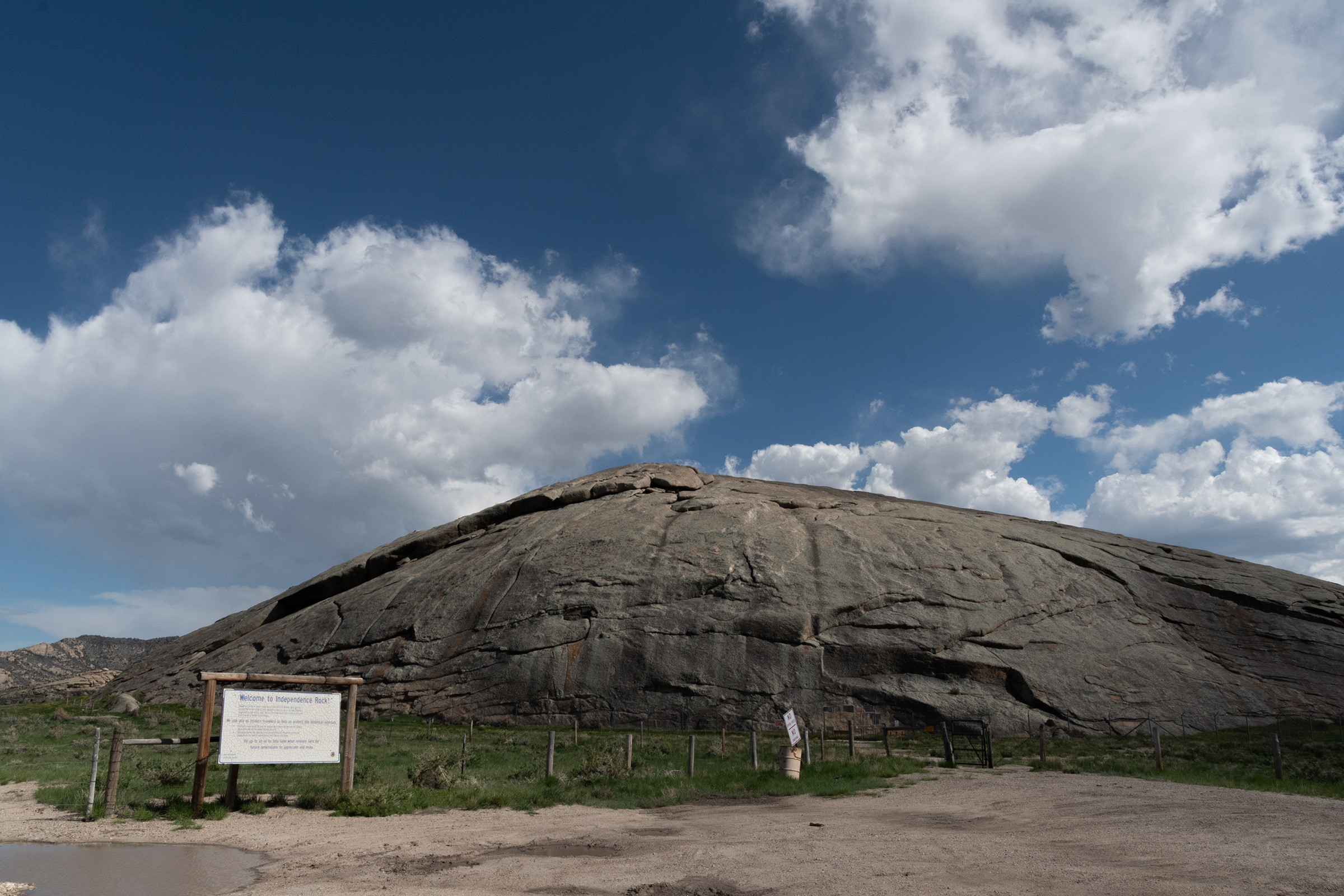
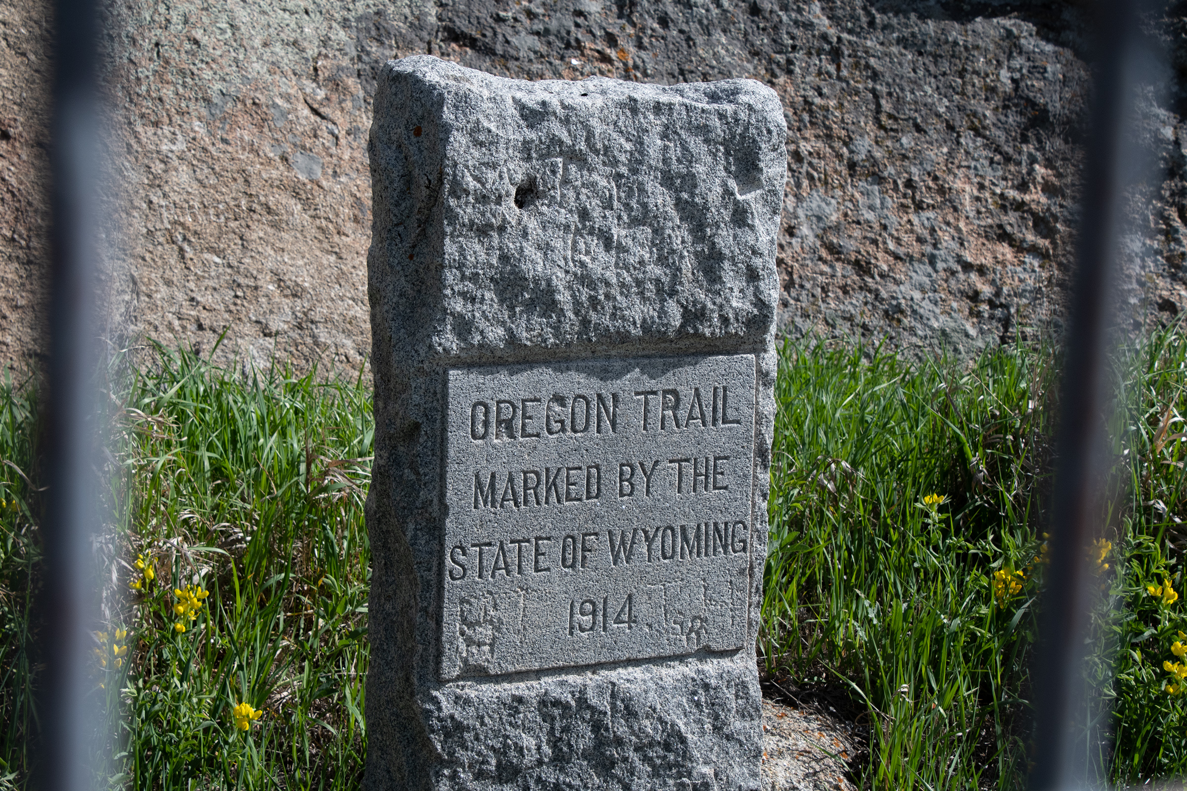
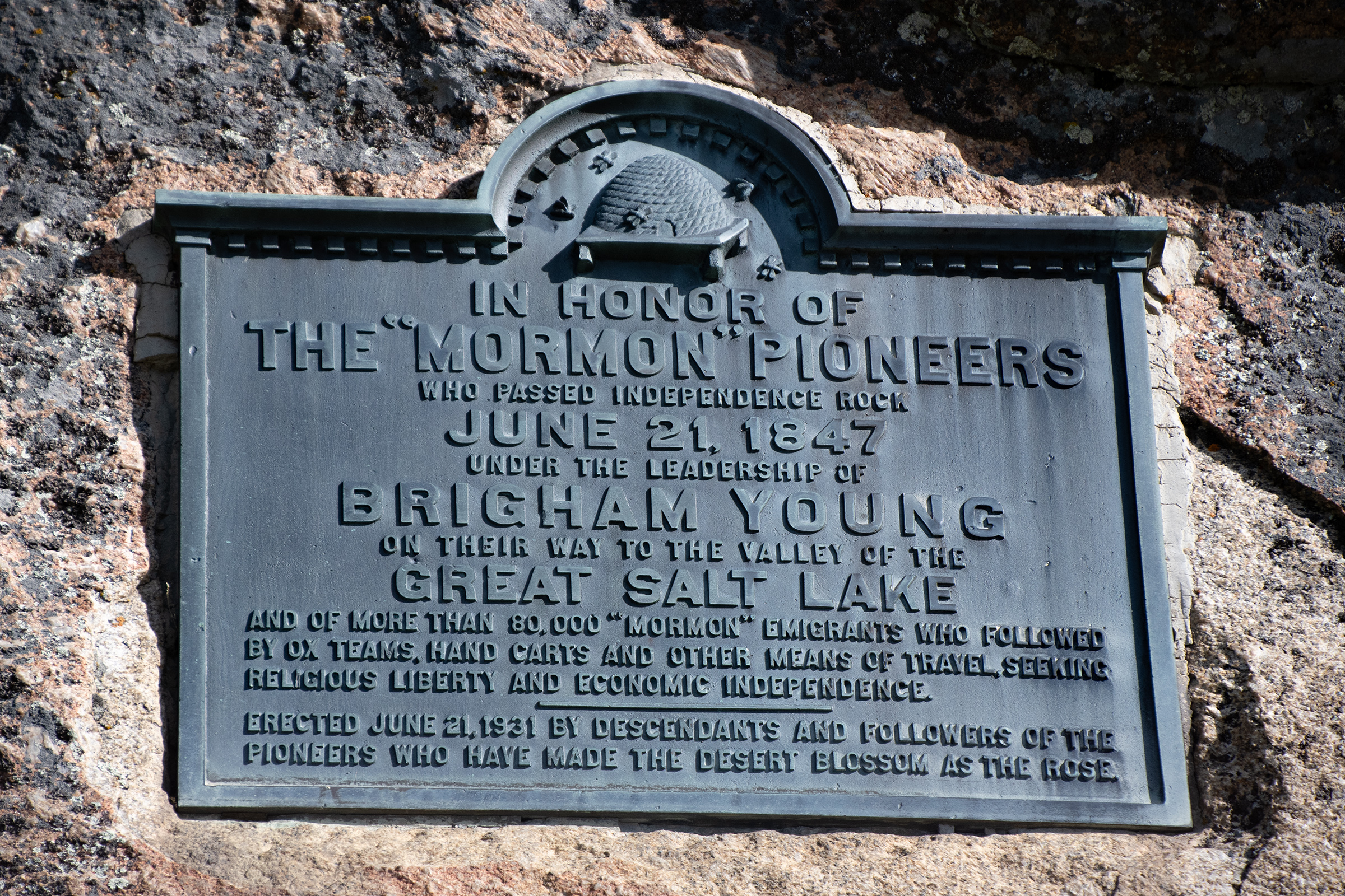
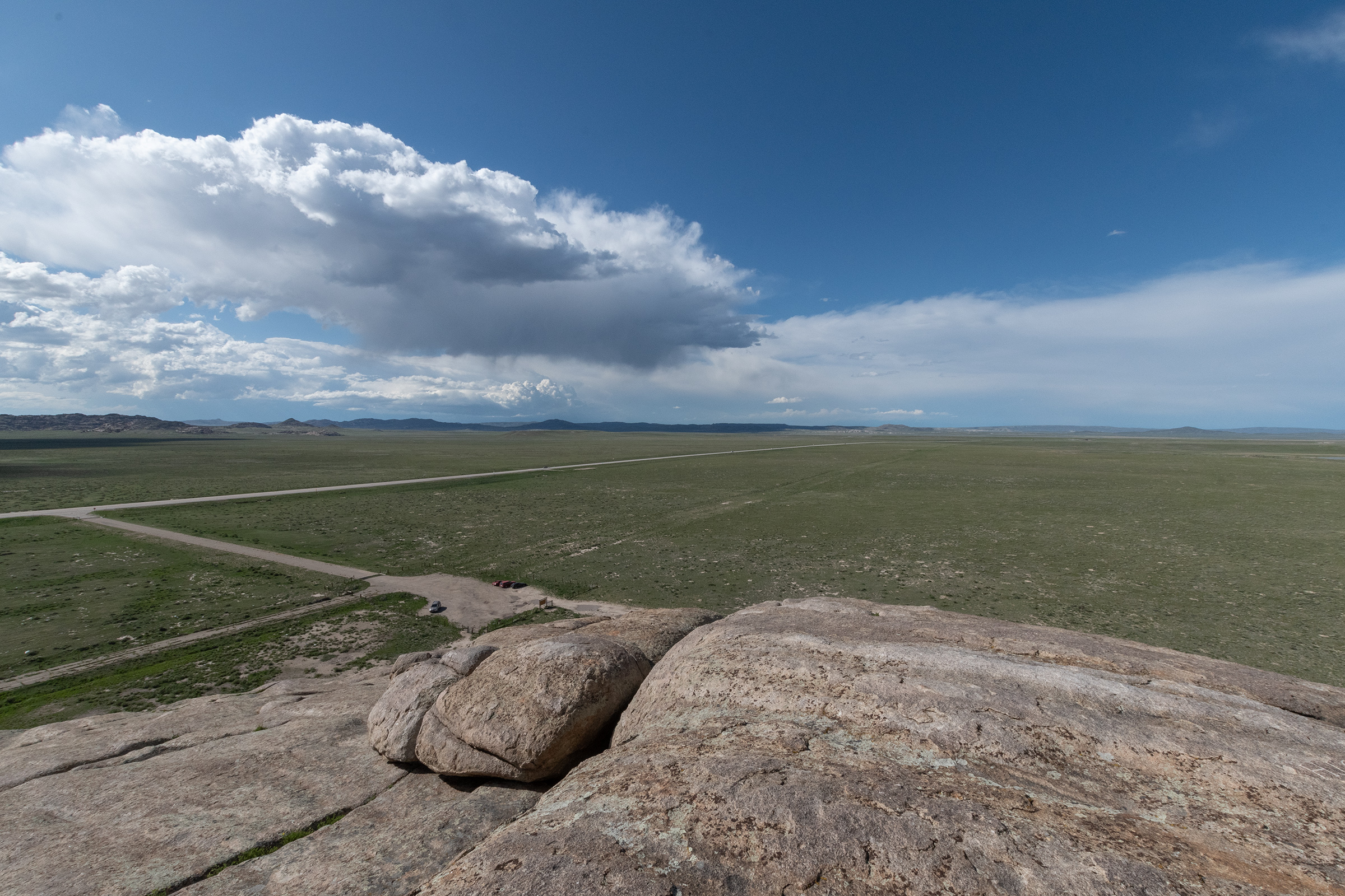
Independence Rock
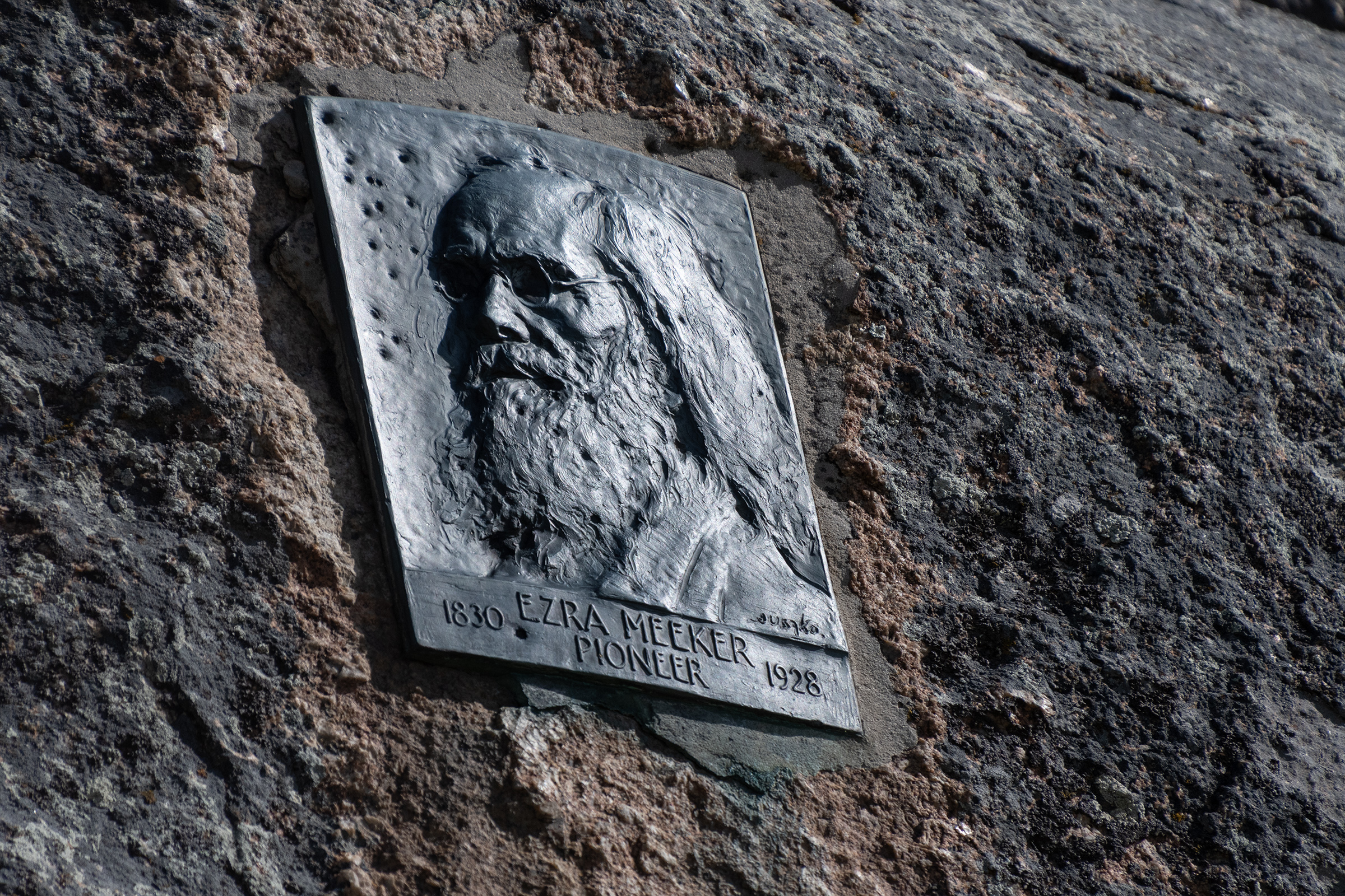
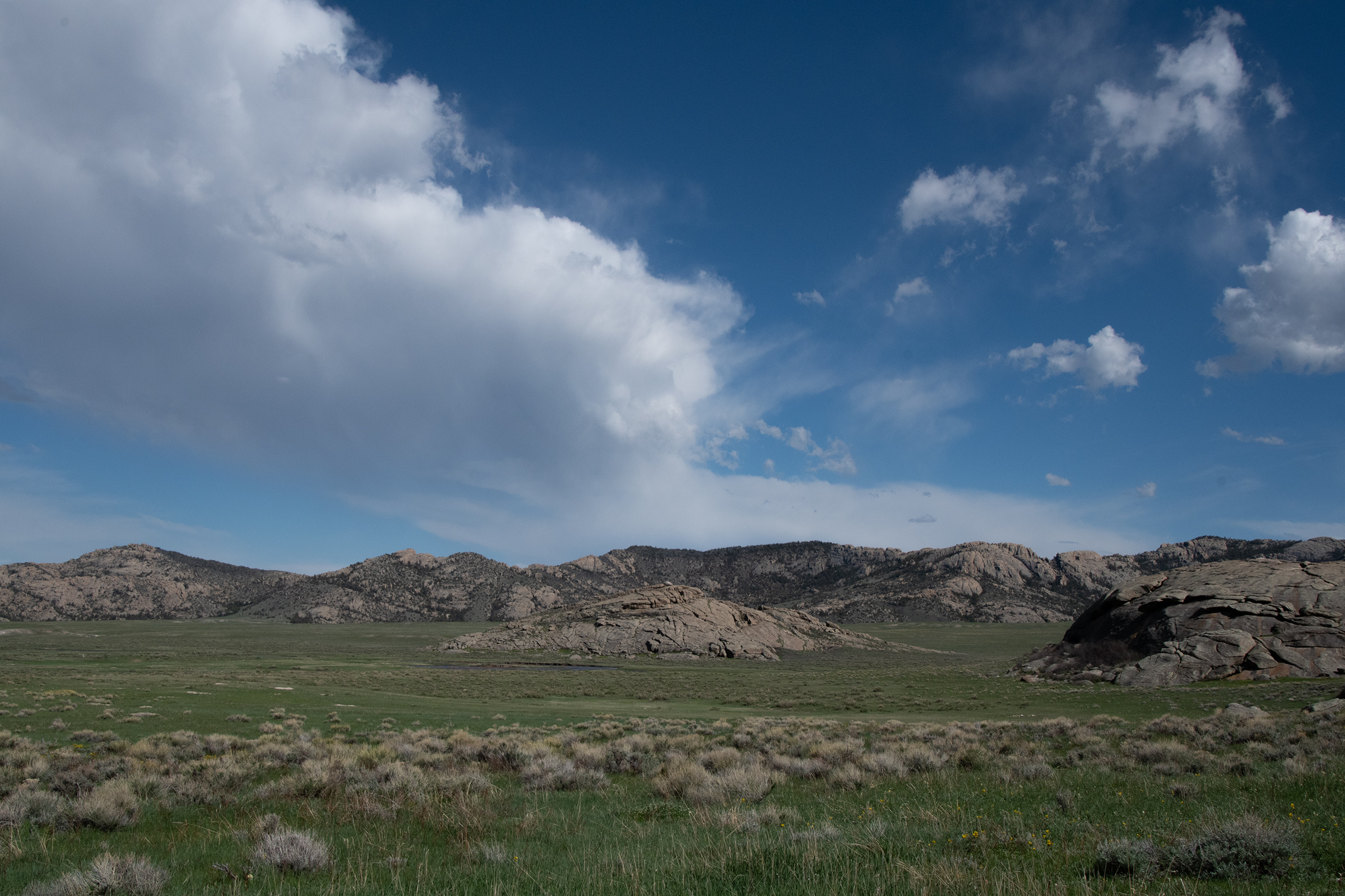
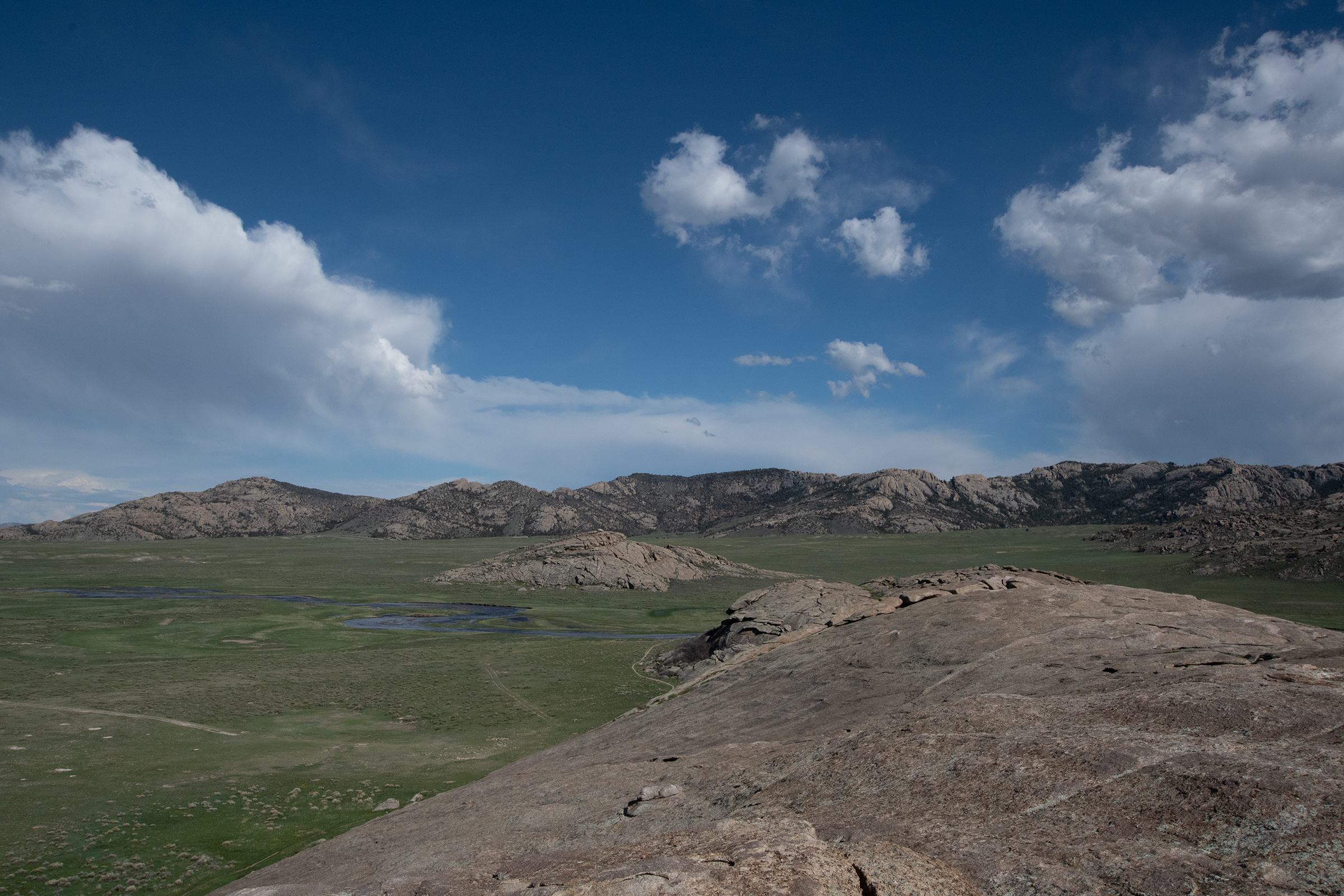
After Casper, Independence Rock is only about an hour’s drive. I’m unclear which came first, the date or the name, but conventional wisdom of the trail seems to be that if you left Missouri in early-to-mid-May and made it to Independence Rock, Wyoming by the Fourth of July, you were making a good pace.
From several miles away, it was easy to see why the immense natural wonder ahead, bounded by the Sweetwater River on its southeast side, had sheltered one of the largest campgrounds along the trail. The huge mound of naturally polished granite rises almost 140 feet above the desert floor, covers twenty-eight acres, and is more than a mile in circumference. Pioneers from the East and Midwest had never seen a freestanding rock of such huge proportions, and they knew that this gigantic signpost in the sky marked their transition from the muddy and diseased drainage of the Platte to the cleaner flow of the Sweetwater. The two-day run down from Fort Casper was desperately dry, and by early summer, places like Avenue of the Rocks and Prospect Hill had become animal boneyards. [… The morning and afternoon shade created a comfortable layover for pioneers to trade, rest, refill water, and wash.
Rinker Buck, The Oregon Trail: A New American Journey
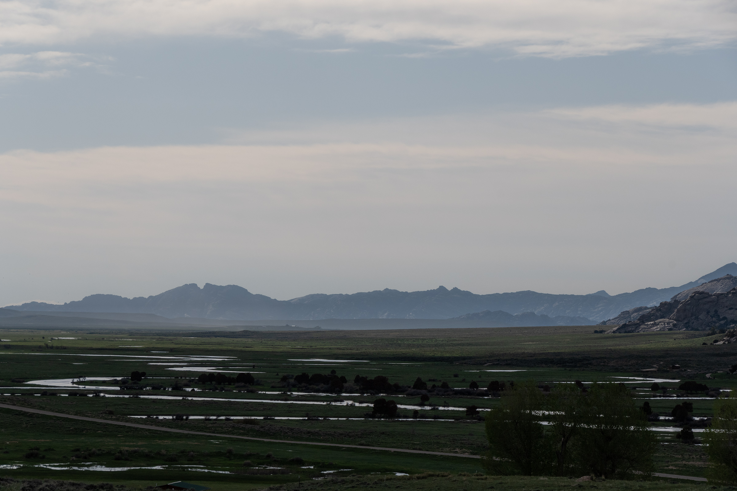
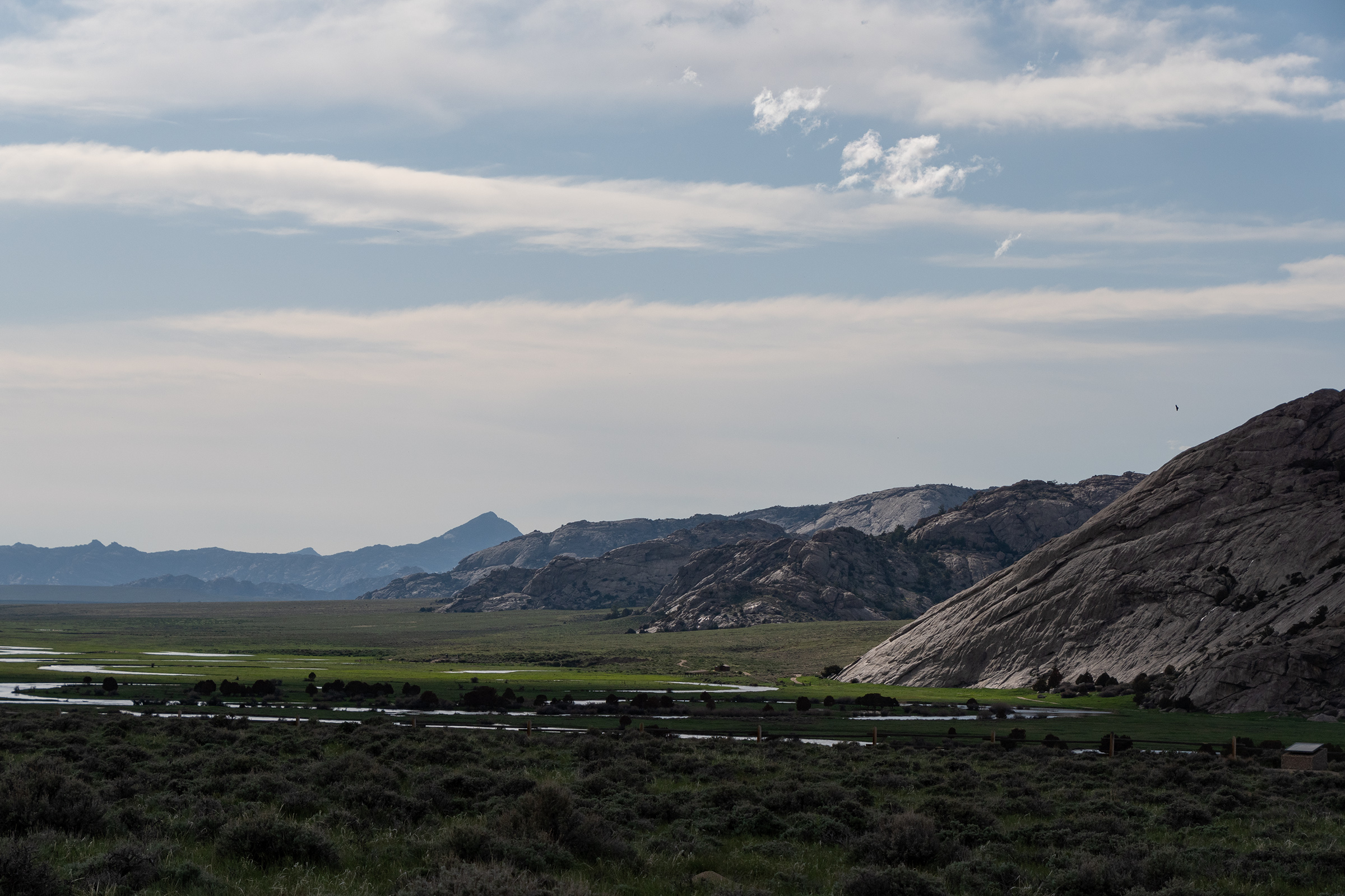
It reminded me a lot of Enchanted Rock back home near Fredericksburg, but bigger, so obviously we had to get on top of it, despite a tremendous wind.
Devil’s Gate (or Martin’s Cove, if you’re a Mormon)
Another popular camping spot along what is now WY-220, about fives miles southwest, was Devil’s Gate, a grassland at the bottom of semicircular granite ridge.
American Indian legend says a powerful evil spirit in the form of a tremendous beast with enormous tusks ravaged the Sweetwater Valley, preventing the Indians from hunting and camping. A holy man told the tribes that the Great Spirit wanted them to destroy the beast. The Indians launched an attack from the mountain passes and ravines, shooting countless arrows into the evil monster. Enraged, the beast with a mighty upward thrust of its tusks, ripped a gap in the mountain and disappeared, never to be seen again.
Robert L. M[??], “Independence Rock and Devil’s Gate” [??], collected by Bureau of Land Management on a barely legible roadside placard.
Two miles to the northeast, nestled at the foot of the Sweetwater Rocks, lies Martin’s Cove. Here Captain Edward Martin’s exhausted company of Mormon handcart emigrants sought shelter from a severe early winder storm in 1856. The Martin Company, low on provisions and traveling late in the fall, first encountered winter weather in late October near present-day Casper. Of 576 men, women, and children, approximately 145 died along the trail before finally reaching Salt Lake City the last day of November.
For more information on Mormon emigrants or the handcard companies, visit the Mormon Handcart Visitor Center located at the old Sun Ranch [an LDS property one mile down the road].
Another BLM placard, with a different author…
Also at the Sun Ranch is a Mormon Youth Camp which, among other activities, does handcart-hauling pilgrimages in the area in the summer, as Rinker Buck (author of one of the books I keep quoting) and his brother learned when they stopped in. What surprises me is that here, at 7,000 feet, a winter storm was unexpected in late October — they left too late, and they knew it, but perhaps had nowhere else to stop? Needless to say, none of this made it into the videogame.
We walked around a trail and admired the incredible view, as we are now surrounded by mountains on all sides and have finally made it to the next river we’ll parallel for a bit.
Back at the car, Evan joined me in a little art direction exercise I’ve been sheepishly wanting us to do — circling the wagons. We’re a decidedly on-pavement-only clearance group, but no one else was here. So we circled up and he broke out his drone for a little fun:
(This is not a quiet video.)
Turns out that the drone and its accompanying app can just do this and put it all together for you, complete with sweeping shots, dramatic swings, and “mood” music.
Lander, Wyoming
Last time I drove through Lander, I guess I didn’t make it to the nice part of town, which is where we discovered quite a swanky little place for dinner. Open late, even, until 9! I decided we were celebrating.
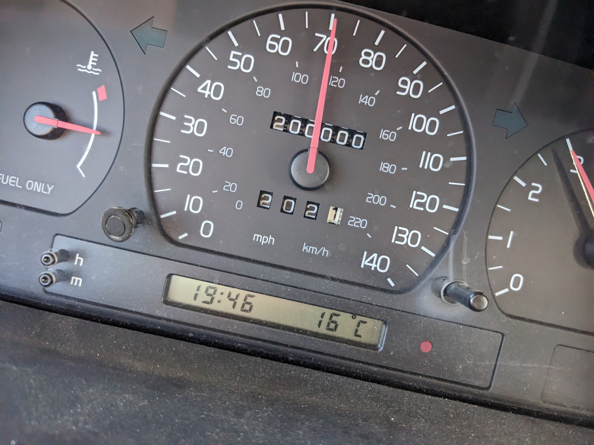
My Wagon, which rolled 1,200 miles from my apartment and 200,000 miles total at Devil’s Gate, seems largely cured and is running better than it has since I bought it. Clearly my Pioneer-aged spark plugs and self-punctured plug wire were the core of my problem — and I have to admit, I’m grateful to have found that part myself, and to have been able to fix it. Or at least thoroughly bodge it.
Bodge (verb; Britain, Ireland): to do a clumsy or inelegant job, usually as a temporary repair; mend, patch up, repair.
Wiktionary. But we learned it from Top Gear.
George, on the other hand, was drinking to forget his troubles — which are deafeningly rattle-y. Something in his sunroof glass repair seems to have unrepaired itself. But as one commenter noted on Evan’s post noted:
And even George was forced to admit, as much work as he’s done on this car to get it here, he’s worried about the rattles now, rather than whether or not it is drivable. So it may be intensely annoying, but it is still a victory in its own way.
It is now some time since I wrote home, or at least since I wrote at any length, having written to you a line by a returning emigrant whom I met on the road and had just time to say that we were all well. Bu there is no certainty in sending letters by such conveyance. […] We shall pass Fort Laramie tomorrow, where I shall leave this to be take to the States. It will probably be the last time I can write until I get to my journey’s end, which may take till the middle of October.
We have had uncommon good health and luck on our route, not having had a case of sickness in the company for the last four weeks. Not a creature has died, not a wagon tire loosened, and no bad luck has attended us.
The country is becoming very hilly; the streams rapid, more clear, and assuming the character of mountain streams. The air is very dry and clear, and our path is lined with wild sage and artemisia.
We had a fine [Fourth of July] celebration today, with an address by Mr. Sexton, which was very good; an excellent dinner, good enough for any hotel; and the boys drank toasts and cheered till they are now going in all sorts around the camp.
[…] I am hearty and well, far more so than when I left home. That failing of short breath which troubled me at home has entirely left me. Notwithstanding these facts, I would advise no man to come this way to California.
William Swain, writing to his wife Sabrina on July 4th, 1849. Collected in “Oregon Trail Stories” (David Klausmeyer).
I woke up this morning surprisingly well rested and without any immediate automotive chores, so I went on a run down the river trail in Hot Springs and up into the neighborhood for a look around town while Evan tried to work some magic on his door or heater.
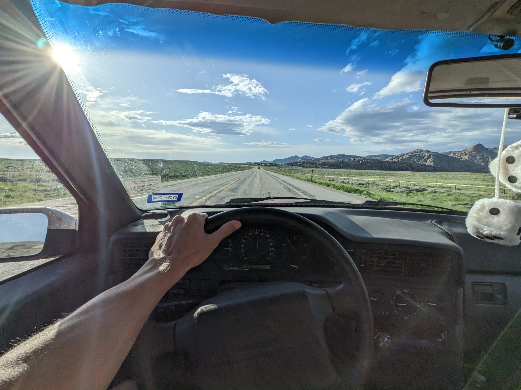
Four miles later, I packed up and we headed down the block for breakfast before heading out of town. Not far into today’s drive, we crossed into Wyoming and headed south. The Volvo was feeling rather sluggish, but when we stopped at an overlook, I realized we were driving into an absolutely fierce headwind and that made me feel a little better.
Along the way, we stopped at a NAPA in Lusk, WY for a few supplies. I’m gonna see what new spark plugs do for my situation. George needed a battery (ouch). Evan needed a tubing and hose clamp to bypass his (still stuck on) heater.
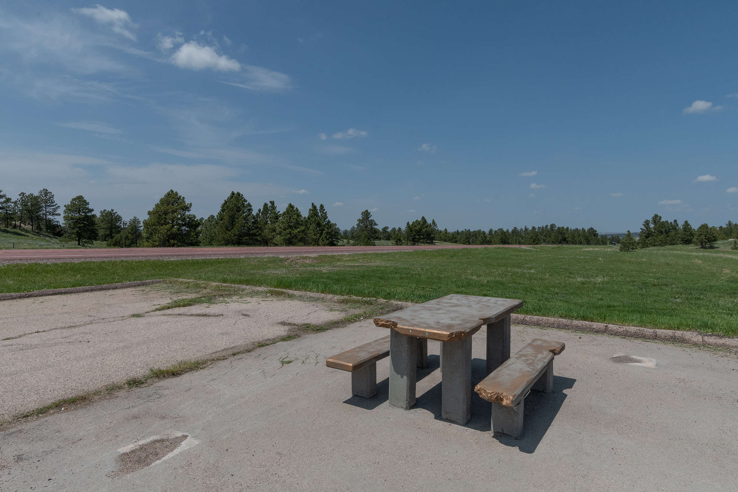
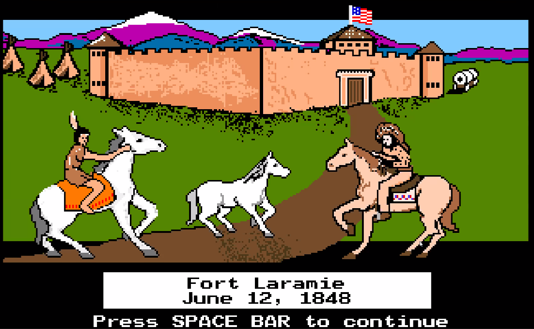
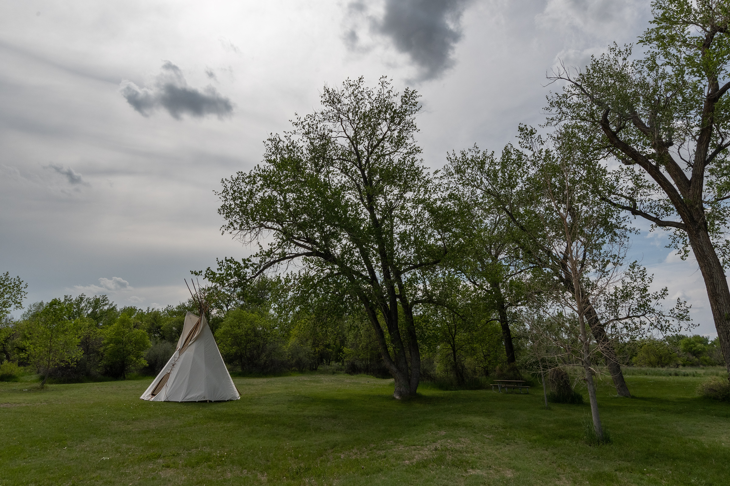
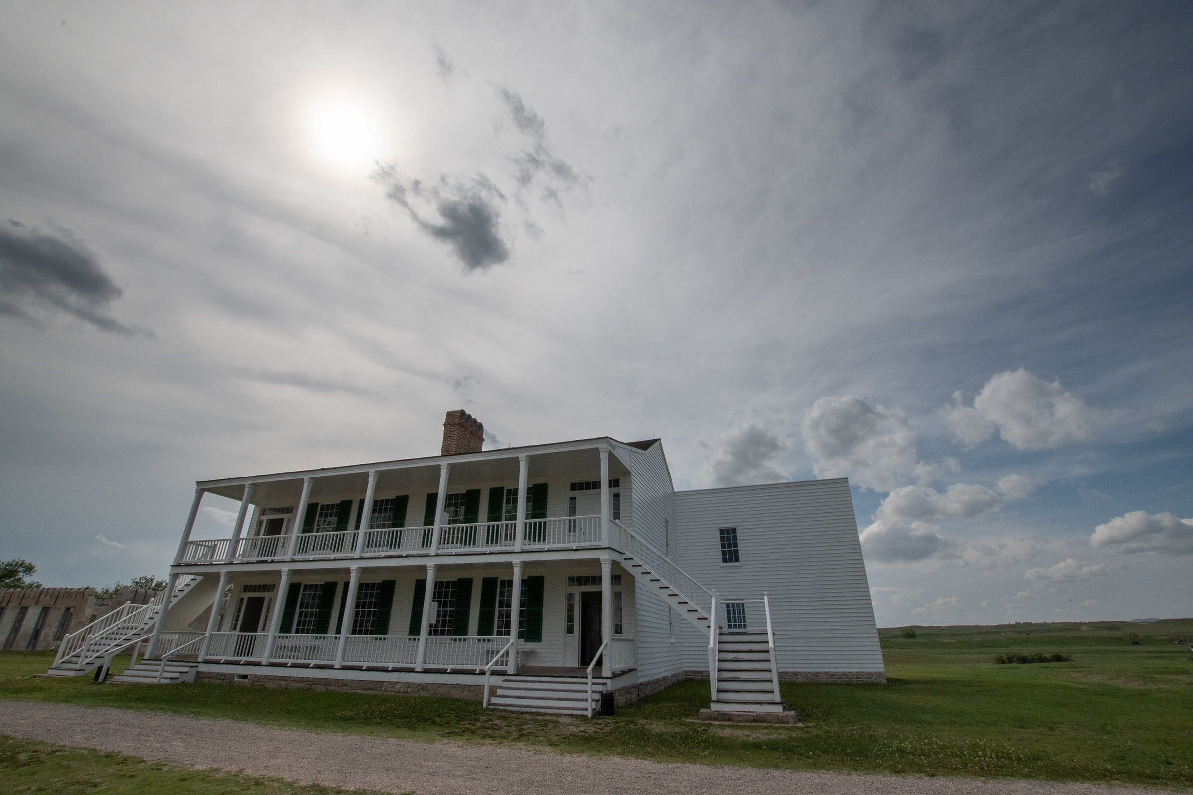
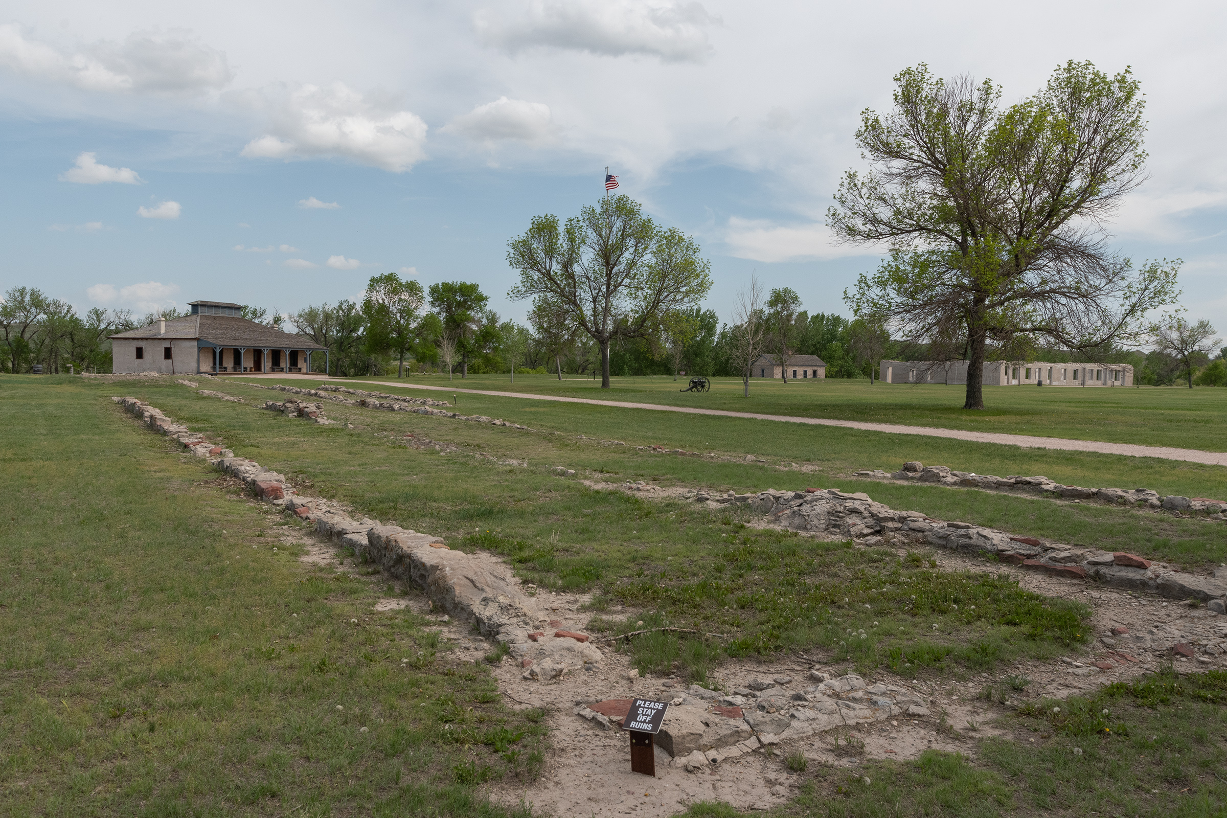
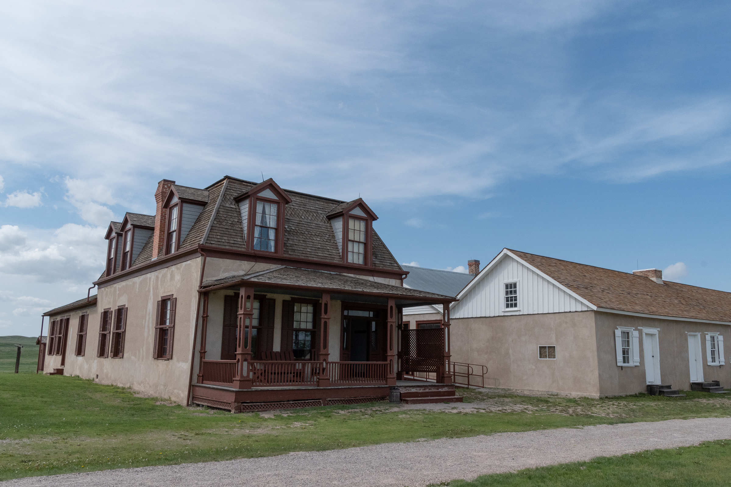
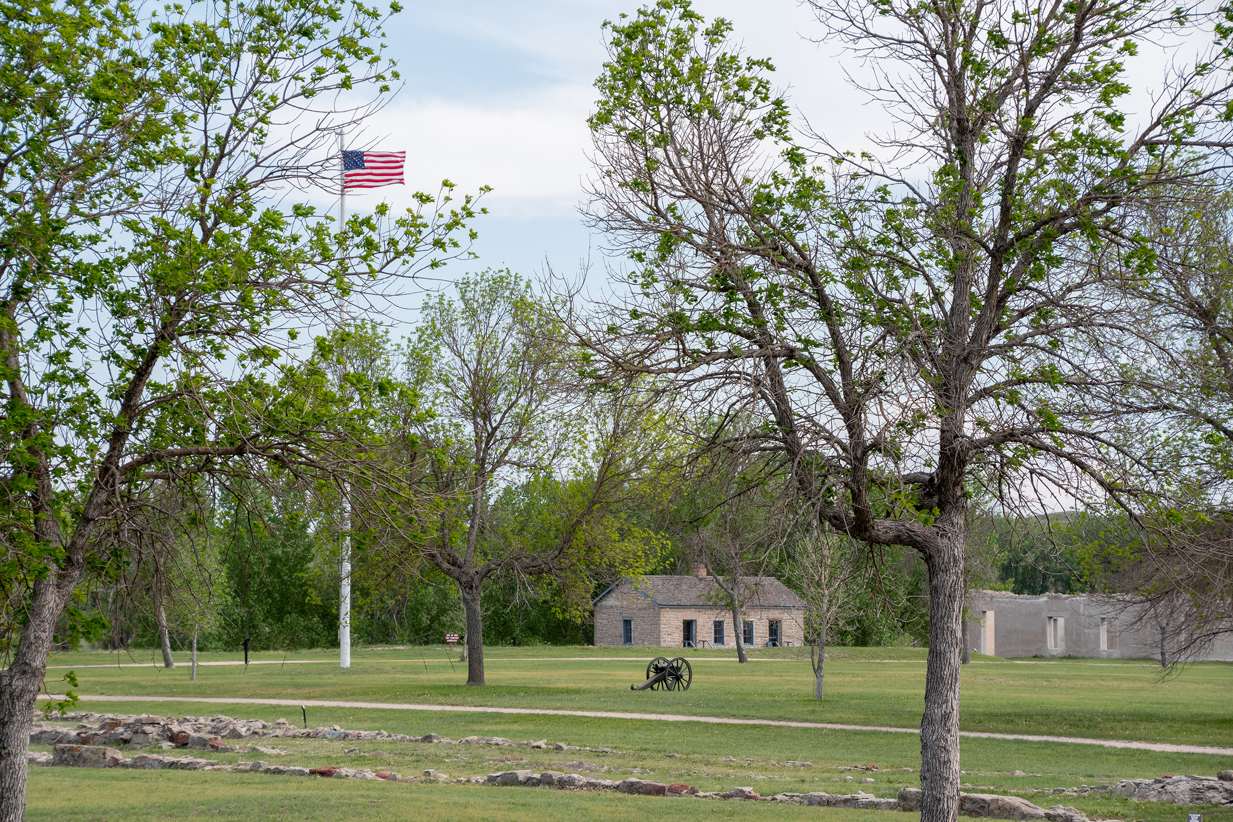
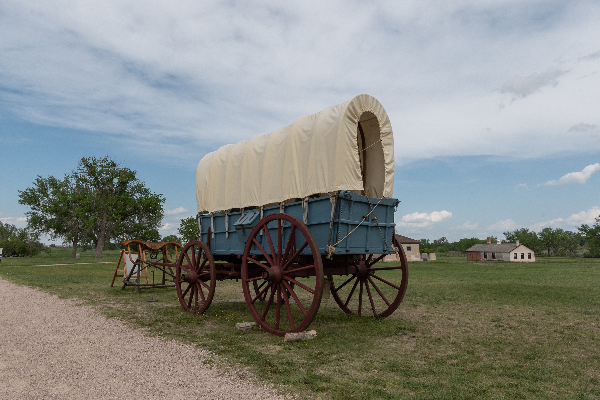
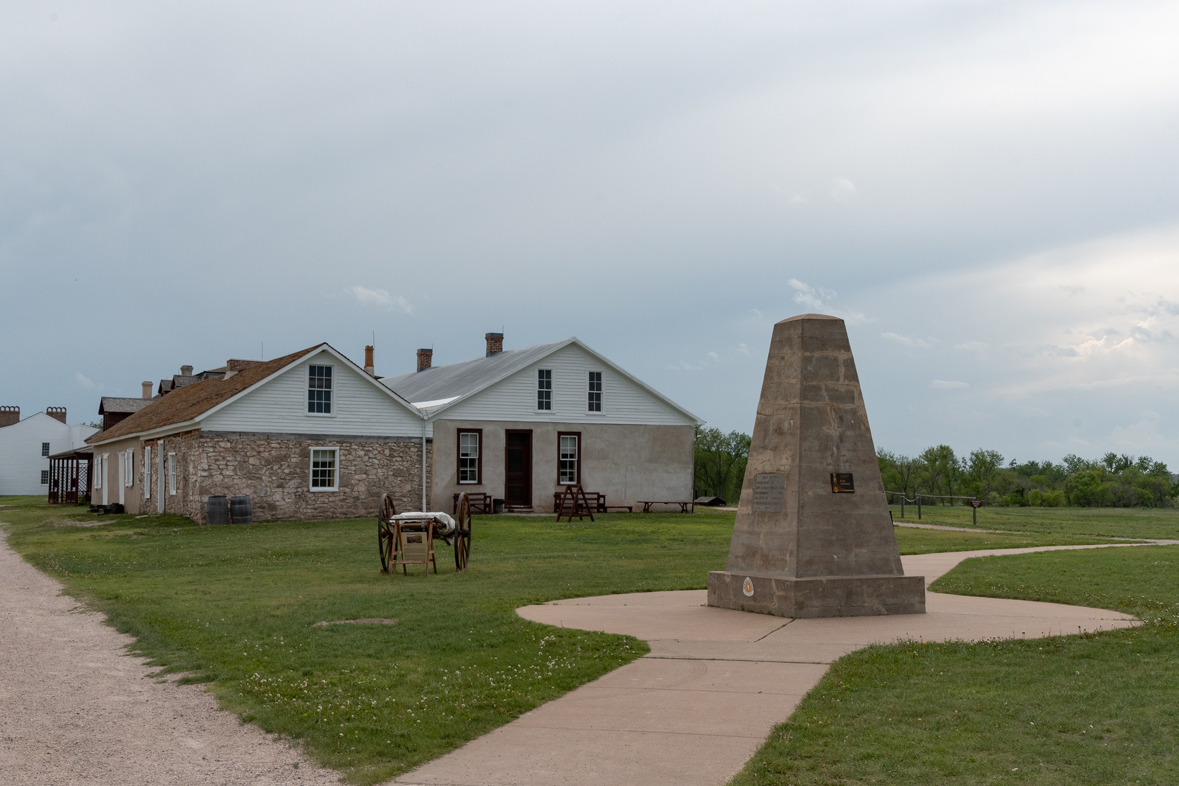
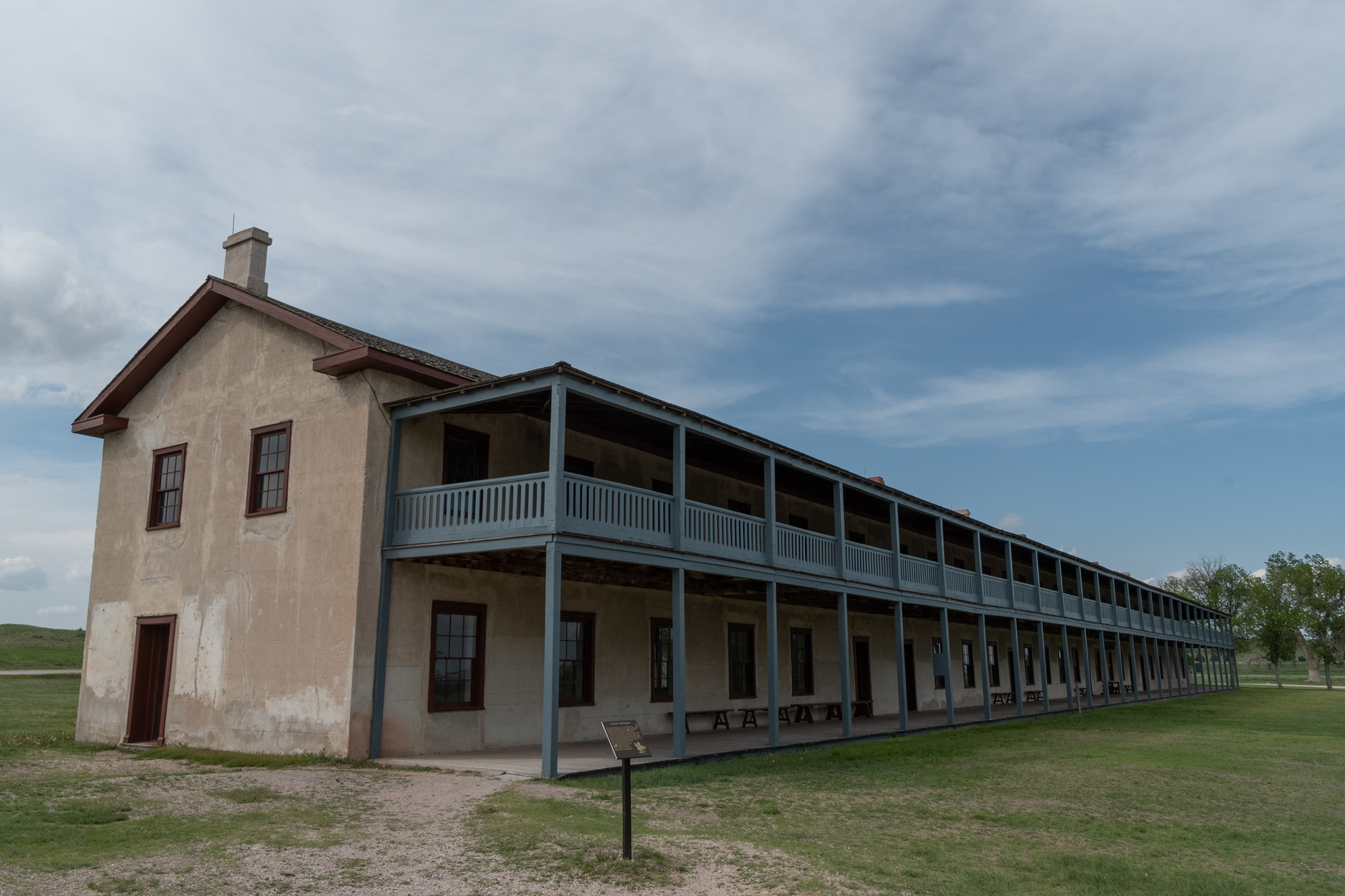
Fort Laramie
We rejoined The Oregon Trail proper not far from Fort Laramie, Wyoming — another famous waypoint for both westward emigrants and early video gamers.
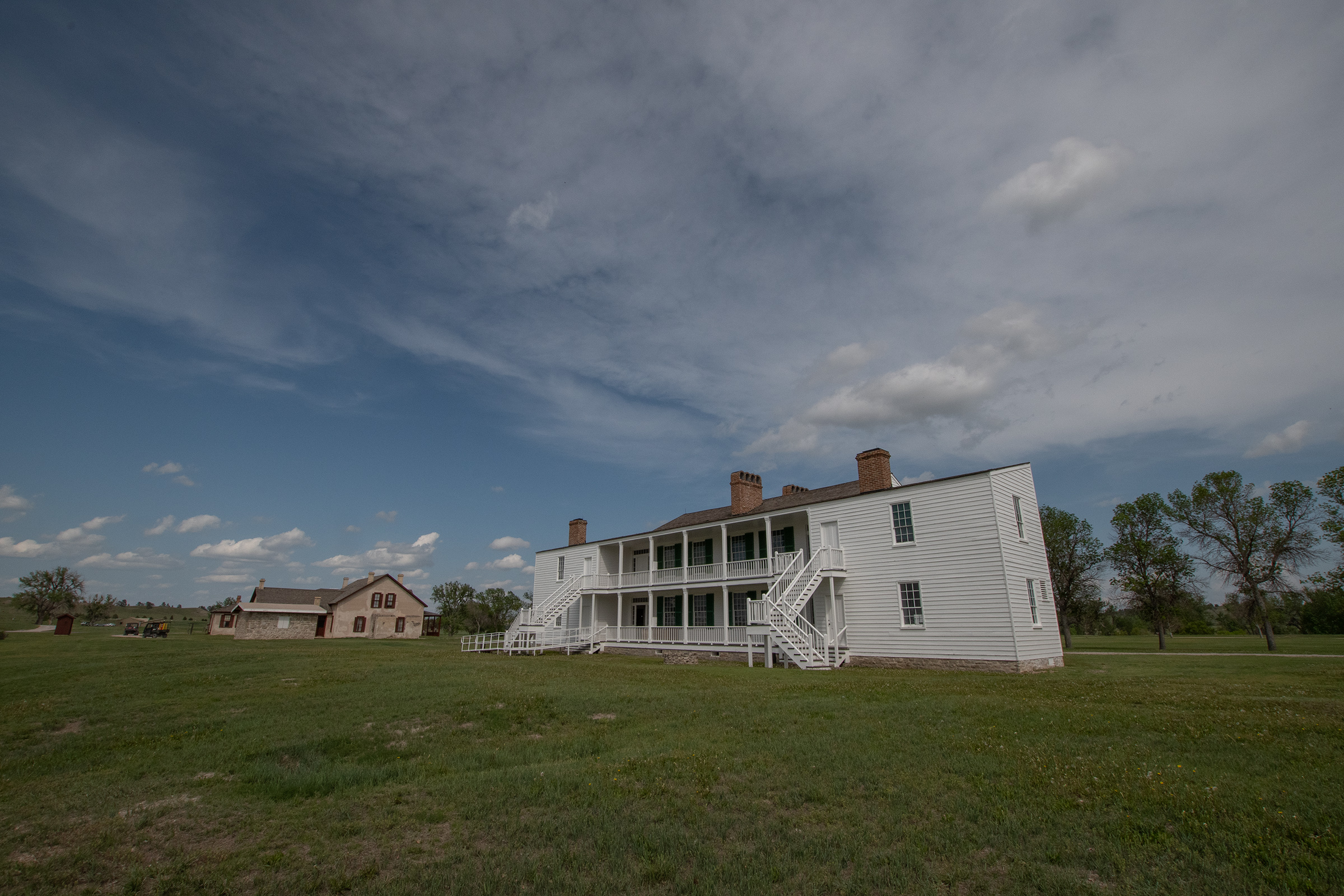
Fort Laramie once stood sentinel over the Oregon, California, and Mormon emigration trails; was a stop on the Pony Express route; and served as a staging ground for both peaceful and hostile dealings with Plains Indians. Its association with important figures, including Sitting Bull and Crazy Horse, and historic events makes Fort Laramie an icon of the American West. The one-time Army post, now managed by the National Park Service as a national historic site, looks much as it did 150 years ago.
National Park Service
The fort was originally built in the 1830s to support the fur trade. Sitting along the North Platte River before the foothills of the Rocky Mountains, it was a useful stop for emigrant trains headed west. The Army took over the fort and used it as a supply and protection outpost for travelers.
After the completion of the transcontinental railroad, the fort’s importance gradually decreased. Fewer wagon trains journeyed west, and regional Native Americans had been largely subdued. The fort was decommissioned in 1890. The original abandonment order was issued in 1889, and four of the infantry companies stationed there at that time went to Fort Logan, near Denver, Colorado that fall.
Wikipedia
The Park Service has not rebuilt any buildings that have fallen or were dismantled entirely, but they do maintain what’s there. They also outfit suitable buildings with displays of period equipment, houseware, and dress. Compared to Fort Kearney, Fort Laramie was much larger and with far nicer buildings (in fairness, it operated longer and later).
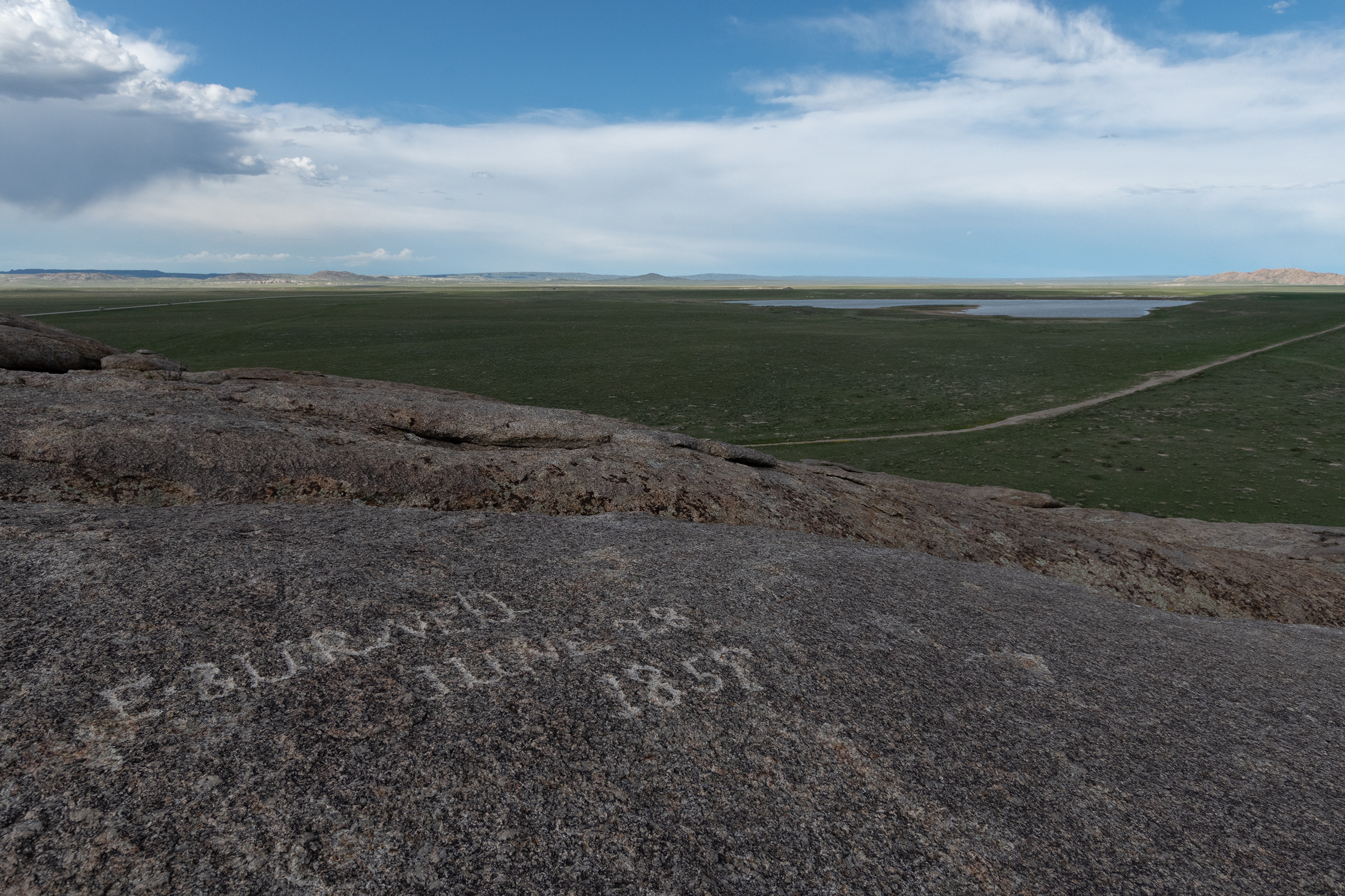
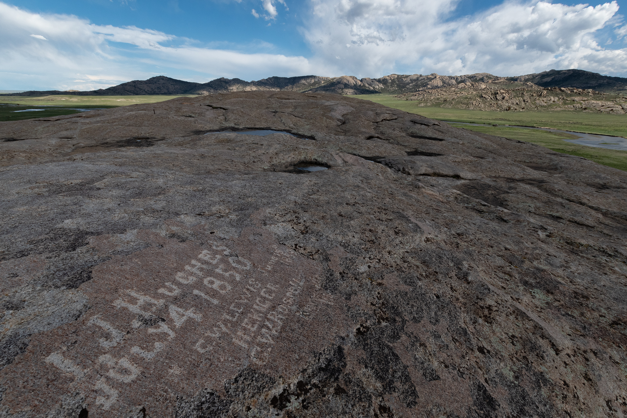
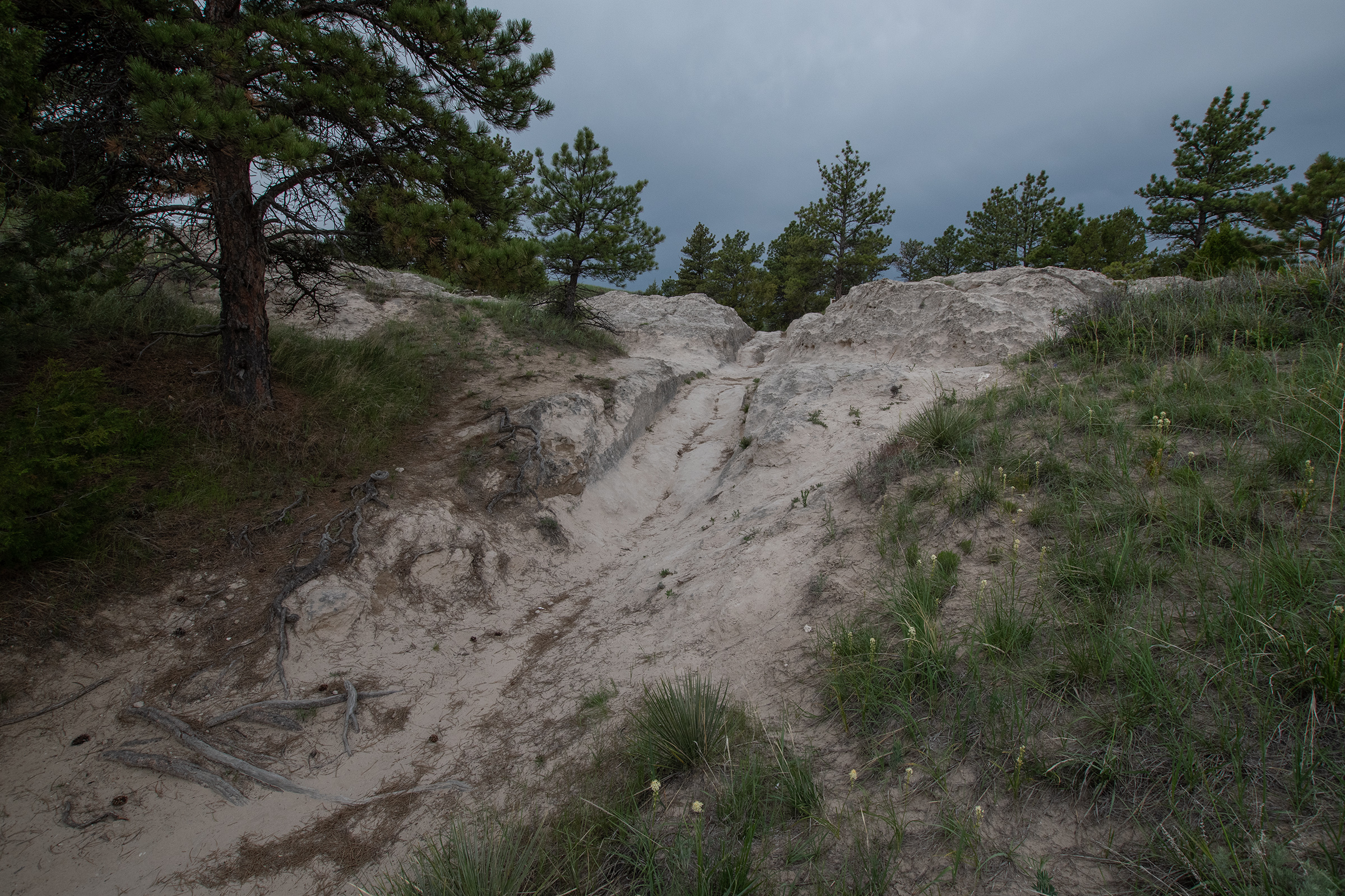
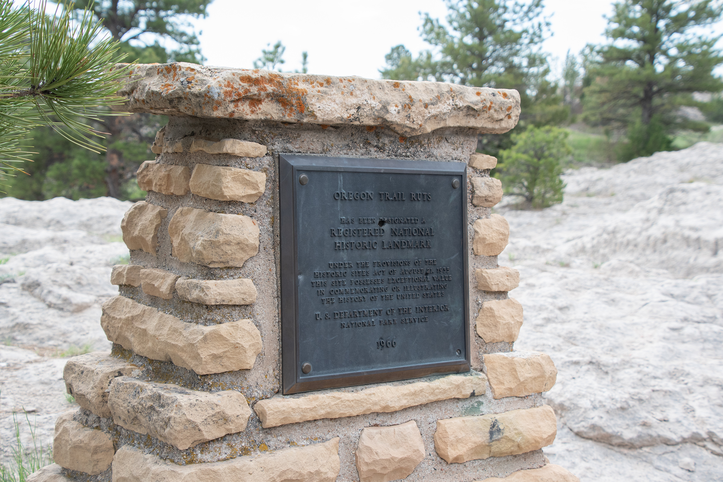
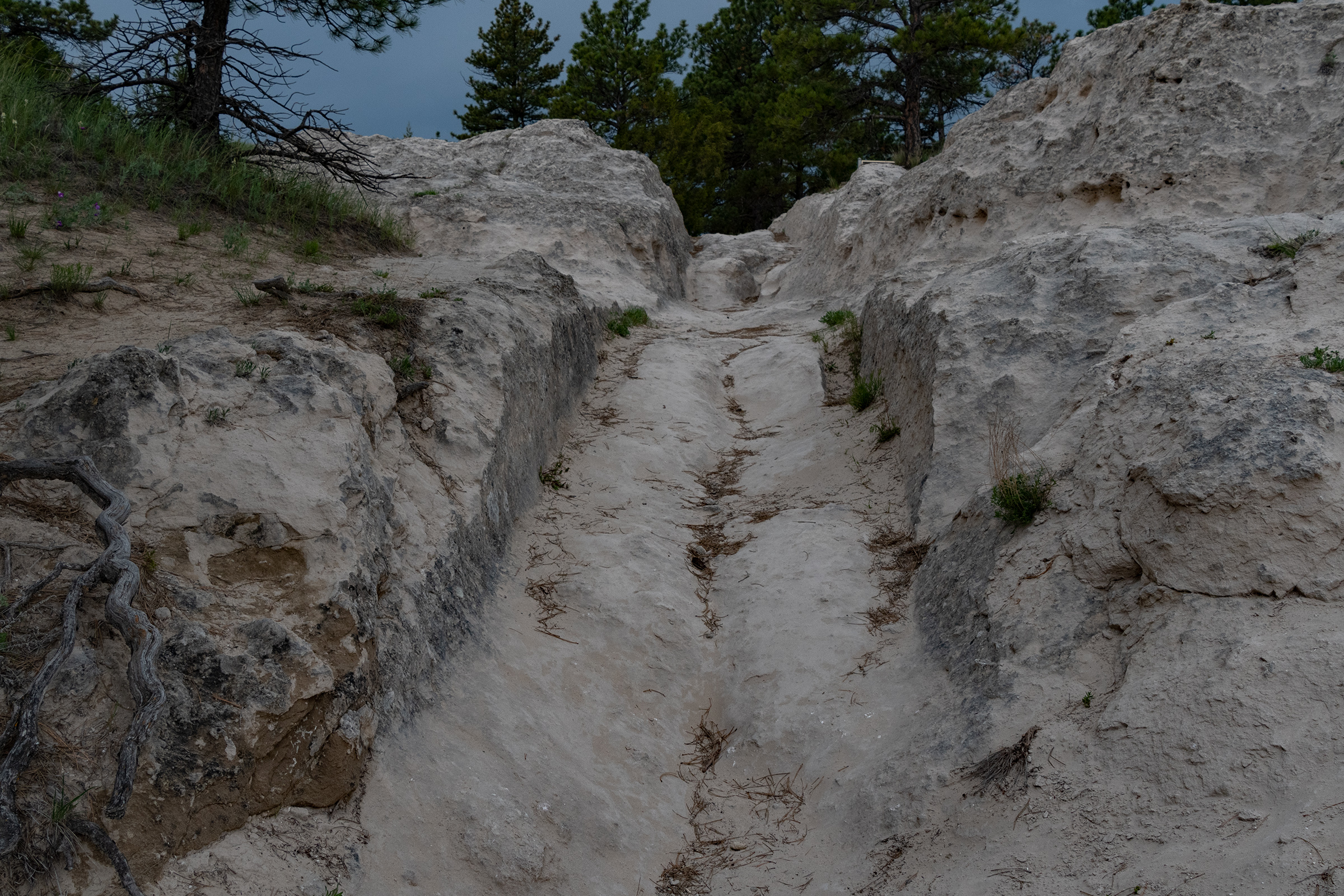
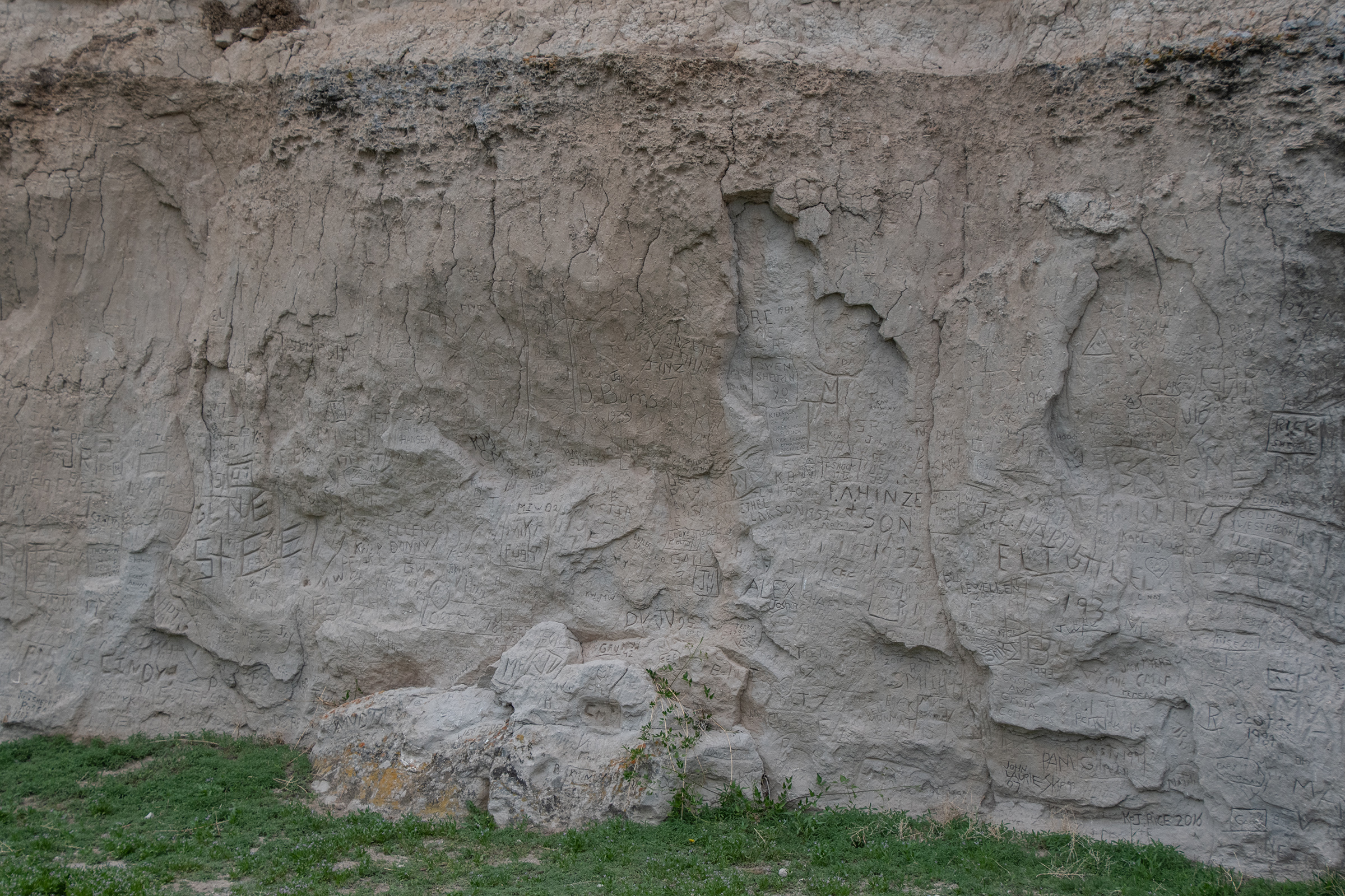
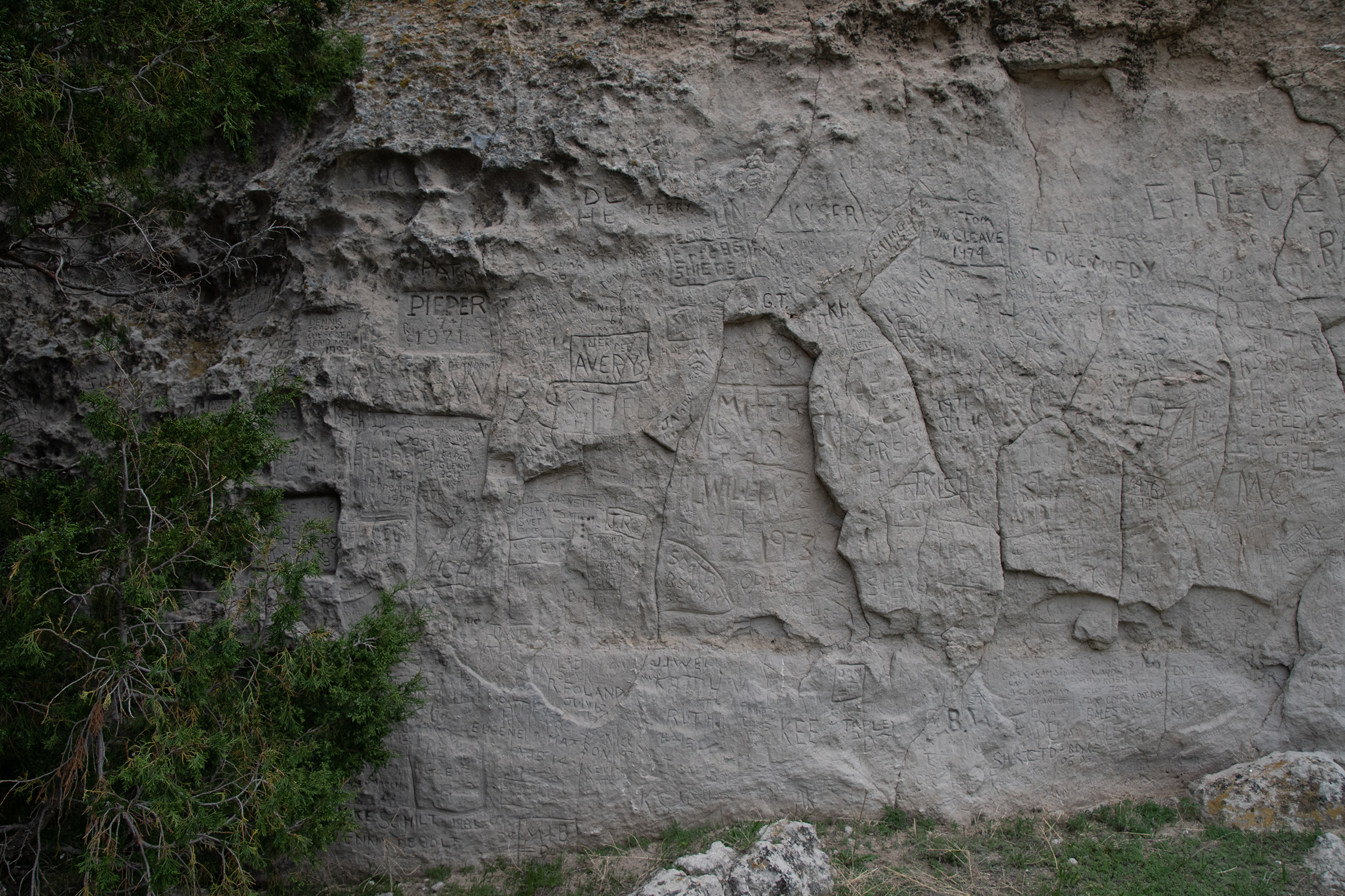
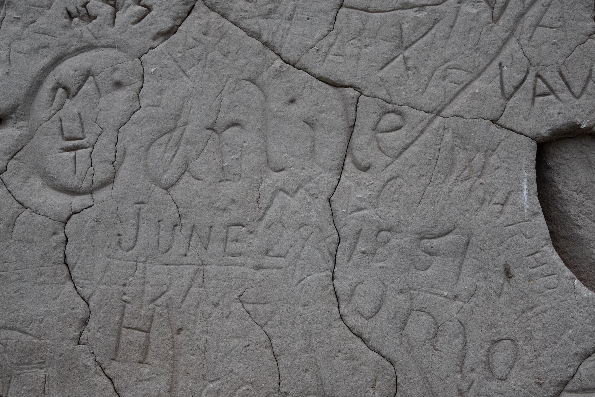
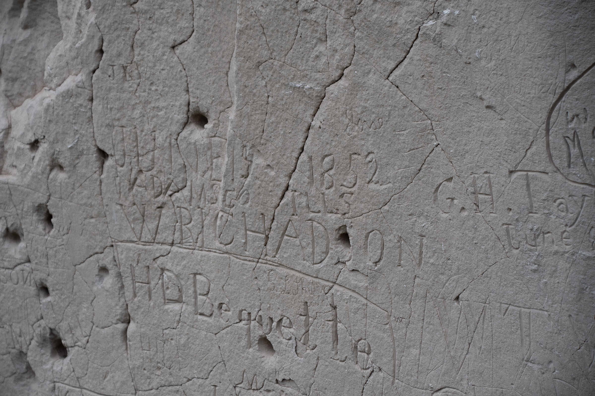
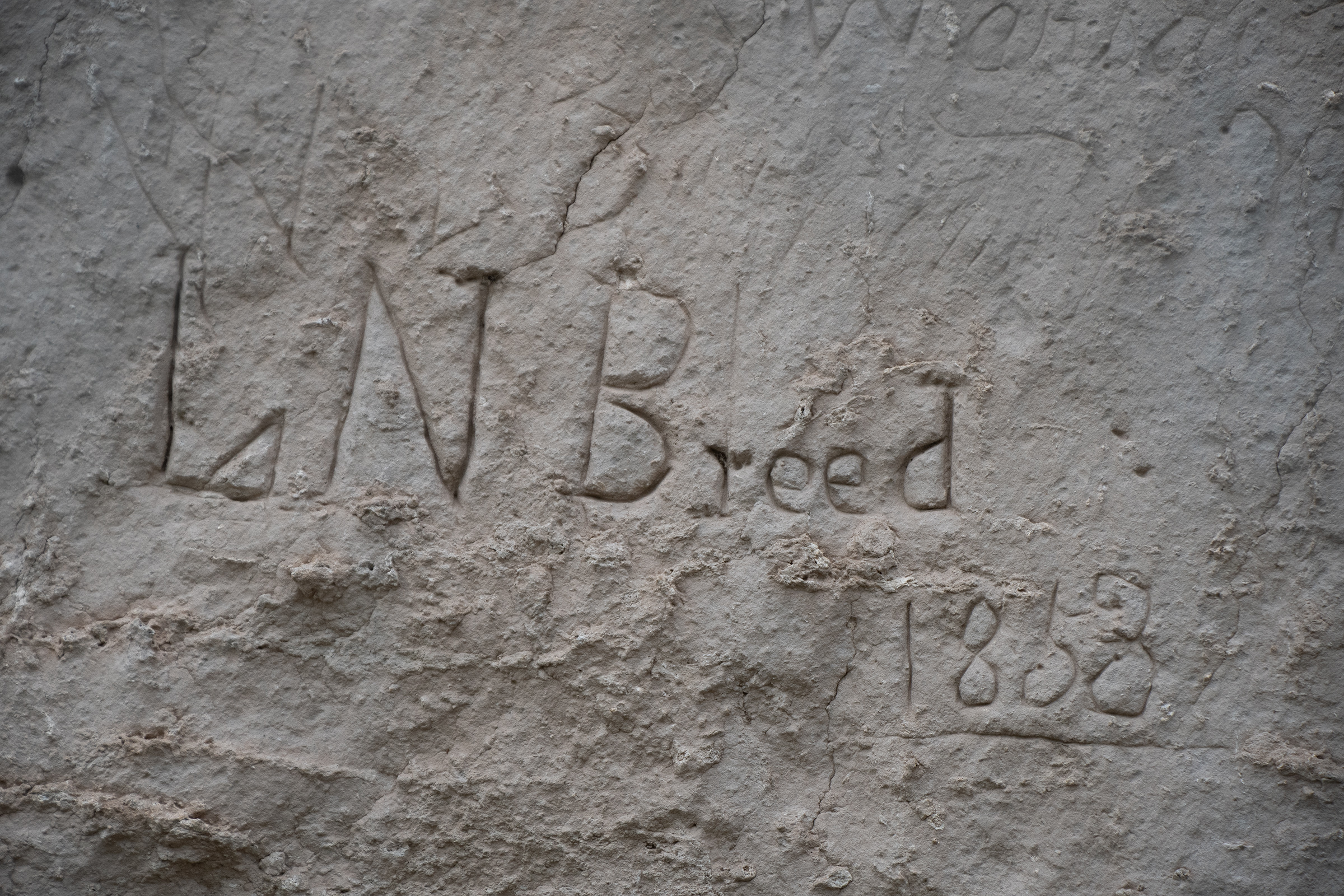
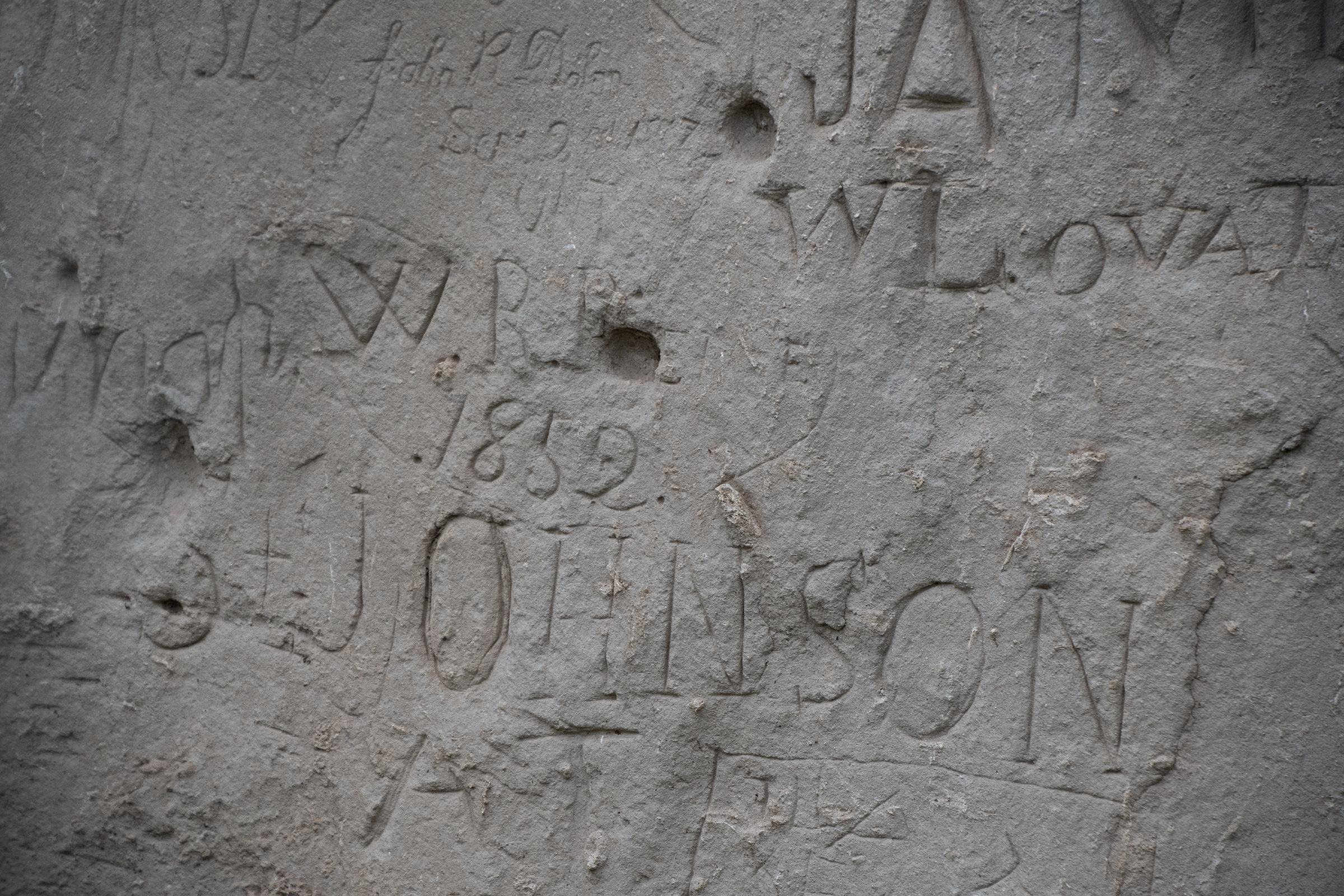
Guernsey Ruts and Register Cliff
Our last stop for the day was another visible set of wagon ruts — in stone! Wear over the high-traffic years through this particular path actually wore ruts into rock, preserving them much more dramatically than the curious grass depressions that other ruts seem to have re-wilded into.
Ruts in grass, much less visible, more of a general indentation
I suppose when I heard “you can still see some wagon ruts from the original trail!” what I envisioned was “two track Jeep trail in mud.” But those fade if not in active use. So of course that’s not what it would look like now. But these do, so these were pretty cool to see next to each other.
Register Cliff is located 2 miles to the East. The camp site was located on the flats below a mile long cliff of soft sandstone used as a name register by thousands of emigrants from 1847 on. It’s interesting that no emigrant ever mentions inscribing names or initials on the cliff in their diaries.
Wyoming Army National Guard
We saw some dated as early as the 1850s, although plenty have also been carved within my lifetime, too. Cue the complaint, “this is why we can’t have nice things,” although both George and I talked about having a hard time deciding what year marks the threshold between “historic markings” and “asshole vandalism.” Wagon trains of the 1860s earned it. But in the 1890s… 1920s…? This wasn’t exactly an easy trek until the US Highway and US Interstate systems and reliable vehicle transport were commonplace. I drove here in a car with air conditioning. (Although I suppose if that’s my measure, George and Evan can both leave their initials.)
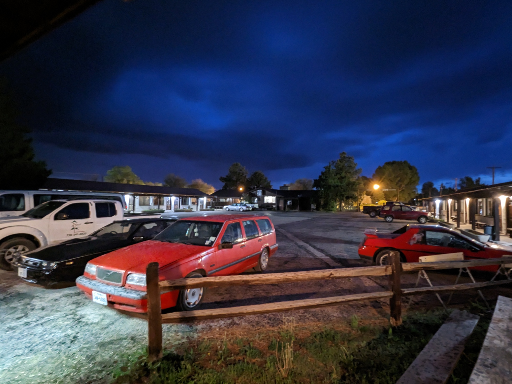
Bunkhouse Motel
After dinner at (checks watch) the only restaurant still open at 7pm in this town, we headed to our motel for the night. With lightning moving in from the distance, each of us set about a small car project. George developed a rattle in his sunroof glass today that is has apparently become dramatically loud. Evan tried to see if he could make headway on his heater. And I replaced my spark plugs to see if a little old-fashioned tune-up would help matters at all. In the process, I made two discoveries:
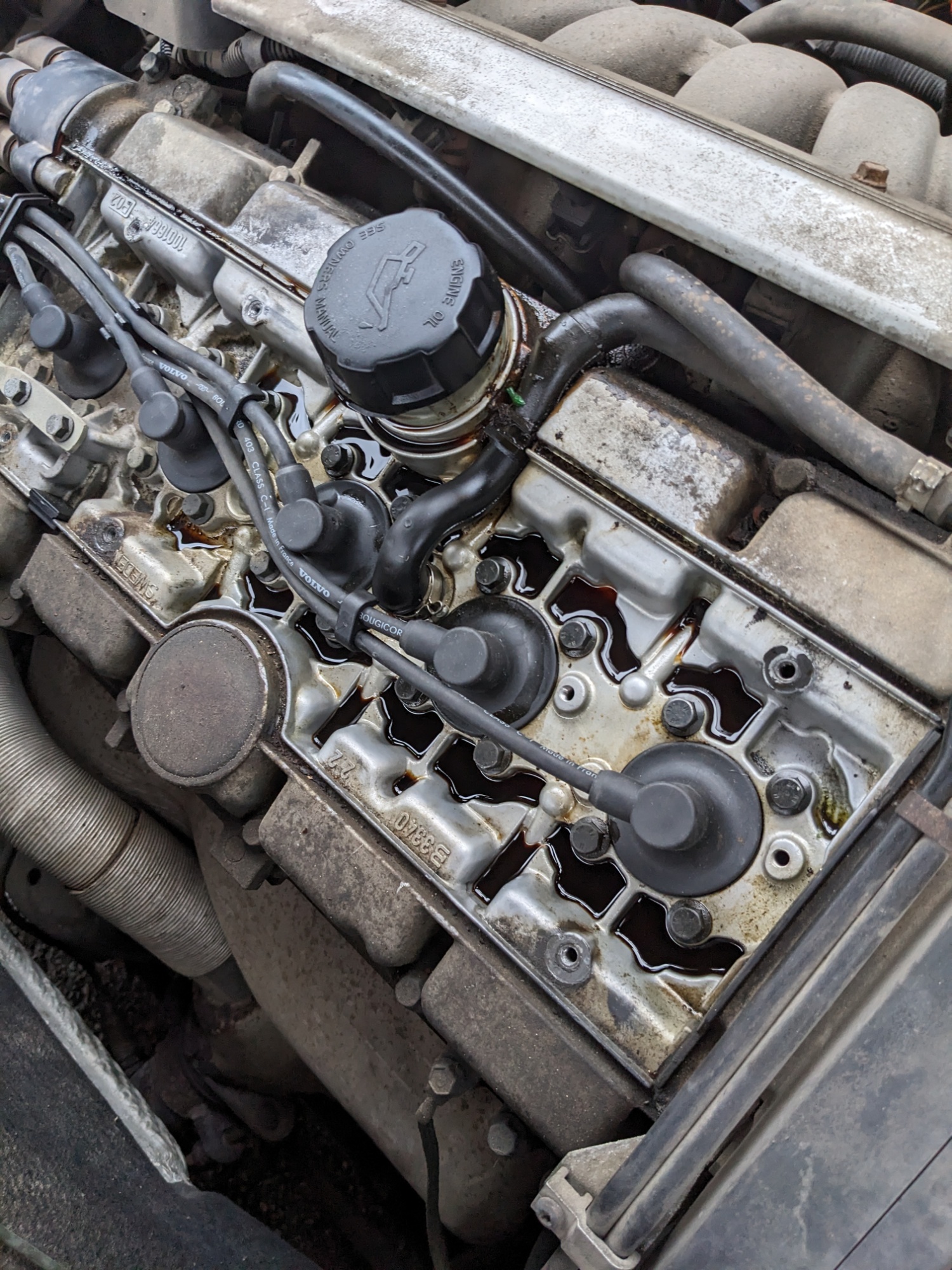
First, that butyl gasket shim we added to my oil cap to seal it apparently doesn’t. The spills on top of my valve cover are worse now than they were before. The gasket seems like it was was pushed out by pressure, which implies that perhaps my PCV valve is fouled? (Talking out of my ass here: that’s not a thing I knew about until tonight.)
The question is: do I put on a new oil cap to seal the leak — which, if the valve is actually fouled — might cause a new leak to form elsewhere? Or do I think the oil took the path of least resistance and a new cap would send it through the PCV properly instead…
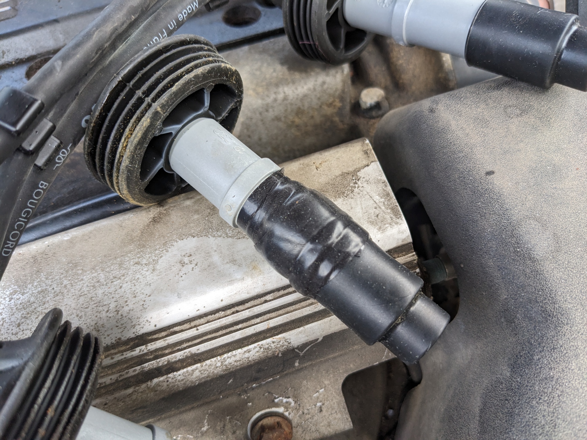
Back: what it should look like. Front: what trouble looks like.
Second, look at that spark plug wire. That looks like arcing through the sheath, which would bypass (or cut voltage to) the spark plug and send current through the engine ground instead, causing a partial or total misfire. That right there might be my biggest problem. Unfortunately, these plug wires would require a few days lead-time at just about any store I might get them from.
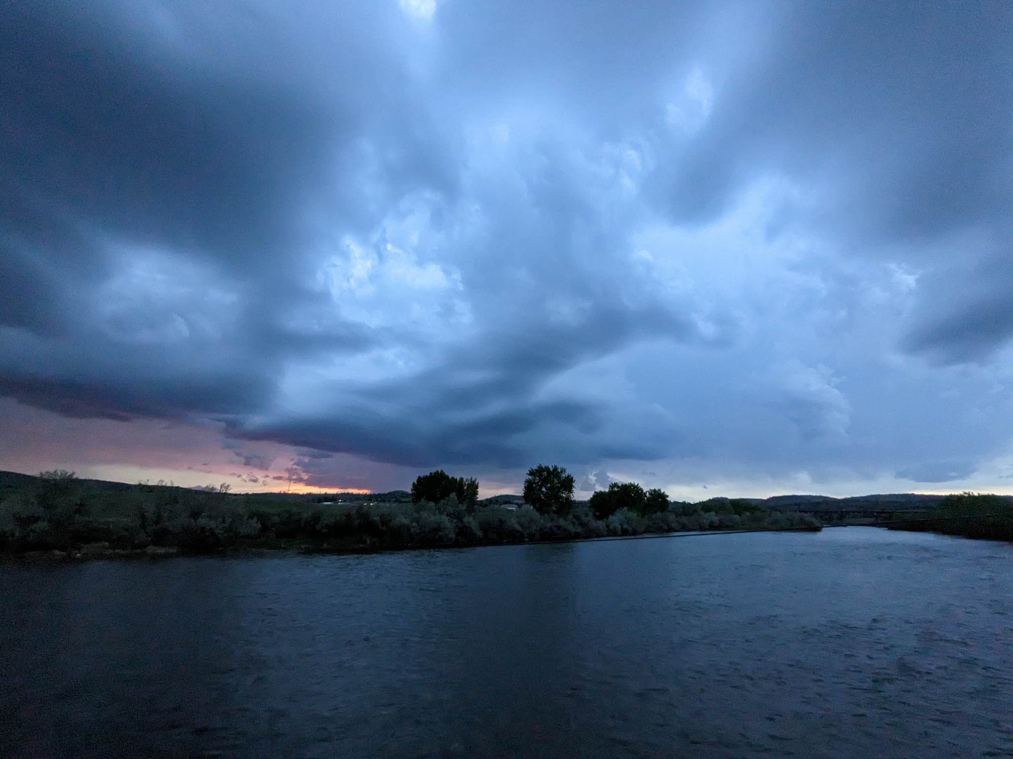
But as the sunset behind an approaching storm, I closed the hood over my partially reassembled motor, poured a little whiskey, and went to stand in the lightning and thunder and breathe the mountain air until it started to rain. Tomorrow’s problems can wait.