Copilot has requested an Albuquerque to Death Valley adventure and I’m delighted. Creativity flourishes in constraints — but I’ll admit having had a helluva time reducing this down to an itinerary we can conquer in just three days. And it’s only 1,500 miles! But at long last, I’ve built a map I’m excited about…
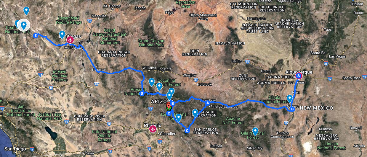
…and the resulting spreadsheet says it’ll be fine if we just don’t sleep.
Friday

I think I’m just going to warn people that they’d better not expect me to answer any messages Friday afternoon. San Lorenzo Canyon is one of my favorite best-kept-secrets of New Mexico, and I haven’t been back since the before times. I’d rather see it in daylight.
From there, we’ll head out via US-60 to either Globe or Payson, both just northeast of Phoenix. Neither is terribly far, with a few roadside attractions along the way.
Saturday
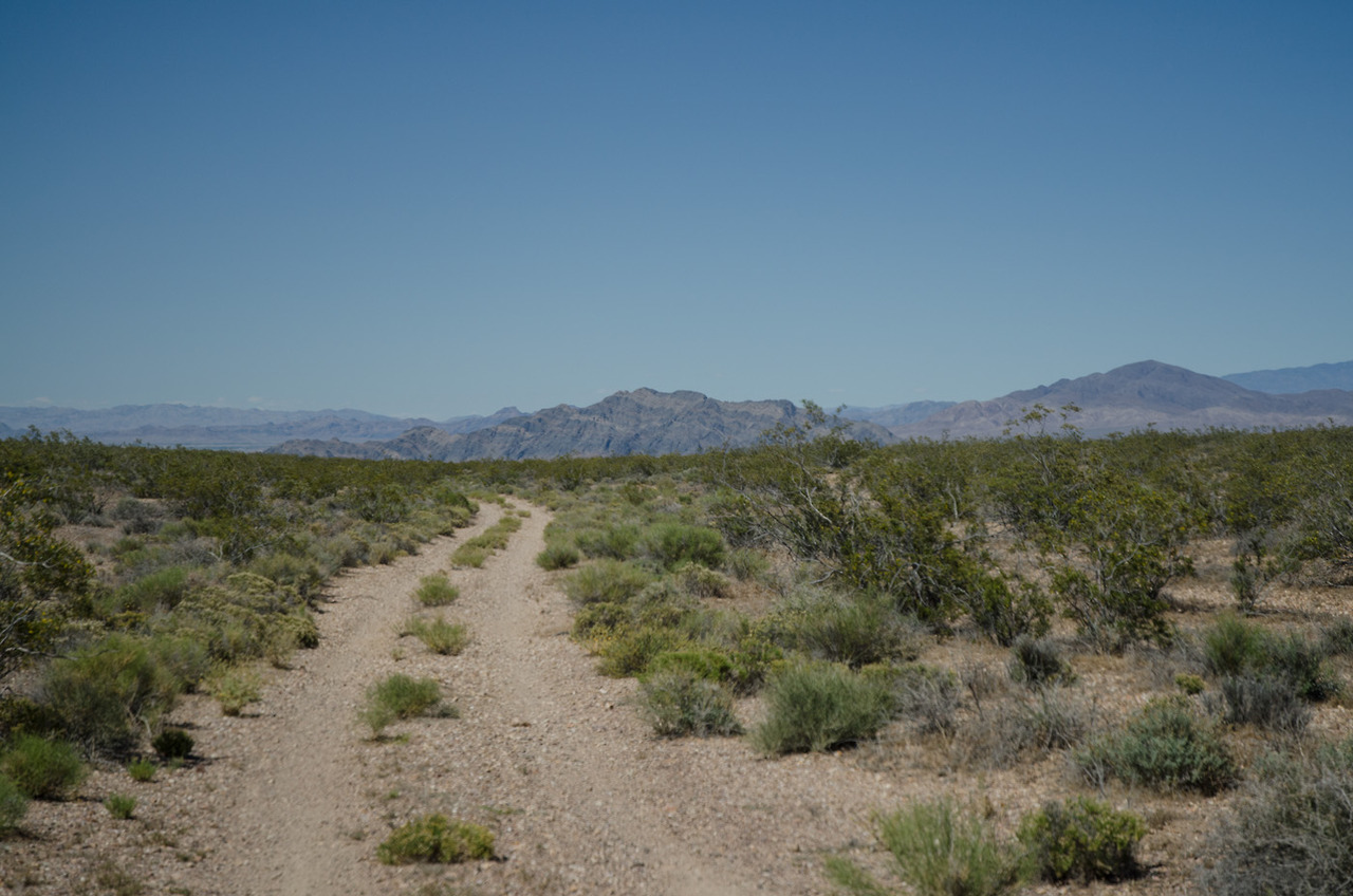
Given that my favorite offroad route in Death Valley is closed, I went looking for an unpaved adventure — for authenticity. Pulling up TrailsOffroad and AllTrails at the same time is always fun. I found me a mountain in two acts. My favorite.
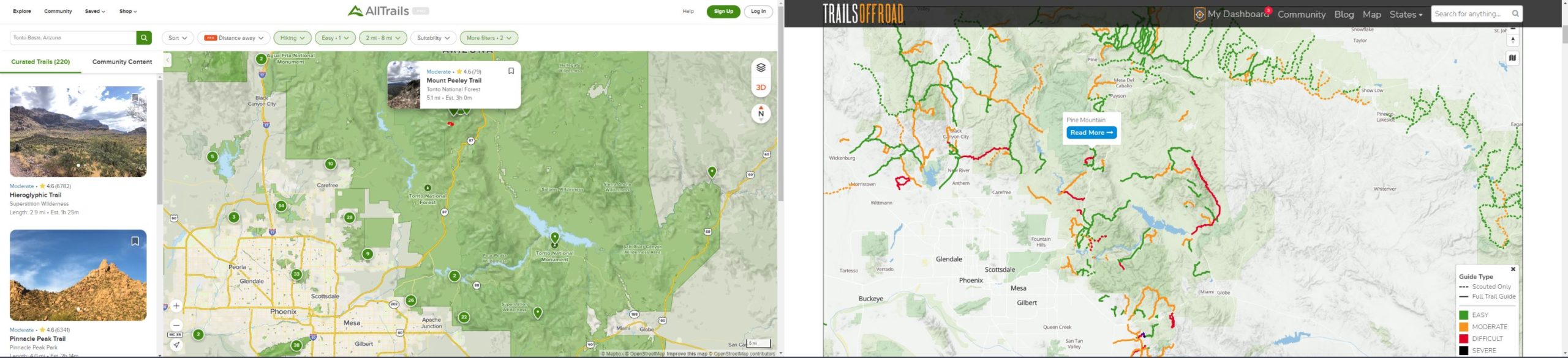
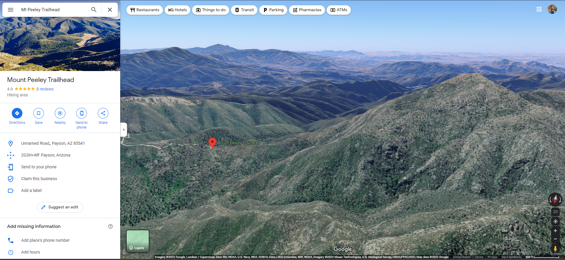
And this should work if they haven’t gotten a lot of snow. From the highway, an easy but scenic 5 mile drive to a 2.5 mile hike to the peak. … And back.
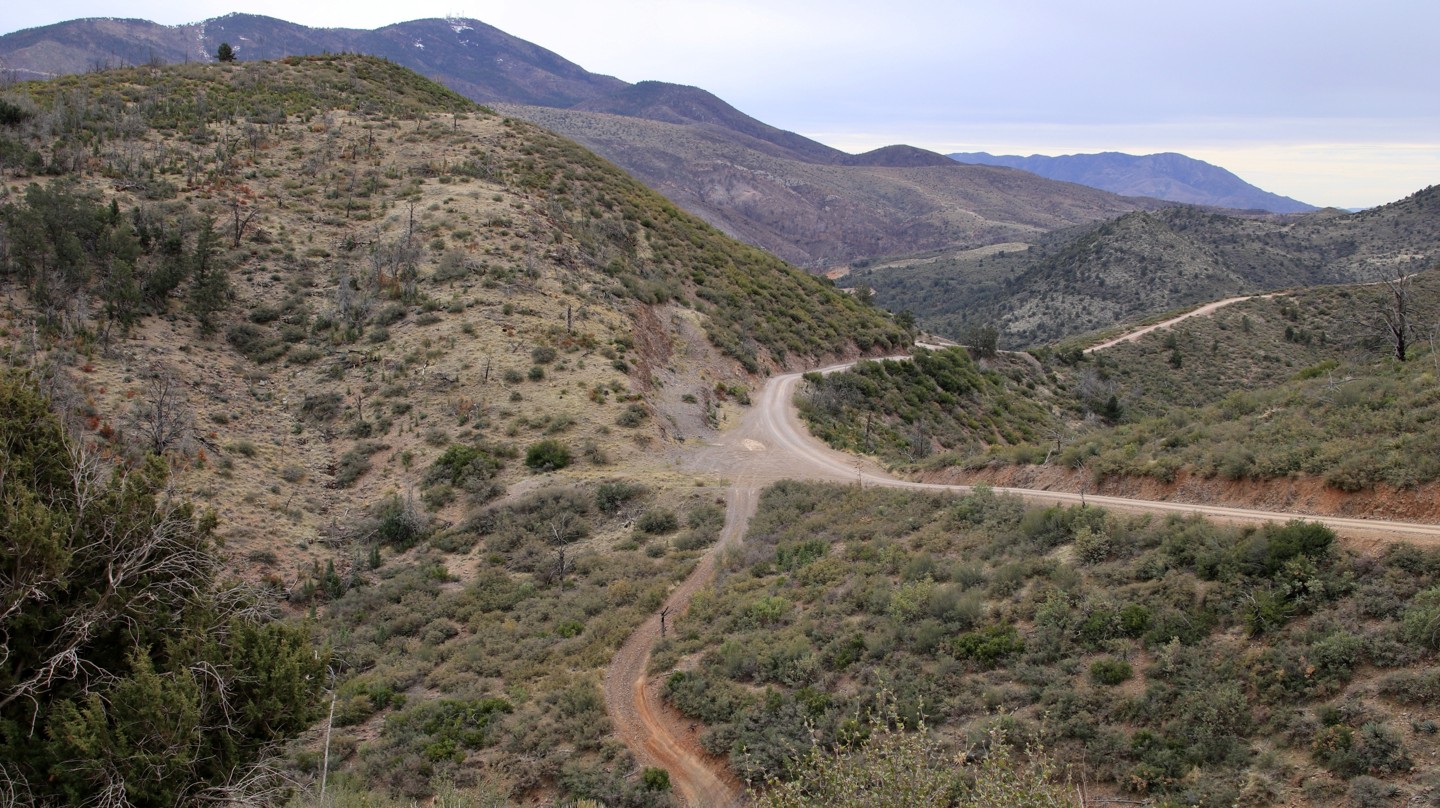
A drive up Pine Mountain unveils the rugged beauty of […] Tonto National Forest, the largest of Arizona’s National Forests. The drive offers long views across a vast landscape of rolling hills and deep sycamore lined canyons carved by small streams fed by runoff from the looming Mazatzal Mountains. […] The rating is based on narrow shelf roads and a few sections of mildly rocky road surface.
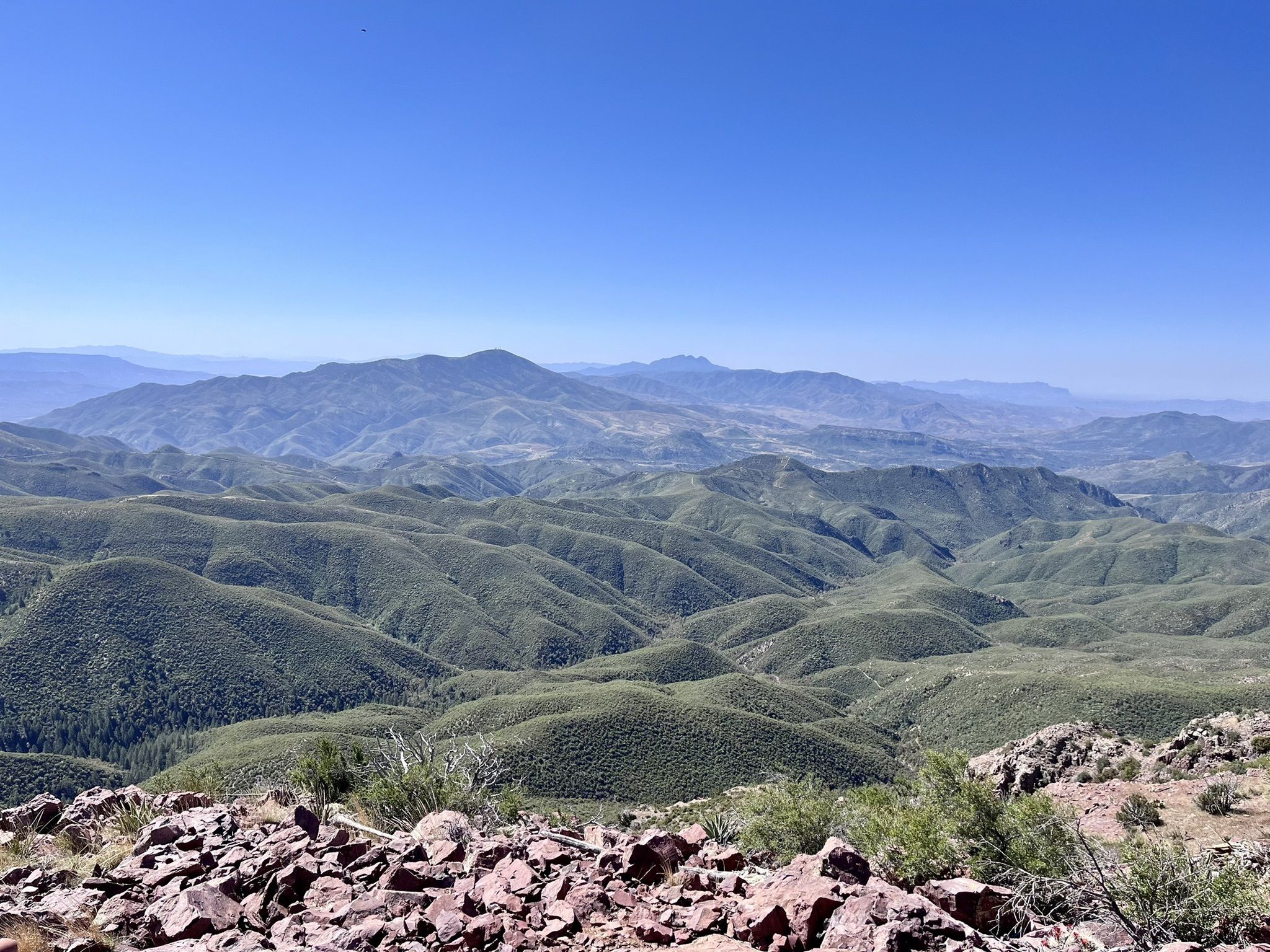
Experience this 5.1-mile out-and-back [hiking] trail near Payson, Arizona. Generally considered a moderately challenging route, it takes an average of 3 hours complete. […] Part of the Arizona Trail, it’s well maintained and easy to follow. 1,453 foot elevation gain. Be careful of your footing, but it’s not difficult if you’re experienced.
I hadn’t heard of the Arizona Trail before — “The Arizona National Scenic Trail is a National Scenic Trail from Mexico to Utah that traverses the whole north–south length of the U.S. state of Arizona. The trail begins at the Coronado National Memorial near the US–Mexico border and moves north through parts of the Huachuca, Santa Rita, and Rincon Mountains.” It even dives down into and out from the Grand Canyon, ending in the Kaibab Plateau area of the Arizona Strip.
In the event of snow, I’ve got a couple ideas in my back pocket, but this looks fun. And from there, it’s about a 7 hour drive to Pahrump or 6 to Las Vegas. A longer day than I would usually inflict on someone (or even myself on a hiking day), but we have a lot of miles to munch.
Sunday
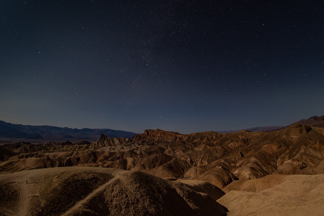
Whatever remains of our drive into Death Valley, which depends on how far we were willing to slog the night before. Then Death Valley shenanigans. I’m still hoping for a little more reopening of park land are between now and then:
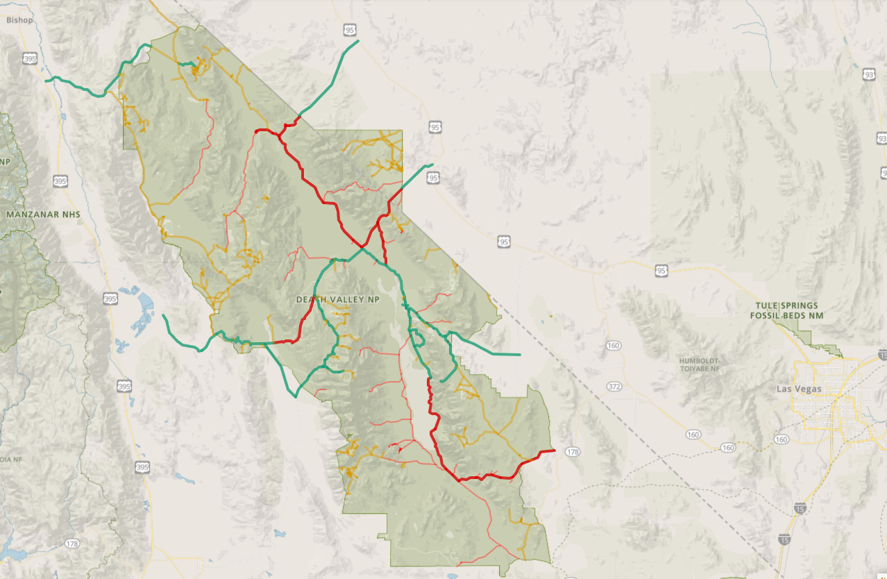
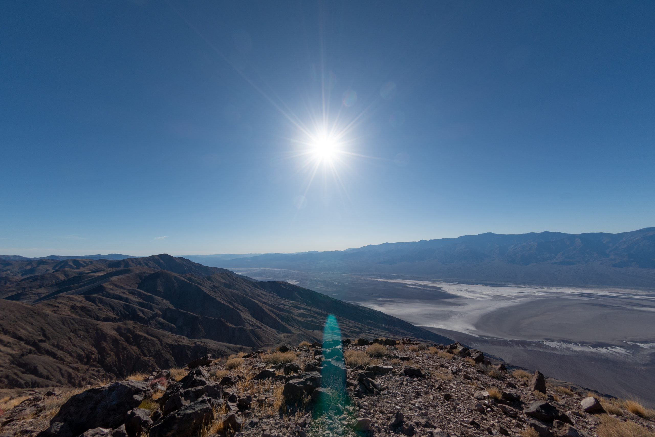
Guess this means we won’t be able to go to That Damn Denny’s in Beatty. But Badwater Road is open as far south as the salt flats, Artist’s Drive and Zabriskie Point are both open, and Dante’s View to Mount Perry is open, too — all of which are greatest hits material.
And there’s also the uncharted (by us, anyway) lands southwest of Stovepipe Wells — Mosaic Canyon Road/Trail, Emigrant Canyon Road, and Tucki Mountain Road are all open, too.
So far, the only room I’ve booked for the whole trip is our finish line at The Ranch at Furnace Creek. The swanky, historic inn from last year was already booked up — but The Ranch down the street may be more our speed this time.
Monday

And finally Dad flies out of LAS at about 3pm, so we’ll need to get moving pretty early. Easy peasy. Although… the park map did show Deadman’s Pass as open…
How hard could it be?