And here I am, on the way to yet another climbing trip in Vegas.
And here I am, on the way to yet another climbing trip in Vegas.
Xterra the Younger and I survived our night at the Armed Extended Stay, but I got kicked out at the noon check-out time. So I “took a lunch break” to go flog myself through 650 feet of autobelays at the Stone Age Climbing Gym down the street, where Dad met me when he arrived into ABQ. He arrived after I had completely pumped out my forearms, but upon his arrival, pride dictated I make a third attempt at a 5.11 that had twice already defeated me at a dyno (jump) 30 or 40 feet off the ground.
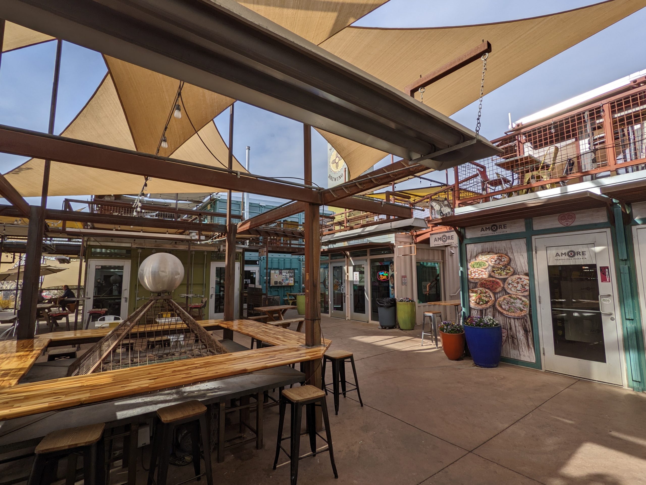
Nailed it. And then it was time for beers and lunch at a little food hall around the corner while I answered a couple more emails.
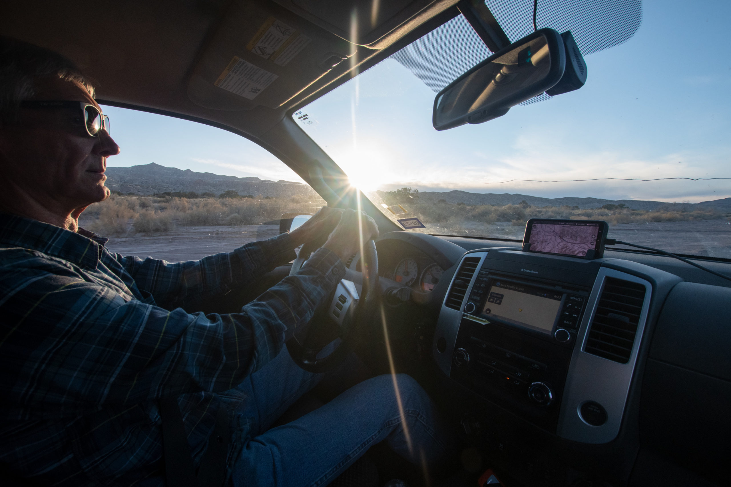
And then it was time to get on the road southbound.
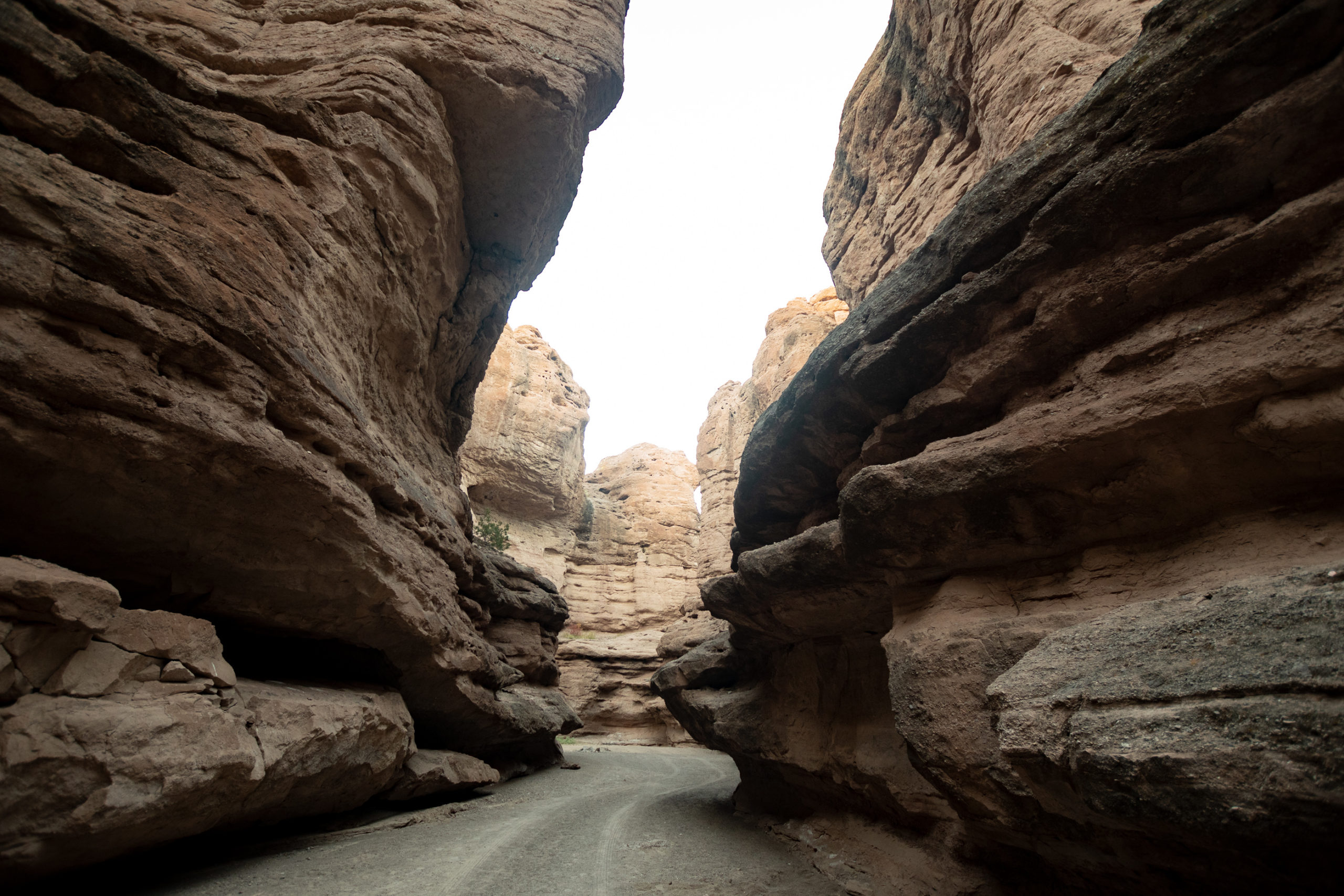
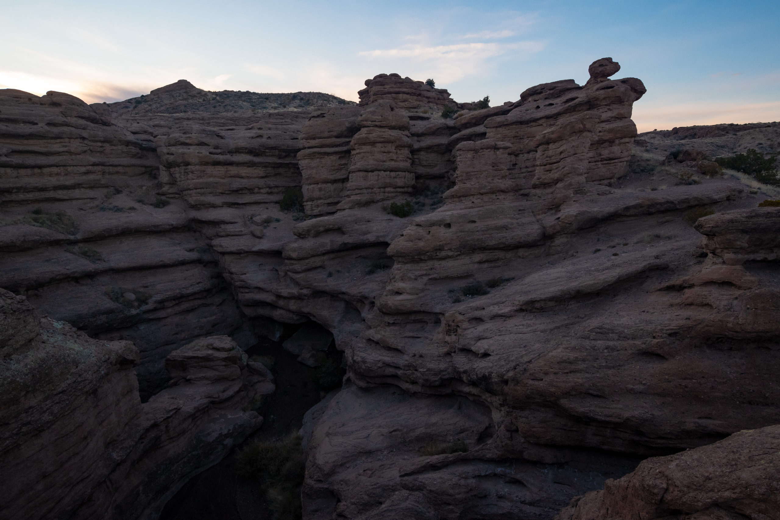
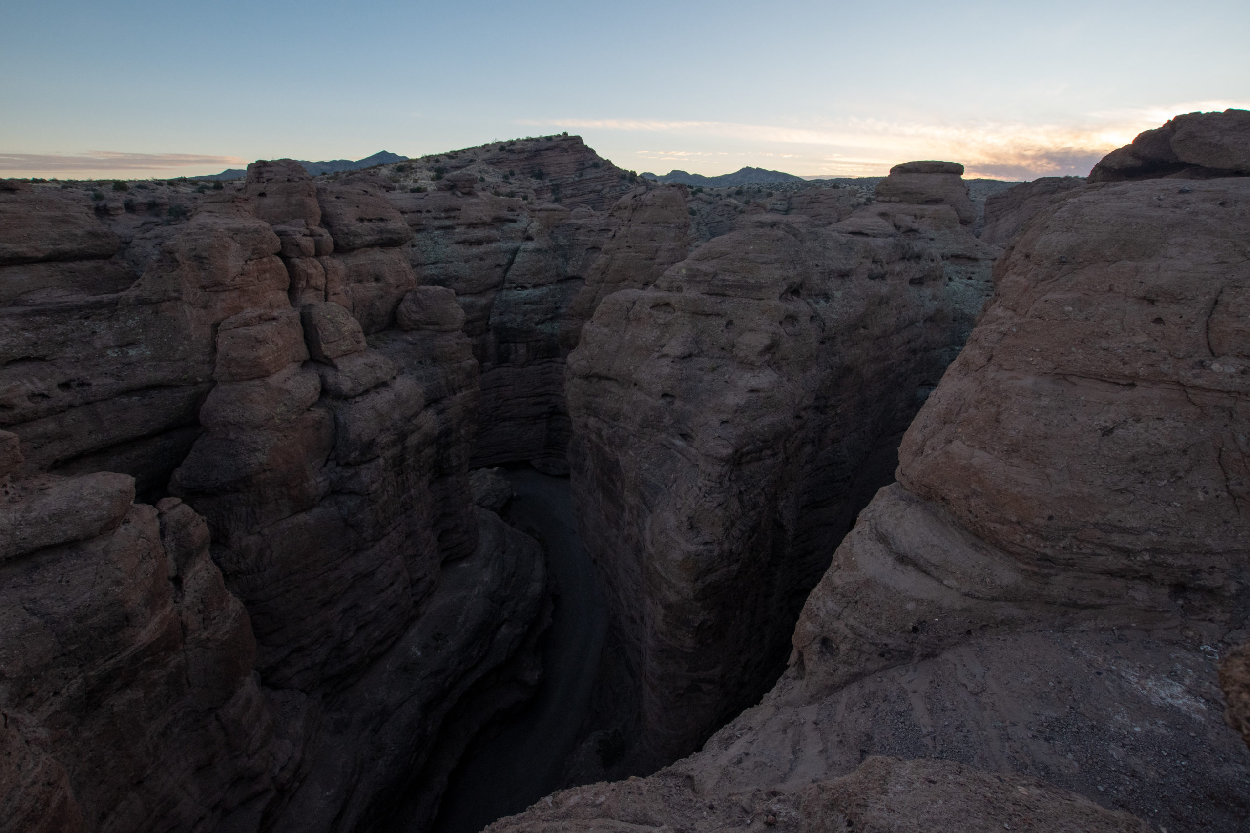
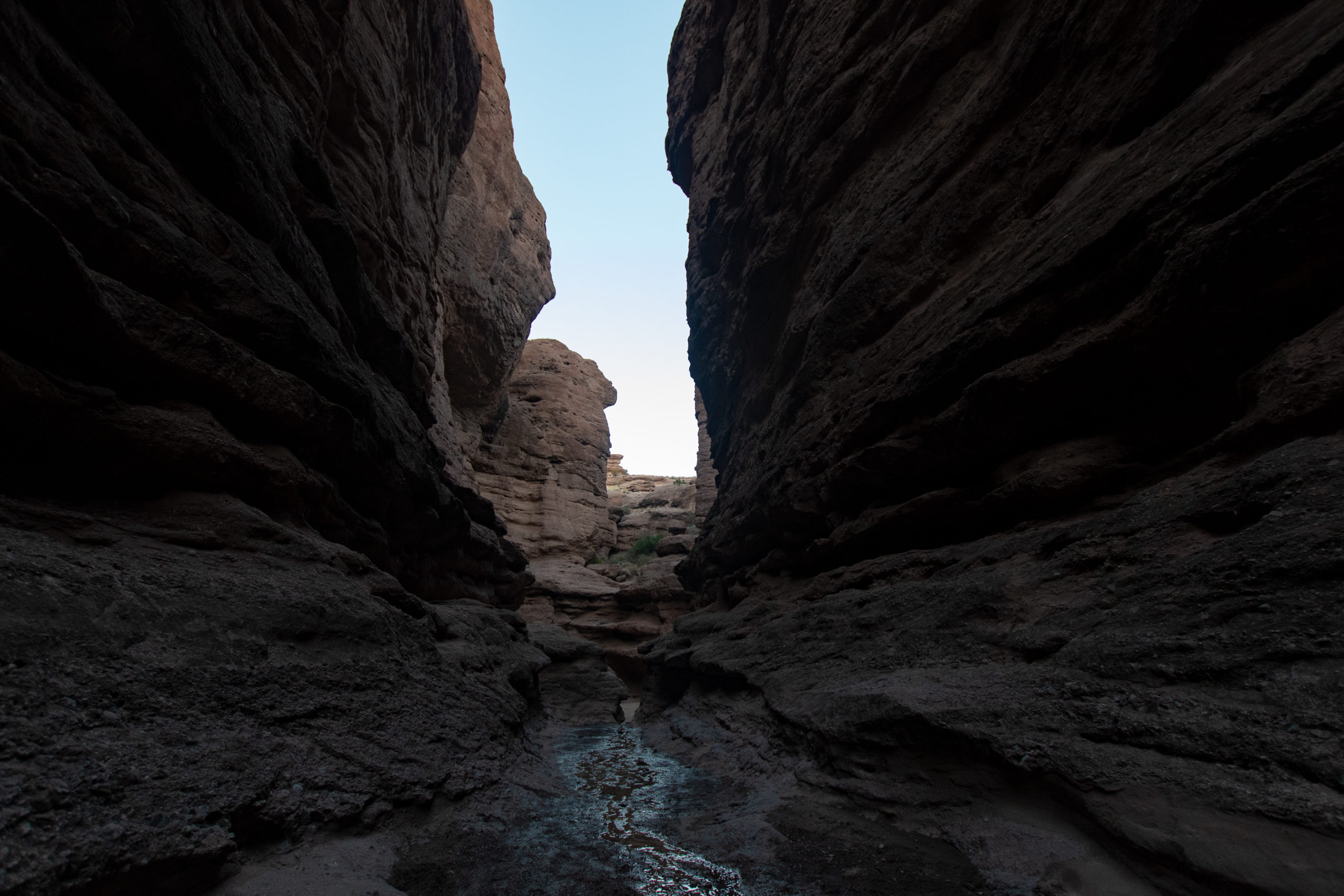
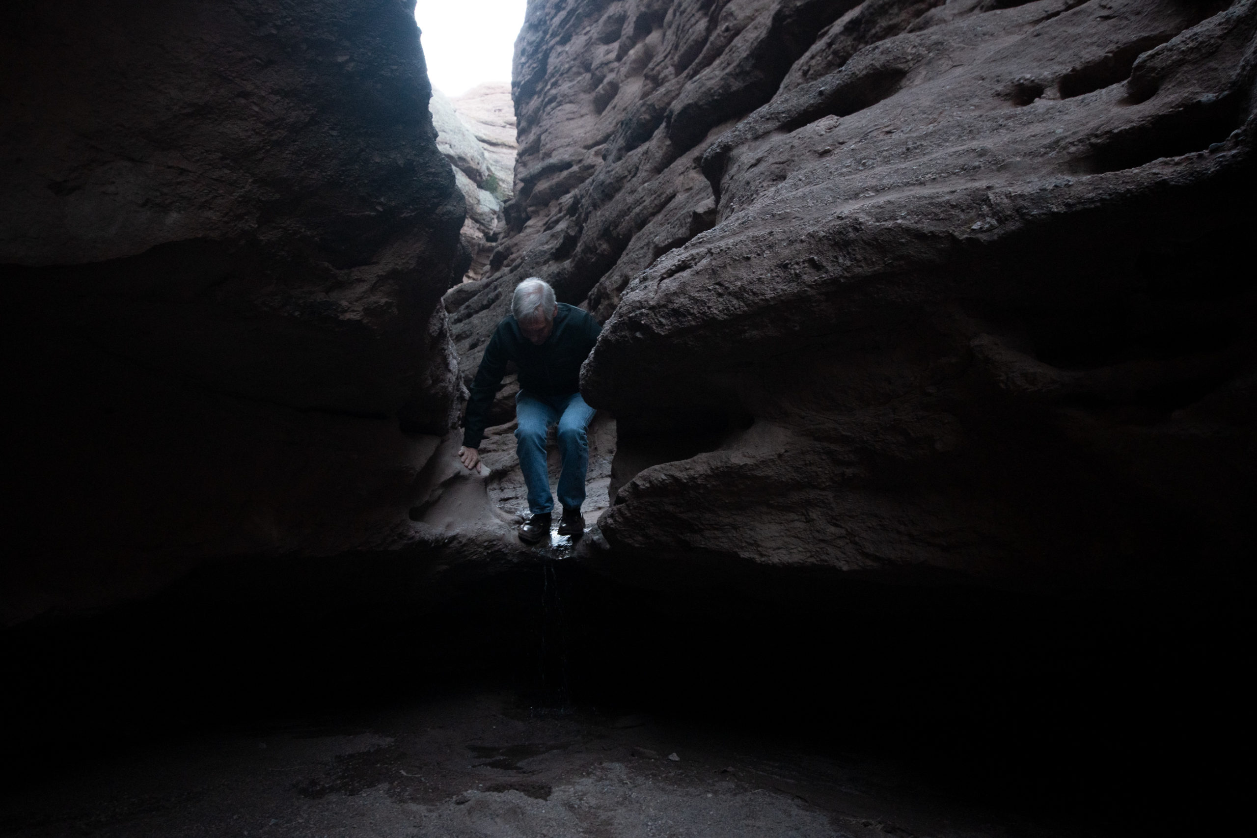
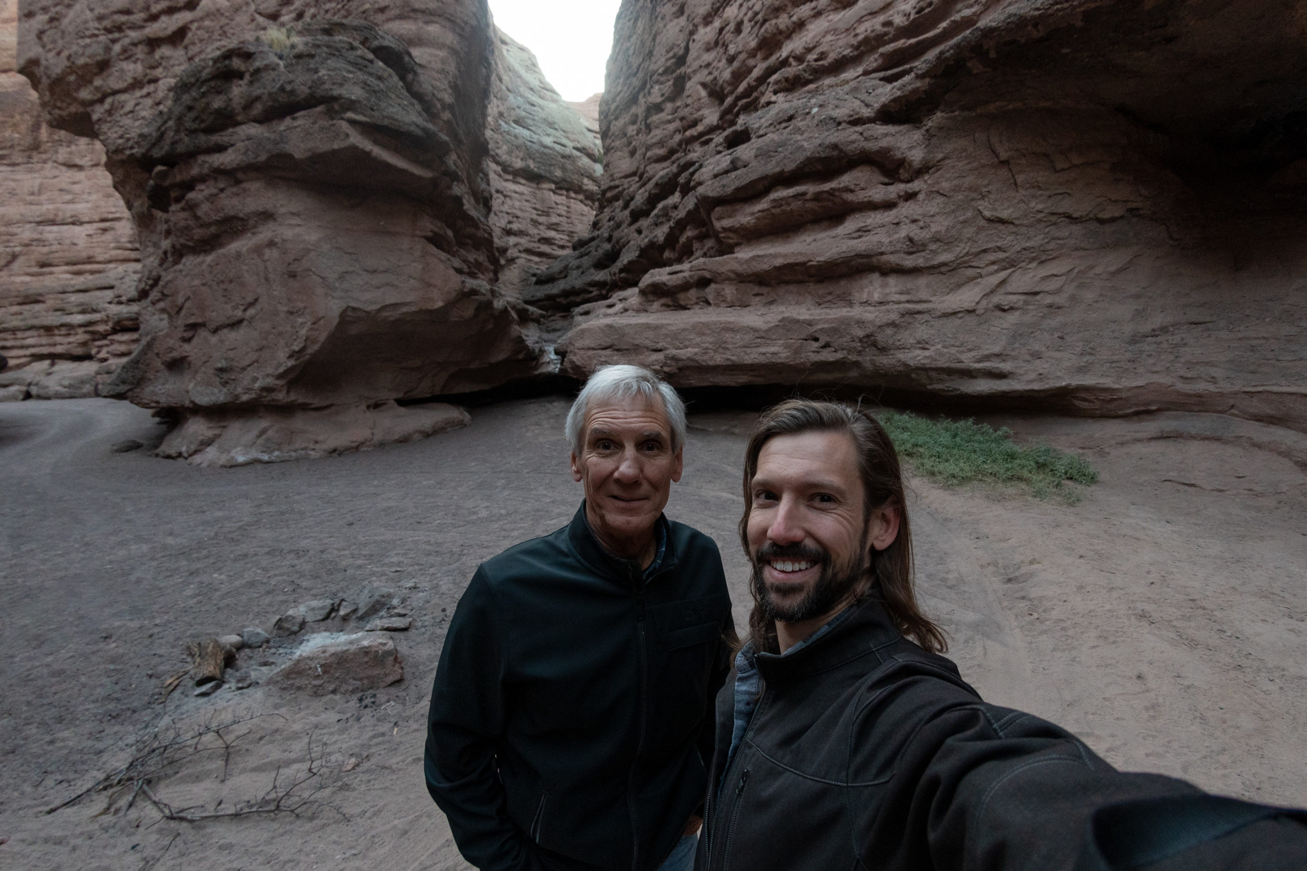
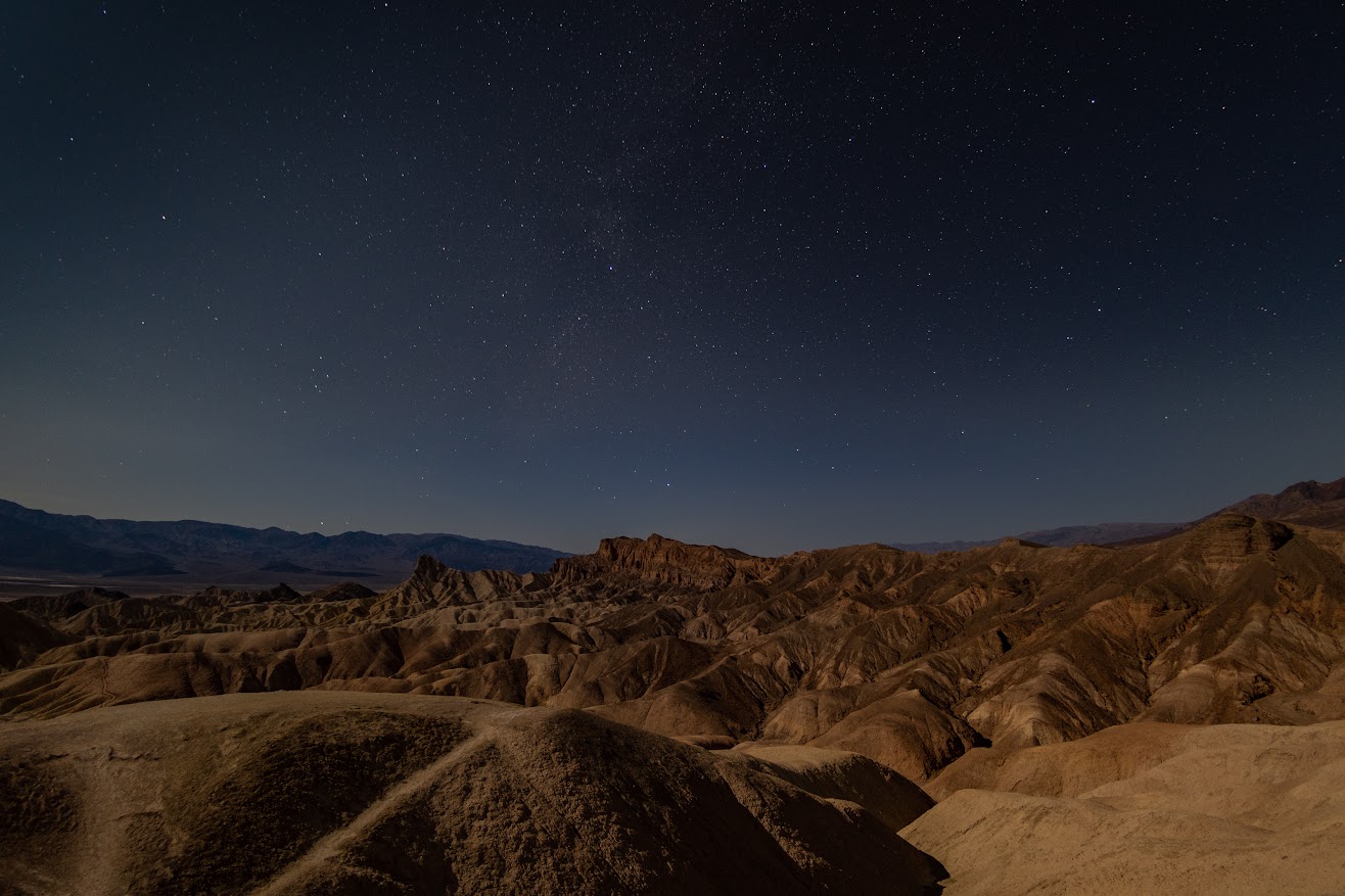
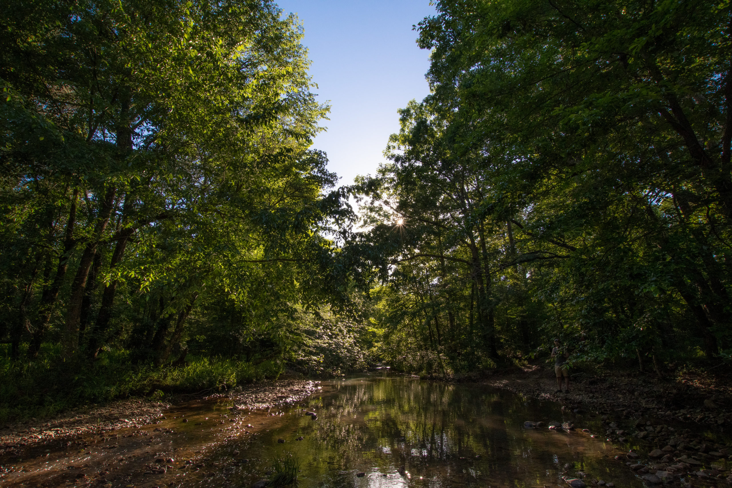
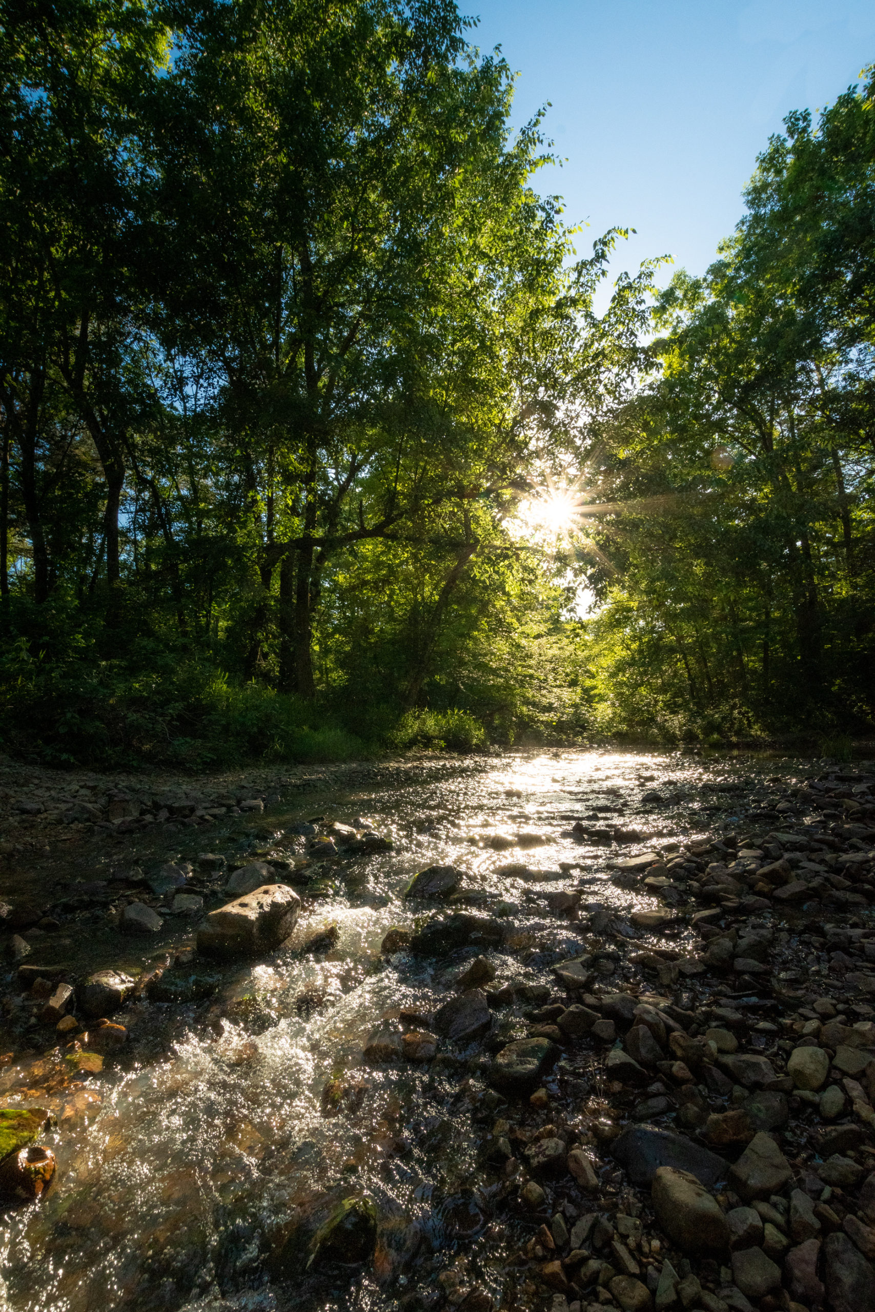
San Lorenzo Canyon isn’t far south of Albuquerque and I haven’t been since we were celebrating our excitement for all that 2020 might be. It’s still there, and still majestic.
As the sun set, we made our way on to Socorro and US-60 headed for Arizona. We did make a brief stop at the overlook for the VLA but the satellites were spaced out and dark, so they were hard to see. But I assured Dad it was pretty cool in concept.
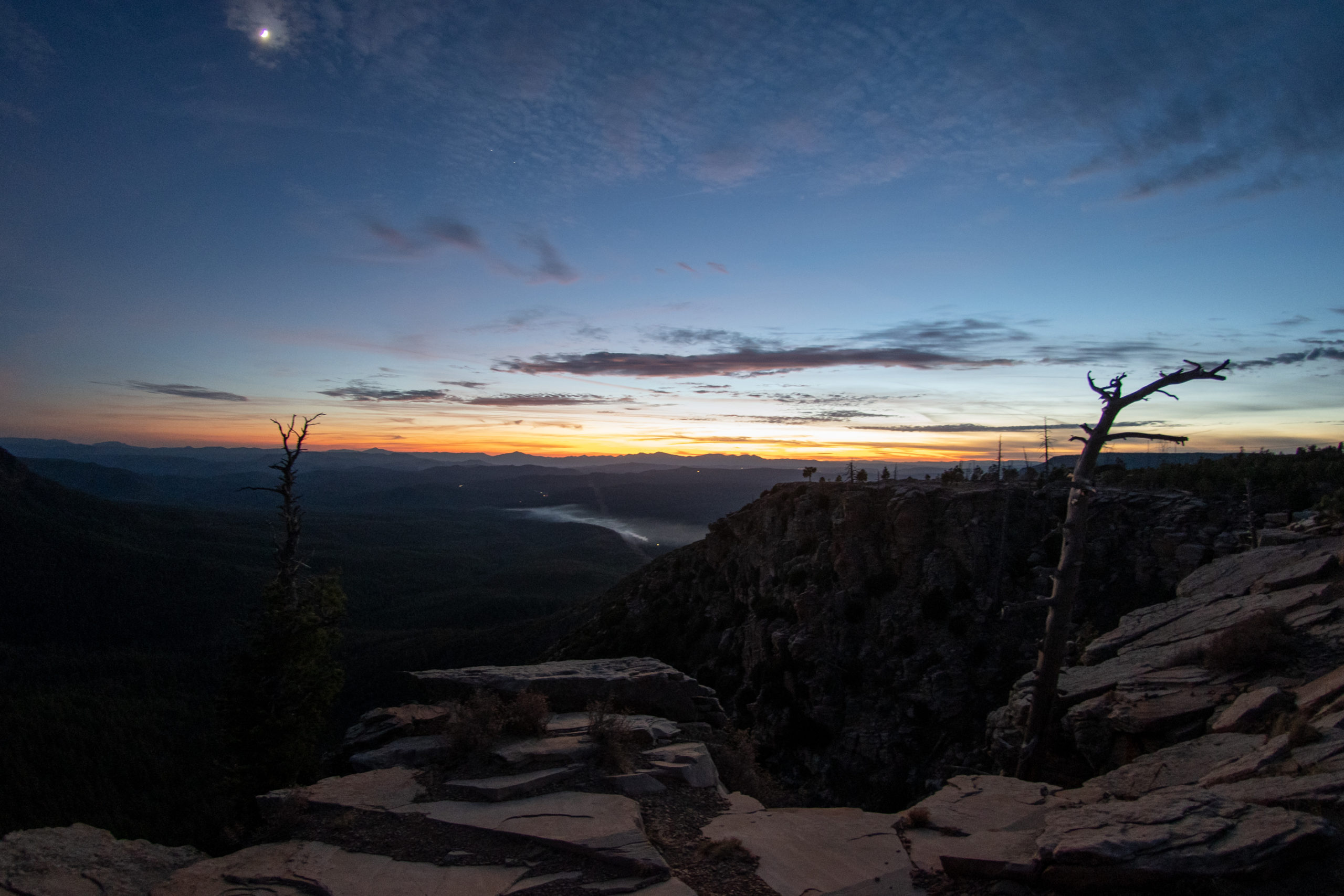
And from there, it was a ride over dark tree-lined mountain passes into Arizona and on to Payson.
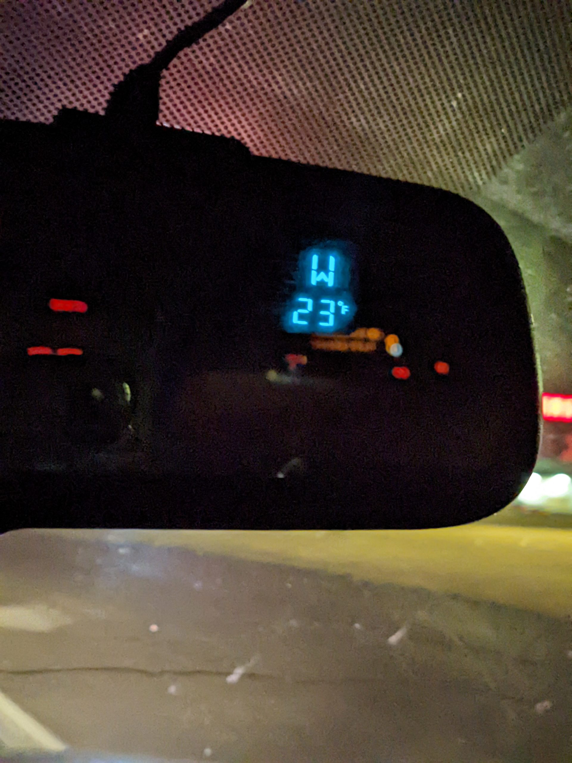
What in the Arctic Circle of hell is this exactly?
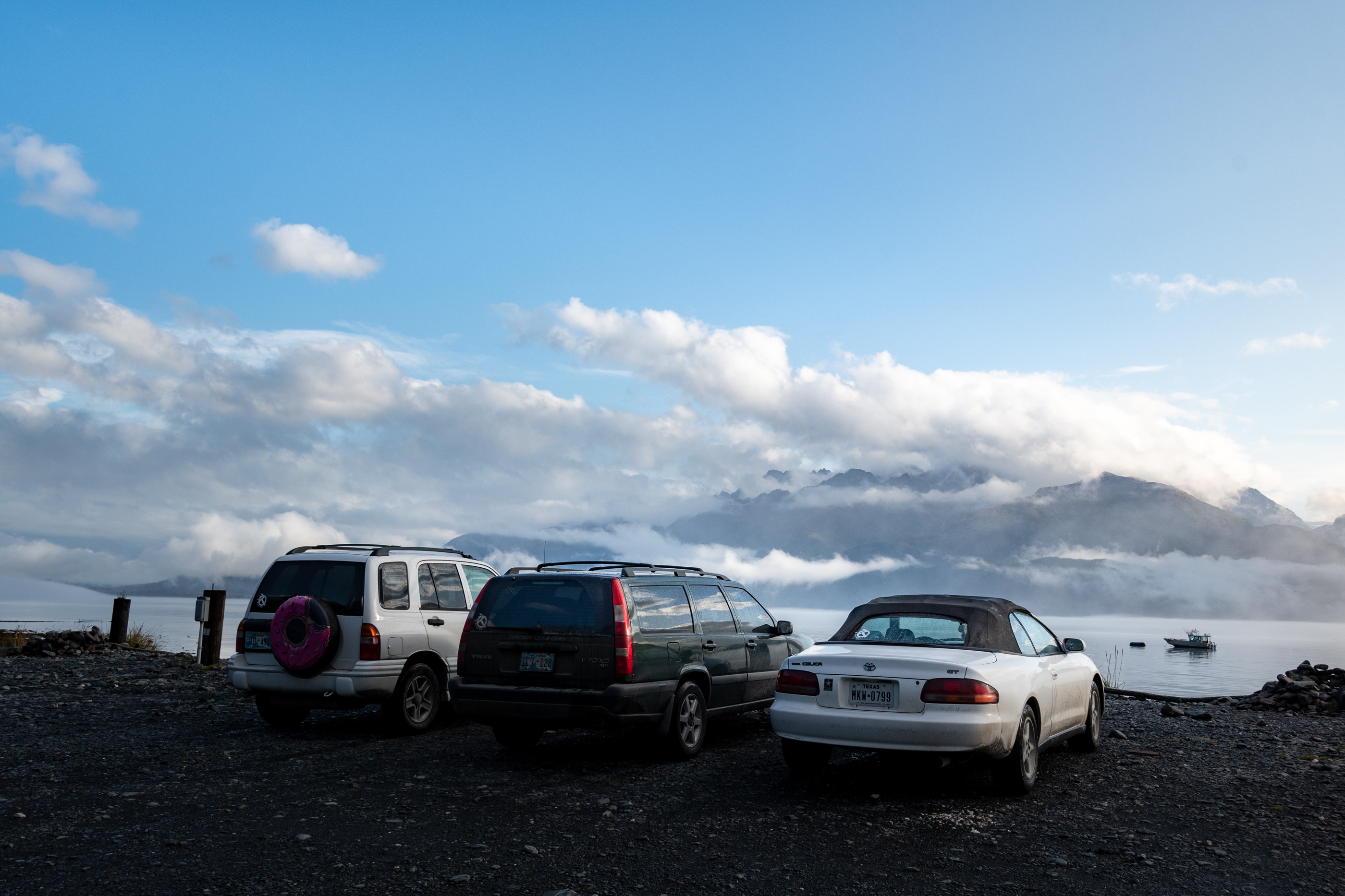
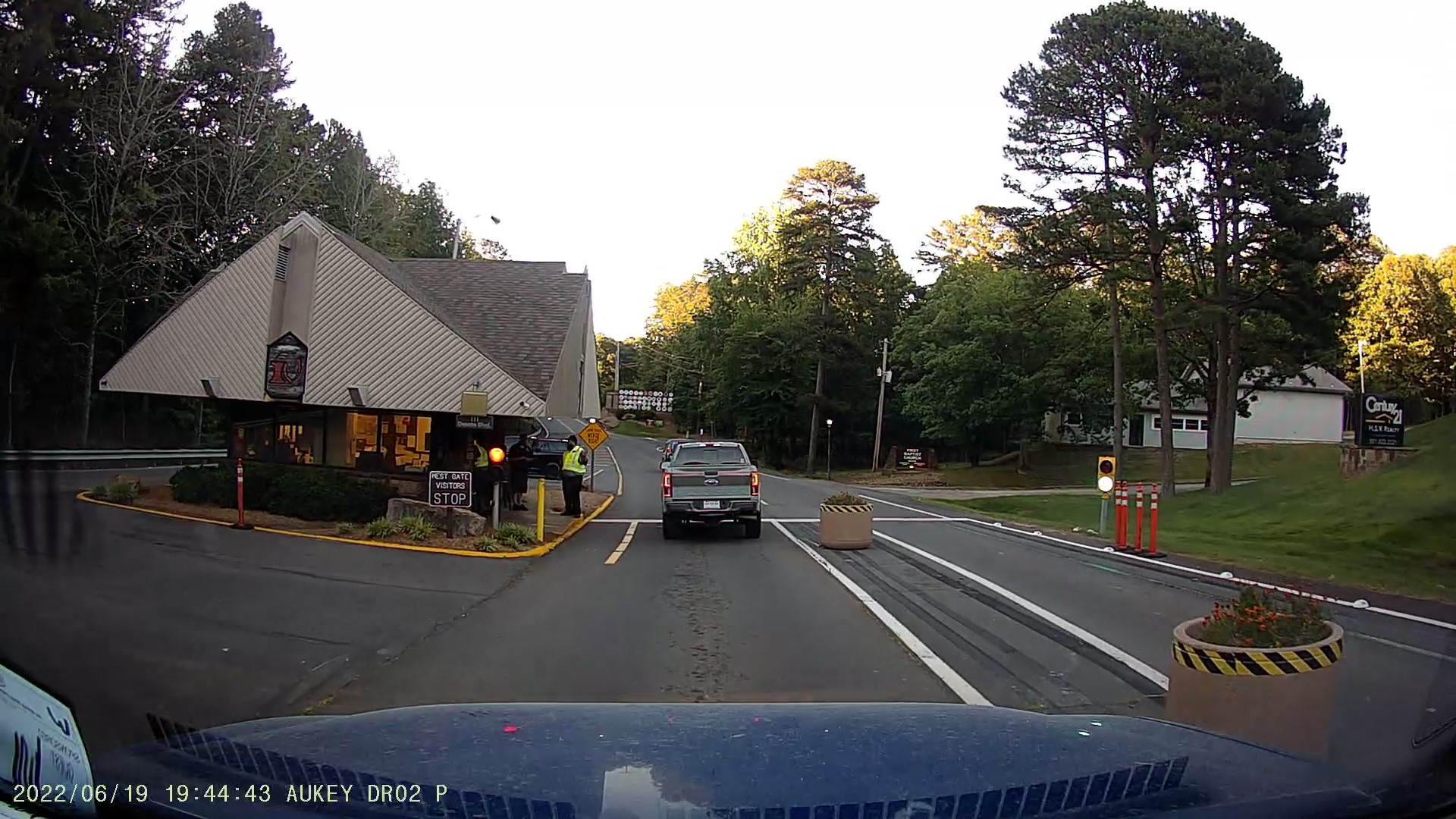
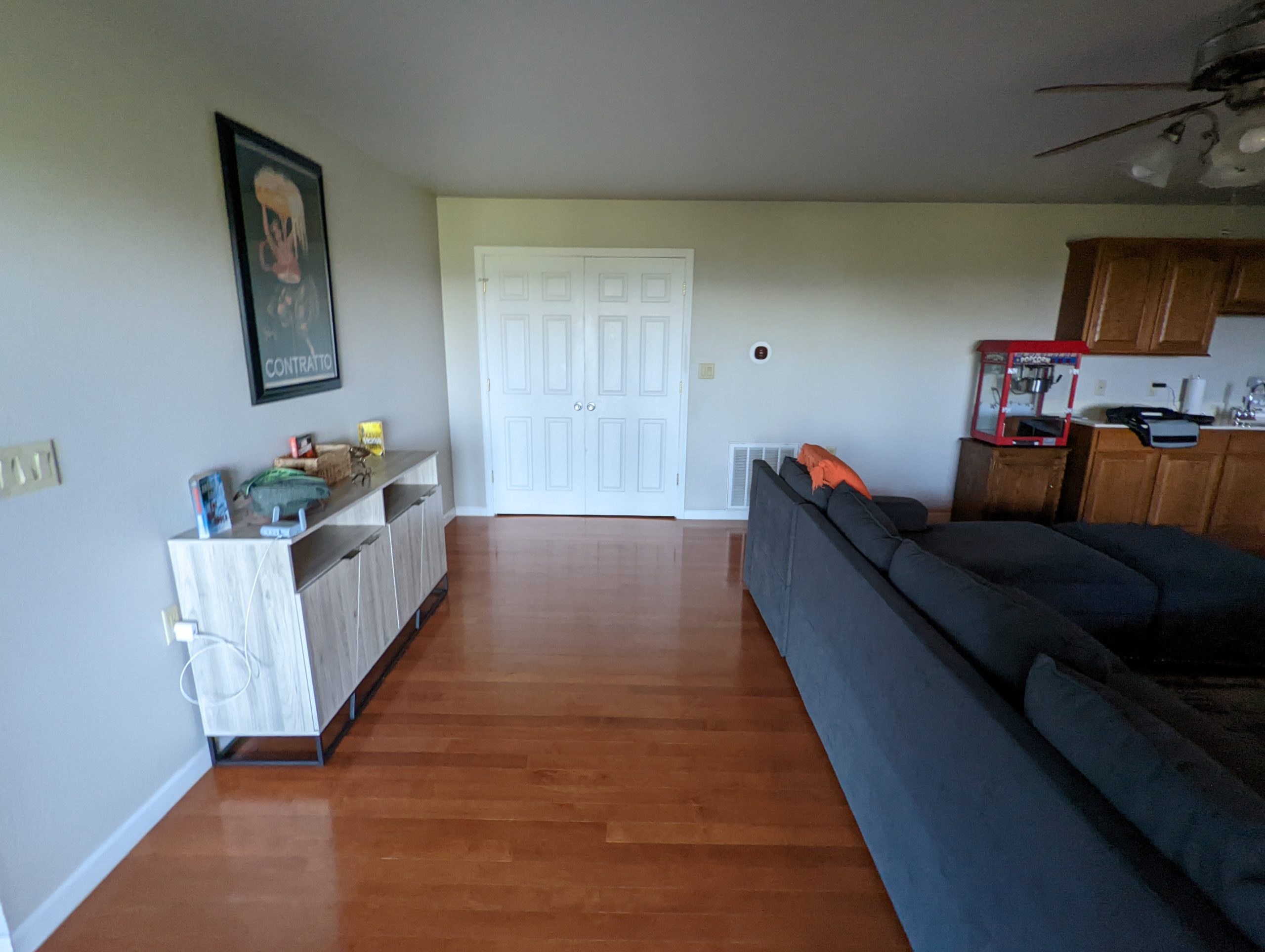
Made it to Albuquerque, although I’m not sure about where I’ve landed. Across the street from my little Extended Stay is the Hampton Inn I wish I was at, which shares a parking lot with a cool food hall and a rock gym. But over here, we’ve got an armed security guard wandering around and they take a $250 incidentals deposit but their credit card machine didn’t work so they didn’t make me pay it…
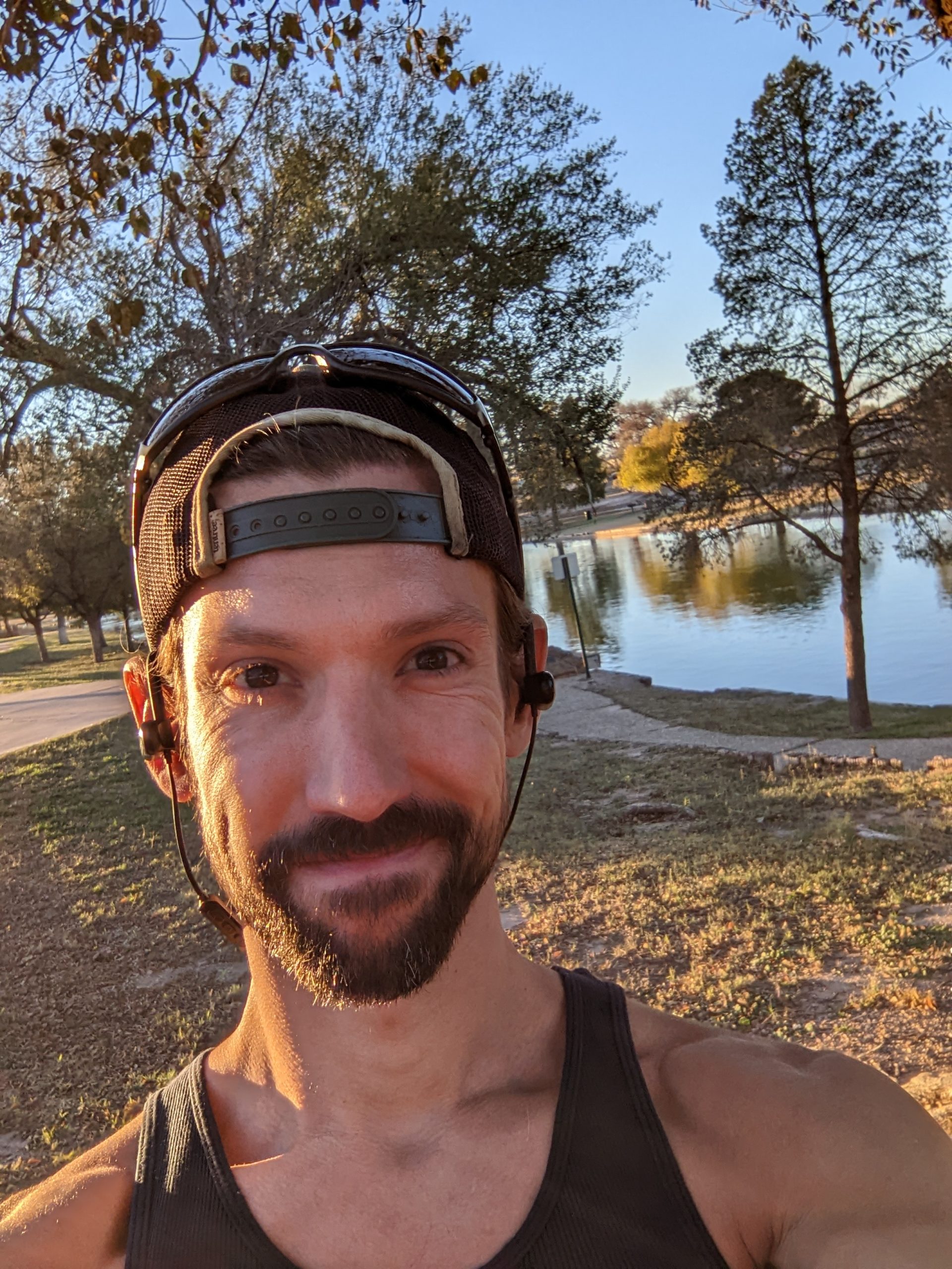
While trying to fight many of bonfire this morning, I realized that I have stayed in this Holiday Inn Express at least once before, maybe twice. But if the calls start at 7:30, they get to end early, I have decided. Or at the very least, I can go for a run and let the chat messages queue up behind me. I scoured Google Maps for any sign of green and blue on the map of this town, and there were not many options, but I’m pleased with what I discovered. Welcome to the Buddy Holly Lake Recreation Area.
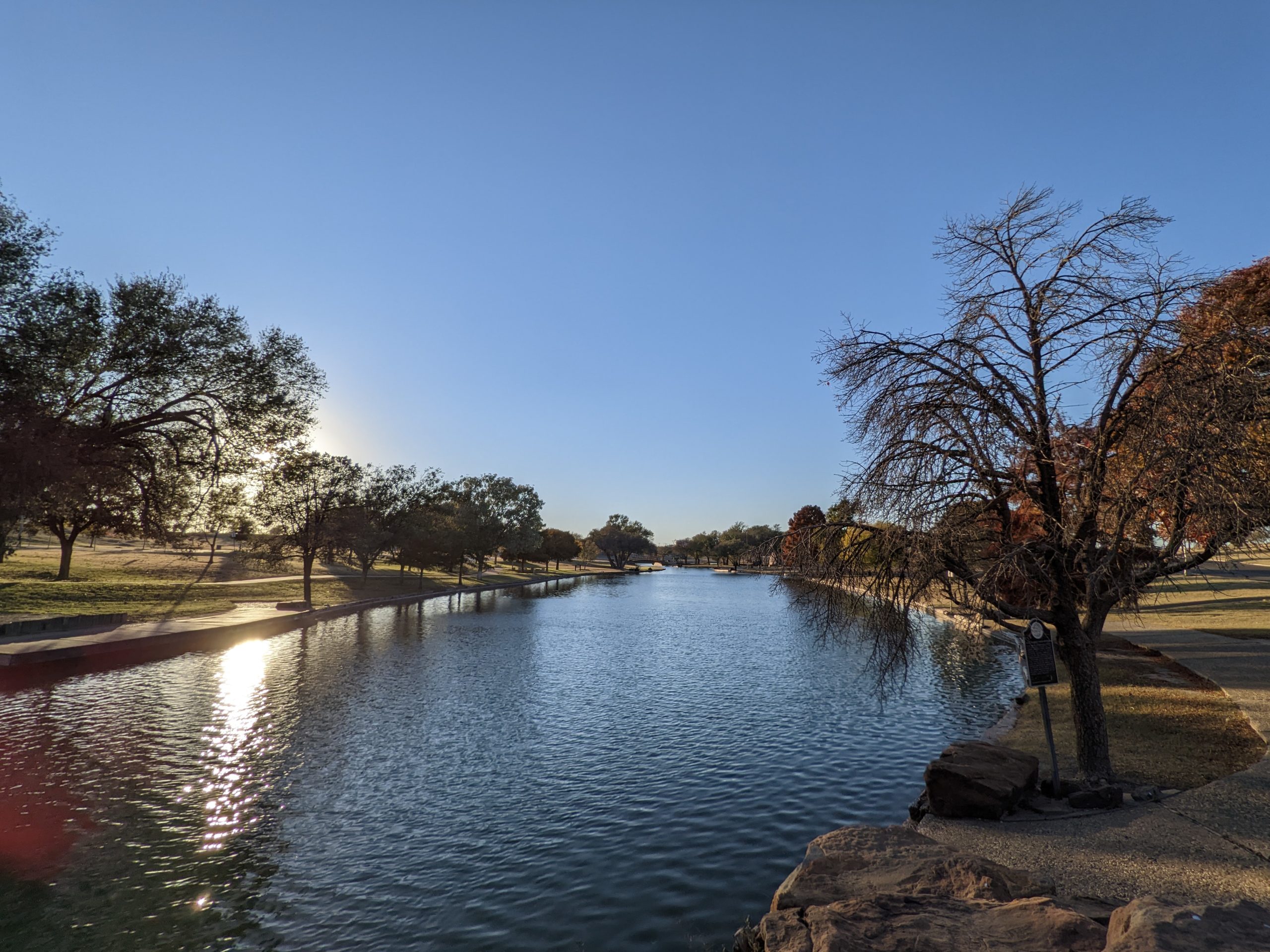
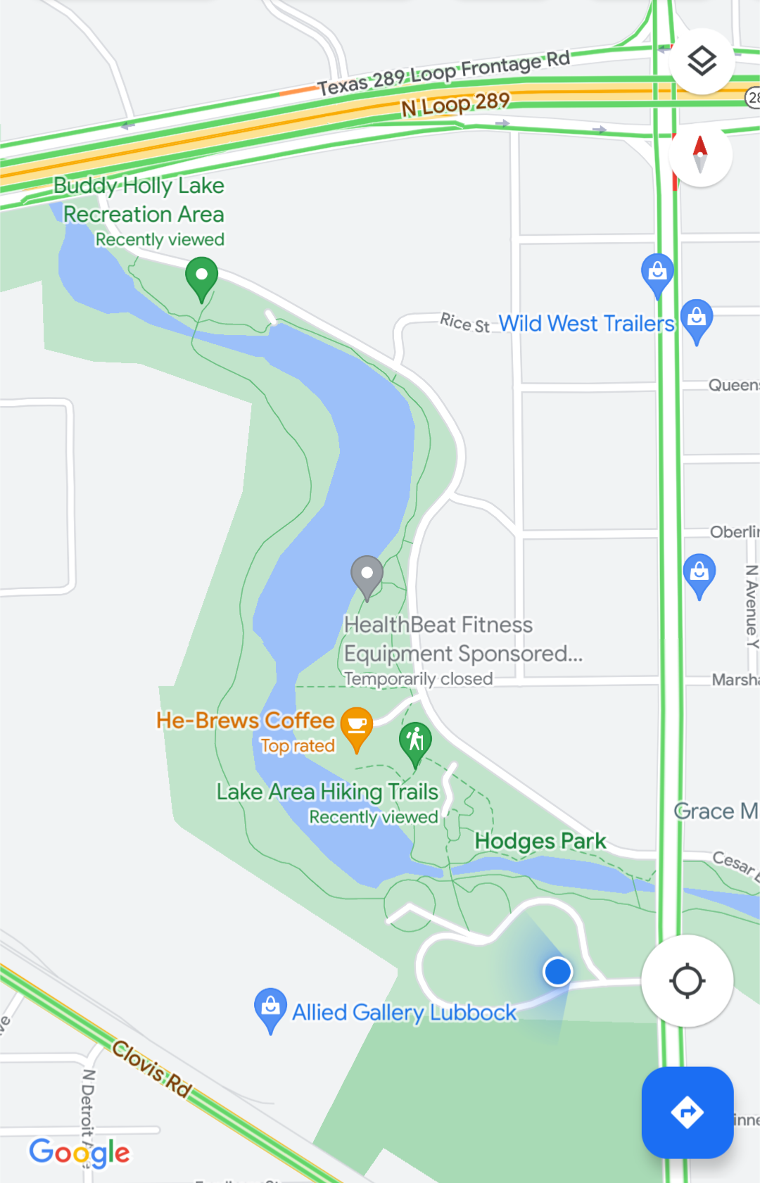
It couldn’t have been a big river that they dammed up to make this little lake, but I have to admit they made it pretty nice.
Onward to Albuquerque. And dinner.
Whelp. I broke my tiny tire inflator that likes to pop fuses. Maybe we’re better off without each other. I did learn that the gas station by my apartment has a free air pump, and that industrial air pumps are a zillion times faster than tiny inflators… I don’t need an inflator for off-roading, do I?
Update: 20 minutes after leaving the gas station, I am still trying to get on 183. So much for getting an early start…
Copilot has requested an Albuquerque to Death Valley adventure and I’m delighted. Creativity flourishes in constraints — but I’ll admit having had a helluva time reducing this down to an itinerary we can conquer in just three days. And it’s only 1,500 miles! But at long last, I’ve built a map I’m excited about…
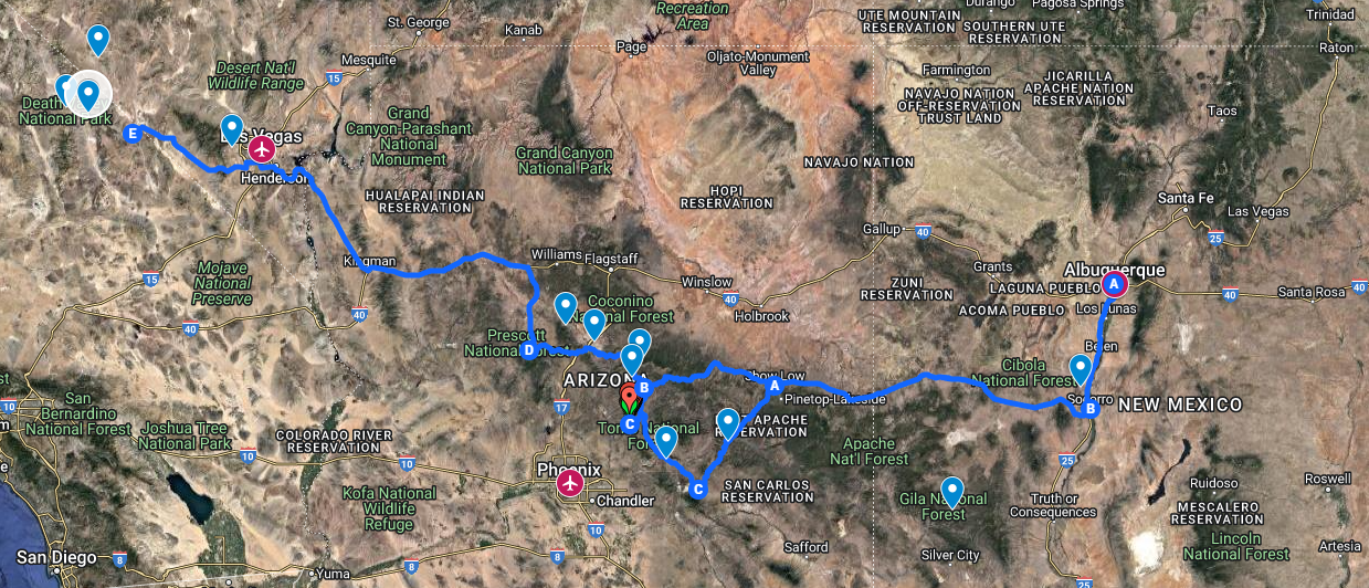
…and the resulting spreadsheet says it’ll be fine if we just don’t sleep.

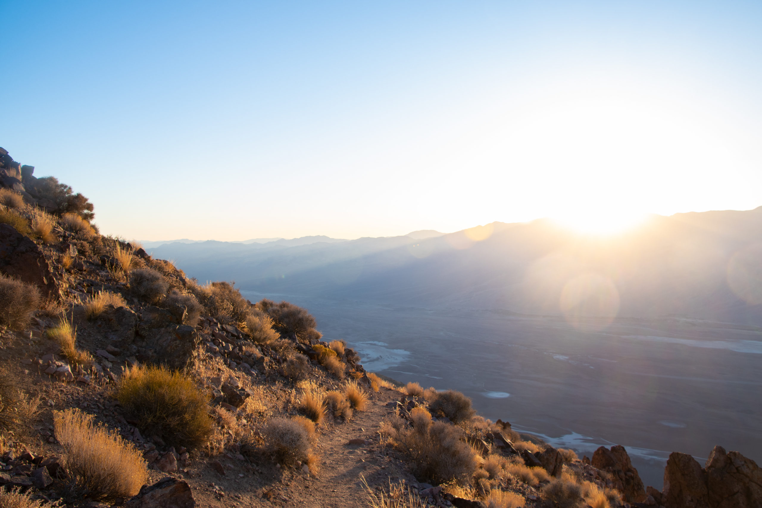
I think I’m just going to warn people that they’d better not expect me to answer any messages Friday afternoon. San Lorenzo Canyon is one of my favorite best-kept-secrets of New Mexico, and I haven’t been back since the before times. I’d rather see it in daylight.
From there, we’ll head out via US-60 to either Globe or Payson, both just northeast of Phoenix. Neither is terribly far, with a few roadside attractions along the way.
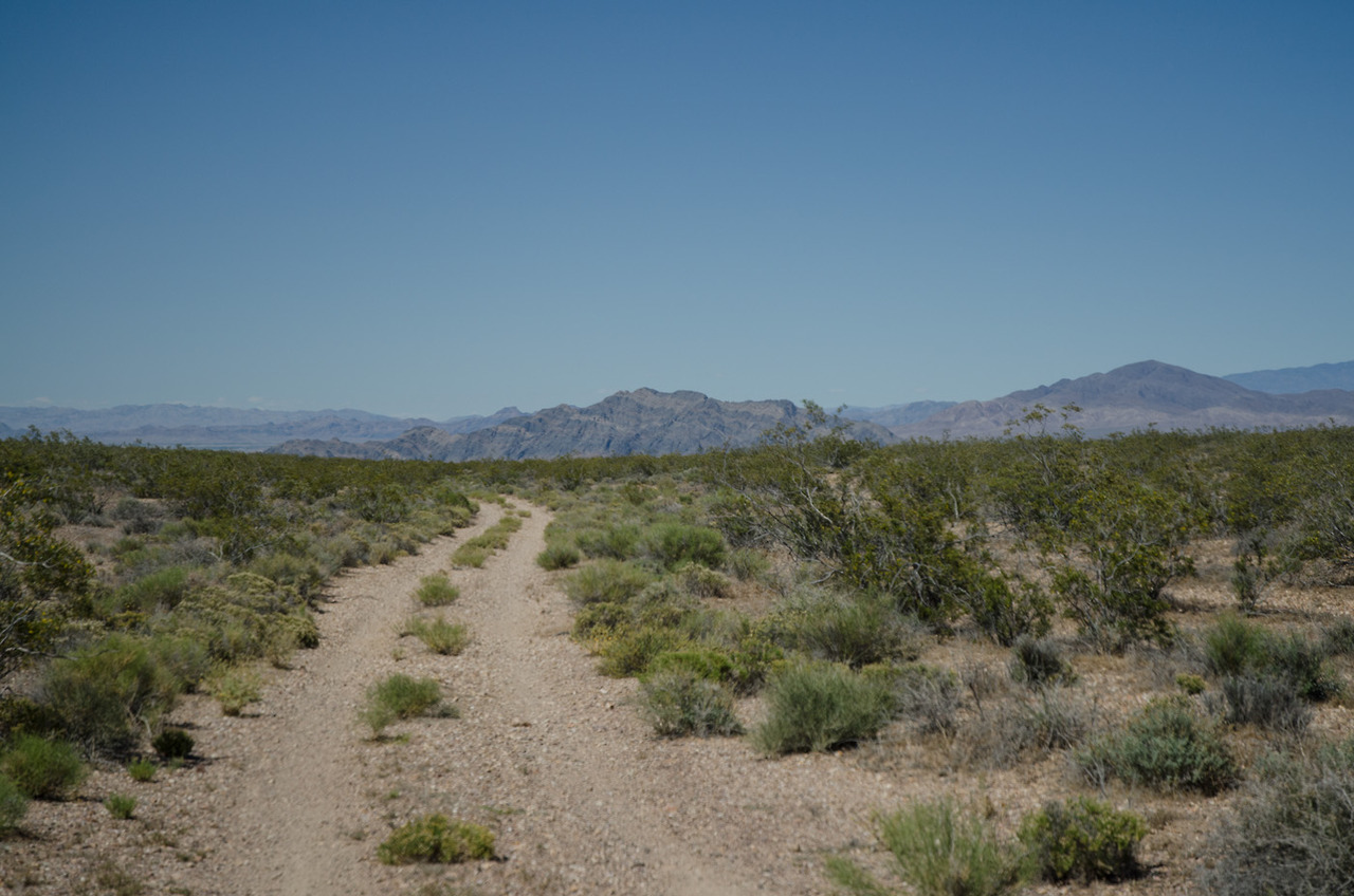
Given that my favorite offroad route in Death Valley is closed, I went looking for an unpaved adventure — for authenticity. Pulling up TrailsOffroad and AllTrails at the same time is always fun. I found me a mountain in two acts. My favorite.
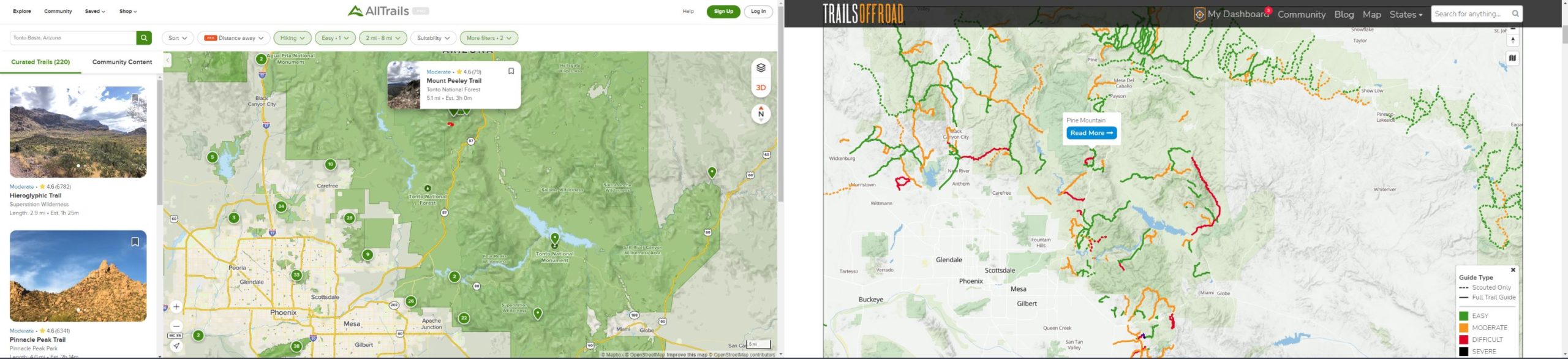
And this should work if they haven’t gotten a lot of snow. From the highway, an easy but scenic 5 mile drive to a 2.5 mile hike to the peak. … And back.
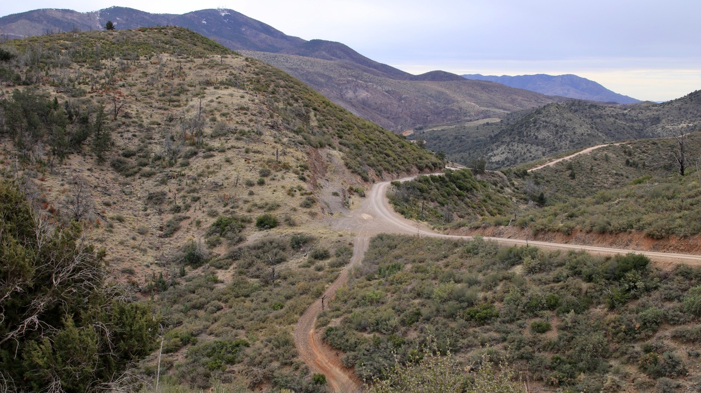
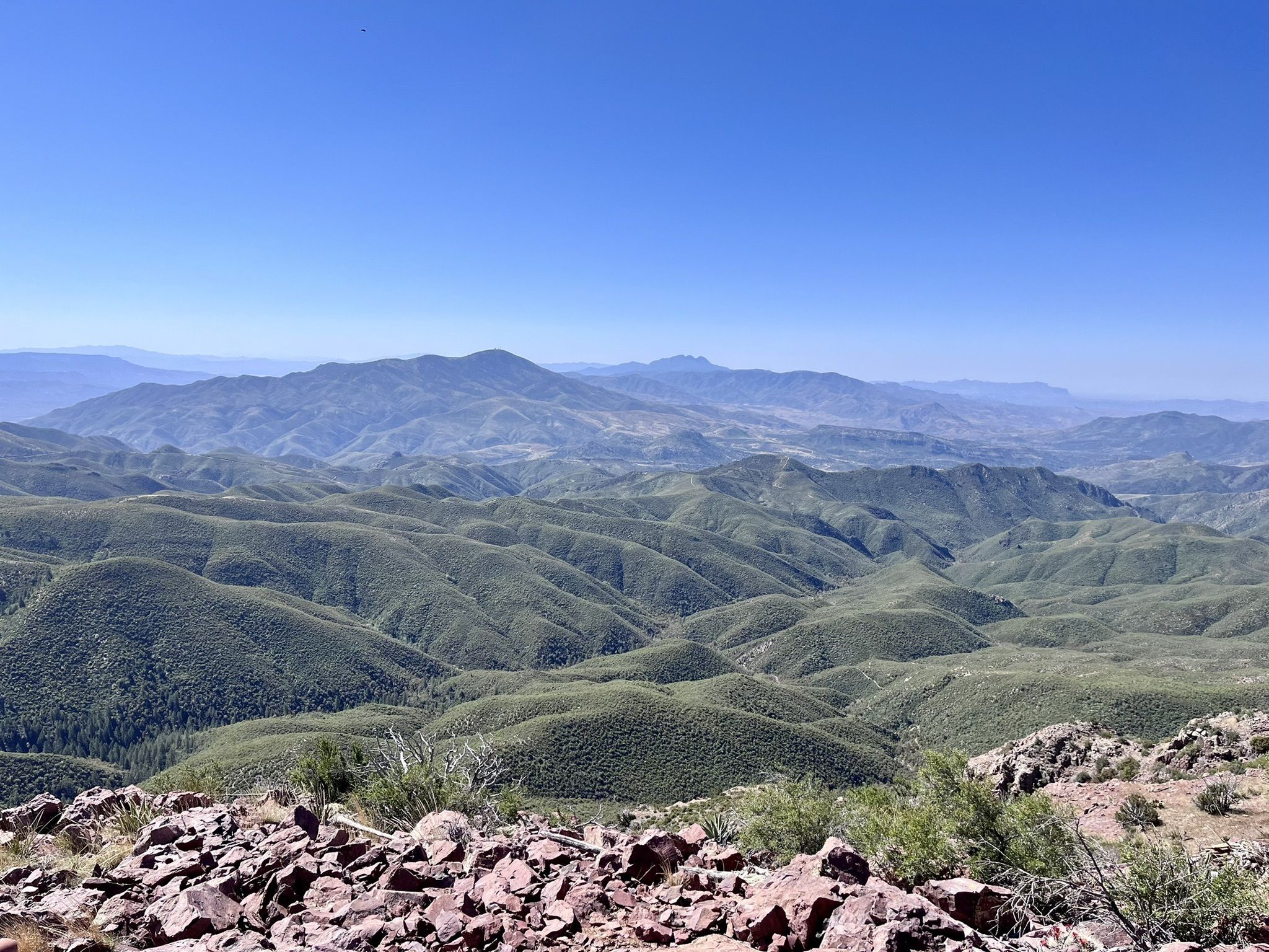
A drive up Pine Mountain unveils the rugged beauty of […] Tonto National Forest, the largest of Arizona’s National Forests. The drive offers long views across a vast landscape of rolling hills and deep sycamore lined canyons carved by small streams fed by runoff from the looming Mazatzal Mountains. […] The rating is based on narrow shelf roads and a few sections of mildly rocky road surface.
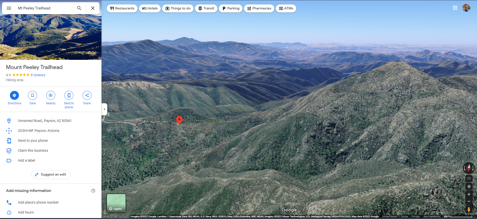
Experience this 5.1-mile out-and-back [hiking] trail near Payson, Arizona. Generally considered a moderately challenging route, it takes an average of 3 hours complete. […] Part of the Arizona Trail, it’s well maintained and easy to follow. 1,453 foot elevation gain. Be careful of your footing, but it’s not difficult if you’re experienced.
I hadn’t heard of the Arizona Trail before — “The Arizona National Scenic Trail is a National Scenic Trail from Mexico to Utah that traverses the whole north–south length of the U.S. state of Arizona. The trail begins at the Coronado National Memorial near the US–Mexico border and moves north through parts of the Huachuca, Santa Rita, and Rincon Mountains.” It even dives down into and out from the Grand Canyon, ending in the Kaibab Plateau area of the Arizona Strip.
In the event of snow, I’ve got a couple ideas in my back pocket, but this looks fun. And from there, it’s about a 7 hour drive to Pahrump or 6 to Las Vegas. A longer day than I would usually inflict on someone (or even myself on a hiking day), but we have a lot of miles to munch.
Whatever remains of our drive into Death Valley, which depends on how far we were willing to slog the night before. Then Death Valley shenanigans. I’m still hoping for a little more reopening of park land are between now and then:
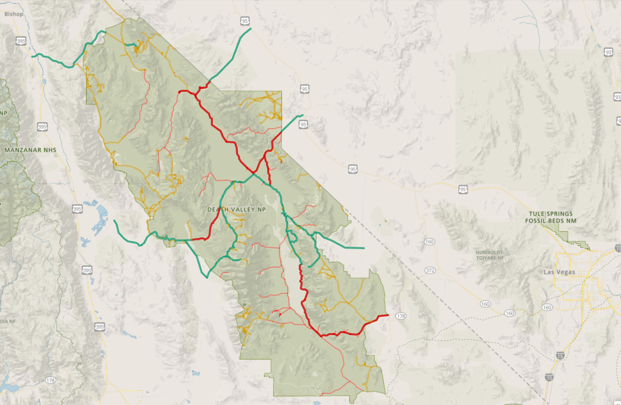
Guess this means we won’t be able to go to That Damn Denny’s in Beatty. But Badwater Road is open as far south as the salt flats, Artist’s Drive and Zabriskie Point are both open, and Dante’s View to Mount Perry is open, too — all of which are greatest hits material.
And there’s also the uncharted (by us, anyway) lands southwest of Stovepipe Wells — Mosaic Canyon Road/Trail, Emigrant Canyon Road, and Tucki Mountain Road are all open, too.
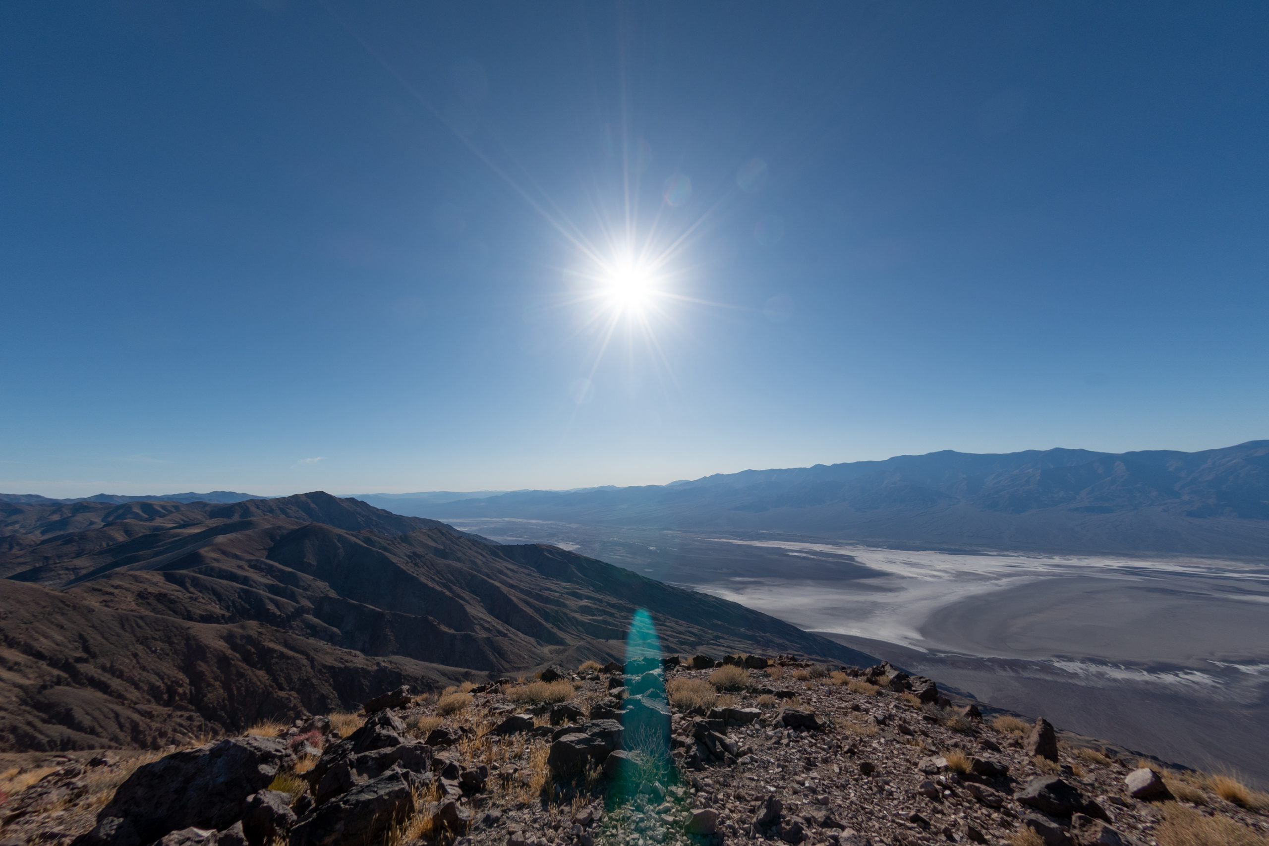
So far, the only room I’ve booked for the whole trip is our finish line at The Ranch at Furnace Creek. The swanky, historic inn from last year was already booked up — but The Ranch down the street may be more our speed this time.

And finally Dad flies out of LAS at about 3pm, so we’ll need to get moving pretty early. Easy peasy. Although… the park map did show Deadman’s Pass as open…
How hard could it be?
Through these years of roadtrip antics, Dad has occasionally mentioned, “One of these days when you’re headed off on some cross-country adventure, I would really love to book a one-way ride.” We never made it work because his work schedule and mine didn’t line up well — usually that “cross-country” part of my drive is “driving all night and working during the day.” And while we both work in what look like pajamas, apparently surgery is one of those things you still have to do in person. How antique.
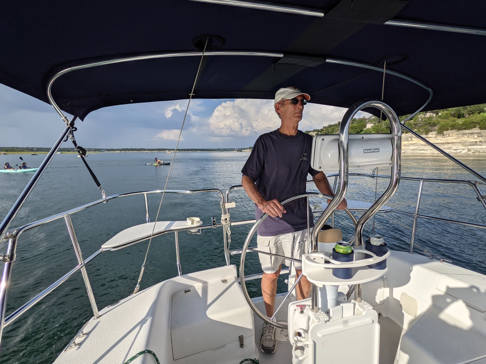
But around the start of the year, he put down his scalpel one last time. I have since joked that I am surely not old enough for my father to have retired. But there is some truth to the notion that — though he is many other things in addition — he has also always (in my lifetime) been a doctor, a well-known one at that, and it does feel weird to me that he has retired from practice. This, of course, does not free him from the obligation to take weekend pager duty from me. But it’s real. He has a sailboat and everything.
So as I start organizing the next Climbsigiving to Red Rock Canyon, I have booked a passenger in celebration. The “Full Roadtrip Experience” usually starts with the great choice-paralysis of route-planning, dramatically recalled here. Thus, let’s begin:

I know a lot of ways to get to Vegas. As tradition dictates, Interstates 10 and 40 are largely off-limits. I’m hoping to make a blend of greatest hits with a new spot or two. We need big hiking, light off-roading, cliff dwelling, quirky artsy weirdness, and epic views of southwestern desert majesty. With perhaps one silly adventure on Las Vegas Boulevard for good measure?
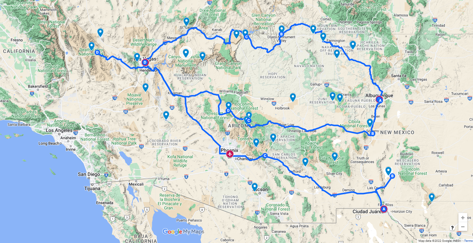
The first night or two will be a boring late-night mid-week slog from Austin to either El Paso or Albuquerque. I’m going to take that section solo so we can spend more time on the fun part. That gives us Friday evening through Monday before the climbers arrive to Summerlin.
I had assumed Death Valley National Park would be our finish line. That it’s been my personal tradition of each previous trip to Red Rock — starting with a big hike in the park. Tragically, the park was recently hit with severe flooding damage after getting almost a year’s worth of rain in about two hours, with another round of heavy rains as Hurricane Kay dissipated inland a few weeks later. Some of my favorite parts of the park are accessible, but much isn’t yet. I’m also trying to avoid retracing Mom and Dad’s recent Grand Canyon South Rim roadtrip or their upcoming run to Zion NP. (I admire how much fun they’re having now that the calendar is more open.)
All that is to say… there are still too many options.

El Paso to Death Valley
Albuquerque to Death Valley, the Southern Route
Albuquerque to Las Vegas, the Northern Route
I also don’t know a whole lot of Southern Arizona. There’s that whole unavoidable stretch of I-40 and US-93 from Kingman, AZ to Las Vegas, NV that I would love to find an alternate for. Perhaps my co-pilot sees a favorite emerging among these?
UPDATE: Copilot has spoken: we start in Albuquerque and end in Death Valley.
Since our big finish in Alaska in 2019, we’ve been debating what the next grand adventure might be. Much delayed by “these unprecedented times,” which seem destined to continue into perpetuity, we’ve decided to put pen to calendar anyway, apocalypse-of-the-week be damned. We’ve swirled around the same handful of concepts we’ve always had on the short list, but as we’ve now done this a few times, we’ve decided two things:
First, these feel the most right when they’re grand journeys — the “leave no stone unturned” exploration of a single area is better for the long weekends.
Second, a route concept that is easy to explain is good for the dramatics, the buy-in, and even the planning. Say, for example, “The Pacific Coast Highway” or “The Alaska Highway” (even if we did less than half of it in favor of other roads). The Southwest Offroadtrip suffered in this regard, being described as “overland from Sacramento to Salt Lake via Vegas,” which has less of a ring to it.
So far, it appears we’re leaning into two viable concepts for Spring 2023.
There are lots of options for epic trips to be found in the archives of westward expansion, but The Oregon Trail shares fame not only as a historic wagon route, but also enshrined in the nostalgia of us so-called “elder millennials” as one of our early forays into computer games. Though oddly enough, none of us really played this one that often.

A cursory review of the Wikipedia page on the subject shows that we could combine pieces of the Louis & Clark Expedition in the early 1800s to enter South Dakota and then cut southwest through Badlands National Park and the dramatic Needles Highway in the Black Hills National Forest, both of which are on George’s and my lists.
From there, we could join up with the wagon trails of the mid/late 1800s for more adventures in Wyoming (which, 💙) and Idaho (which I didn’t get nearly enough time in) on our way to Portland and the Columbia River Gorge.
According to the game, the adventure starts in Independence, Missouri, which is right outside Kansas City. Homework to flesh out this concept includes finding a copy of the game to play, clearly.
Evan did point out one potential problem — would we have to drive wagons?
Except for a summer working at Cedar Point on Lake Erie and a weekend in Chicago, I have yet to explore much of the Great Lakes. And on my fifty-states quest, I’m missing most of the surrounding land, too. There’s plentiful hiking, exploring, and scenic driving potential along these shores, and I would absolutely sign up for another trip into Canada.

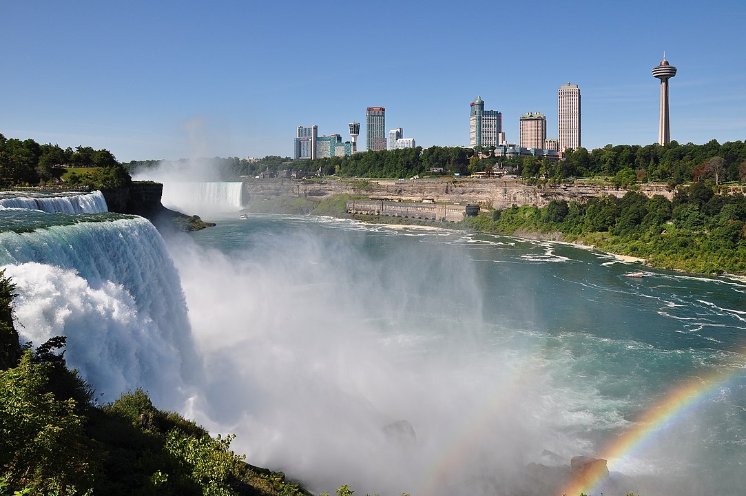
Isle Royal National Park on a giant island in Lake Superior, a ferry ride across Lake Michigan (it feels like tradition), Niagara Falls, lighthouses, rocky beaches, and maybe even a forest lookout tower or two — though several appear to be accessible by boat only. Maybe even a return to Cedar Point? And at my last job, I picked up a surprisingly large group of new friends in this region. I’m not sure if there’s a historic expedition or traditional trip to reference, but that just leaves us open to plan our own. The concept is simple enough.
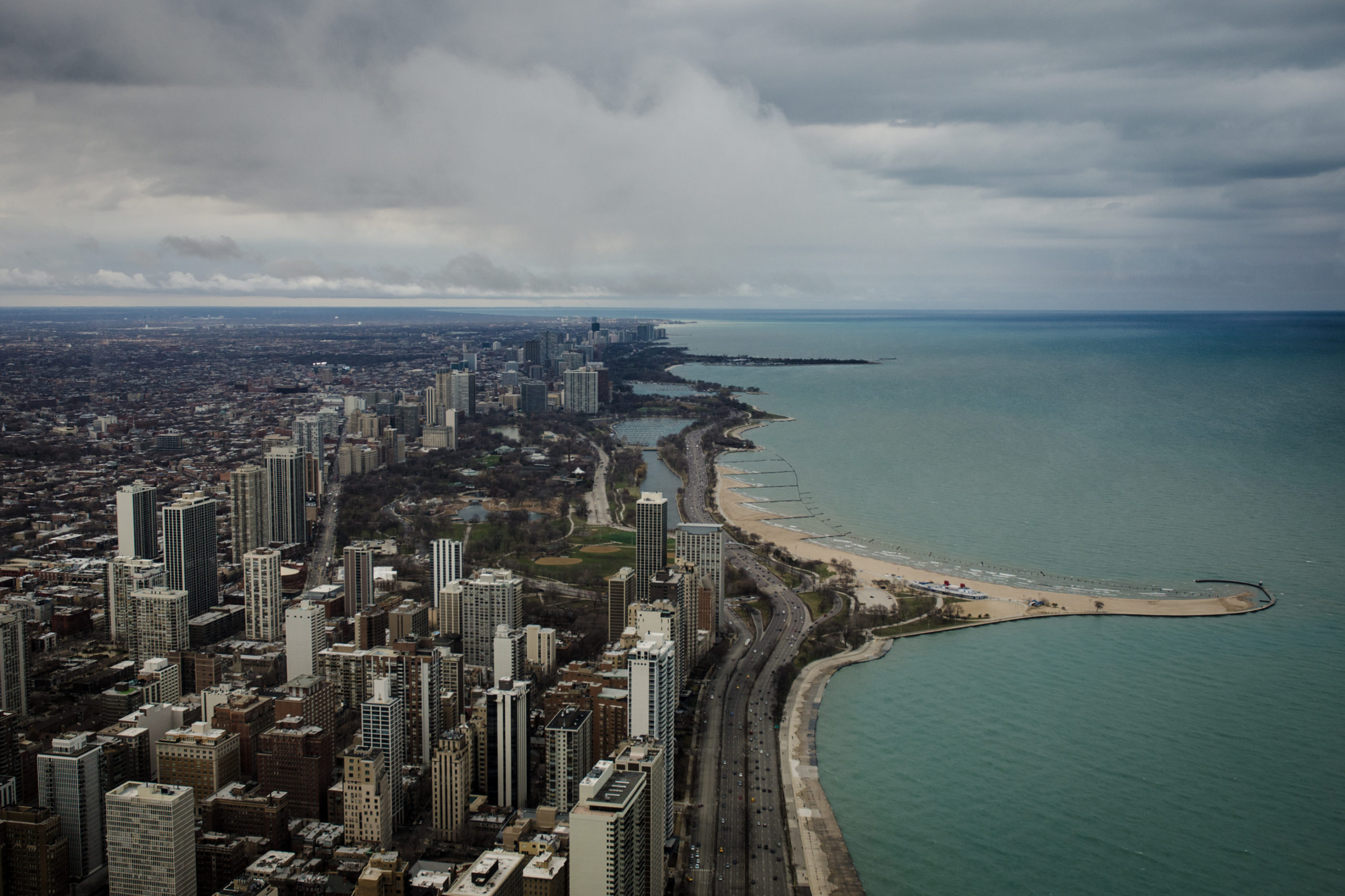
And Chicago is a “close enough to drive” for both a start and a finish line, depending on what we end up doing for cars. We seem pretty sold on the “buy at home” process, given previous success, and avoiding a fire-sale at the finish line has its advantages.
Yes. Late spring or early summer 2023. And in a show of true decisiveness, we’ve come out of this evening’s Zoom happy hour determined that we will either go west or east.
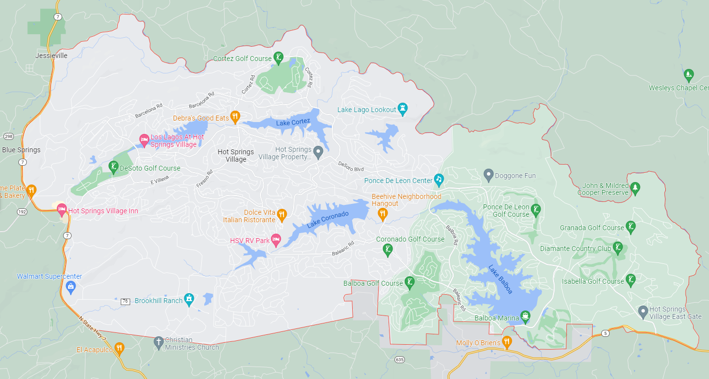
Yesterday’s drive to Muse Mountain took us out the “East Gate” of Hot Springs Villiage, which was at least a thousand miles (well, fifteen miles that takes twenty-five minutes anyway) from the west gate we’d been closer to so far.
Hot Springs Village is a census-designated place (CDP) in Garland and Saline counties in the U.S. state of Arkansas. […] In land area [of 26,000 acres], it is the largest gated community in the United States.
Wikipedia.
Every gated or exclusive community was built, overtly or quietly, to keep out one demographic or another. Initially, we weren’t sure which, until we realized: us. For now, anyway.
The Hot Springs Village master plan began as a retirement community, founded in the early 70s. Though of its 15,800 residents as of the 2020 census, it is 91% white as well…
Hot Springs Village was founded in 1970 when John A. Cooper Sr. decided to develop the 20,000 acres of land into a retirement community modeled after two of his other successful planned communities, Cherokee Village (Sharp County) and Bella Vista (Benton County). […] His plan was to create a peaceful retirement community in a natural setting that would offer all modern-day conveniences without the hassle of living in an urbanized city. Unlike his other two communities, Hot Springs Village was created as a gated community in order to provide security for its residents and as an experiment to see if the gated community would result in more residents than the non-gated communities.
Encyclopedia of Arkansas.
The Wikipedia page has a suspiciously brief “Crime” section, touting not crimes, but how rare crime is. There has to be more to that story. And keeping that clean must be the covert responsibility of someone in the “Hot Springs Village Property Owners’ Association,” the private organization led by a board of 7 and employing nearly 500 people.
The land on which Hot Springs Village was developed was known as the “dark corner” of Garland County on account of its lawless reputation. Before 1873, the Hot Springs Village area was known as Marble Township and was located in Saline County. When Garland County was formed in 1873, the township was split in half. Although this area contained a small population, several communities developed, driven mostly by farmers in Marble Township. Heavily populated with moonshiners and active members of the Ku Klux Klan, this small township became a place many settlers avoided.
Interesting…
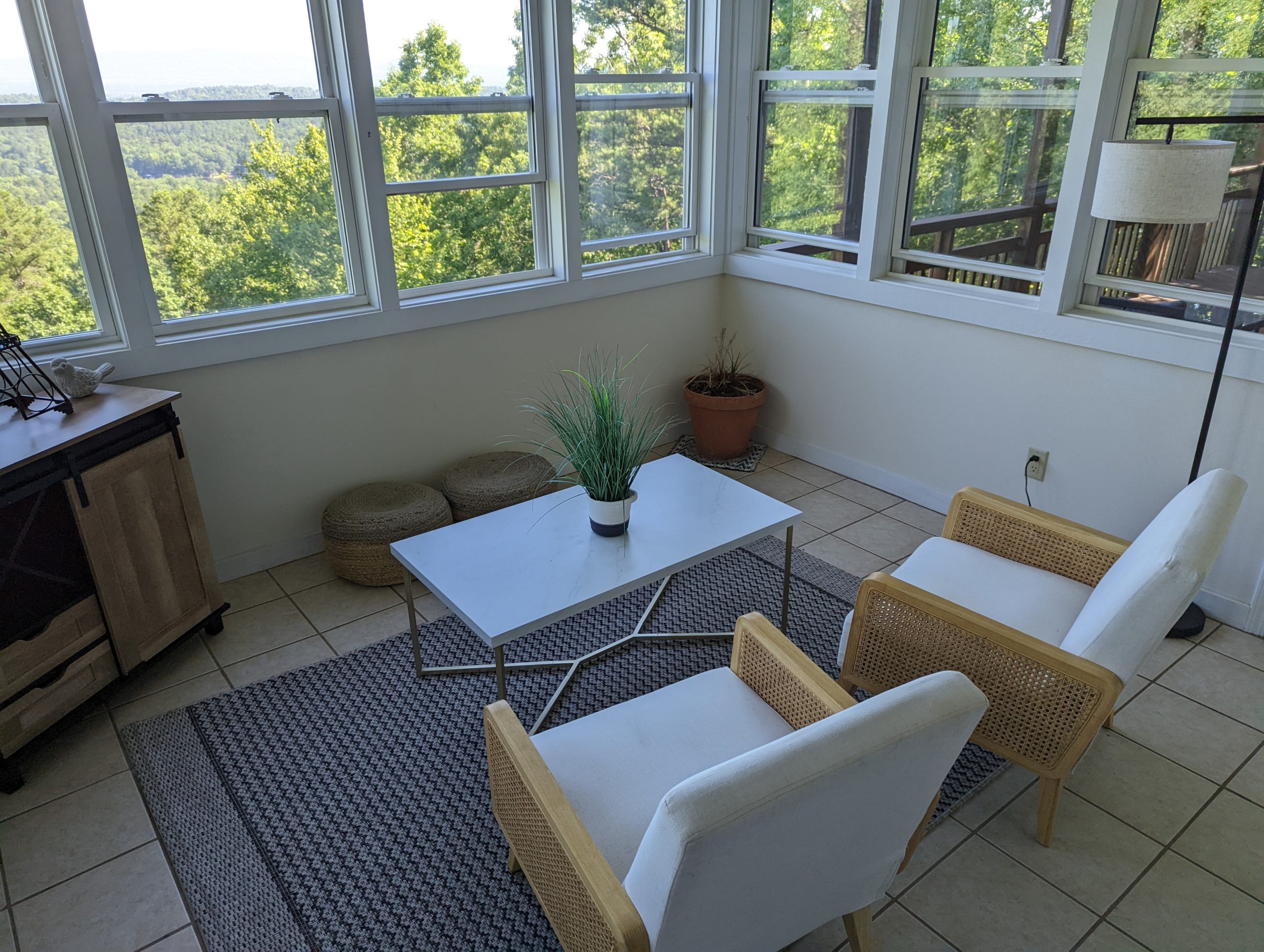
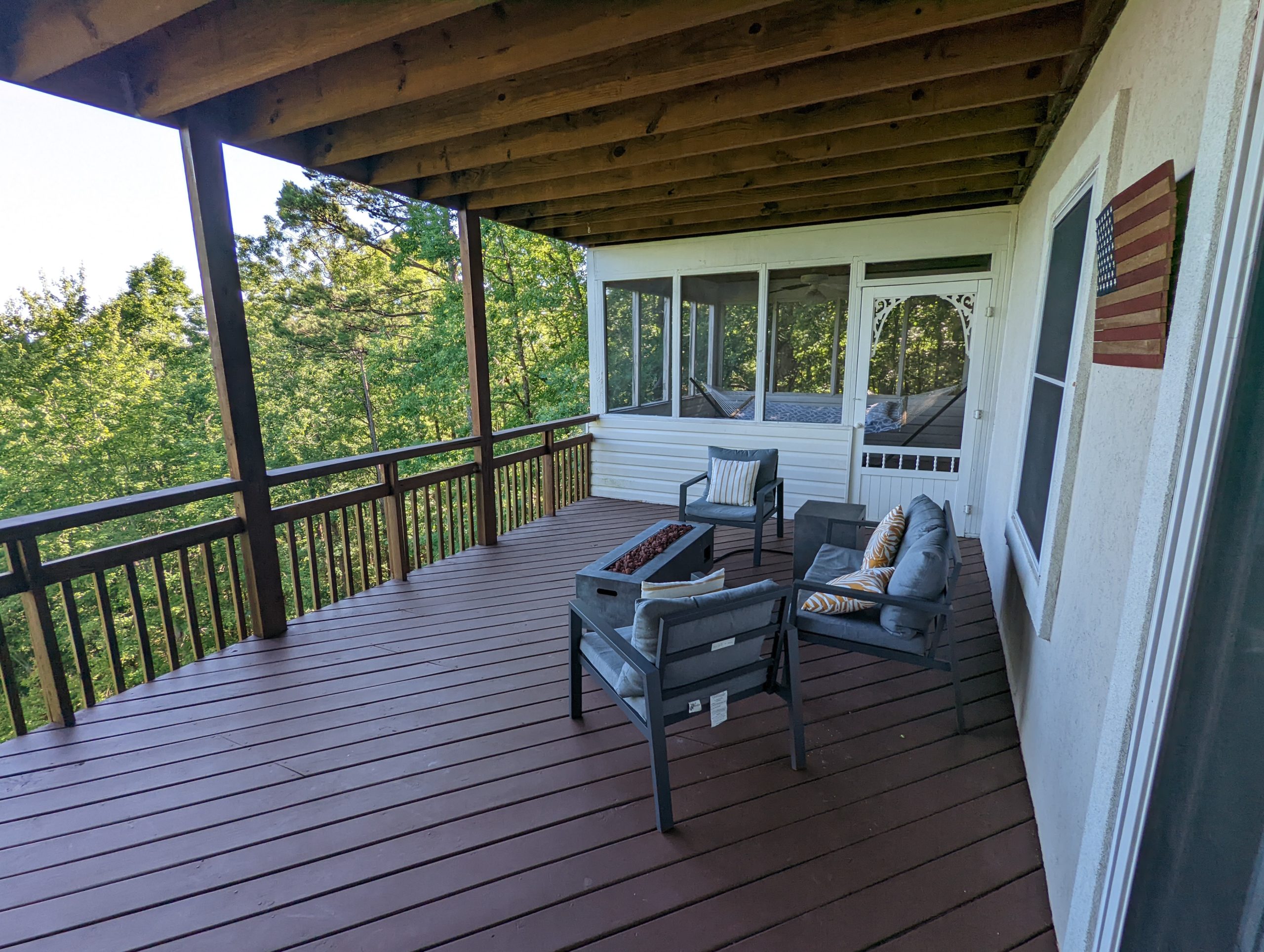
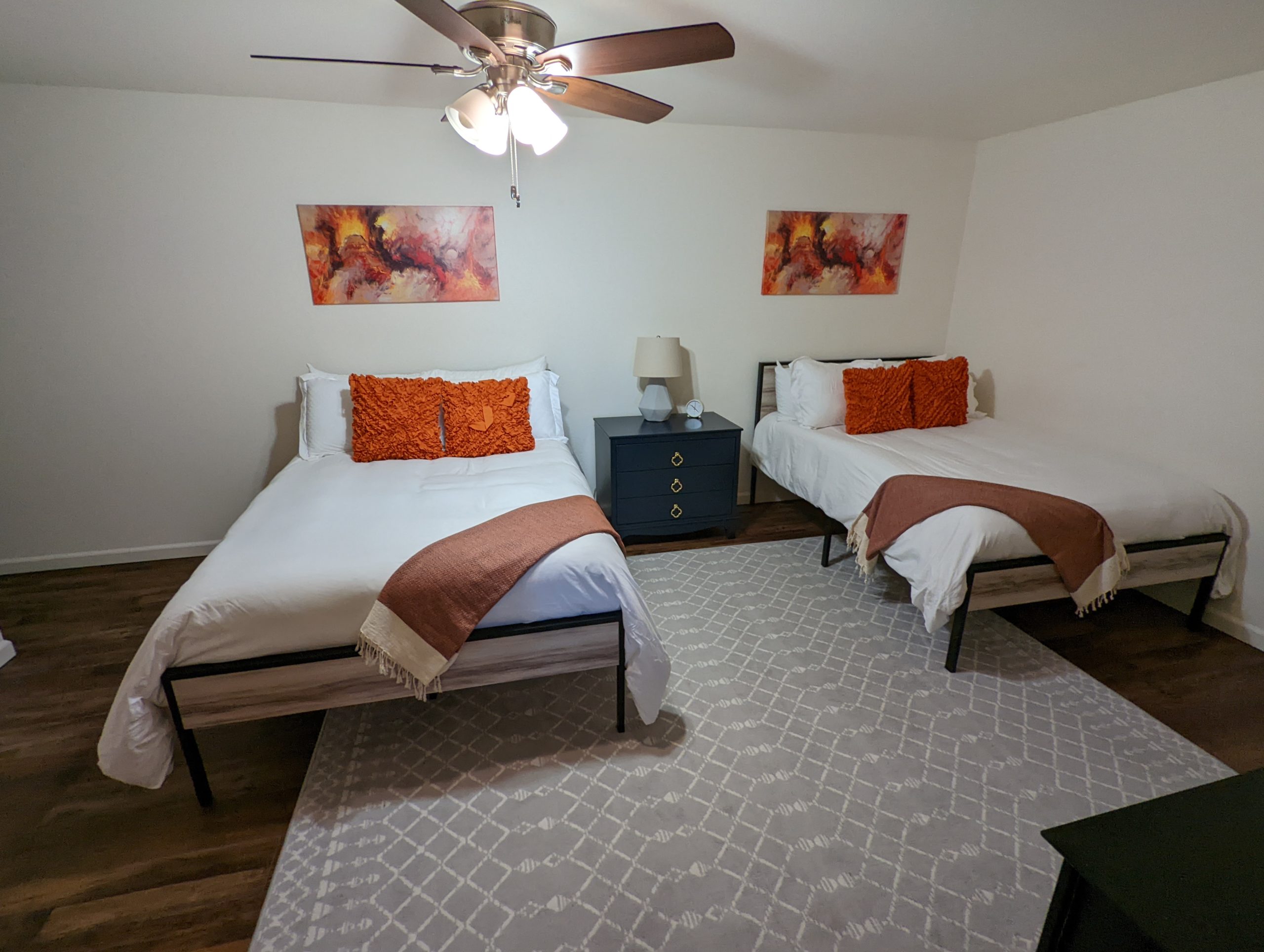
And even our mansion in all its luxury, we still referred to as the “cocaine palace” given some odd features: the day-bed-only bedroom that locked from the living room… the screen porch with hammock that locked from the outside… the overturned wheelbarrow in the trees by the exit stairs, the bedroom on the lowest level that had an open walkway into a gargantuan but sparsely appointed toilet room… and the door in that walkway which didn’t lock and led to an unfinished basement.

Hot Springs Village also boasts twenty-one separate churches within its borders; leads one of the largest bridge clubs in the United States; runs the only 5-star tennis association in the state; maintains thirty miles of walking trails, eleven lakes, nine golf courses, two beaches, two full-service marinas, and two community/convention centers; and hosts the Ms. Arkansas Senior America Pageant.
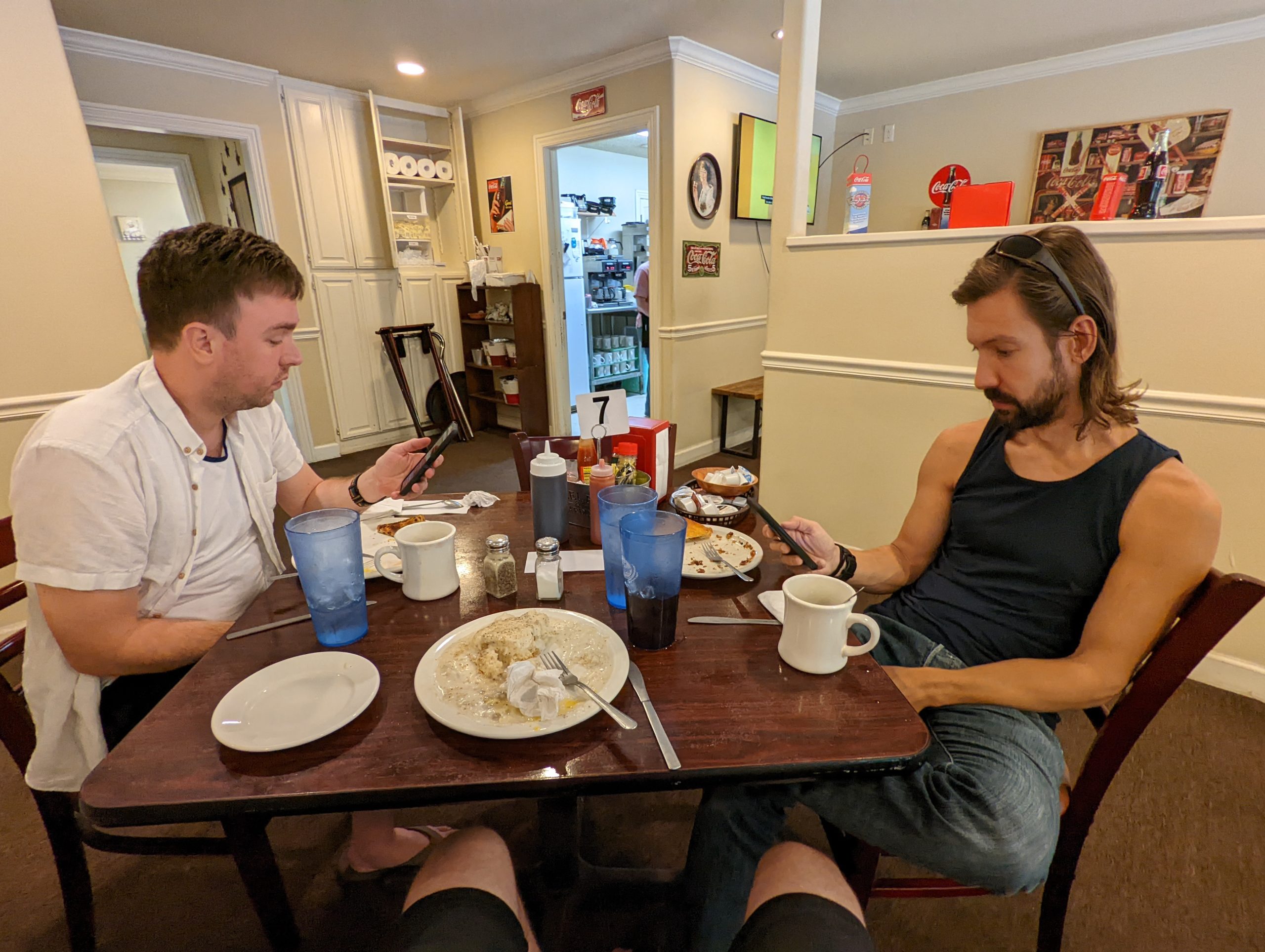
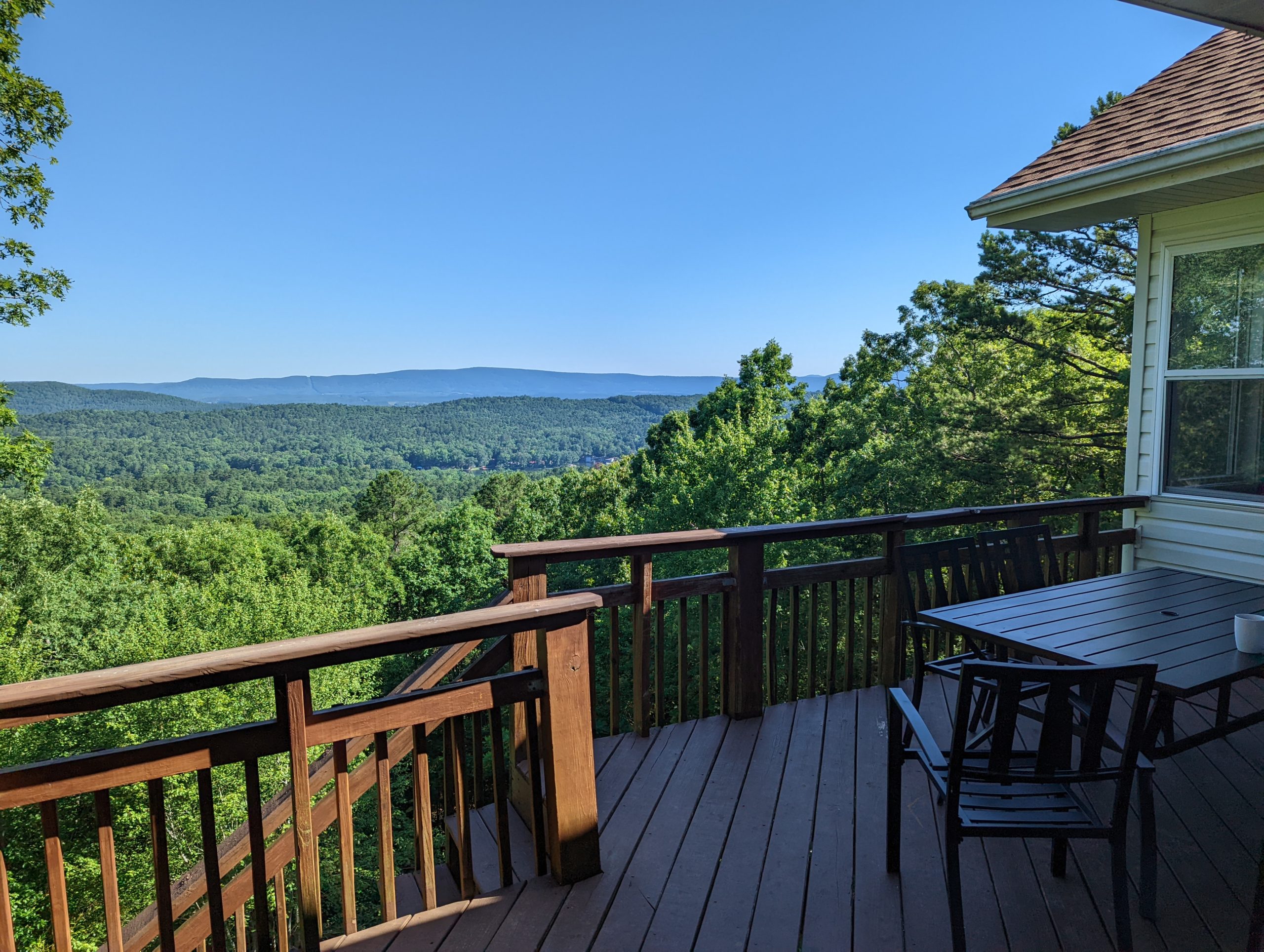
We read all of this last night and partly this morning over breakfast at Debra’s, the greasy-spoon diner in the center of town where we slowly reconnected with the outside world over too much coffee. From there, we headed off in opposite directions on the lengthy drive to an exit gate and then back home. It’s a weird place, but I am glad we stopped here, and I will never get over this porch.
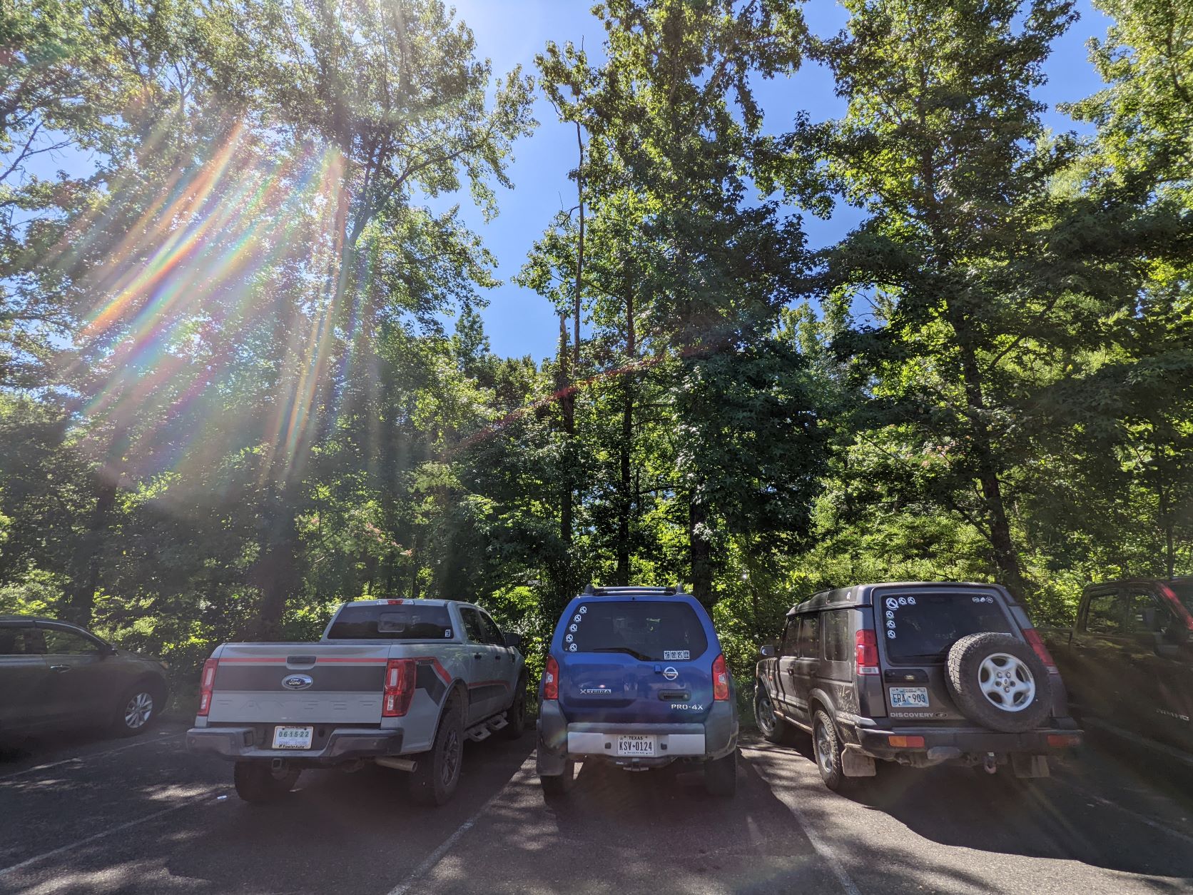
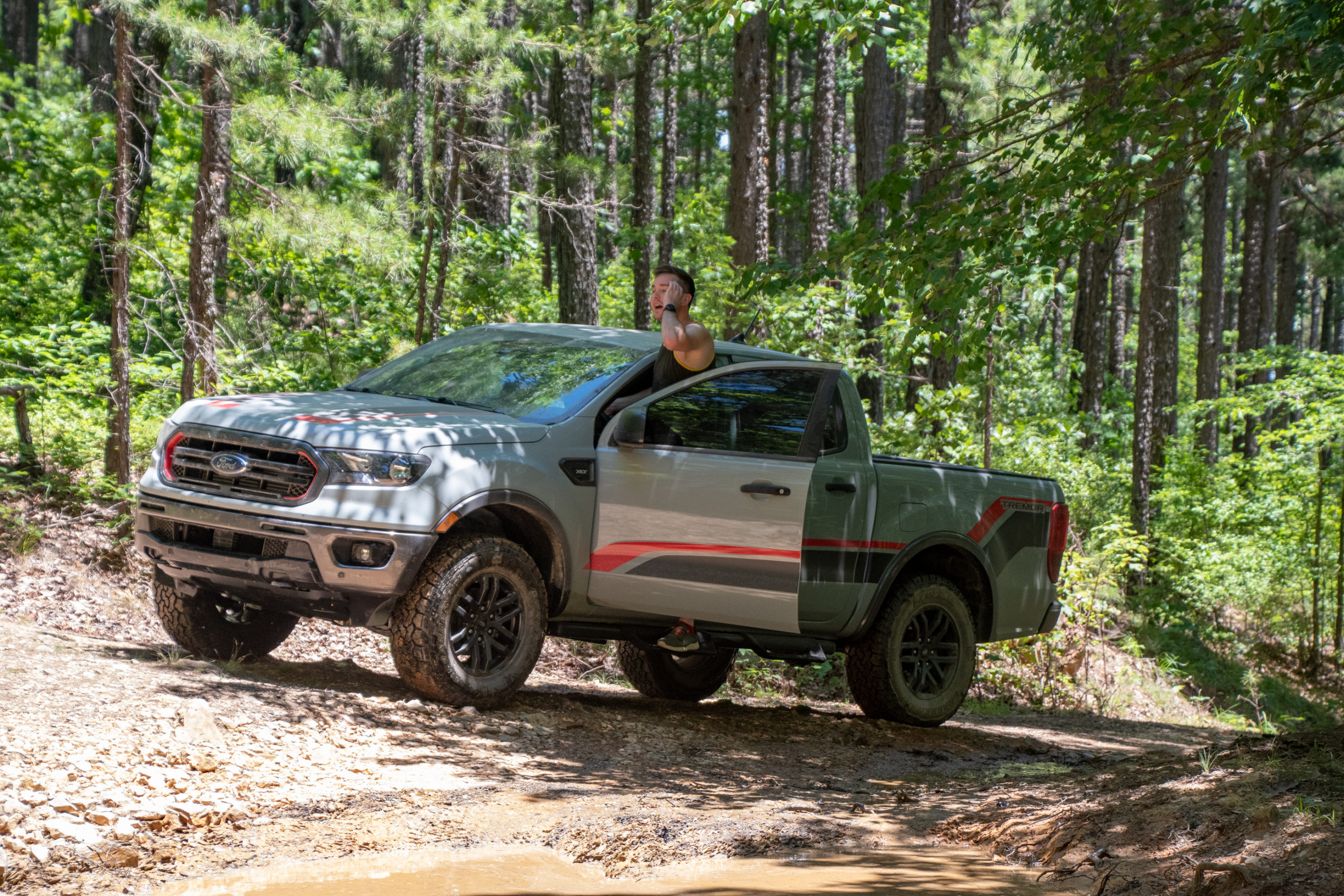
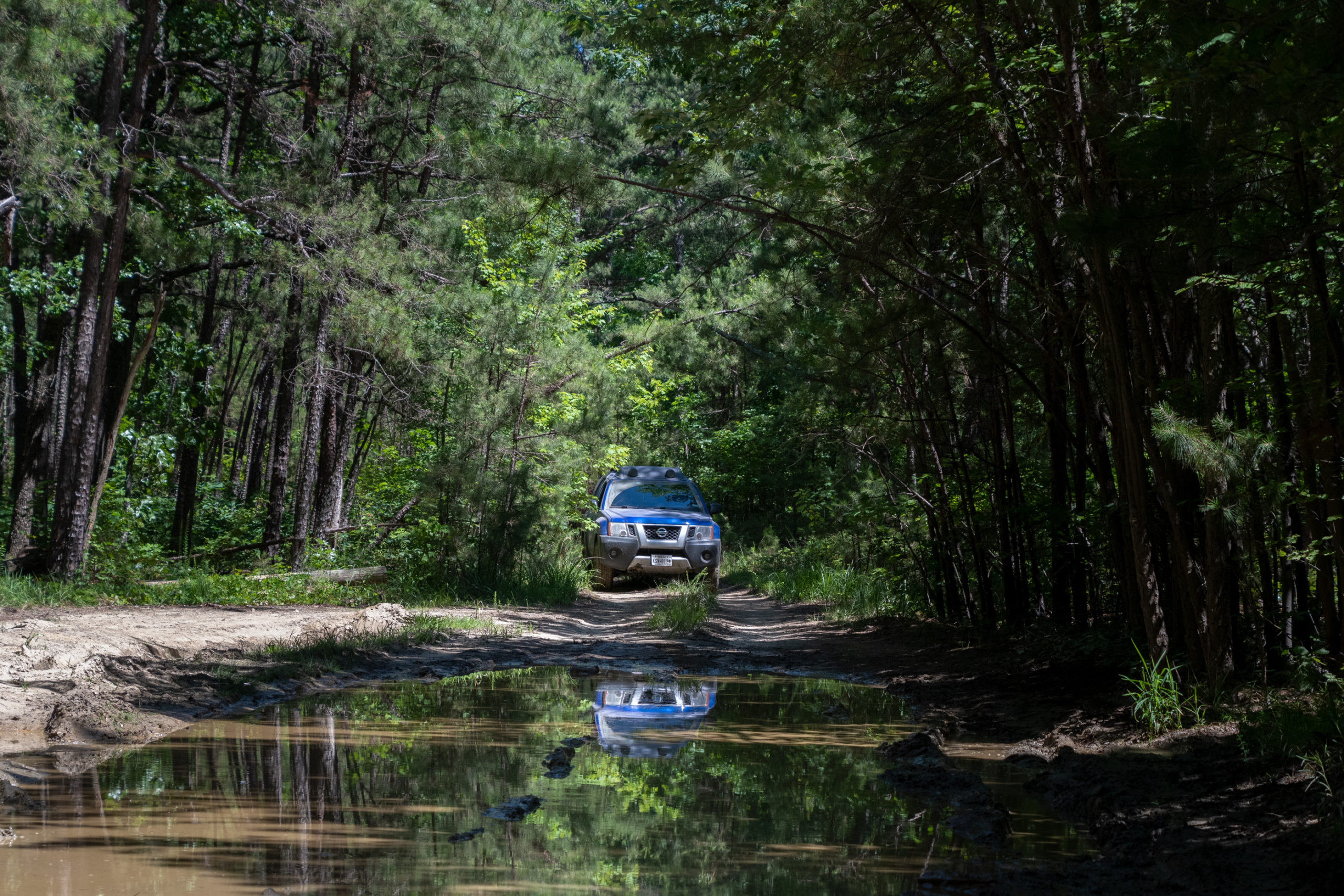
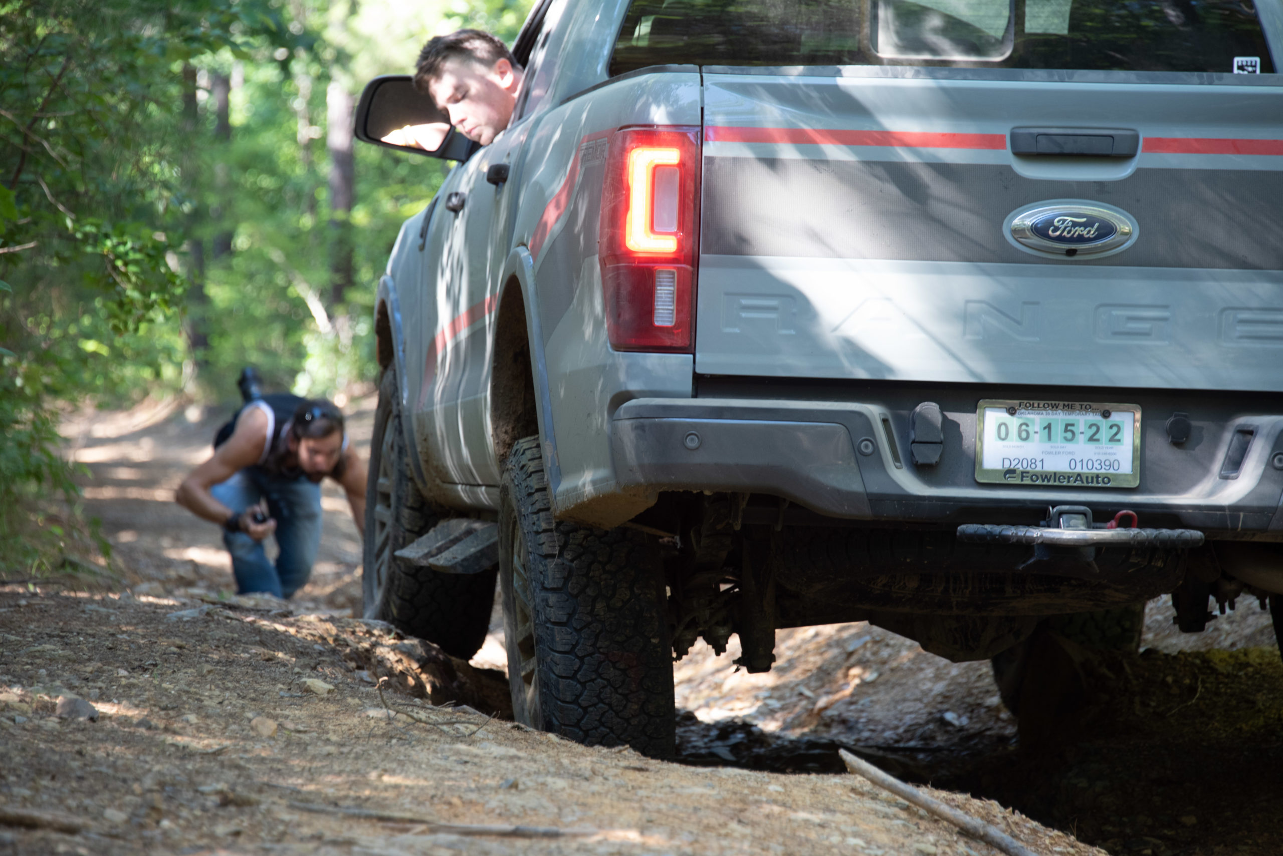
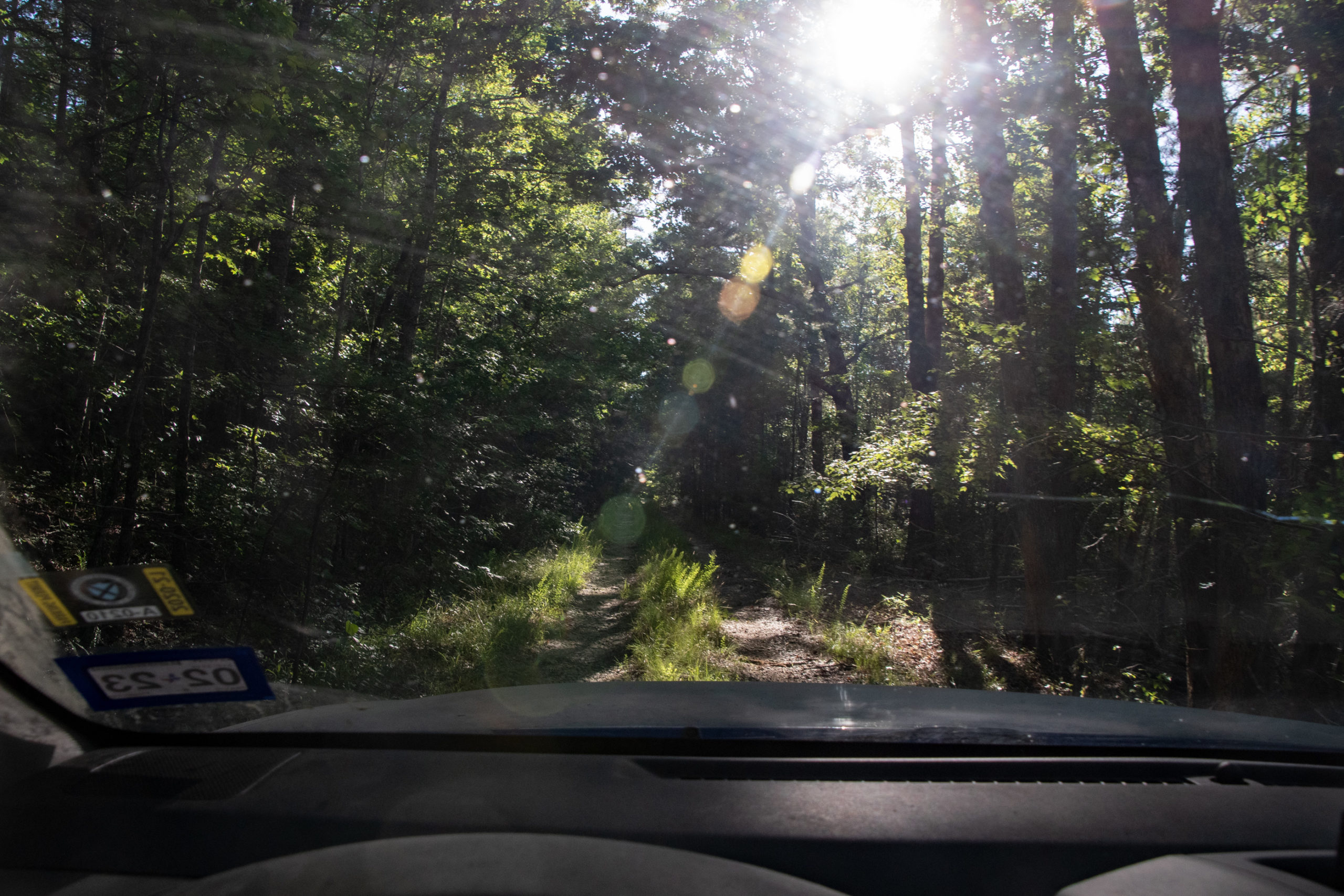
After spending yesterday wandering around the crowded park on foot, we decided to run today on wheels with an off-road adventure deep in the forest. Initially, we didn’t see too many interesting dirt roads in this part of the state, but there were two I found that seemed like maybe they could be promising, even if not particularly challenging: Muse Mountain Trail and the ominously mononymed Ritter.
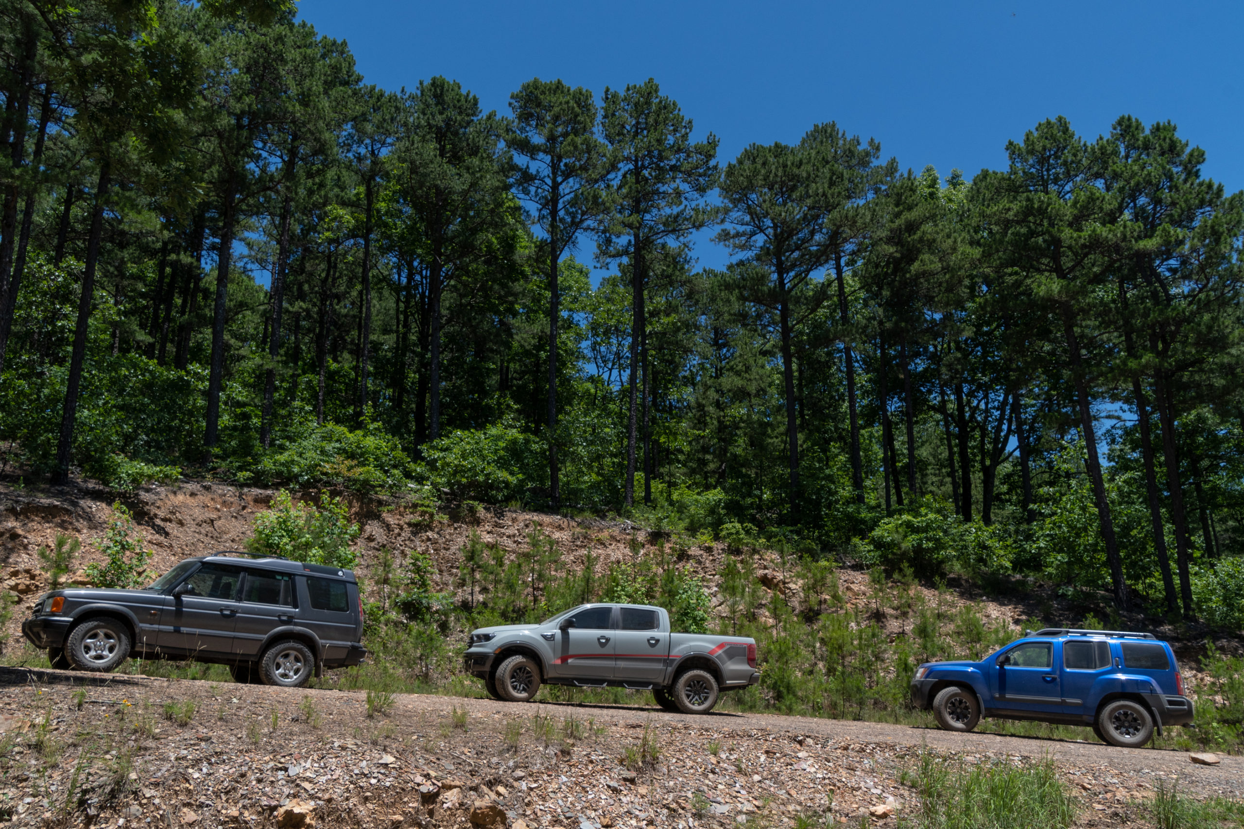
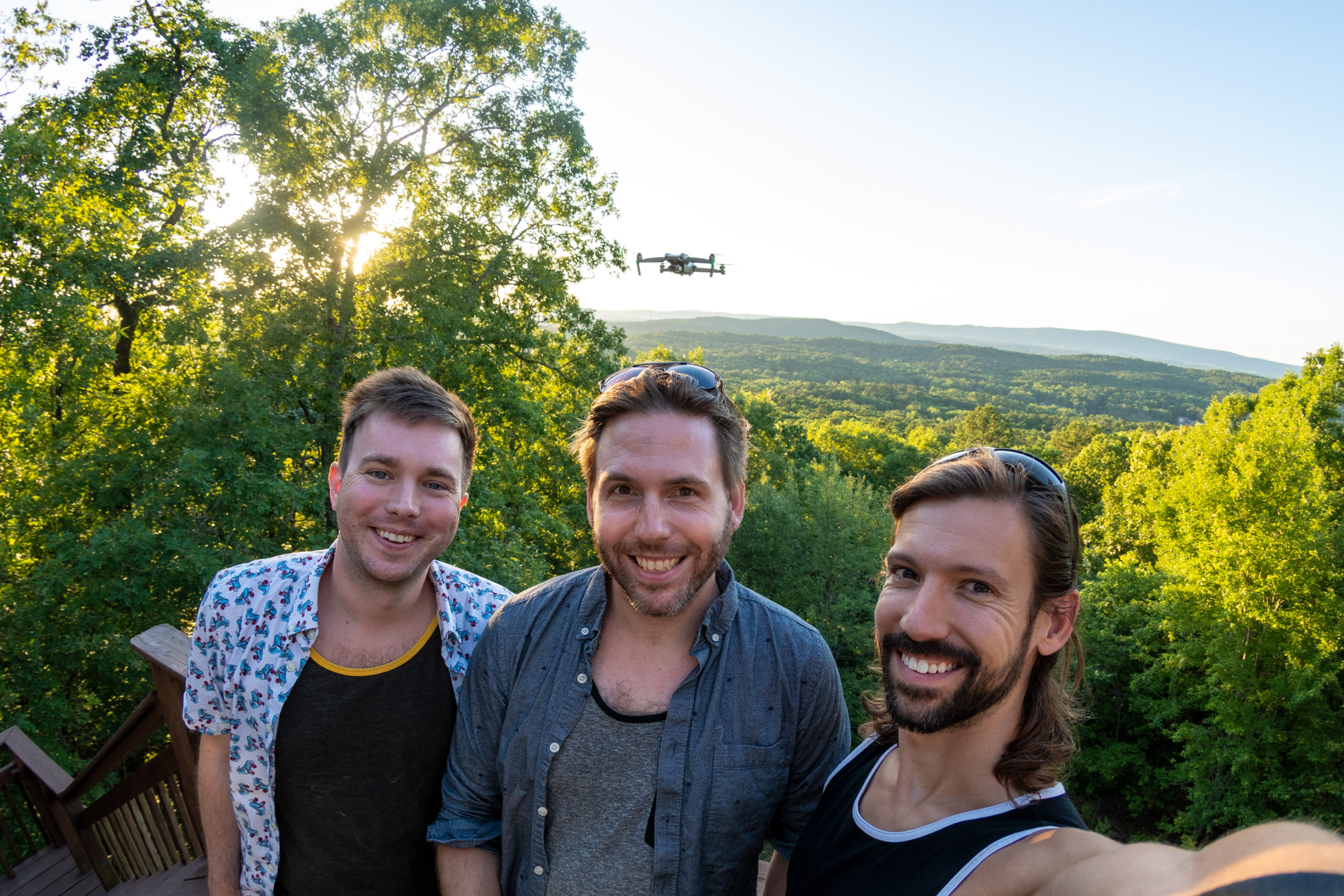
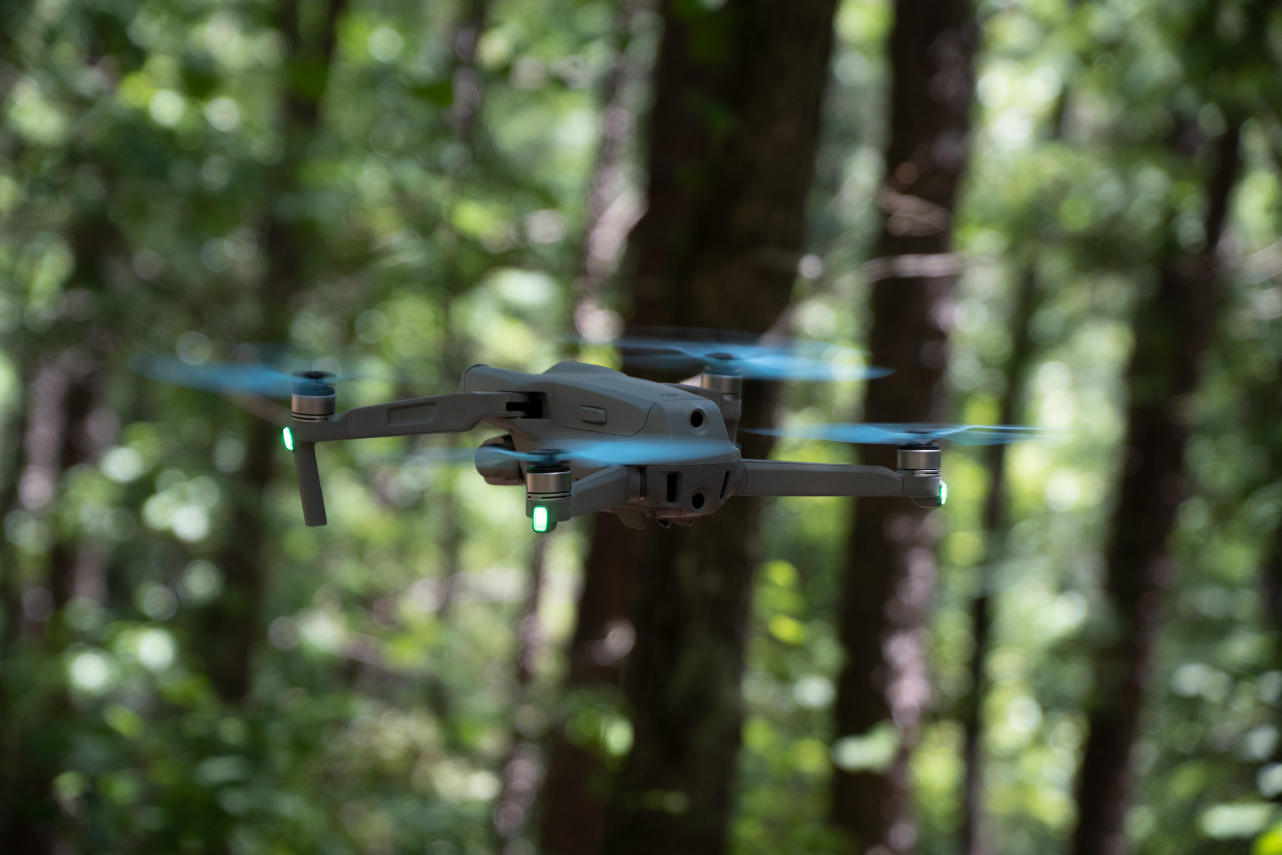
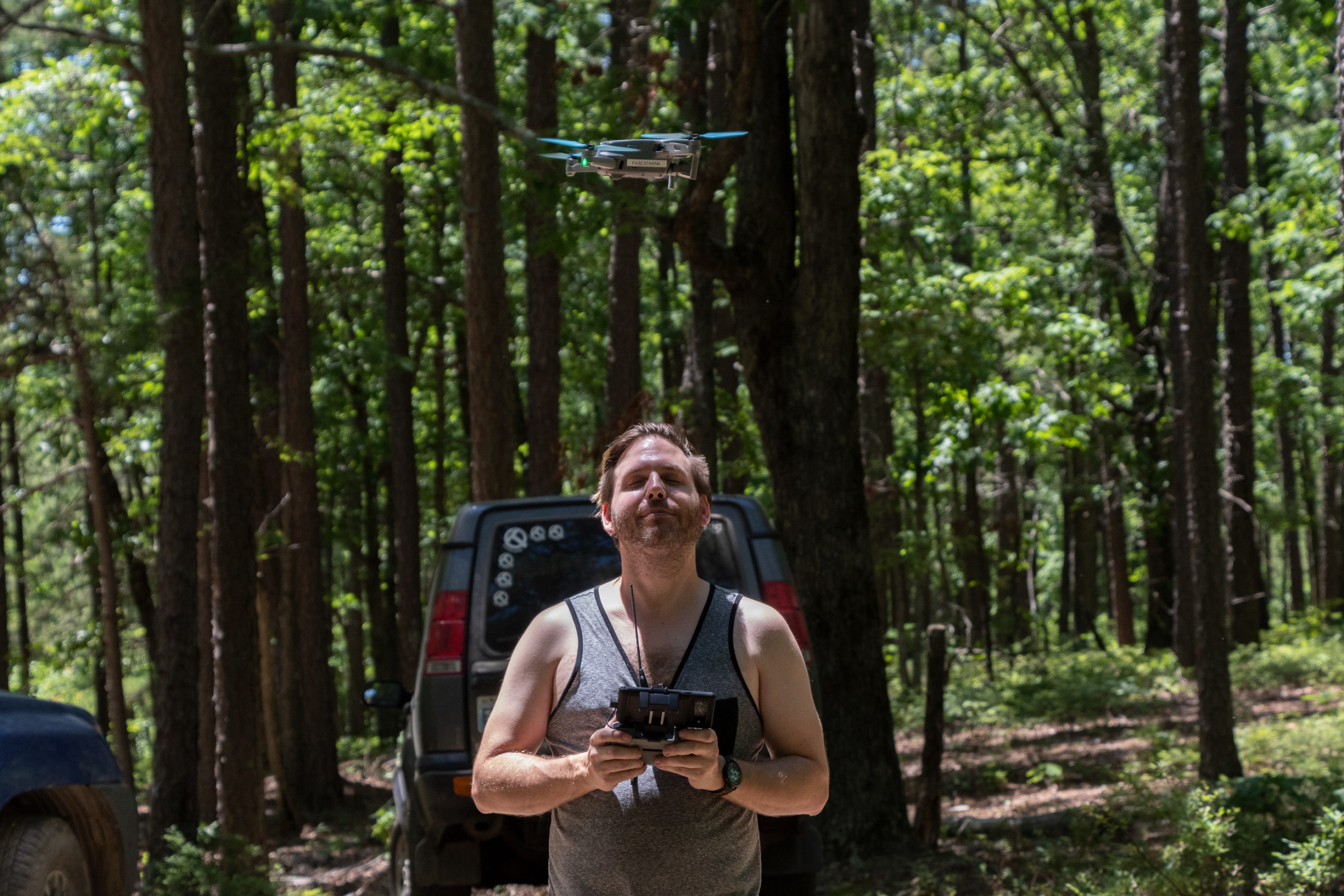
We started on the Muse Mountain Trail and got a few neat photos of the new Ranger in action! And we even got to break out the drone a couple times. We learned a couple things: it’s difficult to do under dense tree cover because of the risk of collision (as well as the conservative on-board collision sensors); smooth sweeping cinematic motions take practice; it’s a whole new world of camera angle possibilities and that takes practice, too. Also it’s hard to divide one’s attention between drone cinematography and driving or spotting. But nonetheless, it is definitely cool. But might be more effective somewhere in the southwest.
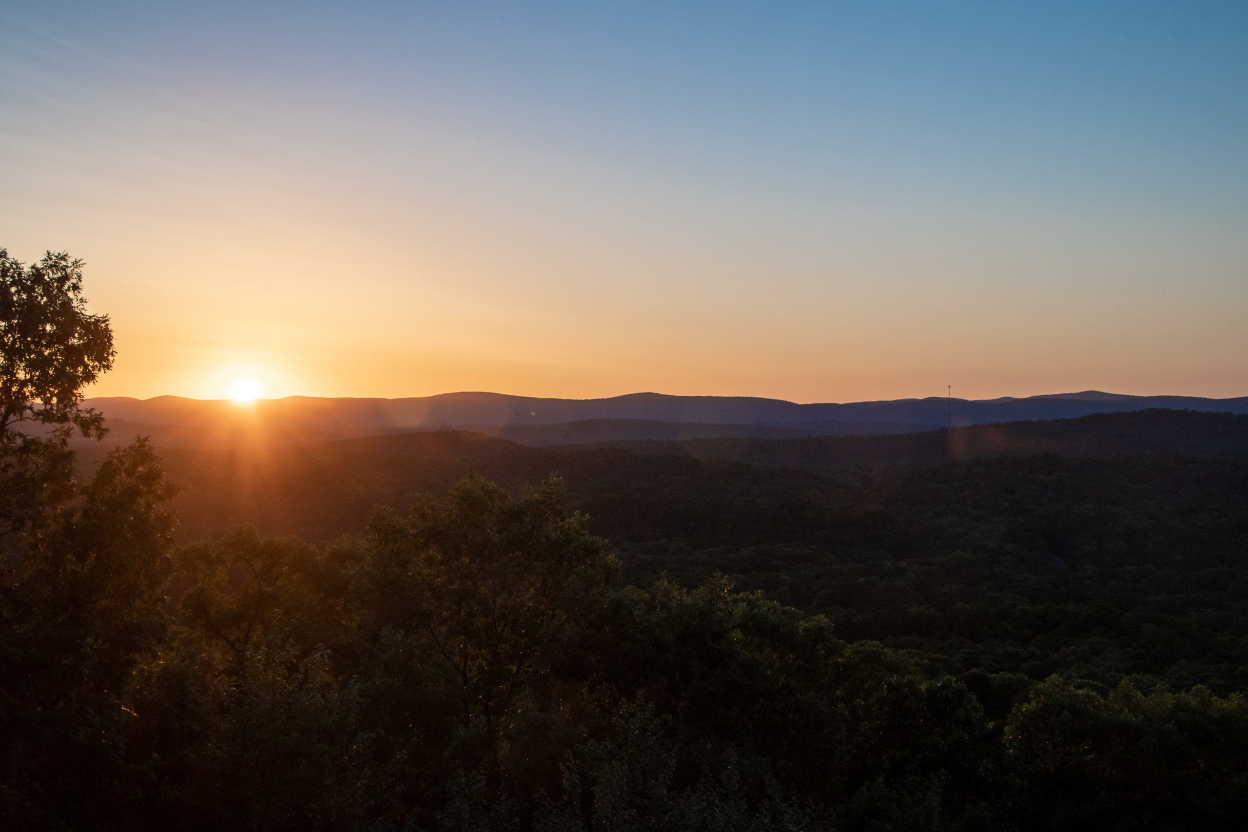
Muse was fun, with a couple rutted sections, and a few lovely clearings to explore. Mercifully, it was cooler today than yesterday, and we spent a lot of it in shade thanks to the density of the forest. We took a short picnic in the middle at a backcountry campsite.


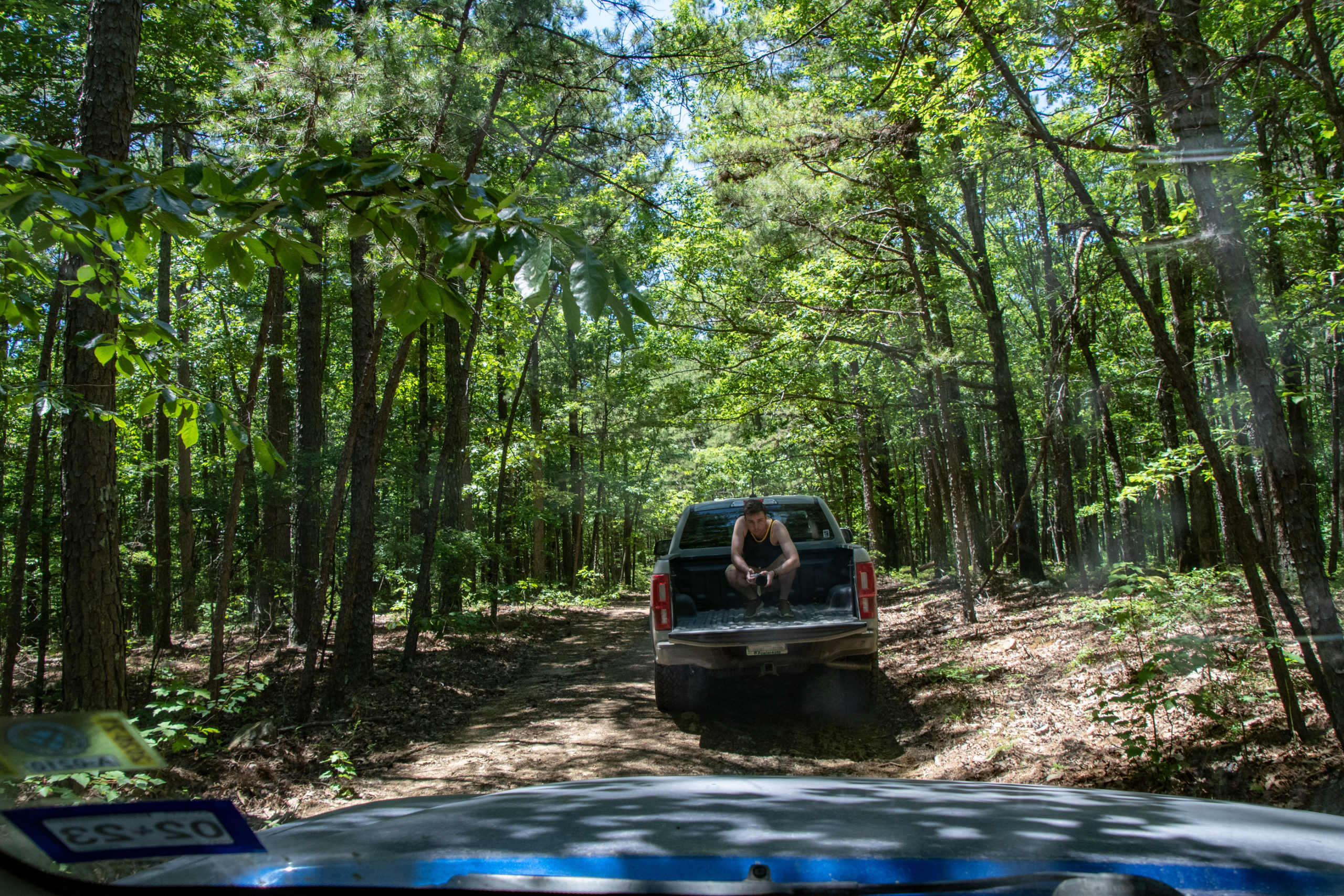
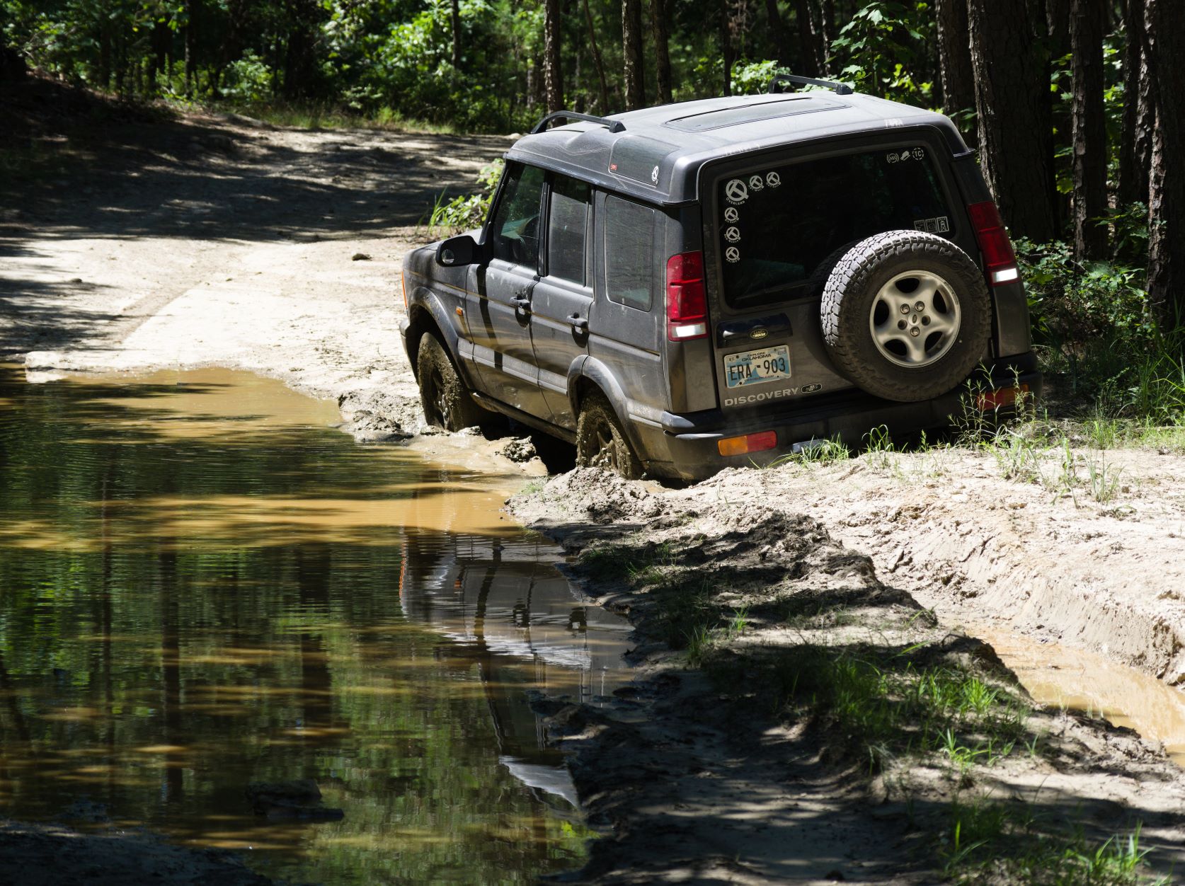

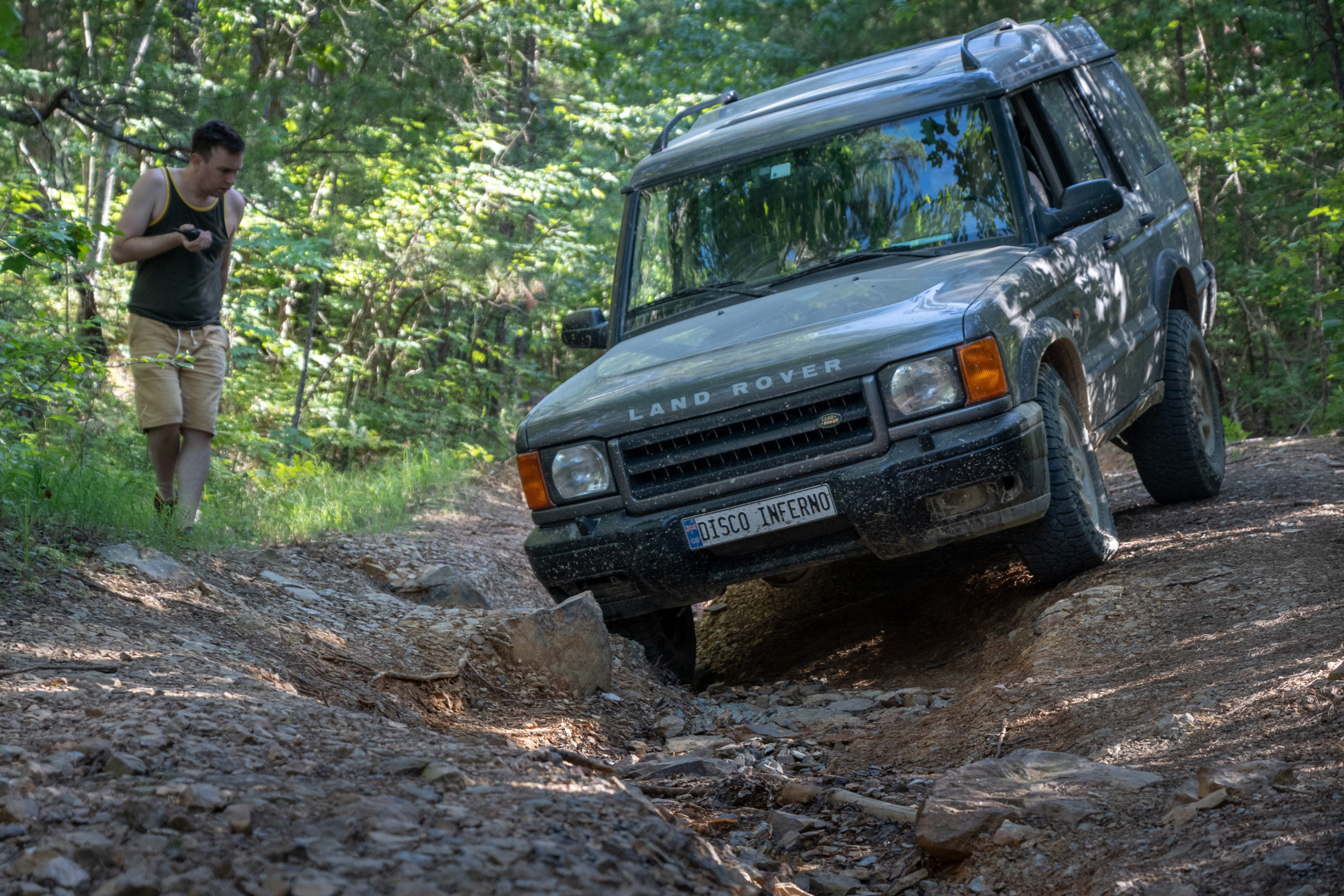
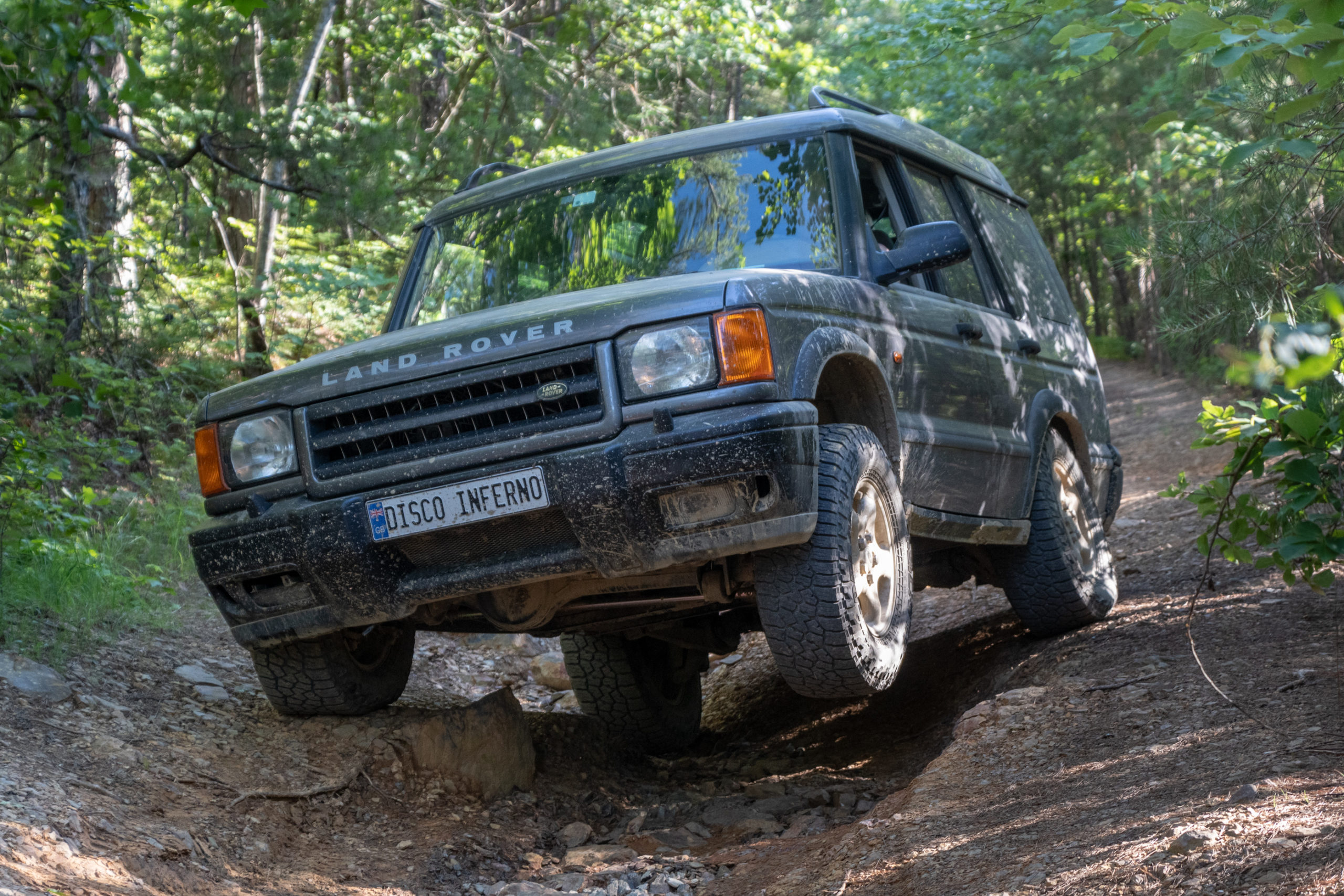
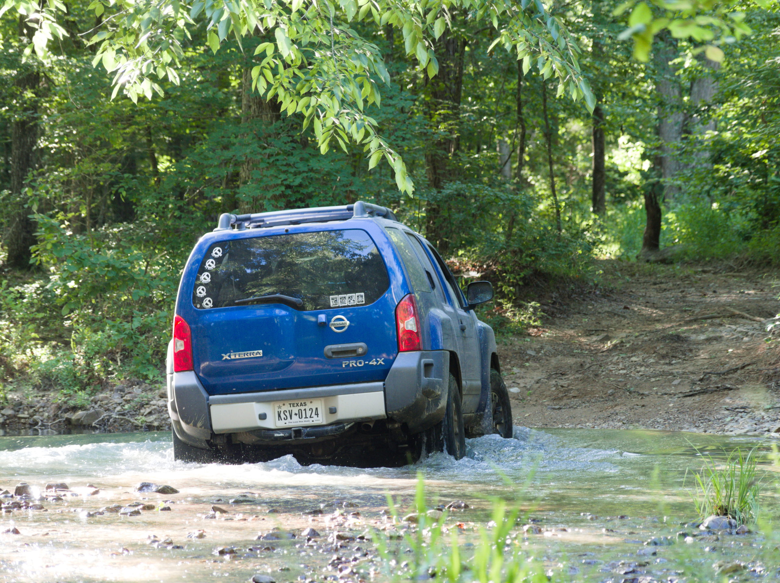
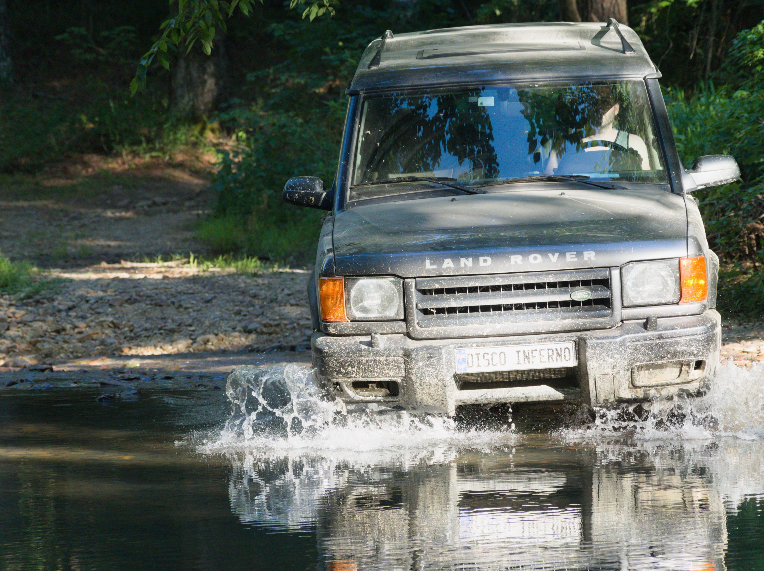
We survived Muse no worse for the wear. Evan did get him self properly stuck in a surprise mud pit while trying to avoid a big muddy puddle of unknown depth. That was amusing. But to the Rover’s credit, Evan managed to drive himself out of it without aid. It did leave the Rover smelling of baked mud for the a while though.
After the Muse trail, it was a short drive to the start of Ritter, and immediately I thought back to the last reviewer of the trail who said he did it with a trailer. Pretty, but easy. Oh well.
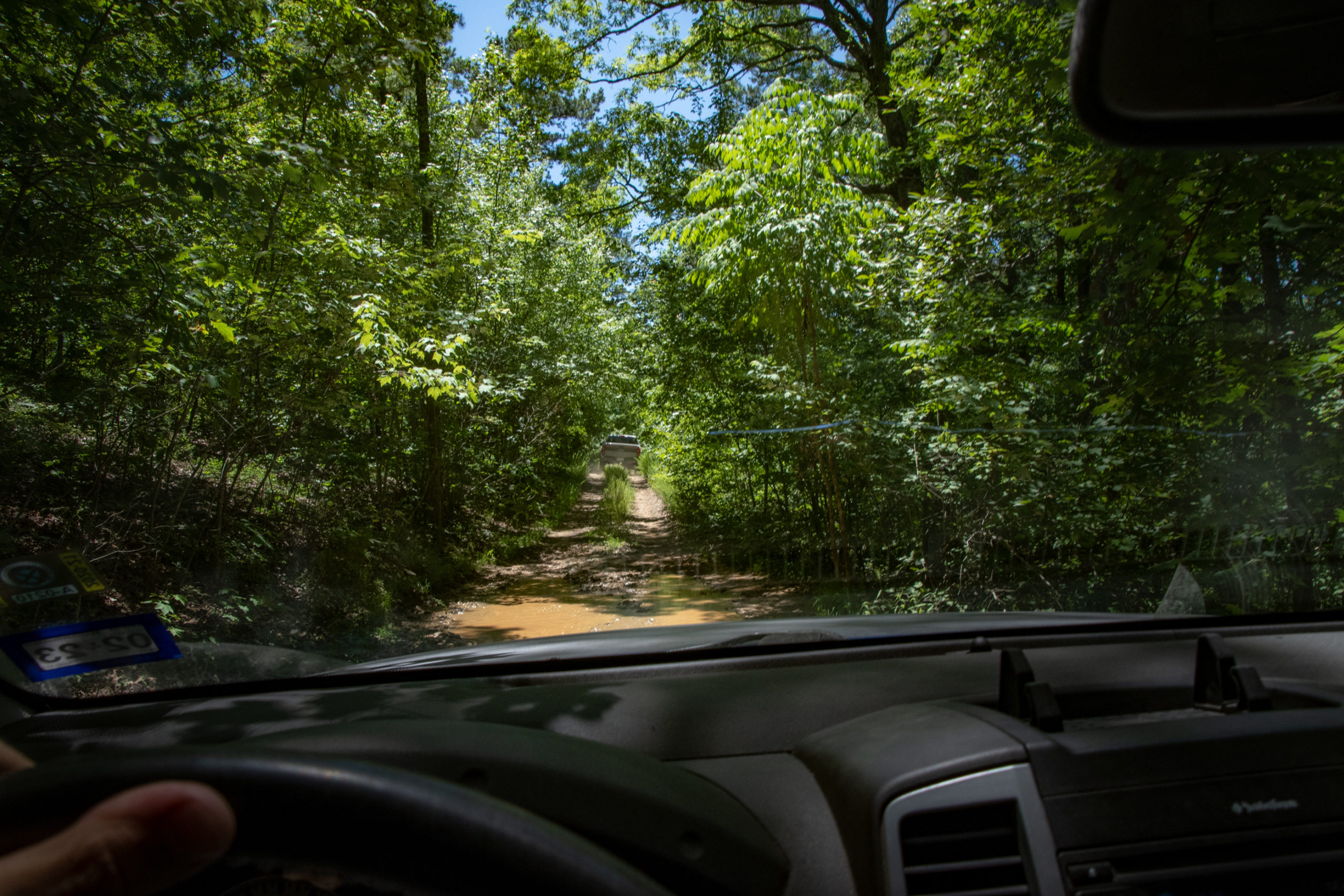
Until very suddenly, it was not.
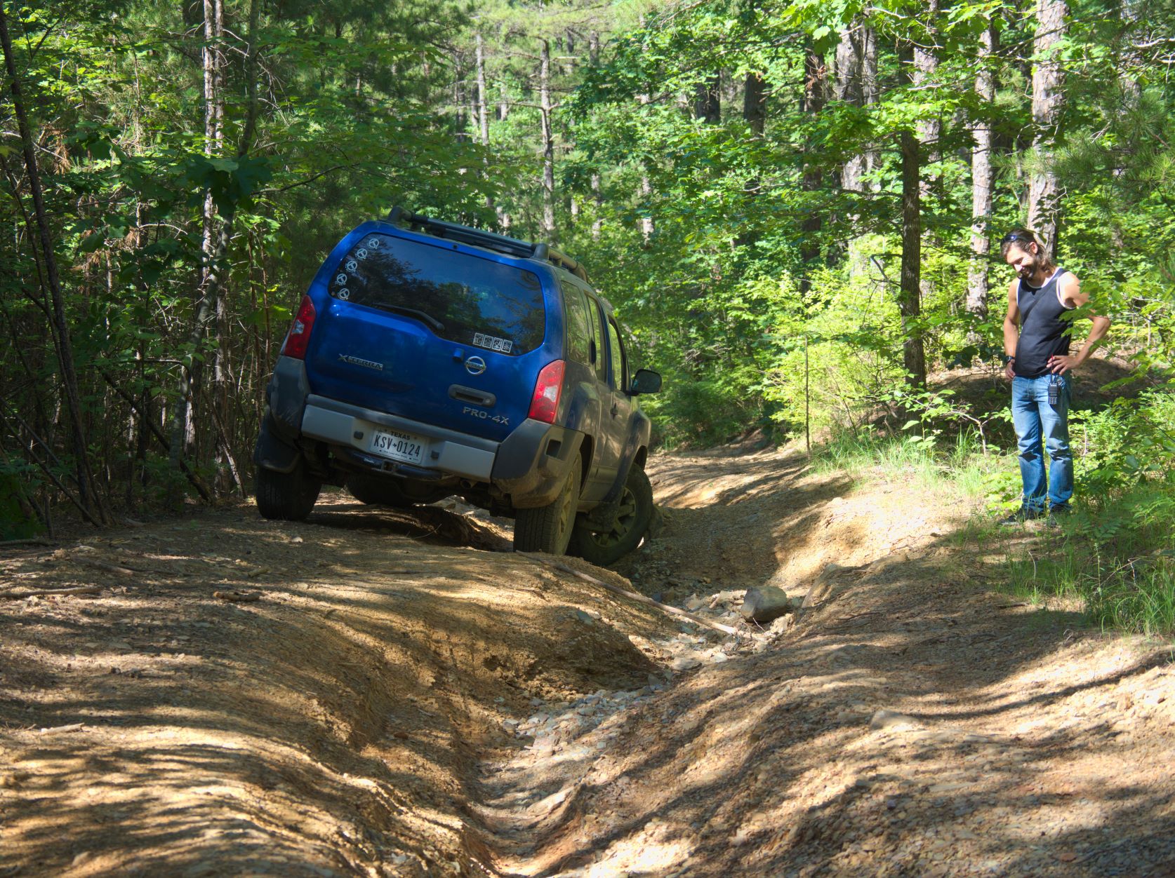
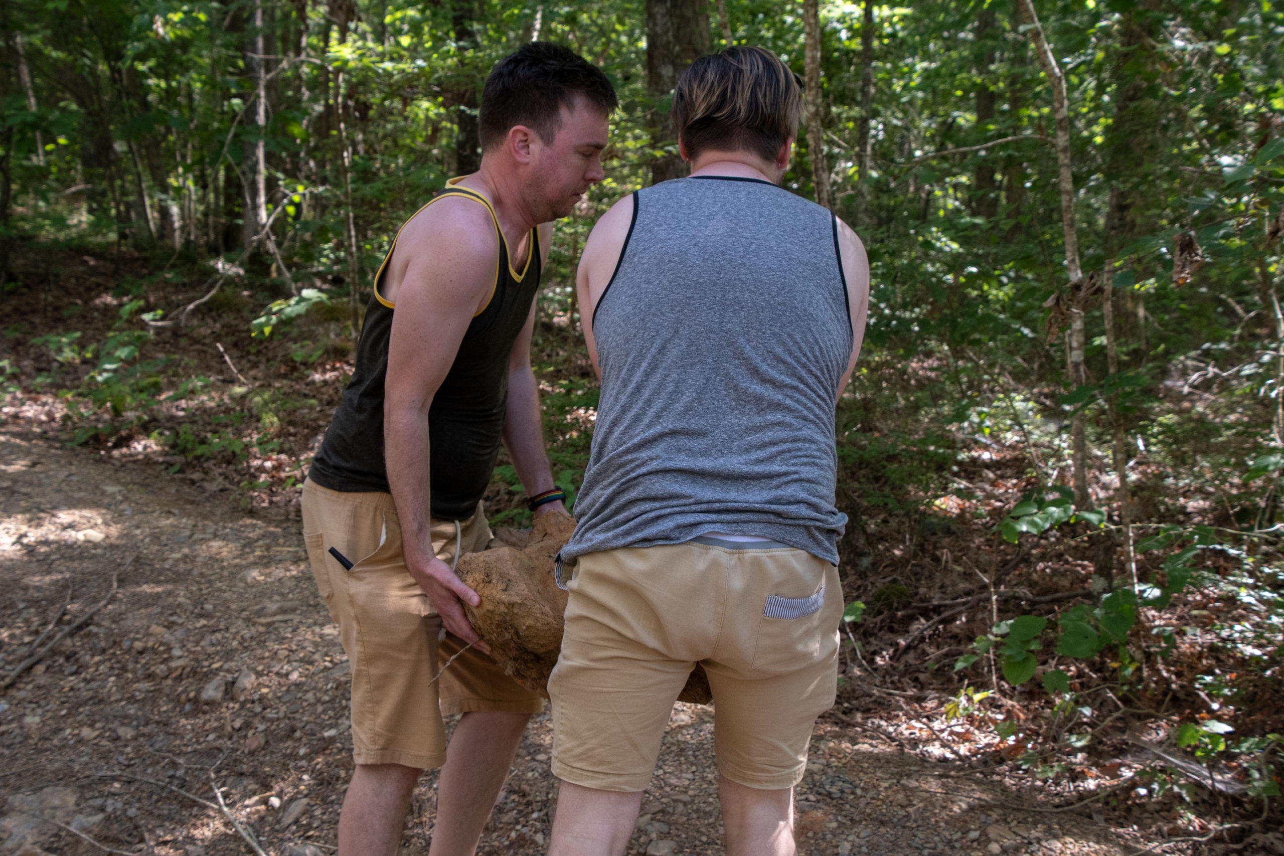
Looks like washout and flooding have hit Arkansas too. I was in the lead and everything was going okay until I got to some deep ruts. I ended up chocking a wheel on a rock and stalling as I tried to cross a ditch, which, turns out, was probably Xterra the Younger’s way of saving himself from some some serious passenger door damage.
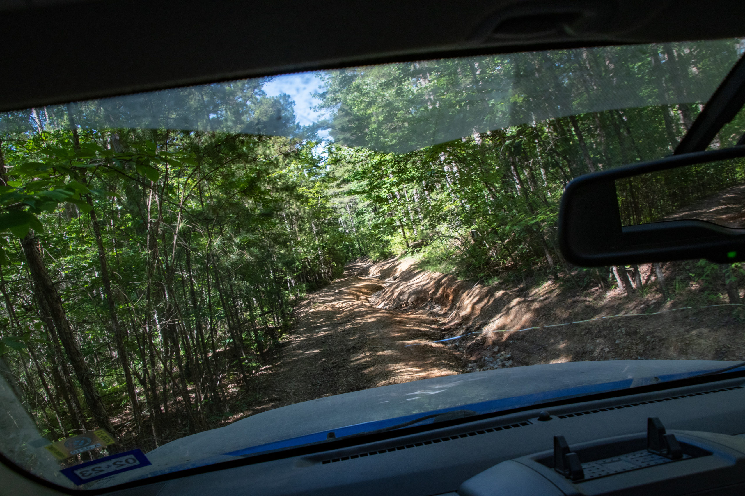
It was a rutted downhill section without much in the way of a place to stop and re-assess along the way. And it was a good fifteen minute walking distance end-to-end. It just. Kept. Going.
(Forgive me; that was entirely too long. But I’m holed up with what is likely mild covid and I’m bored. So I’m calling it an exercise in archival for posterity.)
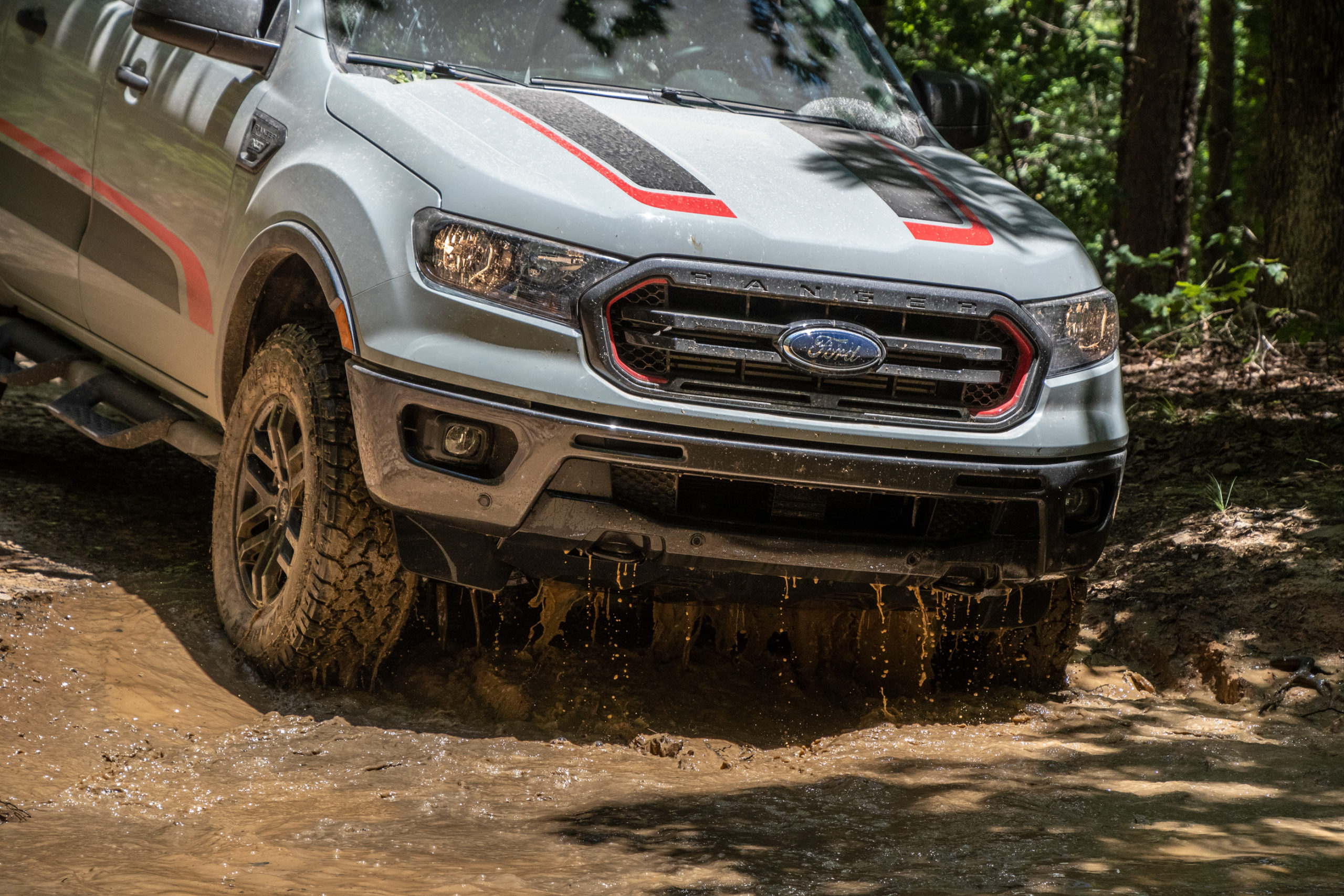
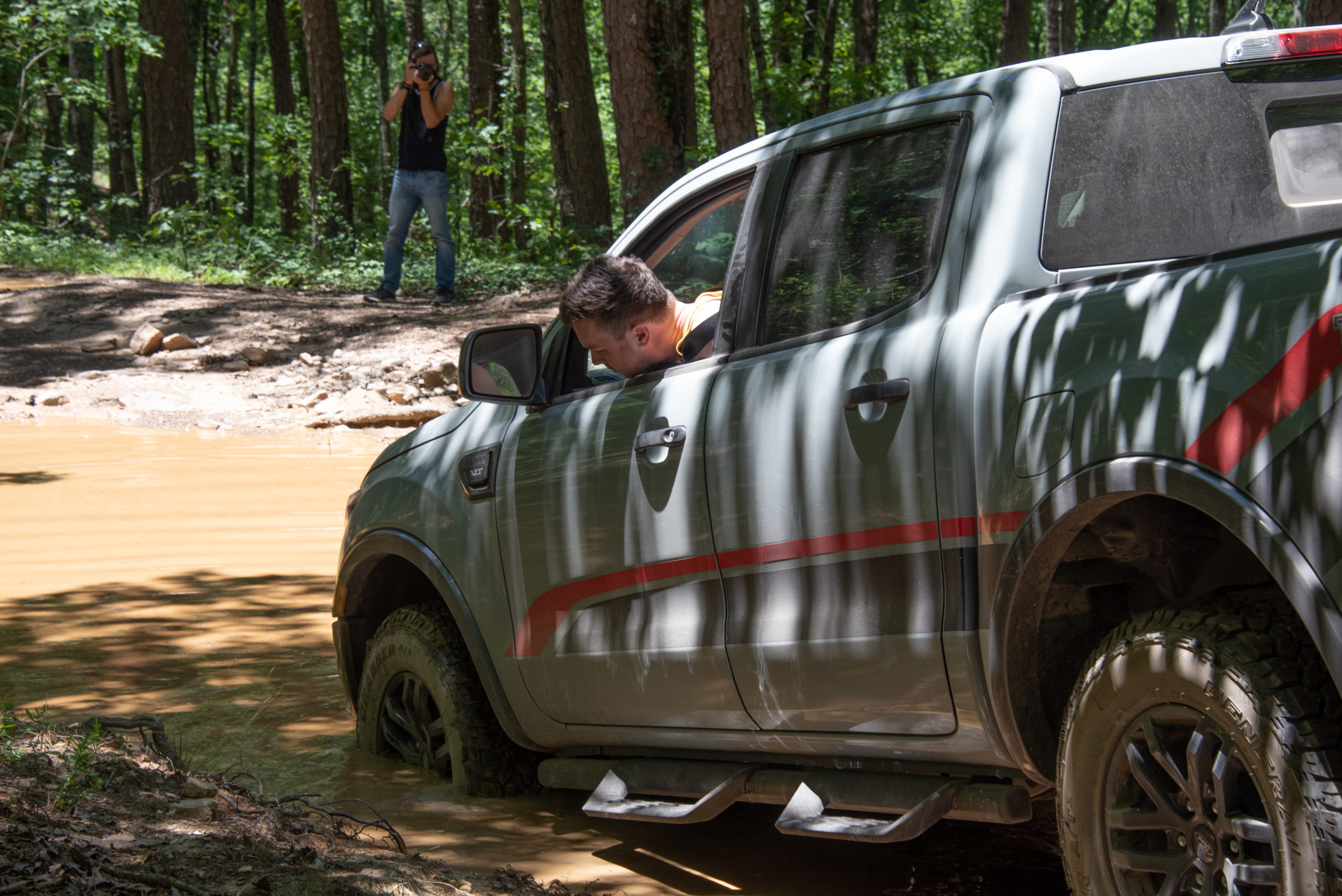
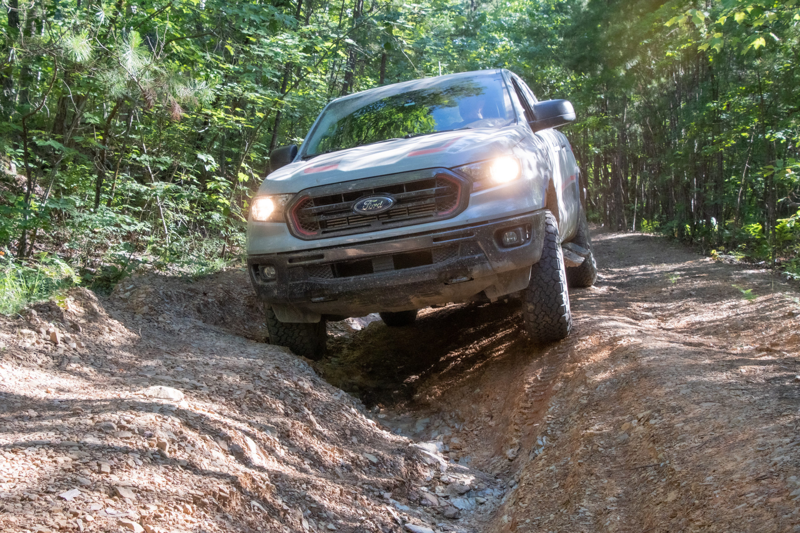
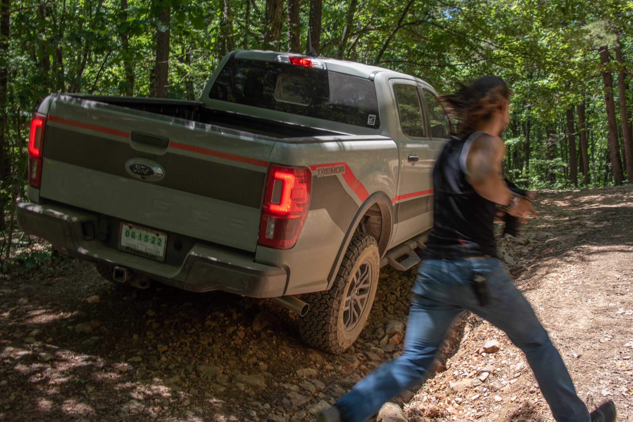
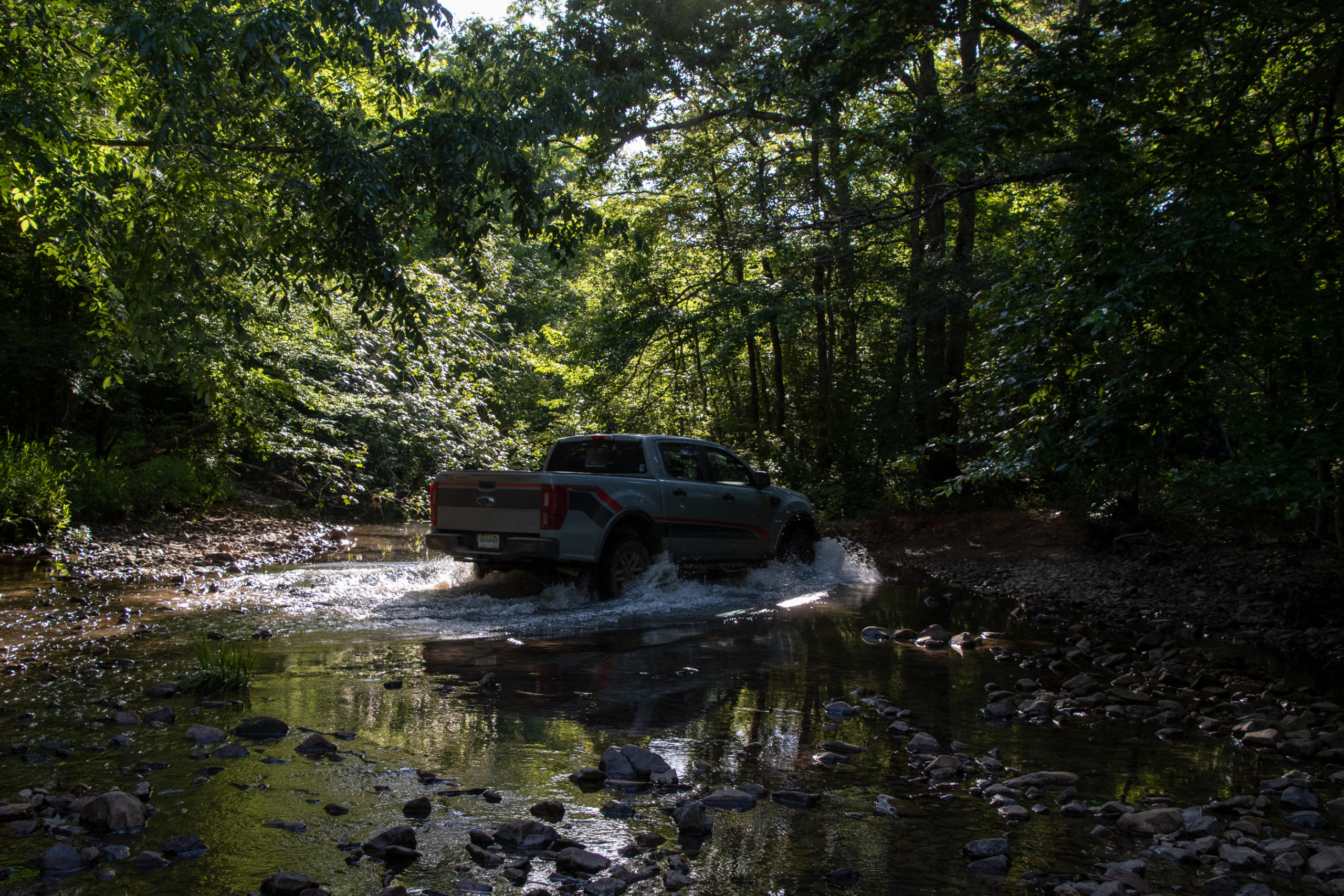
After we got the Xterra through it, we walked back up get the Ranger and the Rover, one at a time. It was quite the ordeal, but even in the moment, it was pretty fun. And the Ranger handled it admirably, leaving us all to wonder what the Renegade would have done. Even with generous wheel articulation on these three, we were seesawing on 2 and 3 wheels multiple times. The Renegade might have had to sprout wings and fly, which, admittedly, we’ve seen it do. Did I mention the Ranger is still on temp tags? Helluva shakedown.


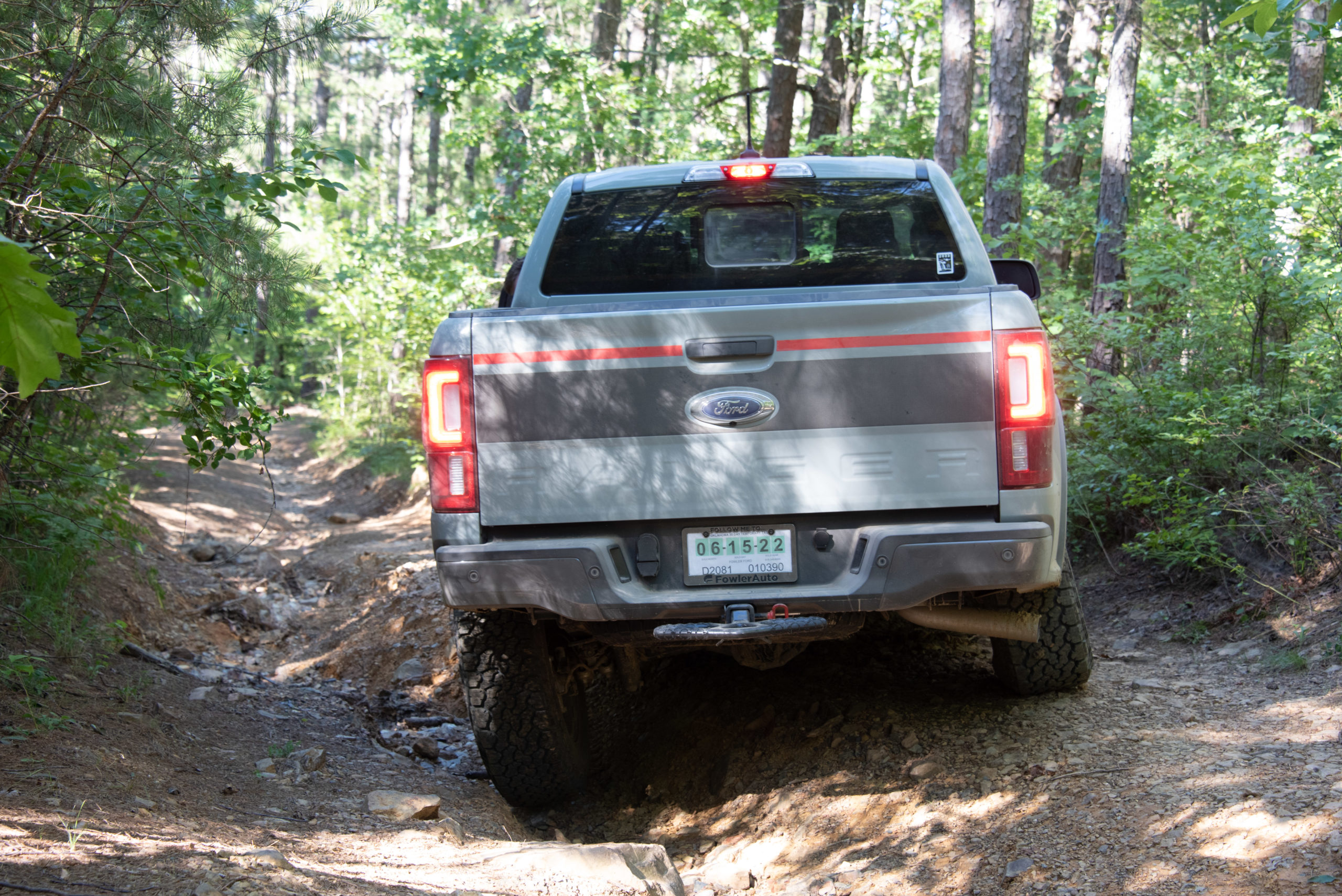

That was the worst of it. From there, just a narrow track through increasingly dense forest until a beautiful creek crossing to rejoin the main forest road back to the highway.
This ended up being exactly the drive day we wanted. Victorious, the drive back to our mansion in the hills was short. We picked up burger fixins’ and had one last sunset on the porch. The (relatively) cooler weather held, and with a breeze and lower humidity, it was just about perfect.